Author Archives: rachel

Three Mates Bluff (11 Mar 2023)

This was advertised as “almost entirely off-track exploration” but was also “aiming for a mid-afternoon finish”. Well we definitely had an entirely off-track exploration, but we did not achieve a mid-afternoon finish. Being back at the cars about 5:15pm was hardly a late day but when you’re trying to get back for the Club’s annual reunion weekend it wasn’t ideal. It also wasn’t ideal that it was a 32°C day in mid-March. I’ve been so used to worrying about rain I didn’t really focus much on the temperature forecast leading into the trip.

Negotiating the dissected ridge on the way in

The first few hundred metres we picked up an old fire trail, and when that ended the going was initially quite good as the soil seemed too poor to support much regrowth. We got to an interesting section of dissected ridge which was slower but fun to negotiate and gave us some good views.

We “just” need to get past those two knolls…

More dissected ridge line

Once we got through the dissected ridge line we really slowed down getting out to the first knoll. It was scrubby, not the worst I’ve been in, just quite a lot of vines, which made it very slow. And somehow all up that the first 5km out to Three Mates Bluff took us 3 hours.

Views from Three Mates Bluff

Fortunately Tom and I had studied the slope maps the night before so were pretty confident we would be able to find a down to the river from the bluff. I’m not sure the rest of the party was so confident as Tom headed off to scout a route down. It wasn’t long before we got the call to follow him down. I do love a direct route and this one was a goody – though maybe a bit more exposure than I had advertised to the participants.

The start of direct descent to the river

Heading down

Tim scrambling

After we’d got through a series of scrambles Tom thought we’d just be able to walk down from there. But then we hit an interesting conglomerate cliff line, but I was able to find a way around it on the left and then the rest of the slope was straight-forward. By amazing coincidence at the same time we got to the river there were 4 kayakers managing their kayaks through the rapids. I did not take long to get in the water – it had been a hard morning’s work but at least we now had the ability to cool down and recharge with lunch.

We reach the Shoalhaven at the same time as these paddlers

After lunch we headed upstream, criss-crossing the river at rapids (picked out from the aerials) to avoid bluffs/scrubby sections. The section of the Shoalhaven we walked up had some very attractive cliffs, which was fortunate as they could distract us from the swathes of Cobblers Pegs we were walking through. My shorts resembled a carpet of them for most of the time we were walking the banks.

An early river crossing

Fourth (and last) river crossing

We had another much needed swim before ascending from the southern end of Apple Tree Flat to the Brooks Plateau Trail. We enjoyed some shade and views from a convenient cave just before getting to the very top.

Views from the shady cave just before topping out on Brooks Plateau

Tom enjoying the views

I think everyone was very happy to hit the Brooks Plateau fire trail and have 2.5km of easy walking to finish the day.

A much tougher trip than planned, and would have been more enjoyable if the temperature had 10°C dropped off it!

Everyone headed to the Club Reunion afterwards where we enjoyed another swim in the Kangaroo River before settling in for an enjoyable, social evening.

Little River (3 Mar 2023)

Admiring Aqua Pools early on

Tom looking pleased with himself

Reflections

Why hello there

Quite the structure

Beautiful Little River

Easy sand walking

Great lunch spot

Different approaches to staying dry

More water avoidance

Taking in views

Looking up Little River

Final stretch of fire trail walking

Ettrema (18-19 Feb 2023)

Ah the joys of putting walks on the club program 3 months in advance… and watching and waiting the weather forecast. I guess 36°C is better than a shedload of rain!? A mini-heatwave over NSW was due to peak on Saturday, with possible severe thunderstorms before a slightly cooler (mid-20s) Sunday. Fortunately our Saturday schedule involved lots of swimming opportunities so I wasn’t too worried about the heat – but Sunday would be a different story.

We had a leisurely 10am start (which just meant leaving home at 6am, rather than something starting with 5). Some largely vertical scrub welcomed us to the area but it didn’t pose too much difficulty and it wasn’t long before we were in the upper reaches of Myall Creek.

Tom taking an early dip on a very hot day

The team scrambling in Myall Creek

Jon’s hat was an early casualty – obscured somewhere in the depths of one of the pools he jumped into. In return the creek offered a couple of drink bottles which had presumably fallen out of previous travellers bags. Jon’s attempts to fashion a replacement head covering kept us amused through lunch.

Lunch in some (rapidly diminishing) shade

Scrambling in Myall Creek

Walking in Myall Creek

Lauren going for a slide

Enjoying another cool off at the Pool of Certain Death

Negotiating obstacles in the creek

Everyone waltzed across the exposed traverse with no concerns (and probably wondered why I’d made such a big deal about it in the pre-trip vetting). It seems less threatening from the top I think?

Belinda on the traverse above the Pool of Impending Doom

Kosta was the only one who braved the high jump, but plenty of lower jumps kept us cool. The hot wind blowing up the creek when we finally headed off reminded us of the heatwave conditions.

Kosta launches

Kosta on his way down

Tom jumps

Lauren simply runs off

Belinda jumps

Where did Jon come from?

Kosta jumps

No longer inhabited

Beautiful Ettrema Creek

The thunder started rumbling as we had (yet another) swim half way to camp. Only a few hundred metres out from camp the roar of (literal?) impending doom rushed towards us. It sounded like a wave of water, but in fact was an immensely strong rush of wind down the gorge. Fortunately we had the audible warning so we could brace ourselves, as it was strong enough to knock an unsuspecting person over.

Storm clouds start to brew

As we got to camp it started spitting so shelters were quickly erected and retreated into. Or not so quickly in the case of the tent which had arrived without its poles 🙁 I kept expecting it to blow through as these sort of storms generally do, but it persisted for a while. Eventually the rain eased off enough to come out and get a fire going. Then the rain returned. Eventually I called “happy hour” even though it was still drizzling. It was an excellent combination of contributions, even if the ‘rats’ may had made a serious dent in the chips while we were huddled in our tents. The storm eventually retreated for good and we had a pleasant evening around the campfire.

The next morning we were away just after 8am. While the forecast was a lot cooler than the previous day, it was still a lot warmer than I would have liked for the big climb we had up Transportation Spur. So the earlier we could get climbing the better.

Tom in Ettrema Creek

Beautiful scenery

We made good time on the rock-hopping down Ettrema Creek. After filling up water at Gallows Gully and having a pre-cooling swim at morning tea we started the climb. Well, we almost started the climb – I almost walked over a large red-bellied black snake so that waylaid us with photo-taking – but then we started the climb. Sadly in Belinda’s case without gloves as they had gone AWOL sometime between leaving camp in the morning and morning tea.

This one’s inhabited!

The initial rocky section of ridge was quite pleasant but it soon led to scrub. Fortunately someone had done a lot of hard work before us and we could use their tunnelling efforts. Unfortunately I lost their pad part way up so things got a bit tougher (for me at least) after that.

The start of the climb up Transportation Spur

Less clear further up Transportation Spur

We had a well-earned break on the first significant knoll where there were good views to enjoy while we recovered. The highlight of the break was Belinda finding her gloves in her pack… A proliferation of very keen march flies had me getting us moving again, as I was sick of being bitten on my legs.

Enjoying a well earned break part way up Transportation Spur

The next section was also scrubby but not as thick as what we had come through. It is interesting to observe the different vegetation bands as you go up the ridge.

Finally at the scramble up to Pardon Point!

Climbing up to Pardon Point

Narrow scramble

The wind somewhat kept the march flies at bay, but there were still voracious – biting through clothing and causing welts to form on some of our more sensitive bodies.

Peter and Lauren enjoying a lunch at Pardon Point

Jon enjoying the views

We’d been hoping the remainder of the walk across the tops wouldn’t be too scrubby. We did pick up a few rock bands to walk along, but also had a couple of quite slow sections in the headwaters of creeks. It was with great relief to almost everyone when we finally spilled out onto the road. The remaining couple of kilometres on the road passed in the a flash as our speed may have tripled!

Some clear walking on the tops

Glad to be back on the road!

We finished off a great weekend with dinner in Nowra before the long drive home.

The storm on Saturday night must have been very severe elsewhere as a number of party members had concerned messages from loved ones hoping we’d got through it ok!

Bell Creek (11 Feb 2023)

The only other time I’d done Bell Creek from the Fire Station was 12 years earlier. And having now done it for a second time I would be included to go for the ‘complete’ version, unless you can’t work the car shuffle.

Tom at the top of a scramble

Bananas? No, waratah seed pods – lots of them!

This trip certainly reminded me we’d been doing a lot of ‘trade’ canyons this season, with very straight-forward entries. The approach took us the best part of 2-3 hours (depending on what you count as the approach). With a 30°C day forecast I was looking forward to getting into the water!

We faffed around getting into Little Bell Canyon, but eventually made it down.

Tom looking excited at the start of Belfry Canyon

Tom descending into Belfry Canyon

Phil jumped into the pool immediately below the climb into Belfry Canyon, whereas the rest of us decided to do the bigger jump into the next pool. Happy to cool down!

Gill choosing to get completely saturated

I’d not done Bell Creek without a lilo before, but the water temperature was pretty warm, and with extra flotation in my pack the long swims weren’t a problem.

Tom in the depths of Bell Creek

Emerging from another swim

Gill and Phil enjoying a bit of sunshine

Walking up Du Faur Creek

Where else would you rather be on a hot day but in a canyon with friends? Another great day out in the bush.

Ranon via Ranon Brook (4 Feb 2023)

I wasn’t at all surprised when Tom suggested Ranon for the weekend. A new abseil had apparently appeared so we needed to go and check it out, oh… and Jon and Lauren hadn’t done Ranon before.

My memory of last time we did Ranon via Ranon Brook was that we’d been out a very long time, as it was such a nice day we kind of just drifted until we realised it was 3pm when we had lunch. I had been talking up how it had taken 13 hours and so I was motivated to keep us moving on this trip to avoid that, particularly given we had twice as many people and a lot of abseils to get through.

The “new” abseil did indeed exist, previously large piles of logs apparently allowed you to climb down, but not any more! (The first photo “at the first drop” from our previous trip has me in the spot where Jon is in the photo below)

Tom on the “new” abseil

The rope decided to tie itself in knots for the second drop and so we took a while to get through that. As I was half way down the abseil I heard an almighty crack as if someone had a whip. I quickly looked around expecting to see a large branch or rock that might have fallen into the canyon. Instead I see Jon on the ground rocking and cradling his head. Initially confused as I couldn’t understand what had hit him, but he’d slipped over and cracked his helmet on the canyon wall. Fortunately after a few minutes he felt sufficiently ok to continue. In the meantime Lauren’s detective skills had found that Jon’s whistle (which was lodged in the side of his helmet) had taken the brunt of the fall and bits of it were shattered into the moss.

We continued down canyon doing lots of abseils – a pleasant change to have some awkward starts from using natural anchors. Many of the canyons we’ve done this season have been bolted and while I appreciate the placements make easier starts, it does take away some skill development and intellectual challenge. (Without getting started on whether bolts should be there in the first place!)

Tom in the canyon

We played it fairly conservatively and abseiled drops even if they might have been down-climbable – ostensibly because Jon was feeling a bit tentative. Though ironically he did one less abseil than the rest of us after deciding to slide/jump one of the drops.

Looking upstream

After morning tea at the Mistake Ravine junction and confirming we were all feeling good enough for another 8+ hours we pushed on.

Tom on another abseil

There was a relatively easy log descent – but on reviewing previous trips we didn’t seem to have to deal with this drop previously. There was a huge log jam behind the boulder, I suspect in the past you could get through underneath but currently it’s blocked up.

Alternate descending option

There was a pretty recent rock fall above the cavern at the start of the two-stage descent to the Claustral junction. The rest of the party made me very nervous by deciding to stop basically on top of them, none of the rocks had settled yet…. I was glad to move on.

Jon on the penultimate abseil in Ranon

Looking down the final drop in Ranon before it meets Claustral

Lauren abseiling

Just after we’d finished abseiling into Claustral I suggested to Jon we should move so that Tom was able to get out of the pool. The rope wasn’t coiled yet and the pile of it somewhat disguised the small pothole which Jon promptly stepped into. From the scream I was sure he must have broken something and when I turned around he was sprawled face first lucky not to have fallen down to the next level.

We had joked at morning tea about how given he’d managed to throw his dry thermals in a pool at the start, then with his slip, that we should probably exit before things got any worse…  Fortunately (?) his shin had taken the brunt of things and we were able to continue.

The occupants of the many cars we’d seen at the entrance had presumably managed to get through well before us. Other than a few voices drifting back we had the canyon to ourselves, and the awful, awful stench of a decomposing wallaby… which kept wafting downstream with the slight breeze.

Lauren & Tom in Claustral

We did catch the tail-end of a large group at the final abseil, and then caught them  properly at the end – I recognised a few ladies I’d met through the Women’s Canyoning weekends so we had a bit of a chat. We set off before them and didn’t see them again.

Fortunately my nemesis section of the exit climb went without incident this time round after getting my foot stuck briefly back in December. We caught up with another large-ish group shortly after that. We then stopped to pick up water so they went past, but we soon passed them again. I had to chuckle (a bit nervously for them) as we went past the second time and I overheard one of their party members saying “Right, we have two options, we can have another rest, or we can follow the people who know where they are going”. Oh dear.

We caught up with a third large-ish group at the exit gully. But despite overtaking those groups there were only a small number of cars at the car park when we got there – so there must have been a lot of other people in the canyon earlier that day.

In the end it was a 10 hour 9 hour 35 minute day for us (party members made me amend the time so as to not tar them with the slow brush!). And when I went back and checked our previous “really” long day had actually only been 10 hours 15 minutes.

Lauren declared it the day her new favourite canyon (not hard as she has a fairly small portfolio to choose from!). An excellent day out.


Kanangra Main (14 Jan 2023)

Kanangra-style canyons aren’t really my cup of tea. I’d much rather be in sculpted sandstone slots than on narrow quartzite ledges. Which probably explains why it had been 14 years between visits to Kanangra Main!

With 3 weeks of big hills in NZ (and a bunch of moving about on sketchy slopes) we were keen to use some of that fitness before it vanished again. We managed to pull together a crew of 5 at fairly late notice for a descent of Kanangra Main.

I expected we wouldn’t be the only ones out there with limited rain in the past couple of weeks and a brilliant weather forecast. There was a party of two heading up the road as we pulled into the Walls car park just after 7am. And then some more cars drove in as we were walking up the road a short time later.

Views on the walk in

The party of two were on their way down the first abseil when we arrived. I turned around to talk to whoever from my party was behind me only to find it wasn’t someone from our group! A group of 3 had caught up with us – they were clearly motivated to get in front of a group of 5 old farts and were quickly suited up and heading down. It was unfortunate timing as we were the only three parties for the day.

Someone’s here ahead of us

Since the wall was occupied we figured we may as well avoid the exposed gully and abseil down instead. It was a nice warm up on a low consequence drop!

Warming up (avoiding the exposed gully) [Our abseil 1]

We had to cool our heels at the top of the wall for a while as the party of 3 got down the first 52m drop. We had decided to split the first drop into two – 15m/39m. Tom & Jon headed down the 15m and set the longer drop. Then Smiffy & I went through with our second set of ropes to set the next drop.

Looking down the wall [Our abseil 2]

Smiffy abseiling to the pinnacle [Our abseil 4]

So far (not very) our sequencing of ropes and people was working out pretty efficiently. The group in front weren’t moving much faster as we kept catching them. Unfortunately getting to the pinnacle was about as far as our planning had gone with who needed to be where when. The wheels fell off the efficiency bus at the pinnacle when we didn’t send the ropes down as soon as they were available. You can tell the group hadn’t done much canyoning together/of this nature recently!

Smiffy leaving the pinnacle [Our abseil 5]

That left me & Smiffy with 4 of the ropes we were carrying, with the 5th set on the abseil, and the rest of the group waiting unable to set the next abseil. To compound matters when we’d pulled the ropes from the pinnacle one of the ends had been pulled downstream and caught in something in the falls. We couldn’t free it from above but fortunately Smiffy was able to abseil part way down, and free it before continuing on.

Smiffy abseiling down to try and free the rope stuck in the falls [Our abseil 6]

We were more conscious of which ropes needed to be where after that! Though there were less abseils directly on top of each other so sequencing was less important.

Smiffy abseiling again [Our abseil 7]

Toni abseiling [Our abseil 8]

After a bit of creek walking most of us used the in-situ handline to get down to the boulder where I set the 9m abseil. Toni and I rapped it – it’s somewhat awkward, definitely looked like going down the chute would be easier.

Jon jumped from the boulder, unfortunately I wasn’t quite ready with the camera, my photo just looks like he’s sitting on it… so it didn’t make the cut for the blog. I was expecting Smiffy and Tom to both jump as well, but the need to protect a camera (Smiffy) and a knee (Tom) meant they abseiled as well.

Smiffy swimming as Tom prepares to abseil [Our abseil 9]

Next up was Tom & my nemesis set of abseils. On our only previous visit we had spent 2.5 hours here, as Tom had needed to prusik up this drop as our ropes wouldn’t pull.

Tom abseiling [Our abseil 10]

This time things went much more smoothly, though the drag on the ropes for the 56m abseil made it hard work getting down.

Tom abseiling again, while the rest of they party look on [Our abseil 11]

Smiffy abseiling – the rest of the party tiny specks at the bottom [Our abseil 11]

The next photogenic drop caused much dissension as all the photographers wanted to get down the bottom. Tom was about as decisive as I’ve ever seen him by getting the rap set and going first. I sacrificed my photographic needs by going last – though my camera went down with Jon hence a photo of me on the drop!

Tom abseiling [Our abseil 12]

Me abseiling! [Our abseil 12] (photo: Tom)

I helped Tom with the rope pull for this drop – it was super hard work. I thought my arms were going to fall off by the time we’d finished dealing with the ropes. In the meantime Toni & Smiffy had bypassed the next drop, but since Jon had set the rope the rest of us abseiled it.

Jon swimming, Tom abseiling [My abseil 13]

Then we abseiled from the tree on the left, though Tom did go scouting for the bolts only finding the single bolt on the right.

Smiffy abseiling [My abseil 14, Smiffy’s 13th]

Finally I set the last abseil since Toni’s scrambling route on the right looked far too vegetated to be any fun. Though checking the notes later supposedly it can be scrambled on the left as well – I didn’t look very hard for a route down.

Tom abseiling [My abseil 15]

The rock-hop down Kanangra Creek was very enjoyable (well maybe for those of us who didn’t bash up our shins just before the exit) and we had great views of the walls. There is something to be said for taking your time through the canyon because then it isn’t so hot for the walk out!

Toni in Kanangra Creek

Tom & Jon in Kanangra Creek

We discussed our sequencing for the exit (somewhat in jest) but knowing that things would be a bit loose. Subsequently I found myself at the front following an initially fairly clear pad up the ridge. I lost the main route at some point and found myself traversing under a bluff higher than I should have been, though I was able to rejoin the more trodden route.

It was a lot less pleasant than I remembered from previous uses – I think post-fires it has changed a bit. However, all my clinging onto vegetation above large drops on the Dragons Teeth two weeks earlier had put me in a good frame of mind for this exit!

The Spires from some way up Manslaughter Ridge

Happy to be at the track at the top

At the top at 6:20pm I headed out to the lookout to wait for the others. We all had the mandatory visit to the lookout and eventually wandered back to the car park almost exactly 12 hours after we’d left it this morning.

It was great to be able to just drive back to (the very quiet) Boyd River Campground and dig into snacks. The other highlight was my clothes being pre-warmed from being in Jon’s car all day – like getting into clothes that have been sitting on the towel-warmer!

So many snacks consumed that we didn’t eat dinner. Eventually fatigue overcame me and I had to retire as the rate of yawning to not-yawning was way out of proportion. An excellent day and evening.

Nelson to Christchurch (3-7 Jan 2023)

Nine glorious days of fine weather had to come to an end at some point. We thought it was at the end of the our 9-day trip, but the good weather still existed on the other side of Takaka Hill. In Nelson we had a glorious dinner by the river the night we finished, and then a lovely (if we ignore the sore feet) walk towards Tahuhanui.

Sunset in Nelson

A relaxed start the next morning had us meandering towards Murchison where we enjoyed “caesar salads” (with the non-traditional ingredients of cabbage, carrot, tomato..) – I didn’t care about the unusual ingredients I was just happy to be eating fresh vegetables! Post lunch we had a short stop at Maruia Falls, before our indulgent night of the trip at Maruia Hot Springs.

Maruia Falls- created by earthquake uplift

Unfortunately no one gave me the memo to bring my fly face net – it would have been perfect. Submerged in the outdoor hotpools it was just my face that the sandflies had access to. Next time it will be an essential item on the packing list – and to be honest, might be something worth throwing in for any NZ trip in summer.

Maruia Hot Springs

The weather was meant to be worst the two days we were in Arthur’s Pass. We tried to be ambivalent about it – after all we had just had the most amazing weather for the part of the trip where it was most important. Heavy rain warnings were in place for much of the North Island and parts of the northern South Island. While we weren’t under a warning there was still the potential for plenty of rain. On the bright side we were in a motel not a tent!

Lookout Keas about!

Those pesky keas

A guilty looking culprit

The rain set in not long after we arrived in Arthur’s Pass village. When it eased off a bit we took the chance to walk to the Devils Punchbowl (waterfall).

Devils Punchbowl

This was followed by an early dinner at the Wobbly Kea. Arthur’s Pass seemed to have the most pronounced staff shortages of anywhere we had been, leading to reduced menus/opening hours and at times poor customer service (not at the Wobbly Kea which was excellent despite its challenges). I understand the issues and have sympathy for the individual business owners, but it does make travelling a bit of a drag. How’s that for first world problems?

The next day we’d been hoping to do Avalanche Peak but with the conditions there was little point. Checking the MetService forecast in the morning we saw there was 38mm of rain forecast for Avalanche Peak for the afternoon, but only a few millimetres for the morning. Better get out and doing something in the morning then. Though then we checked some other forecasts which suggested the afternoon would be better than the morning. Who to believe? In the end we got going and had a relatively dry walk up the Arthur’s Pass Walking Track. At the top we even climbed a bit of a way up the Temple Basin track to get a view of a waterfall (when the clouds cleared enough).

Precipitation

Large daisy

Part way up the Temple Basin Track

We were somewhat bemused as we started seeing a string of people just starting out as we got nearer to the village on our way back – one commented “what a stunning day”. I guessed she’d driven from Christchurch which was still having good weather (but look out the next day). We looked very overdressed in our tramping rain jackets – which admittedly I did need to take off just before the end as I’d got too warm. A small part of me was wondering if we should have waited – but then about an hour after getting back to our motel it poured. And poured. And poured. So much so the smugness threatened to overwhelm our motel room. Eventually it eased off enough for us to run across the road for a coffee. And do a bit more wandering the small tracks around town. Once again glad I wasn’t in a tent.

The next morning we set out in wet conditions towards Christchurch. I had picked out a walk but it involved a 2000m+ peak which seemed a bit pointless/masochistic given the weather. I would have liked to give the Cave Stream Creek cave a go – but at 13°C it didn’t seem like the most sensible option for the day either. Instead we just checked out the inlet and outlet – next time.

Cave Stream Creek exit (creek entrance)

Funky scenery

We also stopped at Castle Hill and did the tourist walk there – the rock formations were great. Eventually we found ourselves at the Botanic Gardens in Christchurch – where randomly we bumped into 2 people we’d met at Fenella Hut on 1st Jan. And there endeth the holiday.

Douglas Range Traverse (Dragons Teeth “High route”) 26 Dec 2022 – 3 Jan 2023 (Days 7-9)

Continued from days 4 – 6

Day 7: Lonely Lake Hut to Fenella Hut

As seemed to be the case almost every day on this trip we started the day with a stiff climb. I was surprised how quickly we exited from the bush and started getting views. The weather was amazing and I was thrilled we had been able to sit out the previous day – I couldn’t help but think of the 9 others who’d left Lonely Lake yesterday who probably didn’t get any views.

Once we left the bush line we followed dramatic ridge after dramatic ridge. Views in every direction! Valley cloud – Tom’s favourite! So many photo stops.

Valley of cloud – can you spot the Brocken Spectre?

Approaching Lonely Lake from the north we didn’t get a view of it until we were almost in it. Whereas if you approach from the south you have many views from quite a way out.

Looking back – Lonely Lake the hanging Lake on the mid-right, Dragons Teeth prominent back left

There were some less than pleasant sections. In particular going over spot height 1610 – this was our first encounter with Golden Spaniard (aka speargrass) for the trip. Up until then I’d been pretty comfortable grabbing hold of whatever vegetation was in front of me when I felt the need. No longer. Some particularly pathetic yelps came out my mouth as I managed to get Golden Spaniard spikes into the scrapes on my knees from the previous days.

All in all this was a magnificent day of walking – but not a good one to do in bad weather. There was still enormous exposure in some sections – and at times I was a bit uncomfortable, I do like having three points of contact and when you’re just walking on a narrow ridge top you only have two!

Climbing the slopes of Kakapo Peak

Traversing the screen slope below Kakapo Peak

A new view! (towards the Cobb Valley)

I saw a few of these through the trip

The closer we got to civilisation (Fenella Hut) the more elaborate the cairns became. Then we started bumping into people. Aagh!

Someone went to a lot of effort with that cairn

The sidle around Waingaro Peak was surprisingly taxing – maybe we’d mentally switched off by that point thinking we were almost done.

Sidling around Waingaro Peak

Fenella Hut

I got more sandfly bites in the first 10 minutes at Fenella Hut than I had in the rest of the trip. We soon retreated inside to escape. Then we walked the “2 furlongs” (400m) to the swimming hole. The write-ups had made a big deal of the swimming hole and with good reason. A tarn perched on the ridge-top with easy access on rock in and out, deep & long enough to swim laps in it. Amazing.

The amazing swimming pool (tarn) near Fenella Hut

Tom with Xenicus Peak behind him

We had been a bit concerned about how busy Fenella Hut was going to be. There had been 12 people there the night before. Neither of us sleep very well in huts with other people, maybe we’d get used to it if we did it more? So even though there only ended up being 6 others we decided to set up the tent. It ended up being a good call as we both had the best night’s sleep we’d had on the trip.

That didn’t stop us socialising with the very chatty group that were in the hut. Three of them had come down from Auckland specifically to spend New Years Eve with Nelson-based friends. One problem – the local friends had not been at the trailhead when they arrived and had not turned up in the 3 days they’d been staying there. We got introduced to the blocks of cheese – Zoe and Zac – named after the missing friends. There was a fire sale that night on all the spare food which had been carried in for them.

Day 8: Fenella Hut – Mt Gibbs – Round Lake – Cobb Lake – Cobb Hut – Fenella Hut (day walk)

Since we still had an extra day up our sleeve (thanks to the amazing weather) we opted for a second night in the vicinity of Fenella Hut.

We had talked about getting up early to do a day walk – mainly to try and get some of the walking done in the early morning before the sun got too intense. But when I looked out the tent there was low cloud so there didn’t seem to be any hurry. Eventually we got up and it looked like the cloud was going to clear so we got going.

I was expecting to feel like I was bouncing up the hills with only a day pack. Sadly that was not the case. The 500m ascent to the Mt Gibbs ridge was just as hard as any other climb we’d done (if not worse).

Views down the Cobb Valley – our exit route the next day

Tom a mere speck on the ridge connecting Xenicus Peak and Mt Gibbs

It turned into another stunning day, and we enjoyed our two morning teas. One overlooking Xenicus Peak from the end of the rocky ridge before the saddle, and the other after summitting Mt Gibbs, overlooking Island Lake.

Contemplating what we walked over the previous 7 days

Views over Island Lake

By comparison our lunch spot at Round Lake was a bit boring.

Descending to Round Lake

We’d considered moving into the hut for our second night to avoid having a wet tent to pack up in the morning. However as more and more people arrived that didn’t happen. The second night had 11 or 12 in the hut, and 5 (including us) camping. One group of 5 had come over the high route like us and we enjoyed debriefing the trip with them. Another adventurous couple were on day 10 of a 15 day circuit around Kahurangi and they were now needing to rush the Douglas Traverse (low route) to try and beat an incoming severe weather system later in the week.

Day 9: Fenella Hut to Trilobite Hut (road end)

Even though our pick up wasn’t scheduled until 1:30pm we decided get away early-ish so we weren’t under any time pressure on the walk out.

The historic Tent Camp on the walk out

The first couple of hours were dry but eventually, in a first for me on the trip, we had to put our raincoats on. It was pretty incredible that for a 9 day trip that was the only time I used my raincoat. There had been rain on a couple of occasions earlier but it was either overnight or on our rest day.

Hmm, do we need to get the raincoats out?

Since we seemed to be making good time we did have our customary two morning tea stops. At the first one a robin came to visit. It was very bold and eventually started pecking Tom’s pack!

Robin intent on pecking Tom’s pack to bits

Even with our two breaks it only took 4 hours to walk out which meant we had ages to wait for our pick-up. The group of 5 that we’d enjoyed chatting with the previous night arrived and hung around for a while so that helped pass the time. And it turned out there were 2 others also waiting for the same shuttle. They were an interesting couple based in Westport who had a lot of local tramping knowledge.

The Cobb Valley trailhead (Trilobite Hut)

Bang on 1:30pm our shuttle arrived dropping off 2 people and collecting 4 of us. As we chatted on the way back it transpired the two people who had been dropped off were the infamous Zoe and Zac – they had made it just a day after their friends had left!

A few hours later we were back in Nelson well satisfied with an amazing trip.

Douglas Range Traverse (Dragons Teeth “High route”) 26 Dec 2022 – 3 Jan 2023 (Days 4-6)

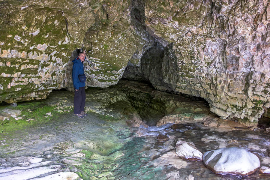
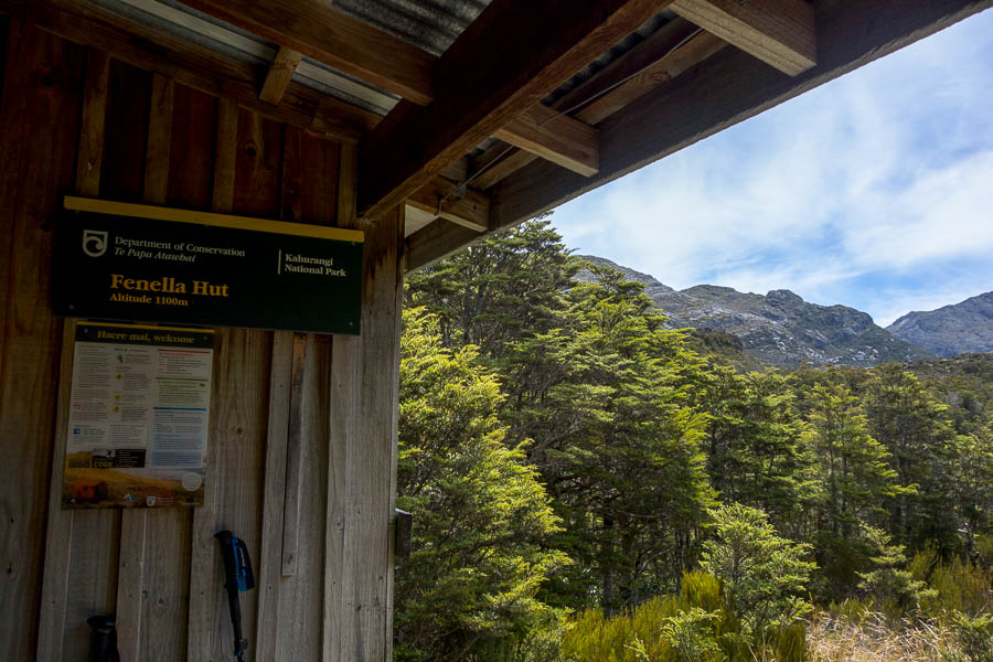
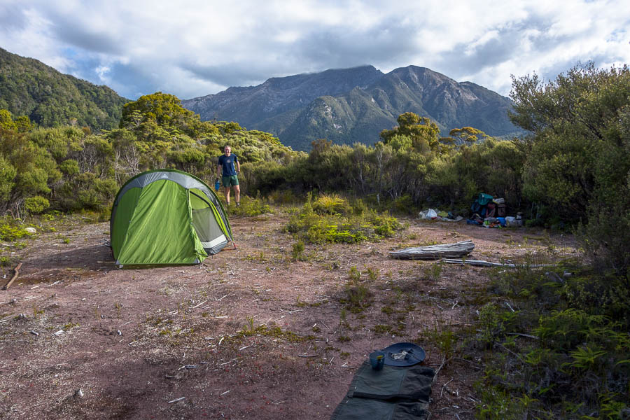
continued from Days 1-3

Day 4: Adelaide Tarn Hut to Anatoki Peak tarns

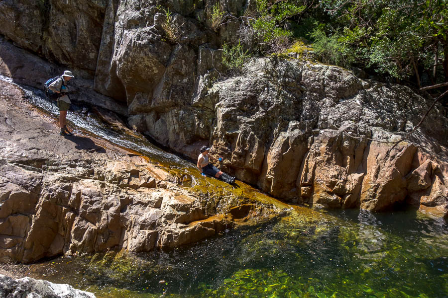
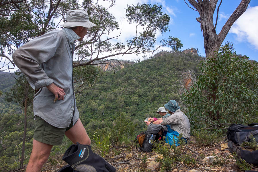
The crux day had arrived. It dawned clear and I tried to prod Tom into action at 5am (first light). He was unimpressed and refused to move until 5:30am. We were away by 7:25am in clear but breezy (cold) conditions.

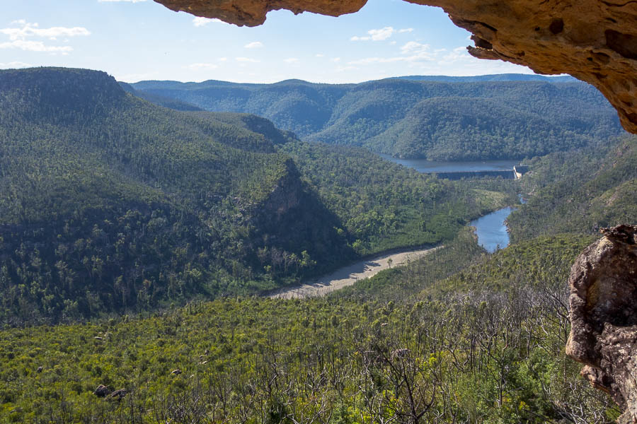
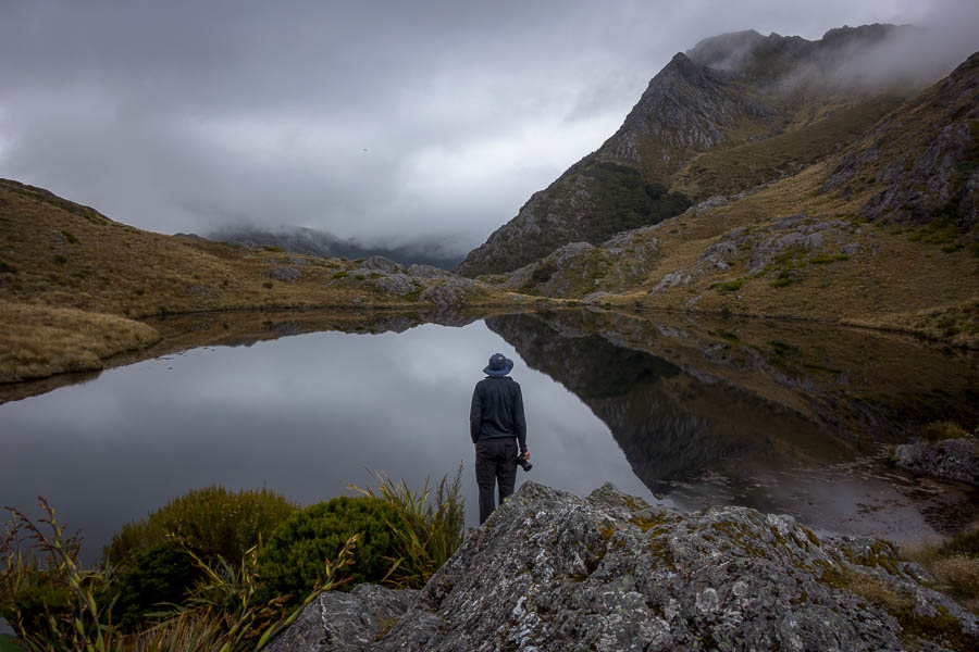
Dawn at Adelaide Tarn, with Mt Olympus just in the sun

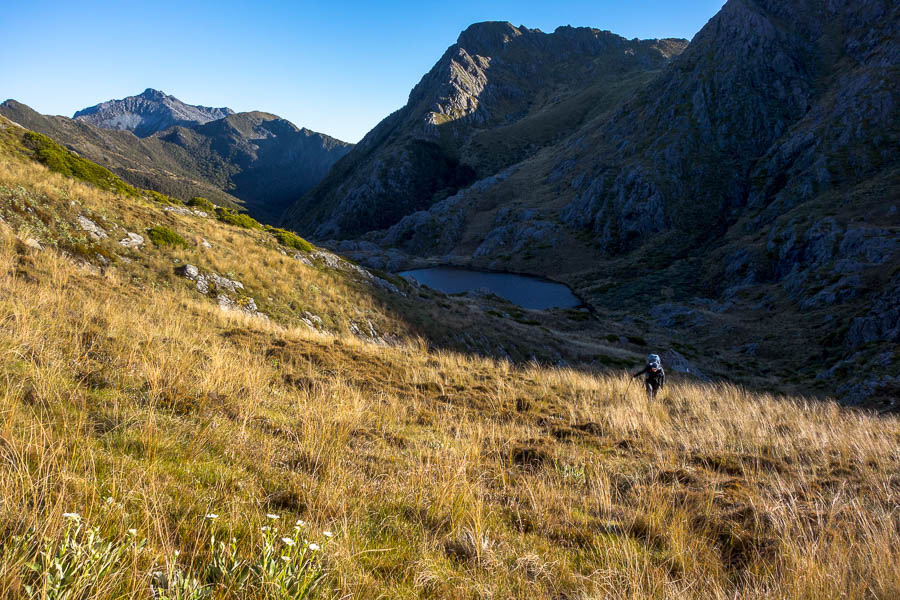
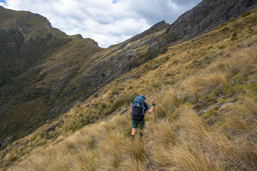
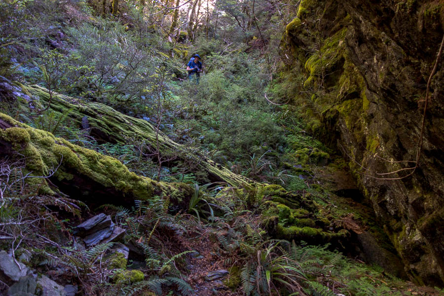
Climbing to the saddle above Adelaide Tarn

On the map we had approximately 2 kilometres to cover for the day. Time estimates from JC were between 5 to 9 hours. The second half of the route had the potential to be the slowest per km rate we’d ever covered.

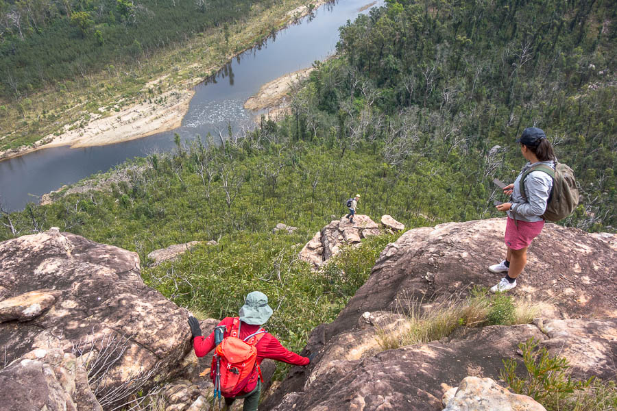
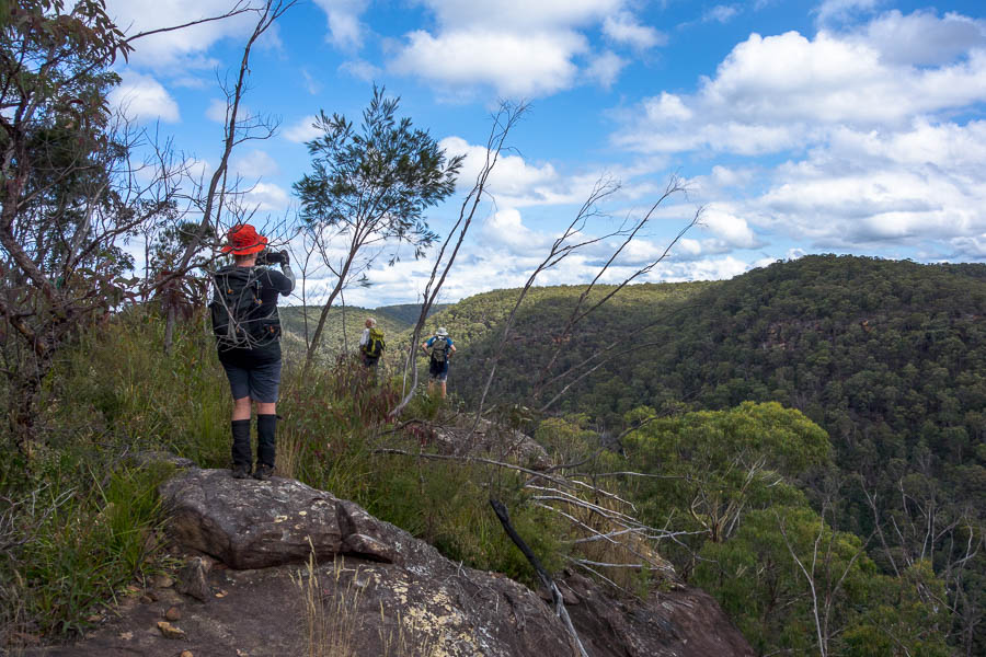
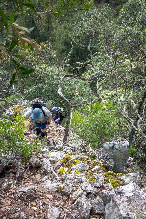
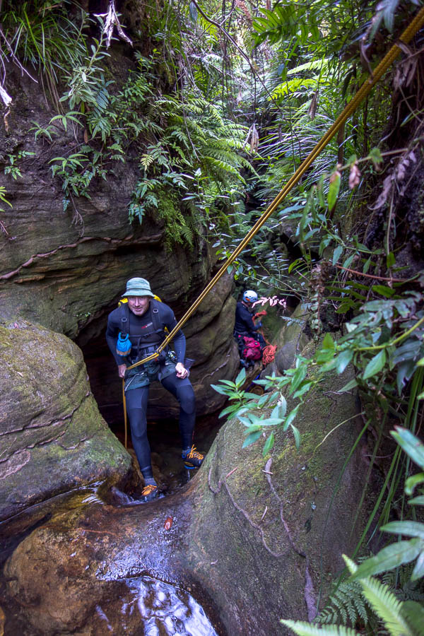
Almost immediately we were over thinking the route – not far below the saddle there is a steep descent down a chute – a bit of faffing about before realising it was easy (or would have been without a pack) and more importantly the way to go.

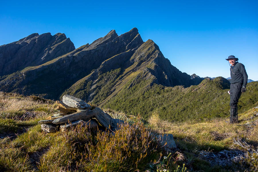
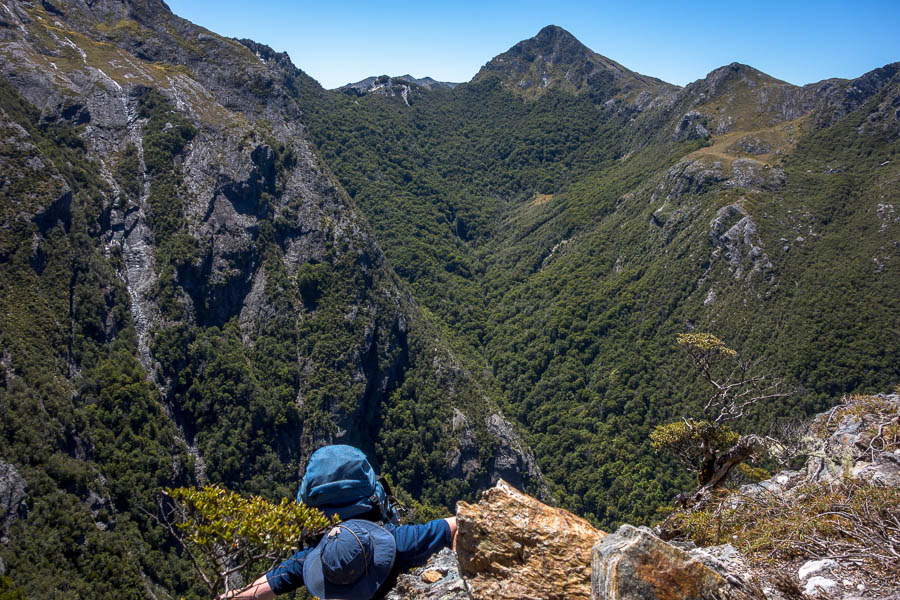
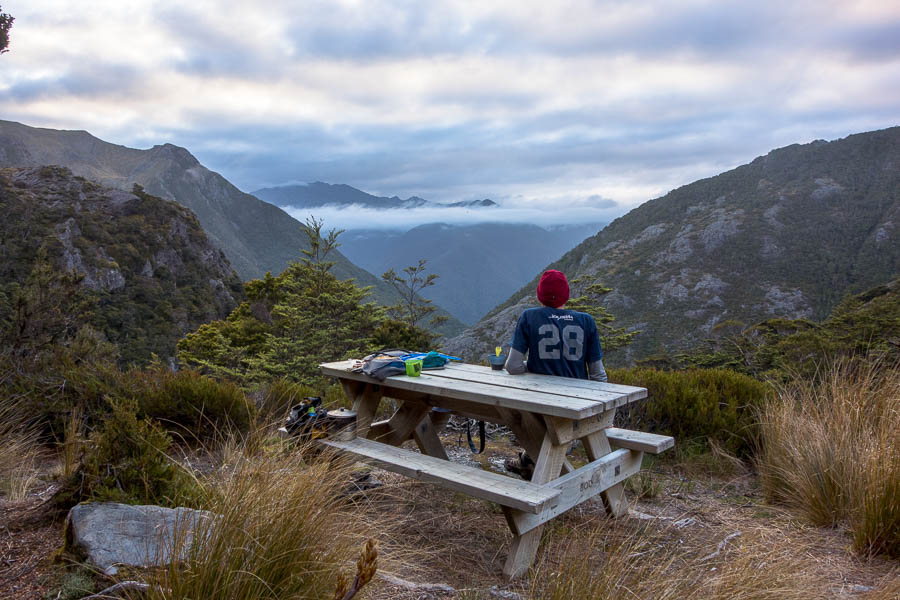
we just need to get around those peaks…

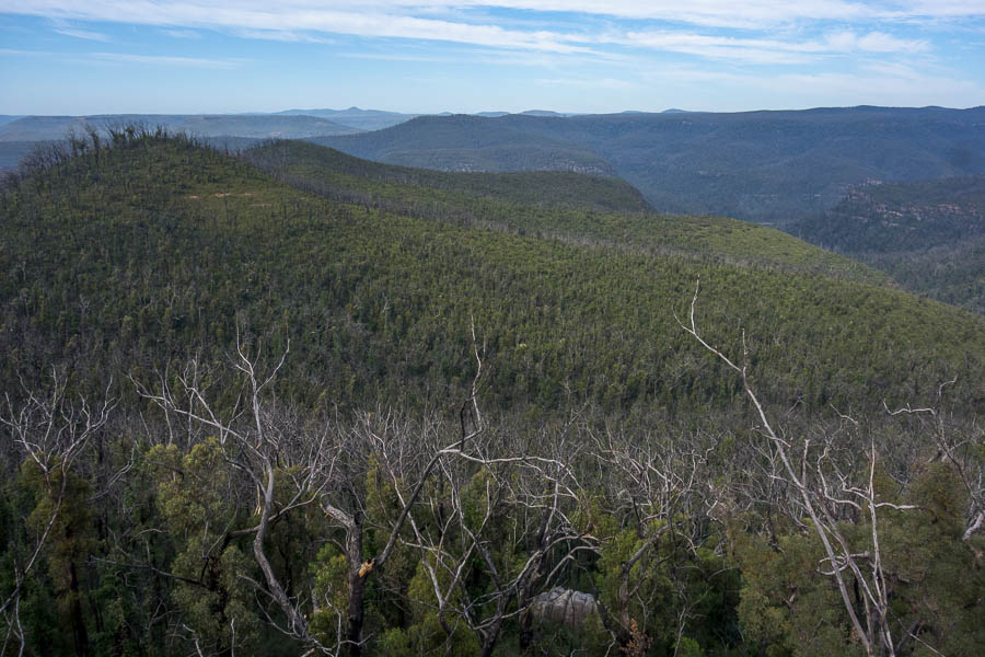
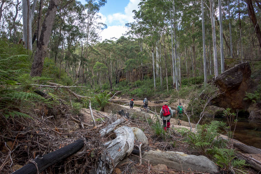
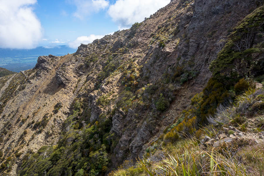
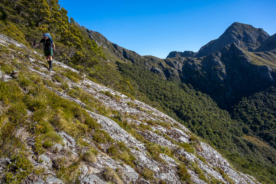
The first section is relatively straight-forward, sidling below Mt Douglas and then following forested sections along the main ridge towards the Dragons Teeth.

On to the main ridge below Mt Douglas

Easy walking in the forested ridge

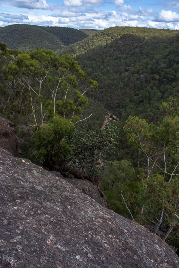
Then it was a matter of staying on course as we meandered up and down and around various open sections, bushy sections, exposed sections. The cool day quickly warmed up with not a cloud to be seen. As we were traversing the eastern side of the range we were getting the full sun – amazing conditions but almost too nice.

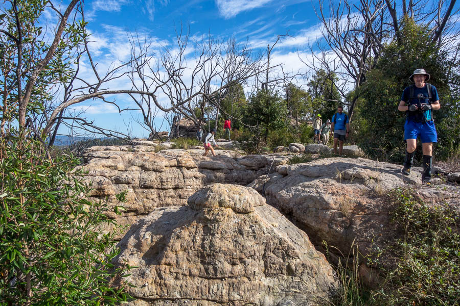
Crossing the first slab

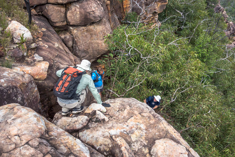
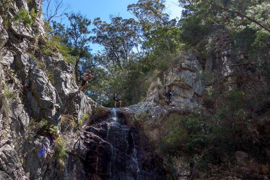
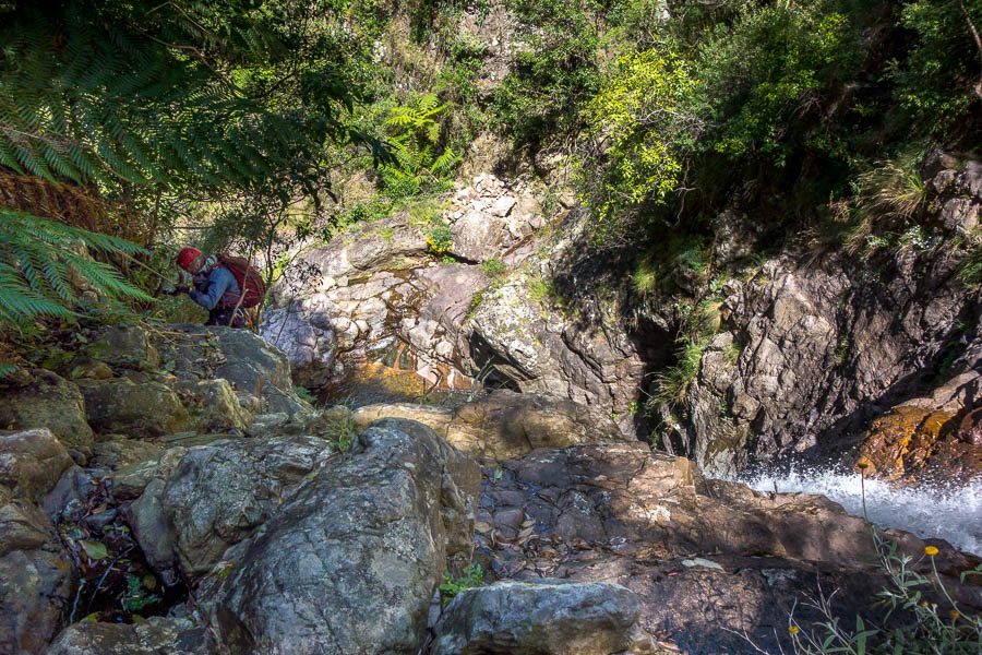
As we started descending along side a cliff line we came to what seemed to be a relatively recent slip*. I was over the shale slip before Tom got there – it was fairly sketchy. Rather than him come across if it wasn’t the right way and both of us have to reverse it I kept going to see if it seemed right. It was well trodden under foot but no cairns or markers.

It kept going a fair way so Tom came across, and we kept heading down. As I started climbing down a vegetated bank (well-trodden but probably not likely to last that long due to the erosion) Tom had a look at the GPS which had an OpenStreetMaps route loaded on it. It suggested we were off the route by 30-odd metres. So he headed back up. Just below the slip there was a ribbon on a tree which we’d missed. So he came back and we went back up with our packs. Climbing up at the ribbon I then found a tin lid on a tree on the ledge we were now on.

Some way below a relatively new dodgy slip – we initially missed the route climbing up to the right after it

So in theory back on track. But that ledge got skinnier and skinnier and I wasn’t overly game to edge out and see what happened. But there didn’t seem to be any other options. In the end I climbed up a vertical bank of vegetation (not a regularly-used option!) and got onto the spur. Tom did a similar but slightly less scratchy route. According to the GPS we were in the vicinity of the route.

We forged our own route up a wall of vegetation to get over this spur

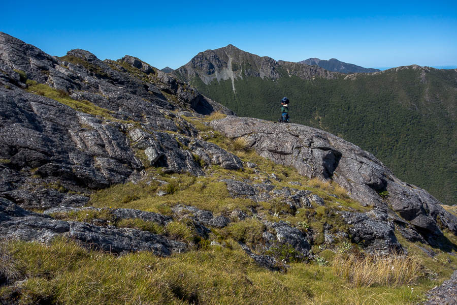
From the spur we had a good view of what was coming up. Consulting JC’s notes we couldn’t really make that much sense of what we could see in front of us based on his description. Nevertheless we followed them and found ourselves back with some markers going into the bush.

Back on the “route” heading over another set of slabs

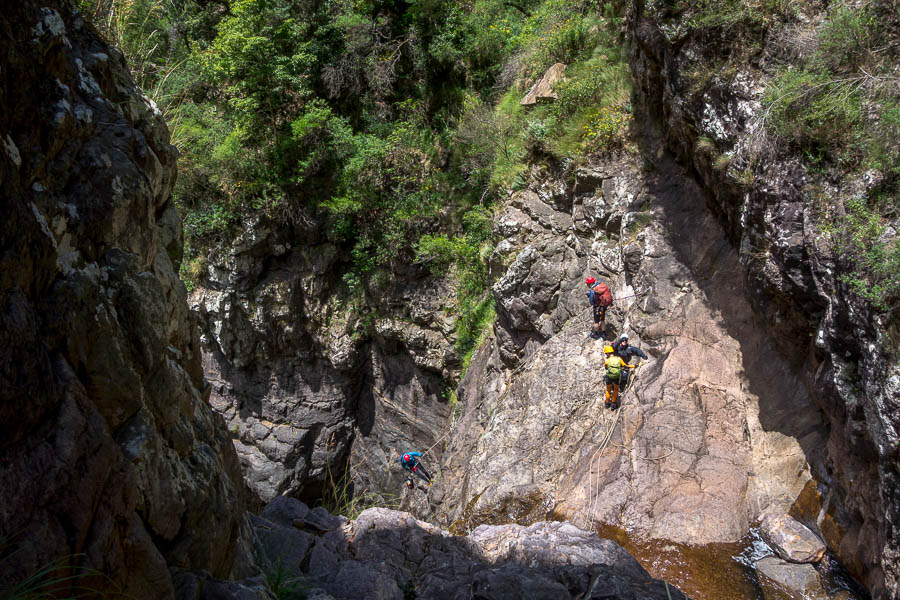
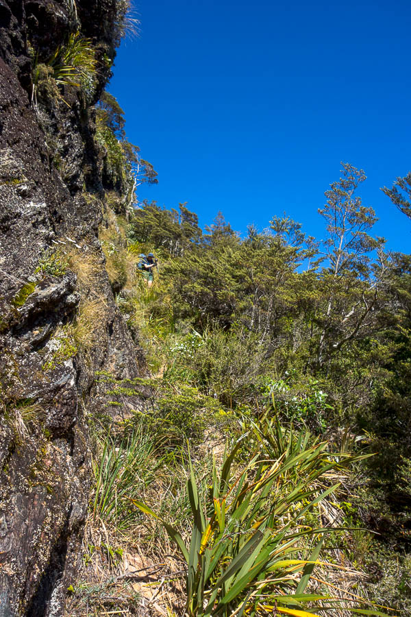
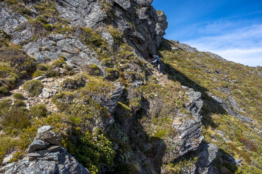
The route then traversed some narrow ledges, with quite a few climb-ups using trees as we made our way around the base of one of the long buttresses. The route was somewhat airy – there was just a line of vegetation between you and a significant drop.

The route alternated between being surrounded by bush and more open sections

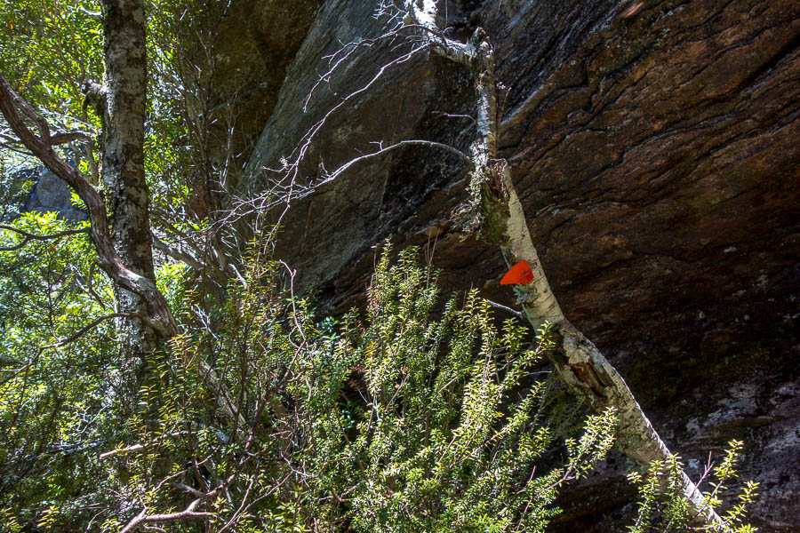
The orange tags were a welcome site as they confirmed we were where we were meant to be (we hoped!)

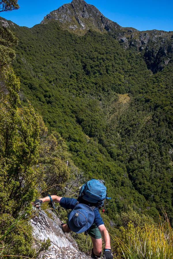
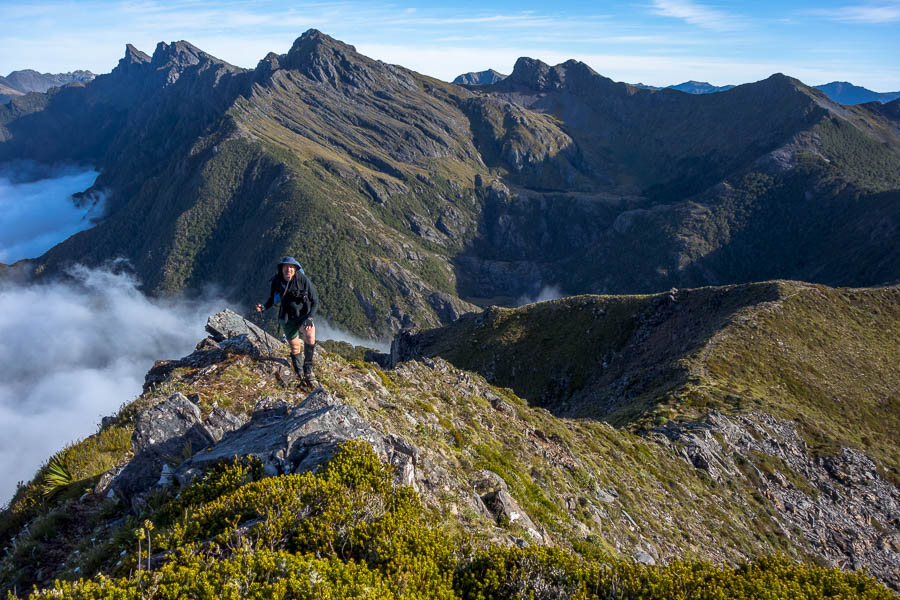
Tom on one of numerous exposed climbs

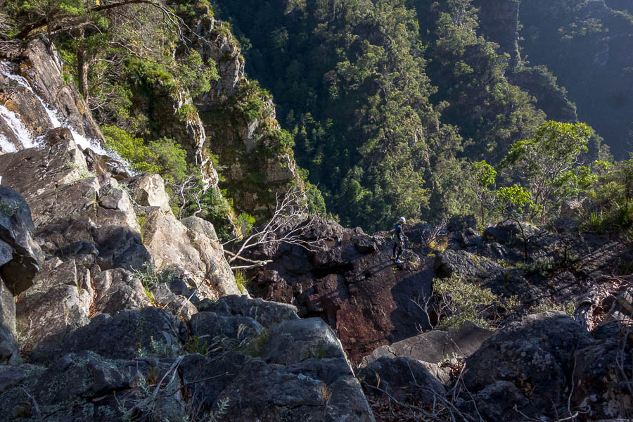
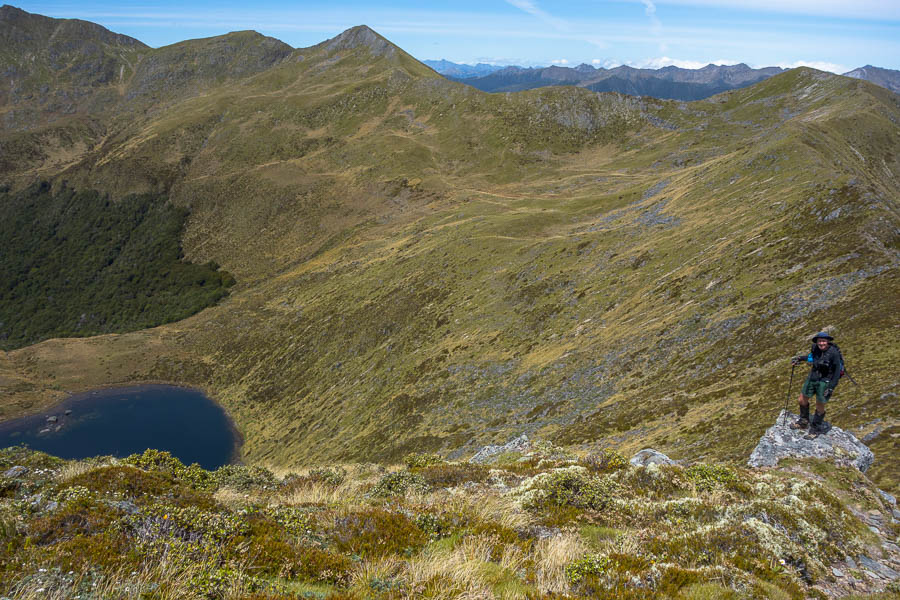
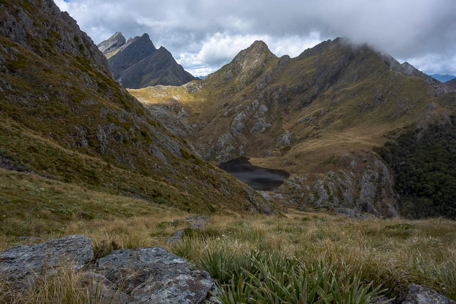
Looking back to the saddle (far left of the photo) where we started from. Tom a speck down the slope

Eventually we popped out onto an open snow grass section. At which point Tom realised that we had not come anywhere near as far as we thought we had – which is why the notes hadn’t matched what we could see. We were now where we had thought we were an hour (or more?) earlier. The notes made a bit more sense now!

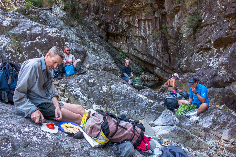
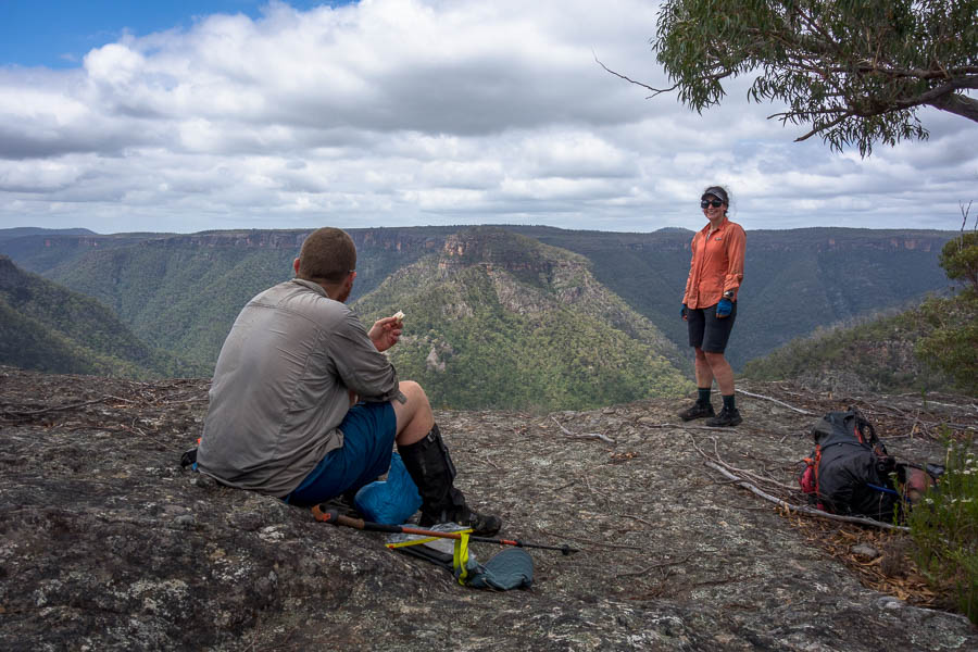
We had continued to be baked as we traversed the east-facing slopes and having had a fair bit of sun over the previous 3 days we agreed lunch needed to happen in the forest. This was a shame as there were some really great spots to stop, but none of them had any shade.

We found a reasonable spot in the forest for lunch before arriving at JC’s “open shale area”. It was fairly evident where to turn off, so maybe several years of his notes being available have helped with the route finding in this section. That said soon after as we exited from a rocky gully the pad appeared to vanish. There was clearly an orange tag indicating to go into the bush but then not much evidence on the ground. After a bunch of pushing through vegetation (and undoubtedly confusing things for future parties) Tom found some orange markers. Thank goodness – this route is fairly committing and having come this far the thought of reversing it to go the low route was almost unthinkable.

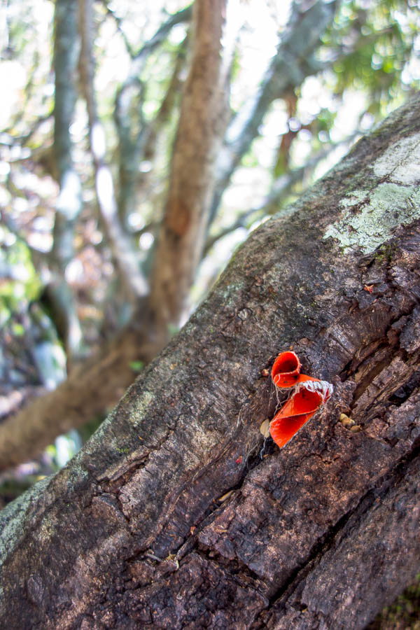
Tree trying to swallow a marker

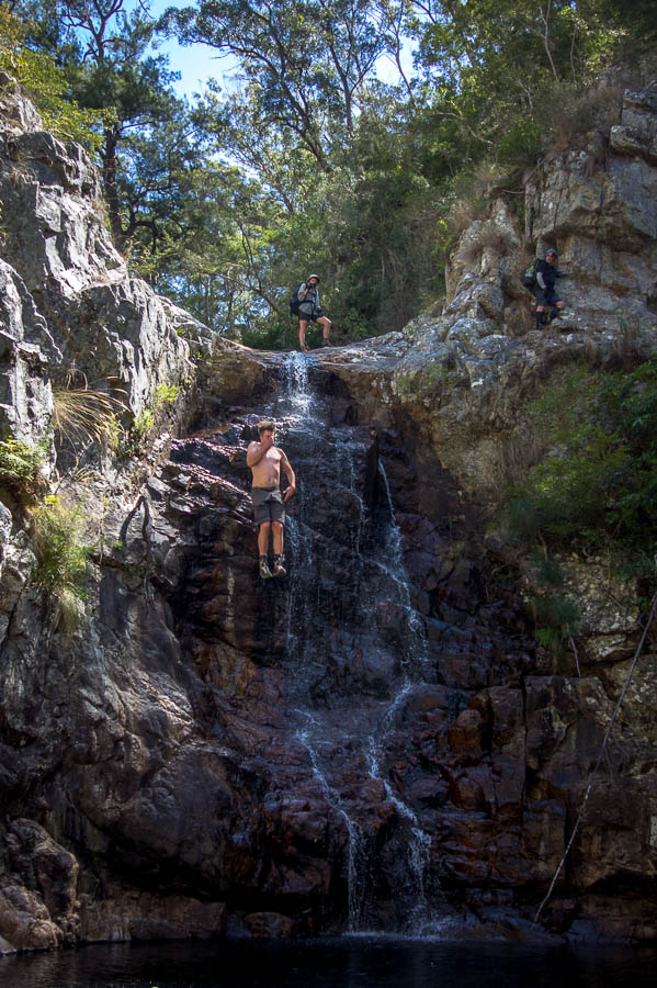
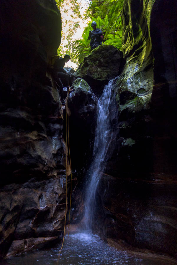
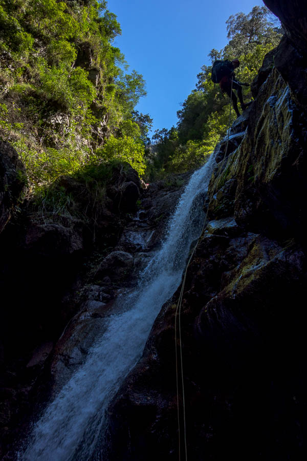
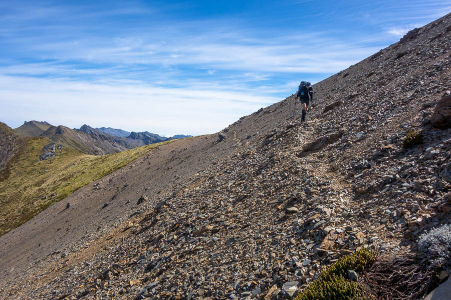
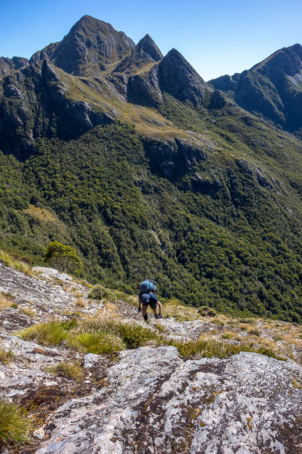
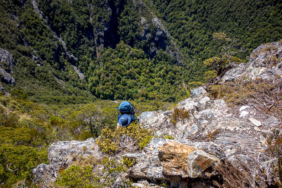
After some easy bush travel we hit the final “very steep climb”. This was around 150-200m of many 2-3m climbs, normally needing to haul on at least one tree if not two. Without the vegetation the route would be perilous – fortunately the vegetation, for the moment, is solid.

Near the base of the final 150-odd metres of scrambling ascent to get onto Anatoki Ridge

Looking down from where you “top out” from the vertical stuff

There was a palpable sense of relief when we finally topped out. I think Tom’s first words were “Well, that was terrifying”. My response was “I have no desire to do that route ever again”.

Somehow we came around that spur immediately behind Tom!

We tried to put our finger on why we felt like we’d underestimated the route. It was within our capabilities but we hadn’t enjoyed significant sections of it. It was way more airy, and the climbing was pretty sustained in sections. None of the moves by themselves were overly difficult – we did all the moves with our (still quite heavy) packs on. But the need to haul on vegetation over and over again with very large drops below you was mentally taxing. The warmth/time in sun also didn’t help general fatigue.

We’d had a big drink before we’d left camp in the morning, and then sculled another litre at one of the streams we’d crossed, in addition to carrying 2 litres of water each. Tom ran out of water just after we topped out, and I finished mine just as we got to one of the tarns below Anatoki Peak. Some comments I’d seen made me wonder if there was more water than usual when we did it – we crossed several running streams and there were lots of tarns below Anatoki Peak – so finding water wasn’t an issue for us – but I don’t know if some of those dry up at times?

If you’re going to attempt this route, every party member needs to be a confident scrambler with pack on, and fine with exposure. Pack-hauling would be quite sketchy/difficult. You do not want to get part way through the route and find you need to turn around.

One of the groups we met later in the trip told us of a solo walker who was behind them in this section. A helicopter appeared and went straight to a spot on the route so they assumed the walker had called for help/set off a PLB. Others we met later on had heard that the walker had got stuck with no way to go forward but couldn’t reverse.

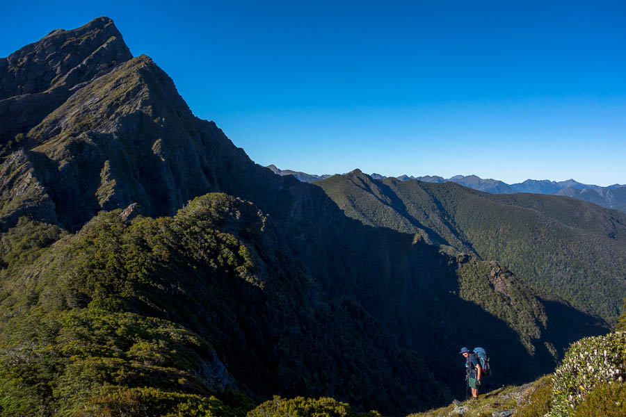
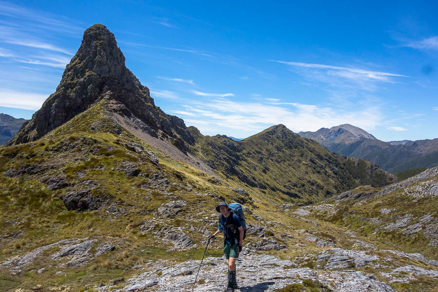
Tom on Anatoki Ridge, with the Dragons Teeth behind him

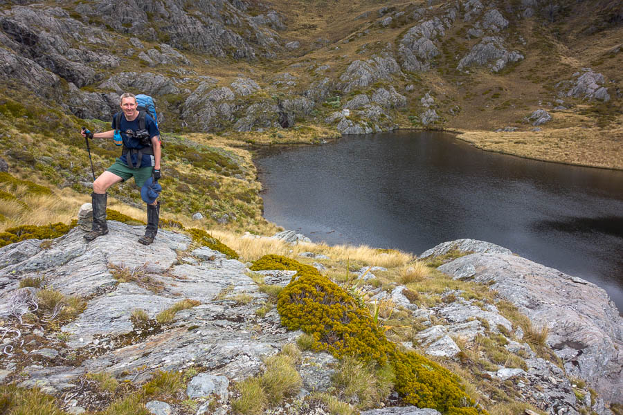
JC said the tarns (with great campsite) were at the top of the K on the word “peak” on the map. Once we had a drink at one of the low tarns I didn’t have any desire to spend any longer than necessary finding a campsite. So I asked Tom where this “K” spot was in relation to where we were. At that point Tom realised he didn’t have the GPS on a NZ Datum, and so despite having map and GPS, it required him digging into his pack and fiddling with his phone for a while to come up with an answer. Both of our feet were suffering by then as our socks and boots hadn’t dried out from the day before. Oh to get to camp and get them off!

Tom trying to work out where “k” on “Peak” on the map correlates to on the ground

We had made it in around 9 hours (including 2 morning teas, lunch, and a water sculling stop and of course much photo taking). We didn’t feel like we’d wasted much time route-finding other then just below the shale slip. Travelling with heavy packs definitely slows you down – hats off to JC’s group who did in 6.5 hours presumably with similar-sized packs.

We didn’t discover the “great campsite”. I climbed a ways further up, and there were so many tarns, but I couldn’t see anything obvious from a camping perspective. Maybe our expectations were too high.

We continued to be baked for a few hours as with the way the rock slopes there wasn’t really any shade – and the sun doesn’t set until 9pm! Ah some relief when the sun went below Anatoki Peak!

I rejected Tom’s tent site selection, and convinced him to set up near a photogenic tarn. Being wedged between two rocks made pitching the guy lines a bit tricky. It didn’t seem to matter too much at the time as there wasn’t much wind…

Our campsite below Anatoki Peak

However the wind swung around and picked up by the time we went to bed. So it was blowing directly into the big end of the tent. We had a somewhat disturbed night as the front pegs got completely blown out a couple of times. Fortunately we managed to locate the pegs each time! When it happened again at 5am I suggested we just call it quits and pack up.

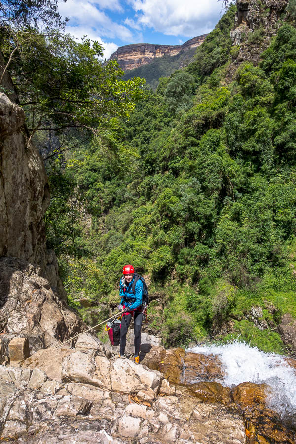
Day 5: Anatoki Peak tarns to Lonely Lake Hut

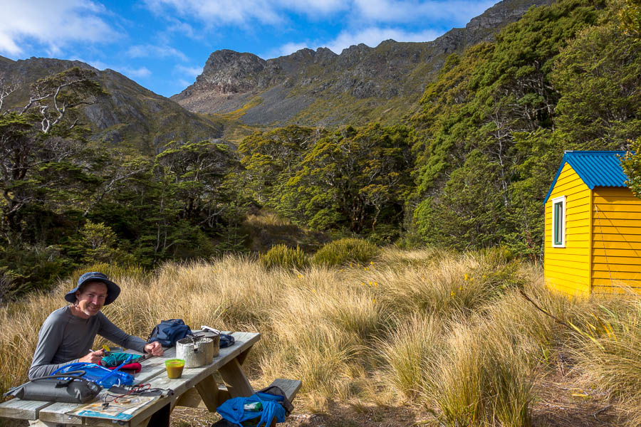
Camp spot chosen for photo potential rather than protection from wind

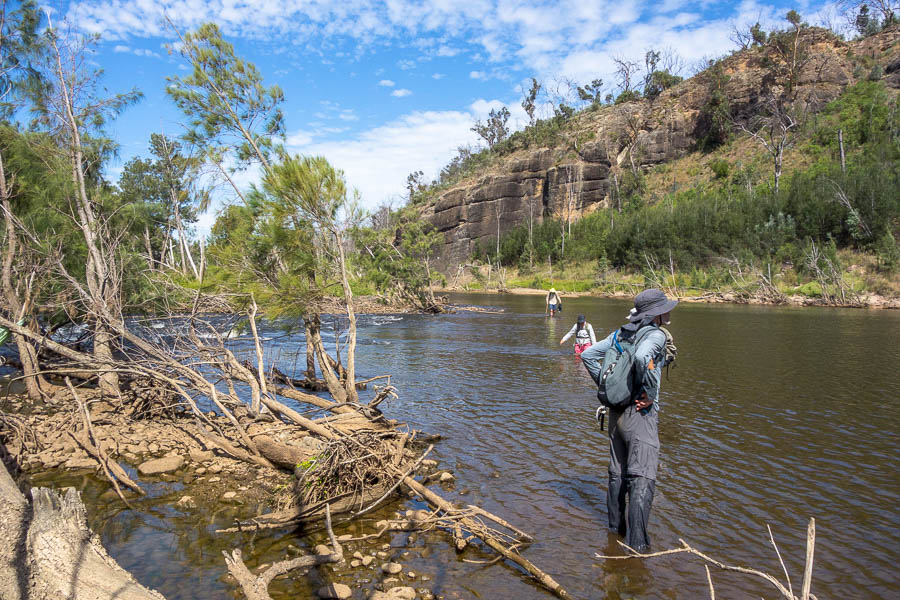
We picked up the cairns near our campsite and easily followed them along the eastern slopes (more baking in the sun to come!). JC made mention of a difficult bit, though easier than anything we’d done the previous day. By comparison the sidle on a narrow ledge was very straight-forward!

1 of 2 slightly sketchy sections between Anatoki Peak and the Drunken Sailors

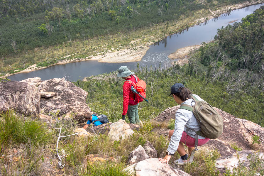
I got us slightly off-track thinking I’d seen a cairn well above us when in fact it was a goat standing in a saddle. But besides that the only spot where we had any issues with the route was the second slightly sketchy section for the day. This was climbing up the slopes of 1564 and needing to traverse around to the saddle below the twin peaks.

I had seen a cairn from a distance but then once we got in below the bluffs I couldn’t see it and there were multiple pads on the ground. The more obvious route along a narrow ledge was difficult to get on to. Eventually we came back to it having exhausted other options and I realised there was an easy(-ish) place further along to get on, and from there it was no worse than, say the ledge traverse in Myall Creek in Morton NP. There was a second section of narrow traversing around the corner which then took us to the cairn I’d seen some time ago climbing up.

The second slightly sketchy section (cairn in left foreground)

JC had suggested the twin summits worth climbing were at 1564. After morning tea we ascended the twin summits – one each!

Tom on one of the twin peaks at spot height 1564

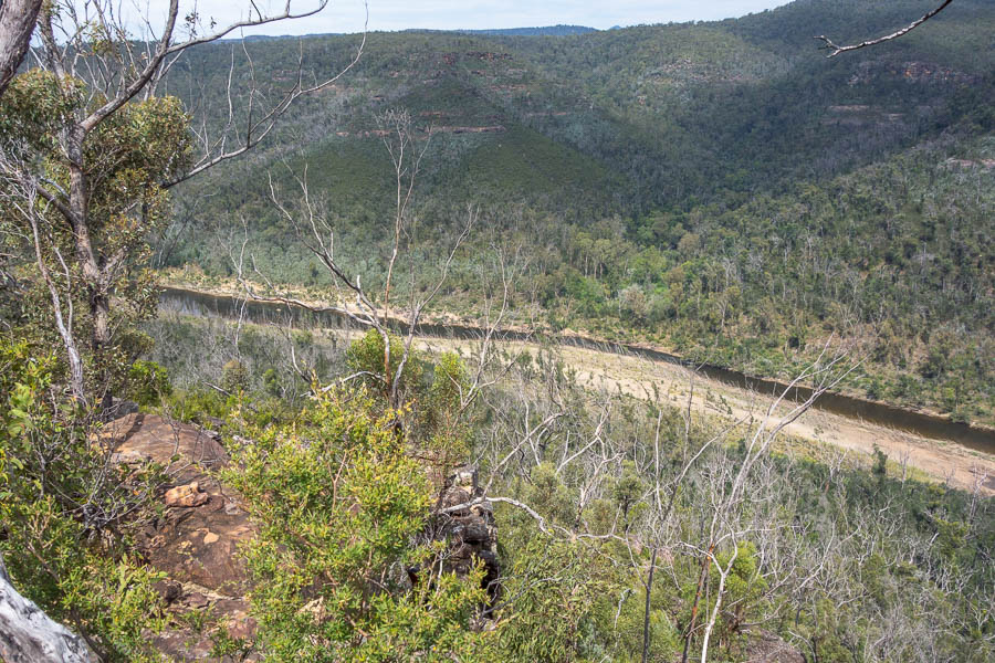
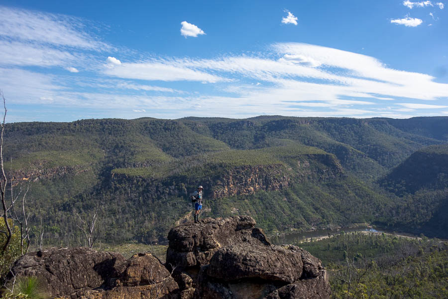
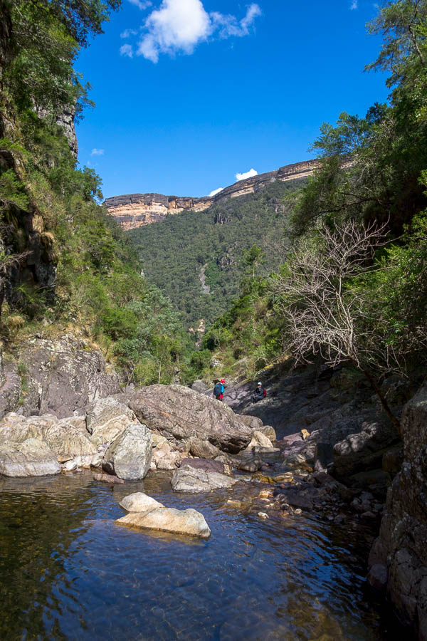
We continued sidling and eventually we were in the saddle below the Drunken Sailors. I guess at that point we could say the High Route was complete, as that is where you would re-meet the route if you did the low version.

Tom with the Drunken Sailors in the background
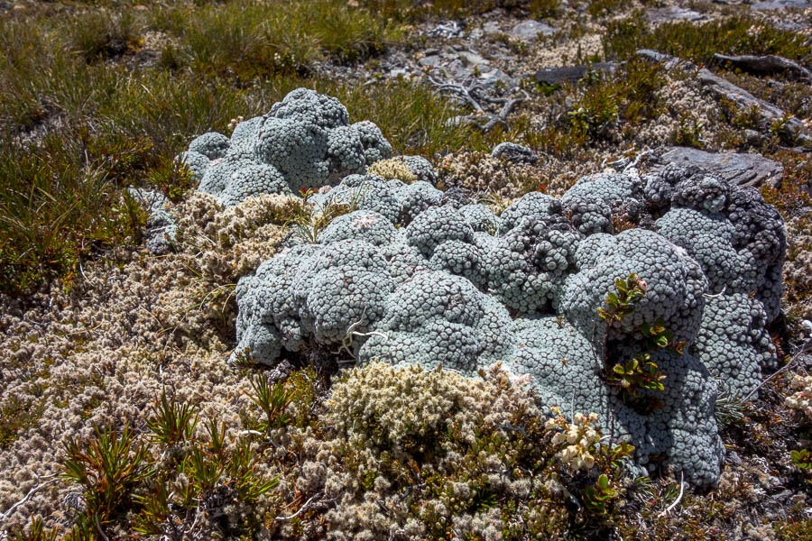
Vegetable sheep

I was (as always) keen to push on to the hut – as it felt like it should be just around the corner. Tom wanted to do yet more foot surgery. But once I realised the hut was a lot further away and I found some shade (a rare commodity) we stopped for lunch. It probably illustrated how little shade the previous 4.5 days had offered that we were so happy to be able to enjoy lunch without worrying about getting burnt. The spot was absolute bliss, next to a delightful running creek.

Lunch in the shade!!!

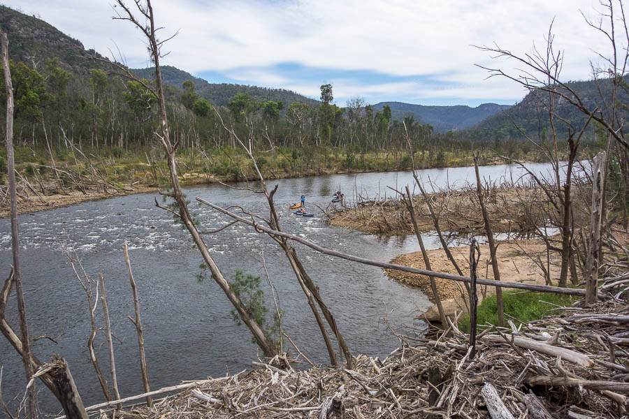
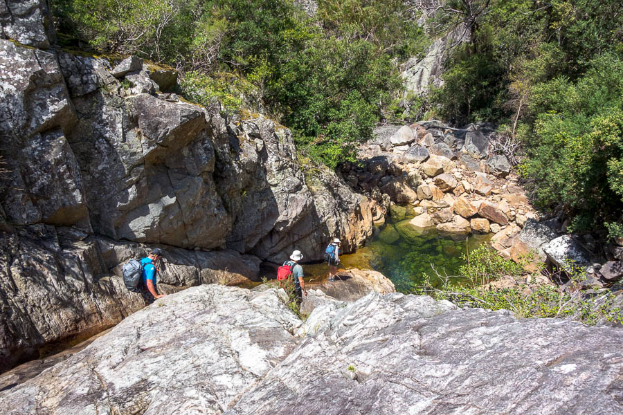
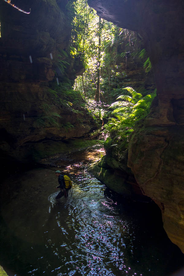
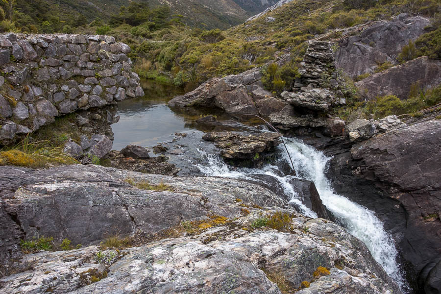
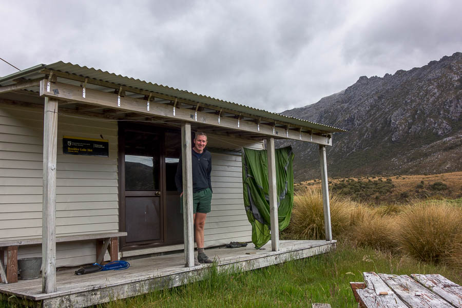
Eventually we tore ourselves away from the shade and continued down towards Lonely Lake Hut. It took a long time for us to get a view of the lake, but I loved following the creek down beside numerous cascades. The hut itself is set well away from the lake on the bush edge. It is a great spot with views, a picnic table, and to our immense relief a flat, sheltered tent spot. There are other camping options nearer the lake but after our windy night we were just happy to have somewhere we would get a peaceful night’s sleep!

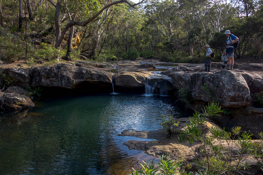
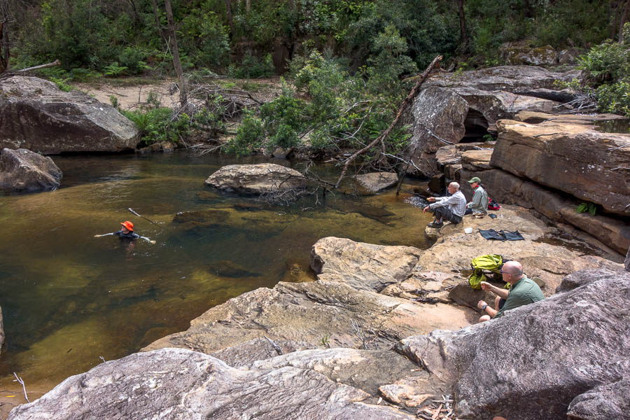
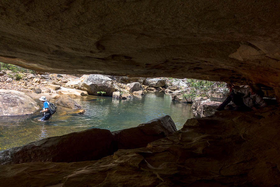
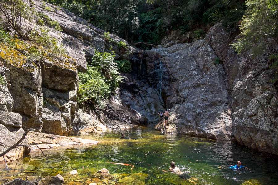
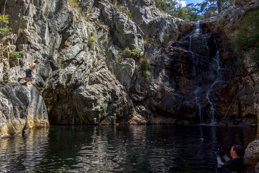
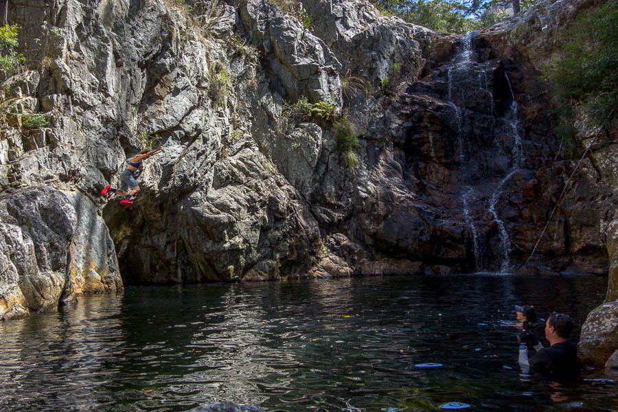
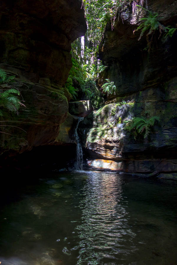
There were already 3 people at the hut when we arrived – having walked in from Fenella Hut that morning. They highly recommended a swim so we didn’t waste much time heading down to the lake. I was excited to find a nice pool below the outlet.

A beaut swimming hole below the outlet of Lonely Lake

We quizzed the others on the weather forecast and they suggested it was supposed to be reasonable until at least the 3rd or 4th. This was excellent news as it meant we could spend 2 nights at Lonely Lake. We were both ready for a rest day.

As we were all settling into dinner another 2 people arrived. George and Holly put our efforts to absolute shame. They had left Adelaide Tarn around 9am, and come the whole way, including climbing one of the Teeth, and got in at 6pm. Though they were carrying packs that looked far more like day packs!

They said there was another group of 4 also on their way – this group arrived some time later looking much more like what we would’ve done if we’d tried to combine the two days. They headed down to the lake to camp so we didn’t chat much to them. But between the original 3 and George and Holly we had a very convivial evening out at the picnic table, even though the mist had turned quite wet. The damp was what eventually sent us to bed.

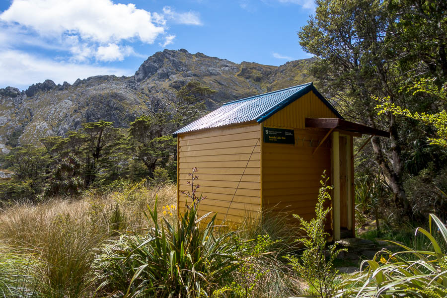
The very cute Lonely Lake Hut

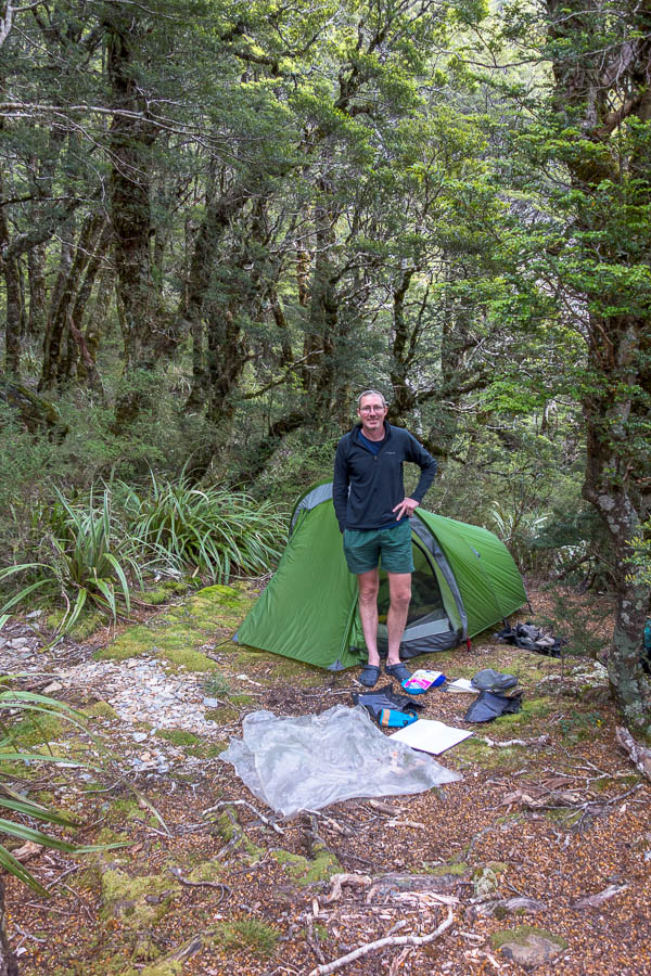
Our sheltered, flat campsite next to the hut

Day 6: Lonely Lake Hut (rest day)

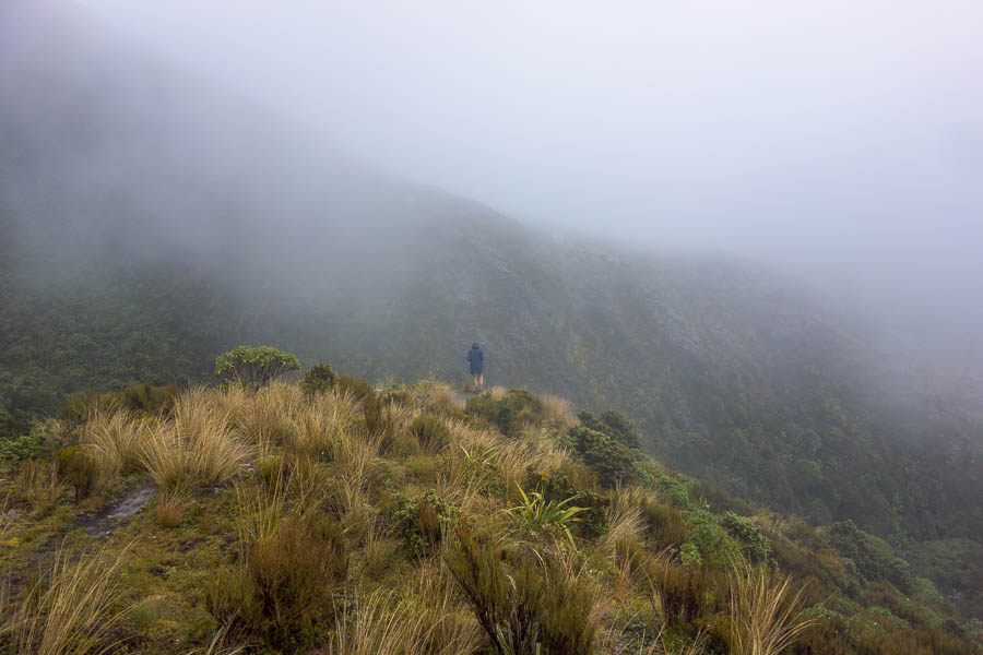
Knowing we didn’t need to go anywhere was amazing. So amazing that we slept in till almost 9:30am – that’s 12 hours in bed. The mist/mizzle from the night before had just got denser overnight. There was little to be seen and the other groups left it late to depart in the hope that the cloud would lift. As it was they all set off in less than stellar conditions, and by 10am we had the hut to ourselves which meant a nice dry (very late) breakfast. We had intended to climb the Drunken Sailors but as we remained in the cloud for almost the entire day I wasn’t unhappy that there didn’t seem to be much point!

No views for most of our rest day

Between reading the hut log books going all the way back to 1973, doing a quiz, screwing up a sudoku and almost finishing a cryptic crossword, the day passed rather quickly. A group of 4 did arrive later in the afternoon having come through the low route due to the drizzly conditions – they camped down by the lake so we had the hut area to ourselves for New Years Eve. Not that we made it up very late!

The evening ended up being quite lovely

The view sans-cloud!

*confirmed to be <4 years old by someone we met later in the trip. He had done the route 4 years earlier and it didn’t exist then.

The trip continues here.

Douglas Range Traverse (Dragons Teeth “High route”) 26 Dec 2022 – 3 Jan 2023 (Days 1-3)

We’d been thinking about the Douglas Range Traverse for a few years. We decided this was the year, and having a read a bit about the “high route” we thought it was definitely up our alley. After all, we love scrambling routes, particularly if it means you can bypass a 700m ascent/descent (the alternative if you go the “low route”).

John Chapman, well-known Australian bushwalking guidebook author, had published some notes for the high route. Having used JC’s notes for the Western Arthurs and Frenchmans Cap in the last couple of years we were familiar with his style, and had some gauge on how our walking times correlated to his (including breaks we were generally about the upper end of his estimates). We took on his advice to allow extra days to give us the best opportunity of good weather for the crux days.

Having booked everything in September we were then beholden to the weather. I tried to avoid looking at it in the weeks leading up – particularly given how inaccurate we’d found the forecasts in the preceding two weeks. I allowed myself some cautious optimism when it seems a slow-moving high was due to arrive on Christmas day. All I could say to people was “the forecast was about as good we we could have hoped for”… knowing all the time that once we started we wouldn’t have any way of getting any updates (other than from other walkers).

Someone inconveniently left a van in front of the starting sign!

Day 1: Trailhead (Bainham) to Beatham’s Clearing

So laden with 9-days of food, Tom’s fancy camera, and 3 litres of water each (! this is NZ!) we were dropped off at 10:30am the trailhead for Boulder Lake. Needless to say our packs were on the heavy side. And it was forecast to be a hot day.

The most challenging route-finding of the day was the first 50m, but soon we were on track. Plodding would probably be the best description of our movement for the day. The trail wound its way through 7-foot high manuka for much of the morning. This is not high enough to give any shade, but high enough to keep out any breeze (not that there was much). It felt much like a sauna.

The route to Boulder Lake used to start from a different spot which made the walk into Boulder Lake shorter/easier. We intended to take JC’s recommendation to split the day into two – our drop-off driver suggested we’d have enough time to push on to Boulder Lake, given there’s so much daylight. We discussed the situations where that might happen – “if there’s no water at Beatham’s Clearing”, “if we’re both feeling amazing at Beathem’s Clearing”, “if there’s no room at Beatham’s Clearing”. All fairly unlikely.

The interesting parts of the day were the limestone karst country – crossing numerous deep slits in the ground. And I saw two pigs, and heard/smelt plenty of goats.

Morning tea on the track – the body language says a lot about how oppressive it is

As we approached Beatham’s Clearing Tom declared there was no way he was going any further. I agreed. Perhaps a sign of how fatigued we were, we got to the “Water” sign – and rather than even walk 5m down the side-track to see if that was where the camping was, we decided to keep walking. We probably only went 5 minutes, but it felt like a lot longer before it became apparent there was no camping coming up. I felt like a complete idiot when I got back to the “water” sign to find that looking from the other direction on the track you could pretty much see the clearing. Anyway, we were there, no one else was. There were some water sumps. We didn’t have to go any further.

There was a well-trod path beyond the sumps, that I was doubtful would yield any better water, but we followed it anyway. Down, down, down we went, we did find some flowing water. (After all looking for water is probably a skill set we utilise a lot more than the average NZ tramper). Somehow we managed to siphon 4 litres out of a very small pool that the water was trickling into. Didn’t realise Tom had that trick up his sleeve. So armed with drinking water for the next day we used the sump water for cooking (not that I think it would have been problematic for drinking). We were both feeling pretty average and dinner had to be forced down – if only to reduce the weight on our packs!

Serviceable camping at Beatham’s Clearing

Day 2: Beatham’s Clearing to Boulder Lake Hut

I slept like a log unsurprisingly. Tom was also feeling a bit better so it was back to it early to try and beat the worst of the heat. The forest was taller in this section so we weren’t directly in the sun like the previous day.

Views back towards Farewell Spit

It was another beautiful day and the views from Cow Saddle were outstanding.

Our first look at the Dragons Teeth from the slopes of Brown Cow

Tom had read a few things which suggested the sidle below Brown Cow was a bit dodgy. JC barely mentions it, so I wasn’t expecting anything much. Admittedly we had perfect conditions but it was nothing of concern to us. Like most things it could be a bit more daunting in torrential rain and wind.

Traversing below Brown Cow. You might (just) be able to make out Tom on the track

Slopes of Brown Cow looking towards Boulder Lake

After the long, tedious descent to Boulder Lake we decided we should do the side trip to the lake outlet. I stumbled into someone’s campsite as I turned off the track. My guess was he had got in very late the night before having mis-estimated against the DOC times – given he was only just packing up at 11:30am!

The side-trip was worthwhile. The old dam wall was quaint, and the waterfall below it was impressive (if hard to get a view of). We had a wash in the stream there, not realising there was an amazing waterfall and pool behind Boulder Lake Hut, before heading back to our packs and having lunch. I also scored a walking pole, which had been left sitting on the edge of the lake well away from the main track.

The old dam at the outlet of Boulder Lake

Arriving at Boulder Lake Hut at 2:30pm there was a couple either just arriving or just leaving – turned out to be leaving. They had also mis-estimated the effort to get in, and so were splitting it up on the way out.

As if on cue the rain started just as we arrived (and they left). We thought we might have the hut to ourselves, but a group of 3 local women arrived later so we enjoyed the evening with them – even if our internal thermostats were very different. They decided to light the fire, after we’d had the windows open all afternoon to try and cool the hut down!

It continued to rain on and off for the rest of the evening, at times quite hard. We all went to bed quite early and I’m not sure if I was the only one still awake when a solo walker arrived just on full dark. She must have been very relieved to get to the hut after what I’m guessing was a very long day.

Boulder Lake Hut – the only hut we slept in

Day 3: Boulder Lake Hut to Adelaide Tarn Hut

We were up very early, and decamped to the verandah to try and avoid disturbing the other 4. We knew it was going to be a wet morning as our first task for the day was making our way up a tussock filled valley. My newly acquired walking pole was invaluable here allowing me to prod for all the holes that exist between tussock.

We’re heading towards the saddle in the distance. What you can’t see is the tussock is saturated after rain the night before.

Once we started up the ridge out of the valley a foot pad became clear and we slogged our way up before, what became a regular occurrence, of “first” morning tea. Our feet were saturated so we gave them the chance to dry out even if they had to go back into wet shoes and socks afterwards.

Almost at the saddle. Lower half completely soggy.

We thoroughly enjoyed the next section of ridge, a bit scrambly, amazing views and once again great weather. The narrow ridge definitely reminded me of the Western Arthurs. Second morning tea was taken after the narrowest section of ridge where we could appreciate the views looking back over what we’d traversed.

Dragons Teeth are getting closer. The next part of the route follows the ridge line.

The next goal was the Eye of the Needle – the pass below the Needle that leads to Adelaide Tarn. Thinking we could see it from a long way out, we were pleasantly surprised to find what we’d thought we were aiming for was much further away than where we were actually going! Many things I’d read in advance had suggested getting into the Eye was tricky. Maybe the footpad used to be more indistinct, but we didn’t have any issues (once we’d worked out where we were!). We got over Needle Pass and got the views of Adelaide Tarn with the Dragons Teeth looming behind just before the cloud descended.

Nearing the Eye of the Needle

First views of Adelaide Tarn

The rest of the afternoon was pretty gloomy.

Adelaide Tarn – the tiny hut perched on the other side of the tarn

Adelaide Tarn Hut is a tiny 4-bed tin hut. The bunks are old-style with metal mesh for the mattresses to go on – and if you’re more than about 5ft 5 you’re going to struggle to fit on them lengthways. Having seen the interior of the hut we didn’t take long to decide we’d camp – which was to Brenda’s benefit when she arrived a few hours later. She ended up with what looked a very comfortable set up (double-mattresses and being of a suitable height).

The inside of the hut was rustic.

I didn’t particularly enjoy hanging out at Adelaide Tarn. The hut is perched on the edge of the tarn, with the toilet above it. The area immediately around the hut and toilet is very muddy which makes it difficult to go exploring once you’ve taken your sodden shoes and socks off. Apparently there were nice campsites near the outlet but we didn’t get over there.

If it had been sunny I could see there were some nice swimming options (I did have a brief dip below one of the waterfalls). So, all in all, I was very glad that the weather was such that we weren’t needing to sit out one of our extra days there!

Low cloud makes for a moody afternoon


Continue to read about the next 3 days…

1 2 3 4 5 19