Author Archives: rachel

Mt Jellore (21 Aug 2022)

Another plan made at 9:45pm the night before – which was a bit unfortunate as this would have been a good walk to invite some other people along on.

My research indicated a number of people on the interwebs had trouble finding the start of this walk and/or following the route once on the ground. There are several minutes of my life I will never get back. Much like a car crash you can’t look away from I started reading a blog which detailed 3 attempts (the final one being successful) on Mt Jellore – along with blow by blow conversations held during the drive there and while walking. I hope my blog readers don’t find my writing so tedious.

We had no issues deciding where the walk starts (though it is not sign-posted) and then finding our way through the mess of fire trails which punctuate the start of the walk. To be fair, it’s probably a lot easier now that the bush has come back after the fires. Tom noticed when we arrived that openstreetmaps had a loop option drawn, so we decided we’d try and do that rather than the usual out and back.

The surrounds were lovely and the sun was out. Early on we came upon a look out which was almost excellent. Other than Mt Jellore being directly behind the trees!

The almost really good lookup (Mt Jellore obscured by the trees on the right)

A sea of paper daisies

A few obstacles on the track

I had read about the creek crossing having ropes on both sides. We didn’t use them but I can see why you might want them, particularly in wetter conditions. The way the track has formed in this section is not ideal – straight up and down on each side. A re-routing which goes across the slope would alleviate erosion and remove the need for ropes.

Now that NPWS has taken over management of the area (rebranded as the Jellore Flora Reserve instead of Jellore State Forest) it would be nice if this walk became official – perhaps in the lead up to that the track could be re-routed. Of course, I doubt this is anywhere near the top of the priority list!

It was impressive how many sizeable pieces of sandstone had been put across the old 4WD tracks leading off Soapy Flat Road, so there’s definite evidence of attention being paid to the area.

Approaching the creek crossing – not an ideal track route

Another place which has had considerable attention is the junction of the track with the private property fire trail. In an obvious attempt to funnel walkers around the private property a sizeable ‘entrance way’ has been built – along with a sign to “Soapy Flat Road”.

The road which avoids private property

Getting close

Tom wanted to check out where the loop route went off before we climbed Mt Jellore. While we were looking for any evidence of the route I found a cairn. So we thought that might be the start. Until I looked more closely and found a geocache – not that we could get the lid off.

We weren’t intentionally geocaching but look what we found

I was somewhat surprised to find the side of Mt Jellore was quite cliffy – I had expected it to be completely rounded. Fortunately the track just works it’s way up the slopes, and other than early on in the climb, does a decent job of switch-backing through to the top.

Half-way up

At the top

Mt Jellore was the first trig station in NSW – established in 1828. Mt Jellore was chosen because it’s such a distinctive peak. Having seen it from so many places it was great to finally get on top.

First trig station in Australia

We headed out past the trig to the rocky outcrops for lunch. We had a couple of wedgetailed eagles do a close fly-by – almost as impressive as the ones we saw at Mt Kaputar. Despite being a lovely sunny day the wind was brisk and there wasn’t much desire to linger once we’d finished eating.

I guess these are acceptable lunchtime views…

After descending and having found no evidence of this ‘footway’ that was on openstreetmaps we decided we’d just go off-track for our return journey. There were a myriad of animal tracks so the going was relatively easy.

Very accessible nest!

We were a bit surprised at the terrain we ended up crossing. After scaring off a couple of pigs we then found ourselves in a thorn thicket which we probably could have avoided with the benefit of hindsight.

An alternate route back

Similarly we picked up an old fire trail on the ridge that we probably could have picked up earlier. Between old fire trails, animal tracks and relatively open bush we made reasonable progress to return to the main track after the thicket hell.

A somewhat shallower creek crossing

Back at the cars after 5 hours this was an enjoyable walk which got us back to Mittagong in time for afternoon tea before all the cafes shut!

Surveyors Crag & Pointy Point (13-14 Aug 2022)

Another week, another walk. This one had been overshadowed in the lead up with a not-so-bad that it should be cancelled, but not-so-good that it should definitely go ahead, weather forecast. In the end Tom decided it would be more work to try and come up with an alternative and we’d just dice with the rain.

It was raining when Jon picked us up at 5:45am which along with the early start wasn’t promoting positive feelings. But by the time we arrived in Mittagong, with plenty of time for a coffee, it wasn’t raining and things were looking up.

The highlights of this walk really came once we got to the cliffs lines – but that was a few hours walking away. During the morning the rain came and went but fortunately the scrub was a lot less intense than feared.

Tom’s recommendation to wear long pants had caused Jon a great deal of consternation before we’d departed but ultimately he had opted not just for long pants but also overpants. Despite this somehow I was in front for a decent period and by morning tea my trousers were saturated from the wet bush.

Rock platforms

We were happy to get to some views for lunch, though the choice of lunch platform seemed to be a trial for some of the more cantankerous party members. Initially I was unhappy that the fine conditions changed to light drizzle as we started lunch, but then the most complete and intense rainbow I have ever witnessed filled the vista before us. Surely worth the damp for the spectacle!

Views

Amazing rainbow!

After lunch we explored the nearby ridge and then keen people went looking for a pass through the cliff line.

Hardenbergia was in flower everywhere

Jo checking out the drop

Jon surveying the progress of the others on their pass finding mission

Eventually we regained our packs and headed off towards Surveyors Crag. The water run en route was a bit more effort than expected – for both the effort through the vegetation and the amount we had to drop to find water. Subsequently we didn’t have a lot of time to set up camp before we lost the light on the cliffs. Nonetheless the views were still spectacular for a jovial happy hour.

Views over the Nattai River

No expense spared for the dinnerware

Tom sent over the edge

The team at happy hour

The view for happy hour

A late spattering of rain sent most of us off to bed a little earlier than we might have gone otherwise. While Jon had suggested a band of rain was on the way it seemed to largely bypass us, and along with a reasonably windy night, the tents were dry in the morning.

A few of us got up for sunrise and we had breakfast in our happy spot looking over the Nattai valley.

Sunrise

Crag Trig

I had found the remains of the logbook container in the cairn when we’d arrived on Saturday afternoon but hadn’t had time to poke around for anything else. On Sunday I was surprised to find the logbook, unprotected from the elements, other than being inside the trig cairn, still relatively intact.* The logbook hadn’t seen much use – a total of two entries since it was placed in 1996!

The logbook & remains of its container

Front page

The first entry in the book

The second and final entry in the book

I know an SBW party visited the spot in May 2018 but they obviously didn’t fill it in. I had wondered about how that trip had gone as it was pre-fires and I imagined the scrub would have been quite bad. But when I went back and reviewed the trip report from the 2018 day walk it had been shortly after an RFS burn. The report concluded “I can honestly say that if it wasn’t for the recent burn we would most likely not have reached our destination in a single day without some very serious night walking.” (as it was they finished after dark).

Since we weren’t doing a day walk we had time for more exploration – so Sunday morning had us crossing a gully so we could get to what Tom had christened “Pointy Point”. (Look at the Hilltop map and you should be able to work out where Pointy Point is!)

The descent creek was a pleasant surprise. Scoured sandstone made for some fun rock-hopping and boulder-scrambling.

Fun rock-hopping creek on Sunday morning

Small cascade

Getting up the other side was a completely different story. I took the lead in plunging uphill through dead incense plants, fallen trees and general vegetation. We eventually got to the top of the other side, which after the 2 hour crossing, meant it was morning tea time!

Hard work getting up out of the creek

I think we were all relieved when the Pointy Point ridge was relatively easy walking. It would be interesting to know how much the 2018 RFS burn impacted how severely the different ridges burnt.

Attractive ridge walking

More splendid views and scrambling around edges of Pointy Point kept us entertained before lunch.

Views of Pointy Point or from Pointy Point

Feeling small & precarious?

Tom had to shelve his idea of another gully crossing as we were running out of time. Post-lunch walking was something of a grind as we followed boring broad ridges and eventually retraced our route back to the cars. I was expecting a post-sunset finish so it was a bonus that we got back just before 5pm.

We capped the weekend off with an early dinner at the Mittagong RSL. Another fun weekend out in the bush with a boisterous party.


*While the logbook was in “relatively” good condition it was still very weather affected and so I took it & the remains of the container home with me. Future visitors won’t find a logbook unless a new one gets placed.

Flat Top Brook circuit (6-7 Aug 2022)

Caro put a Short Notice Walk on the Program which offered a short(er) drive from home, so we signed up. It ended up being a very satisfying weekend of exploring off the Mt Hay Road. And finished in time for afternoon tea in Leura on Sunday. As Tom would say “stoked!” 🙂

Heading off onto a ridge

How do we get down there? (note cairn on opposite side)

Scrambling up the other side

The leader surveys the terrain

I think it will go down there…

And indeed it did go.. all the way to Flat Top Brook

But what goes down must come up

Plenty of wattle in flower

Tom stoked with our destination for the night

The party checking out the views

Tom with more views

Camping on the edge

An unexpected old fire trail

Tom decided winter is swimming weather. In Urella Brook.

Exiting from Urella Brook was a bit of work…

Waterfall in the upper reaches of Urella Brook

Grinding grooves

The top of the waterfall

Beautiful hanging swamp

Road bash back to the cars

Barrallier & Wallarra (23-24 Jul 2022)

I wasn’t that excited when Sue decided Kanangra was where she wanted to go for her belated-birthday weekend. But since the weather forecast wasn’t that great for Saturday we ended up with a short route for the first day – which meant a “late” start on Saturday morning. An absolutely scandalous 10am start meant we only had to get up at 6am!

It started spitting not long after we arrived and we had hopes for the day when it briefly cleared.

A grey old day

But then the drizzle returned and so we headed directly for shelter.

A refuge from the persistent drizzle – but perhaps not as salubrious as we were expecting

Walking in the rain – seeking something better

We agreed not to light a fire during lunch to ensure we would go and explore afterwards… but we got cold and soon our resolve withered and the fire was started. After hot drinks we accepted reality, that we weren’t going anywhere and settled in for the rest of the day. We did stick to our rule of not starting the evening’s eating and drinking before 5pm – even though the 10 minutes leading up to 5pm seemed to go on forever. Sue had her snacks laid out well in advance so we could get into them as soon as the clock ticked over.

Our retreat from the weather for the rest of the day/overnight

A very pleasant evening of eating and drinking followed. Crudites, dips, cheese & crackers, garlic mushrooms cooked in butter and pork balls with a flavour-bomb dipping sauce left us sated. Fortunately dessert stomachs exist independently so we all had room for Toni’s chocolate mud cake.

Gorgeous sunrise from my warm sleeping bag (no clouds!)

With the constant waterfall from above it was hard to know what the weather was doing through the night. But stars seemed to be evident when I looked out and it was amazing to see a completely clear sky as the light broke.

A constant stream of water created a curtain across the overhang

Once we got on top of Mount Barrallier it became evident why there was a constant waterfall – the plateau was sodden. Centimetres of water just sitting on the soil with nowhere to go. If anyone had aspirations to staying dry they were quickly wiped out as we sloshed our way to Bushlanders Point.

Once on top of Mount Barrallier it was clear why there was a constant stream of water…

I was pleased to find a small rocky outcrop at the point to get out of the sword grass and water.

Cake round 2 from Bushlanders Point

We were less motivated for a circuit of Mount Barrallier after the bush-bashing to Bushlanders Point – but with the summit of Mount Barrallier only 300m away, and in more open country, we decided it was worthy of ascending. Myles Dunphy clearly found the views from Mount Barrallier more inspiring than us as he named it The Temple of the Shining Orb. The mind boggles.

Sue taking in somewhat less interesting views from Mount Barrallier

Barralliers Crown (& Tom) from a different angle

A couple of hours later we found an excellent lunch spot looking over classic Kanangra scenery on dry rock platforms. I made sure to roll up my sleeves so my arms got a taste of the sunshine which has been so absent this winter. What a stunning day we had been treated to.

Sue enjoying our birthday present to her – Kanangra views!

Open rock walking on Mount Wallarra

There seemed to be some nervousness about the steepness of our proposed descent ridge. And additionally what the water levels would be like in Christys Creek given how wet the last few months have been. The slope was indeed steep – the upper section being somewhat pleasant to descend as it was quite blocky quartzite, but that turned to vegetation covered slopes which proved far more challenging.

A more typical Kanangra ridge on our way down to Christys Creek

Fortunately these plants were well rooted as I did a lot of hanging on to them on this steep descent

But we made it down without significant issue to find Christys Creek looking relatively benign – I suspect it had been more feisty on a memorable trip Tom, Smiffy, Rich & I did in 2011.

Tom looking tough!?

Smiffy in a healthily-flowing Christys Creek

Ah winter canyoning

Margaret Falls

Tom had somewhat optimistically thought we would have time to head on to Mount Bungin but it was already after 3:30pm by the time we started our ascent from Margaret Falls. The exit track from Dione Dell canyon was not well trodden – some randomly spaced sections of pink tape were presumably trying to get it back after the fires, but the slopes were so open and the tape intermittent – unclear how successful that will be.

The last lookout of the day (so says Tom)

Descending from Pindari Top

We all seemed to take turns trying to find the old track across the heath back to the road. Where we were did locate it you almost didn’t want to walk on it such was the hazard. The slippery clay underfoot threatened to put most of us onto our butts from time to time. Eventually we reached the road – where we had no car since I had said we shouldn’t bother with a car shuffle. Fortunately we managed to flag down a passing car soon after we started walking and so dispatched Tom to get a car and come pick us up. The couple who kindly gave Tom a lift were baffled at Tom’s story of what we’d been doing for fun over the weekend 🙂

Some idiot suggested no car shuffle at the start of the trip…

The shortest discussion of if/when/where to go for post-walk refreshments concluded a pub dinner in Blackheath was in order. Sadly we only caught the final number of what seemed to be an open music performance night.

Unexpectedly good weather on Sunday turned this into an excellent trip with great company as always. A great way to welcome Sue back home.

NO IDeA Rogaine (16 Jul 2022)

It seemed it was the weekend for rogaining. NavShield and the Bidjigal Night Rogaine were on in NSW, but I was in Victoria to do the NO IDeA Rogaine. The NO IDeA Rogaine was set in the Heathcote-Greytown National Park just north of Heathcote. As always the planning and preparation time whizzed past and we hadn’t settled on a route with only half an hour till the start. Opting for Plan A the highlighters were quickly put to work and we made it to the briefing in time.

About to start

This was possibly the most challenging terrain I’ve had to navigate in a rogaine. On the ground was gently undulating with subtle features – difficult to pick up from the 1:30k map. I now have a much greater appreciation of NSW Spatial Services making LIDAR data freely available – it would be fascinating to see this map re-done – unfortunately Victoria does not have the same open data policies.

The bush was open and made for quick cross-country travel. We started off well, whether through skill or luck, we nailed our first 9 controls (55 – 65) in just under 2 hours.

Control check-in

Our only major mishap during that time was losing Mel’s map on a stretch of fire trail where we were eating rather than navigating. Fortunately Mel had photographed the map before we’d started so she at least had a copy on her phone – albeit only a small section she could view at a time. However, we soon discovered compasses and phones don’t play well together, so we were also down to one compass, as Mel wasn’t able to take bearings from the map on the phone. [Tom did point out to me after the fact that I could have given her my bearing so at least she had something to walk on as well]

Rogaine map with our route overlaid (the heavy yellow markings were part of the map)

After 65 the wheels fell off. We got a bit excited after seeing our competition head cross-country from 65 – we abandoned our plan (which had been north-east to the road, then follow the less distinct road south), but then didn’t make a clear replacement one (just a vague head east and expect to hit the less distinct road – which we enact anyway). Having climbed a distinct knoll after crossing a saddle and then not finding the control we were confused.

Looking at our track after the fact and comparing to the map (and to the contours on OpenTopo) I can see how I misinterpreted what was on the ground, and several things we could have done rather than what we did… but that’s the beauty of hindsight.

At the time we didn’t know where we were. Hoping to gain some idea (haha) from the next team who suddenly appeared was unfruitful. And some time later both our teams, independently, ended up meeting again on the road south of the control. Finally we got things back on track but it was a 40 minute mistake.

Our route overlaid on Open Topo Map – compare some of the track placements to the rogaine map

There was a bit more confusion on our way to the next control as well. This time due to a significant 4-way intersection existing on the ground that was not on the map (it is on OpenStreetMap see above). We recovered from that one fairly quickly and got back into it for the next 3 controls. By then I was very happy to be leaving the roads behind and just navigating by features. After nailing our walking on a bearing between 63 and 73, we completely failed on the next control.

Following one of many bearings

The aim had been to get from 73 to 52. But looking at what we did the bearing must have been somewhat off, plus we failed to correct sufficiently having wandered into the wrong gully early on. Once again we didn’t know where we were.

We worked out where we were somewhat faster but gave up 100 points (52 and 54) in the process. I would have liked to have pushed for 54 once we worked out our location but time was starting to be a factor and I think we were a bit mentally scarred from the mishaps mounting up.

Fortunately we made it to the remaining controls in our plan without drama and got back to the Hash House with 5 minutes to spare. I had a chat to Grace & Anna (our competitors from #65) – as it turned out they ended up being the best Women’s Team – and we had done exactly the same route until 65, with only 1 minute separating us 2 hours in. They made it to #80 in 14 minutes as compared to our 56… Though I probably learnt more from that mistake then from all of the controls with no issues!

In the end we came 1st in Women’s Veterans, 3rd in Women’s, 14th Overall (out of 80 teams) on Saturday.

It was a great to get out in the bush with Mel 5 years after our last rogaine together.

Women’s veteran winners – chocolate 🙂

Corang Arch (9-10 Jul 2022)

Possibly the earliest I’ve ever got up for a bushwalk? I dreamt that we’d slept through the alarm, and I was very pleased when we woke up and it was too late to do anything about it. That wasn’t how the day actually turned out (fortunately). I felt surprisingly good when the 4:30am alarm went off.

We had a good run through to Wog Wog even though the road from Marulan has plenty of potholes following the floods last year and enlarged by the recent rain. Turns out no one in the group was keen for a cold, possibly wet, night camping, and we all went for the Saturday morning drive. (Though some with significantly later alarms than me!) The car had shown -1°C not far from the campground and it was still very cold when we started walking.

Subsequently we were all thrilled when we discovered that the Wog Wog Creek crossing was going to involve a wade unless you had long legs and a good sense of balance. Tom & Mark #1 managed to leap across but the rest of us went barefoot. There was a disaster in the offing when Ljiljana couldn’t find one of her shoes which had been thrown across. Fortunately it was eventually located. Our feet took longer to recover from the crossing, it felt like hours before my toes were back to normal.

Ljiljana putting shoes back on after a chilly early creek crossing

Tom surveys the first real views of the day

Corang Peak a distinctive landmark for most of the trip

Areas to explore?

I was glad to get off the sodden, boggy track for some exploration just before lunch. We had a nice stroll down an open ridge (for the moment at least – the vegetation hasn’t come back as much as other places yet) and found a cave for lunch.

Corang Peak again

Lunch cave

Corang Peak and walkers

Portrait of a leader (that’s Jo’s shadow), plus grinding grooves

We oohed and aahed over views for most of the afternoon. Whether that be the distinct peak of Pigeon House Mountain, or a sun-drenched Monolith Valley, or just the 360°C panorama from Corang Peak, or of course the surprise of Corang Arch.

Distant views of Monolith Valley and Pigeon House Mountain

Descending Corang Peak

Mark on Corang Arch

Half the party on Corang Arch being photographed by the other half

The forecast had been for rain to come through during Saturday night. It wasn’t wrong. Fortunately we were dryly tucked away in a cave. It was hard to tell how much it was raining as the waterfalls cascading off the tops were so noisy. As it turned out not an insignificant amount, as Canowie Brook was up a fair bit from the day before. With Sunday’s weather dawning cold, cloudy, windy with the odd-spattering of rain Jo decided (with plenty of support from the party, possibly even twisting her arm?) we would head directly back to the cars.

very different weather day on Sunday!

Still swathed in cloud and battered by wind

Moody views

Up and over

Wog Wog Creek was no longer a leaping prospect for anyone after it’s overnight rise. But, since our feet were wet already, it made getting across a lot less painful.

Jane crossing a swollen Wog Wog Creek

Ljiljana giving Jo a helpful prod 🙂

With the early finish we had time to head to the Nerriga Pub for lunch. A great weekend – easily moulded to suit the weather.

Where it isn’t raining (2-3 Jul 2022)

The forecast for Sydney was a month’s worth of rain on Sunday. Saturday and Monday weren’t far off similar totals. And it wasn’t just Sydney – a large swath of the surrounding area would also get the deluge. So it wasn’t a difficult decision when asked if I wanted to do the ACT Rogaine on Sunday. Canberra seemed to be just on the edge of the east coast low, and would hopefully avoid most of the precipitation. I was feeling slightly ripped off as the rain got heavier and heavier as we drove towards Canberra on Friday afternoon!

Saturday dawned dry, but cold and windy. By comparison with what was going on in Sydney we were in tropical heaven and so bushwalking we were going. Ali had suggested that we would encounter lots of long wet grass, but the wind dried everything out so that promise came to naught. We opted for something closer to Canberra and not too high – and what a great option it ended up being.

Is that blue sky I see?

After being blasted by the wind as we wound our way around the base of the reserve, we soon warmed up once we dropped into the creek we planned to ascend. The creek was a delight – the rock was dry, otherwise it would have been a nightmare. Lots of easy scrambling and rock-hopping. And it just kept going.

What have we got here?

Tom & Ali working out a way

Tom scrambling

Creek crossing

Eventually we got to the waterfall which was the main attraction of the walk, we had morning tea on top but soon got moving again as the wind quickly chilled us.

The Waterfall

Above the waterfall

It was a similar story on Big Monks Summit – not somewhere to stick around – but we were much more protected once we dropped off the side.

The edge of the urban sprawl

Tight fencelines

Healthy lunch

Conferring on the route

The final creek of the day was nowhere near as enjoyable as the other ones we’d walked in so Ali & I quickly made it back on to the tops. Soon we picked up the main trail and then it was just a contouring jaunt back to the car. An excellent walk for less than pleasant weather conditions (but no rain!).

ACT 4 Hour Winter Rogaine

The forecast on Sunday was worse but I had my fingers crossed we’d get a similar day to Saturday. This was mine & Jo’s first pairing in a rogaine and it went pretty well. I’ve never done a 4 hour rogaine before – an unusual length – but long enough to stretch the legs. Particularly since we chose the hilliest part of the course (since running wasn’t on our agenda).

We constantly leap-frogged a team of 4 for the first part of the day. We were pretty confused when only 2 of the team members seemed to actually go to each control. I think maybe each team only had two wrist-bands so the two which didn’t have them didn’t bother getting to the control – doesn’t really seem within the spirit of things. But anyway – they would run past us on the fire trails – we would then take a cross-country route to the next control, shortly after they would run past us again. Oh the feeling of smugness to come out ahead of them on the road.

Winner, winner, cheese toastie lunch

We pulled out a 1st in the Women’s Division – but at 21st overall it wasn’t a particularly impressive victory. That said, there was only 60 points separating the 10 teams above us (810-870). The overall winners did have a resounding victory on 1400 points – second place 240 points behind them! Hartley Lifecare did a great job with the catering – can’t really go wrong with cheese toasties and soup on a coldy, windy day. The rain started as we were driving out to the main road – so winning all round!

Glen Trig | Mark II (25-26 June 2022)

Two bludgey long weekends in a row had left me feeling overindulged. The forecast for the coming weekend was great. “We have to get out” I informed Tom. Unimpressed with the two suggestions I put on the table he countered with Glen Trig. Given he had been suggesting it on and off for a while I figured he really wanted to get back there. I didn’t really care where we went, as long as I got some exercise. Even better if we could line up some other people, then it would be harder to bail out at the last minute.

As we drove along the Wolgan Road water dripped from the trees, the overnight frost starting to melt. The grass was frosted over at the Newnes Campground, and I rapidly reassessed whether I really wanted to wear shorts to walk in. Fortunately the Pipeline Track warmed us up and we were soon feeling positively balmy having escaped the frost hollow at the campground.

Tom pointing

It had been over 18 months since we’d been in the area so a visit to the Pagoda Lookout (now very officially signed) was definitely on the cards. A bit further on we had a late morning tea looking over the Glen Davis side of the Pipeline Pass and not long after left the track for the unknown.

Despite only having a couple of kilometres to cover (as the crow flies), the country was intricate. The map gurus had been at work with DEMs, slopes and probably all manner of other things I don’t understand. It made for relatively easy negotiation of the complex terrain.

Is he still pointing?

Pagoda country

Possibly an escape route?

Though, the maps don’t show if the gullies are going to have water in them, do they!? Tom didn’t believe Toni when she said we couldn’t go the way he wanted unless we were going to get wet. Not far off the shortest day no one was was inclined to get wet feet.

Tom checking out the water barrier

Fortunately Jon had already scouted a dry route which gave us access through the cliff line and into pagoda city. We clearly weren’t the first to use this route as we found a cairn further up the pagodas pointing down to our pass.

The dry route!

Tom was itching to get into the canyon above the water barrier but high cliffs kept us elevated. Something for another trip when we have ropes! Instead we contented ourselves with negotiating the pagodas.

Smiffy, Tom & Toni on the pagodas

Toni & Smiffy and pagodas

Unfortunately the nose had a small section which was more ambitious than we were keen for. So we dropped down and traversed under the cliffs to find an alternate way up.

Smiffy contemplating a route up the nose

Interesting weathering formation

Reminiscent of Remarkable Rocks

Even once we’d made it through the next cliffline the final ascent to the summit was not straightforward. I waded my way through scrub and managed to get on top from one side, while Tom & Smiffy jammed a log in place to get up in a different place.

Jon below Glen Trig

The survey marker

The wind made us keen for a more sheltered spot than camping on the open rocks. We were glad to find a sheltered gully with some flat space. Only a small time window remained before sunset, so any camp set-up was delayed. Instead, a mad dash to get what we needed and settle in with the first round of snacks, cameras and warm clothes on the tops.

Enjoying the sunset

More sunset enjoyment

The last of the light

Post-sunset we went through several more rounds of snacks and finished off with sour cherry cheesecake brownie (thanks Toni!). Efforts to create a natural candle not successful. A rousing round of Happy Birthday to Vivien* (conspicuous by his absence) had to make do.

The next morning Tom, Jon and Smiffy got varying amounts of sunrise photography in, while Toni and I enjoyed being warm in our sleeping bags.

A family of billies

Tom finally packing up the photo gear

Eventually we set off, taking a different route out than the one we’d approached with.

Smiffy enjoying the view

More water (and more inconveniently, a 4m drop) prevented us getting down the gully we were exploring. After reversing we decided to roll the dice and head along the cliffs for a few hundred metres and hope the maps were giving us the right information on an alternative pass.

More water (and height) barriers

Footprints

We got lucky and descended where we hoped to, and explored some more canyon-y sections of the main creek. Before once again deciding it was not the right trip to get wet feet.

Bridging descent

Very mild scrambling

And some scrub

From there it was a relatively straight-forward ascent back to the point we left the track the day before.

Open ridge ascent

We saw a couple of groups of walkers at the Pagoda Lookout, including a couple of women who had walked up with nothing except what they were wearing. The other couple said the women had asked what they were carrying in their backpacks – and were a bit surprised when they said “food, water, first aid”. Apparently a new idea!

The cold wind put paid to any ideas of lounging about looking at the views.

Toni traversing the pagoda

Pipeline Pass descent

Back at the cars at 2:30pm meant we got to Pie in the Sky just in time to get apple pie before they sold out. An excellent weekend with good weather, great company and spectacular views.

*and me

Mudgee wanderings (17-19 June 2022)

It was finally time to use a gift voucher I’d been sitting on for almost a year. After months of rubbish weather nothing could be taken for granted about whether we’d be able to fly. Fortunately a week of fine weather lasted, and the forecast fog was insufficient to cancel the flight. Using the voucher in June was part of a cunning plan to avoid getting up too early – only a few days off the winter solstice meant probably the latest start one could hope for. Our accommodation was only 5 minutes walk from the meeting point, so a “civilised” 5:25am alarm gave us plenty of time to make the meeting point at 5:45am.

The weather was being fickle. We set off to the launch point for Plan A, but some further wind testing by the pilot had us driving back across town to launch point B.

pre-dawn light

Getting the balloon ready is a bit of an operation but eventually we had lift off.

Prepping the balloon

Almost ready for us

Beautiful colours

About to take off (photo: Balloon Aloft)

And we’re off

A bit noisy!

Lovely early morning light on the hills

Sunrise (photo: Balloon Aloft)

As I enjoyed the views towards the Bylong Labyrinth Tom reminded me of our trip there almost exactly two years earlier. This weekend was definitely a lot easier!

Tom & the Bylong Labyrinth in the distance

Lush Mudgee surrounds after months of rain (photo: Balloon Aloft)

Single file sheep

In the balloon

Flying (photo: Balloon Aloft)

Hot air balloons cannot be steered – their direction is solely dependent on the wind. This makes determining the landing spot somewhat interesting. The wind continued to be a little difficult throughout our flight. Landing spot Plan A came and went with us not in a position to land.

In cloud

Passing over a rocky ridge

Landing spot Plan B was probably more of a hopeful rather than realistic option. It looked pretty good as we were coming in (photo below) but the wind pushed us across towards the trees as we got lower, so up we went again.

Landing attempt #2 (of 3) (photo: Balloon Aloft)

Our third spot worked out well, and it was a very gentle touchdown. The landholder came over to check us out as I don’t think this was a regular landing option – looking rather grumpy – but he was fine just his natural look I think. The kids being taken off to school had a rather different attraction to look at next to the driveway!

We survived (photo: Balloon Aloft)

The real work started after that – getting the balloon back in its box, and the basket on the trailer. We had definitely earned our breakfast by the time we got back to Mudgee.

The rest of the day was spent eating and drinking. As you do.

Lunch

Dinner

So the next day I decided we really needed to do some exercise. We did the Castle Rocks Walking Track. Tom informed me we’d done it before – but given it was in 2008 I feel like it was reasonable that I didn’t remember it. The walk itself is pretty boring (4km of flat firetrail each way), but the pagodas and views at the end are lovely.

Tom & Castle Rocks

We also checked out the Putta Bucca wetlands – unfortunately (but not surprisingly) no platypus sightings.

On our way back to Sydney on our last day we stopped off and did the Ferntree Gully walk. The signs warned of excessive amounts of mud, and also sections which would require significant fitness and agility. We didn’t experience any of that so I guess we were lucky! While it’s only a short loop it’s a good one which I’d recommend for anyone in the area looking for a hour(-ish) walk.

Tom in Ferntree Gully

Tom in Ferntree Gully

Impressive fig tree

Dumplings

Lastly we visited Hassan Walls Lookout in Lithgow. Hard to believe for the many, many times we’ve been through Lithgow we’ve never been there. Well now we can say we have!

A very relaxing weekend if not overly energetic.

Nattai Road & River (4-5 June 2022)

Ironically (?) I was home alone due to my last solo trip. Tom was off on a holiday without me since he hadn’t been able to make my Tassie jaunt. The weather looked like it might actually be pleasant on the weekend – I realised I had no excuse to stay home. Of course it was already Thursday, far too late to realistically find company. After a lacklustre effort (I asked 2 people) I found myself setting off, alone, from the Wattle Ridge carpark shortly after 8am on Saturday morning.

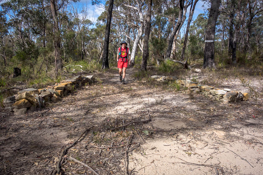
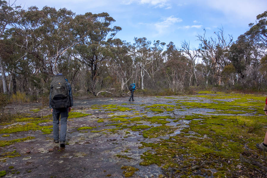
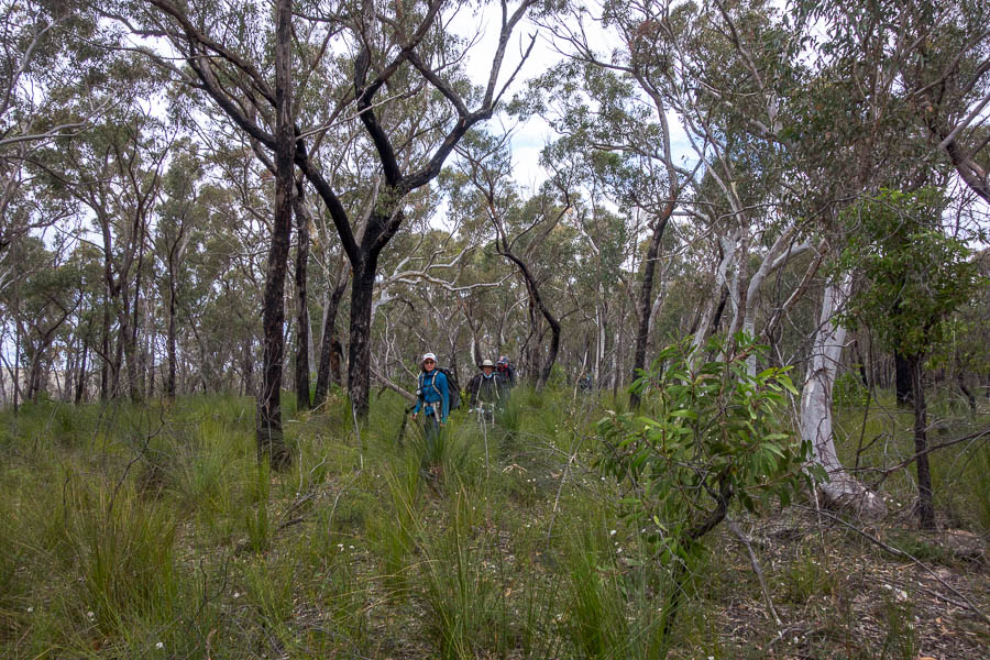
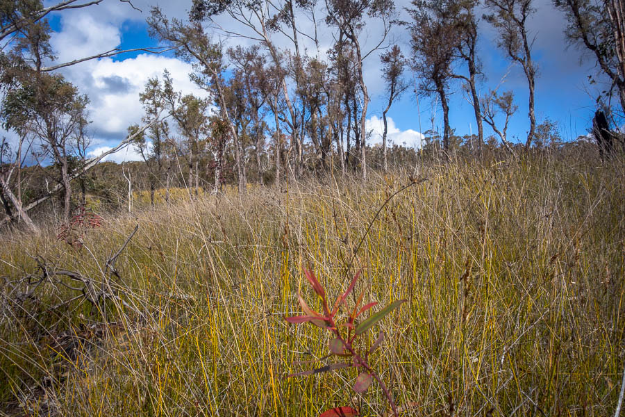
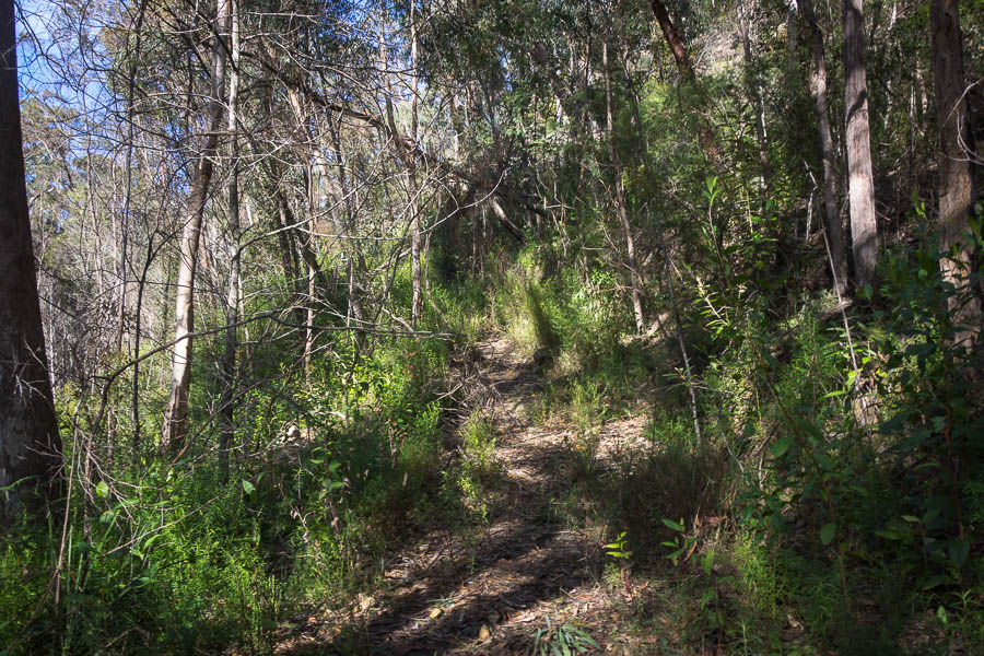
Optimistically dressed in shorts but with a scarf on, it didn’t take long to warm up as I marched along the fire trail. At the Starlights Trail I took the option less travelled (for me at least) and headed out on what the Second Edition maps have marked as the Nattai Road (erased without a trace on the Third Edition). The first part I had walked a couple of times previously, but after reaching the Troys Creek Fire Trail junction I set off into the unknown (yet again, for me!). I wasn’t sure what the state of the Nattai Road would be – non-existent, a recognisable and easy to follow fire trail or something in between?

The condition deteriorated almost immediately, though it was still clearly an old road.

A long unused (un)locked gate near the top of the Nattai Road

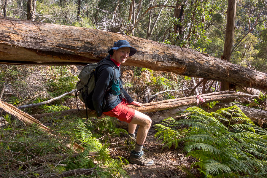
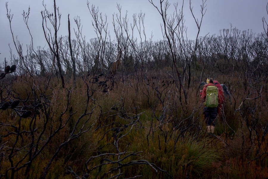
The road seems to get enough use for a pad to exist through the regrowth when it had taken over. The fallen trees were more of an effort to climb through/over/under.

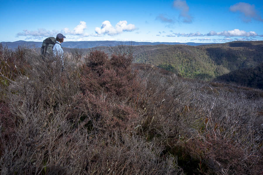
Looking uphill as the road disappears into the regrowth

Then at times after battling through the trees it would open up to a clear road.

In the same spot at the previous photo, looking downhill where the road is wide and easy to follow

Some fairly serious rockfalls across the road

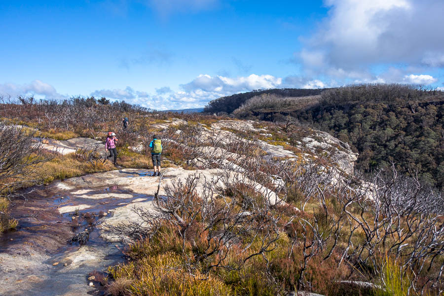
The long series of switchbacks are still in pretty good condition

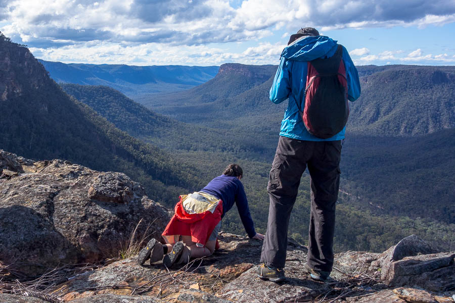
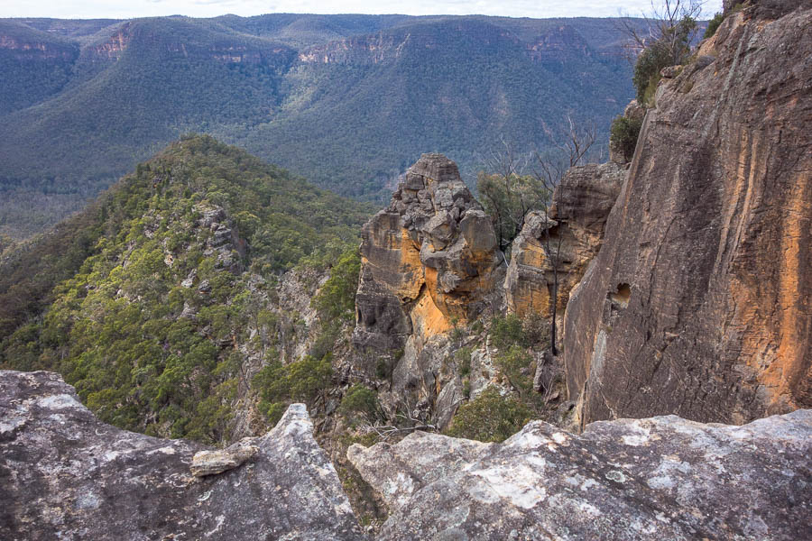
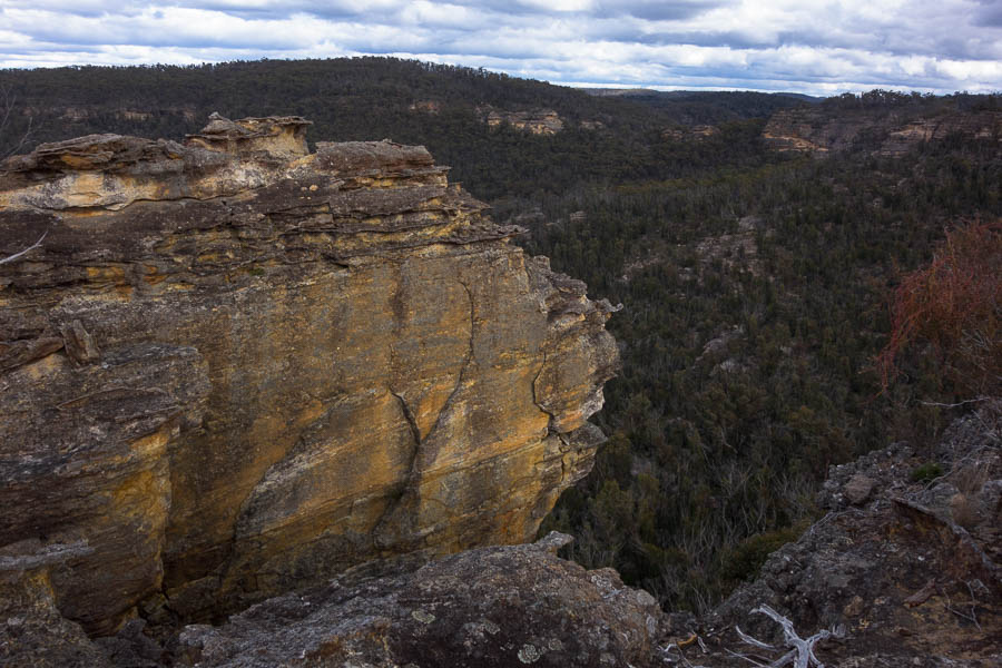
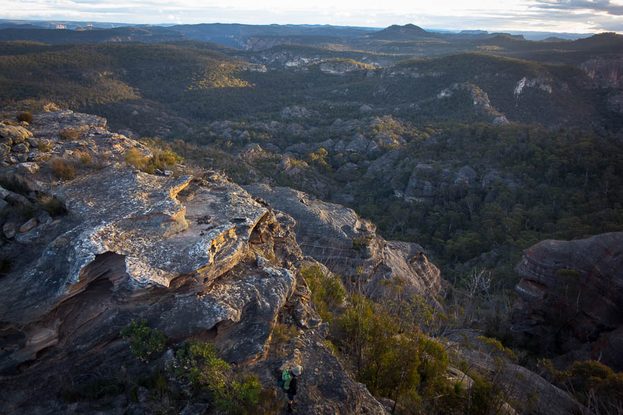
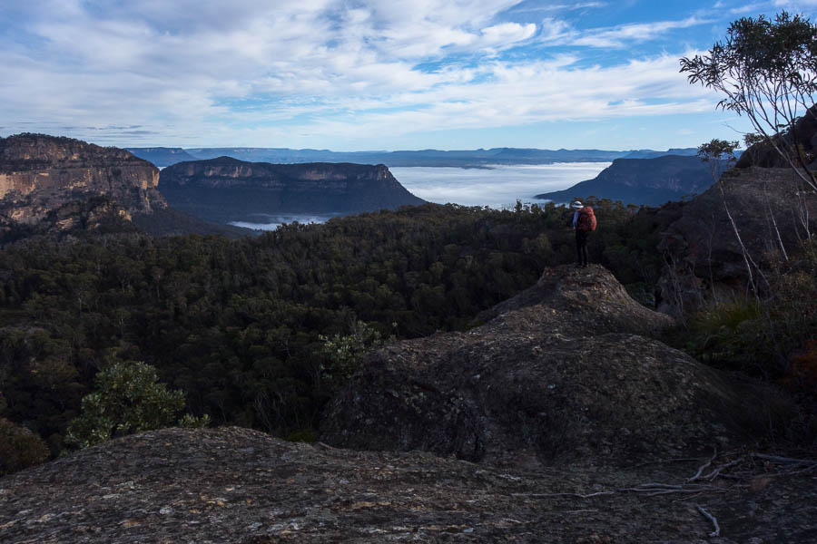
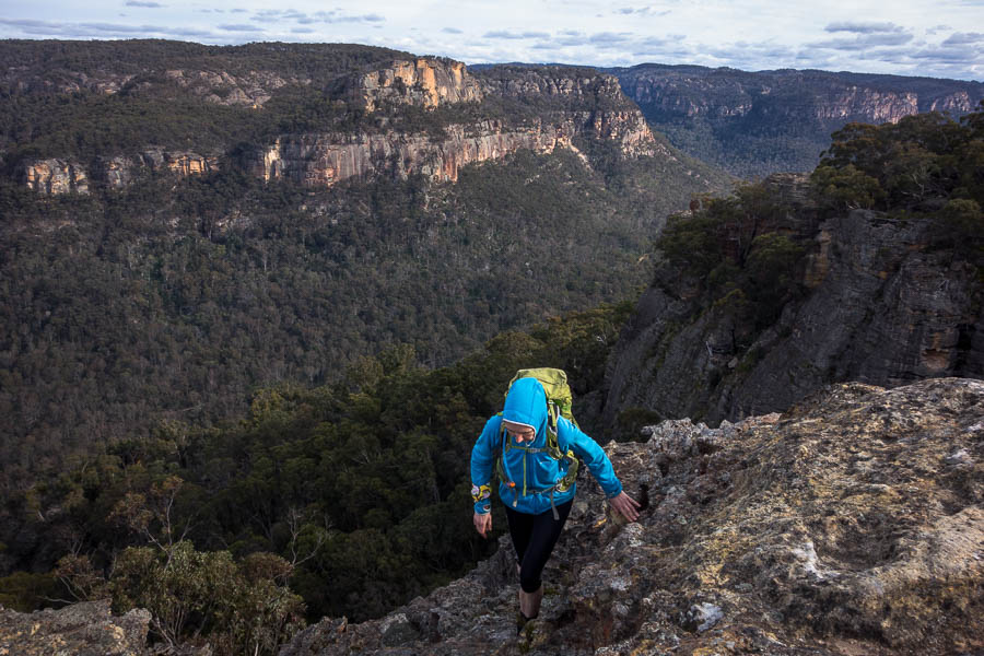
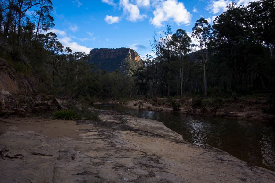
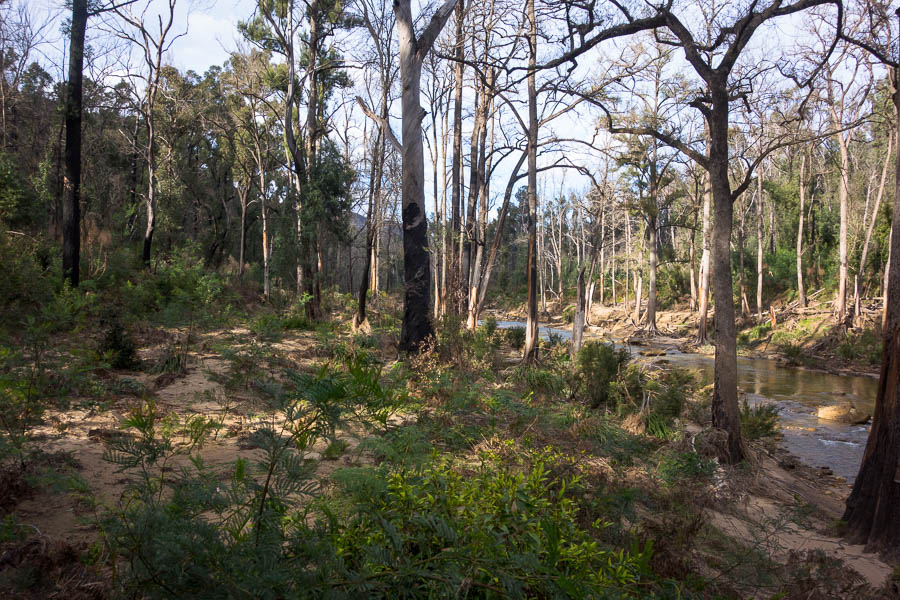
Views across the Nattai River valley

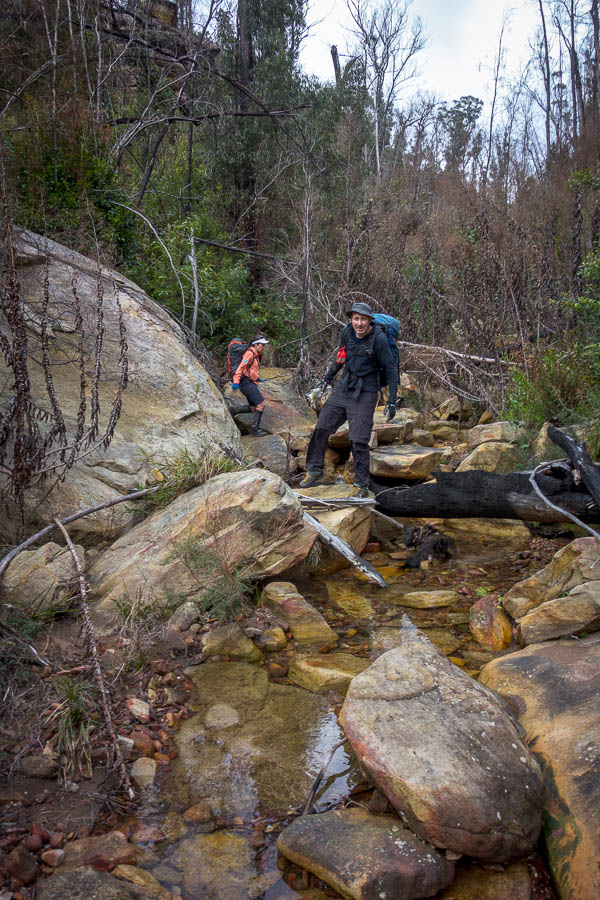
Fortunately there was more relatively easy to follow road than bush/tree wrangling and I made reasonable time to get onto the valley floor. From there the road became harder to follow so I decided it was easier to walk down the creek.

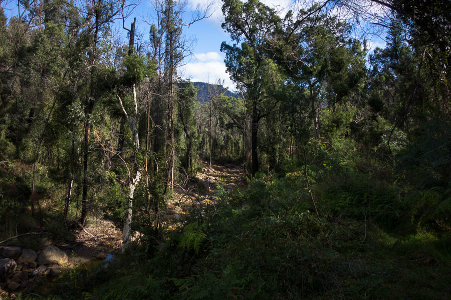
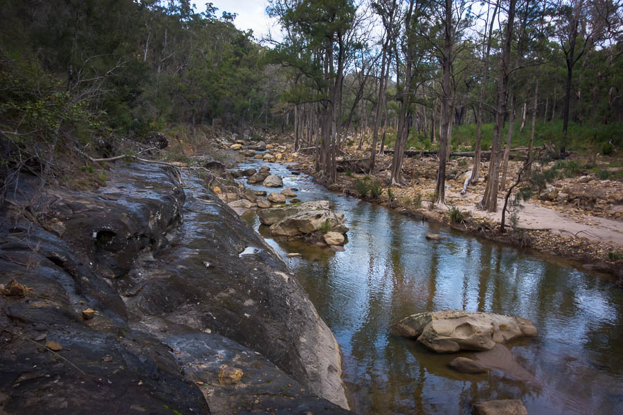
Getting down on to the flats I walked in the creek bed for a while

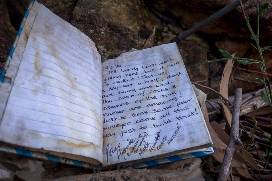
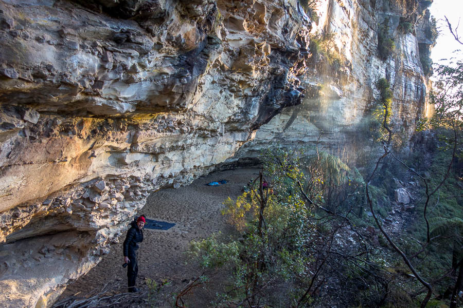
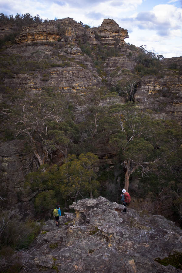
Eventually getting back up on to the bank I found the track again. For not the first time that day I was glad to have marked the line of the road onto my Third Edition map. Knowing where the road had supposedly gone previously was a decided advantage. I was curious to find two cairns close together. It was unclear what they might be indicating – if I had to guess I would say a spot to head up towards the cliffline (which looked imposing)?

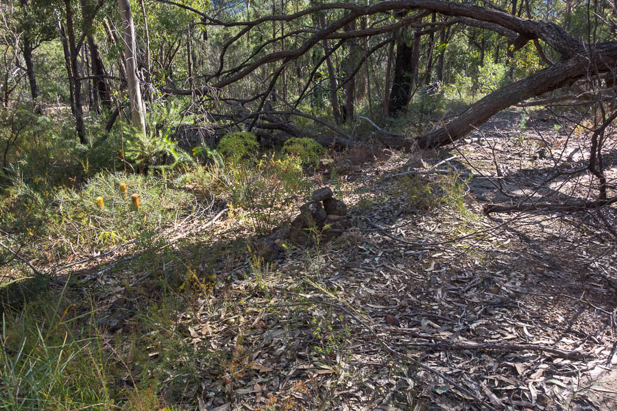
Back on the road at near the River junction I found a couple of cairns – not sure what they were in aid of?

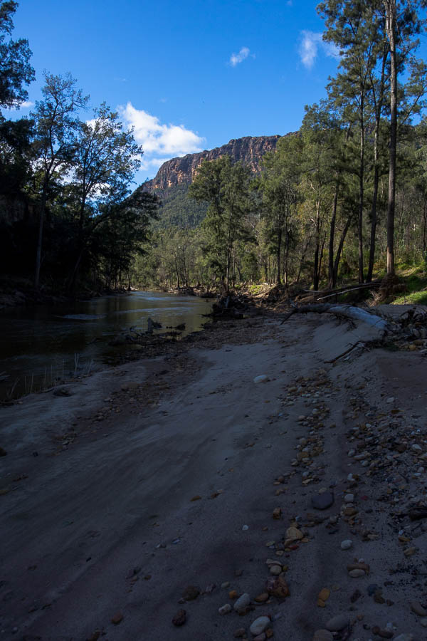
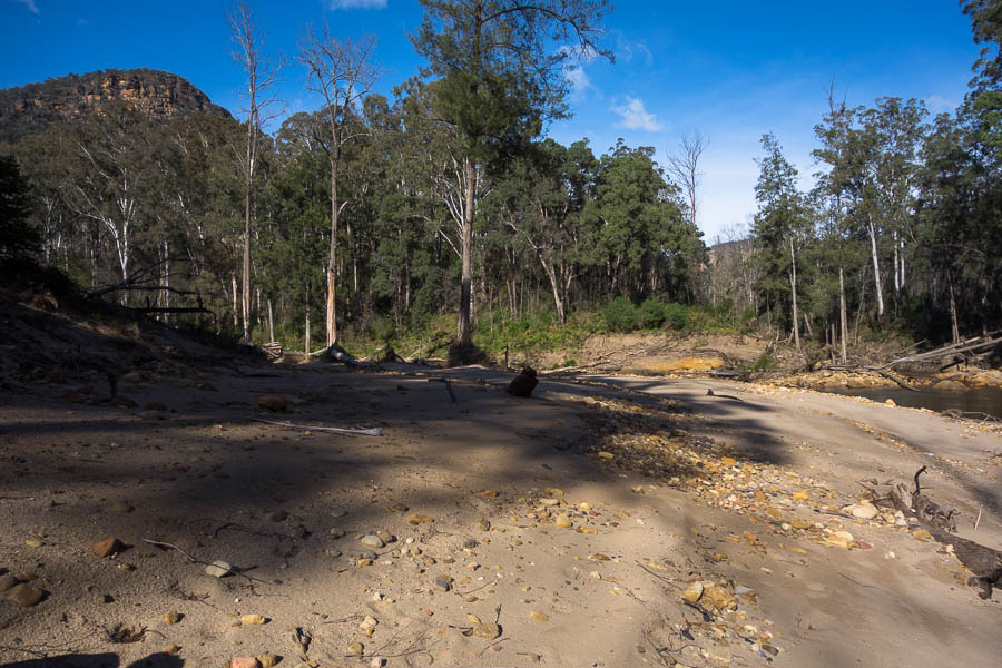
My original goal had been to head a fair way downstream and hopefully get to Grant Head. It became clear that was probably a bit too ambitious for the day. Two poor night’s sleep in a row were catching up with me. I wandered on the large sandbeds admiring the landscape trying to decide what to do. Eventually I decided I should just eat lunch! Feeling slightly more energised I figured I’d head downstream and see what the going was like.

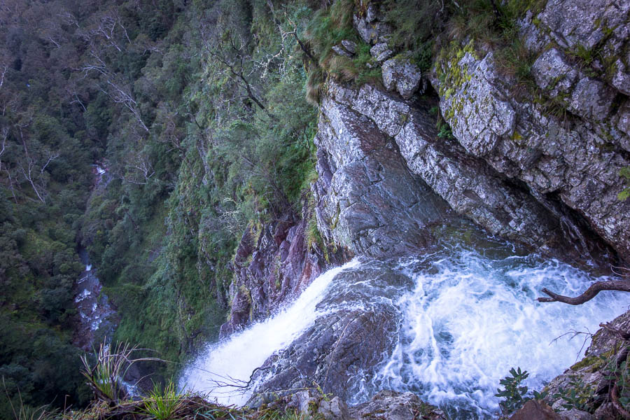
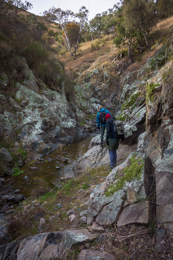
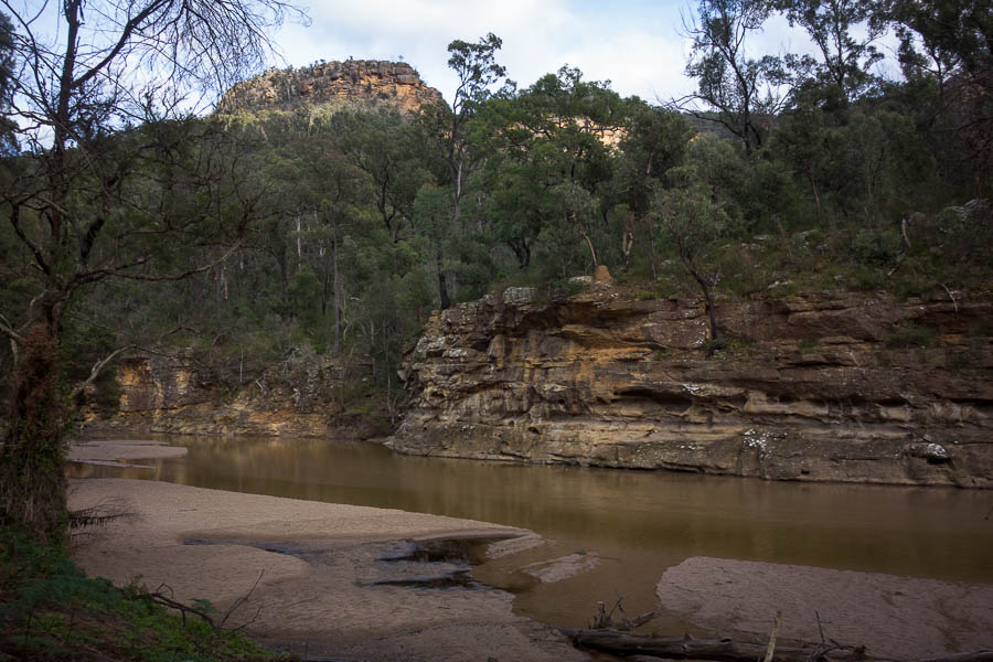
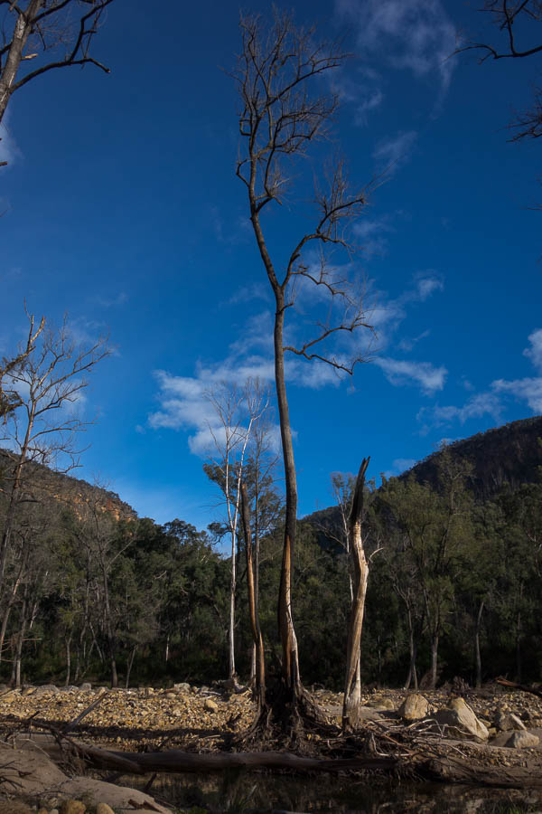
Walking downstream there were plenty of stunning clifflines

While the walking was clear, it wasn’t quick across the sand. When I hit a section where I was going to have to climb up and around unless I wanted to swim I figured that was as good a turnaround point as any. I clearly wasn’t the only one who had been here recently there were quite a number of footprints in the sand.

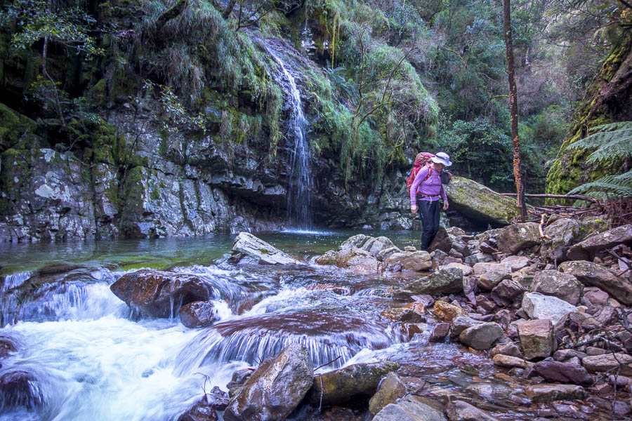
Near the confluence with the Allum River

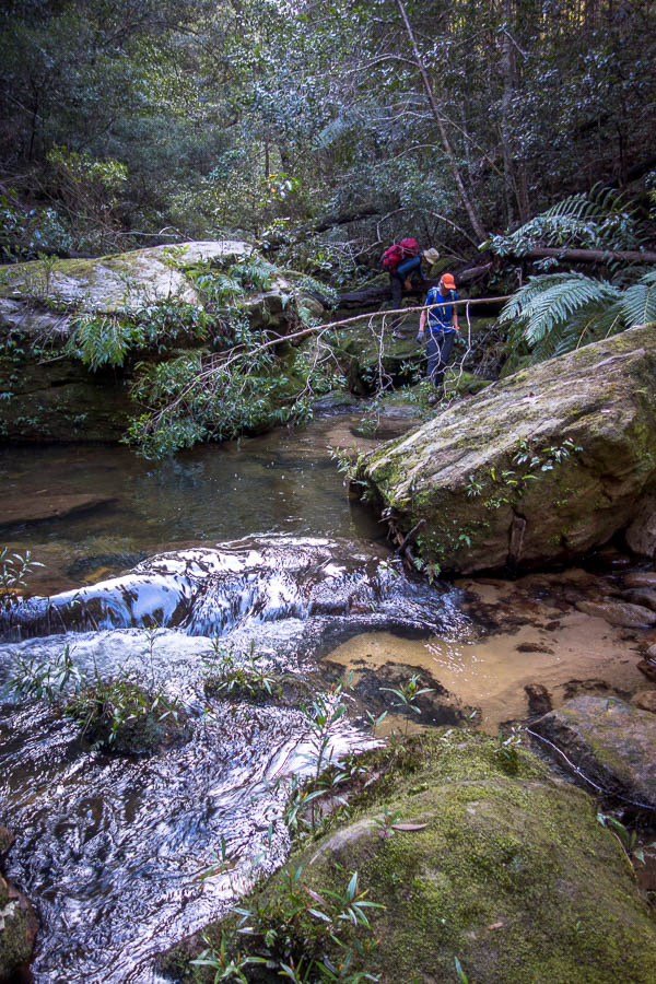
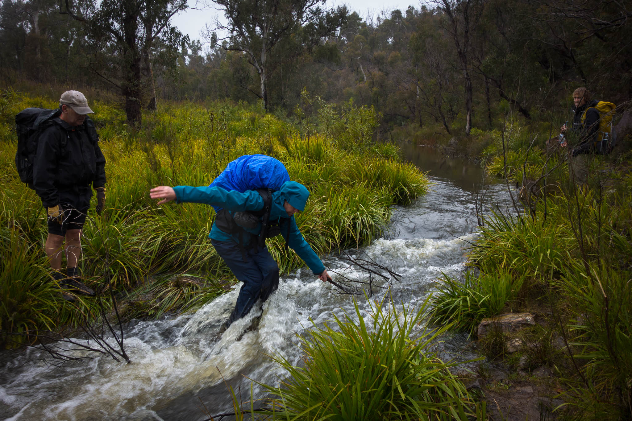
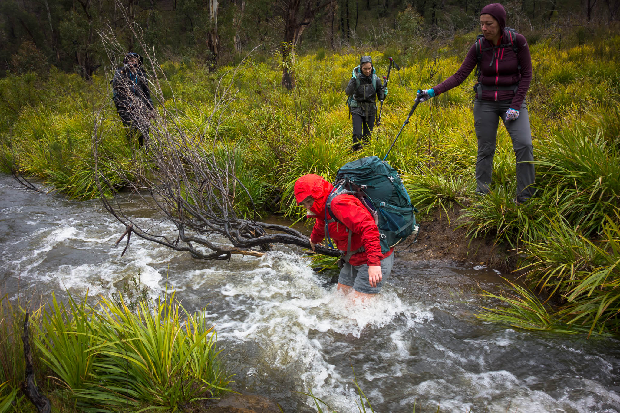
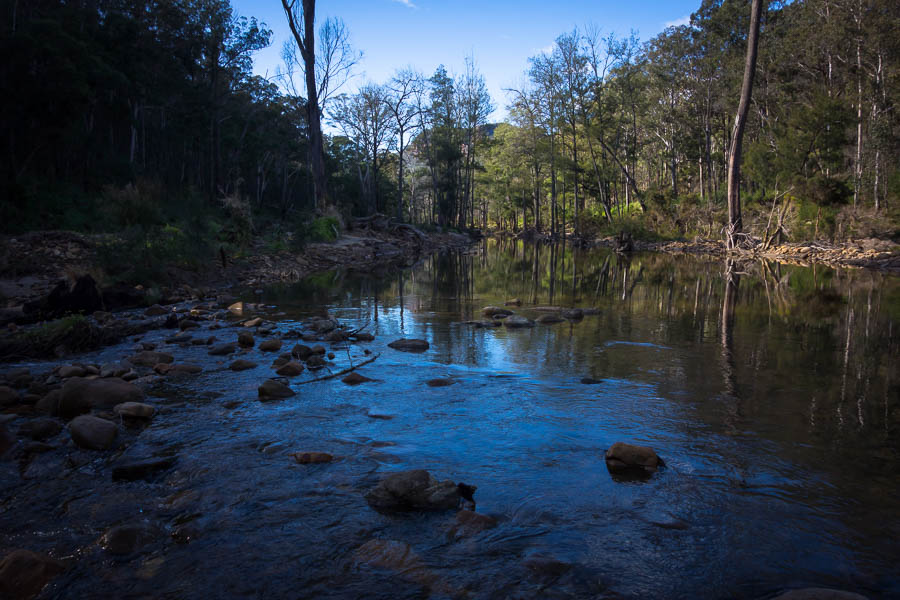
I continued to have the company of a single set of footprints  (other than mine) as I retraced my steps, and indeed the rest of the trip, back to where I had arrived at the Nattai River. This time I chose to stay along side the river rather than pick up the road. Unfortunately that meant a couple of shallow wades – off with the shoes. The side effect of wading through very cold water was a definite perk up in my mental state.

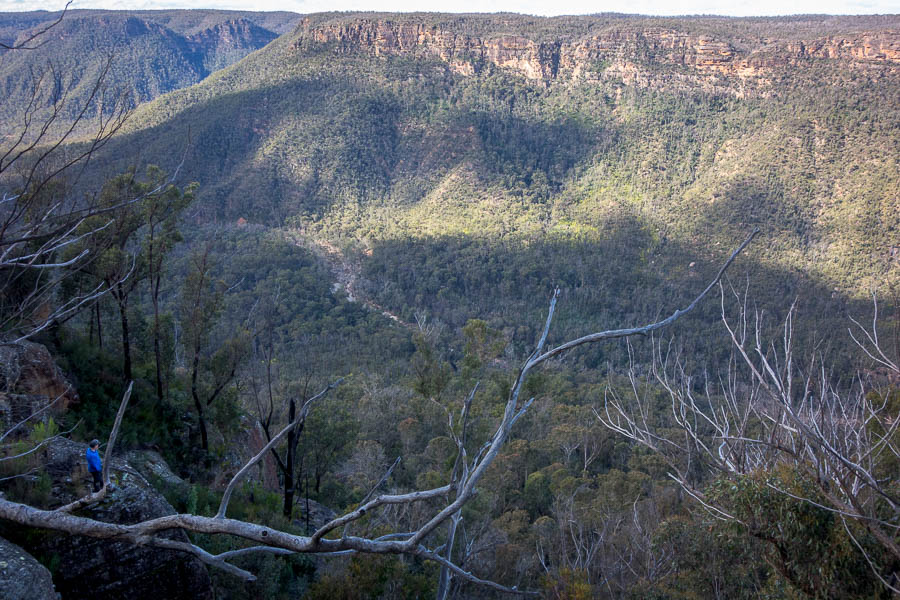
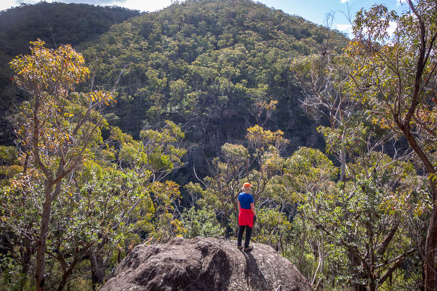
Heading upstream Surveyors Crag catches the afternoon light

I’d told myself I needed to walk upstream till at least 3pm, to make the next day not too unreasonable. So not long after 3pm I settled on a little sandbank opposite Surveyors Crag. I’d passed many, many suitable, and arguably superior, camping options but the spot I chose had a nice feel to it, and it wasn’t like I needed much space! I even had my own little stream. Water is definitely not an issue at the moment – the Nattai River isn’t good drinking –  there were regular flowing tributaries.

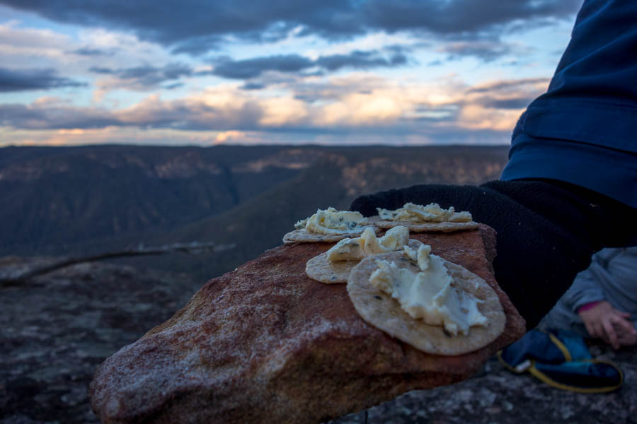
I wasn’t sure how I was going to make myself stay up to even 7pm. But setting time limits to when I could start eating cheese, then soup, then dinner managed to string out the evening. I was amazed it was after 8pm when I decided to retreat to the tent (7pm was going to be a win).
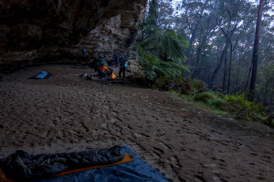
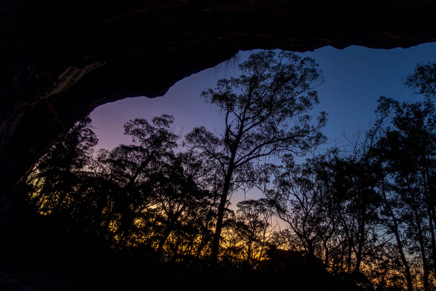
Settled in at camp

I spent some of the many hours in bed worrying that I had left too much river walking for the next day. Who knew how rough the going would be? Was I going to be getting out in the dark? I thought it wouldn’t take long to get ready – after all I didn’t have Tom with me! Yet somehow it still took 1.5 hours – so much for my vision of being walking not long after 7am.

However, my fretting from the night before was quickly allayed when I found a secondary channel that I could just march down. I could even look up at the changing angles of Surveyors Crag without being too worried about falling over.

Easy walking in a secondary channel near the start of the second day
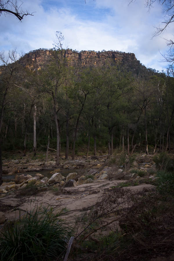
Surveyors Crag

When the secondary channel ran out I hit a cliffy section. The first bit I soon concluded was probably a bit too high in the risk stakes to climb, given I was alone. So shoes and socks off, and a cold wade got me to the next section minus a chunk of my big toenail (ouch). The next section was easier scrambling and I was pleased to get up and avoid a much longer wade.

Humph. Now where?

OK, so I managed to get up and bypass a wade

More attractive rock formations

More relatively easy walking

Beautiful day (much nicer than the forecast)

As the river straightened the pleasant walking was replaced with a bit more effort. Also the campsites which had been plentiful the day before were far more sparse – unless you wanted to cross the river. Fortunately the wombats had left some good tracks to follow – except, of course, the sections which were wombat height. This was much slower and harder work, and even though relatively speaking it wasn’t that bad, I was ready for it to be over well before it was.

Some less pleasant walking

Pleased to have reached the confluence with Wanganderry Creek by morning tea time, I remembered how much I enjoyed the last time I’d been in this spot.

Confluence of Wanganderry Creek and the Nattai River

Not long after morning tea I gave up on keeping my feet dry. I was now back in territory I had visited before. A couple of wades to access a long sandbank in the middle of the river were definitely worth it.

Finally gave up on keeping my feet dry

I wasn’t tracking my route so I’m not sure where I ended up in the final section leading to Emmetts Flat. If I had a trace at that point I think it would have been rather inefficient. Pushed away from the river, and trying to avoid vegetation, it seemed to take a long time to finally hit Troys Creek and from there Emmetts Flat.

The campsite is nothing like the one I visited so many years earlier – and was so enamoured by I contrived an overnight club walk just so I could camp there. I was somewhat bemused to see jonquils growing in clumps!

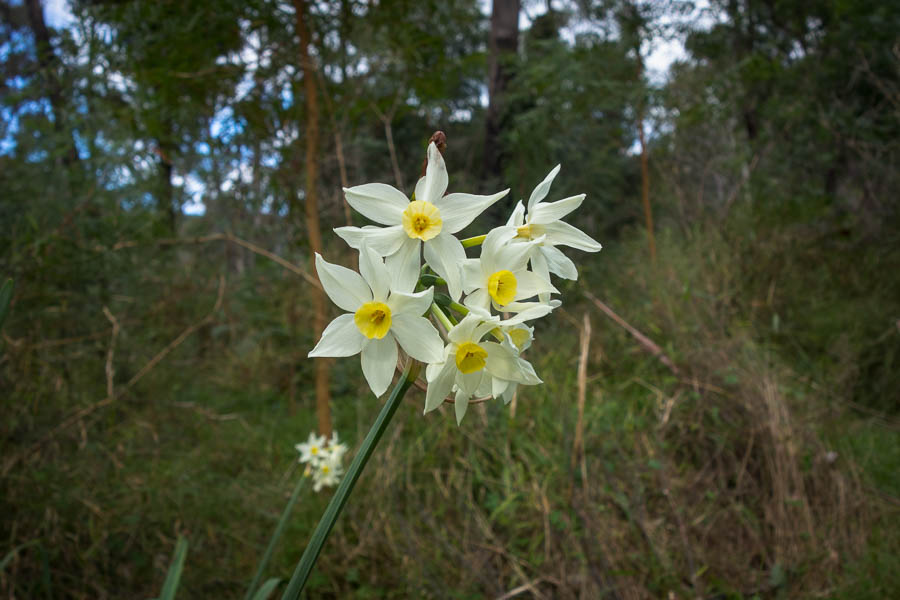
Pretty, but decidedly non-native!?

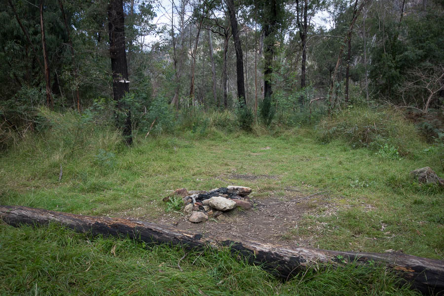
Campsite at Emmetts Flat a shade of its former glory

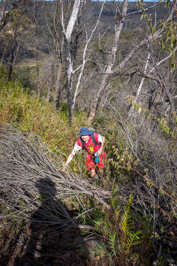
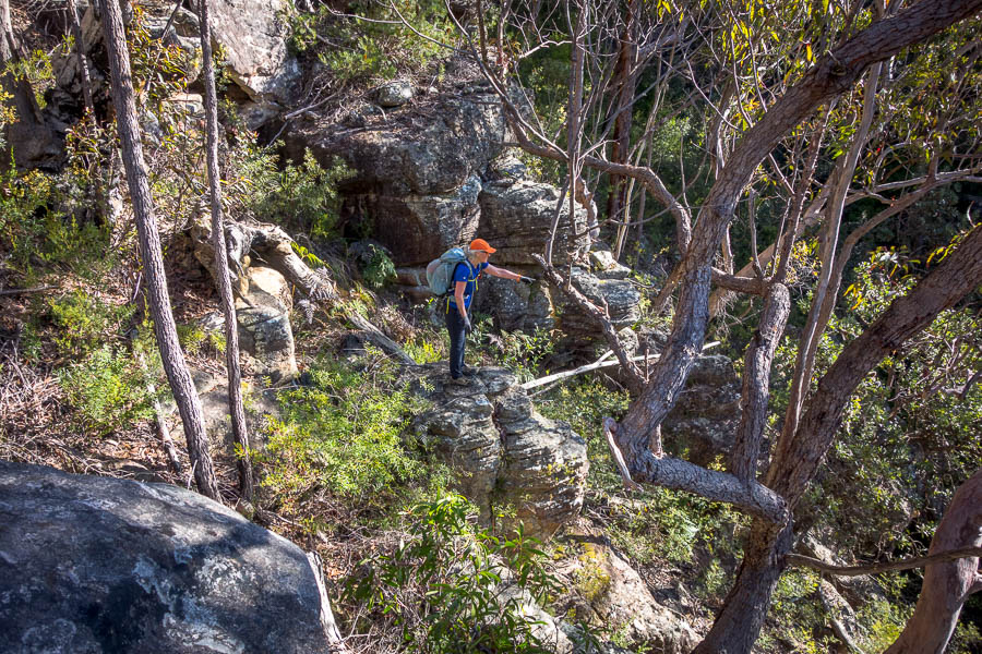
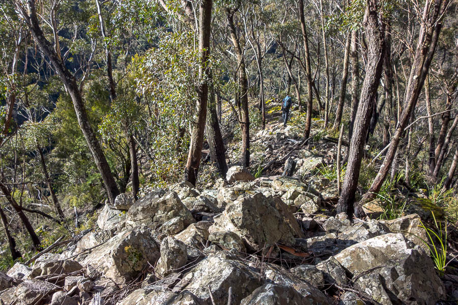
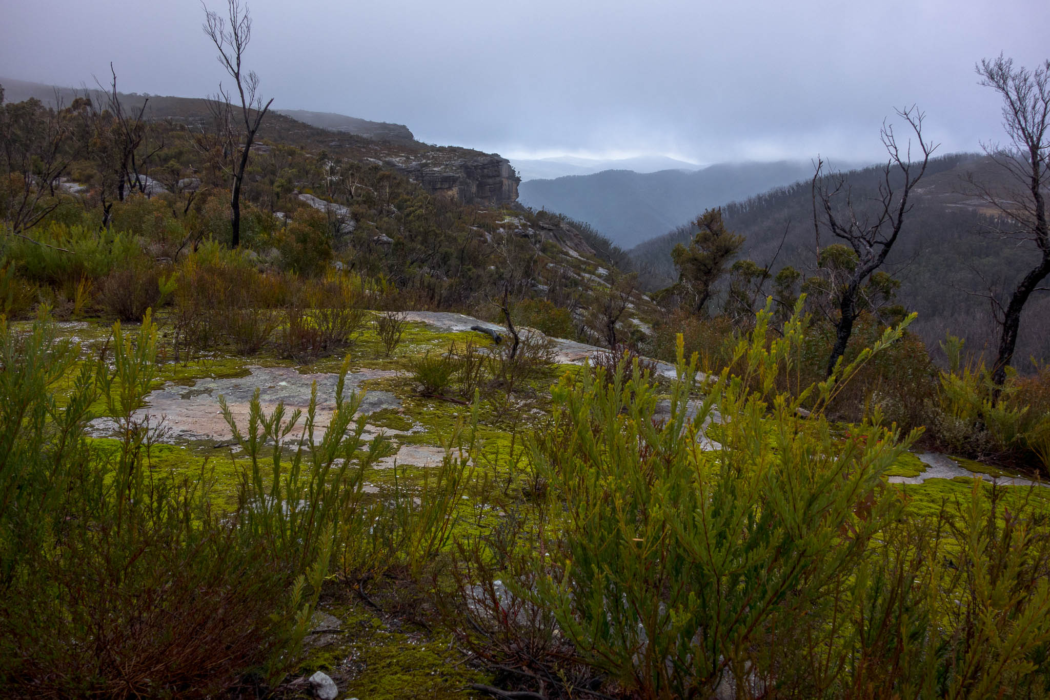
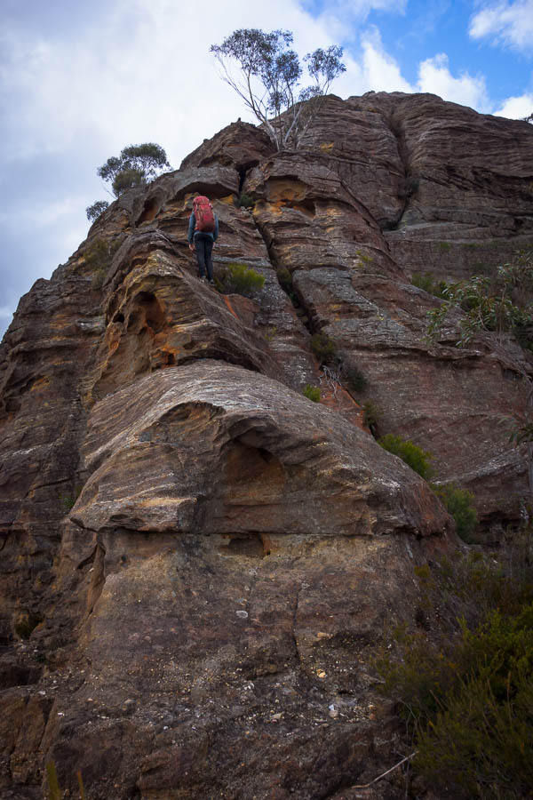
Leaving the campsite I struggled to follow the trail. I found fragments of it near the bottom, but then lost any trace of it going up the ridge. Referring to where it should have been on the map I was happy enough I was heading roughly where it should be. I found a large cairn which gave me hope. But still no sign. The exit was going to be quite a different proposition if the entire trail was gone!

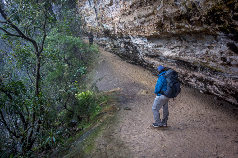
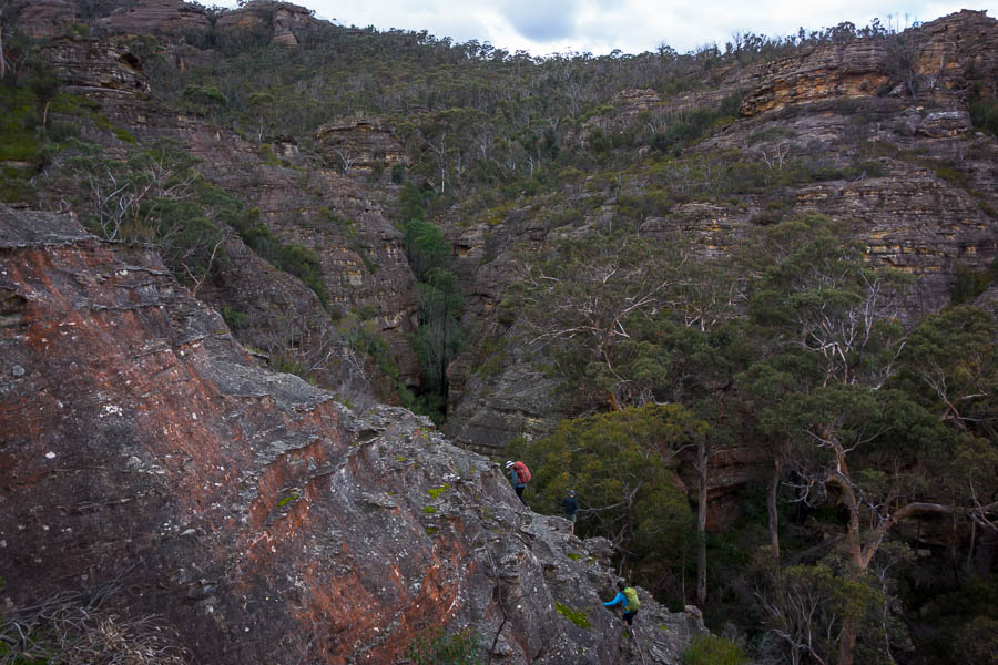
After starting to sidle and meeting a couple of slightly disconcerting loose gullies I was happy to find the trail coming out of the rubble on the other side of a rockfall. It would be interesting to know how much formed track I missed.*

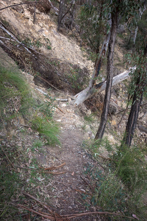
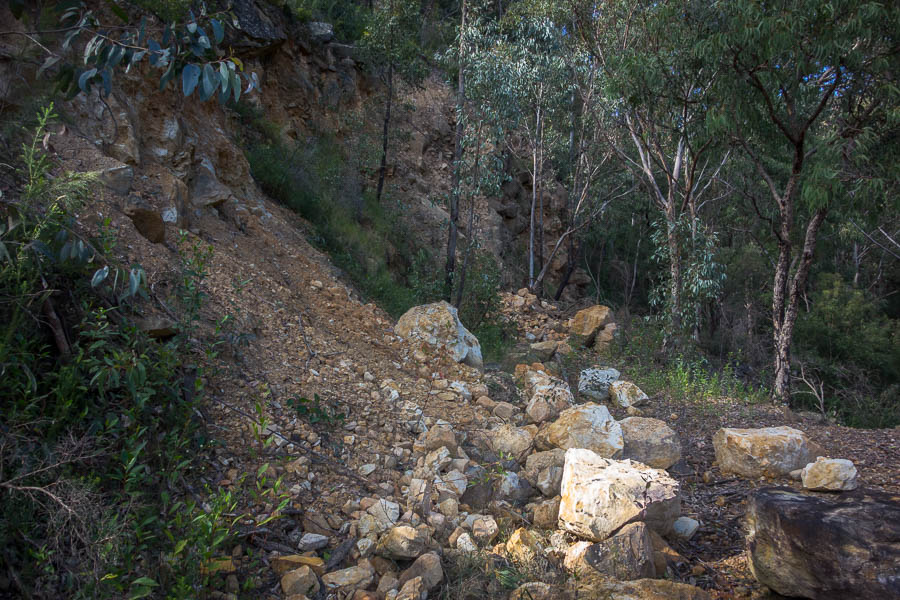
Some of the lower sections of Starlights Trail are quite damaged

Looking up at another rockfall which came across the track

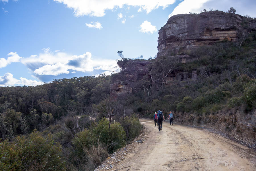
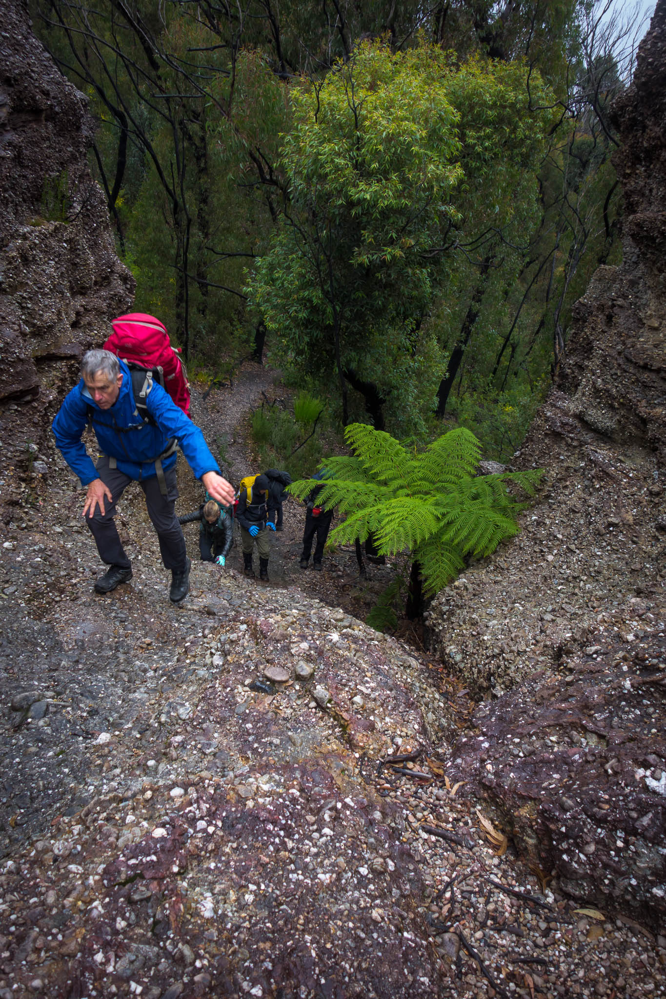
From there it was pretty easy to follow, though there were still a couple of slightly sketchy gullies to cross where rockfall had knocked the trail away. I was a bit surprised when I saw the only other people of the weekend, a group of 4 heading down around midday. Initially thinking they were going to camp but then I realised they only had day packs. I guess there was still plenty of time to get down and back up again.

I managed to walk off the track near the top – probably not the only one given there was a slight pad – but scrambling back up the slope I regained it without much issue.

From the top it was just the final fire trail bash back to the car park. Where I got an almighty fright as a large dog started barking at me out of one of the car windows. His owner, who was sitting the car, assured me it was just very friendly and excited be on his excursion for the day. They were still both sitting in the car 20 minutes later when I drove off!? And despite my fears of an after dark finish it was 2pm with plenty of time to visit a friend on the way home.

A great weekend out.


*A friend later confirmed she had followed it all the way down without issue the same weekend.

1 3 4 5 6 7 19