Douglas Range Traverse (Dragons Teeth “High route”) 26 Dec 2022 – 3 Jan 2023 (Days 4-6)
Day 4: Adelaide Tarn Hut to Anatoki Peak tarns
The crux day had arrived. It dawned clear and I tried to prod Tom into action at 5am (first light). He was unimpressed and refused to move until 5:30am. We were away by 7:25am in clear but breezy (cold) conditions.
On the map we had approximately 2 kilometres to cover for the day. Time estimates from JC were between 5 to 9 hours. The second half of the route had the potential to be the slowest per km rate we’d ever covered.
Almost immediately we were over thinking the route – not far below the saddle there is a steep descent down a chute – a bit of faffing about before realising it was easy (or would have been without a pack) and more importantly the way to go.
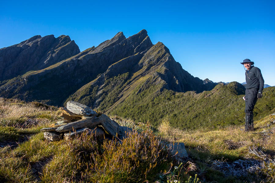
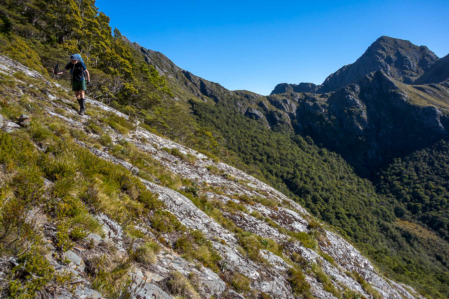
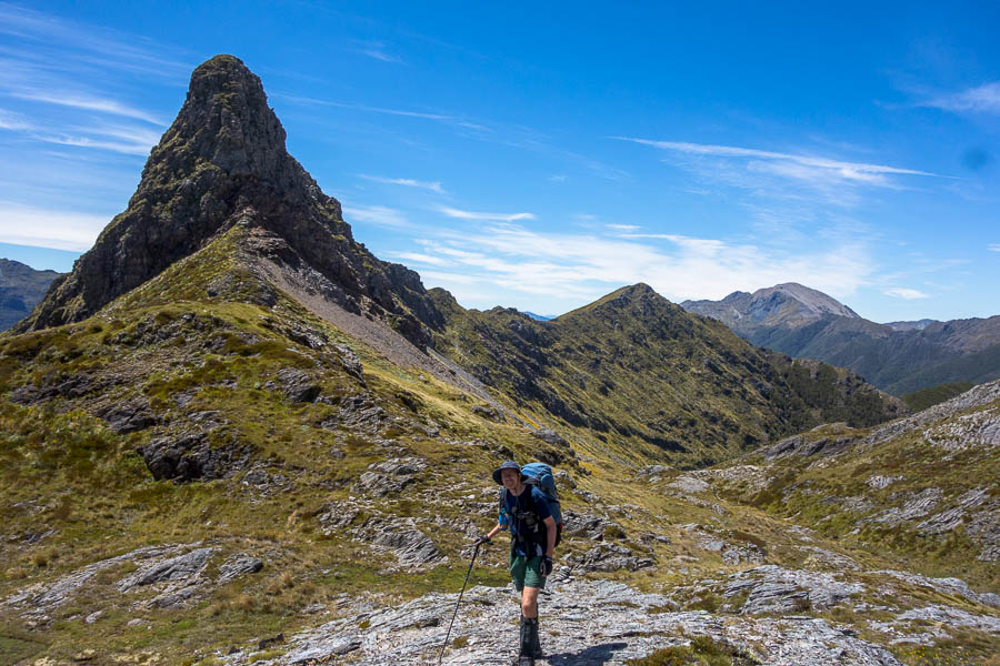
The first section is relatively straight-forward, sidling below Mt Douglas and then following forested sections along the main ridge towards the Dragons Teeth.
Then it was a matter of staying on course as we meandered up and down and around various open sections, bushy sections, exposed sections. The cool day quickly warmed up with not a cloud to be seen. As we were traversing the eastern side of the range we were getting the full sun – amazing conditions but almost too nice.
As we started descending along side a cliff line we came to what seemed to be a relatively recent slip*. I was over the shale slip before Tom got there – it was fairly sketchy. Rather than him come across if it wasn’t the right way and both of us have to reverse it I kept going to see if it seemed right. It was well trodden under foot but no cairns or markers.
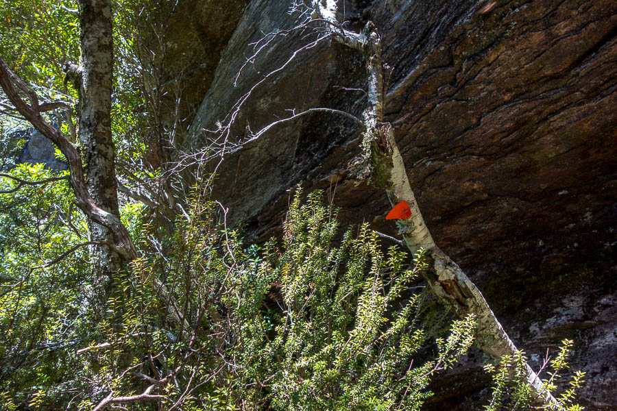
It kept going a fair way so Tom came across, and we kept heading down. As I started climbing down a vegetated bank (well-trodden but probably not likely to last that long due to the erosion) Tom had a look at the GPS which had an OpenStreetMaps route loaded on it. It suggested we were off the route by 30-odd metres. So he headed back up. Just below the slip there was a ribbon on a tree which we’d missed. So he came back and we went back up with our packs. Climbing up at the ribbon I then found a tin lid on a tree on the ledge we were now on.
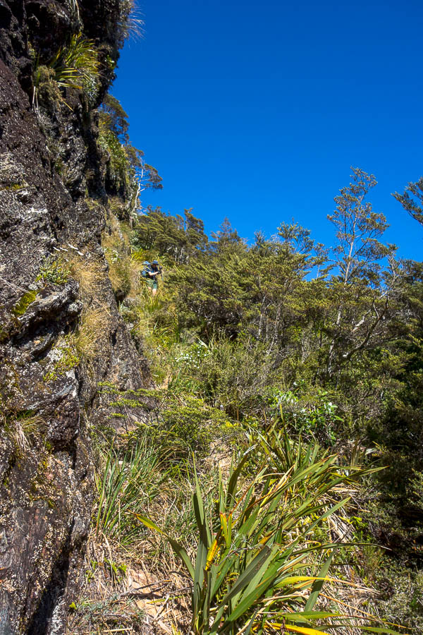
Some way below a relatively new dodgy slip – we initially missed the route climbing up to the right after it
So in theory back on track. But that ledge got skinnier and skinnier and I wasn’t overly game to edge out and see what happened. But there didn’t seem to be any other options. In the end I climbed up a vertical bank of vegetation (not a regularly-used option!) and got onto the spur. Tom did a similar but slightly less scratchy route. According to the GPS we were in the vicinity of the route.
From the spur we had a good view of what was coming up. Consulting JC’s notes we couldn’t really make that much sense of what we could see in front of us based on his description. Nevertheless we followed them and found ourselves back with some markers going into the bush.
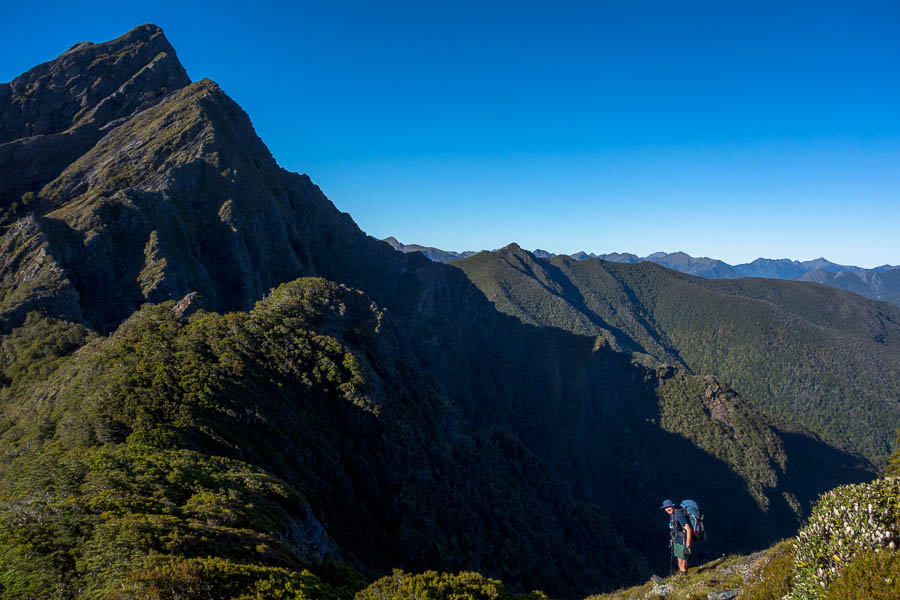
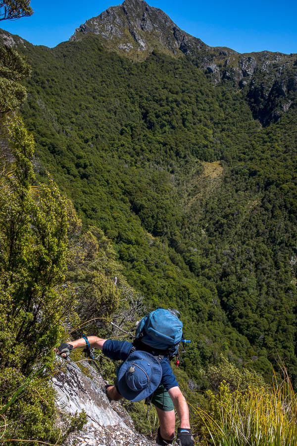
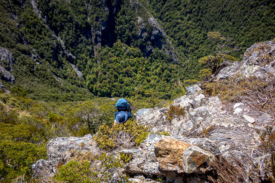
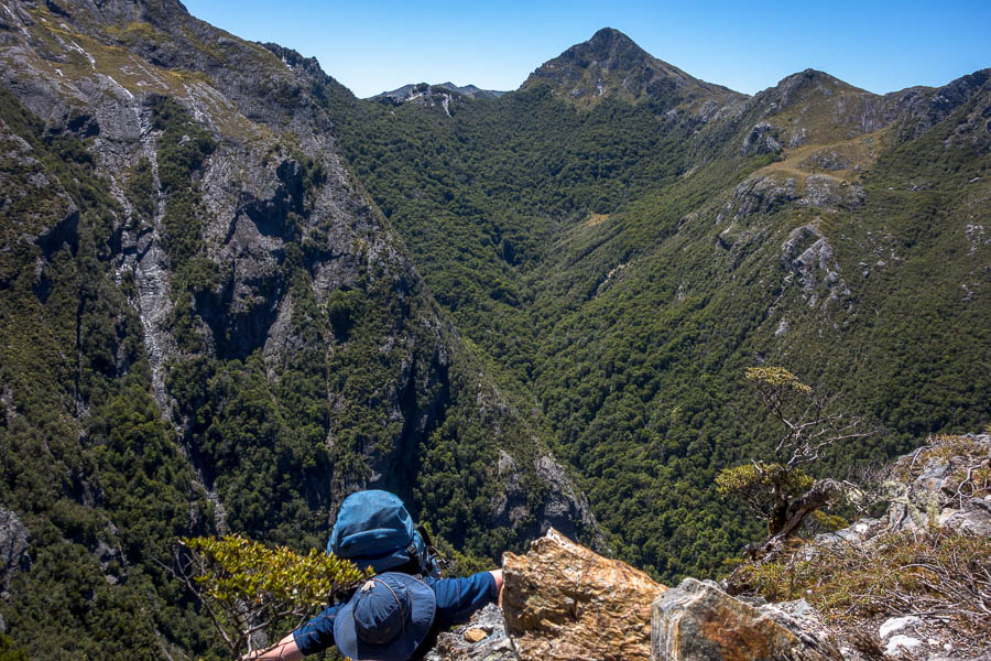
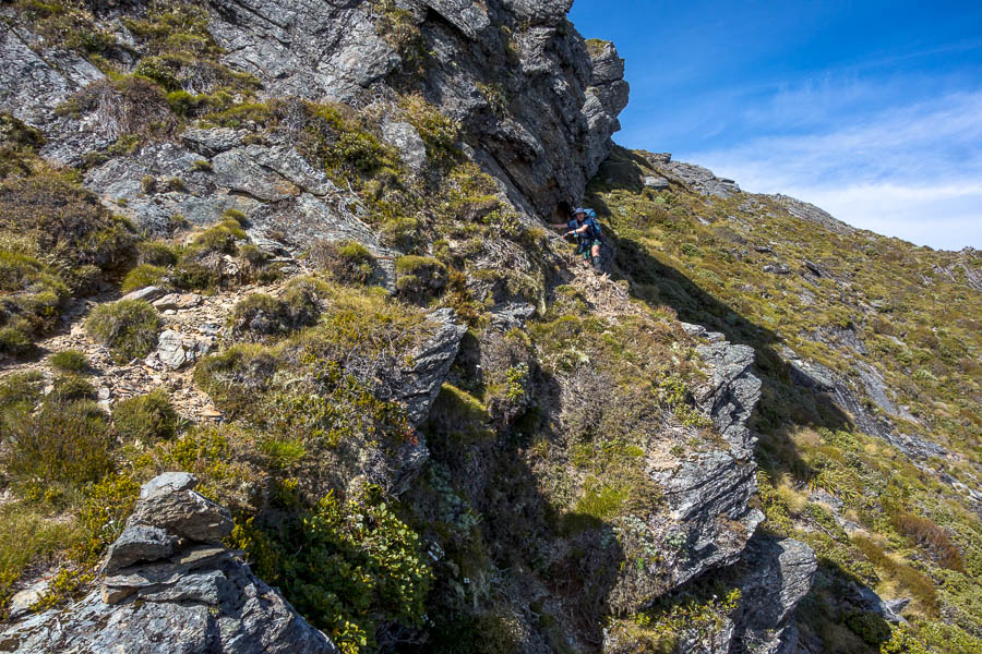
The route then traversed some narrow ledges, with quite a few climb-ups using trees as we made our way around the base of one of the long buttresses. The route was somewhat airy – there was just a line of vegetation between you and a significant drop.

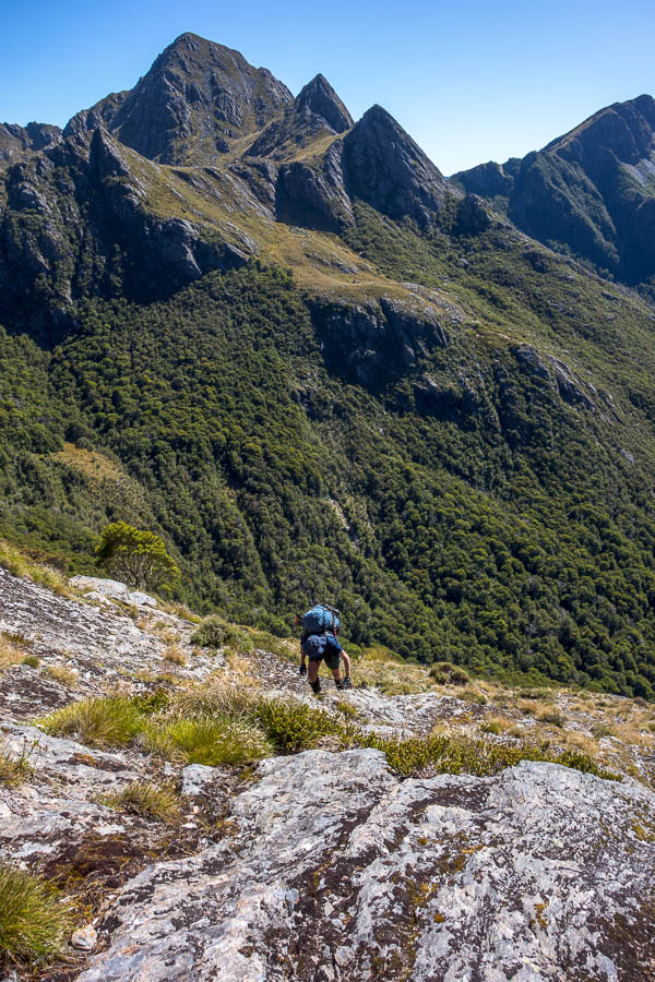
Looking back to the saddle (far left of the photo) where we started from. Tom a speck down the slope
Eventually we popped out onto an open snow grass section. At which point Tom realised that we had not come anywhere near as far as we thought we had – which is why the notes hadn’t matched what we could see. We were now where we had thought we were an hour (or more?) earlier. The notes made a bit more sense now!
We had continued to be baked as we traversed the east-facing slopes and having had a fair bit of sun over the previous 3 days we agreed lunch needed to happen in the forest. This was a shame as there were some really great spots to stop, but none of them had any shade.
We found a reasonable spot in the forest for lunch before arriving at JC’s “open shale area”. It was fairly evident where to turn off, so maybe several years of his notes being available have helped with the route finding in this section. That said soon after as we exited from a rocky gully the pad appeared to vanish. There was clearly an orange tag indicating to go into the bush but then not much evidence on the ground. After a bunch of pushing through vegetation (and undoubtedly confusing things for future parties) Tom found some orange markers. Thank goodness – this route is fairly committing and having come this far the thought of reversing it to go the low route was almost unthinkable.
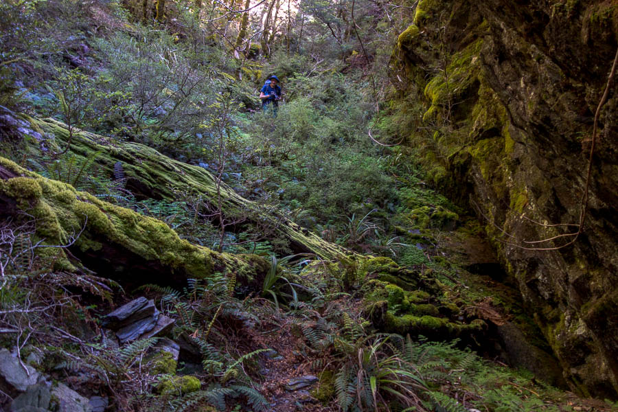
After some easy bush travel we hit the final “very steep climb”. This was around 150-200m of many 2-3m climbs, normally needing to haul on at least one tree if not two. Without the vegetation the route would be perilous – fortunately the vegetation, for the moment, is solid.
There was a palpable sense of relief when we finally topped out. I think Tom’s first words were “Well, that was terrifying”. My response was “I have no desire to do that route ever again”.
We tried to put our finger on why we felt like we’d underestimated the route. It was within our capabilities but we hadn’t enjoyed significant sections of it. It was way more airy, and the climbing was pretty sustained in sections. None of the moves by themselves were overly difficult – we did all the moves with our (still quite heavy) packs on. But the need to haul on vegetation over and over again with very large drops below you was mentally taxing. The warmth/time in sun also didn’t help general fatigue.
We’d had a big drink before we’d left camp in the morning, and then sculled another litre at one of the streams we’d crossed, in addition to carrying 2 litres of water each. Tom ran out of water just after we topped out, and I finished mine just as we got to one of the tarns below Anatoki Peak. Some comments I’d seen made me wonder if there was more water than usual when we did it – we crossed several running streams and there were lots of tarns below Anatoki Peak – so finding water wasn’t an issue for us – but I don’t know if some of those dry up at times?
If you’re going to attempt this route, every party member needs to be a confident scrambler with pack on, and fine with exposure. Pack-hauling would be quite sketchy/difficult. You do not want to get part way through the route and find you need to turn around.
One of the groups we met later in the trip told us of a solo walker who was behind them in this section. A helicopter appeared and went straight to a spot on the route so they assumed the walker had called for help/set off a PLB. Others we met later on had heard that the walker had got stuck with no way to go forward but couldn’t reverse.
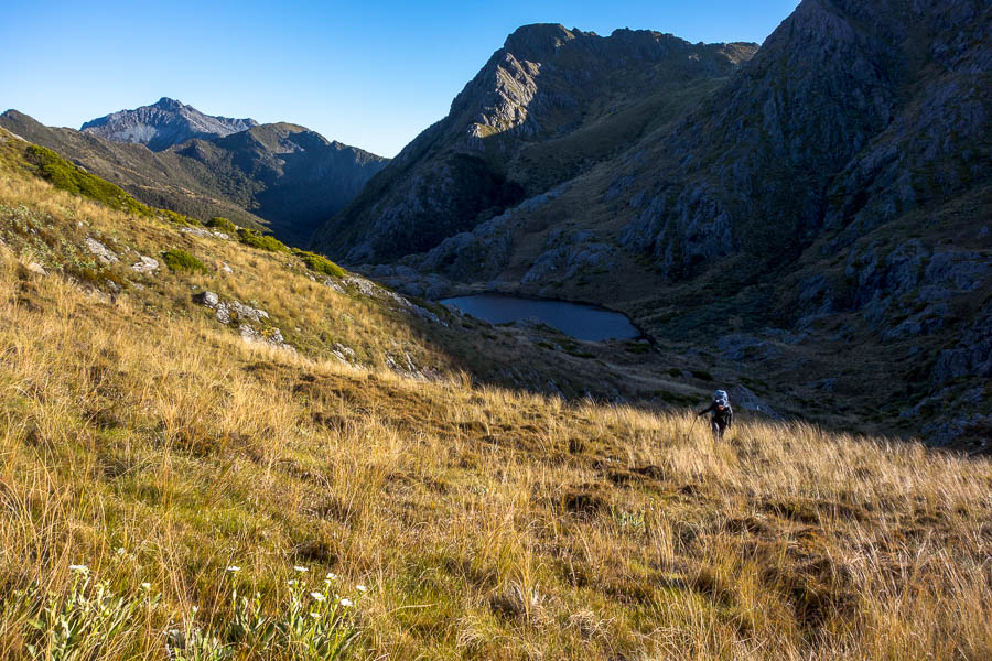
JC said the tarns (with great campsite) were at the top of the K on the word “peak” on the map. Once we had a drink at one of the low tarns I didn’t have any desire to spend any longer than necessary finding a campsite. So I asked Tom where this “K” spot was in relation to where we were. At that point Tom realised he didn’t have the GPS on a NZ Datum, and so despite having map and GPS, it required him digging into his pack and fiddling with his phone for a while to come up with an answer. Both of our feet were suffering by then as our socks and boots hadn’t dried out from the day before. Oh to get to camp and get them off!
We had made it in around 9 hours (including 2 morning teas, lunch, and a water sculling stop and of course much photo taking). We didn’t feel like we’d wasted much time route-finding other then just below the shale slip. Travelling with heavy packs definitely slows you down – hats off to JC’s group who did in 6.5 hours presumably with similar-sized packs.
We didn’t discover the “great campsite”. I climbed a ways further up, and there were so many tarns, but I couldn’t see anything obvious from a camping perspective. Maybe our expectations were too high.
We continued to be baked for a few hours as with the way the rock slopes there wasn’t really any shade – and the sun doesn’t set until 9pm! Ah some relief when the sun went below Anatoki Peak!
I rejected Tom’s tent site selection, and convinced him to set up near a photogenic tarn. Being wedged between two rocks made pitching the guy lines a bit tricky. It didn’t seem to matter too much at the time as there wasn’t much wind…
However the wind swung around and picked up by the time we went to bed. So it was blowing directly into the big end of the tent. We had a somewhat disturbed night as the front pegs got completely blown out a couple of times. Fortunately we managed to locate the pegs each time! When it happened again at 5am I suggested we just call it quits and pack up.
Day 5: Anatoki Peak tarns to Lonely Lake Hut
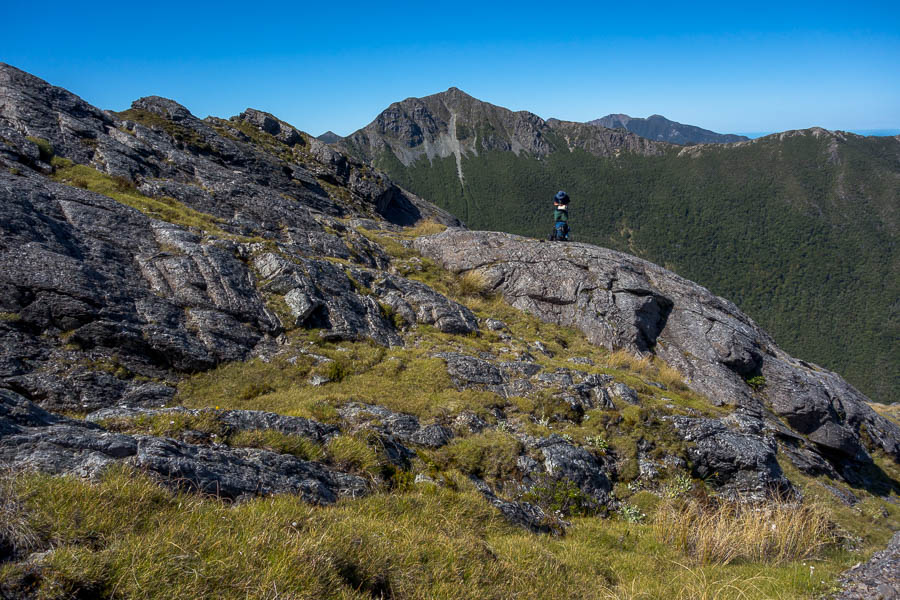
We picked up the cairns near our campsite and easily followed them along the eastern slopes (more baking in the sun to come!). JC made mention of a difficult bit, though easier than anything we’d done the previous day. By comparison the sidle on a narrow ledge was very straight-forward!
I got us slightly off-track thinking I’d seen a cairn well above us when in fact it was a goat standing in a saddle. But besides that the only spot where we had any issues with the route was the second slightly sketchy section for the day. This was climbing up the slopes of 1564 and needing to traverse around to the saddle below the twin peaks.
I had seen a cairn from a distance but then once we got in below the bluffs I couldn’t see it and there were multiple pads on the ground. The more obvious route along a narrow ledge was difficult to get on to. Eventually we came back to it having exhausted other options and I realised there was an easy(-ish) place further along to get on, and from there it was no worse than, say the ledge traverse in Myall Creek in Morton NP. There was a second section of narrow traversing around the corner which then took us to the cairn I’d seen some time ago climbing up.
JC had suggested the twin summits worth climbing were at 1564. After morning tea we ascended the twin summits – one each!
We continued sidling and eventually we were in the saddle below the Drunken Sailors. I guess at that point we could say the High Route was complete, as that is where you would re-meet the route if you did the low version.
I was (as always) keen to push on to the hut – as it felt like it should be just around the corner. Tom wanted to do yet more foot surgery. But once I realised the hut was a lot further away and I found some shade (a rare commodity) we stopped for lunch. It probably illustrated how little shade the previous 4.5 days had offered that we were so happy to be able to enjoy lunch without worrying about getting burnt. The spot was absolute bliss, next to a delightful running creek.
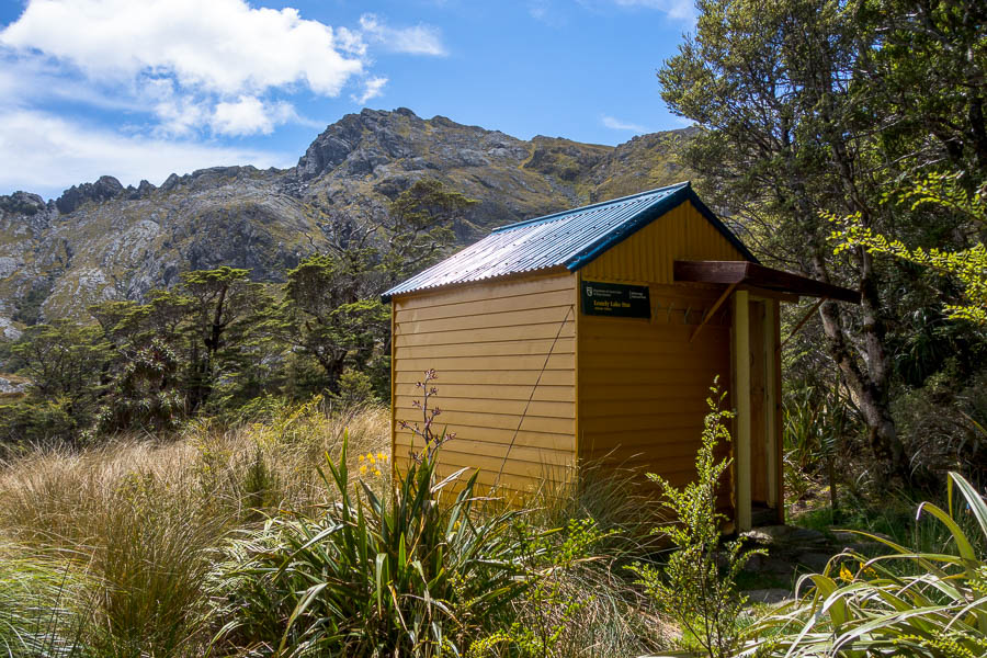
Eventually we tore ourselves away from the shade and continued down towards Lonely Lake Hut. It took a long time for us to get a view of the lake, but I loved following the creek down beside numerous cascades. The hut itself is set well away from the lake on the bush edge. It is a great spot with views, a picnic table, and to our immense relief a flat, sheltered tent spot. There are other camping options nearer the lake but after our windy night we were just happy to have somewhere we would get a peaceful night’s sleep!
There were already 3 people at the hut when we arrived – having walked in from Fenella Hut that morning. They highly recommended a swim so we didn’t waste much time heading down to the lake. I was excited to find a nice pool below the outlet.
We quizzed the others on the weather forecast and they suggested it was supposed to be reasonable until at least the 3rd or 4th. This was excellent news as it meant we could spend 2 nights at Lonely Lake. We were both ready for a rest day.
As we were all settling into dinner another 2 people arrived. George and Holly put our efforts to absolute shame. They had left Adelaide Tarn around 9am, and come the whole way, including climbing one of the Teeth, and got in at 6pm. Though they were carrying packs that looked far more like day packs!
They said there was another group of 4 also on their way – this group arrived some time later looking much more like what we would’ve done if we’d tried to combine the two days. They headed down to the lake to camp so we didn’t chat much to them. But between the original 3 and George and Holly we had a very convivial evening out at the picnic table, even though the mist had turned quite wet. The damp was what eventually sent us to bed.
Day 6: Lonely Lake Hut (rest day)
Knowing we didn’t need to go anywhere was amazing. So amazing that we slept in till almost 9:30am – that’s 12 hours in bed. The mist/mizzle from the night before had just got denser overnight. There was little to be seen and the other groups left it late to depart in the hope that the cloud would lift. As it was they all set off in less than stellar conditions, and by 10am we had the hut to ourselves which meant a nice dry (very late) breakfast. We had intended to climb the Drunken Sailors but as we remained in the cloud for almost the entire day I wasn’t unhappy that there didn’t seem to be much point!
Between reading the hut log books going all the way back to 1973, doing a quiz, screwing up a sudoku and almost finishing a cryptic crossword, the day passed rather quickly. A group of 4 did arrive later in the afternoon having come through the low route due to the drizzly conditions – they camped down by the lake so we had the hut area to ourselves for New Years Eve. Not that we made it up very late!
*confirmed to be <4 years old by someone we met later in the trip. He had done the route 4 years earlier and it didn’t exist then.


