Category Archives: Canyoning

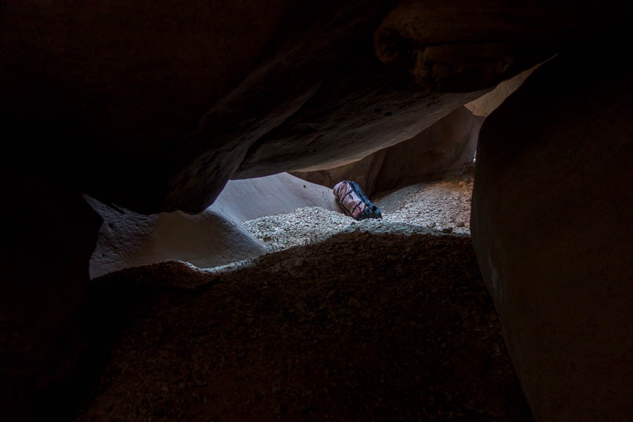
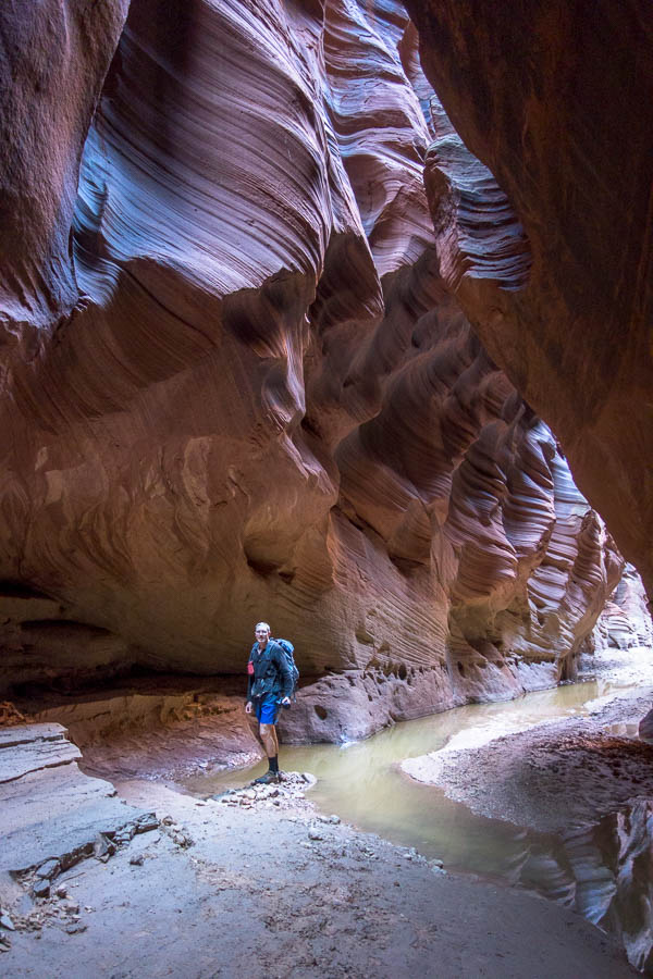
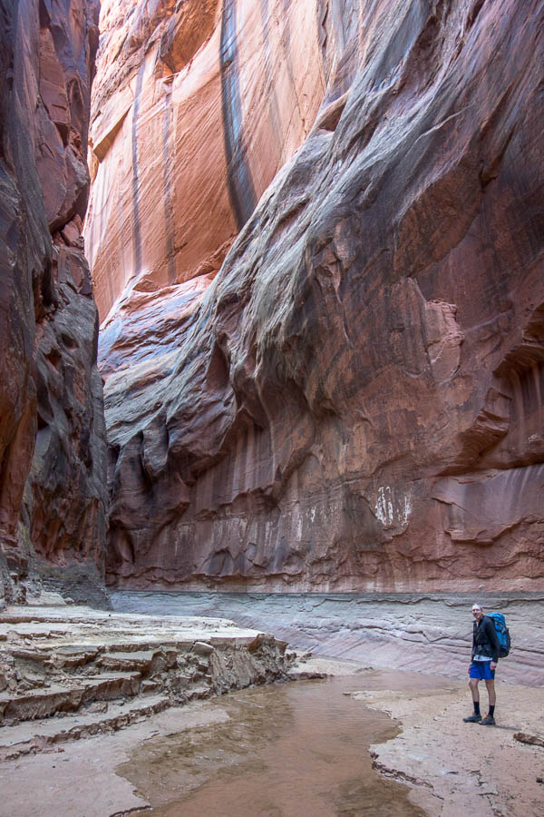
Bungleboori canyoning (22-23 Nov 2024)

The forecast was about as good as you could get for canyoning – three days of ‘sunny’ with temperatures in the mid-high 20s. I had commitments for the Sunday so this seemed the perfect opportunity for a Fri/Sat trip. It had been a while since we’d been into the Bungleboori – I was a bit surprised to see it had been 4 years since our last trip. That said, it had been 15 years since we did the route we had planned for this weekend! Looking back on the photos from the 2009 trip there were some stark differences. I had a day pack and Tom was loaded up with a full overnight pack. It’s been a while since that’s been the weight distribution for our trips!

I had done Luna Park significantly more recently than Tom – 2016 – whereas he hadn’t been there since our 2009 trip. When James & I did it in 2016 we were pretty efficient – but that wasn’t the way Tom & I were rolling this time round. Initially we missed an early ridge so had to do some back-tracking, then couldn’t decide whether we were going exploring (and if we were, were we taking full packs, small packs, or just doing an out and back.. ). It hadn’t even occurred to me that it was well after lunchtime even though I’d been ravenous for quite a while. It was only when Tom said it was 1:20pm that I realised there was good reason that I was hungry! We enjoyed lunch in the shade of a pagoda with great views over the Bungleboori before finally dropping into Luna Park about 3pm.

We had the usual array of short abseils, jumps and climb downs before hitting the deeper part of the canyon. I had a strong memory of what the anchor was going to look like for the trickiest abseil start … and a sharp corner, with a pool leading into it were not it! Anyway, with the rope anchor set-up there seemed to be a less stretch than previously, and we both made it down with the usual device grating over the edge.

Tom checking out the below water anchor on the ‘tricky’ abseil

Classic Luna Park

Whatever technique works…

Towards the bottom we strung together a couple of drops which I think we’d done separately on previous trips. There weren’t obvious intermediate anchors, but given we had sufficient rope to combine the drops we didn’t look too hard.

Tom about to swim a pool

Tom on the final abseil

Another classic Luna Park shot

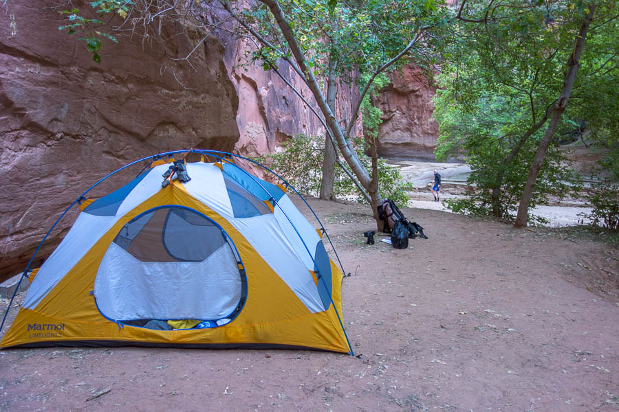
Luckily for us there was a convenient sandbank in place to camp on once we were spat out onto the Bungleboori. When I’d been here in 2016 there was no sand just rocks so it obviously comes and goes, as we camped in the same spot on a sandbank in 2009.

Just as we arrived at camp a black swan floated upstream – almost like it had been waiting for us to arrive so it would be part of the backdrop. I don’t think I’ve ever seen a black swan in the greater Blue Mountains bush – it seemed quite out of place.

Basic but comfy campsite

It’s been a while since I’ve slept out with glow worms for company along the walls and the stars over head. I would have liked to watch them for longer but I was asleep almost as soon as I lay down.

The next morning we got away reasonably early as we weren’t sure if our intended route would go and wanted to leave time for alternatives. Fortunately our first choice route did go and in less than 45 minutes from leaving camp we we were dropping into Dead Tree Canyon.

Given the floods and fires of recent years Tom was musing over how many dead trees would be in the canyon given it was chock full of them before. We weren’t disappointed – almost immediately climbing down a number of dead trees.

By coincidence it was almost 20 years to the day since Tom’s first visit to Dead Tree Canyon.

Dead Tree Canyon living up to its name from the start

I wonder how many years this dead tree has been here?

We enjoyed having our abseiling skills tested with numerous tricky starts – generally from low-slung logs into narrow Vs which then opened up into overhung sections.

Whatever technique works…!?

Tom delicately balancing on a very insecure log

Straight and narrow

More dead trees

It turned out I’d never done anything with my photos from our 2009 trip, so I thought I’d include a few here (there wasn’t anything worthy of inclusion from Luna Park!) for comparisons.

Tom abseiling (2009) – definitely not using pitt stops anymore!

Tom on the same abseil as the 2009 shot above

Trying to stay dry (he falls in just after I take this photo)

Better skills in 2009 – I think he manages to get the whole way round

The final abseil before reaching the ‘Boori

Final abseil (2009)

We were happy to warm up in the sun on the Bungleboori for morning tea before heading back to the rest of our gear that we’d left where we camped. The black swan was still hanging about in the pool upstream of our camp and wasn’t too happy about us heading that way. We tried to steer clear of it – maybe it had a nest in the vicinity?

Generally the section of the Bungleboori up to Hailstorm Retreat felt fairly quick – there’s lots of sections where you can walk on the bank. But, despite feeling quick it took us well over an hour. So those sections where we got stuck in boulder mazes or thigh deep in quicksand must have eaten up the time. We had lunch and then it was time to ascend Hailstorm Retreat. We were pretty happy it had clouded over by this stage – the heat from the direct sun makes a huge difference.

Someone’s pack is too fat

Good thing he can get through!

Slightly easier fit in 2009? 🙂

Tom & Chris in Hailstorm Retreat (2009)

I feel like I’m slightly mentally scarred walking out Waratah Ridge – it always seems to go on and on, and even once you hit the Hole in the Wall fire trail you’ve still got the best part of 4km to go. It was no different on this trips. My feet were over it shortly after we hit the main track (where there were a couple of tents pitched, though no sign of the occupants).

We made it back to the car to find our tyre with a slow leak was very saggy. Tom insisted it was fine to drive into Lithgow on it (I’ll resist commenting on that) – so a slow trip into the servo to pump it up was a bit of a downer to finish the trip. It seemed only fitting that dinner was pizza in Richmond as it so often has been after Bungleboori trips in the past.

Utah/Colorado/Arizona/California (Sep/Oct 2024)

Tom & I spent four weeks in south-western USA primarily Utah, Colorado & Arizona. The main goal was canyoning but we ended up with quite a bit of hiking as well and even some via ferrata!

I have a list of things we learnt from across our 3 trips (2013/2017/2024) which might be helpful to any Australians planning a canyoning trip to Utah.

Day Date km Driving Time Overnight at…
0 Fri 6 Sep 10 Las Vegas, NV
1 Sat 7 Sep 300 3h 21 Watchman Campground (Zion NP), UT
2 Sun 8 Sep 156 2h 17 Lava Point Campground (Zion NP), UT
3 Mon 9 Sep 170 2h 16 Point Supreme Campground (Cedar Breaks NM), UT
4 Tue 10 Sep 107 2h 18 Panguitch Lake Campground (Dixie NF), UT
5 Wed 11 Sep 336 3h 27 Dispersed camping, UT
6 Thu 12 Sep 85 1h Green River, UT
7 Fri 13 Sep 185 2h 8 Dispersed camping, UT
8 Sat 14 Sep 0 0 Dispersed camping, UT
9 Sun 15 Sep 186 2h 45 Green River, UT
10 Mon 16 Sep 210 1h 56 Grand Junction, CO
11 Tue 17 Sep 141 2h 1 South Rim Campground (Black Canyon of the Gunnison NP), CO
12 Wed 18 Sep 119 2h 12 Amphitheater Campground (Uncompaghre SF), CO
13 Thu 19 Sep 11 23m Amphitheater Campground (Uncompaghre SF), CO
14 Fri 20 Sep 12 27m Amphitheater Campground (Uncompaghre SF), CO
15 Sat 21 Sep 120 1h 44 Friend’s place, CO
16 Sun 22 Sep 142 2h 27 Morefield Campground (Mesa Verde NP), CO
17 Mon 23 Sep 440 4h 43 White House Campsite (Grand Staircase-Escalante NM / Vermilion Cliffs NM), UT
18 Tue 24 Sep 205 2h 20 Big Water, UT
19 Wed 25 Sep 27 20m Buckskin Gulch, UT
20 Thu 26 Sep 270 2h 51 Flagstaff, AZ
21 Fri 27 Sep 72 1h 6 Flagstaff, AZ
22 Sat 28 Sep 12 20m Flagstaff, AZ
23 Sun 29 Sep 190 2h 15 Christopher Creek Campground, AZ
24 Mon 30 Sep 393 4h 53 Tucson, AZ
25 Tue 1 Oct 237 2h 42 Ajo, AZ
26 Wed 2 Oct 453 4h 57 Blythe, CA
27 Thu 3 Oct 195 2h 22 Ryan Campground (Joshua Tree NP), CA
28 Fri 4 Oct 51 55m 29 Palms, CA
29 Sat 5 Oct 315 3h 30 Plane

Total – approx 5,150km

SW USA Part 6: Arizona Canyons

Continued from Part 5

We briefly stopped in at Lone Rock – in Lake Powell – before retracing our drive up and out of Page from a couple of days earlier. I can’t remember what letter of the alphabet the music was up to but it wasn’t enough to keep Tom alert and I got to take over driving duties much earlier than I expected.

That meant Tom was on accommodation booking and we ended up at a Motel 6 for a bargain basement price of US$50 for the night (the nearest camping was close to US$40). Tom did warn me it was close to the Interstate but as we drove in I thought it didn’t seem too bad. Except we soon discovered our room, understandably at the price, was round the back of the complex, with nothing but a couple of hundred metres separating us from the traffic. Neither of us slept particularly well, and so when the alarm went off pretty early, there was a brief conversation about ditching our ambitious plan for the day. But, with the amount of traffic noise, I figured we weren’t going back to sleep, so we may as well get up and go.

We headed to Illusions Canyon, a tributary of the West Fork of Oak Creek. We had finished our last US trip in Sedona and driven past this area. On that trip, we hadn’t given any thought to hiking Oak Creek – even though it’s apparently one of the most popular trails in the area – and definitely had no thoughts of canyons in the area.

Illusions is considered one of the best canyons in Arizona, by many people on the interwebs, and had come highly recommended to us by a friend. But it also comes with a myriad of warnings about a possible keeper pothole at the very end. In easy mode it’s simply a pool which you swim across after the last abseil, but in hard mode it’s a 19 foot deep pothole that many of the usual pothole escape methods don’t work on. We don’t have much (any) need for pothole escapes in Blue Mountains canyons and so we don’t own pothole escape tools, let alone have the experience for a challenging escape (I have stood on Tom’s head once to get out of an easy-ish pothole…). So there was no way we were going to attempt this canyon if we thought there was even a chance it wasn’t in easy mode. The Arizona Canyoneering Facebook group and conditions reports on RopeWiki assured me it had been in easy mode the week before.

The other big decision was whether to do the traditional approach and exit, which involved hiking up the AB Young Trail – a 500m ascent, and then descending the West Fork of Oak Creek at the end. The alternative is a much shorter ‘sneak’ approach which involves about an hour of driving on forest roads to get to the top.

Given my well-known love of dirt roads, we (I) figured we’d rather ascend 500m on foot! Plus West Fork of Oak Creek is supposed to be a worthwhile objective in its own right. With the decision made, an early start was definitely in order, which is why we were at the trailhead not long after 7am. The hike up AB Young wasn’t too bad, as it is a series of many (33) switchbacks and we were early enough that the temperature was quite pleasant.

Tom most of the way up the AB Young trail

From the top we took a somewhat circuitous route on the plateau to the Illusions drainage. If we were to ever do it again (unlikely – because we live in Australia, and we’d likely do the sneak route) we’d probably contour across the plateau to save some walking. I hadn’t packed the compass which I was somewhat regretting as we were trying to follow the instructions to get in. We had various electronic navigation devices, but nothing beats having a compass when you’re just trying to head in a particular direction.

We found ourselves in the drainage and got our first introduction to Arizona bushwhacking. I’d heard enough about it from friends, but you never know what other people’s scrub thresholds are. And as it was neighbouring largely vegetation-free Utah I had thought the scrub might be over-hyped. I like to think my scrub threshold is pretty high – but being surrounded by unfamiliar plants made it a lot more challenging. Turns out lots of the Arizona plants were spikey – like blackberry spikey. I was also a bit surprised that for what I thought was a pretty popular canyon there didn’t seem to be much of a route. We likely dropped in slightly early and we did find ourselves on a social trail after a few minutes.

Bush-whacking – Arizona style

The vegetation didn’t really ease off, but at least I started to work out which plants really needed to be avoided! Eventually we got to the sign warning us of all the dangers of canyoneering and soon after that the creek turned into a canyon – one that wouldn’t have been out of place in the Blue Mountains.

Out of the vegetation and into the canyon

We could be in the Blue Mountains

The upper section very much could have been the Blue Mountains but soon we got to features and downclimbs that were not at all Blue Mountains-esque. Twisting corkscrew downclimbs, climbing through arches, abseiling through arches all wonderful features of this canyon.

Wonderful arch feature

Corkscrew downclimb

Abseiling through an arch (though afterwards we realised for the sake of rope groves we should’ve gone over it)

Tom on the other side of a swim

Tom on a tricky downclimb – I got down in a different spot

Besides the pothole, our main concern with this canyon was the temperature. We only own 3mm and 3/4mm wetsuits – which seemed to be on the light end of what was ever recommended at any time of year. We were hoping with it being autumn that we’d get through ok. By the time we got three-quarters of the way through we were definitely feeling the cold. We got to a drop which our beta said was a downclimb, but Tom didn’t like the look of it. As were both shivering we just needed to make a quick decision. I meat-anchored Tom down and then he partner-assisted me. While we could see where a skilled person could downclimb it was above our comfort level that day.

Tom abseiling

Tom below a beautiful section of canyon we’ve just abseiled down

We were glad to get to the final section of narrows as it promised warmth wasn’t too far away. Other trip reports I’d read had made me think the final narrows were going to be a bit longer – but the two raps were right on top of each other and with only the two of us we made pretty quick work of them. Tom was wondering whether to prepare for needing to escape the final pothole – but I was like “just assume it’s going to be a swim and get on with it!” Fortunately that was the case and it was just a swim across the pothole.

Tom abseiling again

Tom on the final abseil – can’t see the pool/pothole from the top

The pool/pothole – hard to imagine it empty!

After Tom hauled me out I got to have a look at the pothole. It is amazing what difficulties can be hidden! It was such a nondescript pool. It made me wonder how many Blue Mountains canyons hide similar problems – but the pools just never empty so we don’t have to deal with them.

I assured Tom I’d read two trips reports that said there was another abseil further down the creek. We were cold enough (and weary of the vegetation) that we left our wetsuits on. After quite a way he was definitely sceptical that the abseil existed. But we did eventually hit the final rappel. From there it wasn’t far to the West Fork of Oak Creek proper. Time for a late lunch!

Lunch on the West Fork of Oak Creek

Great rock colourings

From there Tom had suggested it was only 3km or so to the car park so I was expecting an hour at most. We started bumping into people once there was a track (rather than wading) and a couple of ladies asked how far it was back – of course we hadn’t done it but I suggested 2 miles, and they said ‘no way, we’ve walked way more than that’. Tom… what haven’t you told me?

Tom on the walk down West Fork of Oak Creek

Once we’d walked the trail of indeterminate length (3km / 3 miles / who knows?), at least one of us needed to retrieve the car from the car park 3km down the road. Tom had unfortunately rolled his ankle as we had been descending the tributary. He suggested I should push on quickly and then go retrieve the car. So I set off at a brisk pace, with my very heavy pack (I had the wet 60m rope in addition to all my wet personal gear). The trail was lovely but it did take a lot longer than I had been expecting.

Once at the Call of the Canyon car park I “just” had to get back to the Bootleggers Picnic Area where we’d left our car in the morning. Before we’d separated Tom had tried to point out some tracks that ran parallel to the road on OpenStreetMap, but I hadn’t thought walking along the road had looked too bad. Not sure which section of road I’d been looking at to think it wasn’t too bad!

There was basically no shoulder for lots of it, so my early technique was to jog the bits with no shoulder, walk the sections which did. I got lucky early on that the breaks in traffic coincided with my no shoulder sections. However 2km down I hit a section with much longer no shoulder sections, and a lot more cars. Eventually I gave up on that and was, fortunately, past the private properties, so I cut down to the creek and picked up the track on the other side. Eventually I was back at the bottom of the AB Young trail and could clamber back to our car – 5:30pm, only 10 hours after we’d left it. The walk along the road was the scariest part of the day – in retrospect I should have tried to get someone leaving the car park to give me a lift down the road.

Luckily the lady on the car park booth didn’t make me pay to stop and pick up Tom, and so we were soon on our way back to Flagstaff. I was feeling pretty smug as I’d decided we needed to book accommodation the night before as I had an inkling it would be a long day. We’d largely avoided being in towns on Friday & Saturday nights – but there was no avoiding this. The whole area is a popular spot to visit and the change in price for the weekends was significant. The basic room we’d had at Motel 6 the night before for $50 on a Thursday night was $180 on Friday night. Needless to say we didn’t head back to Motel 6. I’d found us a lovely Air BnB for the weekend, and we were delighted to have a well-appointed kitchen and the opportunity to eat some fresh produce (and no traffic noise).

Two of the three previous days had been up there with the hardest on the trip, and we had been on the go for almost three weeks. We were both ready for a day off, and what better location than Flagstaff. At 2,100m it was sort of escaping the heatwave. Our sole excursion for the day was to a bakery/café, where I got a surprisingly good coffee (US trips are generally coffee free for me). Otherwise we read, rested and ate good food.

Enjoying our rest day

The next morning we were refreshed and ready to go again. Arizona canyons have a short season as most of them are fed by snow melt, so by the time autumn rolls round there’s little to no flowing water. Christopher Creek was the main suggestion from the locals for the time of year, unless we wanted to find ourselves in stagnant disgusting water. So, Christopher Creek was our next stop.

After securing a campsite we drove a short way down the interstate and strolled the 15 minutes in to the creek. Christopher Creek is a more open creek, rather than slot canyon, the main attraction is jumps. I’m not really a jumper unless I have to, but even if I was, I don’t think the water levels were high enough to do much jumping.

Tom sliding in Christopher Creek

Tom abseiling

Tom abseiling

Another abseil

Tom downclimbing

We did quite a lot of swimming though and sadly my camera didn’t survive. Well, the camera survived, but the screen did not and as there is no view finder I was taking photos in the dark so to speak.

We encountered a couple of climbers part way down. And then a whole lot of climbing hardware – via ferrata style lines set up so they could get upstream to climbs avoiding the canyon, and many bolted routes.

Sadly we didn’t take lunch in as the exit point would have been a great place to eat it.

Relaxing at Christopher Creek campground

Back at camp we enjoyed the pleasant conditions in the shady campsite, particularly knowing this was the last time we were likely to be cool for a while!

Continued in Part 7

SW USA Part 5: Buckskin Gulch

Continued from Part 4

The decision to stay indoors meant we had a quick, easy departure the next morning to meet our car shuttle operator. When I’d booked our shuttle for 7:30am I hadn’t looked at the sunrise times. Sunrise was only at 7:15am. Once I’d realised I almost made it later – turns out it was a good thing I didn’t. We also had to make sure we were talking Utah times as Arizona doesn’t observe daylight saving and had an hour time difference – tricky when the border was only 20 minutes from where we were meeting!

Our shuttle operator was waiting for us at the White House Trailhead well in advance, and we were on our way to Wire Pass Trailhead exactly on time despite our faffing. The trip to Wire Pass went twice as fast as it would have had we been driving! Yermo had clearly driven the road many, many times previously, had a 4WD and was completely comfortable. Perhaps too comfortable, as he pulled out his phone, while driving, to show us photos of Antelope Ridge Canyon – apparently going to be the next big thing in the area.

Early start at Wire Pass Trailhead

I didn’t really know what to expect from our overnight trip through Buckskin Gulch. Even though I’d read that it was claimed to be the “longest slot canyon in the world”, I hadn’t really thought about what that would mean. After the first half hour approach, we were walking down a slot canyon for the entirety of the day. It wasn’t always super narrow, and to be honest those wider sections were something of a relief, but a good proportion of it was 2m wide. There is only one escape, the ‘middle exit’, and so it’s not a location to be walking if rain is forecast.

Unfortunately the area had got decent rain in early September which had filled up the canyon. The water had been draining (or evaporating) slowly but apparently even the week before we would have been doing chest-deep wades.

Early on – still have dry feet!

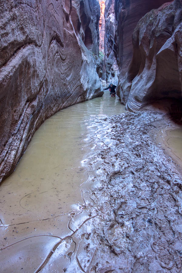
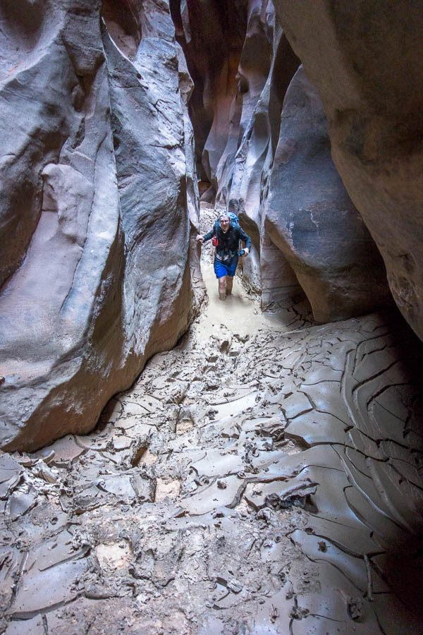
As it was we hit our first knee deep pools (and of course mud) quite early on. It didn’t detract from the canyon – though Tom was apparently expecting a more spectacular canyon. I think his expectations were too high!

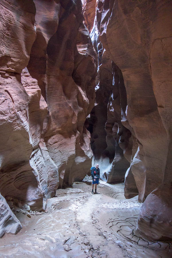
The notes we had suggested 3 hours from when we entered the slot to reach the middle exit. But every time I looked at something promising it didn’t go… and we kept going, and then hitting more mud and deeper pools. I had now been in up to my upper thighs, and in danger of getting wet shorts (which had been hitched up as high as they could go). The mud and pools made things very slow as it was so slippery you inch through the pools trying to ensure you don’t fall over and end up saturated and stinky.

Beautiful sculpted walls – but we’re concentrating on not falling over

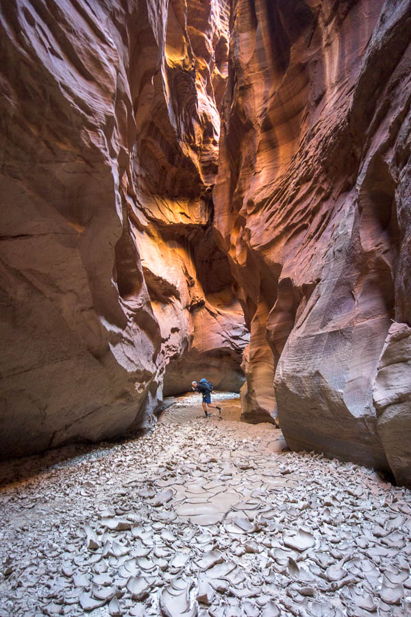
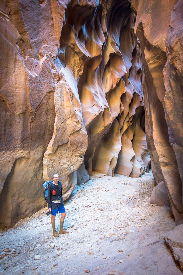
Amazing colours

Enjoying a more open section

Tom admiring the canyon formation

Somewhat dried out mud

Tom enjoying the mud…

A not very happy mouse

Yay, more wading

It’s getting deeper

Eventually we reached middle exit – it had taken us closer to 5 hours rather than the expected 3. Subsequently it was a very late lunch! We bumped into 3 others at the base of middle exit. Two who’d walked up from Lees Ferry over a couple of days, and the third appeared to be a guide to get them out middle exit. It became clear while we were eating lunch why they needed the guide. Middle exit seemed to be a slickrock ramp that just needed to be walked up – easy if you’re used to friction walking in that environment. Not so easy if you’re not used to it – they were still getting up the ramp as we finished our lunch.

We were somewhat buoyed by the news from the other walkers that there wasn’t really any water downstream. They had been covered in mud so we weren’t getting too hopeful though! Thankfully it was largely dry for the next hour and we were happy to be able to march down the canyon without much thought to foot placement.

Happy to be in faster moving terrain

The canyon formation just keeps going

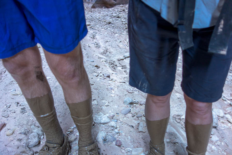
We were also waiting for the crux of the day to arrive, which according to the notes we had, was about an hour downstream from middle exit. So every indication of rockfall we thought – this must be it! But no… however, we did get to a mud pool. The description from the other couple made sense once we hit it – they’d said no water but just mud you keep sinking into. It was basically knee-deep liquid mud. We came out of with a slick layer of mud over anything that went into the pool.

Now onto the liquid mud section

Mud socks

Look at those walls!

Of course, feet covered in the mud, was when we eventually, about 2 hours downstream hit the crux.

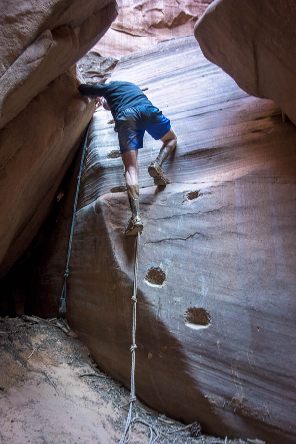
The crux is a pile of large boulders. Sometimes you can go through a hole at the base, but other times that hole is blocked up and you need to downclimb a boulder which has had steps carved in it. Both options were available to us, though Tom left his pack behind when he went to investigate the low route, so had to climb up the boulder to get back to his pack. I guess he got the full experience.

Tom climbing up the crux… to get back to his bag

Which he’d left behind when he’d taken the low option (though that is my pack where I’d left it to go back and help him get down)

More spectacular formation

We were hoping this later section was going to be ‘on time’ and not an extra two hours because we were already looking at a 5pm arrival at camp. Fortunately it was. We actually walked past the campsites initially – it was only when we arrived at the confluence of the Paria River and Buckskin Gulch that we realised our mistake. We were a bit grumpy about it as it had been a long day and we didn’t want to have to do unnecessary extra walking – but too late! As it turned out it really wasn’t that far back upstream to the campsites. We’d both been expecting that the canyon would widen out for where we camped – but having seen the sites it was then abundantly clear why you were required to carry your poo out (remember the wag bags). We were literally camping in the canyon – just on a couple of well-entrenched sandbanks.

Tired, after what was by far our longest day, we quickly devoured snacks, soup and dinner and were in bed pretty early. Before we could leave the next morning we got to have our first use of a wag bag. I’d done a bit of research before we left but I hadn’t appreciated that we would be needing to poo into a bag (as opposed to onto a flat sheet). I’m quite used to digging holes in the bush but the set-up for the bag required a bit more coordination. I’m sure after a few uses you get it sorted but I wouldn’t say it was the most user-friendly experience I’ve ever had.

Camp in the canyon

From there we headed back to the junction with the Paria River, which we would exit up. We had been surprised how few people we had seen in the canyon – a few at the start near the car park but otherwise we’d largely been on our own. So it was a bit jarring to bump into 3 people and 2 dogs, coming from downstream, first thing that morning. We recognised the group as they had set off from White House Trailhead when we’d been camped there two nights earlier. The smaller of the two dogs had a much harder time of it – lots of pools it had to swim! Another thing about the USA which just feels weird to me – dogs being allowed in so many more places than they are in Australia.

The section of the Paria was quite stunning and we enjoyed the morning’s walk. There were lots of people (and horses) heading in as we walked out. The closer we got to the car the sooner we needed to start making some decisions.

Paria Canyon – also spectacular

Arch in Paria Canyon

Amazing rock strata

This was meant to be the end of the canyoning section of the trip, and from here on we were heading to Arizona for desert hiking and cactus viewing. However Tom had looked at the forecast a couple of nights earlier only to find ‘extreme heat warnings’ issued over almost the entirety of Arizona and California for the next week. Did we really want to head into that? And if not, what were our alternatives?

We needed to make a decision before we drove anywhere, so we settled in under the picnic shelter at the Paria Contact Station with our maps of Utah and Arizona, phones at the ready, to try and work out a plan for the rest of a trip.

Because the heat was so widespread there wasn’t really anywhere that close to escape from it. If we opted to do some more canyoning in the Paria area (which had been skipped in favour of Colorado) we would be doing it in 30°C+ heat. That wasn’t likely to be that much fun – so perhaps we should just suck up the 40°C+ heat further south?

With that solid reasoning behind us we set off for Flagstaff – which at least at its higher altitude wasn’t setting daily record temperatures for that time of year (unlike Phoenix).

Continued in Part 6

SW USA Part 4: Mesa Verde, around Page

Continued from Part 3

I was keen to drive the “Million Dollar Highway” while it was dry so we made sure we got an early start. The highway was a treat with many Aspens turning to their fall colours. We stopped a few times to take in the views.

Fall colours on the Million Dollar Highway

From Molas Pass we did a few kilometres of the Colorado Trail to Little Molas Lake and then part way up the Twin Sisters Trail section. We hadn’t intended to go far and so hadn’t taken anything (e.g. raincoats) with us. However, we’d kept walking – just to get to ‘that’ spot, or that next view, and next thing we knew we’d were over an hour from the car and the weather had packed it in and was snowing on us. Dropping down a few contours back into the trees got us to drier climes and we got back to the car without getting drenched!

Little Molas Lake in the background, along with the brewing storm

We also got lucky as shortly after we’d stopped for lunch at James Ranch, a massive hailstorm came through. There were piles of hail all over the yard. We were lucky to be ensconced in the dining room eating burgers and not on the road. With the weather as it was we were very glad to be staying with Rachel who we’d met at Poison Springs the previous weekend. At our trip halfway point it was great to be staying in a home, with the opportunity to get some washing done.

Remnants of the hailstorm during lunch

Mule deer eating its way through the flowers in Durango Botanic Gardens

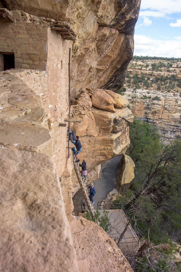
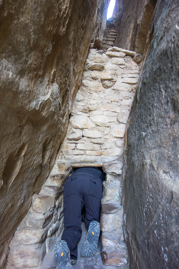
We got away relatively early the next morning heading to Mesa Verde National Park. Mesa Verde is famous for cliff dwellings that the Ancestral Pueblo people occupied until around 1200AD. We were booked on a guided tour to Balcony House – involving ladders and crawling through narrow access points. The cliff dwellings are very impressive and the thought of trying to access them without modern ladders makes the mind boggle.

Modern day access to Balcony House

Tom in Balcony House

Exit for Balcony House!

We hadn’t appreciated how much there was to see at Mesa Verde, and also how much driving was involved. Despite getting to the park at 10am we didn’t make it back to the campground much before sunset – to think we’d originally had ideas of then pushing on to somewhere else (mainly because the campground is extortionately priced).

The perfectly lovely, but very expensive, Morefield Campground

The drive to Page the next day was one of our longer driving days. It was brought to us by songs beginning with I, J, and K. When Tom had been connecting his phone up to the car he’d had some difficulty getting his music to play. When it finally did start working it was playing his collection in alphabetical order – not daring to touch it in case it broke, that was how it stayed for the whole trip. Perhaps unsurprisingly there are a lot of songs beginning with I.

Things on the schedule were a bit vague from here as we were constrained by the dates of our Buckskin Gulch permit and how to work other activities around it. In retrospect the order we did things was likely inefficient, but at the time it seemed sensible. After finding a delightful green-grass covered park in Page for lunch, we headed out to the Paria Contact Station to pick up our permits and WAG bags (more on this later!) for Buckskin Gulch two days later. While there we checked out the White House Trailhead and decided to secure a campsite for the night. Catstair Canyon was just a few minutes up the road, so that was the next stop.

Catstair Canyon has a unique feature of many old cars stacked up, presumably as surety for the wall of the road? Otherwise it’s a pretty brief canyon ending at a petroglyph wall. A good way to stretch out the legs after a long morning in the car though! And another opportunity for me to meat-anchor Tom/him to partner-assist me down.

Unusual canyon feature! (A major road runs parallel with canyon left)

Abseiling in Catstair Canyon

Abseiling again in Catstair

I had thought we’d do something else but it was a very hot afternoon, and the other canyons on our hit list weren’t particularly close. Instead we settled for the shade, behind the car, back at the campsite. Though later that afternoon I used my spare pair of gloves to clear the tumbleweed (yes, literally, aka Russian Thistle) which had taken over the marked tent area of our campsite.

Camping at White House Trailhead – I cleared the entire tent ‘platform’ which you can barely see for the Russian Thistle in this shot

The next morning we set off for Blue Pool Wash, another canyon that was very close to Highway 89, and also contained random car parts in it. We hadn’t dressed for down-climbing (my poor bare knees) so we made things a bit trickier than they should have been. However, a good canyon, and well worth the stop.

Tom trying to remember how to downclimb at the start of Blue Pool Wash

He’s remembered!

But not so much that we didn’t abseil

Another rap

Beautiful sculpting

If Lake Powell was full the area this area in the background would be underwater (would make for an interesting exit!)

From there we stopped in Page for Tom to check out the Glen Canyon Dam while I tried to book us some accom for the night. We’d agreed it would be better to stay in a motel so that we didn’t have to pack our gear up for our 7:30am shuttle pickup. Unfortunately, unlike earlier in the trip where leaving bookings to the last minute had resulted in cheap prices, the opposite occurred in Page. In the half hour I was searching the prices increased, agh! I ended up booking a motel I’d looked at the previous day but at a 50% higher price.

With logistics sorted we had a long drive around to the Lees Ferry Road. Tom was enamoured with abseiling to the Colorado River, even if it was a pretty contrived route. We set out for 2.8 Mile Wash in sweltering temperatures in the early afternoon – no relief was provided in the wash as it was very wide.

In 2.8 Mile Wash. Mountains behind are much higher than they look

Tom, in particular, then had a long time in the sun as he very carefully set up a retrievable anchor for the 50m abseil to the Colorado. Our pull cord was only 35m so we’d tied our handline on to it and hoped that would make it long enough – we’d only know once I’d got to the bottom.

We can see the Colorado…

Just need to get down this drop

Well, I’m down! Tom’s head sticking up at the top

Fortunately, the handline/pull cord combo was long enough, so that meant we could use the retrievable anchor and not need to leave a sling behind. Nothing like using a fiddlestick for the first time in the field, with just the two of us, on a 50m drop! The moment of truth – the pull – and it came away perfectly.

Tom almost at the bottom, pull cord (handline!) well out of the way

It was a relief to get down next to the Colorado with some breeze in the shade. It wasn’t long before we made it to Cathedral Wash (which is normally done as an out and back) and proceeded to scramble our way back up and cross-country to the car. Despite being somewhat less enthused for this outing compared to Tom, having done it I can see the attraction, particularly for out-of-towners.

Making our way up Cathedral Wash

Tom had wanted to go to Horseshoe Bend for sunset but that just made logistics difficult so he conceded and we paid our $10 parking fee and went in the late afternoon. We seemed to have hit a slightly less busy period – most people had headed off to start winding down for the day, and the sunset crowd hadn’t yet arrived. By the time we left new tides of people were arriving by the minute. Despite the crowds it is a very impressive view, and there are plenty of vantage points along the clifflines.

Horseshoe Bend & Tom

Finally, not long before sunset, we made it to our motel. As it turned out our expensive room meant we had a seat out the back with extensive views over the desert as the sun set – lovely. If you could ignore the odd dude who was digging in the gravel of the car park until it got dark. Packing for our only overnight walk (canyon) of the trip – not so much fun, but as we’d ended up with a two-roomed apartment we had plenty of room to explode our gear everywhere.

Continue to Part 5

SW USA Part 3: Black Canyon of the Gunnison NP & Ouray

Continued from Part 2

One of the issues with canyoning around Hanksville is the general isolation, and lack of mobile reception. When we’d headed into Maidenwater Canyon three days earlier the forecast had been for rain to come through on Monday. Without reception we didn’t know if that was going to come earlier/later/not at all until we got out late Sunday afternoon. I’d had some slightly nervous moments on Saturday night watching lightning in the distance and wondering if a storm was going to come through that night.

Regardless of weather, we needed to head to some form of civilisation because we needed to fill up water, and restock a few lunch supplies.

As it turned out the unstable weather, which had been due to come through on Monday would bypass the Hanksville area, and wouldn’t hit until late Monday. It looked like our new plan had us driving straight into it – but not wanting to make yet another plan we stuck with the new plan. And so we headed to Colorado – somewhere that hadn’t been on the itinerary at all – and my first time there.

It was a bit of culture shock to go from rural Utah towns to the slightly up-market foodie destination of Palisade! We had a lovely lunch at Carboy Winery with views out to Mt Garfield before doing the Palisade Rim (Lower) Hike. The second winery visit was slightly less relaxing as the wind battered the exposed deck we were sitting on and the rain snuck in the small gaps. We didn’t linger.

Mt Garfield views from Carboy Winery, Palisade

Palisade Rim Hike (Lower section) – views over the Colorado River, Book Cliffs, Mt Garfield

Palisade Plunge – look out! (mountain biking track)

A saturated car park and heavy grey skies greeted us the next morning and made us feel good about the decision to stay in a motel. We sat around waiting for the weather and eventually headed off towards the Black Canyon of the Gunnison National Park – ever heard of it? No, neither had we until a couple of days earlier. The name apparently comes from the narrowness of the canyon – some points in the gorge only receive half an hour of sun a day.

Right on forecast the weather cleared in the early afternoon, just as we arrived at the park. So we set off on some short walks, and then drove around and enjoyed some of the overlooks at sunset. We did the remainder of the short walks / overlooks the next morning before moving on to Ouray.

Black Canyon of the Gunnison National Park

Black Canyon of the Gunnison National Park

Sunset at Black Canyon of the Gunnison National Park

The Painted Wall, Black Canyon of the Gunnison National Park

We were lucky to secure a campsite at the Amphitheater Campground above Ouray and then set off to do Angel Creek Canyon. Ouray is famous for its Class C (flowing water) canyons, but being autumn the water levels were very tame. We hadn’t researched any of the canyons prior to the trip and definitely missed having RoadTripRyan. The RopeWiki descriptions weren’t always easy to match to reality.

Angel Creek Canyon

Rap 1, Angel Creek, Ouray “You will get soaked on the first rappel”

Rap 2, Angel Creek, Ouray

Rap 4, Angel Creek, Ouray

We came away a bit underwhelmed at how easy Angel Creek had been – but then chatting to a guy in the outdoors store he said he knew of a group that had to bail out of it because of rapidly rising water only a couple of weeks before. So despite what appeared to be very innocuous conditions I guess you’ve always got to be on top of possible dangers.

Not all of the creeks were tame – the Box Canyon, one of Ouray’s main attractions, was absolutely pounding – very impressive.

Box Canyon (Tourist access!), Ouray

Home for 3 nights at Amphitheater Campground

The next day we hit up the Ouray Via Ferrata. There’s two routes – the Upstream and Downstream, which both start from the same place. The outdoors store guy had told us doing the Upstream route first, if we were planning to do both, was the more efficient, so that was our plan. The Upstream Route (VF Grade: 4.5B) is the harder of the two and we quickly found out that it wasn’t going to be an easy ramble – a step up from anything we had done in the Dolomites. Almost immediately we were doing slightly overhung moves and wondering if we’d got ourselves in over our heads. Fortunately the difficulty ebbed and flowed and we managed to make it through the route – albeit with much more of a workout than expected.

On our way to the Via Ferrata start

Ouray Via Ferrata – Upstream Route

Upstream Route, Ouray Via Ferrata

Tom climbing the Helix Ladder, Upstream Route, Ouray Via Ferrata

Upstream Route, Ouray Via Ferrata

Upstream Route, Ouray Via Ferrata

Final somewhat challenging climb, Upstream Route, Ouray Via Ferrata

We had a late morning tea (as it was already after midday) before wandering back down the track, to the start, to do the downstream route. The Downstream Route (VF Grade: 4B) was more scenic – the gorge in that section was more attractive, and it was easier. Though our hands were pretty worn after the morning so Tom, in particular, found it a bit trying. It would have been challenging had we done them the other way around! The end of the Downstream Route is at the car park so we were then able to head into town for a very late lunch near Cascade Falls.

Ouray Via Ferrata – Downstream Route

Downstream Route, Ouray Via Ferrata

Downstream Route, Ouray Via Ferrata

Downstream Route, Ouray Via Ferrata

Downstream Route, Ouray Via Ferrata

Downstream Route, Ouray Via Ferrata

Ouray is well-known for its hot springs, so it seemed wrong not to visit them. A couple of hours soaking in the outdoor pools with the beautiful backdrop was wonderful.

Relaxing in the hot pools after a strenuous day (Tom’s head front right)

The outdoor store guy had also suggested that Oak Creek water levels might be at a level we were comfortable with, so that was where we headed first thing the next day. Ouray is already at 2,400m and we had a solid 350m climb to start the day, to take us to the highest altitude canyon we’ve done. (We did visit Pleiades near Moab in 2013 which I think is higher but given it was covered in snow(!) we didn’t descend it). We weren’t really clear if autumn flow conditions warranted wetsuits but we figured we should play it safe and after much wriggling we were suited up and ready to go.

Lower Oak Creek

Taking the dry line R2, Lower Oak Creek

Lower Oak Creek has 9-ish rappels, the highest 40-odd metres down a waterfall. Even in the low flow conditions I got pretty wet on the way down – though Tom tells me that’s because I took a poor line. But he didn’t get to pop into the alcove behind the flow and ‘enjoy the unique view’. Our feet were pretty cold, but other than the main waterfall we weren’t really in the water very much above knee height.

Tossing the rope for the ‘highlight’ 40m rap

Looking back up at R3 (40m) and R4 (6m off the log)

Scenic backdrop (and awkward start) to rap 6

A short rap 7

Tom below Rap 8

It was very easy to tell when we’d got to the end as there’s a pedestrian bridge crossing the creek. After we’d de-wetsuited and packed up all our gear it was time for all the hikers to walk past. It was quite funny when they started asking how far it was to go etc, and us trying to explain we had no idea as we had not got to that spot by hiking. We got back into town in time for an earlier lunch than the previous day.

Packing up all the gear below the hiking bridge

Views from the Perimeter Trail

As we hadn’t yet done Portland Creek, the other Ouray beginner canyon, we figured we better do it that afternoon. We’d driven over Portland Creek several times already, as it’s on the road to the campground we were staying at. In fact the first rap is under the bridge you drive over. It was a short but scenic canyon. You just don’t get canyons like that in Australia where you can basically drive to the start, and so your entire trip is just the canyon – no real time spent on an approach/exit hike. It feels like cheating!

Portland Creek

Upper section of Portland Creek

Portland Creek

Rap 1 in Portland Creek – road to the campground above us

Rap 2 in Portland Creek

The weather was due to turn again the next day so it was sadly time to move on.

Continue to Part 4

SW USA Part 2: North Wash

Continued from Part 1

Maidenwater Canyon

We took advantage of the 11am checkout before heading to the Maidenwater canyons on the Ticaboo Road. We chose the middle fork as the beta suggested it rarely held water, compared to the other forks – we’d had enough of being wet the day before!

There were plenty of downclimbs and it was a good opportunity to try and get our heads back in the downclimbing game. Unfortunately when there’s only two of you and you’re partner-assisting on climbs there’s no one to take photos. At one stage I meat-anchored Tom and then I had to stand on his head to get down – would have been a great photo I’m sure. We’re not quite out of the canyon game yet!

Hot approach walk just after lunch

First abseil – the blue rope was already in place

One of many downclimbs

I think Tom rapped this and then helped me downclimb (rope pull no good from where it was set as you can imagine!)

More downclimbing

Still more downclimbing

From there, we headed to Poison Springs where we were hopefully meeting some friends of a friend to canyon the next day. I heard the others arrive late that night, but Tom had slept through. We’d been told it would likely be a late start (10am), but I don’t think I’d quite believed it until we wandered up to where they had camped at 8:30am and everyone was fast asleep. As it turned out Tom & I probably could have run a canyon that morning as we didn’t get going until after 11am… but that wasn’t the point of the day – the point was to go canyoning with other people!

It was a motley crew from Salt Lake City and Durango – many of whom hadn’t met until that weekend (lots of friends of friends). With 2 Rachels and 2 Coreys, along with Zac, Tom & Val it meant remembering names wasn’t too tricky!

Tom & I put our vote in for doing Constrychnine first as we’d done the other two Poison Spring canyons in 2013. No one else had much of an opinion so off to Constrychnine we went.

Constrychnine Canyon

The first drop is 40m off a deadman anchor, and we spent a lot of time here, as we politely worked out everyone’s skills and who should be doing what… You forget how long it takes to get 7 people down long abseils even if you’re working efficiently, and with the next one being 55m, and then a subsequent 30m one, we spent a lot of time in the canyon! That meant we had plenty of time to get to know everyone.

Top of the first rap – a motley collection of canyoneers and their gear

SLC Corey on the first rap

SLC Corey and Durango Rachel – checking out the second drop

Rachel on the second rap

Piling up at the bottom of the second rap

Val bridging below the second rap. We set a rope for the downclimb so technically our third rap.

The spectacular third (official), our fourth, rap

Third rap

Corey in the canyon

Just as we thought it was over there was one final drop, with no anchor, for us to overcome. Most of us were meat-anchored down, and a deadman/cairn anchor was set for the LAMAR.

Huh, a drop we weren’t anticipating (though if we’d read the notes properly we should have)

(the other) Rachel at the bottom of the final drop

Funnily enough, as it was around 5pm by the time we’d climbed out, there wasn’t too much enthusiasm to do a run through Arscenic to finish the day. Instead we had a great evening socialising, aided by an amazing spread of snacks, and dinner provided by (Durango) Rachel. Tom & I were most grateful for everyone’s welcome & hospitality, particularly given we didn’t have anything delicious to contribute. And it was nice to have someone to talk to other than Tom 🙂

Good times back at camp – Tom, Val, Corey, Zac, Rachel, Corey

The next morning I was keen to get moving and make use of the day as the following day the unstable weather was coming back. Eventually we said our goodbyes and headed off to do Shillelagh Canyon.

Shillelagh Canyon (East fork)

We arrived just as another couple were preparing to do the same thing – we followed them up to the start where they insisted we go ahead as they were just learning. The anchors on the rappels had been extended to avoid rope-grooving. This made the starts quite tricky as you needed to get a long way over the edge before you weighted the rope.

Tom on the first rap

Tom contemplating the awkward start on the second rap (see the rope grooves on the left)

Coupled with the tricky starts, the bottom of rap 2 had a muddy pool. Fortunately Tom was able to do a somewhat stretchy traverse around it – and then was able to haul me across. I suspect the two beginners behind us would have found things a bit more difficult!

Exhausted from hauling me across the pool at the bottom of the second rap? (He traversed by getting off in the alcove in the photo and doing a dodgy traverse around the bulge about the level where the rock strata lines smooth out)

Downclimbing!

Peek-a-boo!

We had an early lunch back at the car and debated what to do for the rest of the day.

Eventually we settled on Angel Slot Canyon even though it involved more dirt roads. Fortunately this was probably the best quality dirt road we’d encountered – though there were three quite sandy sections which may have been tricky without AWD. It was super windy when we arrived at the high, exposed car park and we were happy when we eventually got into the slot.

Angel Slot Canyon

Views over the Dirty Devil Wilderness – can’t feel the wind from the photo though!

Rapping into Angel Slot

Though depending on which way the canyon was running we were having sand blow into our eyes which made bits of it very unpleasant! Overall it was a high quality canyon with plenty of downclimbing and very speccy views on the way out.

In the slot and out of the wind (mostly)

Downclimbing

More downclimbing

In the canyon

More canyon

Spectacular walk out

From there we had a shake at Stan’s in Hanksville for old times’ sake before another motel night in Green River – yes, we’re getting soft.

Continue to Part 3

SW USA Part 1: Zion and San Rafael Swell

It had been 7 years since our last trip to the canyons of Utah. There hadn’t been a lot of canyoning done in Australia during that time either – what with bushfires, floods and Covid in the last 4 years.

I thought I’d set a relatively unambitious schedule with easier canyons – nothing overly exciting on the list. But even that seemed like it might be too ambitious when Tom managed to magic up some bruised (actually more likely fractured as it turned out) ribs the week before we left. Great.

Things didn’t start well when the airline moved our flight 24 hours and didn’t bother to inform us. Fortunately I had logged on to check the flights and noticed – so we managed to fly only 10 hours delayed rather than 24 hours.

As we had learnt from our 2013 and 2017 trips it’s not worth trying to get out of Las Vegas on the first day. Due to the change of flights it was just as well we weren’t planning to, as we didn’t get in till 10pm. That didn’t stop us accepting free (crappy) champagne from the concierge at our hotel though.

Feeling groggy (from the jetlag!) the next morning we set off on the unpleasant task of trying to buy supplies for a month living out of the car. This isn’t fun at the best of times, let alone when you’re jet-lagged and in a foreign country with strange things lining their supermarket shelves. I quickly felt justified at bringing full-fat milk powder, untoasted muesli and cup-a-soup packets with us, as nothing resembling these were available in the supermarket we went to.

Shopping took most of the morning and it was after lunch before we were on our way to Zion. We had hoped to shop the previous day and have time for a longer canyon but as things were we settled for Ghost Rider. The idea was that this would just get our heads in the game. We watched in horror as the car temperature climbed to 110°F (43°C) as we drove across the desert. Ghost Rider wasn’t far off our route so we figured we’d give it a go anyway – the canyon was only supposed to take an hour.

Heading down the drainage to Ghost Rider

Abseiling in Ghost Rider

I don’t think I’d registered it was in limestone country so any hope of it getting us used to the grippy sandstone were dashed.

On the walk out – we haven’t melted!

We didn’t melt and it wasn’t long before we were driving through Springdale with lots of fond memories of previous trips. The advantage of arriving late was there was no queue to get into Zion National Park! The temperatures did not abate overnight and we had a sticky low of ~30°C.

Much like our 2017 trip I had scheduled Boundary for the first couple of days. And much like our 2017 trip Tom decided he wasn’t physically up for it. The forecast was a bit unstable as well – possible thunderstorms. I lay there trying to think of alternatives and finally came up with what I thought was a great option – Middle Echo – we’d really enjoyed it in 2013, we didn’t have drive anywhere, there seemed to be permits available, and it wasn’t too big a day. Except then I realised that the access point within Zion was closed due to rockfall. So much for that idea.

We’d never been to the Kolob side of Zion and I had Lava Point Campground booked for that night. So the compromise plan was to do a hike in that area. It was only the next morning when I looked at things a bit more closely that I realised Lava Point was not really anywhere near the Kolob hiking area. Needless to say there was a little bit of frustration creeping in as nothing was going quite to plan.

Pre-requisite Zion campsite photo

Not having a better option we decided we’d just head to Taylor Creek anyway. We had a pleasant (if hot) hike out to the Double Arch Alcove. After that we headed to the Timber Creek Overlook Trail which had excellent views of the Zion area. I can’t believe we hadn’t been here previously!

Double arch alcove – Taylor Creek

Timber Creek Overlook views

We were forced to have a stop in La Verkin for a cold drink as the jetlag and hot weather combination was making it dangerous to keep driving. Eventually we did safely arrive at our campsite at Lava Point. We were very happy to get up in altitude and to some lower temperatures. While we were setting up there were thunderstorms rolling around, and we eventually retreated to the car as the rain came through.

Watching the thunderstorm roll around us

I still had hopes for Boundary and was trying to convince Tom we should do it the next day. There were still possible thunderstorms forecast but I thought if we got up really early we should be able to beat them. But eventually between Tom’s ribs and the forecast we decided it wasn’t the best idea and we’d just do what the original schedule had called for and head to Benson Creek.

We didn’t take the optimal driving route and so it was a bit later than planned when we arrived – and there were ominous grey clouds positioned right over the canyon. Needless to say I was a little nervous as the thunder rolled around our heads as we marched up the trail. On the plus side it was a short canyon, and the terrain seemed to have some soil to capture the run-off if it did start raining.

Abseiling in Benson Creek

Abseiling in Benson Creek

Abseiling in Benson Creek

We managed to get through Benson Creek narrows in less an hour without the weather deteriorating any further. We then made the (foolish?) decision to have lunch at the picnic area just below the canyon. Most of it was spent huddled under a tree as it spat on us. Just as we were finishing up the rain really started coming down. So there was more huddling, but eventually we sucked it up and marched back to the car in the rain. Why would I bring a raincoat for a trip like this/with a forecast like this?!

Lunch in the drizzle

From there we headed up to Point Supreme Campground, at 10,300 feet (3,100m), the highest place we’d ever camped. No worries about the hot weather here! In fact us, along with many others, spent a couple of hours that afternoon hiding in the Cedar Breaks National Monument Visitors Centre while it alternated rain and hail. It cleared and we were able to set up a dry tent, and even get a nice sunset at one of the view points.

Cedar Breaks National Monument – spectacular

We checked out the Southern Rim Hike the next morning which was excellent – though the altitude did make it harder going than it would have been normally. The light was stunning.

Cedar Breaks National Monument

Cedar Breaks National Monument

The Bartizan, South Rim trail, Cedar Breaks National Monument

Amazing light

From there we drove to an even higher point – Brian Head at 11,307ft / 3446m this was the highest either of us had ever been. No work to do it for it either as there was a road to the high point. Then we did the Twisted Forest hike for lunch. I enjoyed it so much I did it twice… when I realised I’d left my drink bottle at our lunch spot. Fortunately it was only a 40 minute return march the second time round!

Twisted Forest trail

Not content with our activities for the day we finished off with a visit to Mammoth Cave which is a lava tube which I wriggled through, but Tom decided his ribs wouldn’t thank him for it, so he contented himself with photography instead.

Another (not quite as) high camp that night at Lake Panguitch kept us at a good temperature, but the next day we descended down to the San Rafael Swell. We had another short (2-3 hours) canyon on the agenda – Lupacchiotta Canyon. This one involved just parking on the side of the Interstate highway.

Rather than following the directions Tom decided we could navigate better. But he’d forgotten about cryptobiotic soil – you shouldn’t just march cross-country as you bust open the protective soil, so we had a slow and inefficient approach avoiding all the crypto. Should have just followed the instructions!

Abseiling in Lupacchiotta Canyon

Abseiling in Lupacchiotta Canyon

Couldn’t quite avoid the water

Our intended camp for the night while very close as the crow flies, required us to be on the other side of the interstate and it was 12 miles of driving before we were able to turn-around and drive back 14 miles or so. It was a slow drive in to our intended campsite as we spent plenty of time checking out various sections of the road before proceeding, but we got there eventually.

Campsite with all the mod cons

The next day was the first ‘big’ one of the trip – in that it was a full day and not a half day or less. We set off early to try and get the cross-country done before the heat of the day.

Big country – on our way into Eagle Canyon

We weren’t too happy to find ourselves with some waist-deep wades with associated goopy mud as we progressed up Forgotten Canyon. The beta we had promised “This is NOT a route for beginners, nor for those looking for a slot canyon adventure. It IS a route for those looking for an elegant and challenging route with a little bit of technical rope work. The route requires good navigation skills, route finding, and most of all, good judgment. In several spots, there is relatively easy, but very exposed climbing. Not for the faint of heart or inexperienced.

The exposed climbing was not going to be fun with our shoes covered in mud. And our judgment proved correct – we got to the crux climb and stuffed around trying to overcome it. The slickrock that I think we were meant to just walk up just wouldn’t stick our shoes. I tried climbing the corner and couldn’t get up the very top. I tried climbing the dryfall but wasn’t bold enough to get up the final section. Eventually Tom had a go at the corner and managed to get up, and then was able to belay me up the dryfall (easy when you’re on a rope!). And after all the time we spent there I didn’t take a single photo of that section…

Wading in Forgotten Canyon

Once up the crux, we made it up Forgotten and over the mesa and back into Eagle with little issue. Though we did rim walk the upper narrows in Eagle since we could see they were wet. Eventually we got to the short technical section in Eagle – it looked very wet! Time for lunch then before we got saturated.

We made it up Forgotten, looking back at Forgotten Canyon Arch

As this was a route that isn’t done that frequently and it seemed like it had probably flashed recently I was a bit nervous about the anchors – particularly for the final rap which was a log. Without knowing the nature of the log you’re never sure if it’s one that’s going to stick around for years or one that will get washed away with the next flood.

Subsequently we took a very conservative approach to the technical section – leaving ropes in place and checking out anchor options before proceeding. The final log was in place (phew) but with only a sling draped over it (not around it – maybe washed down from elsewhere?) so more time spent replacing that. The final rap took us in to a large pool with a 10m swim to get out of. Probably over an hour to get through 150m at most of canyon.

Tom contemplating a swim in Eagle Canyon

Now how do I get down from here?

Looking excited for a swim at the bottom of the final rap in Eagle

We were relieved to be out of it (and in the sun so we could warm up after several swims), only to find the next section was not only wet but the wet was black, rotting vegetation. No way was I going through that if I could help it! Fortunately we were able to rim walk and then step across the canyon at a narrow section and climb down past the worst of it. Winning!

No, I really don’t want to get in that

Exposed traverse to get back up to the car out of Eagle Canyon

Back to the car at 4:45pm it had truly been a long day. It would have been great to camp another night where we were but we stank. And I was happier to get out that night so I wouldn’t spend the night worrying about whether the car would get stuck. So to Green River and a motel – bliss!

Continue to Part 2

Return to Main Trip Page

Carnarvon Gorge road trip (6-16 June 2024)

King’s Birthday weekend was coming up, and taking the rest of the week off seemed like a great way to get 10 days off in a row with minimal annual leave burnt. But where to go?

Carnarvon Gorge has been on my to-do list for a long time. Not sure exactly why – possibly because it’s mentioned in the back of Rick Jamieson’s Canyons Near Sydney book. (Not that Carnarvon Gorge is near Sydney!). Every time I’ve looked at it before I’ve been overwhelmed with how far away it is from everywhere, but this time it seemed like 10 days might be just enough time to make it worthwhile. Do we fly or drive? Tom convinces me that it’s probably easier just to drive since then we can take all our gear from home and not worry about weight limits on the plane. Slightly dreading the 1500km we have to drive each way I agree.

Day 1: Sydney to Quirindi (350km/4 hours)

We knock off the first 4 hours of driving on Thursday night after work. This puts us in striking distance of breakfast in Narrabri and then the opportunity to visit two areas we didn’t make it it to our on our previous visit to Mount Kaputar National Park – Sawn Rocks and Waa Gorge.

Day 2: Quirindi to Nindigully Pub (573km/7 hours)

Sawn Rocks, Mount Kaputar National Park

Waa Gorge, Mount Kaputar National Park

Mill-Bullah Waterholes, Mount Kaputar National Park

The schedule for the second day was pretty tight, but we managed to make up some time with the overly generous national park estimates for how long Waa Gorge would take to explore. We figured that gave us time to stop for coffee in Moree… but we’d failed to note where One Ton Post in Mungindi actually was. And had no reception – rather than just drive until we found signs we tried to find it (on the wrong side of the Barwon River). Any time we’d made up in Waa Gorge was squandered, but we made it into Nindigully Pub just on 5pm. We were somewhat disappointed that the thick stands of trees surrounding the pub obscured much of what had promised to be a good sunset.

Thallon Silos

Nindigully Pub

The pub was pumping and we somewhat accidentally found ourselves in the food queue, which was just as well, as otherwise we may not have got our first choice order. Live entertainment by Adam Kilpatrick was excellent – I couldn’t have pictured a more stereotypical Queenslander! (Maroons shirt & cap, stubbies & thongs… in 6°C) We particularly enjoyed his full rendition of American Pie towards the end of his set.

Day 3: Nindigully Pub to Carnarvon Gorge (491km/5.5 hours)

The next day was an early start, our preferred way to tackle a long driving day, getting a couple of hours of driving under the belt before breakfast (in Surat). With the schedule already falling behind we didn’t do the full riverside walk but it was good to stretch the legs out.

Roma’s supermarkets seemed packed with people like us stocking up for a few days. We managed to get in and out fairly quickly before lunch at Injune, in June (never gets old I’m sure). The only option was the pub of which we were 2 of 4 patrons. It’s hard to imagine the economics work – but I assume it must get busier at night. The chips were some of the best I’ve ever had – so crunchy!

Largest bottle tree in Roma

By the time we got into the Caravan Park at Carnarvon Gorge mid-afternoon I was ready not to do much for the rest of the day. Originally we had thought we might go and do a walk, but setting up camp, and not having to think for half an hour won out. That said there was a lookout to visit for sunset and some supposed platypus viewing to be had. Sadly, we didn’t look at the map properly and so spent a good 20 minutes looking for platypus at the swimming hole instead of the platypus area. Then mistimed our arrival at the lookout for sunset. Quickly dashing back to the actual platypus pool we did get to spot one before it swam off downstream away from where we were allowed to go. Ah well, can’t have it all. With a new moon the sky was dark and clear, the stars were phenomenal. It was also good to know we didn’t have any real driving for the next 4 days.

Day 4: Carnarvon Gorge caravan park to National Park entry (Driving: 6km / 15 min)

Another relatively early start, complicated by needing to pack overnight packs for the next few nights. But we managed to be walking by 9am which was the goal. The vegetation was so lush – not really what I was expecting. It really didn’t feel like we were in Outback Queensland. We did all the side-trips as we walked up the gorge; the Moss Garden, the Amphitheatre, the Art Gallery and Cathedral Cave. Wards Canyon was closed due to flood damage.

Beautiful day in Carnarvon Gorge

Tom in the Amphitheatre

The Art Gallery – the most impressive collection of art I’ve seen in one location

All 17 crossings up the gorge were labelled – though the signs got further and further back from the creek as we went upstream

Around one of the communal fires the previous night we’d met a couple of young guys who were heading out on the Great Walk and camping at Big Bend like us that evening. We kept leap-frogging them through the day – though they were doing was more exercise than us, as we dumped our packs at the junctions, whereas they were carrying them in and out on all the side trips. We also explored up an unwritten up side creek, which ended up being quite a lovely section of gorge/canyon.

Precipice Sandstone cliffs in lovely light

Big cliffs

Dramatic gorge, small human

Epic camp cave (Cathedral/Pitjara) – you can see why this was used by the local people for thousands of years

Eventually we made it to Big Bend – the last arrivals for the day, with 6 others already set-up. As such we got the ‘worst’ pick of the campsites, but we were happy enough with it that we didn’t bother moving when everyone else cleared out the next morning.

Our camp cave not quite so epic (or is it..)

We chatted with the two young guys until it got dark and cold. They headed for their tents, and we rugged up. Another couple from Cairns shared the picnic table with us while we had dinner. The third couple barely left their tent, so we never spoke to them. It was pretty cold, and the Cairns couple headed to bed by 6pm. That left me & Tom partying until 8pm.

Day 5: No driving!

It was a chilly night, we slept really well and after all our early starts were happy to have a sleep in. Our relaxed start meant we didn’t get away from camp until almost 10am. A day of exploring up-gorge with no real goals meant timing was pretty flexible. We had a successful day poking our heads up a number of gorges, generally getting stopped by some sort of chockstone block-up.

A canyon!

Tom in the canyon

Trying to replicate a photo of me in Blarney Canyon in Utah (turns out not that similar)

Tom looking small in a mossy section

Will he hop in the water in an attempt to continue upstream?

Large log jam!

Cliffs in the main gorge

Staghorns

Starting up another side gorge

up/down climb (depending on your direction)

Handy roots provide access into this side creek

Back at camp we had a new cohort of campers. Mum & 2 young daughters who were obviously experienced campers and quite precocious, plus a couple from Mackay on their final day of the Great Walk. They spoke of how cold it had been at the higher camps of the previous few nights. It seemed slightly warmer than the night before but still pretty chilly and yet again we were the only ones up at the late hour of 8pm.

Big Bend campsite reflections

Day 6: No driving!

On day 6 we were back to an early start, aiming to get up Battleship Spur in the cooler part of the morning. Not that it had been particularly warm during the day (maybe 19°C?), but a 500m ascent is a 500m ascent. What a delightful walk – the start of Boowinda Gorge was quite impressive, the scramble up the gully onto the ridge, then the ridge walking was excellent, before traversing across the tops to the lookout. We had a perfect day for it, and it was really enjoyable.

“the Subway” of Boowinda Gorge (at least that’s what it reminded me of)

On our way up to Battleship Spur

It took us 2 hours from camp to the lookout which was great timing for morning tea.

Battleship Spur viewpoint

Eventually we decided we better head back down. Everything had a slightly different perspective going the other direction. We enjoyed watching a couple of wedge-tailed eagles soaring just overhead, and Tom got to photograph the orchids we’d rushed past on the way up.

Tom in dinosaur country

At the bottom of the steep gully which gives access up to the tops

Back down in Boowinda Gorge, we headed upstream. I wasn’t really feeling it so I let Tom keep going while I found a nice flat rock to lie on. The sun vanishes early from the gorge in winter, and it was pretty chilly in the gorge, so it wasn’t quite as relaxing as it could have been. Tom eventually reappeared and said he’d found a flowing canyon only 9 minutes upstream. So we headed up to that, but I decided I didn’t need to go past the section where wading was required (Tom already had).

Tom found a wet canyon!

Back in the subway

On the way back down the gorge we had an unusual encounter. Two wedge-tailed eagles were perched in a tree in the gorge – seemed unusual, but maybe they roost there for the night?

It was a lot milder that evening – I didn’t even put my down jacket on till after 7pm. We had a full party around the picnic table – Mum & her daughters were still there, plus a couple from Kingaroy on their first overnight hike, and a couple from Brisbane just starting the Great Walk. Despite the mild(er) temperatures we were still the last ones up – at 8pm!

Day 7: National Park entry to Carnarvon Gorge caravan park (Driving: 6km / 15 min)

Day 7 was another full schedule so up early again – but to be fair when you’re going to sleep by 9pm, that’s still over 9 hours sleep with a 6:30am wake-up. The first half of the walk back down Carnarvon Gorge passed very quickly. The first of the day trippers we encountered quite early – unfortunately one of them had fallen in at Creek Crossing 10. We’d seen 2 people slip in there while having lunch on our first day. So beware crossing 10! The second half dragged a bit as we both waited for the turn off for Boolimba Bluff to appear. Eventually it did. We stashed our packs and walking on air with only day packs as we headed up to the lookout. The ‘steep and rugged’ walk up the gully reminded me of the Devil’s Hole in Katoomba and was lovely as it was in the shade. Apparently we’re fitter than we thought as we overtook quite a few people on our way up.

I obviously wasn’t that impressed with the view as I didn’t see fit to include a photo!

On our way back from Boolimba Bluff lookout. The sigh says “the next 300m is very steep and rugged. Recommended only for the physically fit”. Not sure what Tom was doing up there… 🙂

We were back at the visitors centre in time for lunch. We almost lost lunch to a determined kookaburra but fortunately it didn’t manage to make off with most of our cheese.

Post lunch we still had Mickey Creek, and side creek Warrumbah Creek that doesn’t even get a mention on the map, to do so Tom said there was no time for me to have a coffee. Boo. Turned out to to be a good thing, since by the time we’d been up the upper left fork and upper right fork of Mickey Creek and then explored a long way up Warrumbah Creek there wasn’t that much time left in the afternoon.

Found us another canyon

Turns out we left the best for last. Warrumbah Creek was a stunner. I think the other canyons may have felt a bit disappointing if we’d done this one first. Tom went a bit further than me, as I wasn’t keen to have wet shoes to go back down the flimsy branch we’d balanced on to get up the canyon. He didn’t get much further though as he came to a chest deep section, followed by a tricky looking climb up. With his camera/phone/gps in his short pockets it made it an easier choice to turn around.

Slanty corridor here we come

Canyon shoes come into their own for some bridging

Don’t think he bridged that pool!

Flimsy branch provided access up-canyon

Spectacular canyon

Back at the Caravan Park we prioritised platypus viewing over sunsets. The first pool didn’t provide much, so we wandered to the second one. Almost immediately I spotted some churned up dirt and bubbles. Bingo! We ended up watching two platypus swim about for half an hour. The closest view I’ve ever got of one. It was an excellent end to the trip.

My best platypus viewing experience – it was in fact excellent, even if this photo doesn’t perhaps suggest that

Day 8: Carnarvon Gorge caravan park to Toowoomba (611km / 7 hours)

Surprisingly (not), day 8 was an early start. We had an excellent breakfast in Injune (the sole cafe is open in the mornings), before stops in Chinchilla and then Dalby to stretch our legs walking along the river. I’d left booking accom to the last minute, and lots of motels in Toowoomba were full. Eventually I found us a much nicer room than I would have normally booked – and for once I took advantage of having a spa bath to soak my legs which were feeling the 4 days of walking.

Day 9: Toowoomba to Girraween National Park (191km / 2 hours 20 min)

We had a relaxing start to the day as we only had a couple of hours of driving and a similar amount of walking. Despite being our first visit to Girraween National Park we eschewed the popular walks and instead headed to the Mt Norman side to walk into a remote bush camp site I’d booked. I don’t think I’d appreciated the walk in was entirely on fire trail, but it was, so we made quick work of the 8km. Unfortunately the blue skies we’d started the day with were now grey clouds which didn’t bode that well for photography.

Stone gate entrance, Girraween National Park

South Bald Rock remote camp

Tom directed us to a track which led around the back of South Bald Rock and eventually up to the granite. At that stage I was wondering why we hadn’t camped closer to the summit as the thought of retracing the route after dark (or before sunrise) was a bit daunting. However, once on top it looked like we might be able to walk off the front back to camp.

Looks like sunset but it’s only mid-afternoon

Can we get off the front of this?

Camp is a long way down

Unfortunately it then started raining – that was not in the forecast! I’d been so casual about the forecast I hadn’t even brought a raincoat. Fortunately there was a large overhanging boulder near by so we sheltered under that with our happy hour while the rain blew through. In the scheme of things we couldn’t have done much better.

Hiding from the rain under a convenient boulder during an un-forecast bout of rain

The rain stopped for sunset but there was a bit too much cloud for anything spectacular. We made it back to the tent before the next lot of rain came through, so I got lucky on my lack of raincoat.

Actual sunset… Putin eat your heart out

Day 10: Girraween National Park to Armidale (265km / 3 hours 10 min)

Tom’s description of the morning didn’t make me rush out of bed to join him for a pre-sunrise hike back up South Bald Rock. I enjoyed being warm in bed while he went seeking sunrise. We walked out straight after breakfast and were back at the car by 11am. A bit earlier than expected – I was a bit over the walking – the weather combined with the fire trail made the trip a bit disappointing.

Instead we turned to the other thing we often do on roadtrips – wine tasting! Only 15 minutes up the road was Queensland’s premiere (and only!) wine region. We found ourselves at a winery with a generous lunch platter and tasting flight – an excellent way to spend a couple of hours before hitting the road to Armidale.

Day 11: Armidale to Sydney (480km / 5 hours 30 min)

We decided to take Thunderbolt Way back to Sydney – looking forward to a breakfast stop at the patisserie in Gloucester. We were very nearly too late as we secured the final two vanilla slices! Though to be honest I think the sausage roll was probably more impressive. Breaking the trip up we had coffee in Stroud, before the final push back home.

Total 2983km

Colo Pass 5 & 1 (20-21 Apr 2024)

James wanted to go canyoning for the weekend. Woohoo! But his suggestions were far more energetic than either Tom or I were capable of, and the weather forecast was not overly enticing for wet canyoning. But why work out plans more than 48 hours in advance? Eventually we settled on a trip into the Upper Colo since James had never been there, and I was hoping it would mean we wouldn’t be away the *entire* weekend.

About 20 minutes after leaving home on Saturday morning Tom started swearing. His phone and wallet are still on the table at home. “Am I taking the next exit?”… “Running out of time for a decision?”… I assured him it would be like going bush in the old days before Lidar maps existed and we had to just use our experience. I’m not sure he was convinced.

We continued on; but without Tom’s drivers licence I ended up doing most of the driving. Well, until we got to the boggy sections on the Culoul Range Fire Trail. I got us through a few puddles but as we started swinging about I decided I’d had enough. And Tom, licence or not, could be responsible for getting us through the remainder. We made it to the end of the road intact and were soon fairly saturated as we started walking along the overgrown trail. The forecast rain seemed to have come through before we arrived that morning and everything was sodden.

Eventually we dropped off the track, where apparently it hadn’t rained given how dry it was, and headed down to our creek. It was slow going, with plenty of young lawyer vine ready to leave its mark.

Between a petrol stop, a coffee/banh mi/pastry stop, the wet road in and then the overgrown approach, it was almost midday by the time we got to the first abseil. The banh mi had been smelling alluring the whole drive up, but were slowly getting soggy and squashed in our packs. The others weren’t keen for an early lunch so we kept going to the further detriment of the banh mi.

Tom on the first abseil

After the reasonable gap between the first and second abseils I got James to read out Tom’s notes from previous visits. I think both him & I were a little surprised (horrified) to find the base of second abseil was going to have a waist deep pool and the base of the third a chest deep pool! Slightly concerned at my lack of water proofing I was happy to let the others go first.

James on the second abseil, Tom at the base

I convinced them we should have lunch before getting into a chest deep pool and we were lucky to have a calm period on the ledge so we didn’t get cold while we ate our soggy banh mi.

As per our usual practice I took my shirt off for the third abseil, which prompted the others also to do so. I was not unhappy to find it was unnecessary as the pool was only waist deep (maybe even shallower than the previous one).

All smiles that a chest-deep pool didn’t exist (just a waist deep one)

Somewhere around this part of the day Tom objected to my efforts to increase our (his) efficiency getting down the drops. I was labelled the ‘fun police’ and then he started imitating Blackboard from the children’s program Mr Squiggle. “Hurry up” then became his catch-phrase for the rest of the weekend – even though he was really the only one that directive needed to be applied to! 🙂

James with an awkward sit-start for the 4th abseil

Tom on the 5th abseil

James on the 5th abseil

James on the 6th abseil

James on the 7th abseil, Tom on the ledge

Tom in the Colo (as well as two of our ropes!)

James on our 8th and final abseil

We had afternoon tea on the Colo before heading upstream. The river, unsurprisingly given the recent rainfall, had a lot more flow in it than on previous visits. There was no way we were going to be able to just wade up the middle of it.

Looking back up where we came

Tom above the Colo

We had a very pleasant night in our cave, particularly with it drizzling very lightly on and off most of the night. We woke the next morning to sections of blue sky which became full sun and blue sky later in the day. Such a contrast to the very grey day we’d had on Saturday.

It was pretty easy going to the base of Crawfords Lookout – truly spectacular country.

James and Tom enjoy a log walk

James crossing Wollemi Creek, but where is Tom going?

Colo horseshoe bend from Crawfords Lookout

We made it to Hollow Rock!

I won the 3 (or more?) time guessing games against Tom over the course of the weekend. Each time only by a couple of minutes which was highly satisfying.

Back at the car at 2:14pm (beat him again), we had a late afternoon tea stop in Windsor on the way home. A very enjoyable weekend in remote country, even if I’m still not fit enough to carry an overnight canyoning pack and enjoy it.

1 2 3 7