
NavShield 2023 (15-16 Jul 2023)
Every year Bush Search and Rescue NSW (BSAR) organises and runs the Australian Emergency Services Wilderness Navigation Shield or NavShield. While it’s intended as a training event for the emergency services, it’s essentially a 9 or 27 hour rogaine. NavShield has a reputation for being the hardest rogaine out there – often in non-ideal (read: scrubby) rogaine locations. While I enjoy 6 and 12 hour rogaines, I haven’t caught the bug for the longer form. That, with NavShield’s reputation for being a scrub-fest, had not made me rush to do it.
However back in early June I was informed I was the back-up team member for a team I didn’t even know existed, whose services were now needed 🙂 I’d been out of action for much of autumn so my fitness was going to be questionable – but despite that the team apparently wanted me. This was perhaps less because of the wonderful qualities I bring as a team member and more because I was a member of SBW and the team was entered in the Bushwalkers category and needed a minimum of 4…
Anyway, eventually NavShield rolled around and we had an SBW team of 4 (with another back-up team member recruited). The experienced NavShielders suggested we were better off staying away from Base on Friday night as it can be very noisy and cold. Once the location was revealed (this only happens a week before so no one can cheat by going walking in the area) I found a wonderful place to stay in Denman.
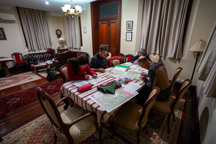
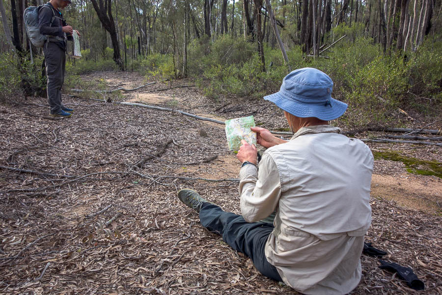
Luxurious planning location – hard at work marking up the map
We had another team staying with us, plus our Team Photographer/Cook/Driver/Hot Chocolate maker (Tom 🙂 ). The place turned out to be even better than expected, particularly with several large tables which we could use for planning. One big difference between NavShield and a normal rogaine is that the controls are not marked on the map – the first thing you have to do is mark them yourself. I found this quite difficult – with 8-digit grid references I kept mixing the numbers up. Plus the map was double-sided A2, with a considerable overlap, so we had to mark quite a few on both sides. By the time that was done I had very little mental energy for route planning. However we cobbled together a plan and headed for bed.
Far too early the next morning we were off to Base in Goulburn River National Park. The event started at 9am Saturday.
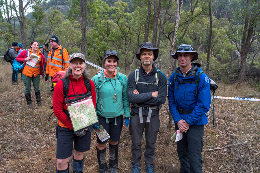
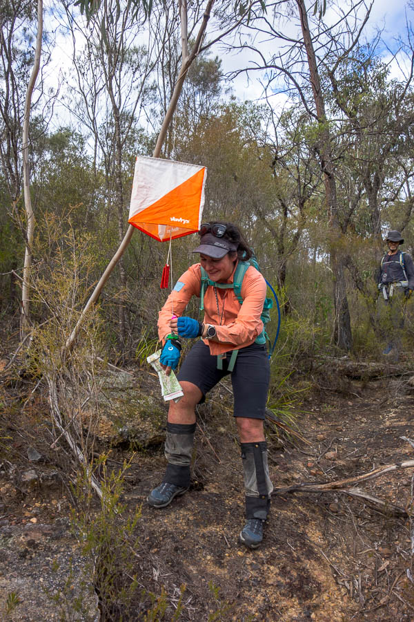
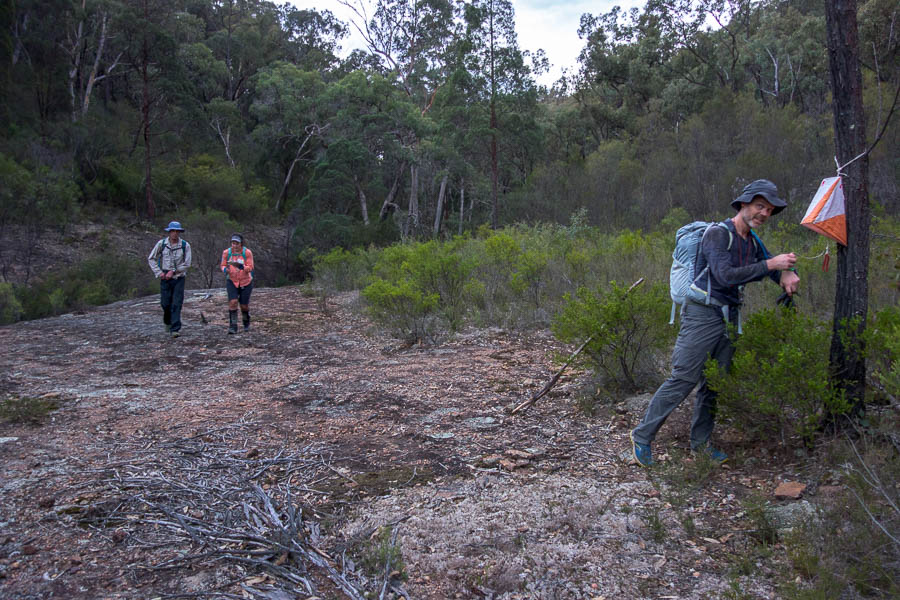
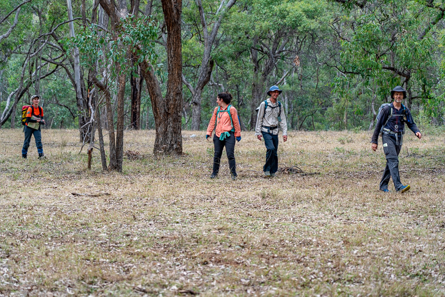
SBW Team (me, Lauren, Jonas, Vivien) just before the start – conspicuous by our lack of high-vis

And we’re off…
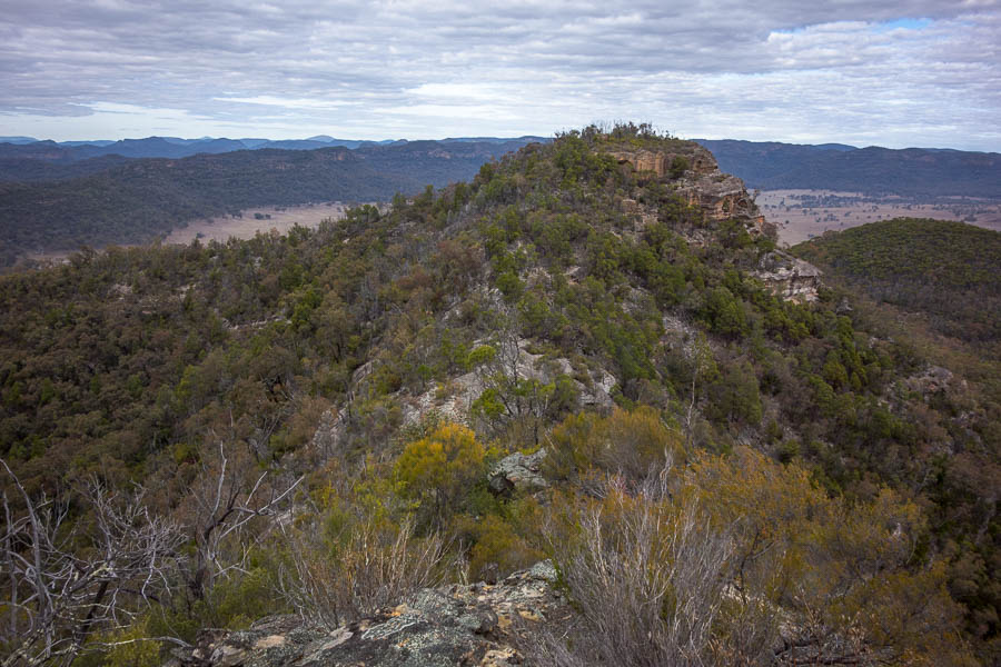
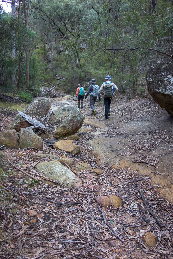
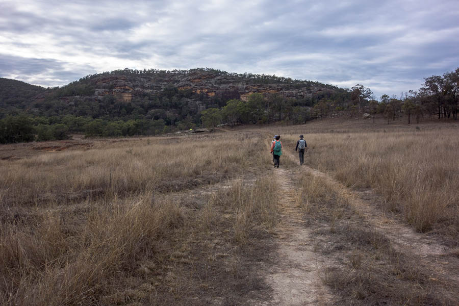
We made quick work of our first control, ascending through broken clifflines with no issues. Saturday morning was great – we traversed some spectacular narrow ridges and no navigational issues. Things were a bit slow and “sticky” (lots of dead trees/sticks to bash through) but in general quite enjoyable.
The other feature of Saturday morning was our ongoing leap-frogging of our arch-nemesis team SUBW (Sydney Uni Bush Walkers). We must have crossed over 4 times in the first 3 hours.

High sidling early on day 1
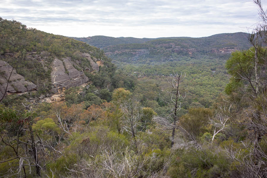
Looking back towards Base (the white specs in the valley)
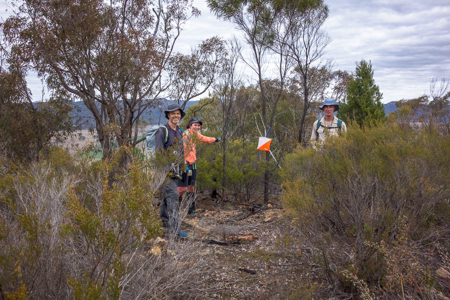
Finally got everyone to stop moving for a photo! (Control 60)

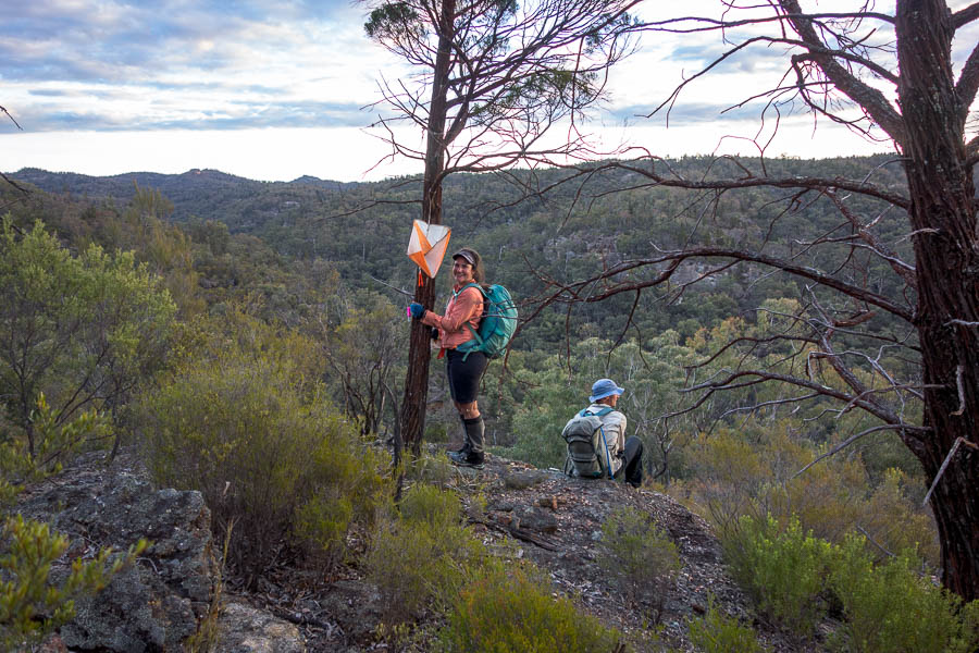
Taking in the views from the speccy high route we chose between 60-50
Looking back on the narrow ridge
We can see the next control…
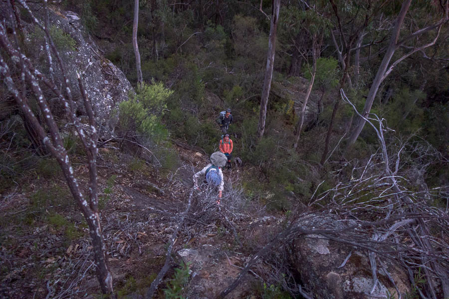
After a quick sit down for lunch (luxury!) we crossed over a larger valley and into a new section of the course. Saturday afternoon brought another spectacular narrow traverse, less views and more scrub. We also got our first experience of the waterways, which we had been told were generally easier going than the ridges. The Saturday afternoon water ways were the fastest we’d moved since we left the fire trail 10 minutes into the event!
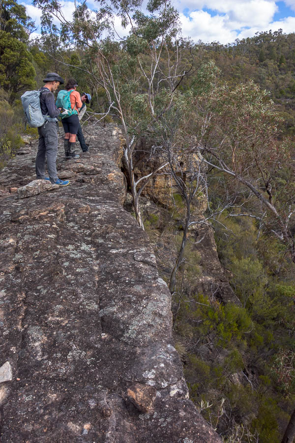
Above a cliff edge
The team descending to another speccy narrow ridge
SUBW caught up with us again here. They said we were acing the nav, but I suspect we were just a little lazier and they’d gone to to a 40-point control we’d decided to omit. As it turned out we wouldn’t see them (or anyone else) again until after dark.

This one needed a bit of scrambling to get onto

Vivien & Lauren on the ridge between 72 – 61
Lauren looking delighted to be punching (58?)
The fastest we’d moved all day!
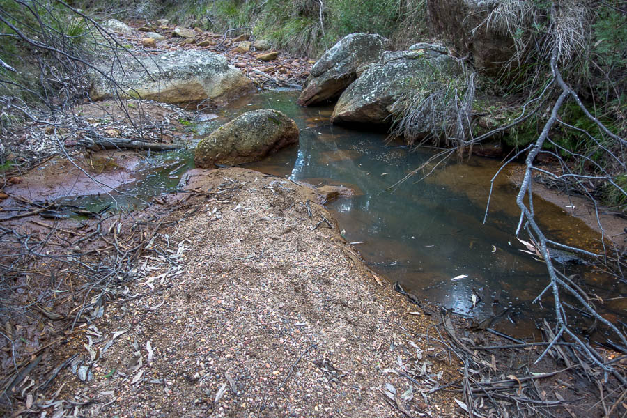
The most water we saw all day (until we dropped down to the Goulburn River after dark)
Our only navigational mistake during Saturday daylight hours was dropping off one knoll too early to get to Control 71. Fortunately we only detoured by a few hundred metres and it was easily corrected.
Pleased to be at 71 (our only daylight mistake?)

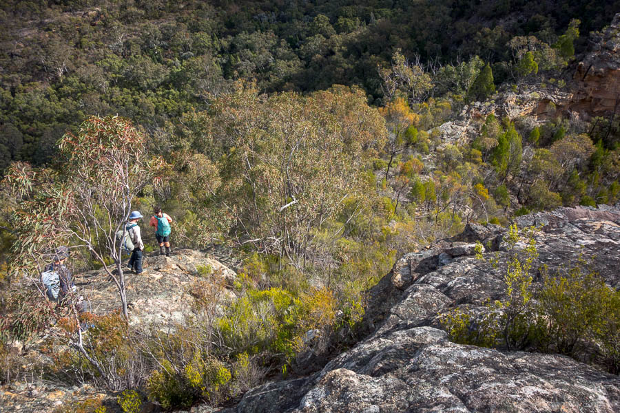
Descending yet again as we lose light
Final daylight control of day 1 (Control 81)
From 81 it was a battle with the light. We made it up onto the next ridge just as it was time to get torches out. We were all running low on water by then despite setting out with 3 litres. It had been an unseasonably warm day and the only water we’d seen in the watercourses we’d crossed were very small stagnant pools. So the team was excited that Radio Checkpoint Charlie was not too far away – where we’d be able to fill up.
Attaining the next ridge before dark
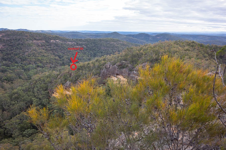
Our first control in the dark didn’t go successfully. We seemed to do all the right things but couldn’t find the control. We couldn’t work out what we could have done wrong – everything seemed to have been right until we couldn’t find it. In the end we conceded defeat and just headed on without the control. Looking at the trace* afterwards we were <100m from the grid reference and may well have been able to see it if it was daylight, but sadly that was 50 points that went begging. The SUBW team (we had yet again bumped into them just after abandoning the quest for 54) told us afterwards they initially also had trouble locating it, so maybe it was also slightly off in its description and/or placement.
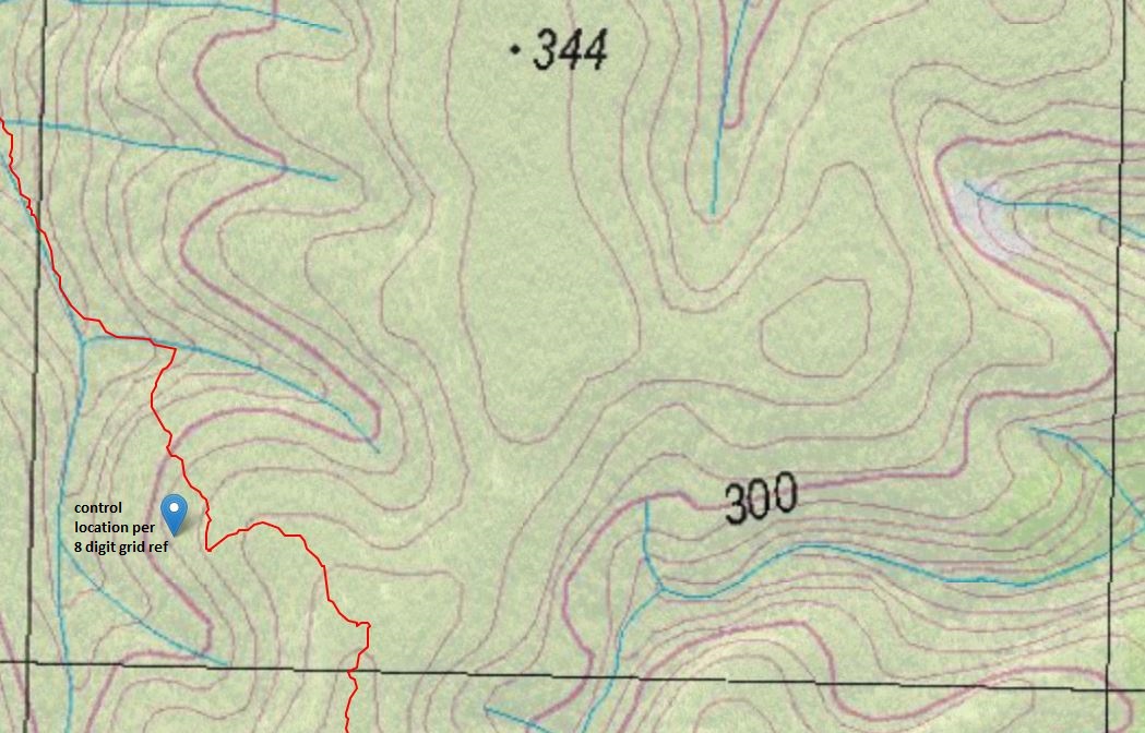
The story of Control 52. Red line is where we went. Marker is the grid ref supplied on the control sheet. (1km grid)
Arriving at Checkpoint Charlie at 7pm was wonderful. There was quite a few bushrangers there and as there’d only been 1 other team there (SUBW of course) they were excited to see us. We filled up water, then with much appreciated boiling water from the bushrangers had some soups/dinner and a rethink about the rest of the course. We ended spending an hour there.
With a slight amended plan we set off again – taking a flat (but longer), easy navigation route following a big bend in the Goulburn River to control 73. It was a very pleasant change to just be walking through grass rather than sticks whacking you across your body every step. There were no issues with 73, so then we headed up a side creek to 53. Unfortunately that watercourse was narrow and fairly vegetated – not pleasant easy walking. But we found the control with no issues.
I was fading mentally by this point, to the extent that I hadn’t even realised we’d swung from walking NE to SW to get to our next control. Fortunately that’s where the value of a team comes in – and the hope that everyone doesn’t fade at the same time. The control description for our next control was The Spur (Rock House) – I was imaging a rock formation of some sort, but it turned out to be something resembling a Rock House. It was beautiful camping here but as it was only 10pm and we’d agreed to go till around midnight we pushed on… I needed to hit the caffeine-infused gel to get me through the next couple of hours.
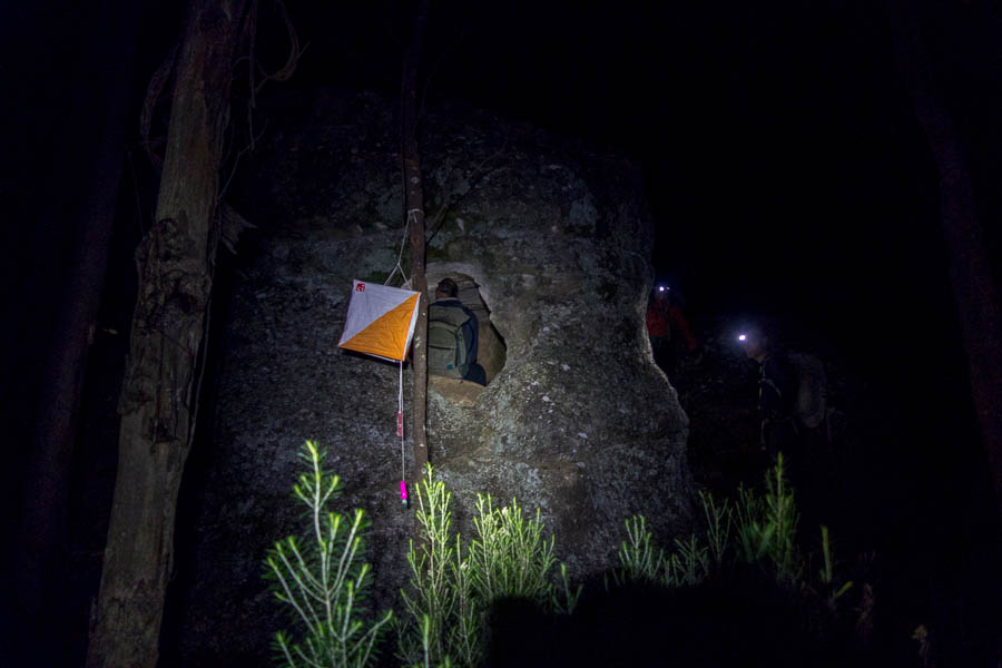
Control description: The Spur (Rock House) (#90)
Unfortunately the next 2.5 hours gained us no points and just got us back to the same place we’d been at 10pm. Our next control (45) we couldn’t locate and the terrain (large cliffs) didn’t really seem to marry with what we were reading off the map. After almost an hour wasted on that we gave up and tried to move on to the next one (68) but then got bamboozled by creek junctions. Eventually deciding the only way to work out where we were was to go back a known location (the rock house) and start again.
We agreed we’d start again on first light and so at 12:30am I collapsed into my sleeping bag on a patch of grass and hoped for sleep to come swiftly and deeply. We were rudely awoken around 4:50am when it started raining. We hadn’t bothered putting up a shelter so we were getting wet. The rain was light enough and we were all sufficiently tired that not much was done and next thing I knew Lauren was yelling out that it was 5:50am and time to get up.
Wearily, and still largely in the dark, we headed back up the same watercourse as the previous night. By the time we got near 45 there was enough light we could make out the clifflines and saw we’d been in the right place, just had underestimated how far we had to go up. We decided to not bother trying a second time.
The junction, which we’d discarded the night before as too small to be the right one, was easily seen as large enough when you could see the break in the cliffs behind it. We didn’t have any further navigational issues – just running out of puff – particularly me. My feet were blistered and so I was trying to step carefully which slowed me down.
At 24 hours in we were at the stage where it was easy to sit down and then not really want to get going again. This is another time when team mates get you going when you haven’t got your own motivation.
Vivien directing from the ground
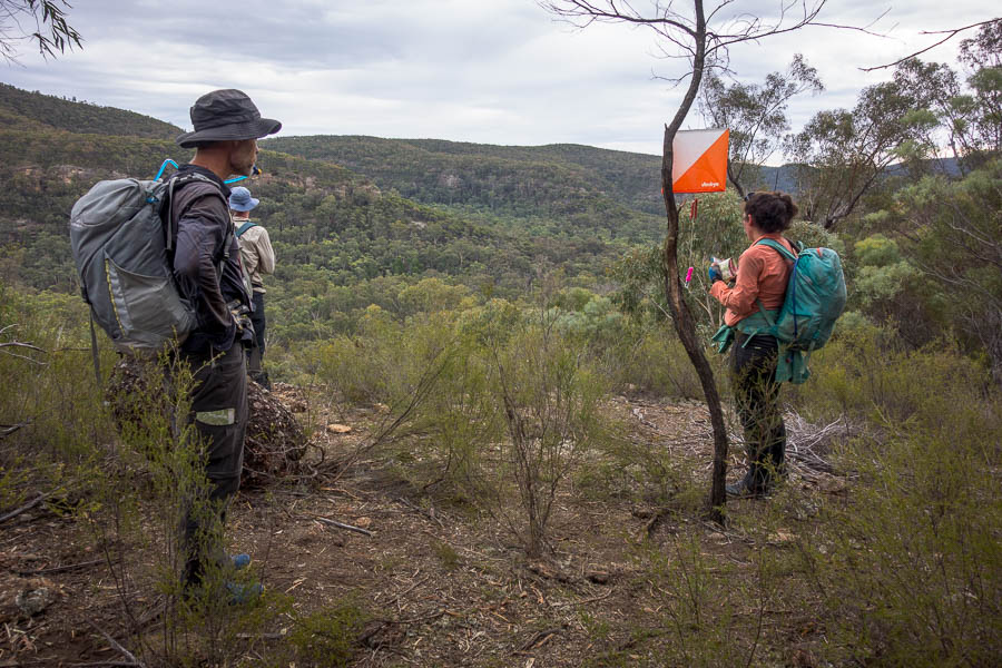
We had a quick visit to Radio Checkpoint Alpha (you have to visit at least one radio checkpoint each day) and then with a revised route and 2.5 hours left we were on the homeward stretch.
Some easy walking on day 2
We were somewhat surprised to find that the descent from one of the controls involved a fairly steep bridging exercise down a gully. I used my canyoning skills to ensure I didn’t slide down the final almost vertical section. I was surprised at how worn it was as I wouldn’t have expected most teams to be skilled enough to descend it safely – but found out later there had been a rope placed by one of the one-day teams for some of the previous day.

I didn’t know this course also involved canyoning
Interesting shute we descended from Control 63 – probably not suitable for most (many?) at NavShield
Final control (64) before heading back to Base
We ended up finishing after 26 hours 16 minutes. If I’d been fitter and had less sore feet maybe we could have pushed for another control, but the points penalties for being late are so severe it’s really not worth it if it’s touch and go time-wise!
Just about to finish – my distance behind everyone representative of the 2nd half!
Tom was still on support duty – he just happened to be at the finish as we were coming in so could capture the moment. Then retrieved a chair for me before I collapsed in a heap on the ground. What sweet relief to sit down and take my shoes off! That was all I could do for a while.
We ended up third across all divisions, and 2nd in the Bushwalkers Division, soundly beaten by SUBW (who didn’t sleep and went all night).
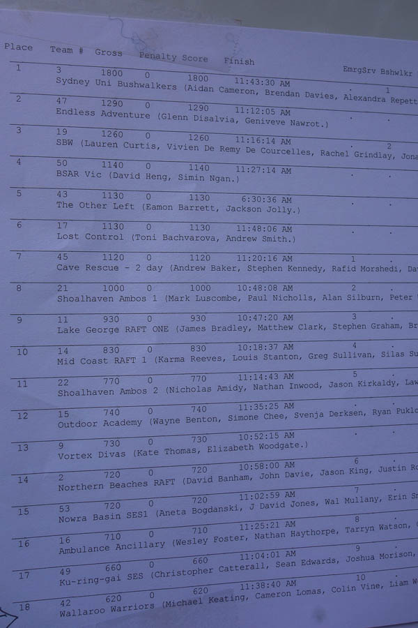
Score sheet
After the presentations we headed back to Sydney – Tom doing his best support work of the weekend by driving most of the way. A weekend full of mostly Type 2 fun – I’m sure it will be far more enjoyable in memory when I can’t feel my blisters any more!
*You might be wondering if we had a GPS going why we didn’t know where we were. The rules for rogaining only allow for navigation by map & compass so the GPS is off-limits during the event. But it’s always nice to look at it after the fact so you can work out what the hell happened at the time!