Category Archives: Rogaining

Aus Rogaining Champs – Goobang (30 Sep-1 Oct 23)

The 2023 Australian Rogaining Championships – the pinnacle of the sport in Australia. This year the Champs were held in Goobang National Park and surrounding private properties. Goobang National Park is near Parkes in Western NSW. It was set in the southern part of the National Park which is not normally accessible due to being surrounded by private property. It was only my third long (>12hr) Rogaine.

Lauren & I had done NavShield and the Lake Macquarie Rogaines together in the last few months and our low key approach to the Aus Champs started from this initial conversation:
“Just thought I’d check whether you had any interest in doing the National Champs in Goobang on the Oct long weekend? I have been umming and aahing over whether I want to spend my Oct long weekend doing that or not. Still not sure!”
“I do have some interest … yet to have made any other plans for the long weekend partly as I had been thinking about the opportunity to see Goobang NP.”
(2 days later..) “So does that mean we have agreed we’re doing it…. ?”
“I think it might mean that!”

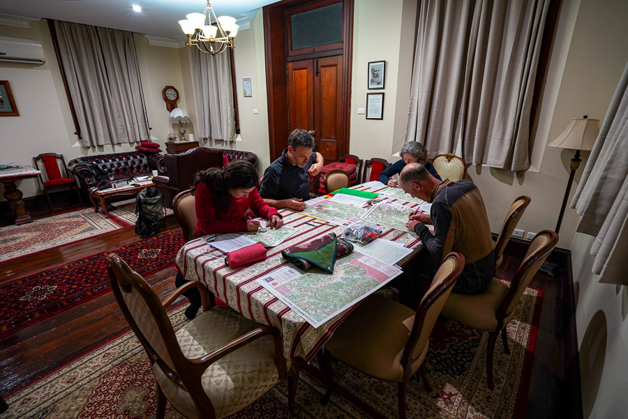
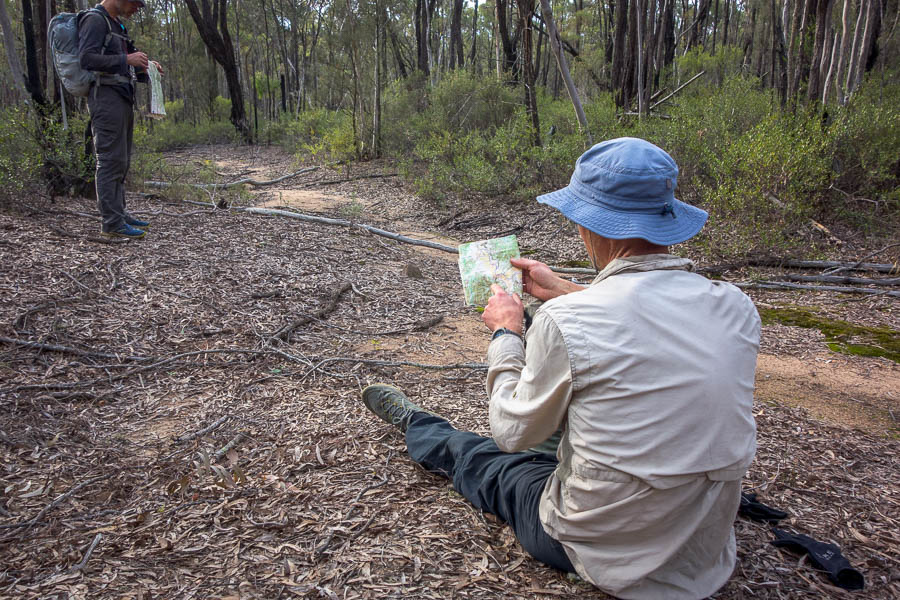
Our relaxed approach meant we hadn’t discussed whether we were sleeping or any other strategy for the event. On the drive up we confirmed that we both expected to sleep at some point – but would need to see the map to decide if it was going to be on the course or back at the Hash House. It took all of 2 minutes looking at the very large A1 map to decide sleeping at the Hash House was the go.
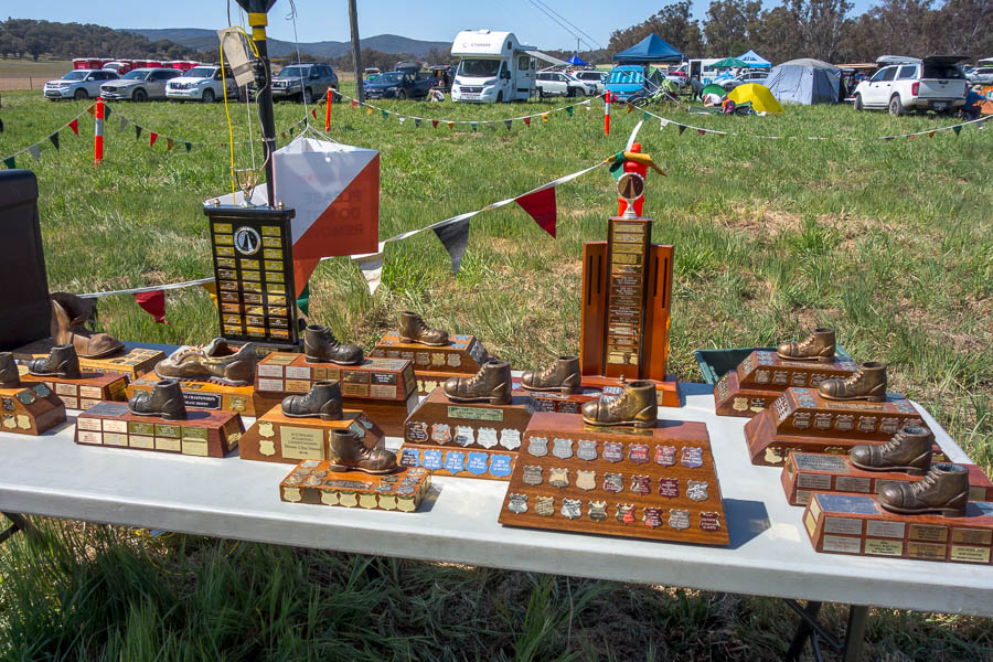
All the trophies

A1 Map!

I think the heat may have already been affecting our thinking as we did our planning. With so many unknowns: vegetation, terrain, how the heat was going to affect us; the course plan seemed like a nebulous concept. We didn’t even bother planning how we would finish our initial loop back to the Hash House. And why we would we need to work out how many km we had planned!? This was going to come back to bite us many hours later, but blissfully unaware of this, we made our plans while hiding in the shade of the bus.

It was so unfortunate the weather had turned out as it did. Had the event been a couple of days earlier we would have had far more reasonable temperatures, but Saturday’s forecast high was 30°C, overnight low in the mid-teens and then Sunday’s high was to be 34°C. I said to Lauren just before we started “What are we doing here? If this was the forecast for a bushwalking weekend I would be in a canyon or creek, not ridge walking all day!”.

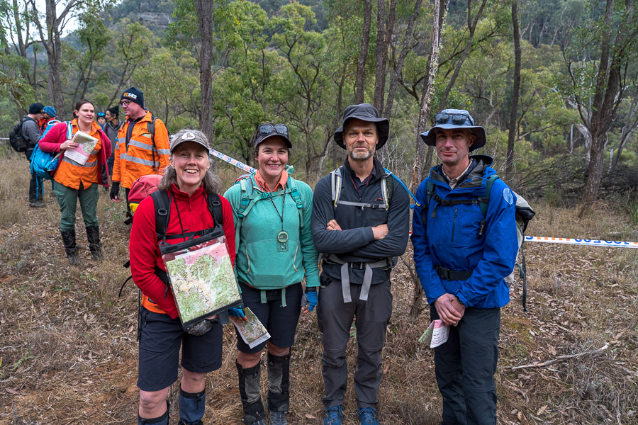
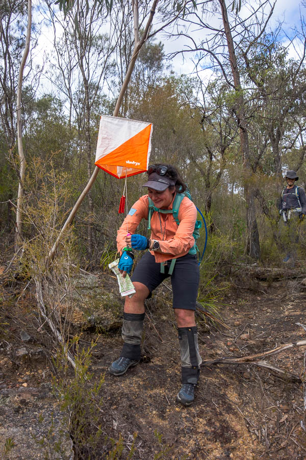
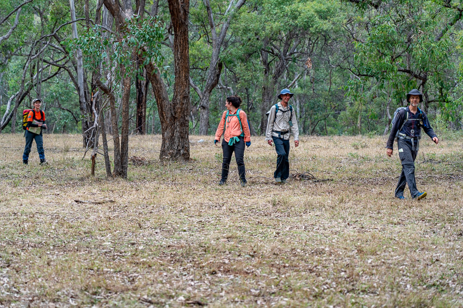
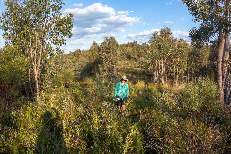
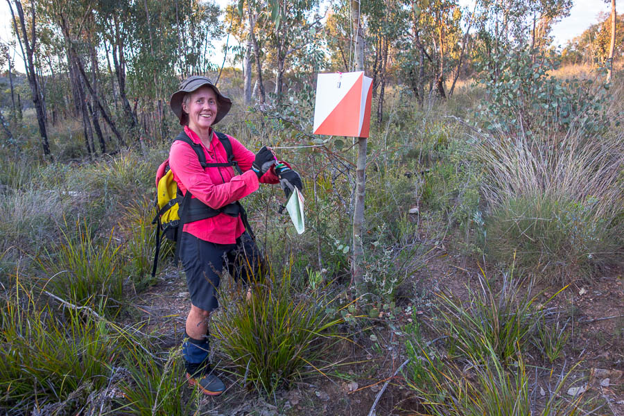
Looking clean and excited before we start

Nevertheless, we were here, and at 11am we were off. Just to add to complications the daylight savings change was mid-event, so we were starting at 11am AEST and finishing 24 hours later at 12pm AEDT*. Not that anyone needed to worry about auto-updating devices since the rules of rogaining ban those – just ‘dumb’ watches and compasses allowed.

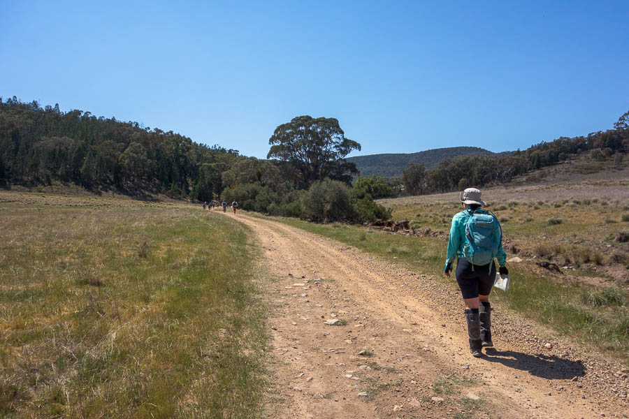
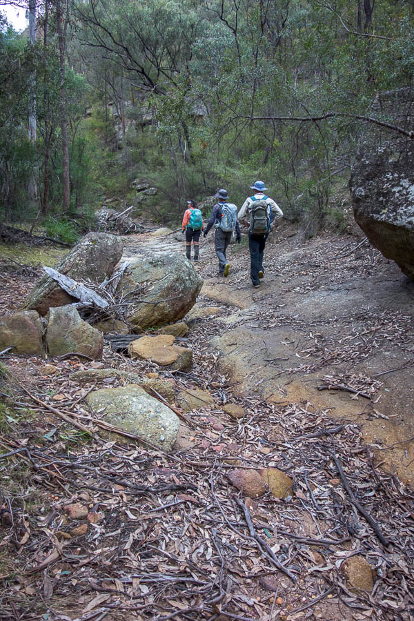
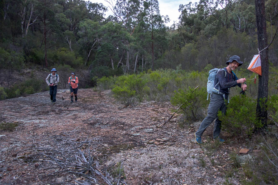
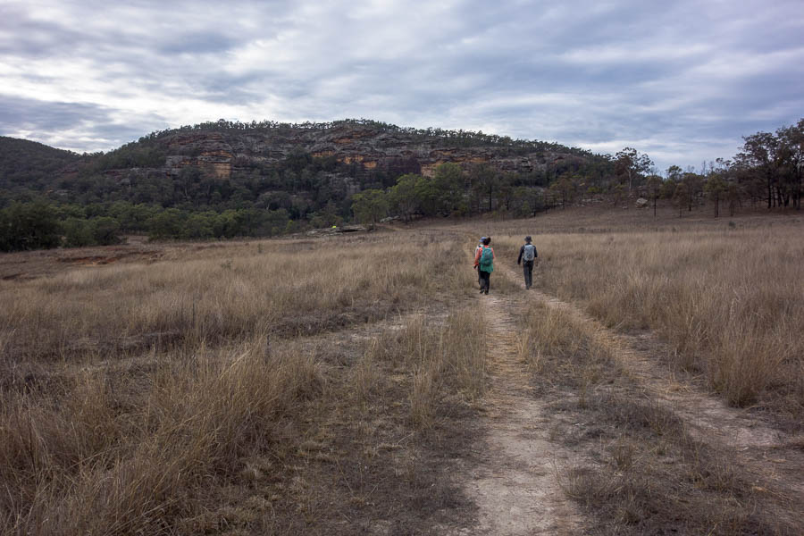
Walking farm roads at the start [on way #45]

Our initial controls all went well. We were excited to get into the rocky gorge country, I was less excited with the climb up on to the ridge. The views were spectacular but I needed a rest. I had a cold. Between that and the heat, I wasn’t feeling the best on anything involving a climb. With some food and water into me I was feeling more human so we were off again.

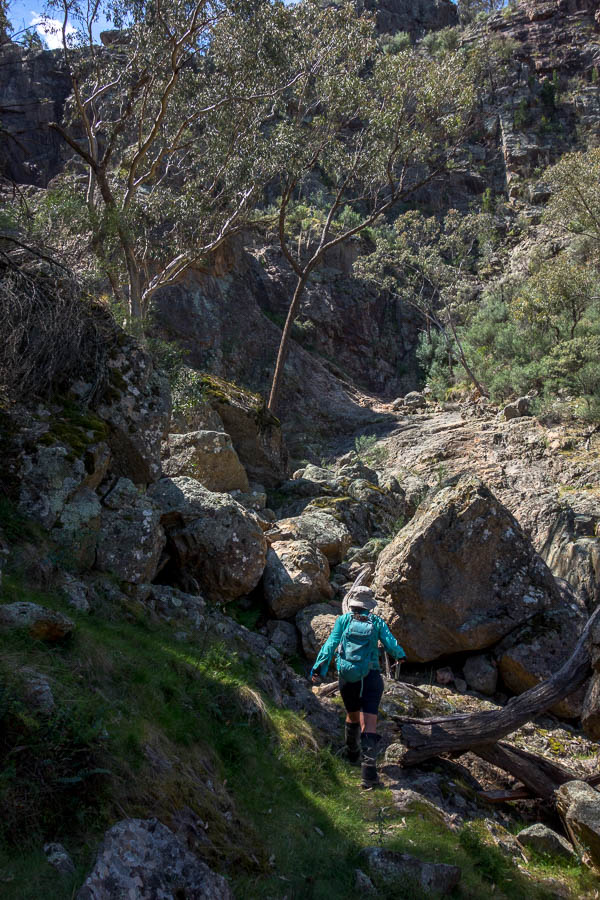
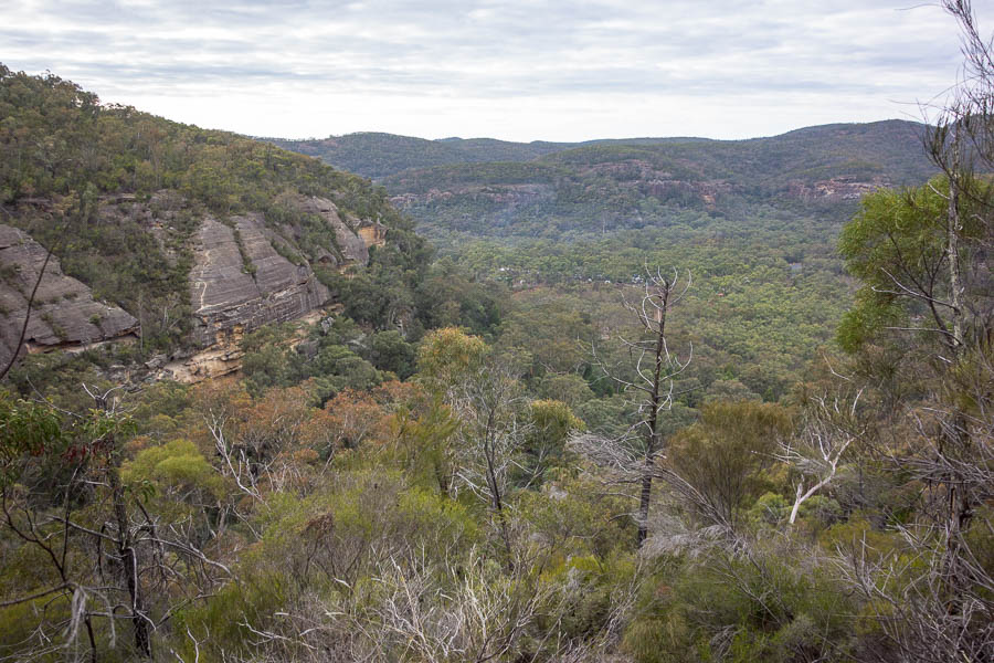
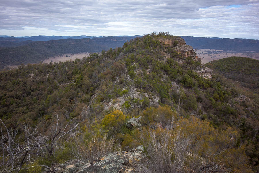
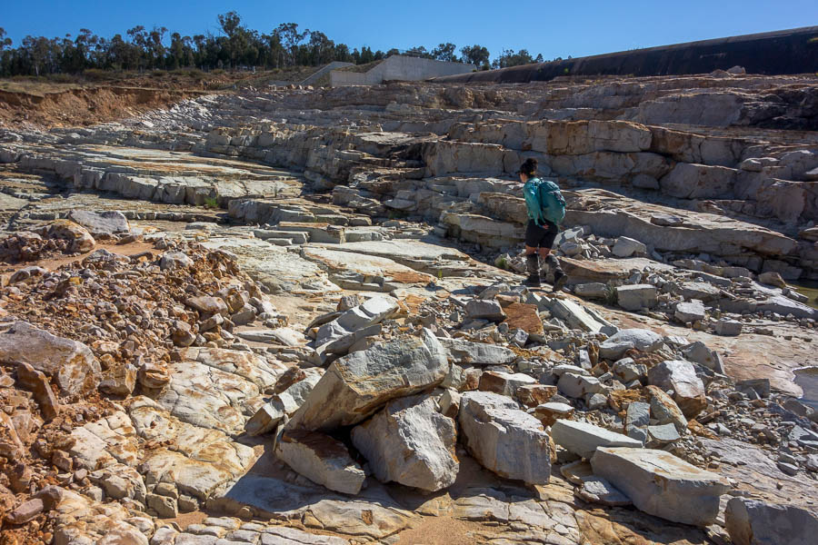
Gorge country [approaching #60]

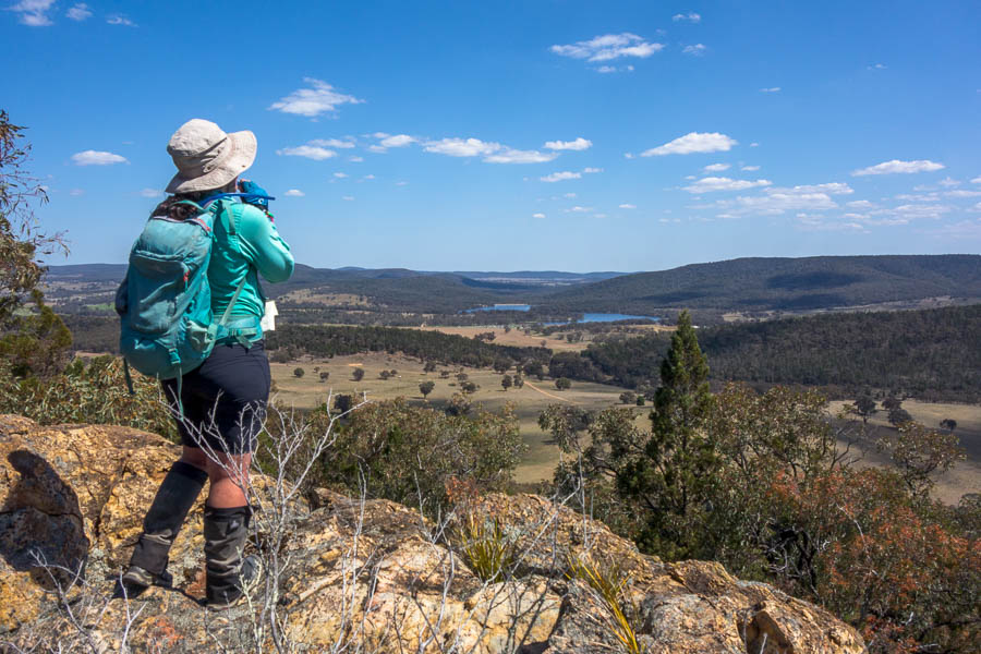
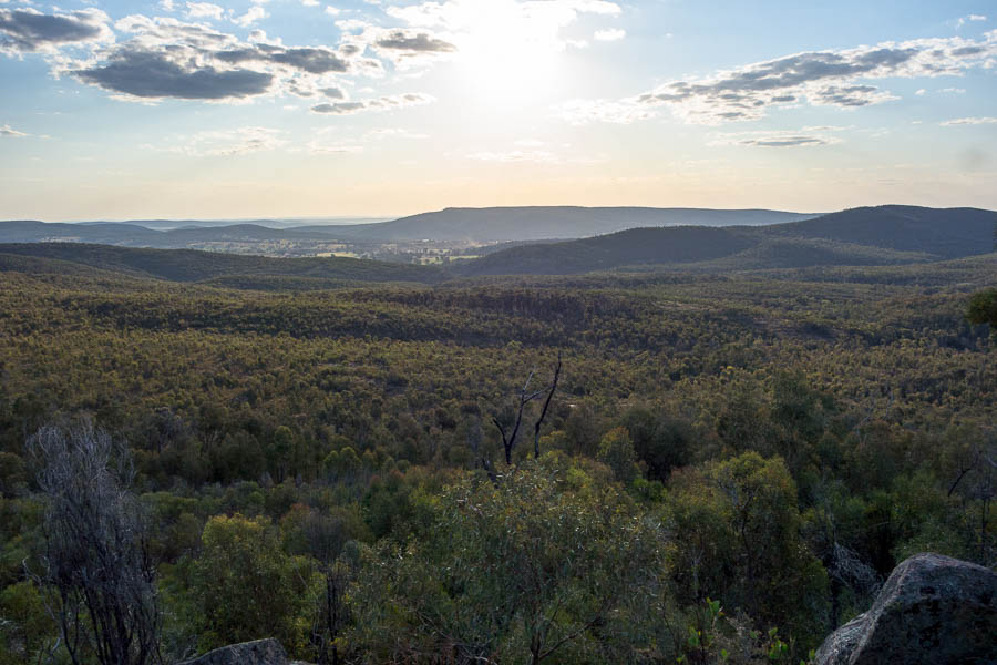
Views to Lake Endeavour (and Hash House) [near #100]

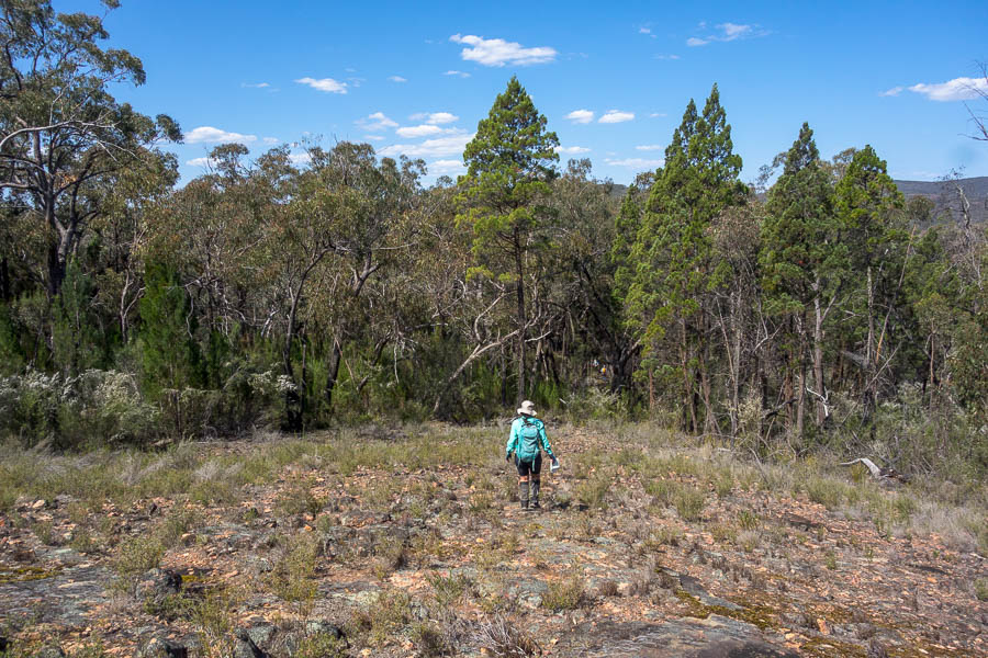
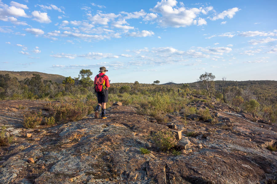
Vegetation change ahead!

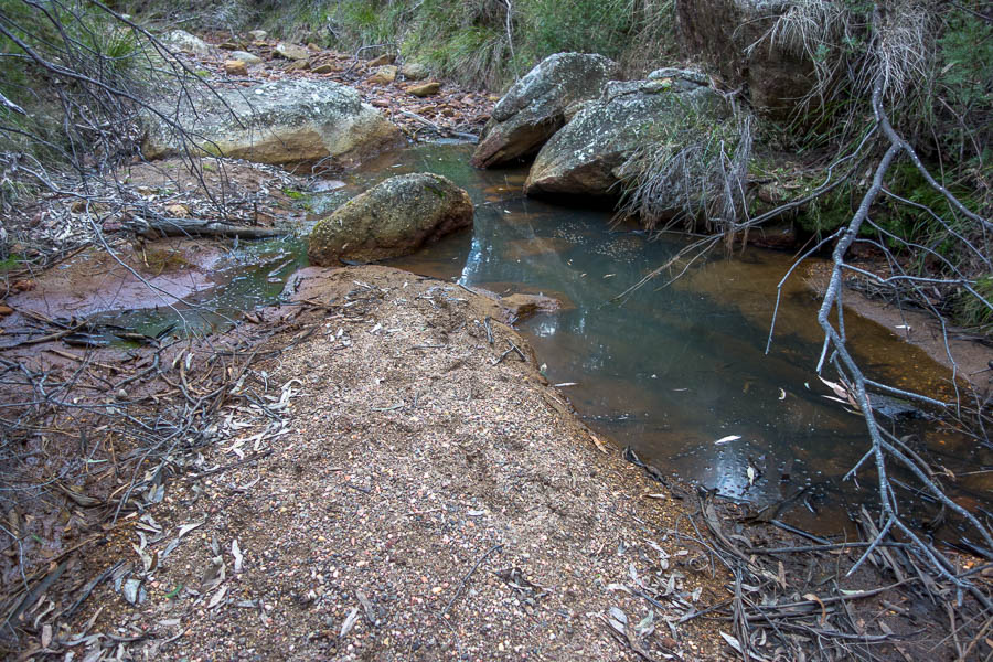
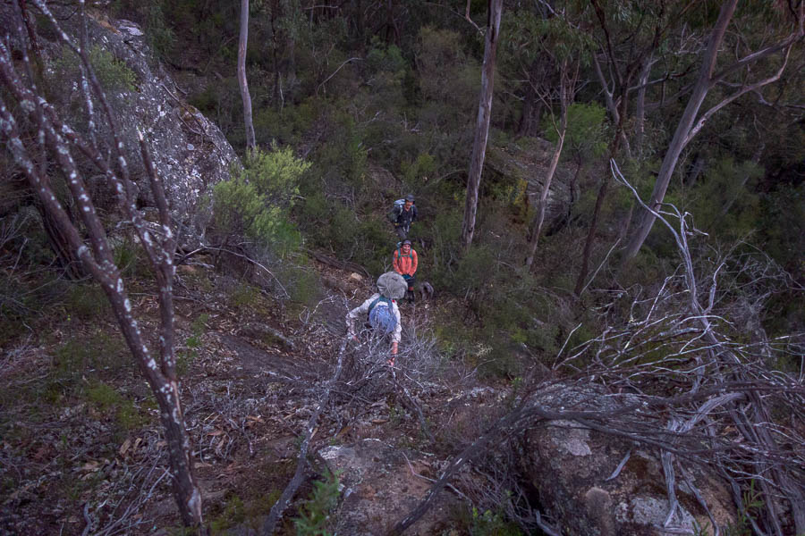
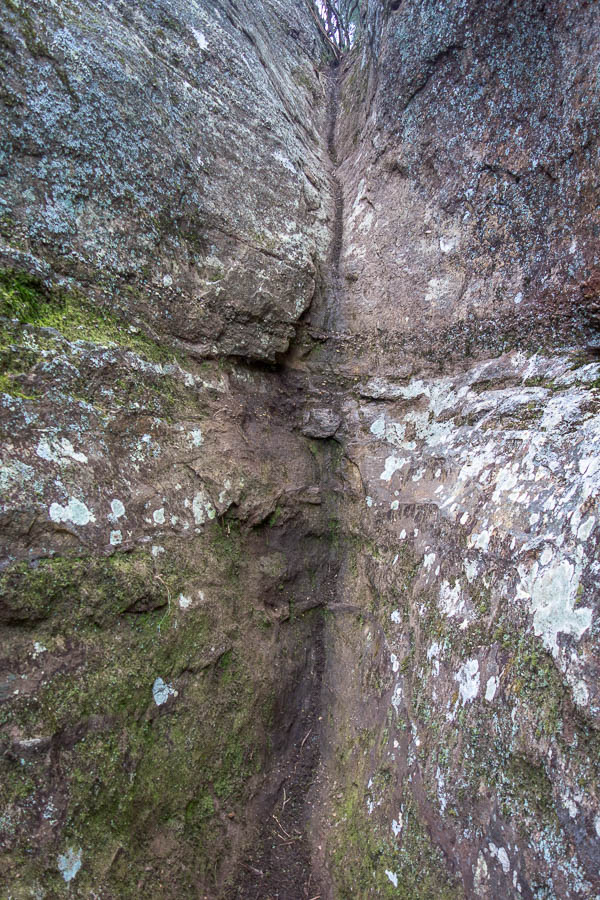
If we’d been excited to get into the gorge near 60 it was nothing compared to the excitement of the walking up Gulf Creek. The organisers had warned us all water courses were going to be dry – but in reality we saw quite a bit of water on the course. This was great for keeping hats and shirts wet. This was a spot I’d happily come bushwalking again – perhaps evidenced by the number of photos in this section!

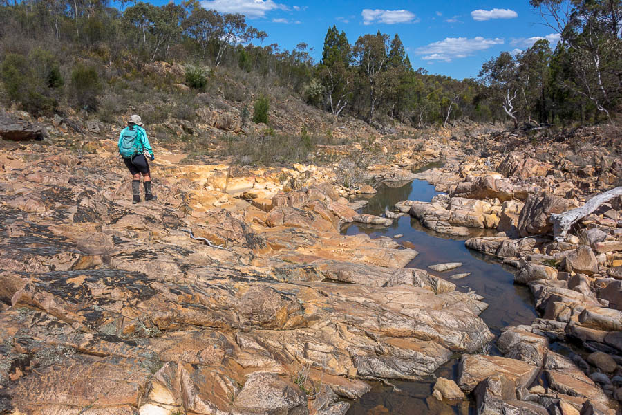
Lovely creek walking

More great creek walking
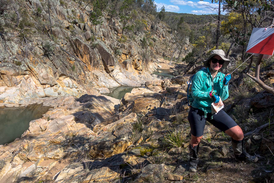
Spectacular #91

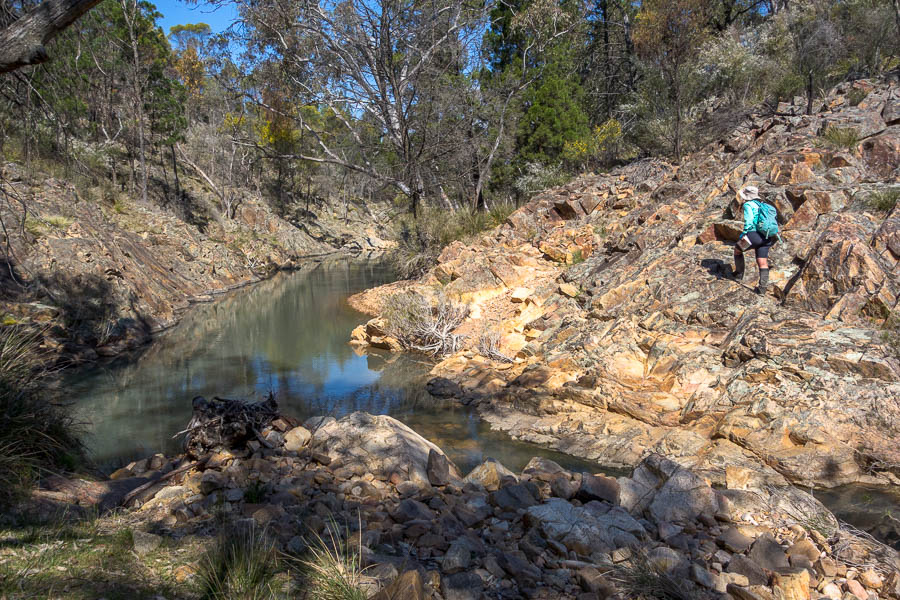
We enjoyed scrambling down the creek from 91 – ignoring the course setter notes that seemed to imply you had to climb around. No climbing around for us, thank you!
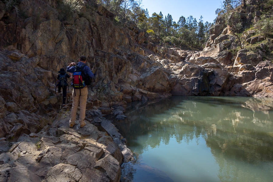
Downstream from #91

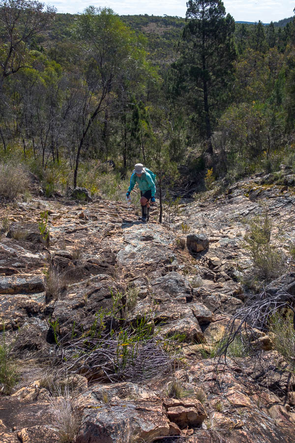
Climbing out of the creek

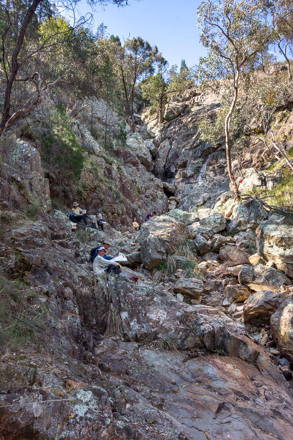
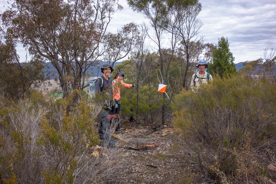
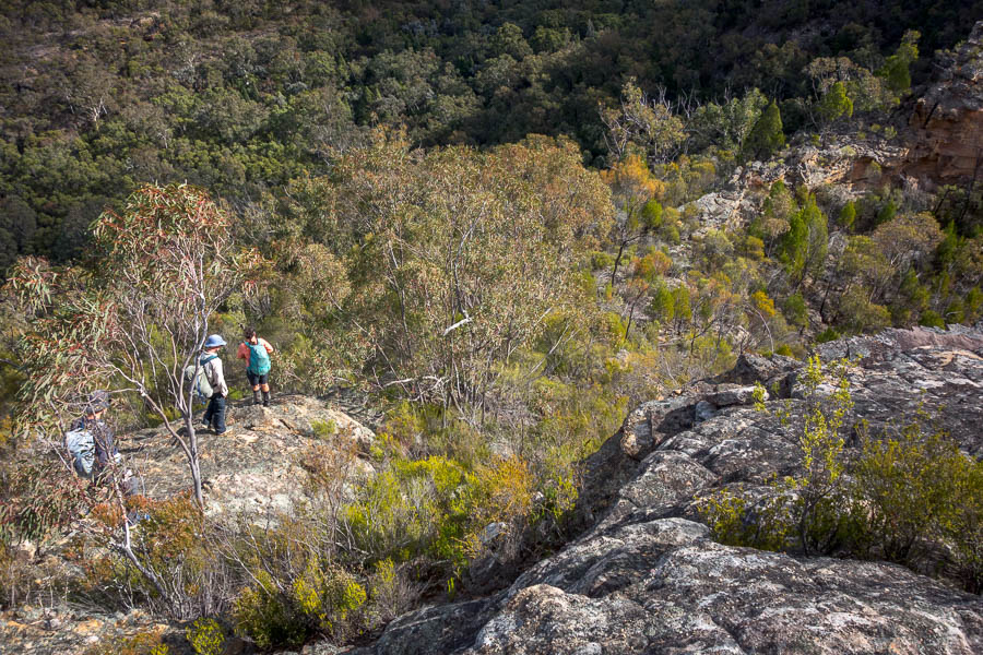
#87 and three teams resting!

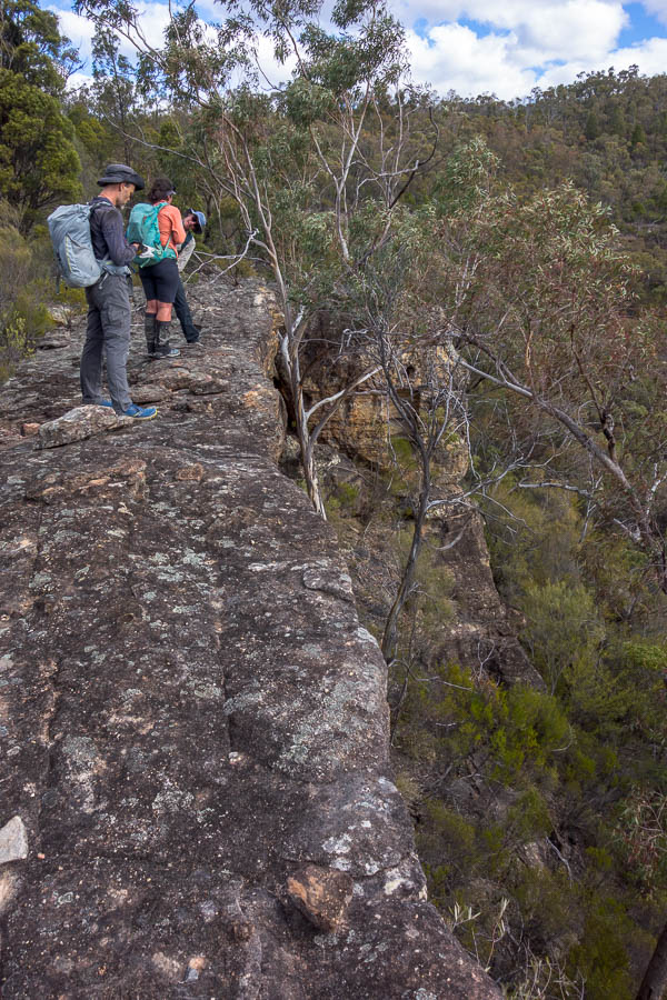
At the base of the next dryfall at #87 I was a bit surprised to see 3 teams resting. In retrospect, we should have added to their number, as it was shady and relatively cool. But it was only once we’d finished the big climb out (with spectacular views of a couple of low-flying wedge-tailed eagles) and were looking at the map at the top that we realised there were better options to what we’d just done. (For anyone playing along with the map we should have gone to #101 from #87).

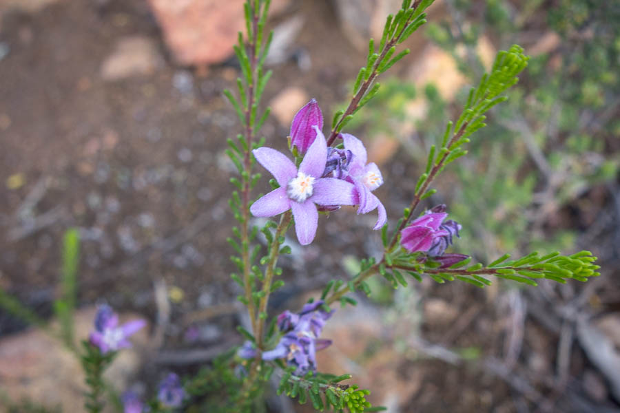
One of many wildflowers (only one I photographed though)

We had a bit of trouble with #99, but found it eventually. Lauren was out of water by this point (and had been conserving for some time). We elected to continue with our plan rather than go directly to the water drop. This paid off fairly well as the walking to #101 was straight-forward, and #62 was visible from a fair way off so easy to locate.

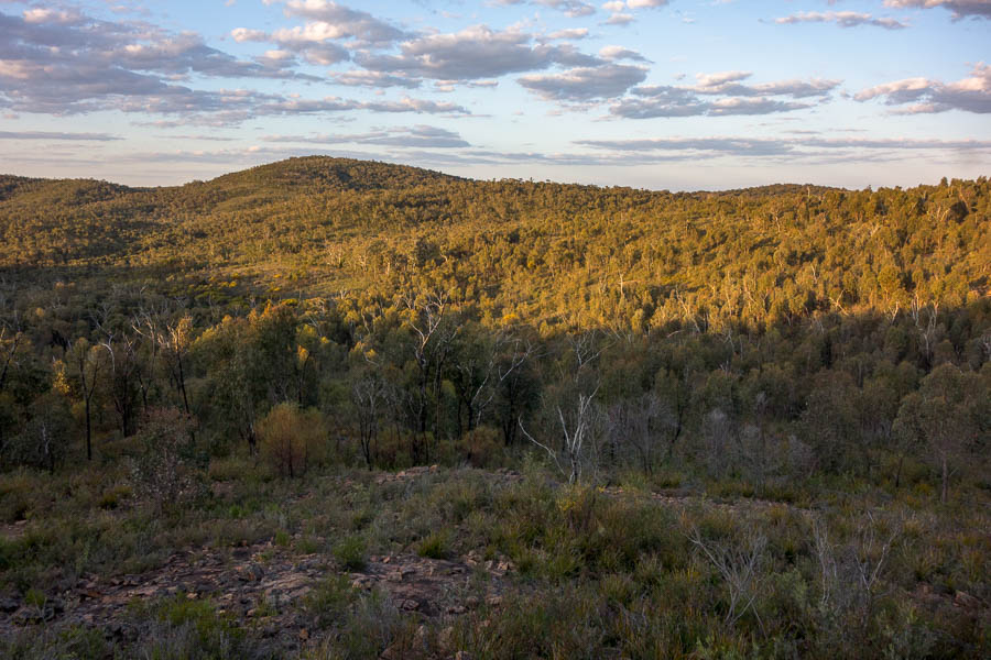
Late afternoon light. I mainly took this photo to remind me this was spinifex country

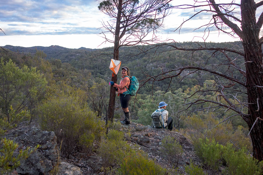
Expansive views from #101

Heading to #62

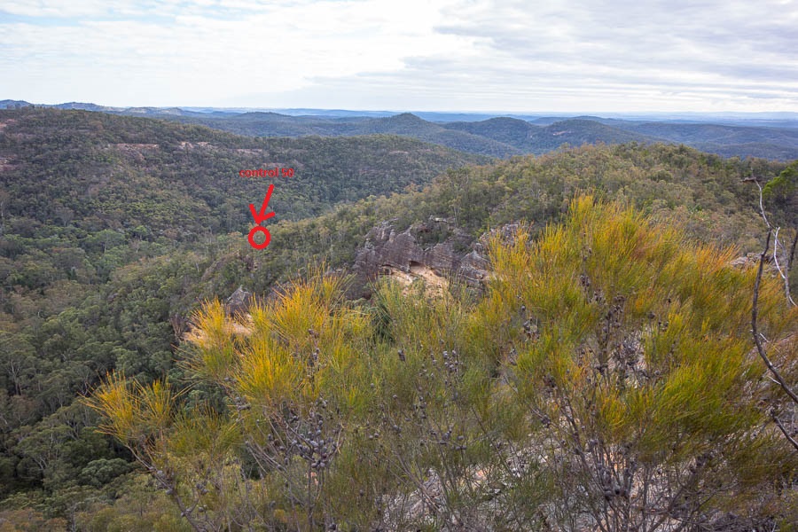
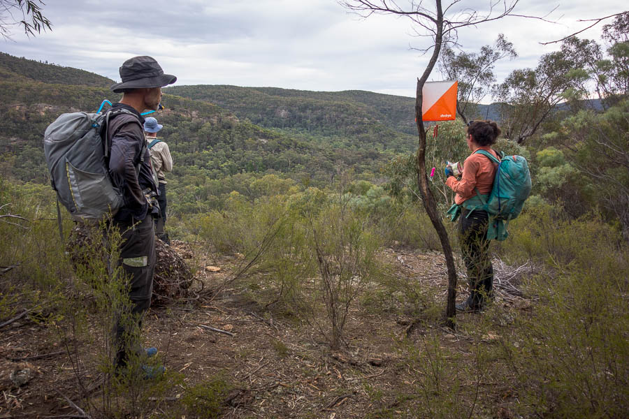
“The most visible from far away” control. You can’t see it at this resolution but blown up #62 is in the middle of the shot.

Last control before a blessed, blessed water drop

I was also out of water by the time we hit the water drop. I’d been thankful for the fruit I’d brought along – apple and mandarin both went down very well in the conditions. I heard later that (fortunately) the water refilling team had been at this control when 15 teams had arrived concurrently. Something like 120 litres had been doled out in short time.
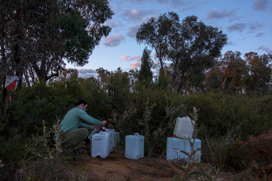
WATER!!! (#14)

We did a bit of a replan here, but that only involved dropping off a couple of controls, not working out how long it would likely take us to get back to the Hash House. Our stated intention had been to bed around midnight so we could get 5-6 hours sleep before heading out for a decent loop the next morning.

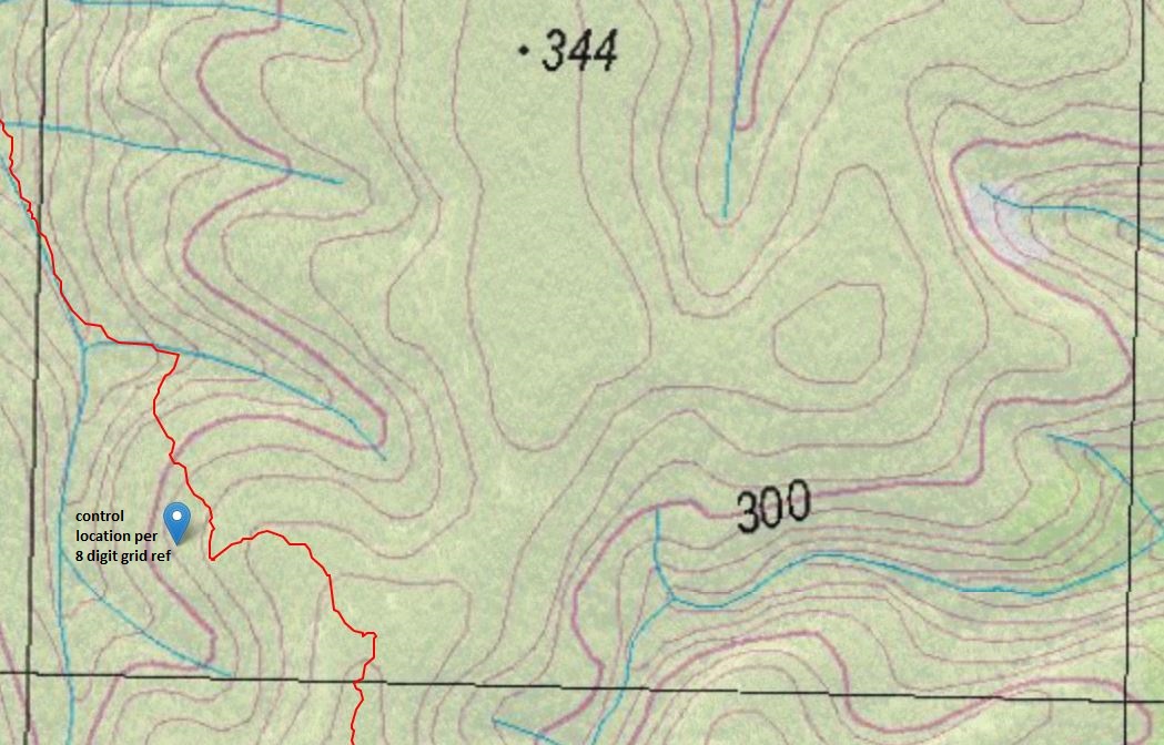
I think the A1 map contributed to our difficulty in realising how far we still had to go in our loop. It was cumbersome to have the whole thing visible at any one point, so when you just focussed on any given folded section you couldn’t see the big picture. And as there were no horizontal gridlines, coupled with the (angled) magnetic north lines, I had more difficulty doing estimates of distance than usual.
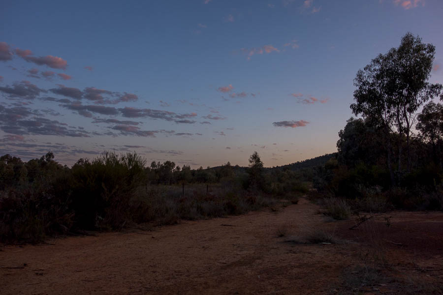
Last of the light

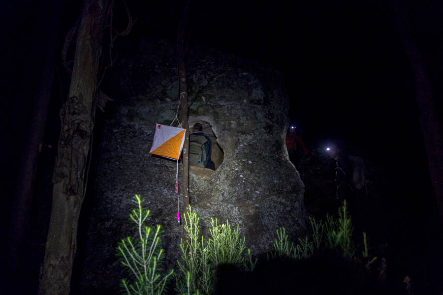
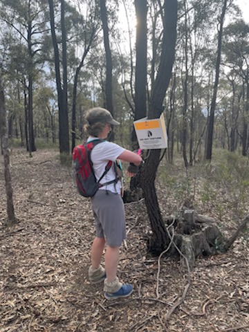
So off we went. Our first 3 night controls were out and backs from the road and went very well. These 3 were all quite subtle control placements so I think we did well in locating them as efficiently as we did.

Full moon rise (yes, it’s blurry… but to remind me that we had a spectacular full moon)

I think it was around now that we started to realise how far we were from the Hash House and how the chances of being back by midnight were non-existent. However, we persisted, and the next 2 controls were also no issue.

Unfortunately our only real navigational blunder of the course came after this. We were meant to follow a creek north to a saddle and then drop over the other side and hit an indistinct trail. However we couldn’t locate the trail and the landscape didn’t match the map. Eventually we decided just to head west as we didn’t know what was going on (our team name “Strategically Bearing West” seemed somewhat apt at that point). Of course, shortly after that decision, we hit the trail. Looking at the trace afterwards we came up a side creek instead of the main creek (obviously not watching the compass), and hence were in completely the wrong place to find the trail.

From there we had no problems with the next 2 controls. A very long descent west brought us close to #102. By this stage Lauren declared she didn’t care – she just wanted to get to her tent (which was still a good 8km away). I convinced her we had to be pretty close, and 5 minutes later we had another hundred points – at exactly midnight (13 hours in).

It was evidence of our exhaustion that we didn’t get any points from there back to the Hash House. It wasn’t until 3:45am I was in my tent. 3h 45m seems a long time to do 8.5km – given we were predominantly on track. But that did include half an hour “sleeping” on the side of the track at from 1:45-2:15am. The next day looking at the map we walked past 44, 84, 54 that would have have been relatively straight-forward to get. But we weren’t thinking about points at that point, we just wanted sleep.

Given we were so late back we agreed on being ready to go again at 8am. I was awake before 7am, hearing other teams head out. I was a little jealous as the early morning light (and temperatures) are a wonderful time to be walking. I was thrilled to find a bacon and egg roll and a coffee; heard some war stories from other teams; before checking in on Lauren. Her feet were in similar shape to mine so it was a fairly gingerly-treading team which set out at 8am. With only 3 hours we didn’t have a lot of time, particularly given the state of our feet.

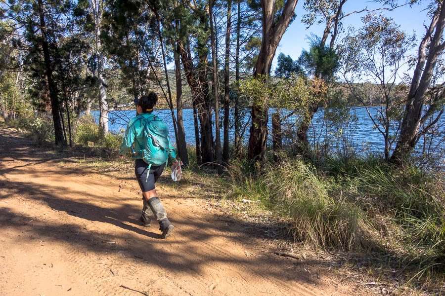
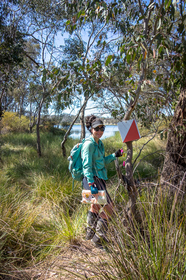
Walking the shores of Lake Endeavour

We had hoped to pick up some of the higher point controls in the south west but it became clear after taking 45 minutes on easy tracks to #41 that we weren’t moving quick enough.

Below the dam wall

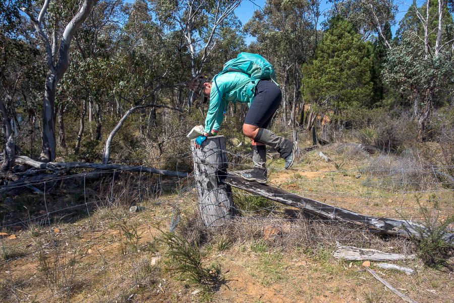
One of many fence crossings

Last control of the event for us

We settled for being 45 minutes early as we both just happy to get our of our shoes.
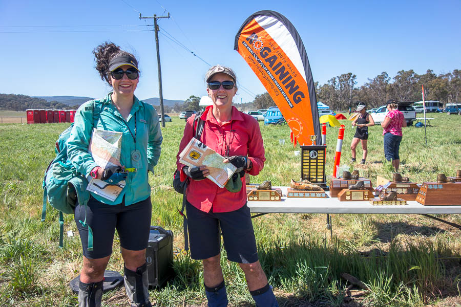
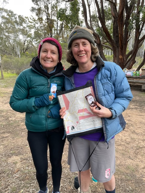
We’ve finished!

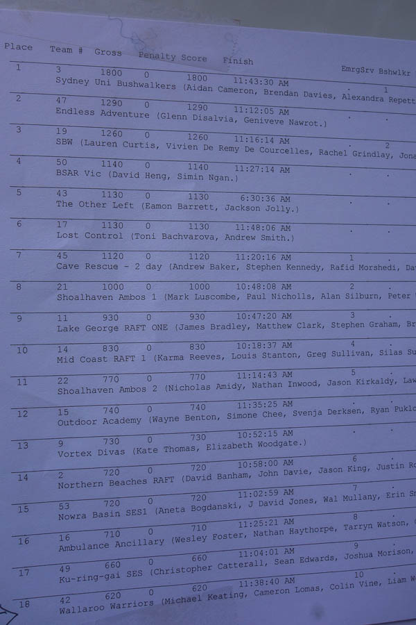
With this being the Australian Championships, and also an reasonable effort to get to, the people who were at the event really wanted to be there. It wasn’t like a lot of rogaines were there are people just ‘giving it a go’. It was a highly competitive field, and made us realise just how much we could improve when we came in 39th out of 80-odd teams. Our score total (1560) was under half of what the overall winners got (3580)! Other than the one navigational blunder which I mentioned above our nav was pretty good – it was the planning that let us down.

Final course statistics
11am – 3:45am – 44.53km
8am – 11:15am – 8.09km
Overall ascent/descent 2,466m
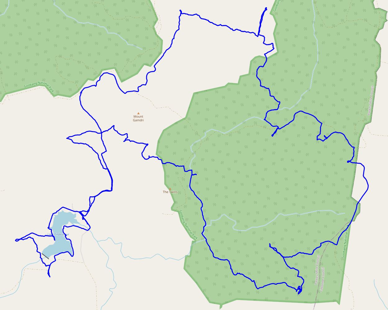
Our course

*all times mentioned in this report are AEST

NavShield 2023 (15-16 Jul 2023)

Every year Bush Search and Rescue NSW (BSAR) organises and runs the Australian Emergency Services Wilderness Navigation Shield or NavShield. While it’s intended as a training event for the emergency services, it’s essentially a 9 or 27 hour rogaine. NavShield has a reputation for being the hardest rogaine out there – often in non-ideal (read: scrubby) rogaine locations. While I enjoy 6 and 12 hour rogaines, I haven’t caught the bug for the longer form. That, with NavShield’s reputation for being a scrub-fest, had not made me rush to do it.

However back in early June I was informed I was the back-up team member for a team I didn’t even know existed, whose services were now needed 🙂 I’d been out of action for much of autumn so my fitness was going to be questionable – but despite that the team apparently wanted me. This was perhaps less because of the wonderful qualities I bring as a team member and more because I was a member of SBW and the team was entered in the Bushwalkers category and needed a minimum of 4…

Anyway, eventually NavShield rolled around and we had an SBW team of 4 (with another back-up team member recruited). The experienced NavShielders suggested we were better off staying away from Base on Friday night as it can be very noisy and cold. Once the location was revealed (this only happens a week before so no one can cheat by going walking in the area) I found a wonderful place to stay in Denman.

Luxurious planning location – hard at work marking up the map

We had another team staying with us, plus our Team Photographer/Cook/Driver/Hot Chocolate maker (Tom 🙂 ). The place turned out to be even better than expected, particularly with several large tables which we could use for planning. One big difference between NavShield and a normal rogaine is that the controls are not marked on the map – the first thing you have to do is mark them yourself. I found this quite difficult – with 8-digit grid references I kept mixing the numbers up. Plus the map was double-sided A2, with a considerable overlap, so we had to mark quite a few on both sides. By the time that was done I had very little mental energy for route planning. However we cobbled together a plan and headed for bed.

Far too early the next morning we were off to Base in Goulburn River National Park. The event started at 9am Saturday.

SBW Team (me, Lauren, Jonas, Vivien) just before the start – conspicuous by our lack of high-vis

And we’re off…

We made quick work of our first control, ascending through broken clifflines with no issues. Saturday morning was great – we traversed some spectacular narrow ridges and no navigational issues. Things were a bit slow and “sticky” (lots of dead trees/sticks to bash through) but in general quite enjoyable.

The other feature of Saturday morning was our ongoing leap-frogging of our arch-nemesis team SUBW (Sydney Uni Bush Walkers). We must have crossed over 4 times in the first 3 hours.

High sidling early on day 1

Looking back towards Base (the white specs in the valley)

Finally got everyone to stop moving for a photo! (Control 60)

Taking in the views from the speccy high route we chose between 60-50

Looking back on the narrow ridge

We can see the next control…

After a quick sit down for lunch (luxury!) we crossed over a larger valley and into a new section of the course. Saturday afternoon brought another spectacular narrow traverse, less views and more scrub. We also got our first experience of the waterways, which we had been told were generally easier going than the ridges. The Saturday afternoon water ways were the fastest we’d moved since we left the fire trail 10 minutes into the event!

Above a cliff edge

The team descending to another speccy narrow ridge

SUBW caught up with us again here. They said we were acing the nav, but I suspect we were just a little lazier and they’d gone to to a 40-point control we’d decided to omit. As it turned out we wouldn’t see them (or anyone else) again until after dark.

This one needed a bit of scrambling to get onto

Vivien & Lauren on the ridge between 72 – 61

Lauren looking delighted to be punching (58?)

The fastest we’d moved all day!

The most water we saw all day (until we dropped down to the Goulburn River after dark)

Our only navigational mistake during Saturday daylight hours was dropping off one knoll too early to get to Control 71. Fortunately we only detoured by a few hundred metres and it was easily corrected.

Pleased to be at 71 (our only daylight mistake?)

Descending yet again as we lose light

Final daylight control of day 1 (Control 81)

From 81 it was a battle with the light. We made it up onto the next ridge just as it was time to get torches out. We were all running low on water by then despite setting out with 3 litres. It had been an unseasonably warm day and the only water we’d seen in the watercourses we’d crossed were very small stagnant pools. So the team was excited that Radio Checkpoint Charlie was not too far away – where we’d be able to fill up.

Attaining the next ridge before dark

Our first control in the dark didn’t go successfully. We seemed to do all the right things but couldn’t find the control. We couldn’t work out what we could have done wrong – everything seemed to have been right until we couldn’t find it. In the end we conceded defeat and just headed on without the control. Looking at the trace* afterwards we were <100m from the grid reference and may well have been able to see it if it was daylight, but sadly that was 50 points that went begging. The SUBW team (we had yet again bumped into them just after abandoning the quest for 54) told us afterwards they initially also had trouble locating it, so maybe it was also slightly off in its description and/or placement.

The story of Control 52. Red line is where we went. Marker is the grid ref supplied on the control sheet. (1km grid)

Arriving at Checkpoint Charlie at 7pm was wonderful. There was quite a few bushrangers there and as there’d only been 1 other team there (SUBW of course) they were excited to see us. We filled up water, then with much appreciated boiling water from the bushrangers had some soups/dinner and a rethink about the rest of the course. We ended spending an hour there.

With a slight amended plan we set off again – taking a flat (but longer), easy navigation route following a big bend in the Goulburn River to control 73. It was a very pleasant change to just be walking through grass rather than sticks whacking you across your body every step. There were no issues with 73, so then we headed up a side creek to 53. Unfortunately that watercourse was narrow and fairly vegetated – not pleasant easy walking. But we found the control with no issues.

I was fading mentally by this point, to the extent that I hadn’t even realised we’d swung from walking NE to SW to get to our next control. Fortunately that’s where the value of a team comes in – and the hope that everyone doesn’t fade at the same time. The control description for our next control was The Spur (Rock House) – I was imaging a rock formation of some sort, but it turned out to be something resembling a Rock House. It was beautiful camping here but as it was only 10pm and we’d agreed to go till around midnight we pushed on… I needed to hit the caffeine-infused gel to get me through the next couple of hours.

Control description: The Spur (Rock House) (#90)

Unfortunately the next 2.5 hours gained us no points and just got us back to the same place we’d been at 10pm. Our next control (45) we couldn’t locate and the terrain (large cliffs) didn’t really seem to marry with what we were reading off the map. After almost an hour wasted on that we gave up and tried to move on to the next one (68) but then got bamboozled by creek junctions. Eventually deciding the only way to work out where we were was to go back a known location (the rock house) and start again.

We agreed we’d start again on first light and so at 12:30am I collapsed into my sleeping bag on a patch of grass and hoped for sleep to come swiftly and deeply. We were rudely awoken around 4:50am when it started raining. We hadn’t bothered putting up a shelter so we were getting wet. The rain was light enough and we were all sufficiently tired that not much was done and next thing I knew Lauren was yelling out that it was 5:50am and time to get up.

Wearily, and still largely in the dark, we headed back up the same watercourse as the previous night. By the time we got near 45 there was enough light we could make out the clifflines and saw we’d been in the right place, just had underestimated how far we had to go up. We decided to not bother trying a second time.

The junction, which we’d discarded the night before as too small to be the right one, was easily seen as large enough when you could see the break in the cliffs behind it. We didn’t have any further navigational issues – just running out of puff – particularly me. My feet were blistered and so I was trying to step carefully which slowed me down.

At 24 hours in we were at the stage where it was easy to sit down and then not really want to get going again. This is another time when team mates get you going when you haven’t got your own motivation.

Vivien directing from the ground

We had a quick visit to Radio Checkpoint Alpha (you have to visit at least one radio checkpoint each day) and then with a revised route and 2.5 hours left we were on the homeward stretch.

Some easy walking on day 2

We were somewhat surprised to find that the descent from one of the controls involved a fairly steep bridging exercise down a gully. I used my canyoning skills to ensure I didn’t slide down the final almost vertical section. I was surprised at how worn it was as I wouldn’t have expected most teams to be skilled enough to descend it safely – but found out later there had been a rope placed by one of the one-day teams for some of the previous day.

I didn’t know this course also involved canyoning

Interesting shute we descended from Control 63 – probably not suitable for most (many?) at NavShield

Final control (64) before heading back to Base

We ended up finishing after 26 hours 16 minutes. If I’d been fitter and had less sore feet maybe we could have pushed for another control, but the points penalties for being late are so severe it’s really not worth it if it’s touch and go time-wise!

Just about to finish – my distance behind everyone representative of the 2nd half!

Tom was still on support duty – he just happened to be at the finish as we were coming in so could capture the moment. Then retrieved a chair for me before I collapsed in a heap on the ground. What sweet relief to sit down and take my shoes off! That was all I could do for a while.

We ended up third across all divisions, and 2nd in the Bushwalkers Division, soundly beaten by SUBW (who didn’t sleep and went all night).

Score sheet

After the presentations we headed back to Sydney – Tom doing his best support work of the weekend by driving most of the way. A weekend full of mostly Type 2 fun – I’m sure it will be far more enjoyable in memory when I can’t feel my blisters any more!


*You might be wondering if we had a GPS going why we didn’t know where we were. The rules for rogaining only allow for navigation by map & compass so the GPS is off-limits during the event. But it’s always nice to look at it after the fact so you can work out what the hell happened at the time!

NO IDeA Rogaine (16 Jul 2022)

It seemed it was the weekend for rogaining. NavShield and the Bidjigal Night Rogaine were on in NSW, but I was in Victoria to do the NO IDeA Rogaine. The NO IDeA Rogaine was set in the Heathcote-Greytown National Park just north of Heathcote. As always the planning and preparation time whizzed past and we hadn’t settled on a route with only half an hour till the start. Opting for Plan A the highlighters were quickly put to work and we made it to the briefing in time.

About to start

This was possibly the most challenging terrain I’ve had to navigate in a rogaine. On the ground was gently undulating with subtle features – difficult to pick up from the 1:30k map. I now have a much greater appreciation of NSW Spatial Services making LIDAR data freely available – it would be fascinating to see this map re-done – unfortunately Victoria does not have the same open data policies.

The bush was open and made for quick cross-country travel. We started off well, whether through skill or luck, we nailed our first 9 controls (55 – 65) in just under 2 hours.

Control check-in

Our only major mishap during that time was losing Mel’s map on a stretch of fire trail where we were eating rather than navigating. Fortunately Mel had photographed the map before we’d started so she at least had a copy on her phone – albeit only a small section she could view at a time. However, we soon discovered compasses and phones don’t play well together, so we were also down to one compass, as Mel wasn’t able to take bearings from the map on the phone. [Tom did point out to me after the fact that I could have given her my bearing so at least she had something to walk on as well]

Rogaine map with our route overlaid (the heavy yellow markings were part of the map)

After 65 the wheels fell off. We got a bit excited after seeing our competition head cross-country from 65 – we abandoned our plan (which had been north-east to the road, then follow the less distinct road south), but then didn’t make a clear replacement one (just a vague head east and expect to hit the less distinct road – which we enact anyway). Having climbed a distinct knoll after crossing a saddle and then not finding the control we were confused.

Looking at our track after the fact and comparing to the map (and to the contours on OpenTopo) I can see how I misinterpreted what was on the ground, and several things we could have done rather than what we did… but that’s the beauty of hindsight.

At the time we didn’t know where we were. Hoping to gain some idea (haha) from the next team who suddenly appeared was unfruitful. And some time later both our teams, independently, ended up meeting again on the road south of the control. Finally we got things back on track but it was a 40 minute mistake.

Our route overlaid on Open Topo Map – compare some of the track placements to the rogaine map

There was a bit more confusion on our way to the next control as well. This time due to a significant 4-way intersection existing on the ground that was not on the map (it is on OpenStreetMap see above). We recovered from that one fairly quickly and got back into it for the next 3 controls. By then I was very happy to be leaving the roads behind and just navigating by features. After nailing our walking on a bearing between 63 and 73, we completely failed on the next control.

Following one of many bearings

The aim had been to get from 73 to 52. But looking at what we did the bearing must have been somewhat off, plus we failed to correct sufficiently having wandered into the wrong gully early on. Once again we didn’t know where we were.

We worked out where we were somewhat faster but gave up 100 points (52 and 54) in the process. I would have liked to have pushed for 54 once we worked out our location but time was starting to be a factor and I think we were a bit mentally scarred from the mishaps mounting up.

Fortunately we made it to the remaining controls in our plan without drama and got back to the Hash House with 5 minutes to spare. I had a chat to Grace & Anna (our competitors from #65) – as it turned out they ended up being the best Women’s Team – and we had done exactly the same route until 65, with only 1 minute separating us 2 hours in. They made it to #80 in 14 minutes as compared to our 56… Though I probably learnt more from that mistake then from all of the controls with no issues!

In the end we came 1st in Women’s Veterans, 3rd in Women’s, 14th Overall (out of 80 teams) on Saturday.

It was a great to get out in the bush with Mel 5 years after our last rogaine together.

Women’s veteran winners – chocolate 🙂