
Pantoneys Crown (22-23 Jul 2023)
It had been quite a while since I’d been in on the Long Swamp Trail towards Baal Bone Gap/Point Cameron. I needed a road condition report to work out if I could plan my Pantoneys trip from that side – friends had been in a couple of months earlier and said the road was fine, they’d had a 4WD but hadn’t used the 4WD functions. (But maybe I misinterpreted). So when I asked the trip participants if the 4WD owners could drive us out to the start I was expecting it to be just a bit of insurance. It ended up being fortunate we had 2 4WDs and 2 safe and careful drivers as the road was a mess. Fortunately we made it out to where I wanted to park a bit slower than expected but with everything intact and no boggings.
Having left Lithgow at -2°C we were glad the temperatures had made it into positives by the time we started walking. It wasn’t long before most layers were off and we were walking in beautiful, still, sunny conditions.
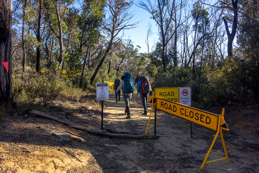
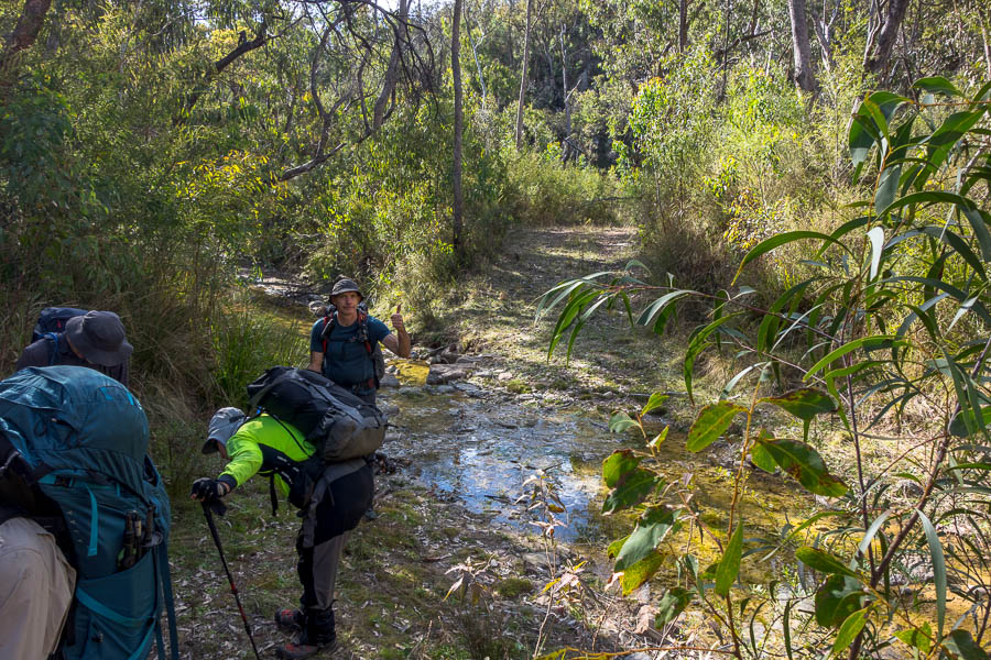
Heading where cars can not
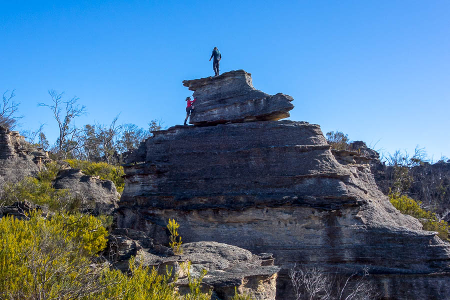
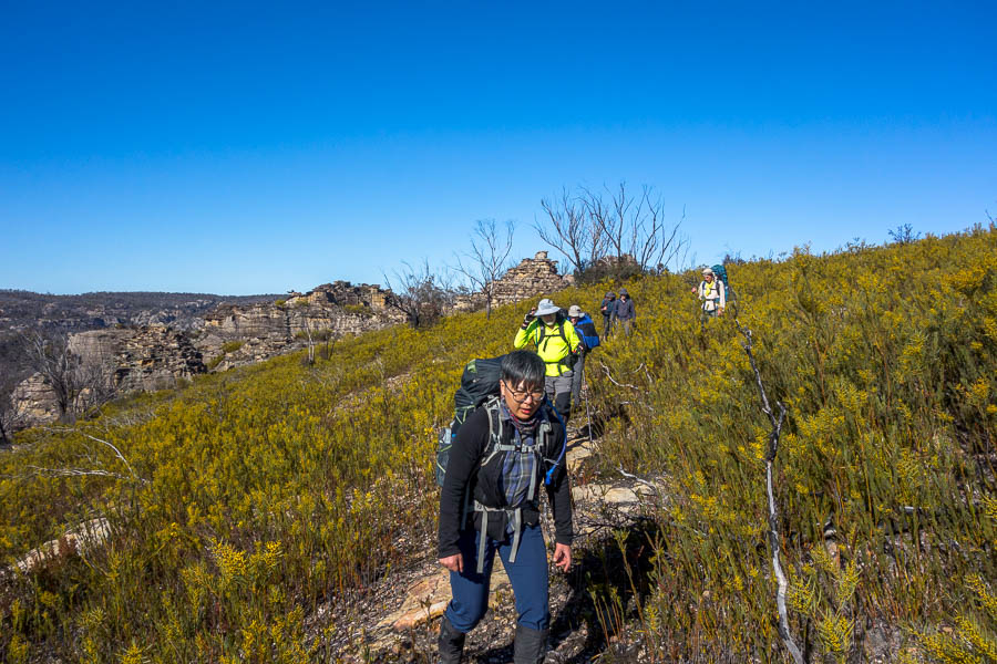
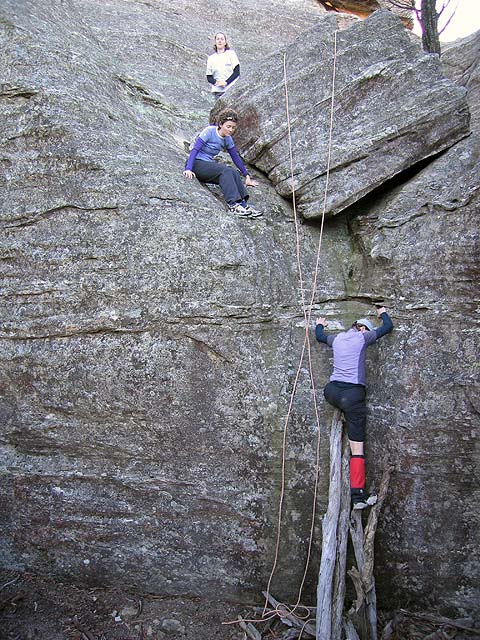
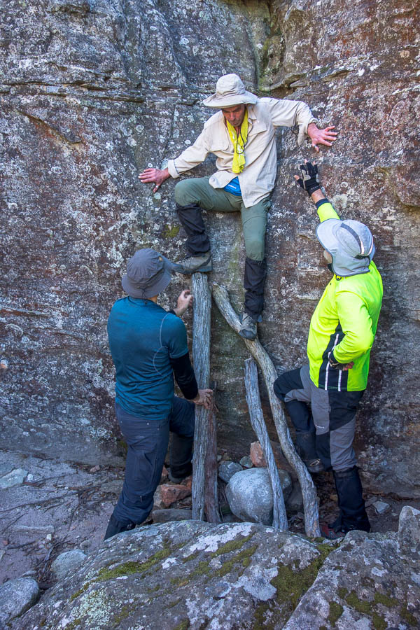
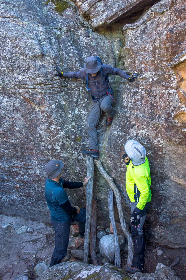
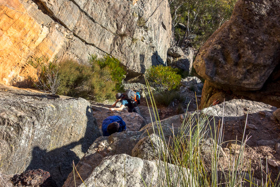
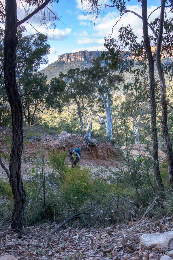
Ascending the boot
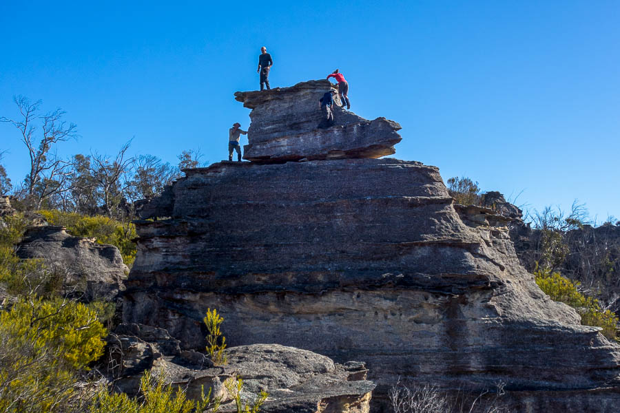
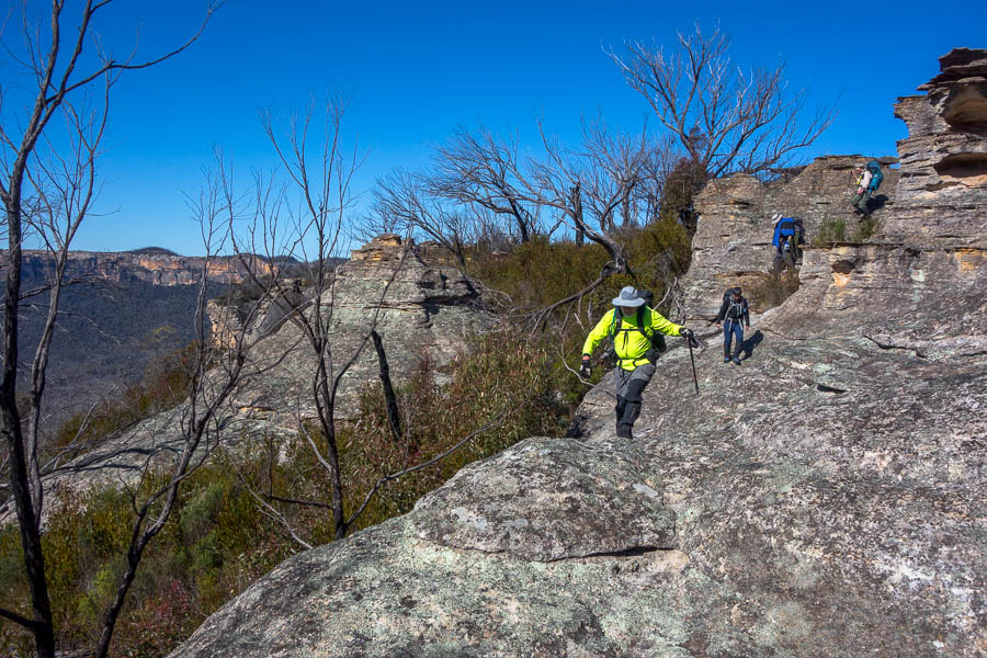
Some of the group on The Boot
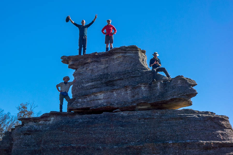
We made it!
The ridge between Baal Bone Gap and Baal Bone Point had a fair bit of eucalypt and wattle regrowth. We tried to stick to the rocky sections to avoid the worst of it, but there were some slows bits as we pushed through the tightly packed trees. The closer we got to the point the less scrub we encountered. I was surprised to startle a wallaby at one point on the rocky cliff edge!
Pleasant walking when we could find the rocky sections along the ridge

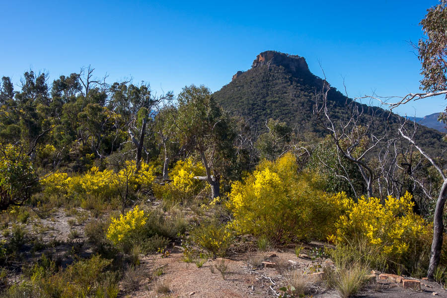
Views and cliffs for miles

Some of the walking less pleasant as the post-fire regrowth takes over
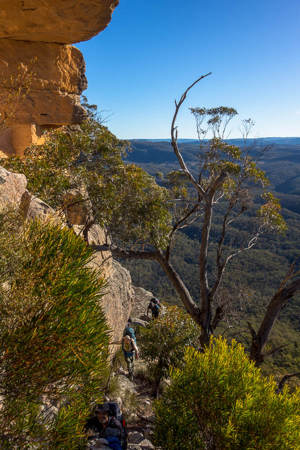
Pagoda walking

More pagoda walking

Views from lunch – to our destination
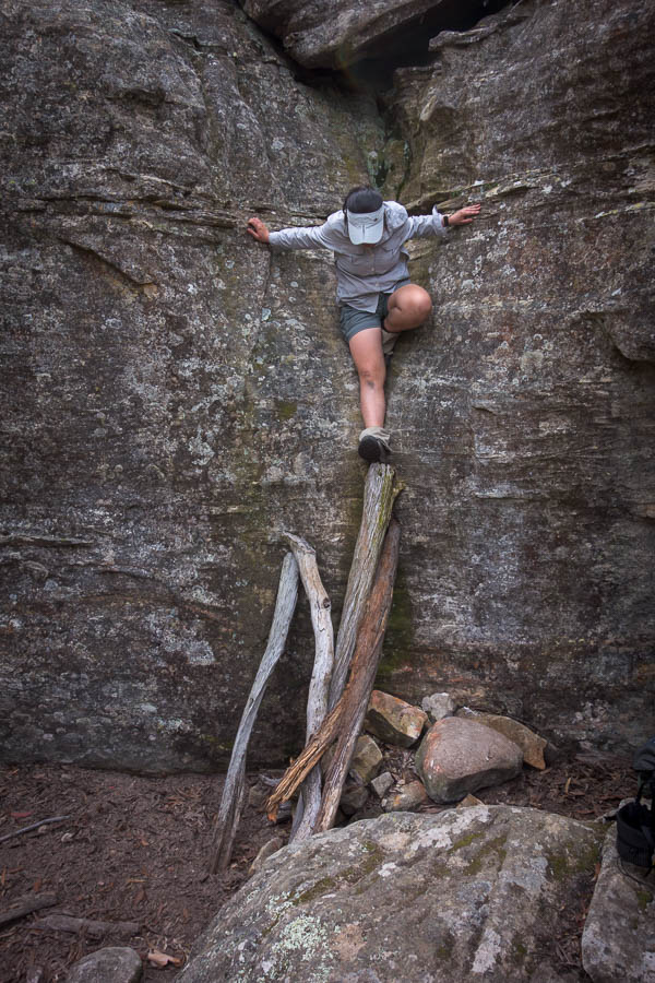
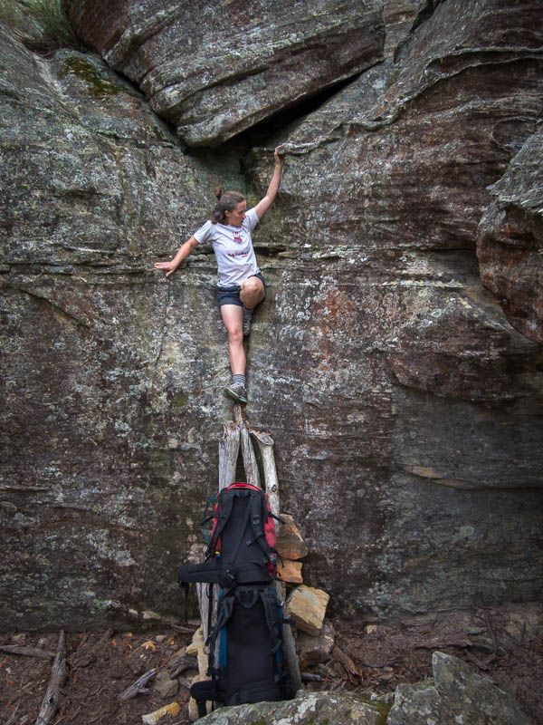
The down climb off the point still has the same logs in place, and the trip report wouldn’t be complete without a couple of shots of people in the same position. (See the same position from previous trips in 2020, 2014, 2007)
The requisite photo (Tim) of the scramble off Baal Bone Point
And another one for good measure (Jonas)
The flatter section of ridge descending to the saddle was a delightful walk. It was what many ridges used to be like pre-fires – and a sad indictment on current conditions that this one seemed so extraordinary.
What a view
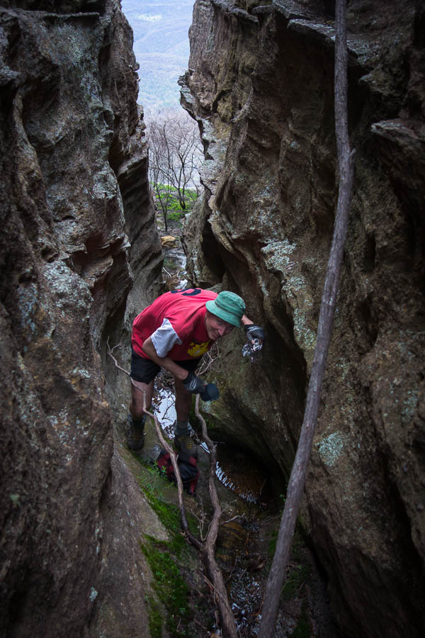
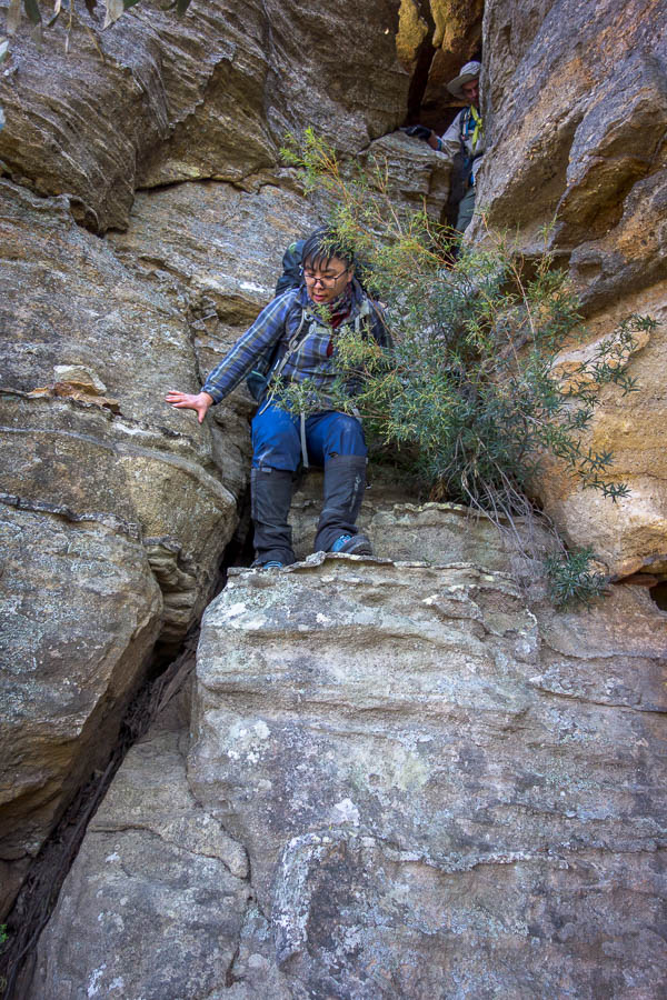
The lower sections of the ridge and the saddle seemed to contain every kind of spikey plant known to the area. But the human pin cushions soon made it on to the slopes and eventually found ourselves at the base of the Southern Pass onto the Crown. Rick and I were the only ones who’d been to Pantoneys previously so knew what was coming. The others said the warning photos I’d sent out in advance hadn’t quite translated to what they had to do – but with a fair bit of pack passing we all made it up with no issues.
Rick and Eckhardt on the upper section of the Southern Pass
The team skirting the ledge to get onto the top of the crown
The still conditions lasted all weekend so it was very pleasant camping near the cliff edge and having happy hour on the edge.

We do get to see Pantoneys even though we’re on it! (the shadow)
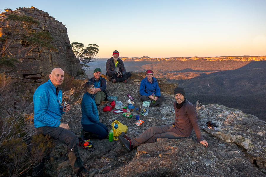
Happy hour 🙂
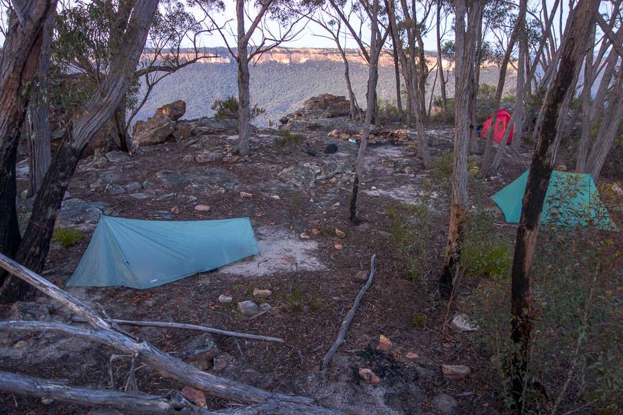
Campsite views

Early morning views
We popped into see how the water source was compared to our last visit in the height of the wet period. I was surprised to find a couple of small pools which would do if you were drying of thirst.
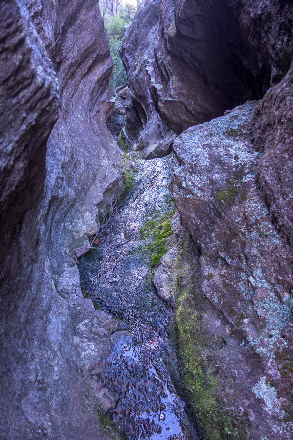
The gully which had a couple of small pools in it
Easy walking approaching the summit
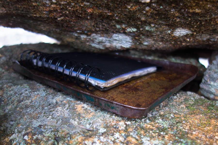
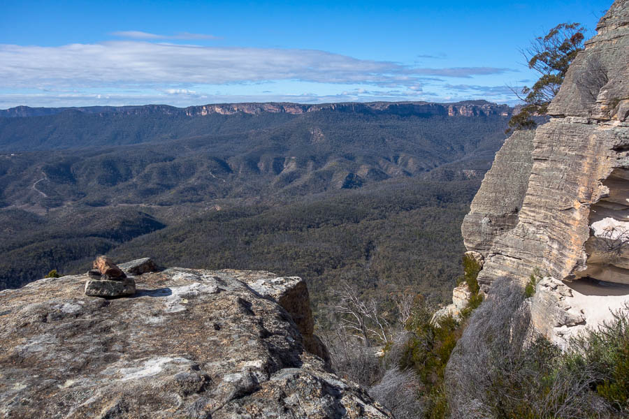
The views from the summit were spectacular. I spent a fair bit of time at the summit cairn trying to find the logbook unsuccessfully. I had given up until Jonas spotted a plastic big inside the base of the cairn. He thought it was rubbish but when he said he could see the word Hercules I knew we were in luck.

The summit cairn and views
With some Jenga skills employed the logbook was retrieved and signed. It’s clearly not found by many parties as it has been going since 2001 and isn’t a very big notebook. There’s only 2 pages left – so maybe take a replacement if you’re heading in – though on current signage that will probably last 3 years! (we were the 4th entry in 12 months)
In 2020 I took a saturated logbook out with us as the container it was in no longer existed – but we’d managed to find this logbook on our trips in 2005, 2007 and 2014 as there’s written evidence in the book.
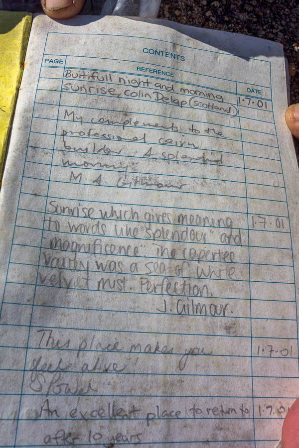
Logbook which we failed to locate last time (though I carried out a different one). Been going since 2001!
Eckhart at the Northern tip
Valerie and Tim getting down through the top cliff line
Above the third scramble of the Northern pass
On every other trip where we’ve descended to Crown Creek there’s stories of Tom failing to navigate us down as intended. I’ve never had to do the nav for that section before and I made a bit of a mess of it on my first attempt. The topo map is only 20m contours which is tricky, and despite Tom furnishing me with a 5m contour map on my phone it was so detailed I struggled to place where we were on that compared with the topo map. Anyway, eventually after crossing two gullies and then still ending up on the wrong ridge I decided we would take our luck in the creek. It turned out to be much easier going – thanks to the local wombats (or maybe pigs 🙁 ). We had lunch at a wider grassy section a few hundred metres before we hit the road.

Relatively easy walking in the creek

Cutting the corners in the final wiggles of the creek
Crown Creek was flowing fairly strongly – I was a little bemused as I wasn’t expecting to have water (we’d been carrying it for the whole weekend). Then decided it must not be good for drinking. But when I got the photos home and showed them to Tom he was surprised at the flow – so I guess it’s been dry when we’ve been there previously. We spotted a creature ahead on the road at one point – not sure if it was a pig or a wild dog (!!) – it was odd looking whatever it was.
We made it to the road, and Crown Creek was flowing
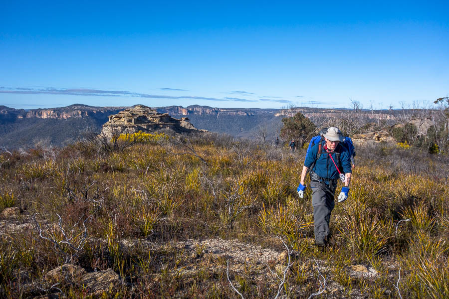
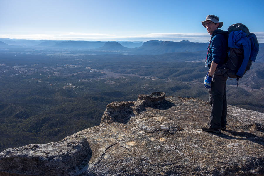
It had been 15 years since I’d walked up Crown Creek Trail to Baal Bone Point – it’s feels like more than 300m of ascent. The incline at times is brutal. But we had nice crisp temperatures for walking in and the views made for a nice distraction.
Views to Point Cameron to distract from the brutal ascent up to Baal Bone Gap
Back at the cars shortly after 4pm and quickly away to avoid driving the road in the dark. We came across some less careful drivers who’d been retrieved from one of the large boggy puddles – we were warned not to drive straight through (we weren’t planning too!).
An excellent weekend and we couldn’t have asked for better weather – just need that road to get graded. It’s hard to imagine it was once in a state where we took a 2WD in (admittedly getting bogged in the process).