Category Archives: Bushwalking

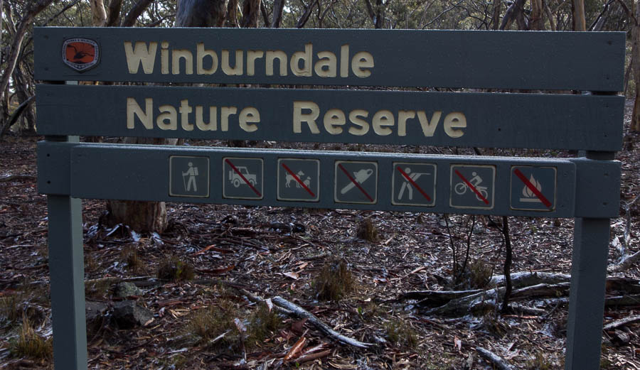
Winburndale – third time lucky? (4-5 July 2020)

In 2018 when we were partially based in the upper mountains I spent quite a lot of time looking at blobs of green on the map. One of the blobs I found was Winburndale Nature Reserve. After putting an exploratory club trip on the program for Nov 2018 I discovered water was likely to be a problem – so I was not too unhappy when most of the sign-ups withdrew and I had to cancel the walk. Fast forward to 2020, bushfires decimated many areas but Winburndale escaped. It seemed the perfect opportunity to resurrect the walk, particularly since there has been decent rain. I rescheduled the trip for May 2020 – with a full contingent signed up – but then Covid-19 arrived.

Determined to get this bunny off my back I rescheduled for July 2020. At last we would see what Winburndale had to offer. Most of my May sign-ups were back, plus a couple from the original 2018 trip, so we had a full party scheduled to go. It was a pleasant drive through the mountains to Lithgow where most of us met up. We lost one to over-sleeping on Saturday morning, so we were down to 7. My well-planned meeting point was a fail since the cafe didn’t open until we were meant to be leaving, and the toilets were having maintenance done on them!

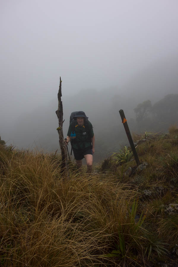
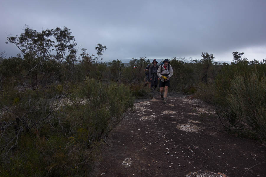
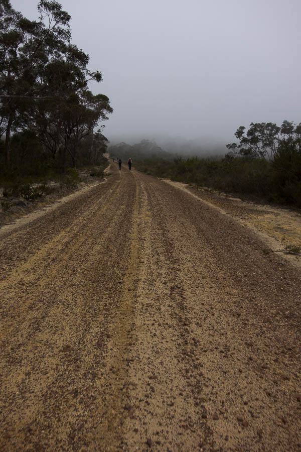
The forecast was for a cold front with possible snow flurries on Saturday morning. By the time we got to Yetholme the visibility was low, it was lightly sleeting and if I didn’t know it was forecast to clear I would have been wondering why on earth we were heading out. Picking up our 7th member from Yetholme we ventured into Sunny Corner State Forest – I was glad we had an AWD & 4WD as the precipitation meant the dirt roads had little traction. It was a magical drive out through the pine forests which had a light dusting of snow. Lauren must be the lucky (!?) charm as the last overnight walk Tom & I did with her it also snowed!
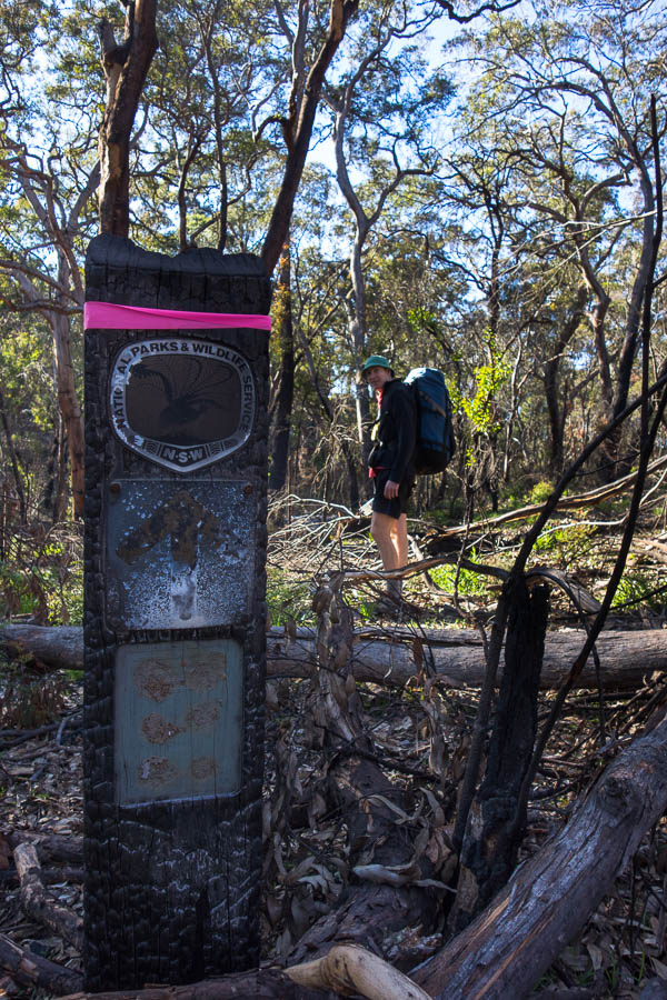
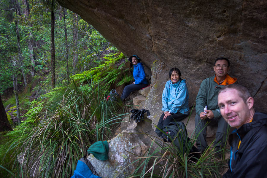
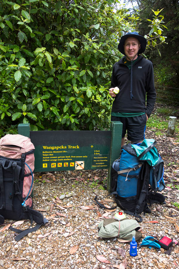
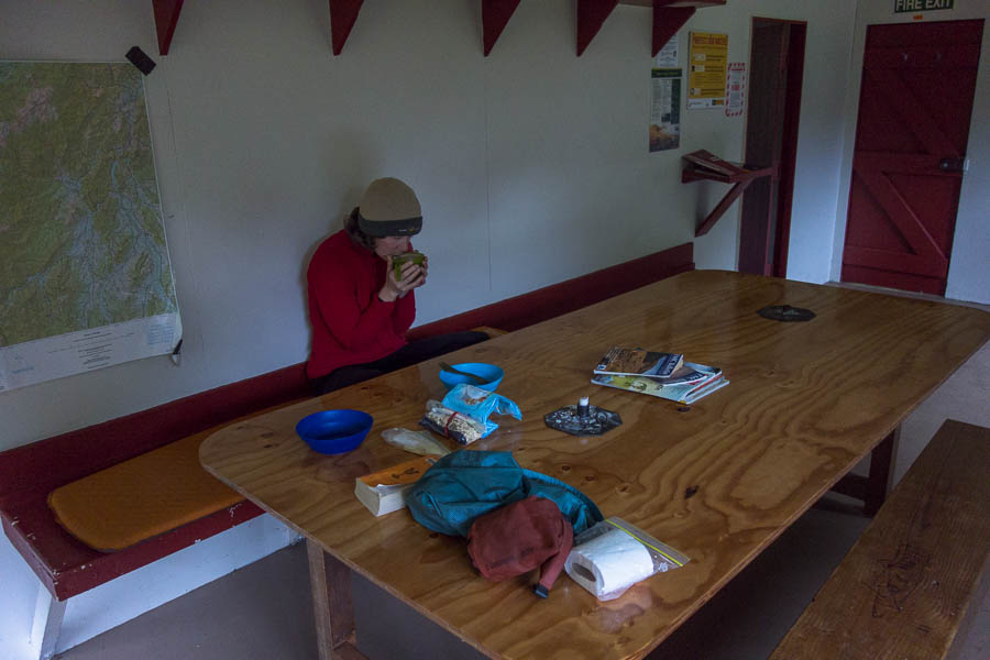
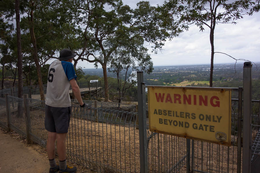
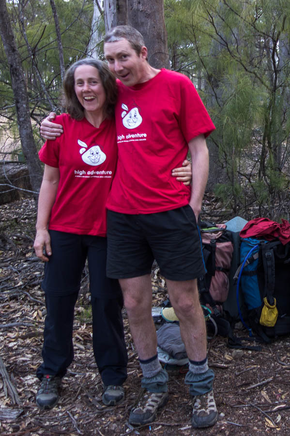
DSC02372

Walkers only!

DSC02369

Wintry start to the day

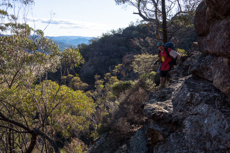
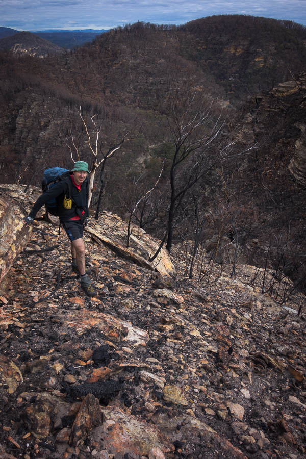
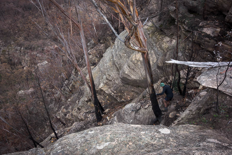
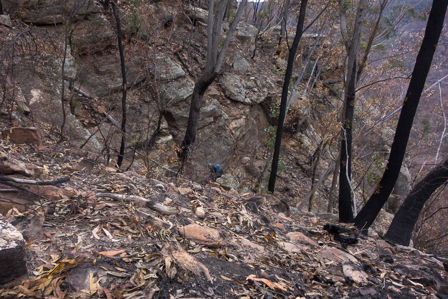
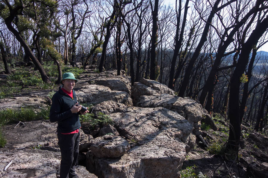
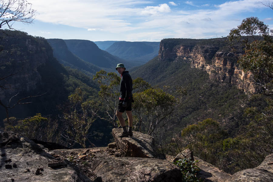
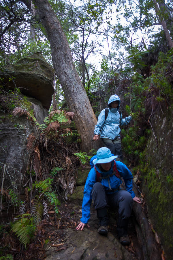
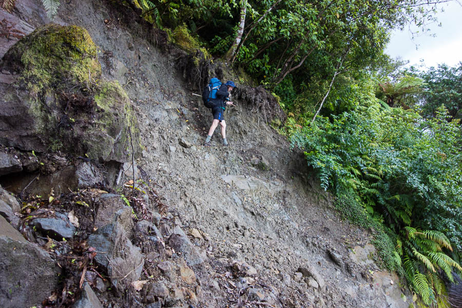
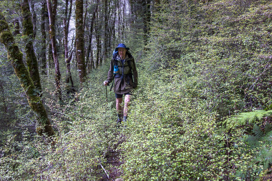
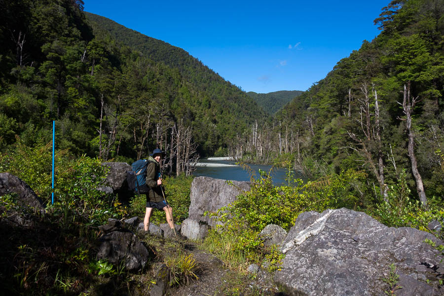
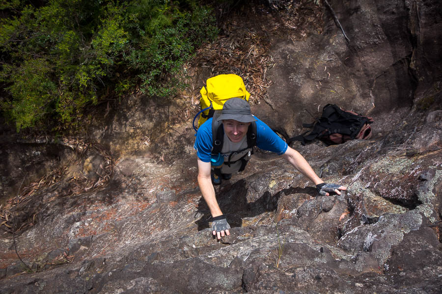
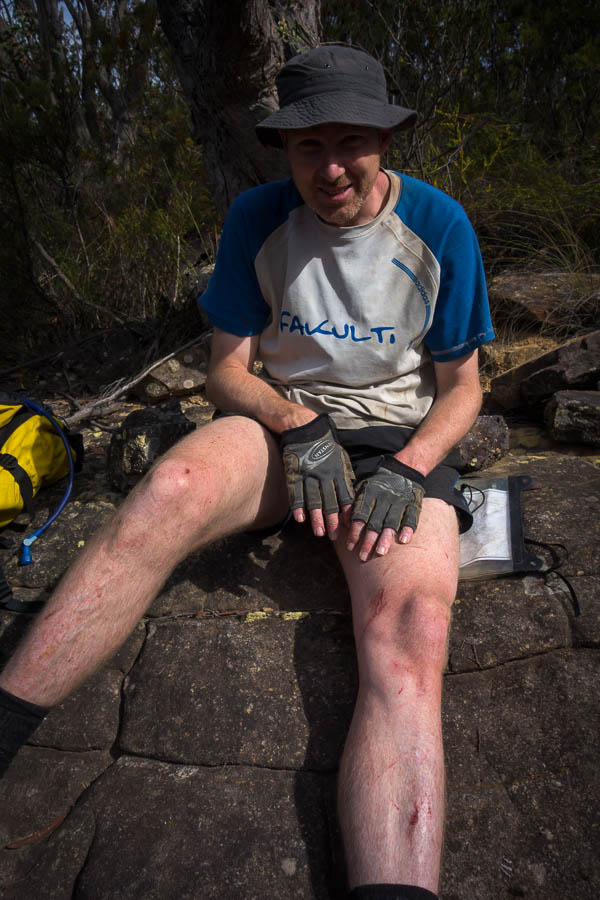
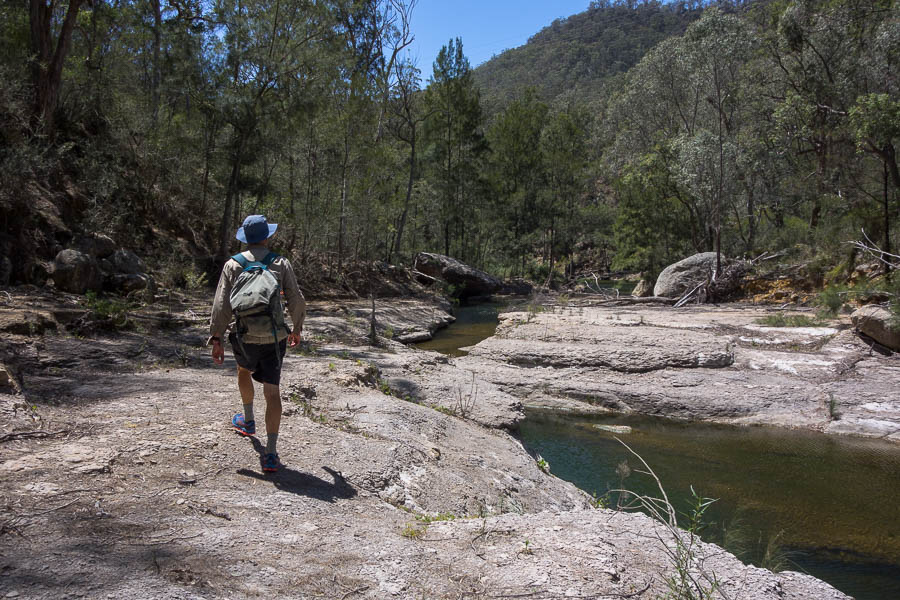
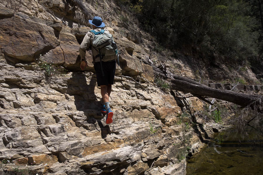
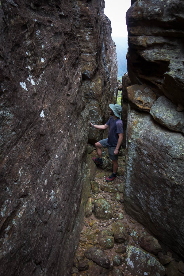
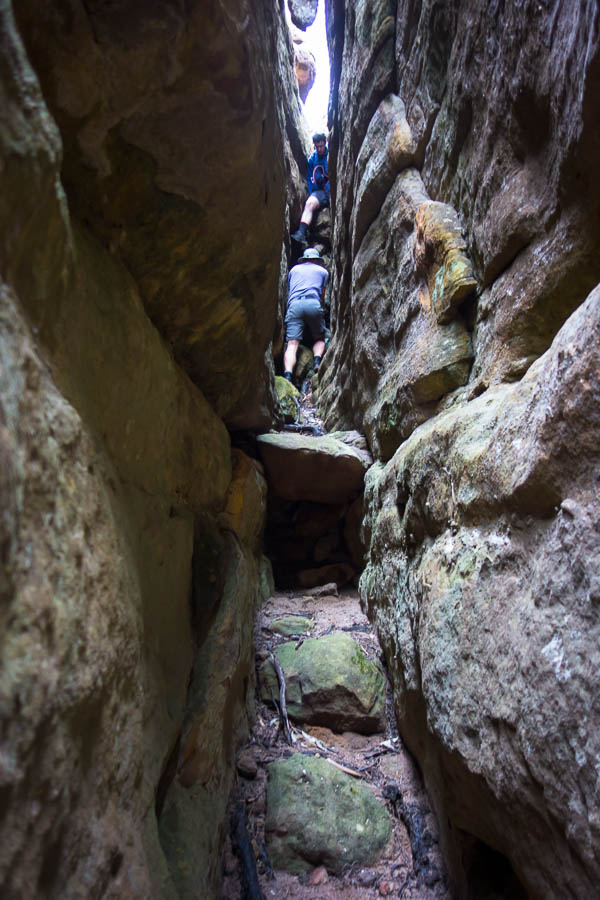
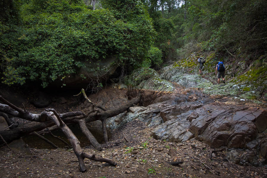
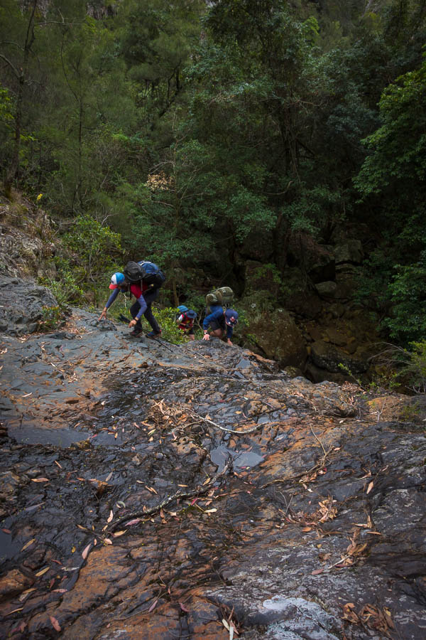
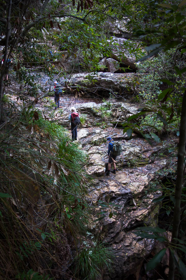
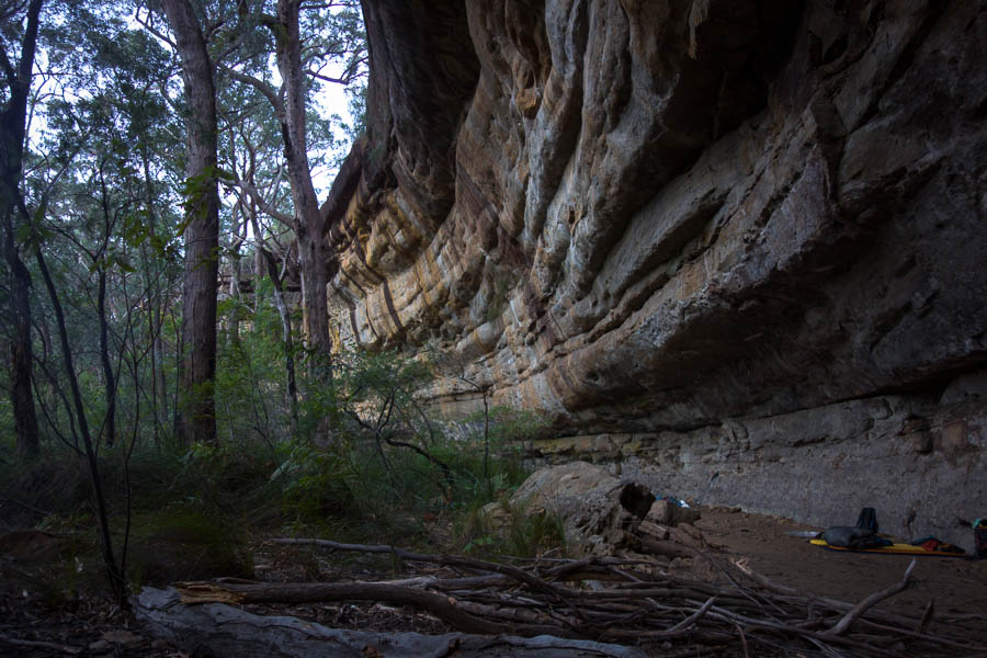
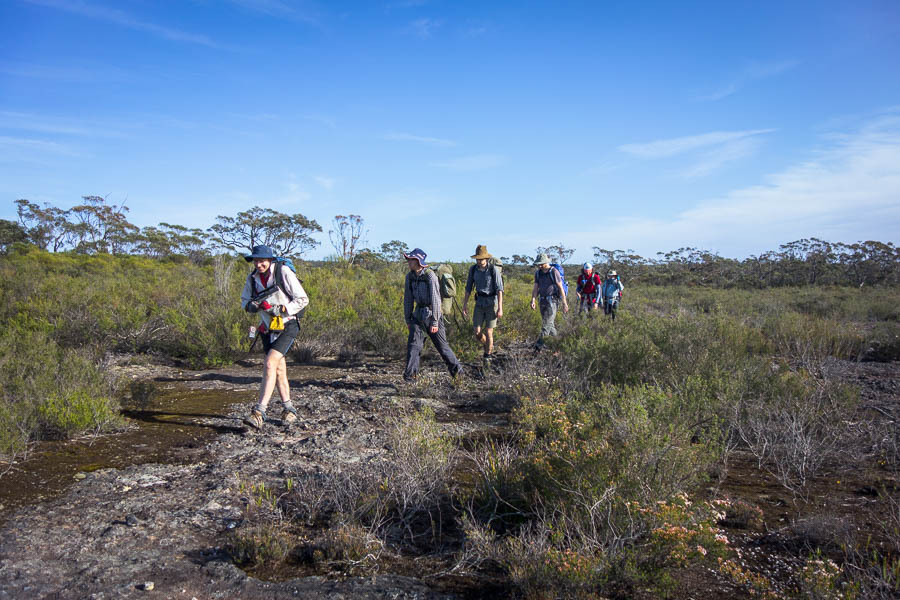
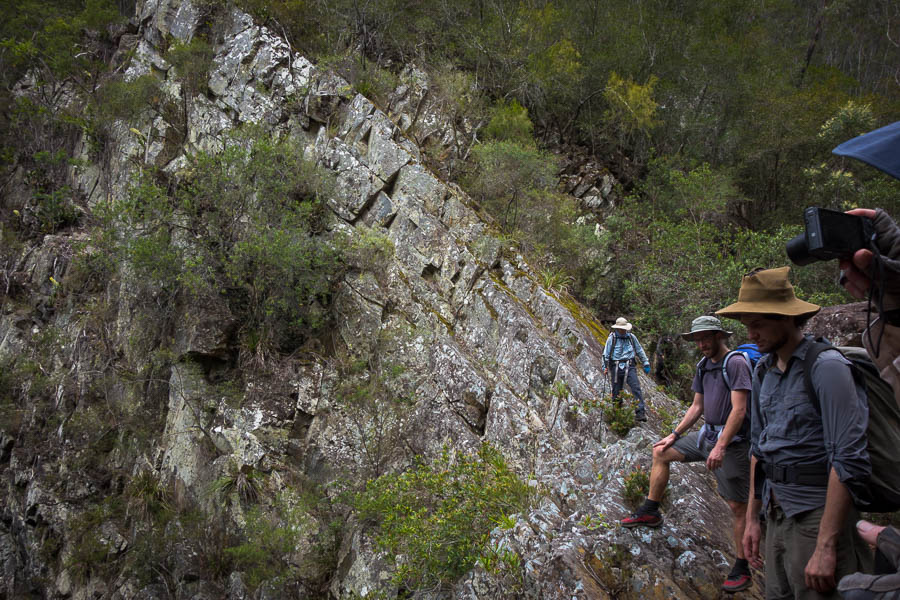
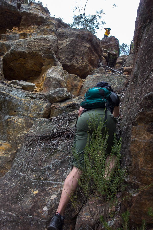
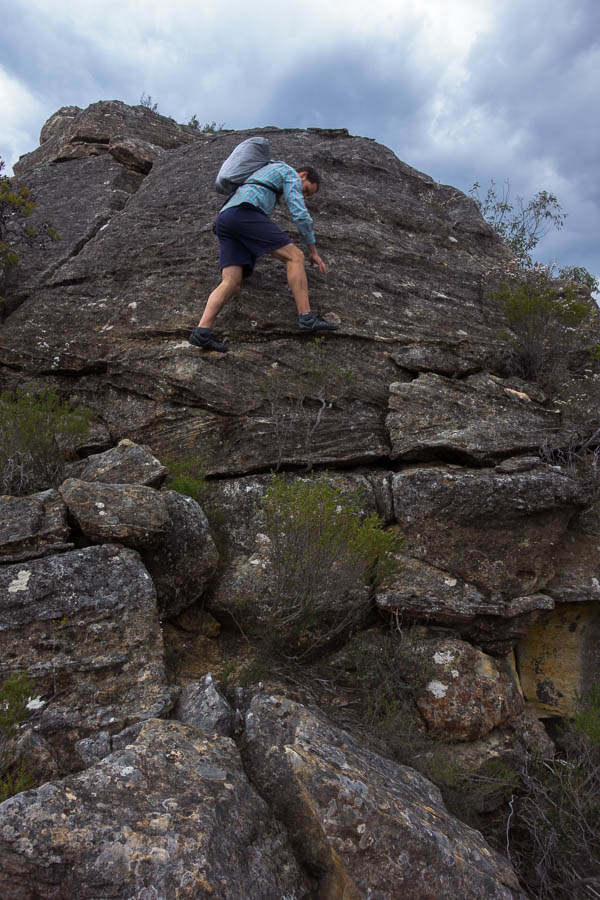
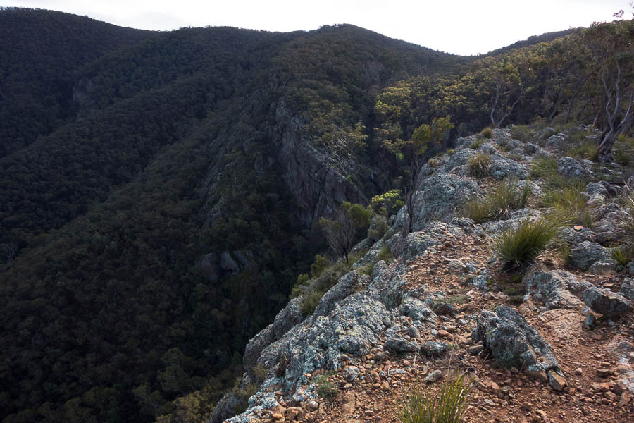
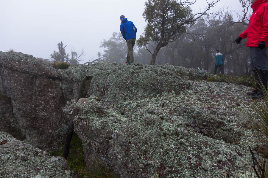
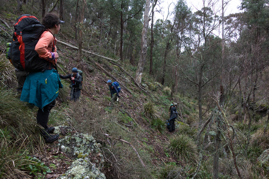
By the time we started walking the weather has lifted. Lauren even optimistically applied sunscreen before we left the cars. Blue sky poked through and it was really quite a nice day if the wind wasn’t blowing. Eschewing the fire trail we followed the cliff line where we could – though the conglomerate rock proved rather slippery under foot.

DSC02374

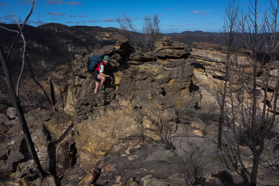
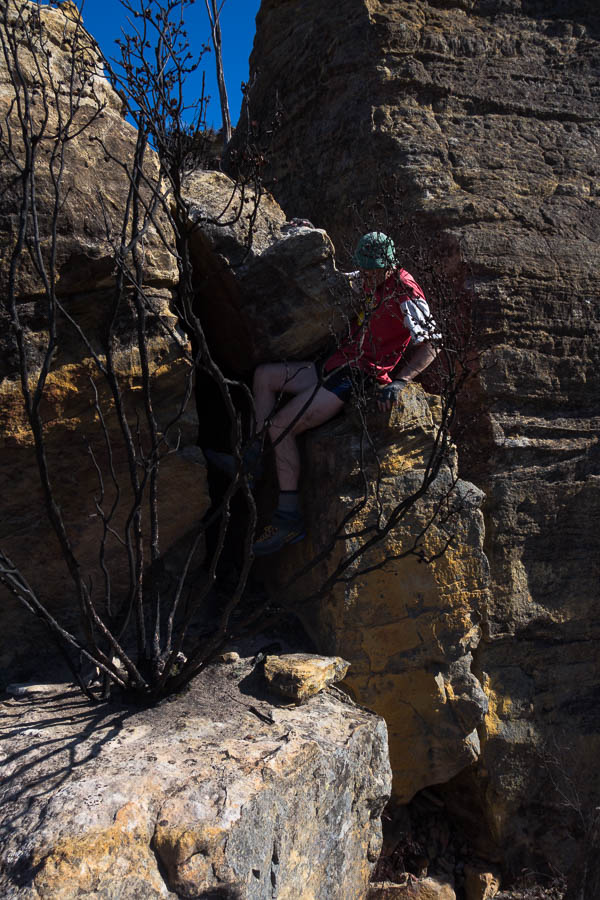
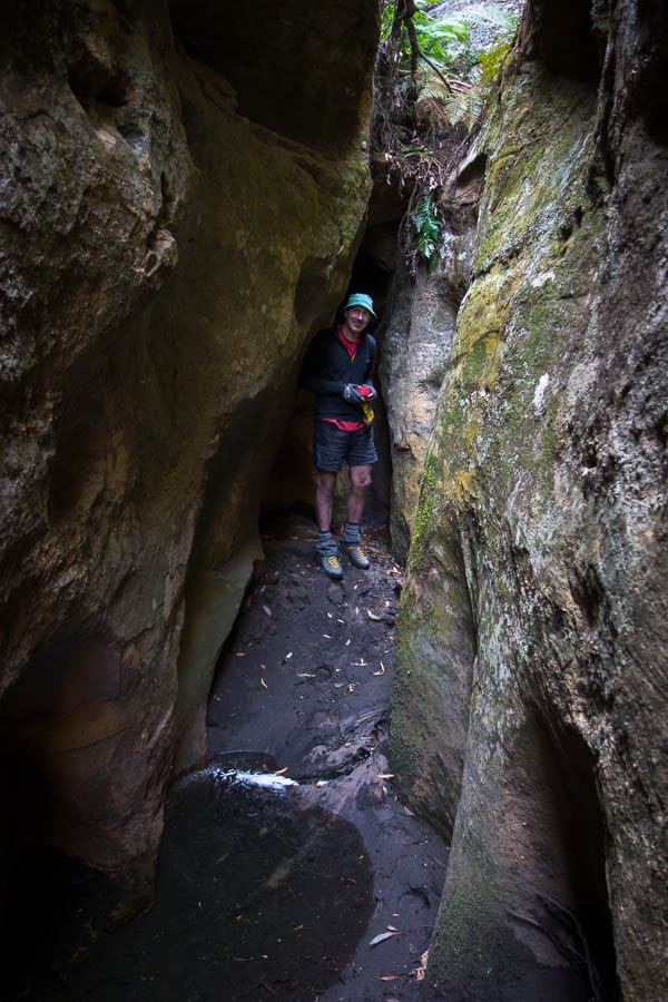
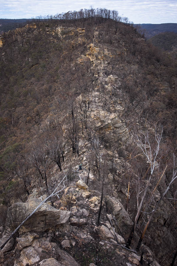
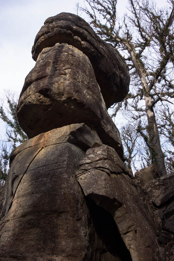
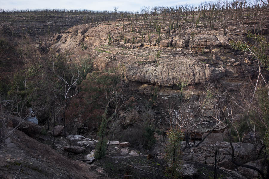
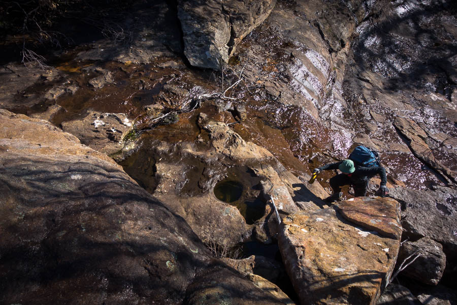
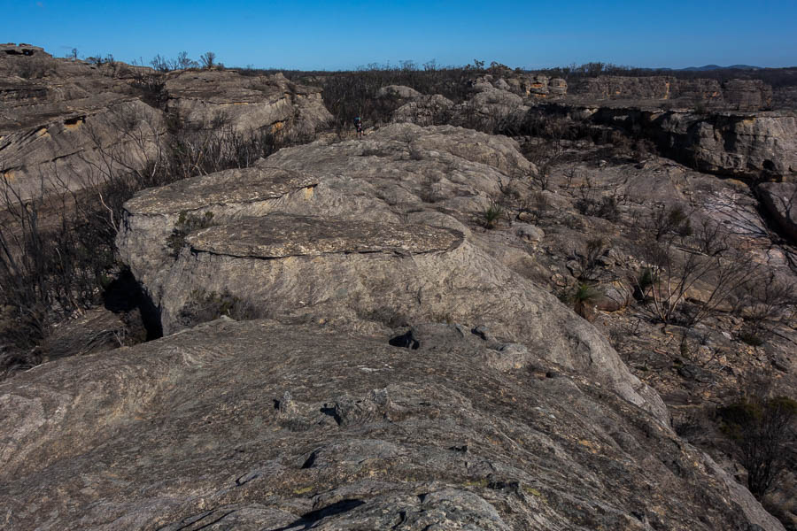
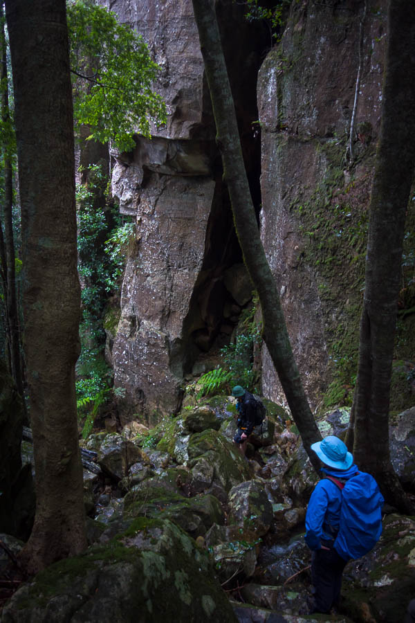
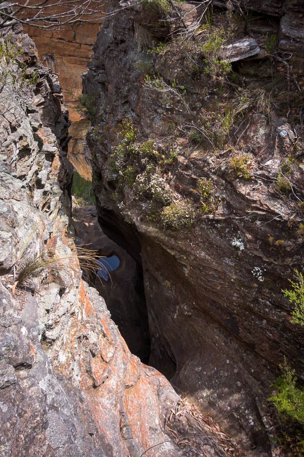
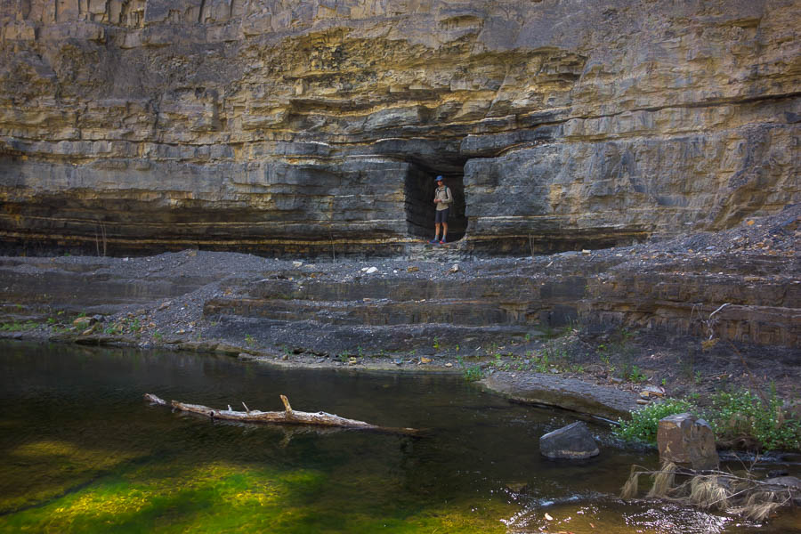
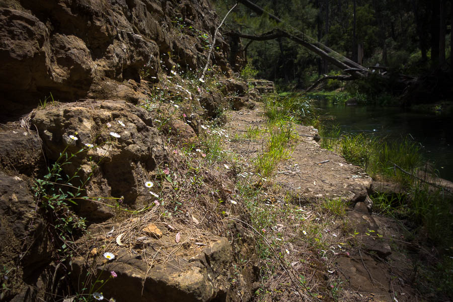
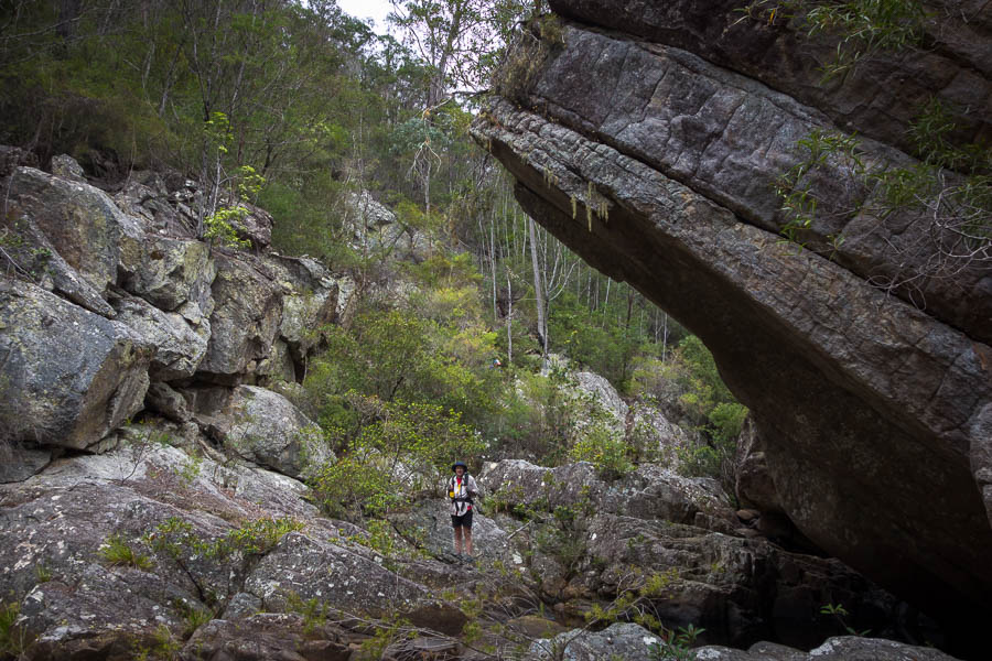
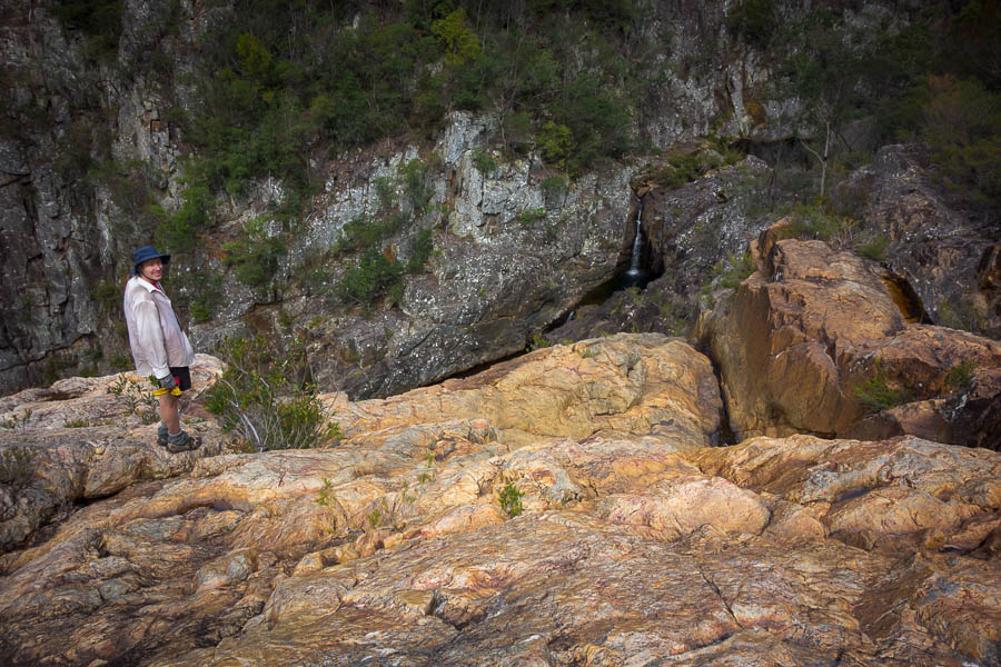
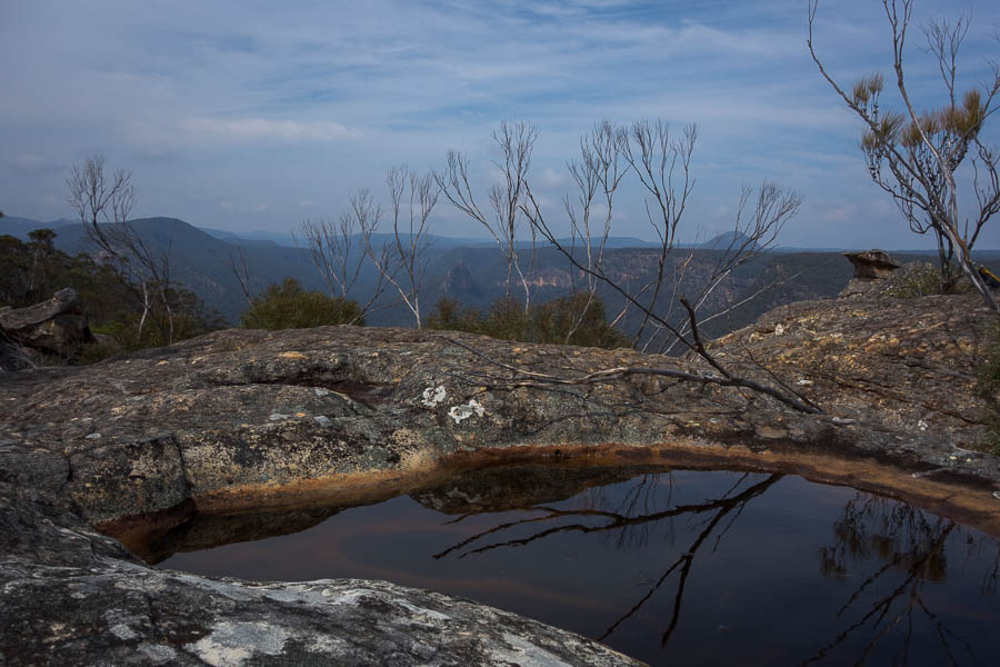
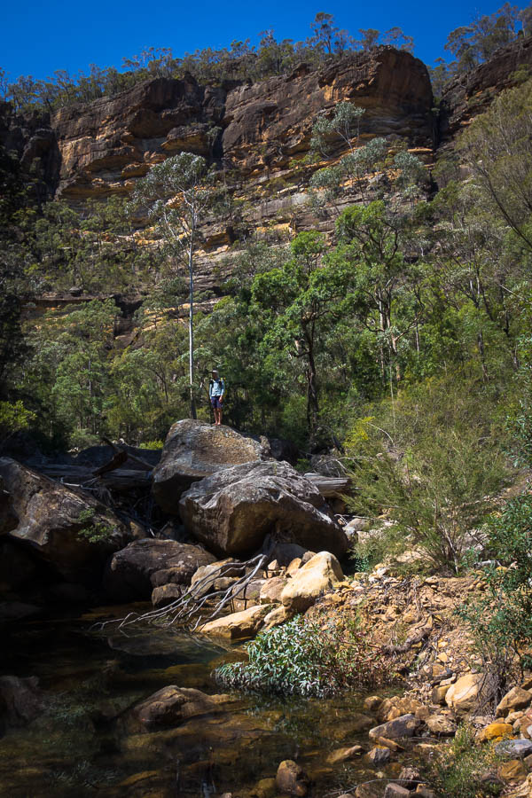
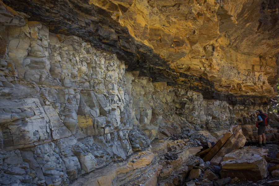
Spectacular conglomerate outcrops

DSC02375

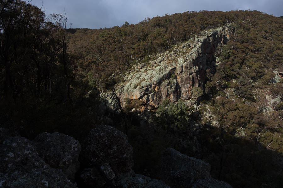
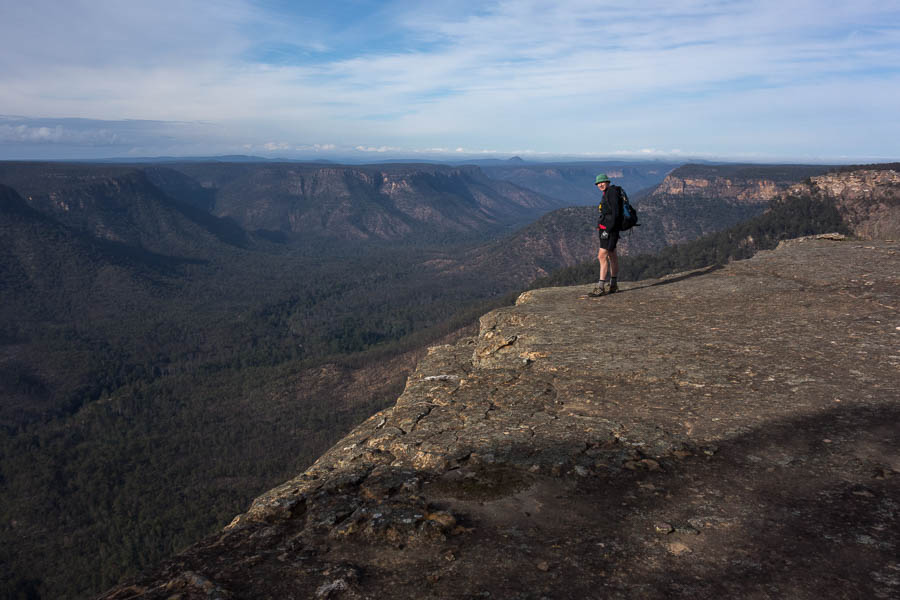
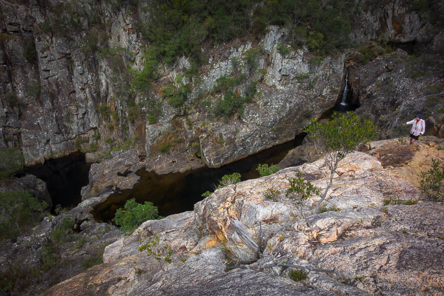
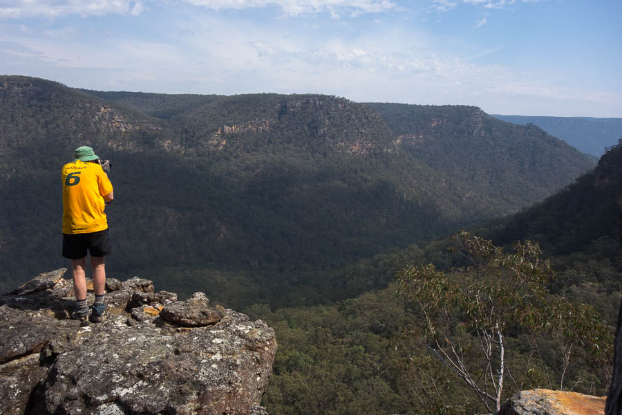
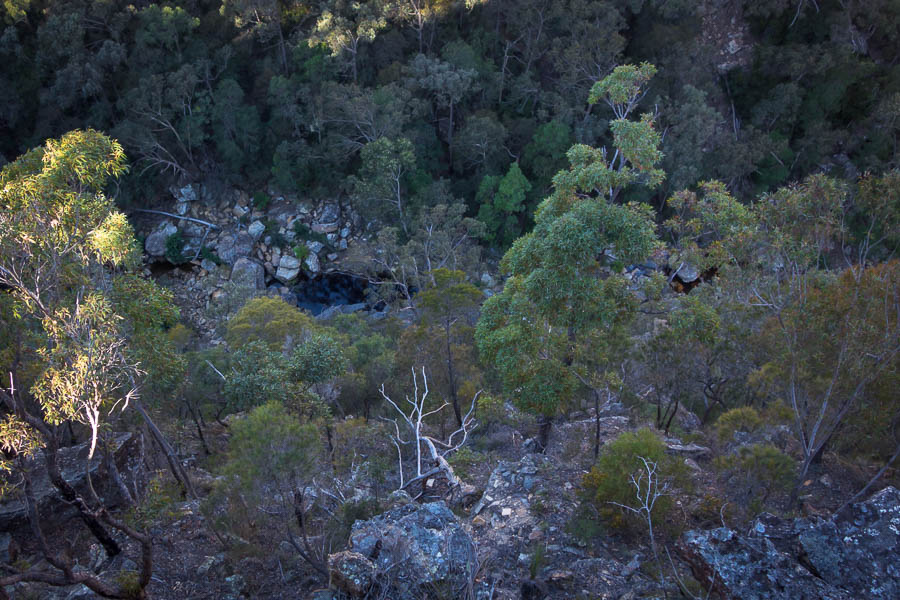
Interesting cliff line

DSC02379

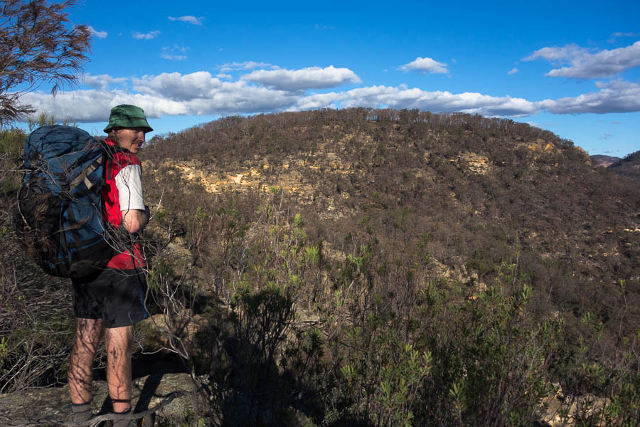
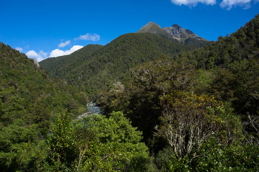
Looking at Mt Panorama

DSC02382

More conglomerate outcrops

DSC02389

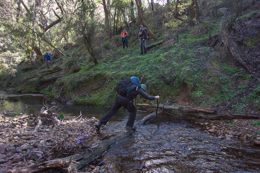
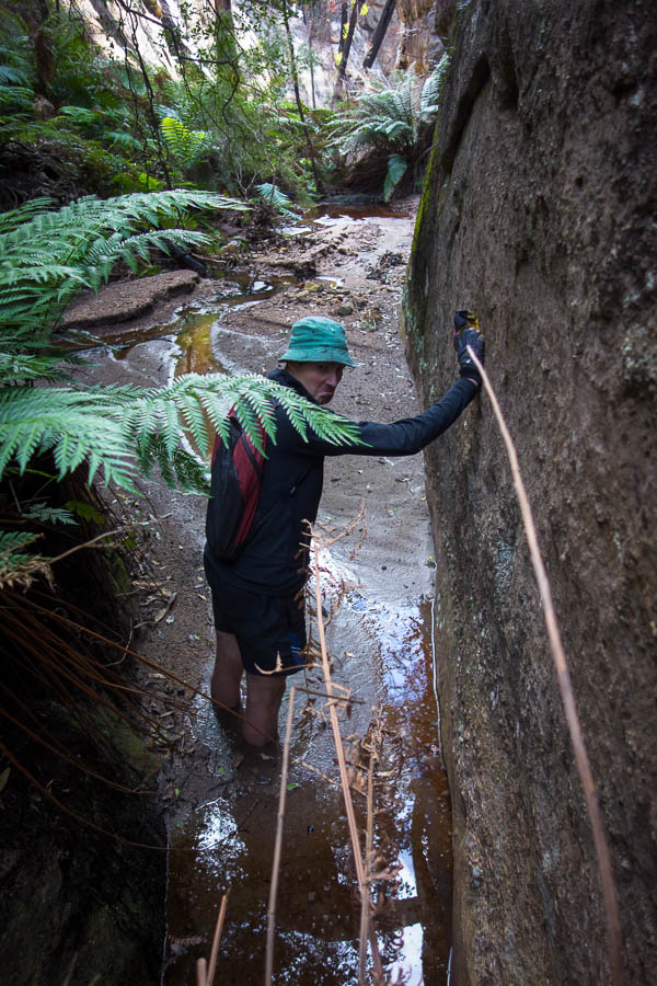
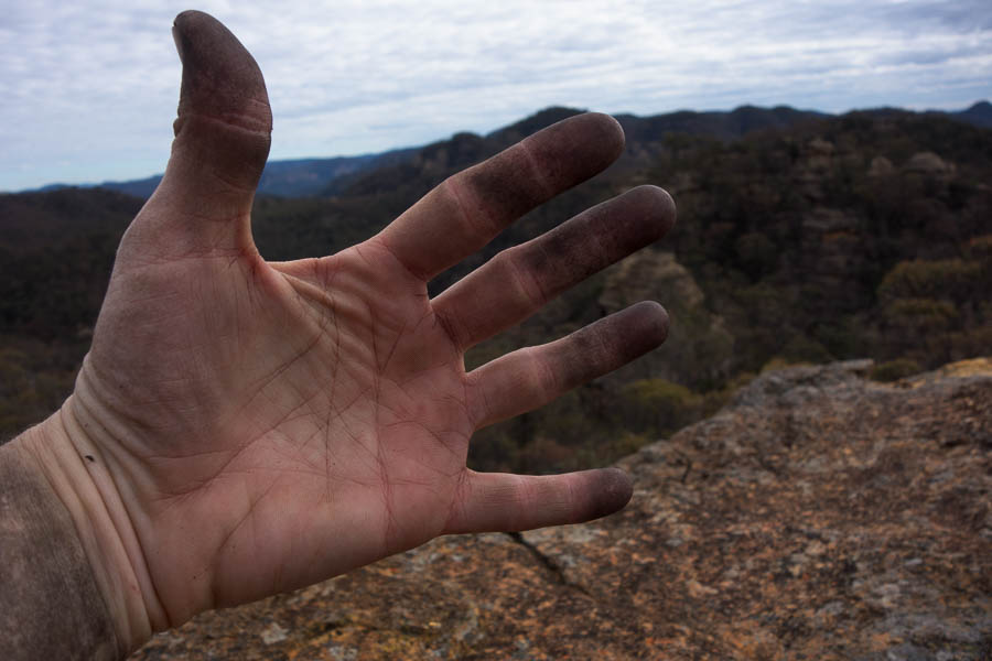
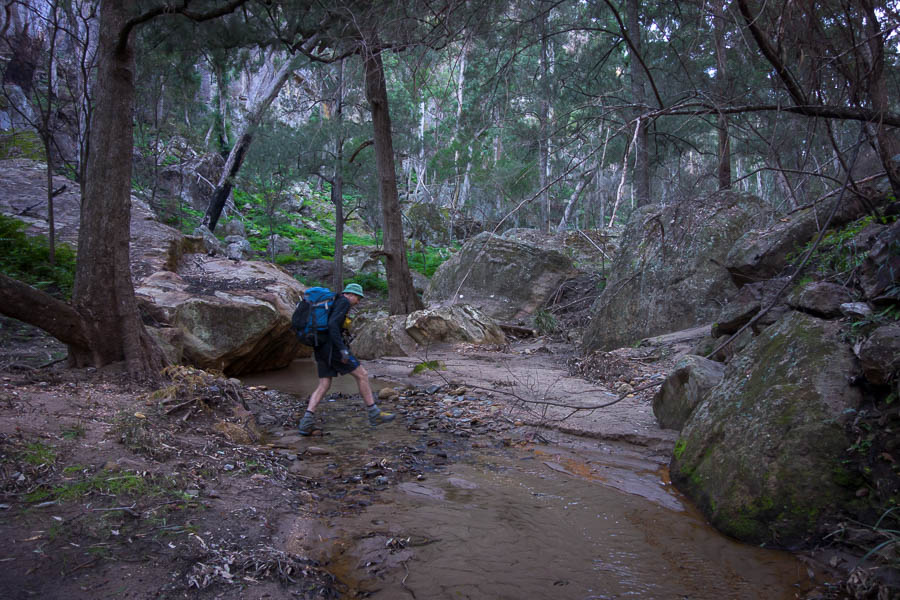
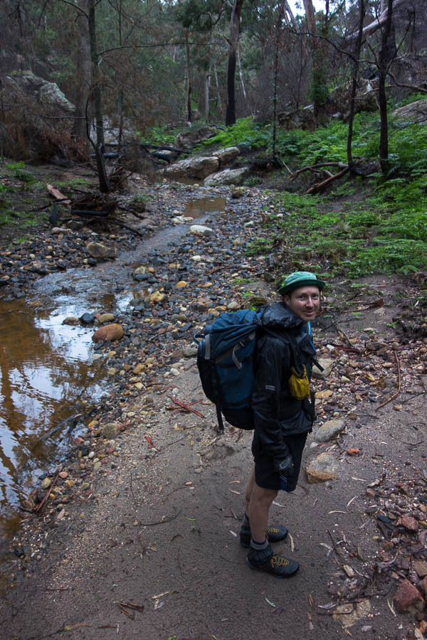
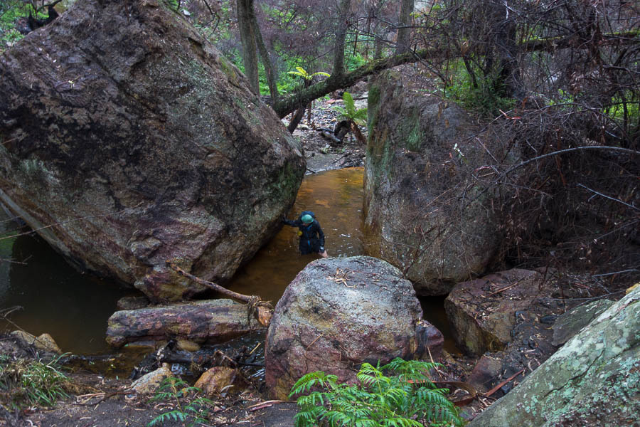
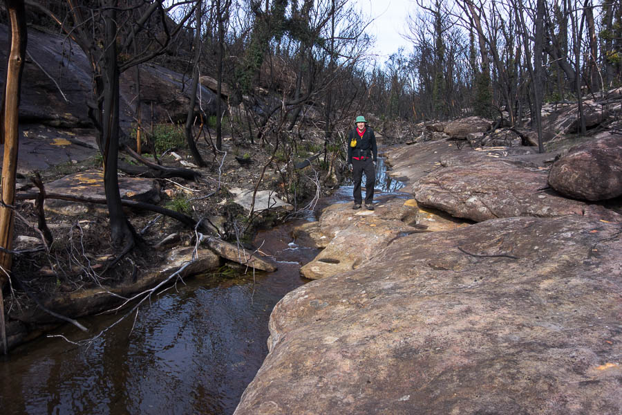
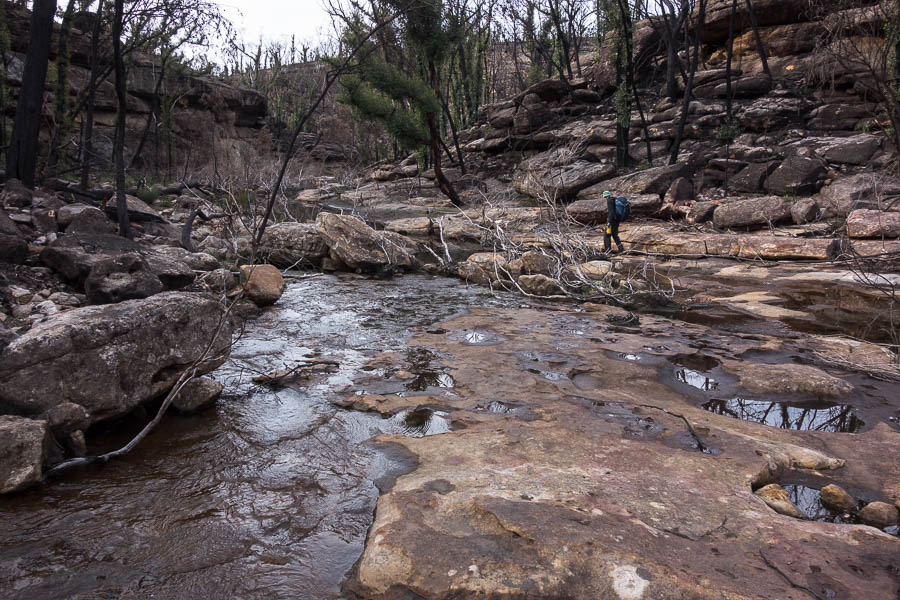
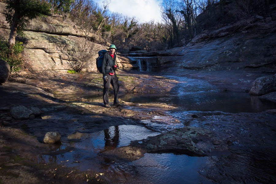
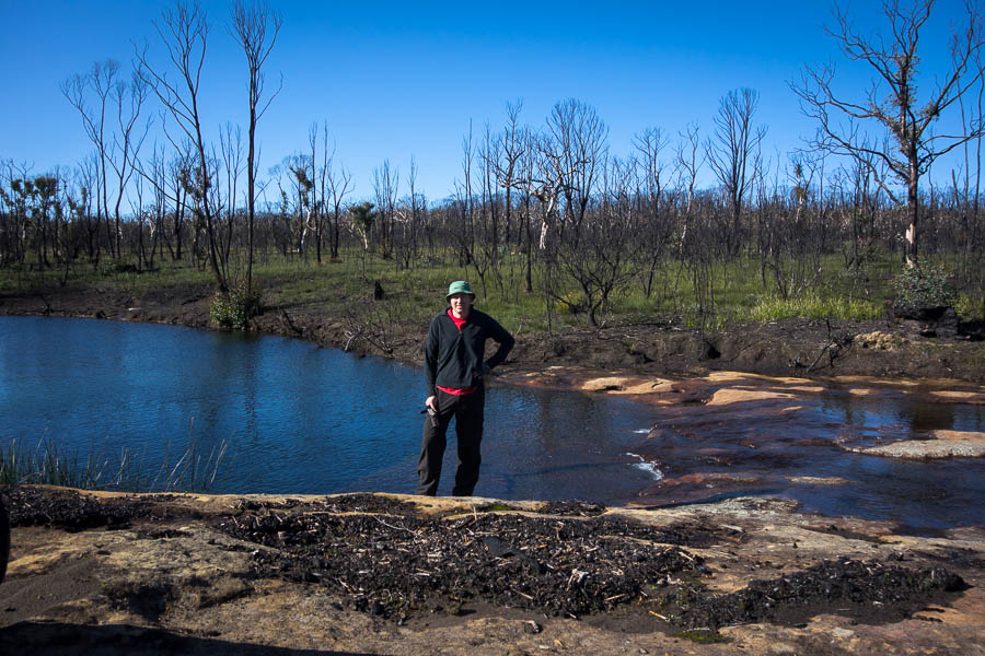
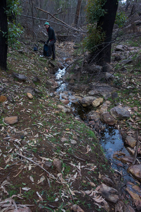
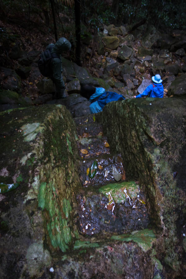
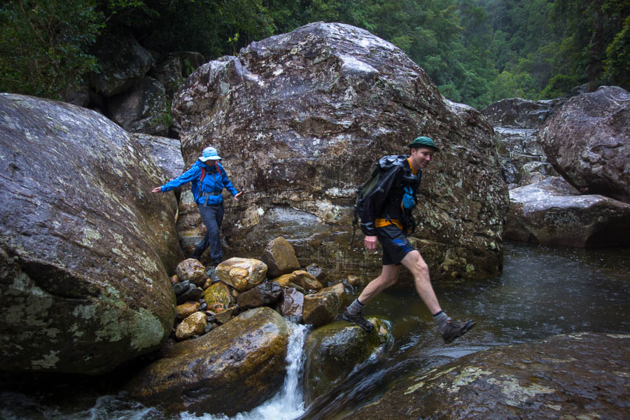
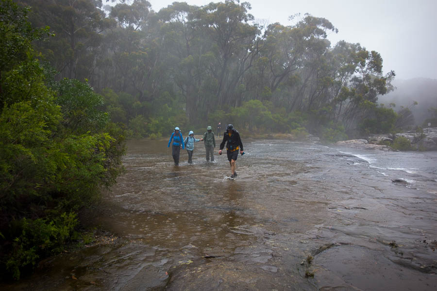
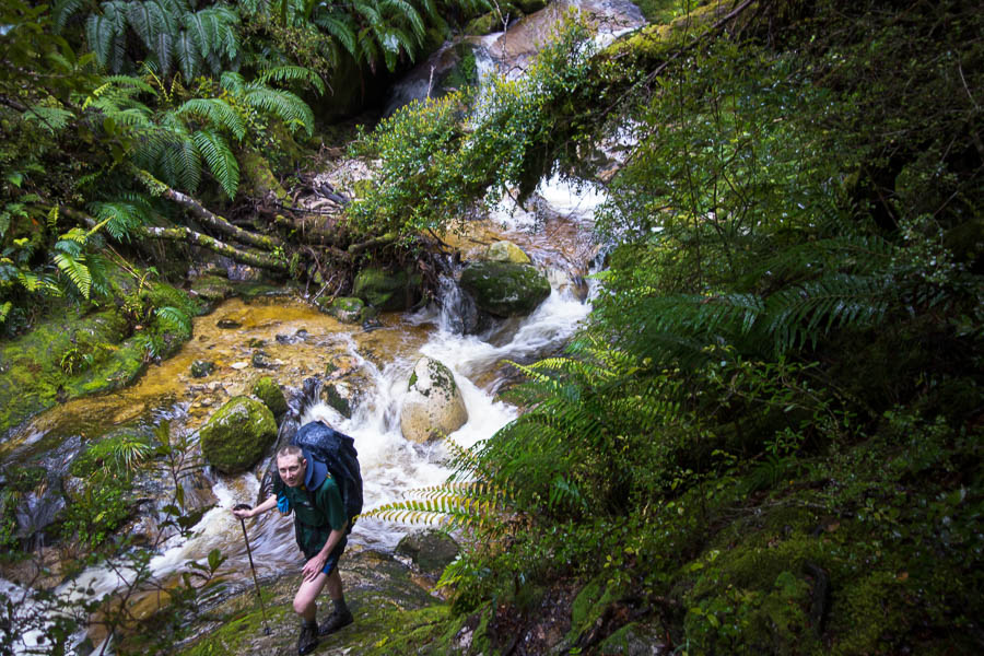
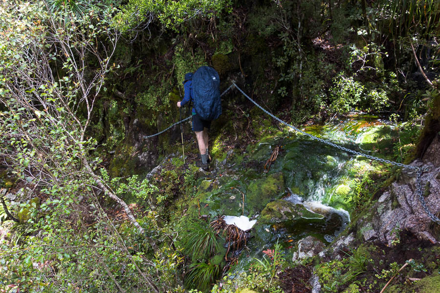
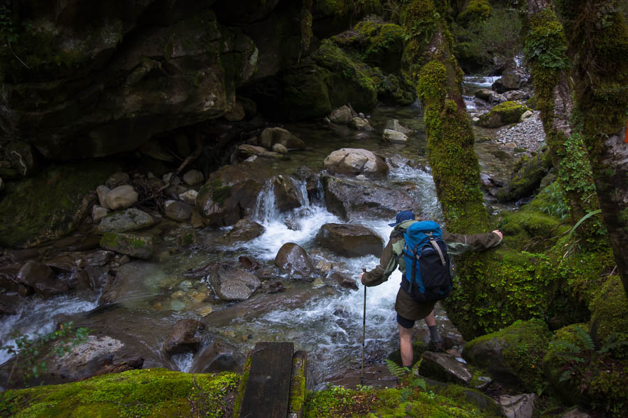
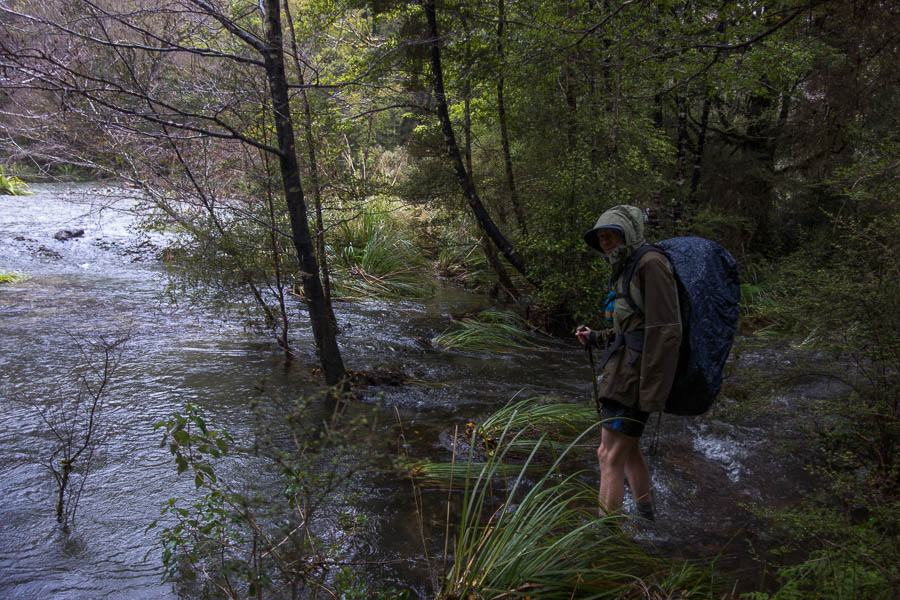
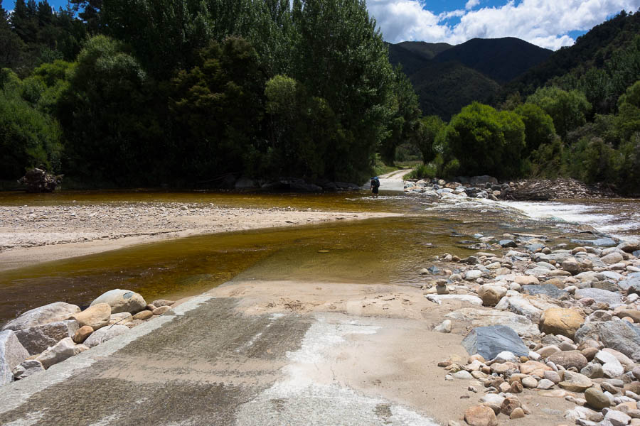
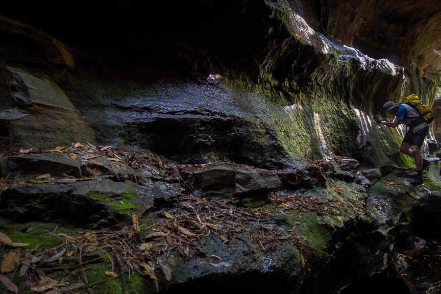
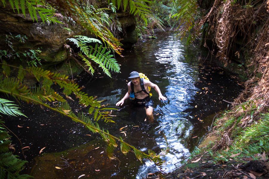
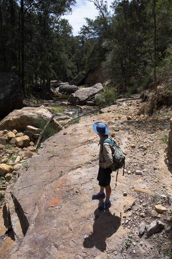
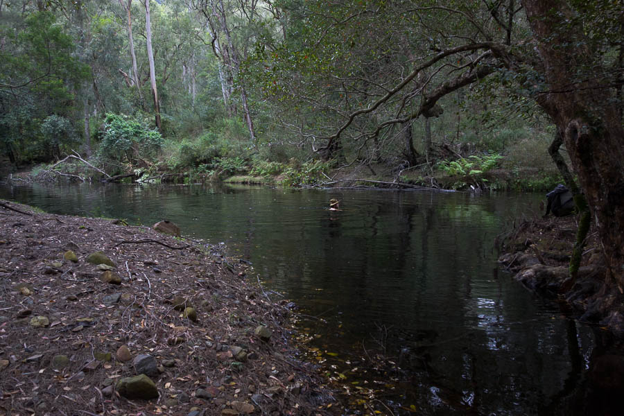
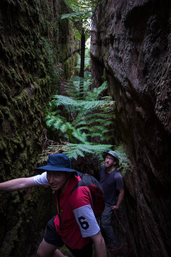
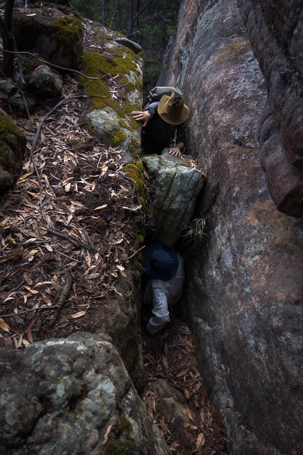
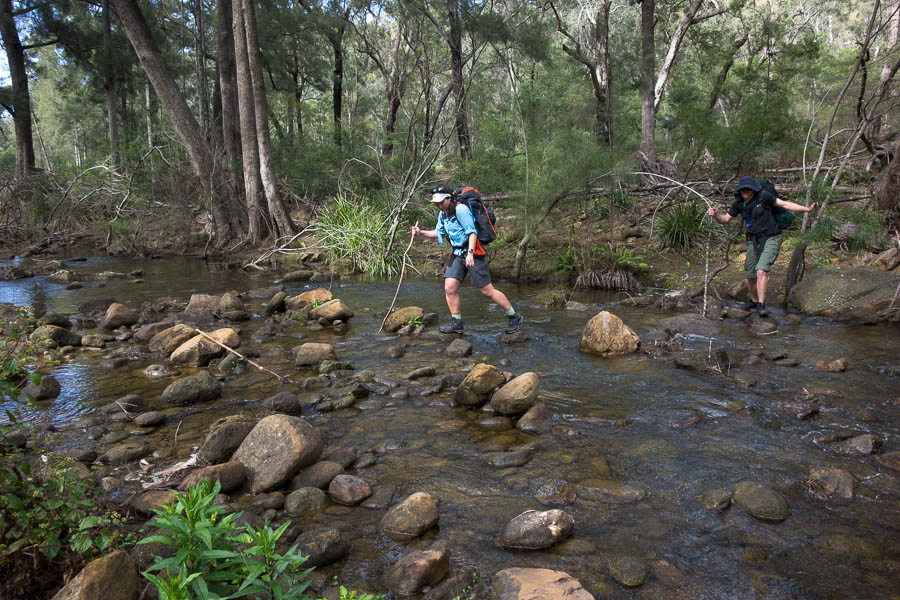
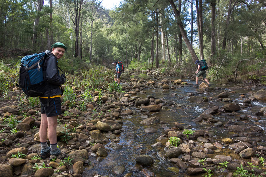
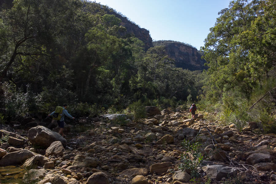
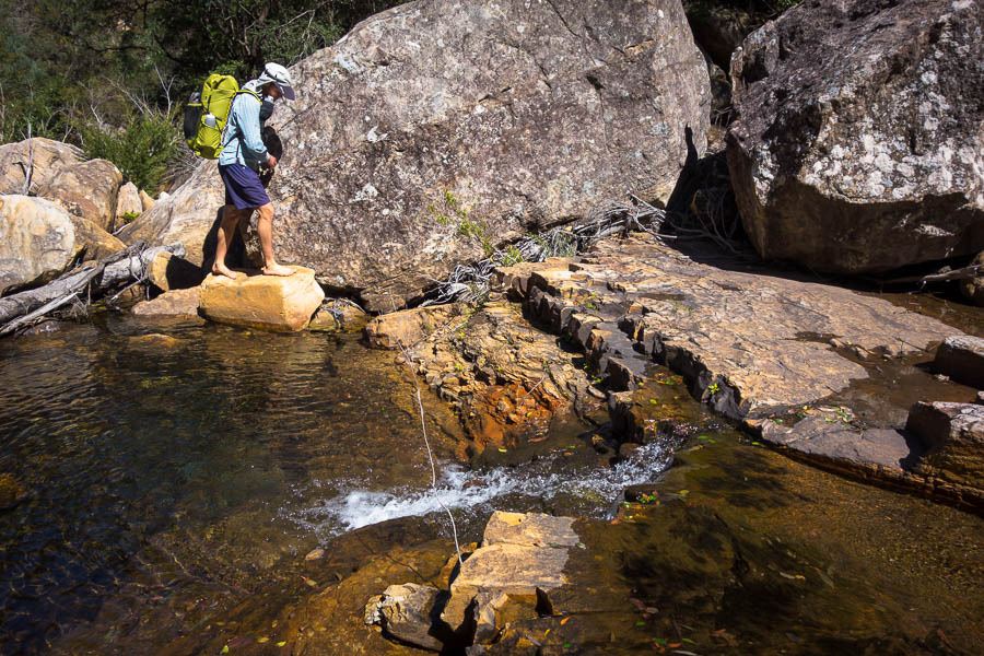
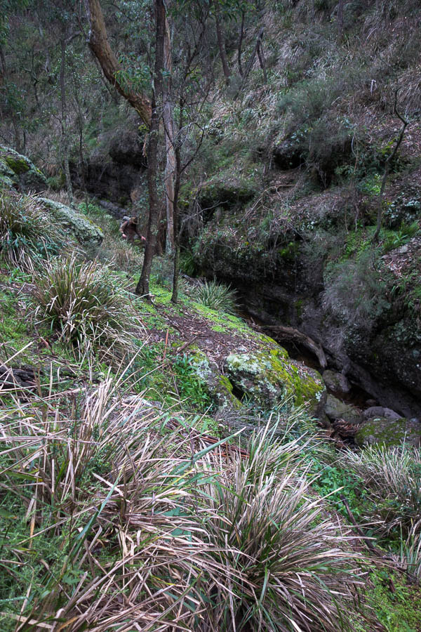
Crossing a creek (only one finger sacrificed in the process)

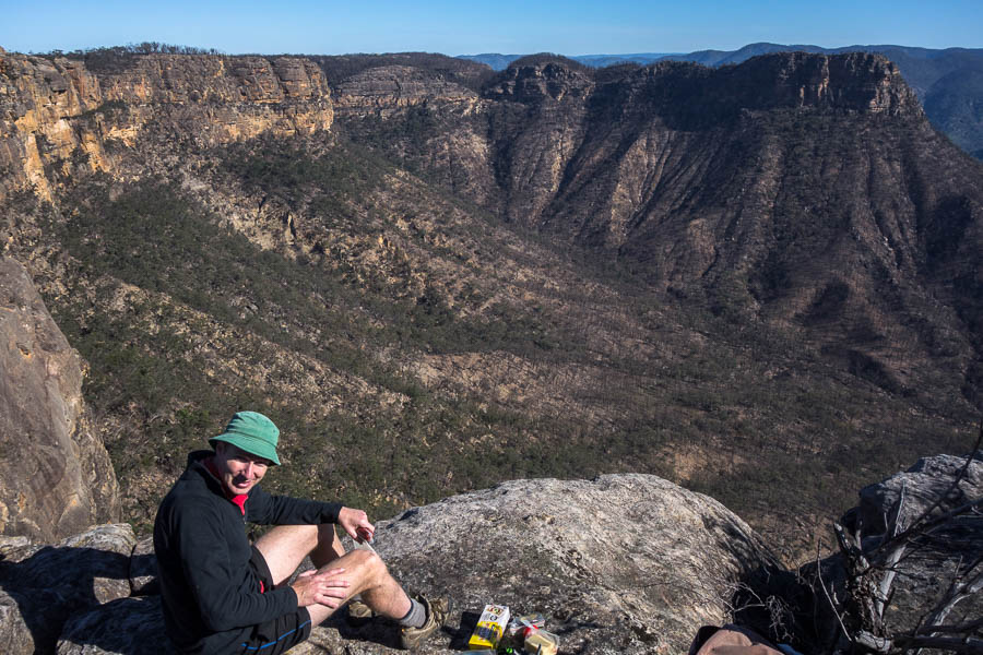
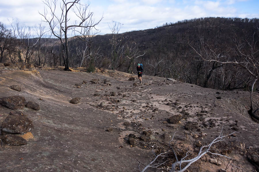
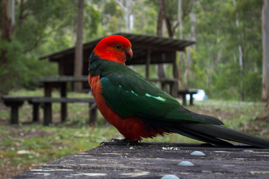
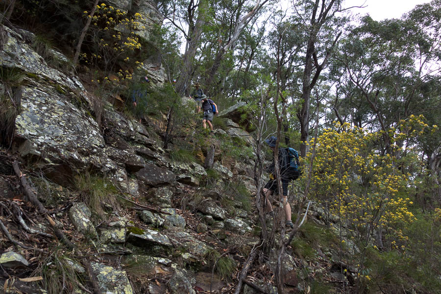
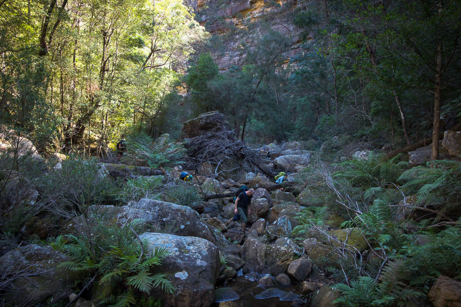
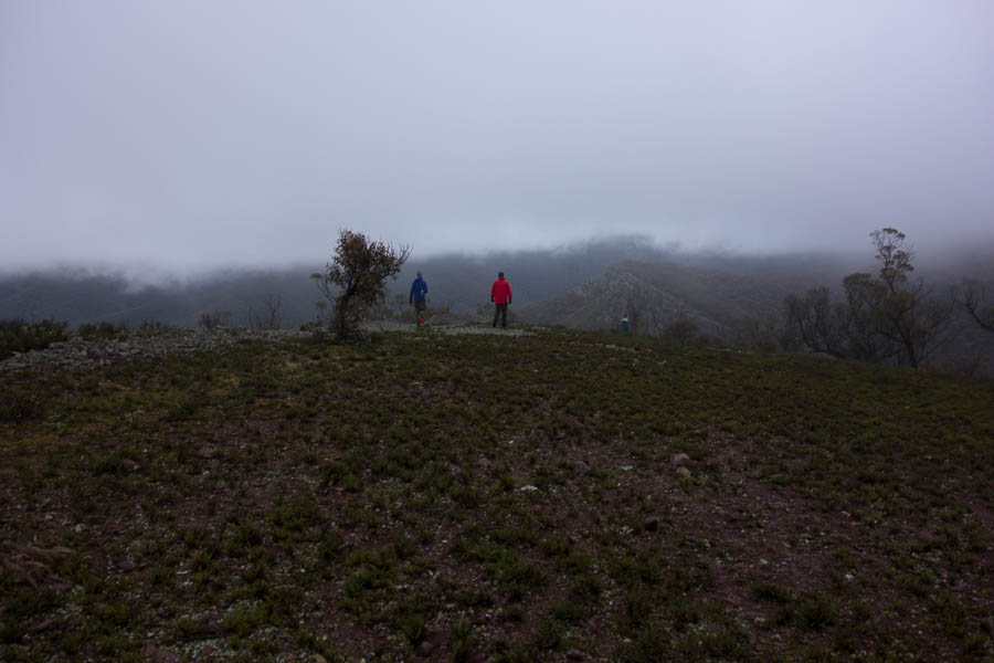
A solid 300m climb warmed us up prior to morning tea – I suspect the first decent ascent many of us had done in a while. We saw our first (but not last) goats of the trip not long after this. I am pleased to see the Reserve will be closed in a couple of months for pest control.
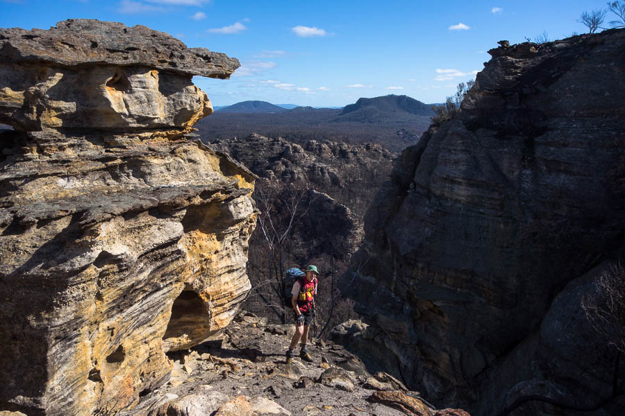
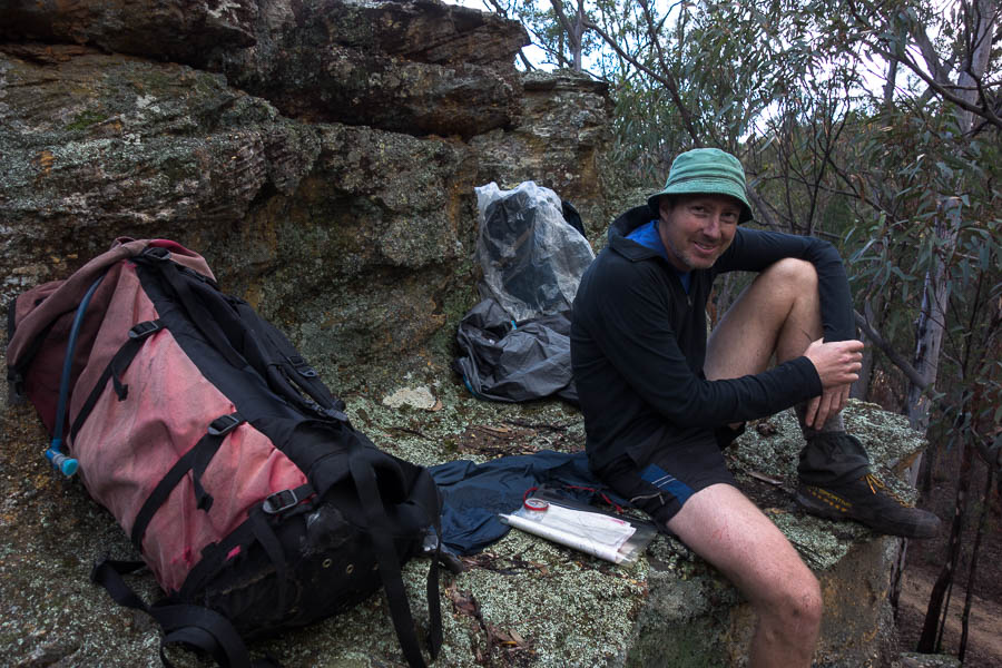
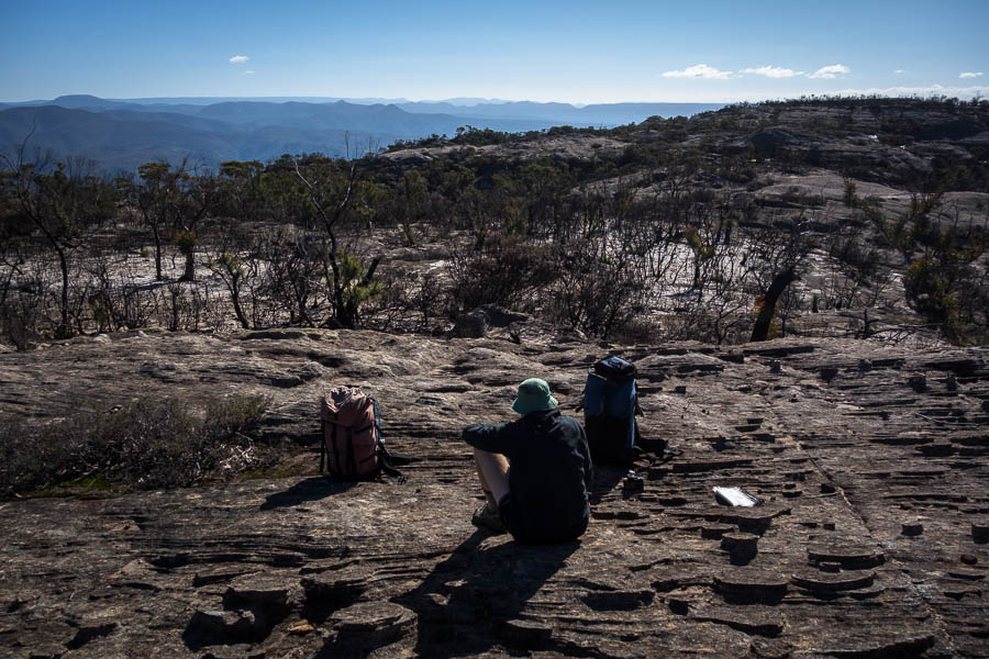
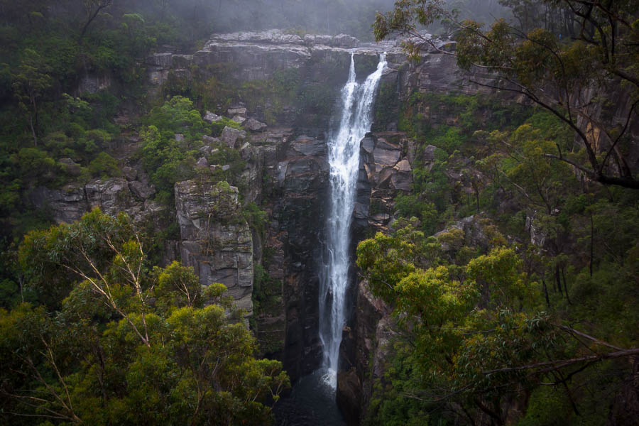
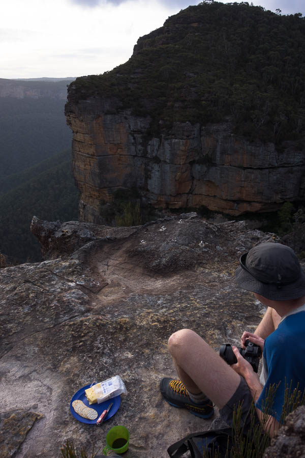
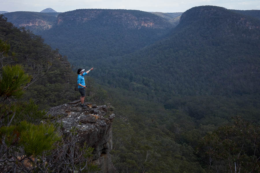
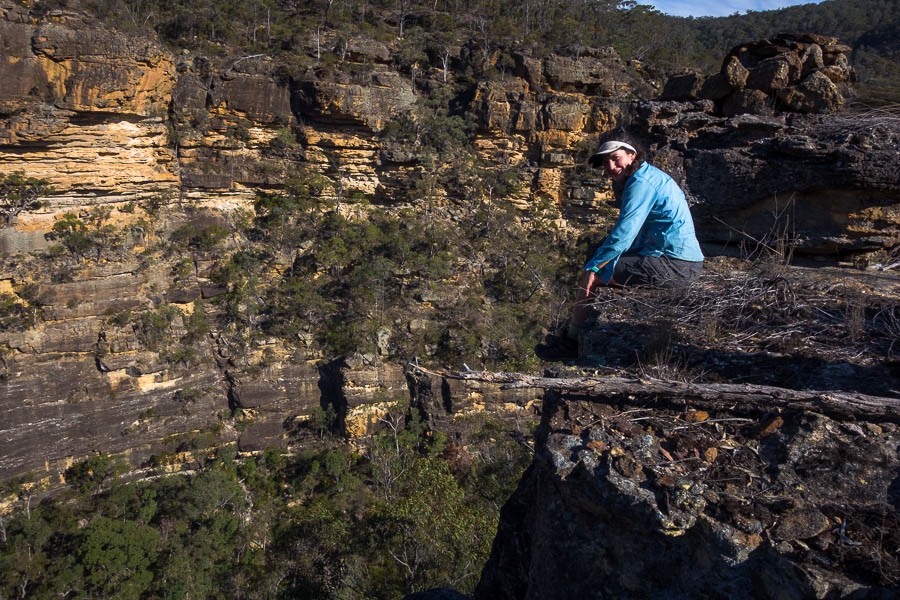
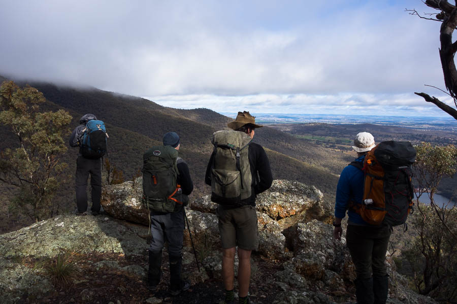
DSC02391

Morning tea views

DSC02393

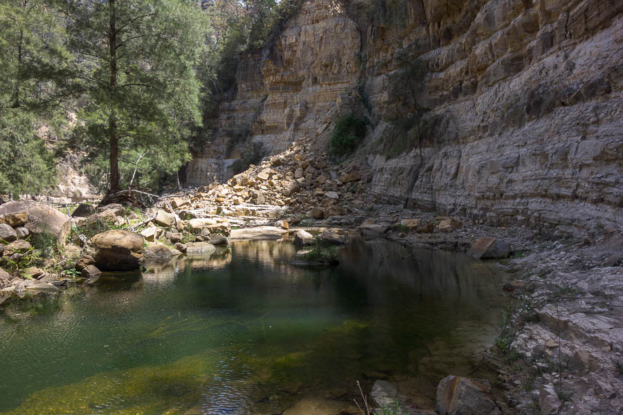
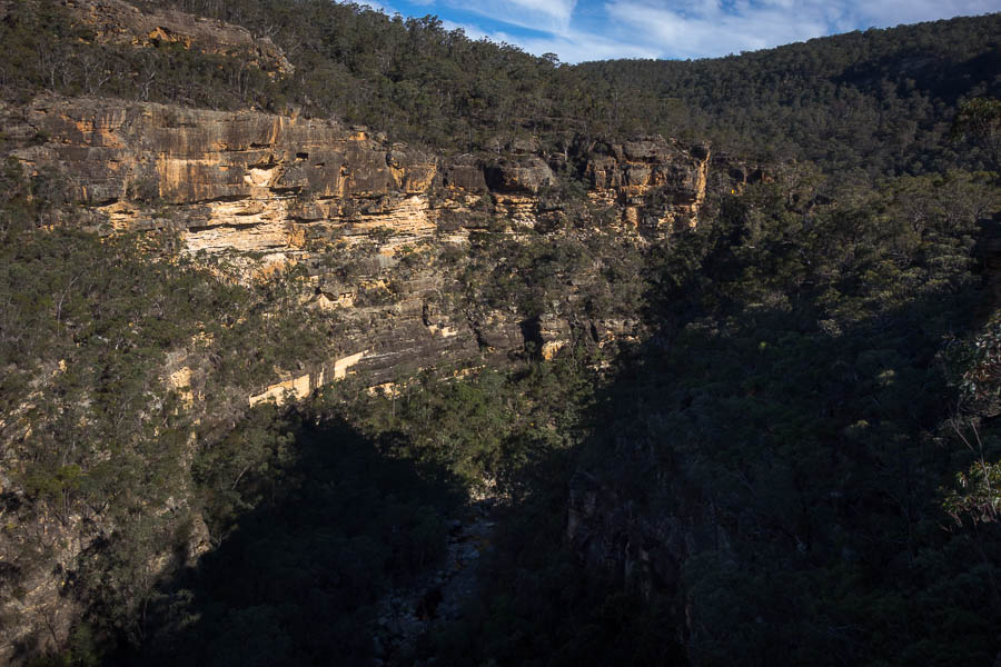
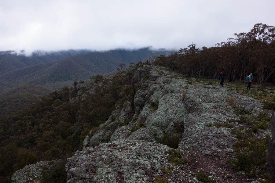
More speccy cliff lines

DSC02402

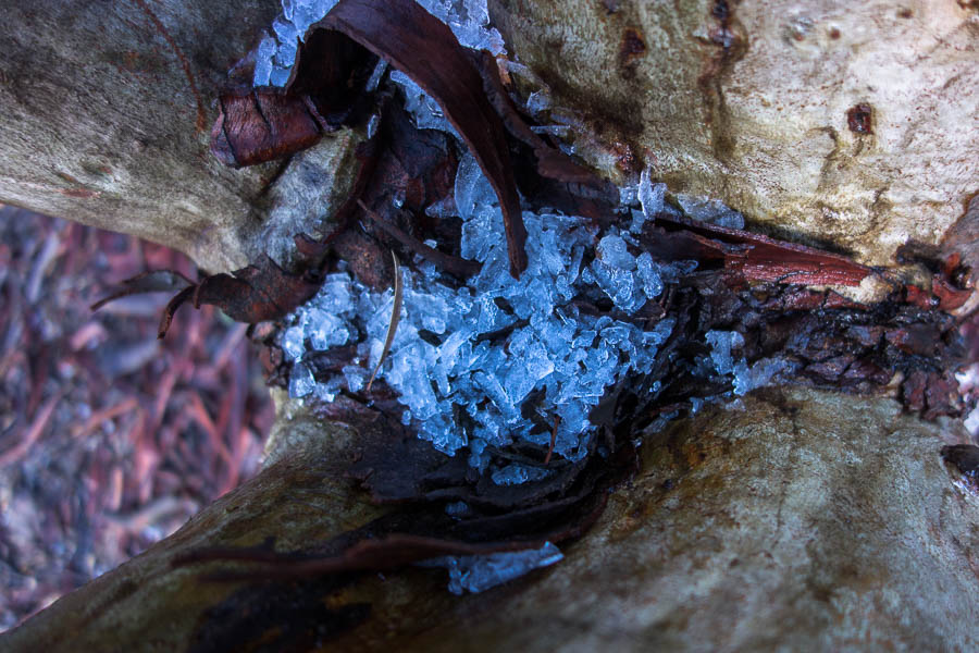
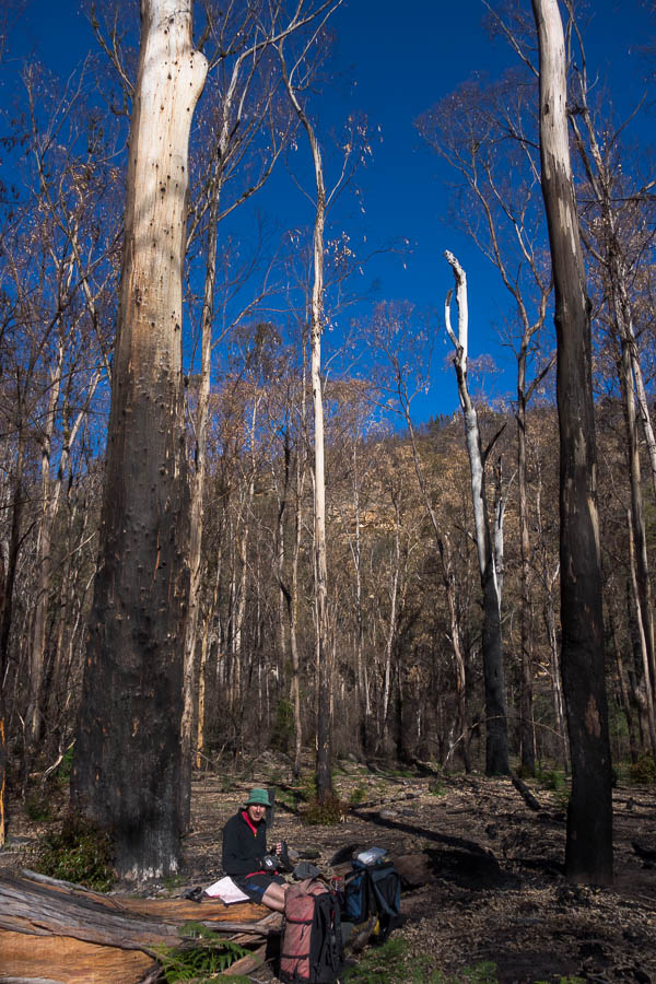
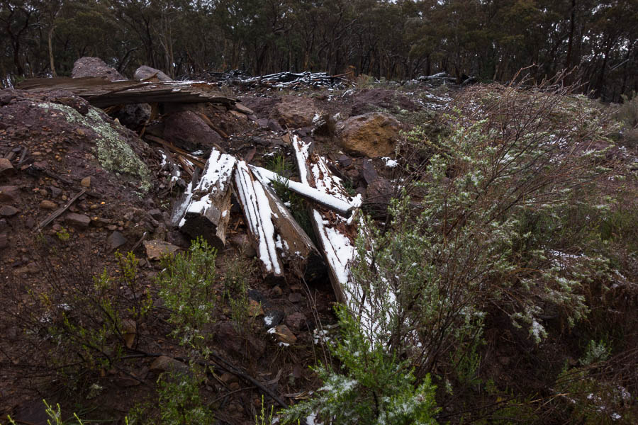
Remnants of the cold blast overnight

DSC02404

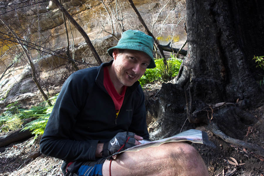
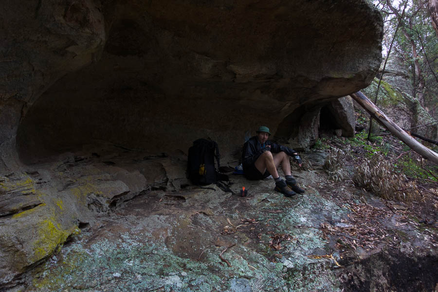
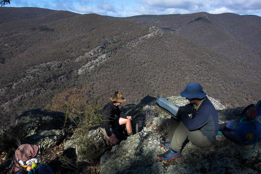
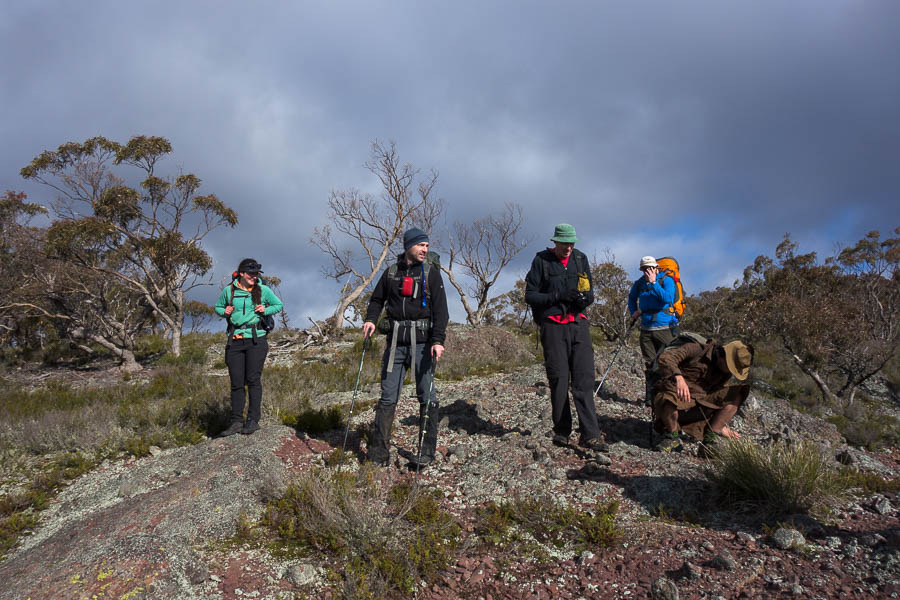
Looks like a serious discussion going on – without the leader!?

DSC02408

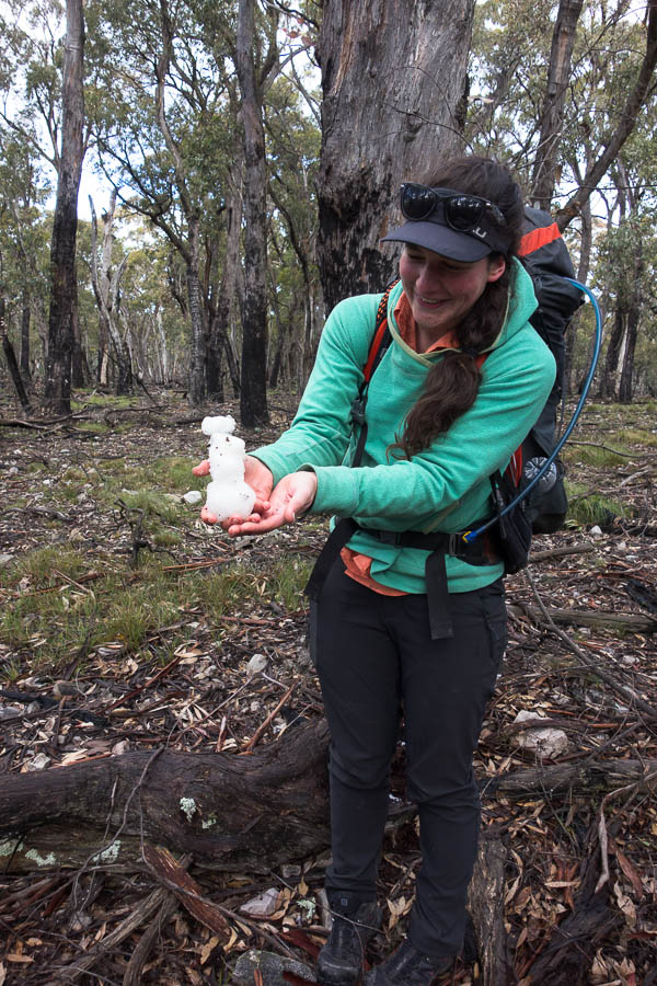
It’s not every trip you get to make a snowman
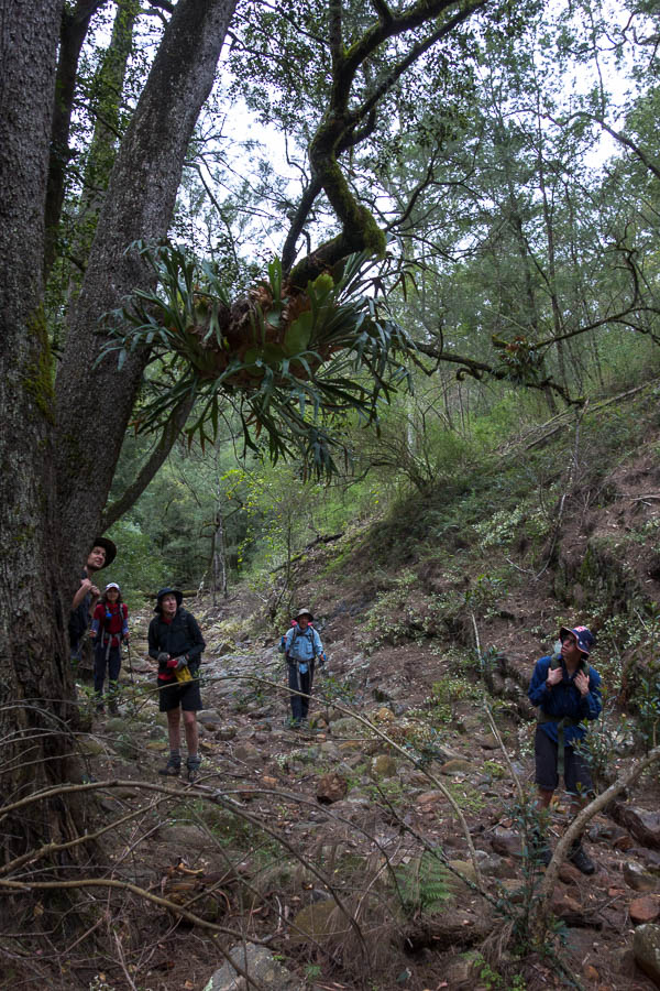
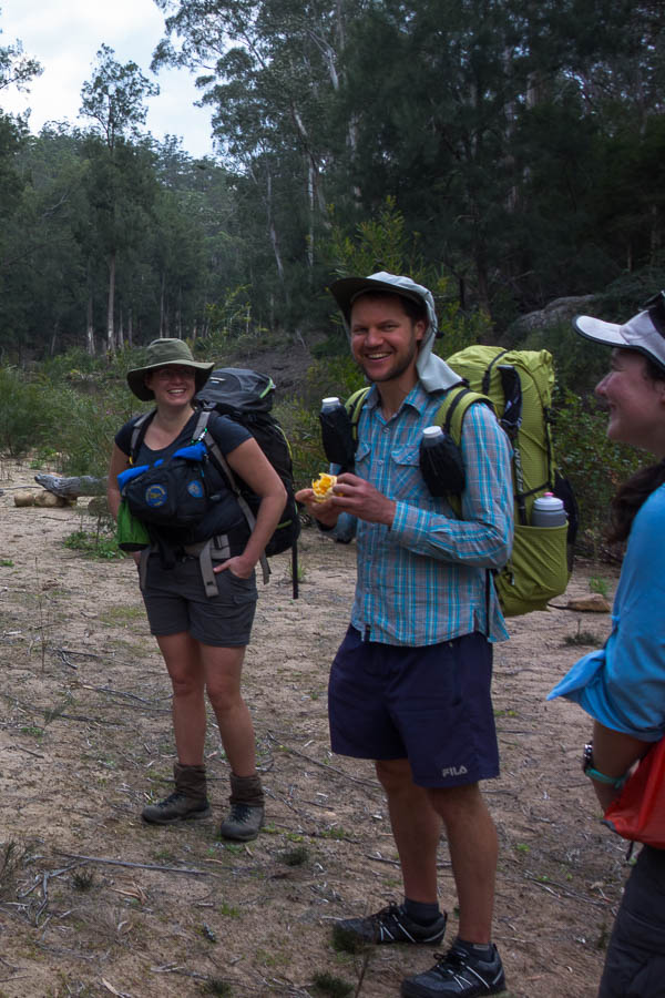
DSC02411

Most of the group

DSC02417

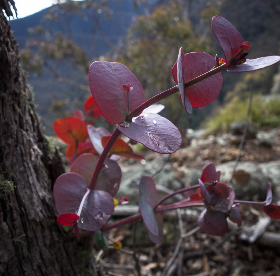
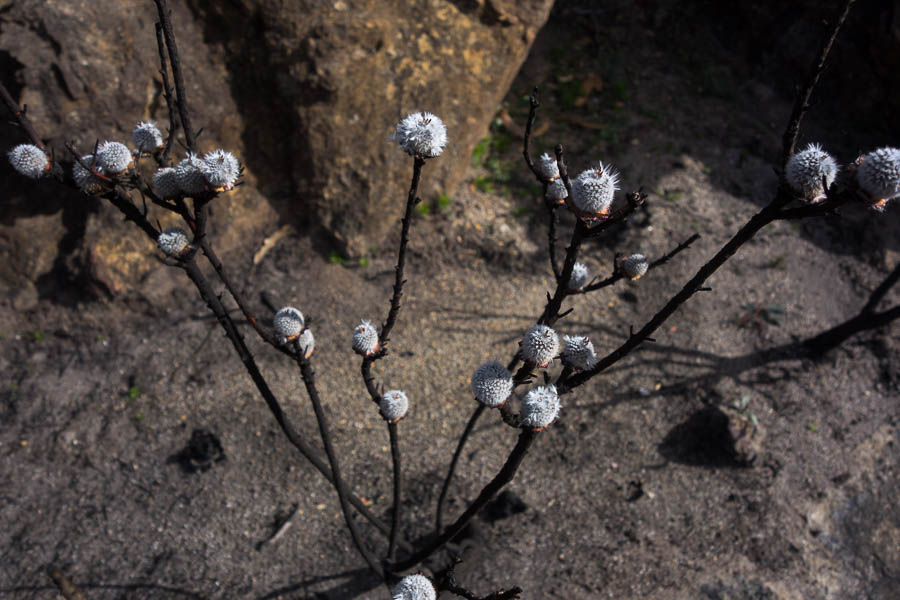
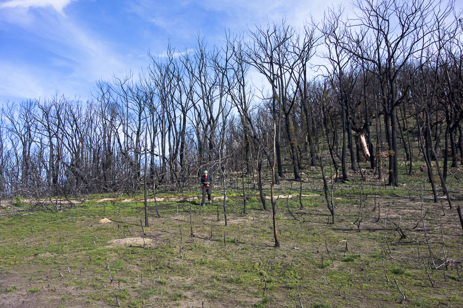
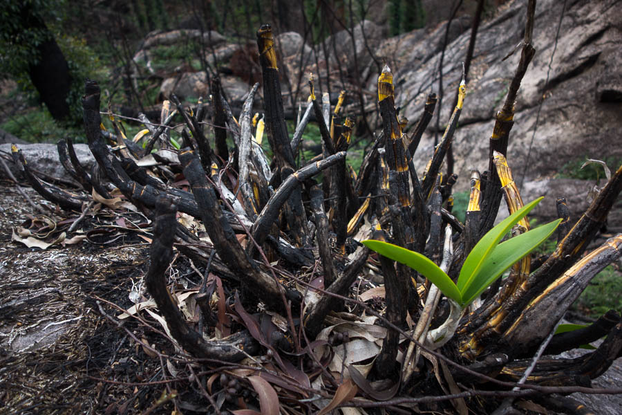
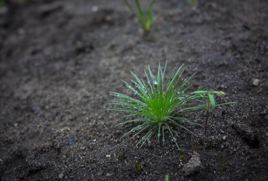
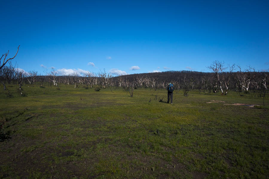
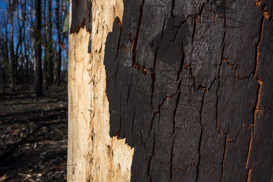
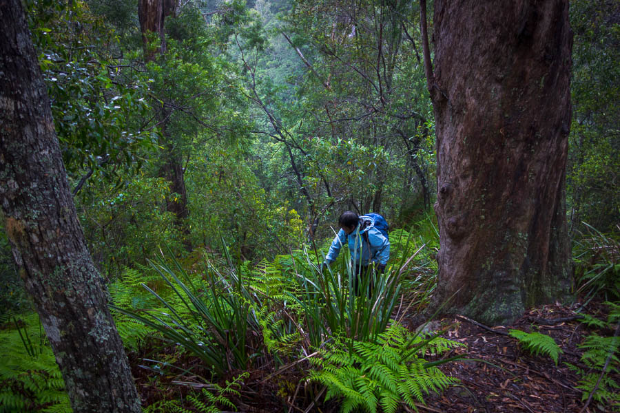
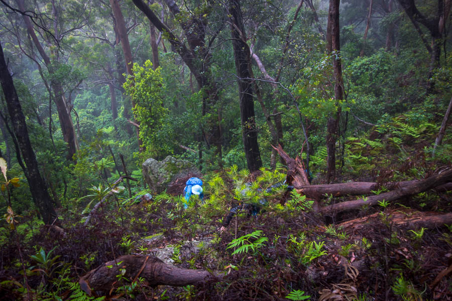
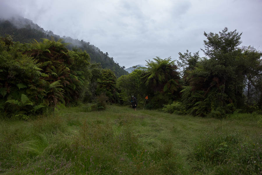
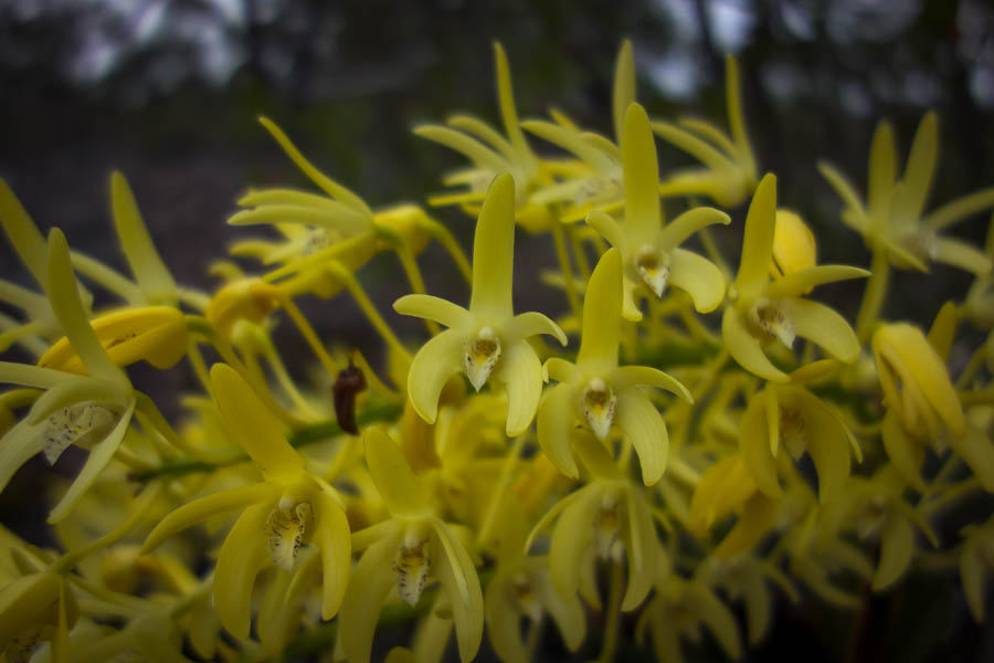
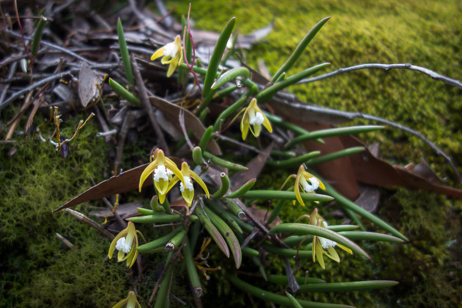
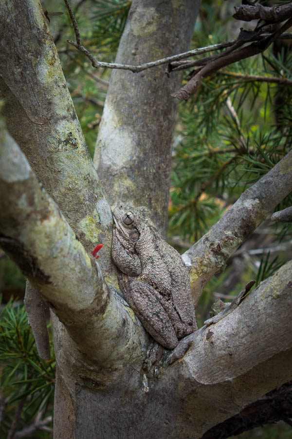
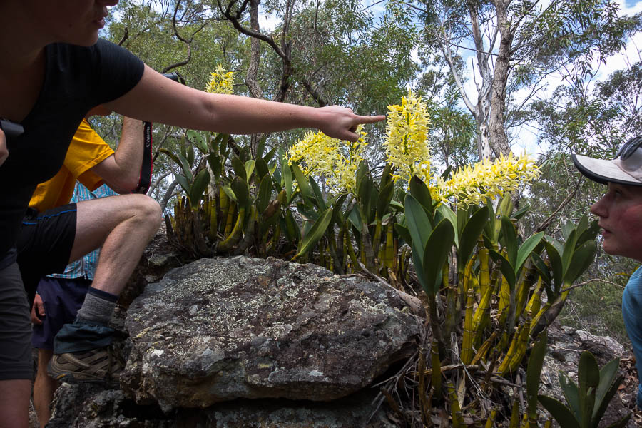
New growth – not sure why, this area is unburnt

DSC02418

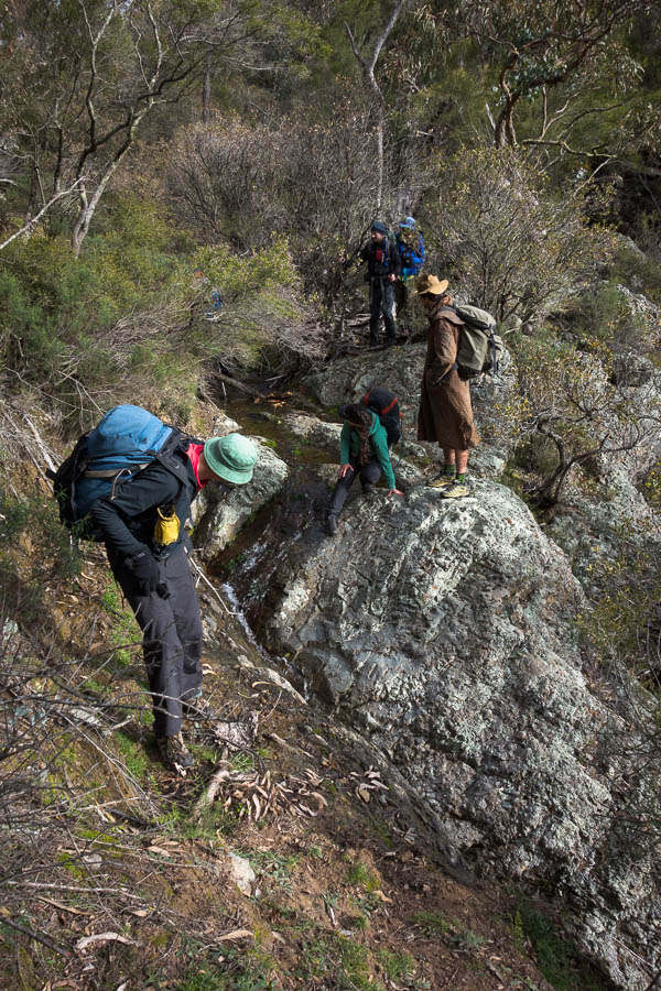
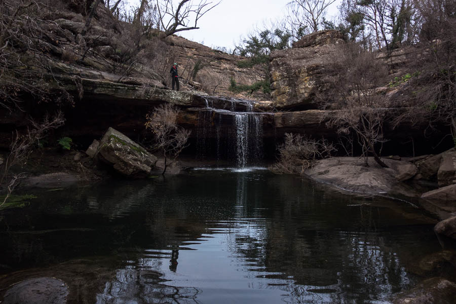
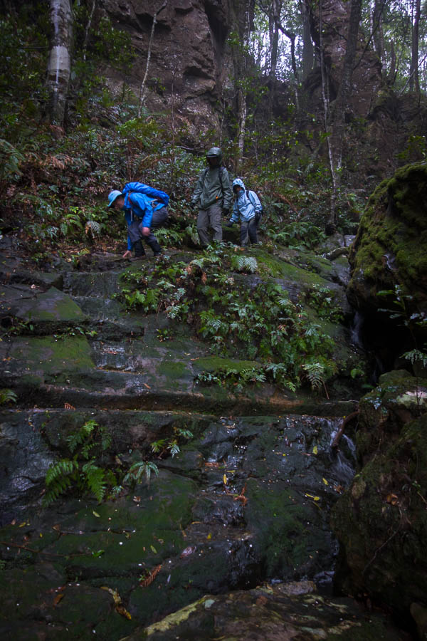
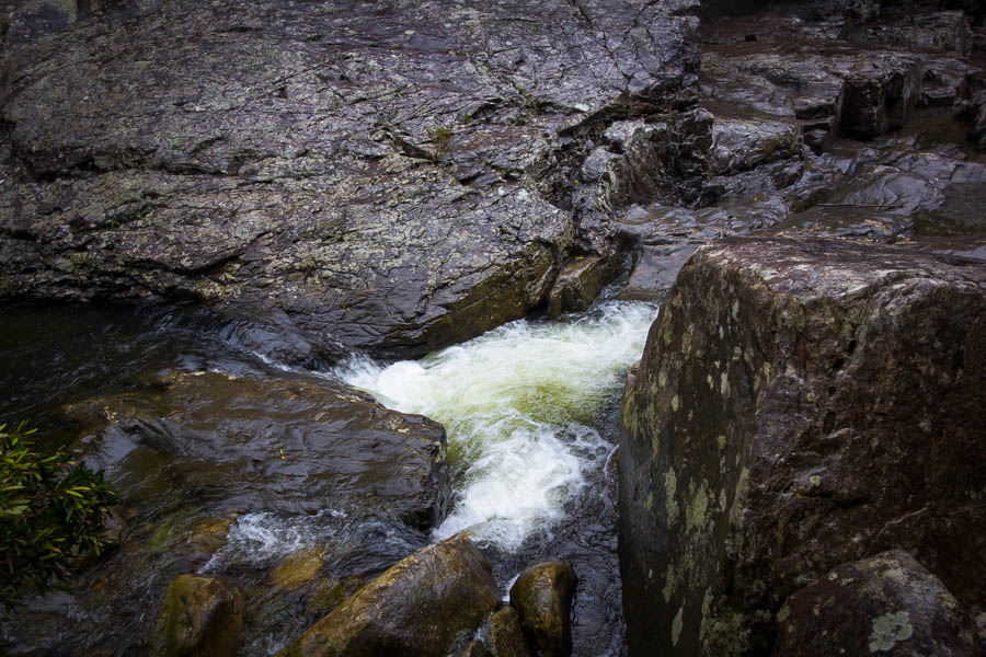
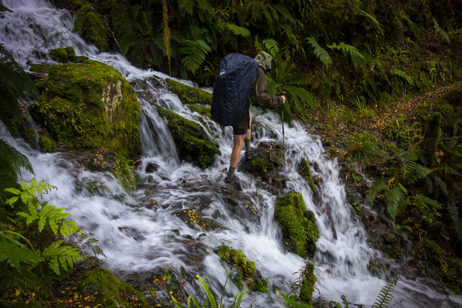
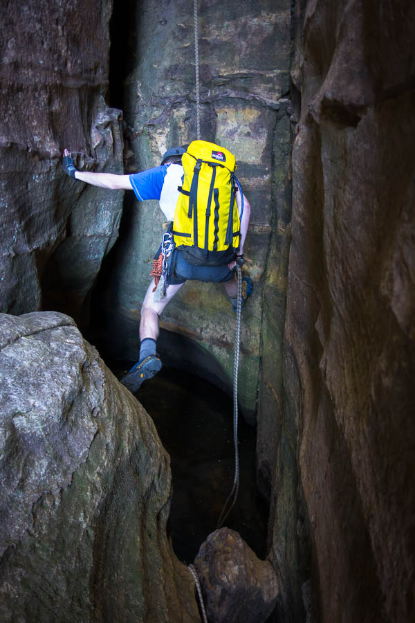
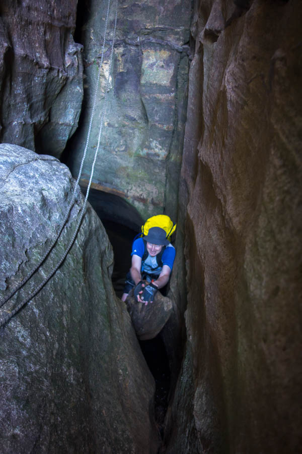
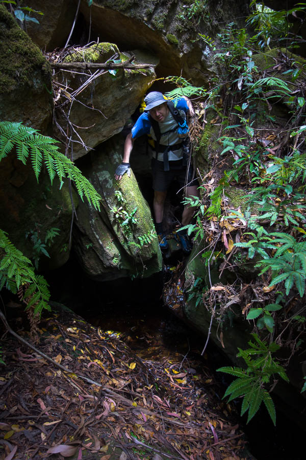
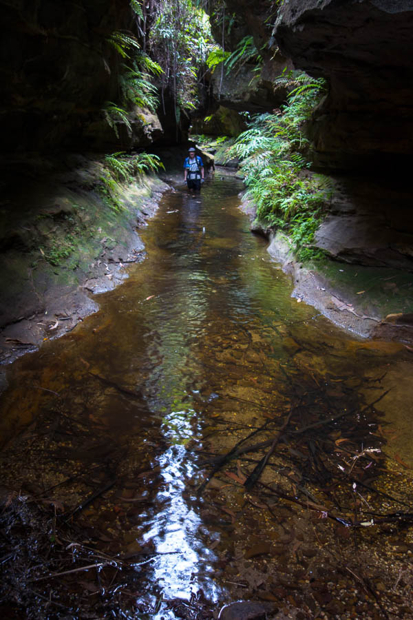
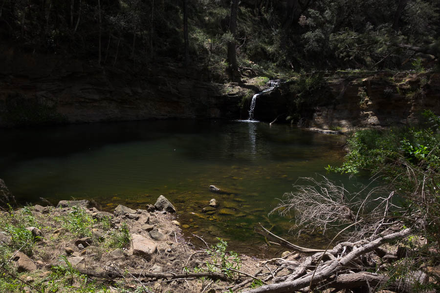
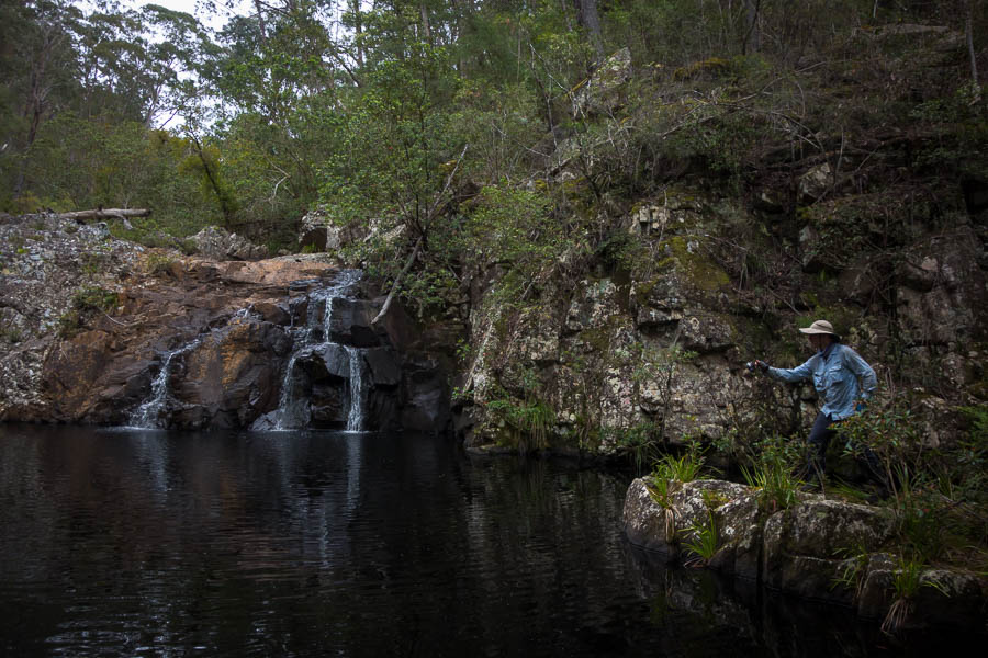
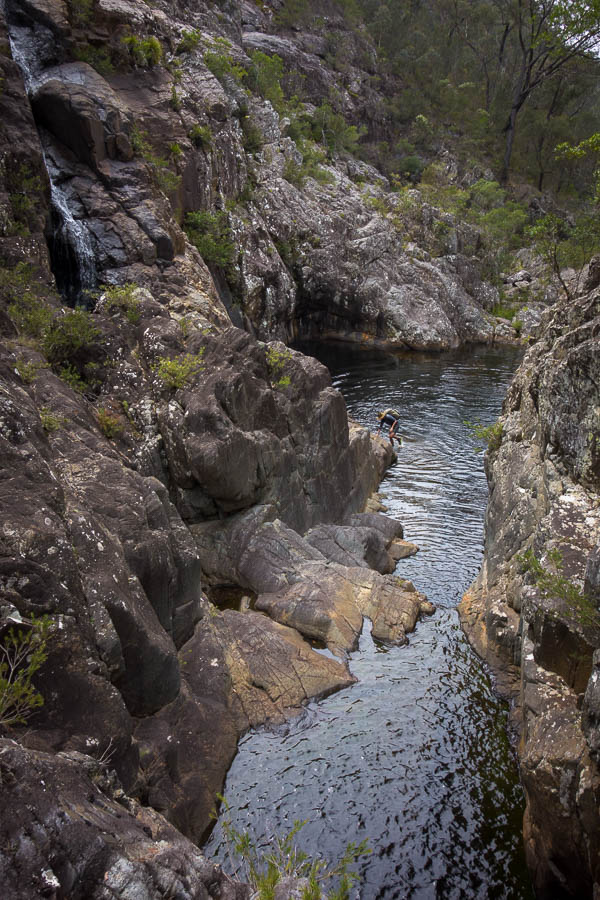
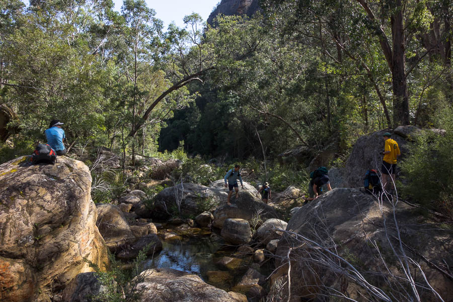
Crossing a slightly trickier creek/waterfall

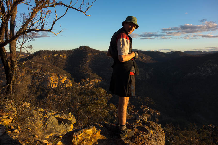
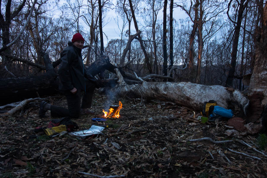
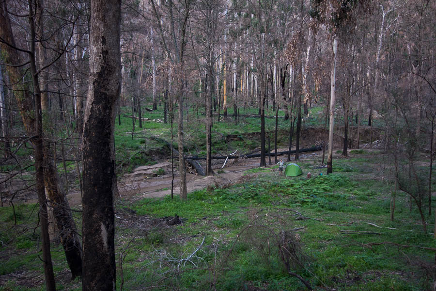
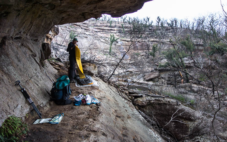
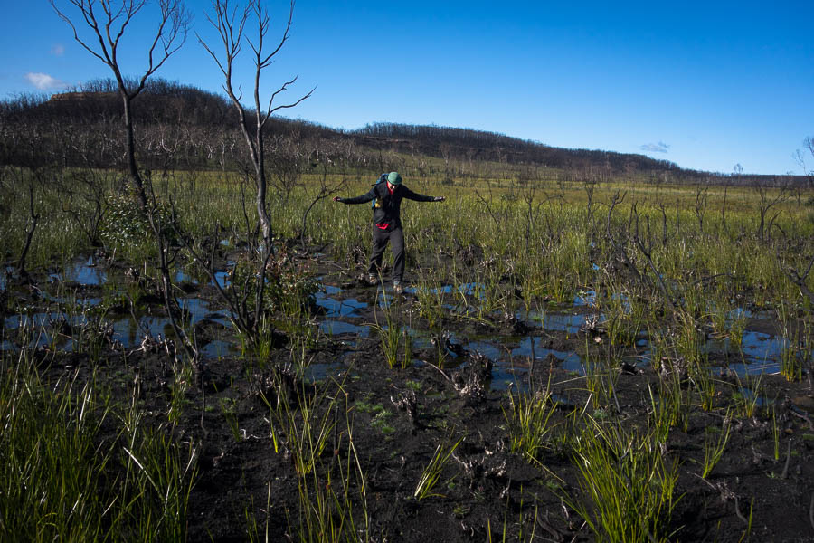
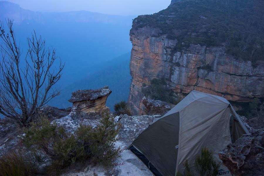
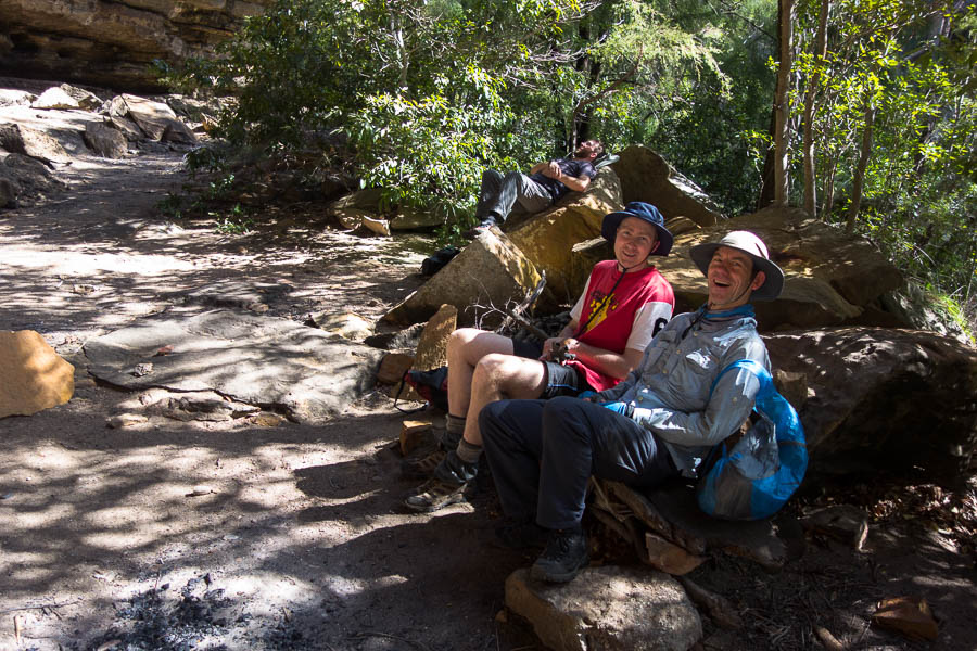
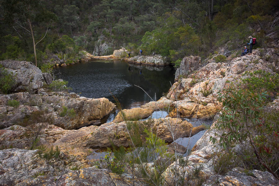
Arriving at a potential camp a bit too late for a side trip I had planned I ummed and ahhed about whether we would camp high. Having had some spectacular high camps recently I was keen on the idea – but also aware it was a lot colder than the previous weekends we had been out. In the end I decided it was a nice spot and I didn’t have a certain low camp spot in mind, so better to stick with a known one. Keen to keep moving to avoid getting cold everyone came on a water run despite only half of us needing water. There was no problem finding water in the creek we dropped into. We saw a wild dog (probably trying to catch a goat!) just before we headed off to get water so were glad to see our gear was untouched when we got back.

DSC02429

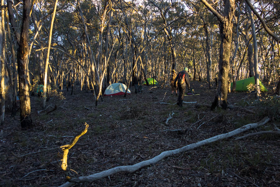
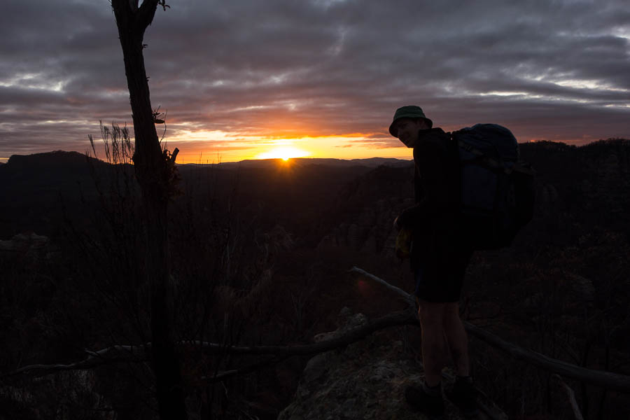
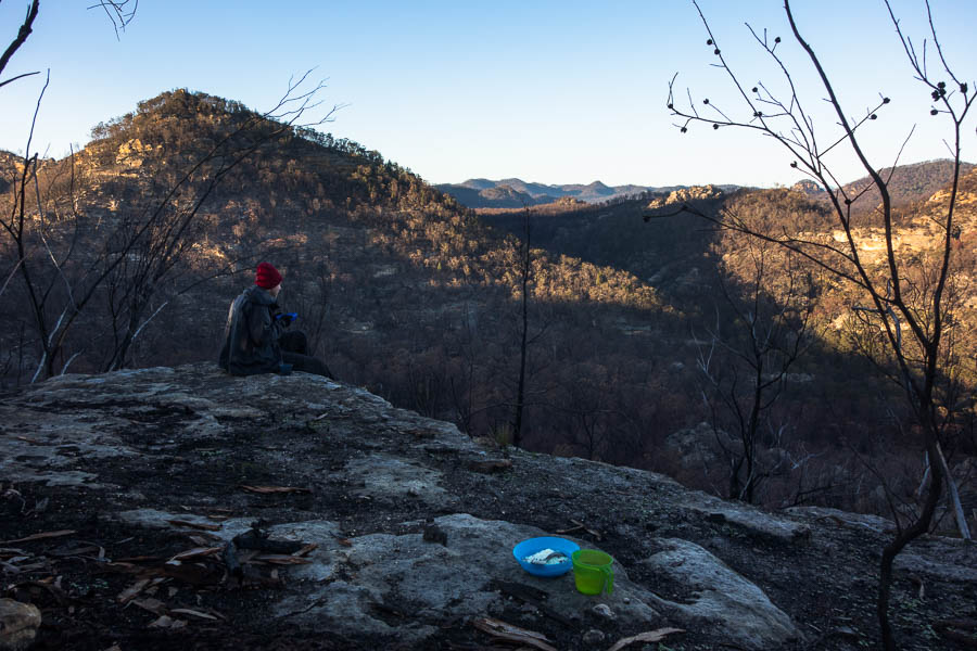
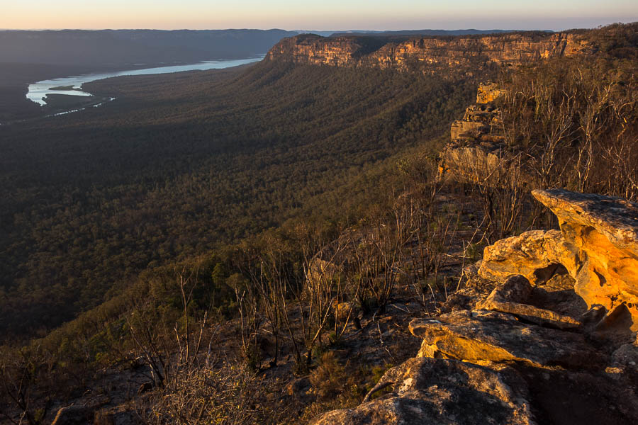
Late afternoon sun on our high camp

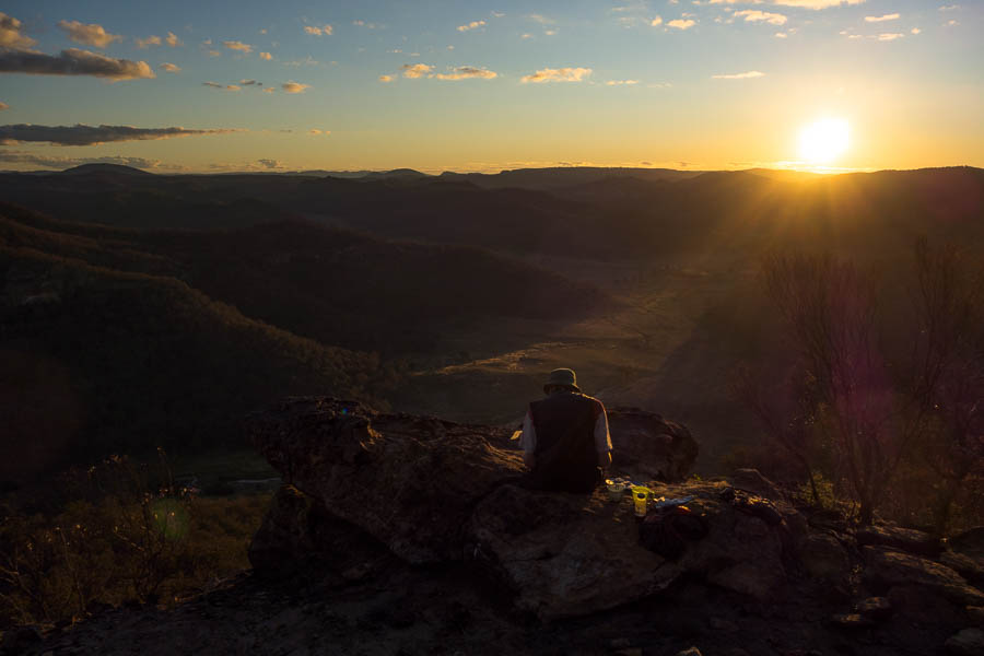
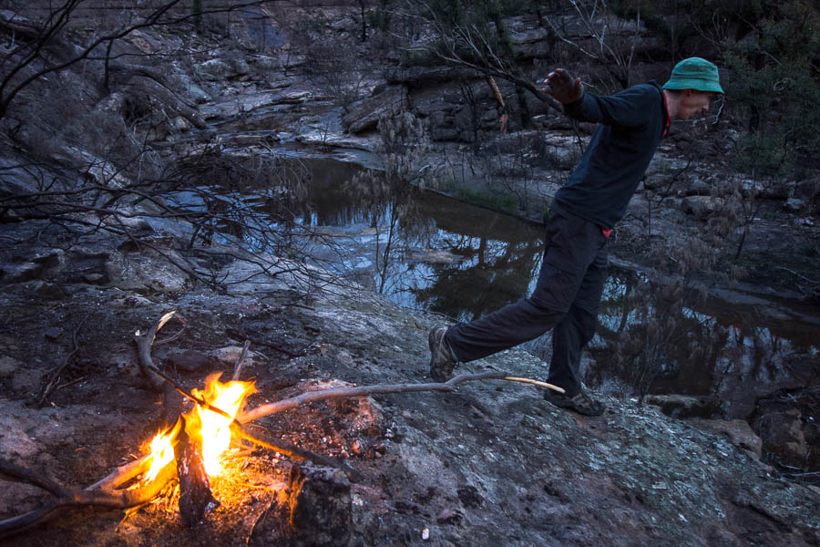
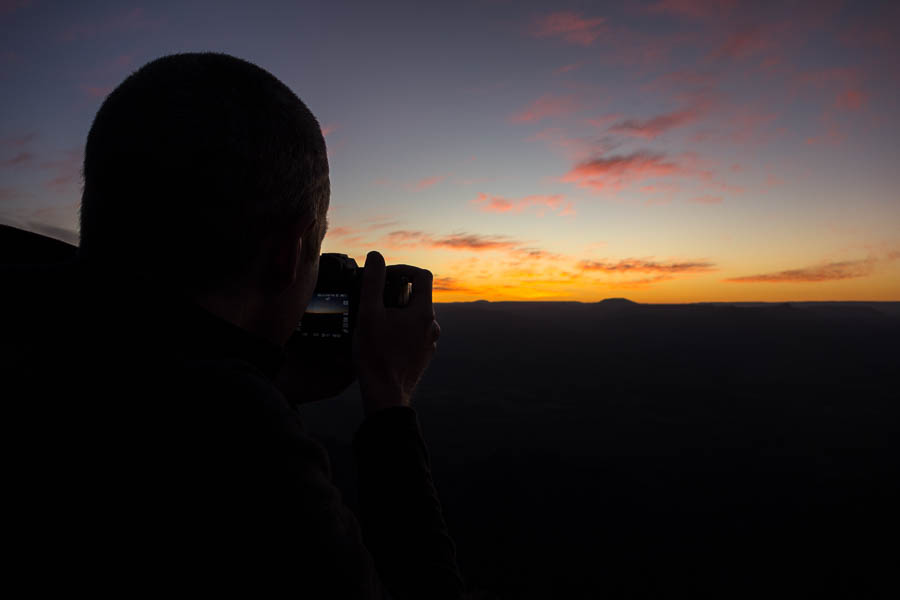
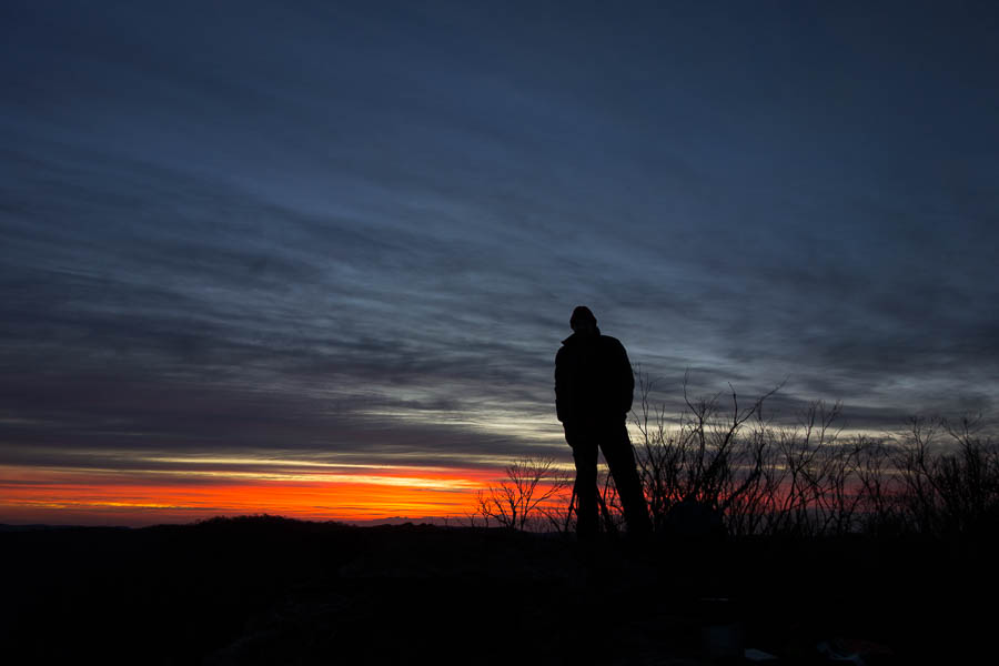
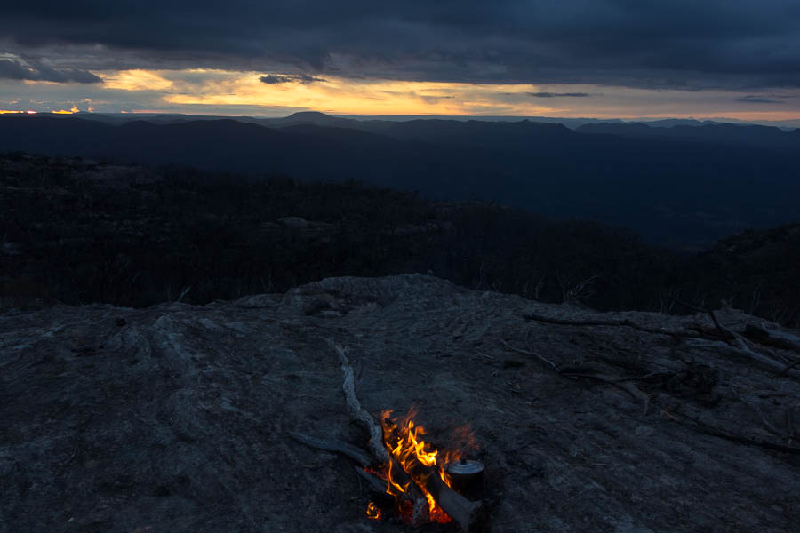
Getting back to camp it was almost sunset so we headed out to the cliffs. I had barely put together 3 crackers & cheese before my fingers could hardly hold the knife. The wind was biting and after about 10 minutes half of us decided we couldn’t hack the cold and headed back to the relative shelter of the trees.

DSC02430

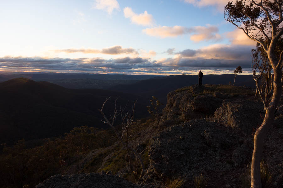
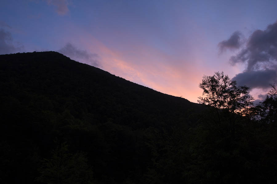
Sunset on the cliffs

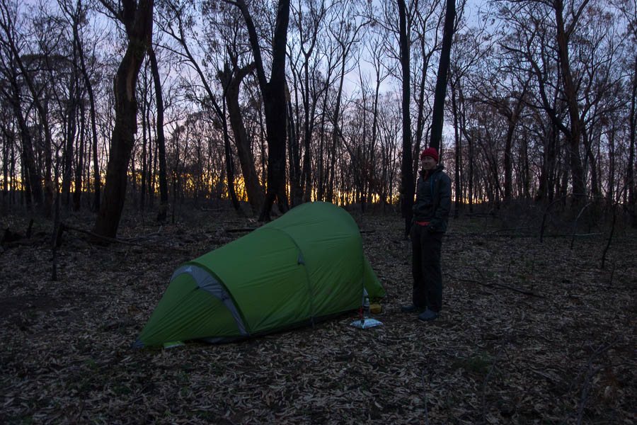
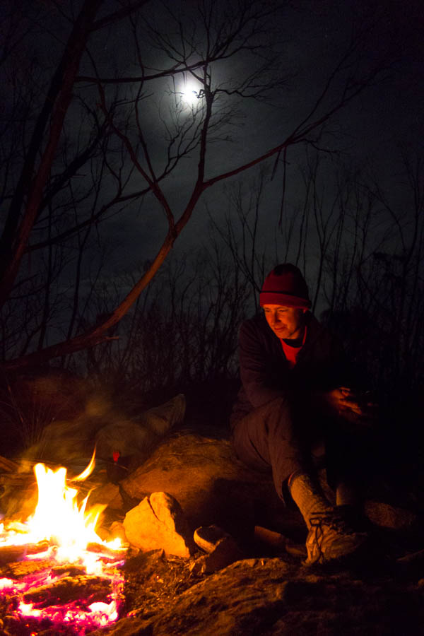
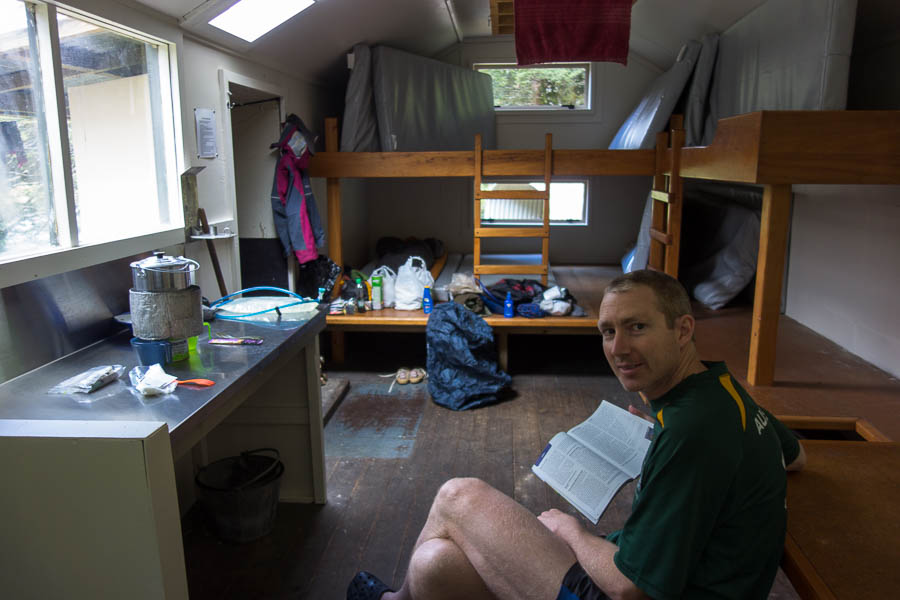
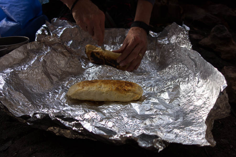
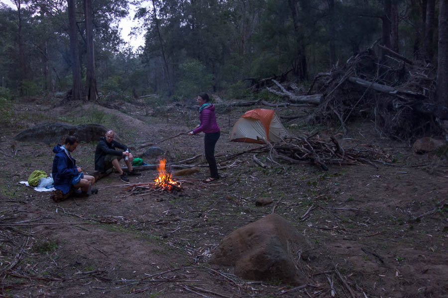
There was some grumbling about the lack of fire – they are not permitted under the Winburndale Plan of Management. Everyone had been warned in advance so should have come prepared. Gas canisters were being nursed inside our down jacket to improve their performance. Vivien’s metho needed the same treatment as it wouldn’t light initially. There were some very early retirements to bed and sleeping bags to try and get warm. Alex, in somewhat typical fashion, had forgotten his usual sleeping “mat” (ratty piece of foam). Fortunately for him Vivien had gone exploring when we first arrived at camp and miraculously found an almost brand new compact foam mat in the bush.

DSC02434

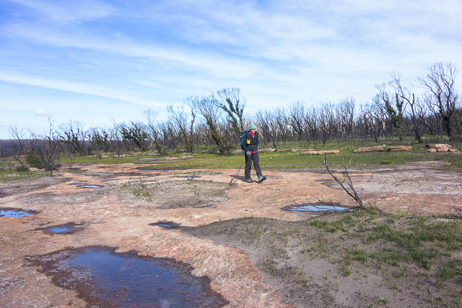
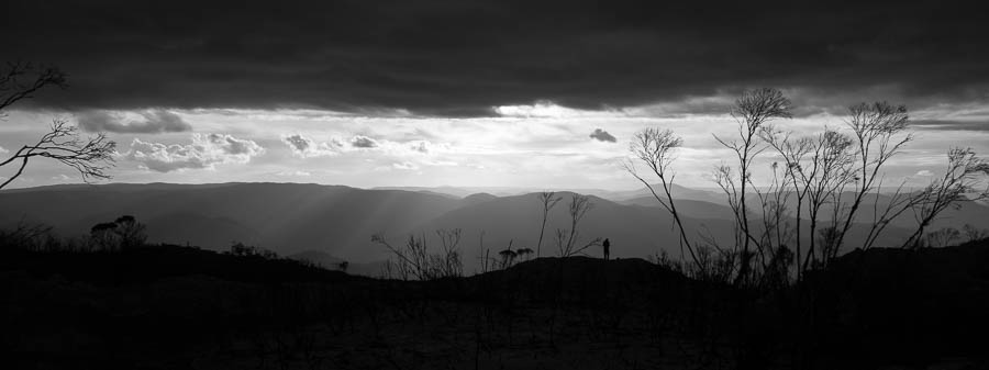
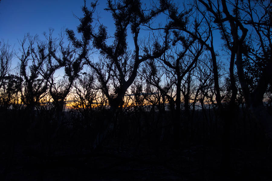
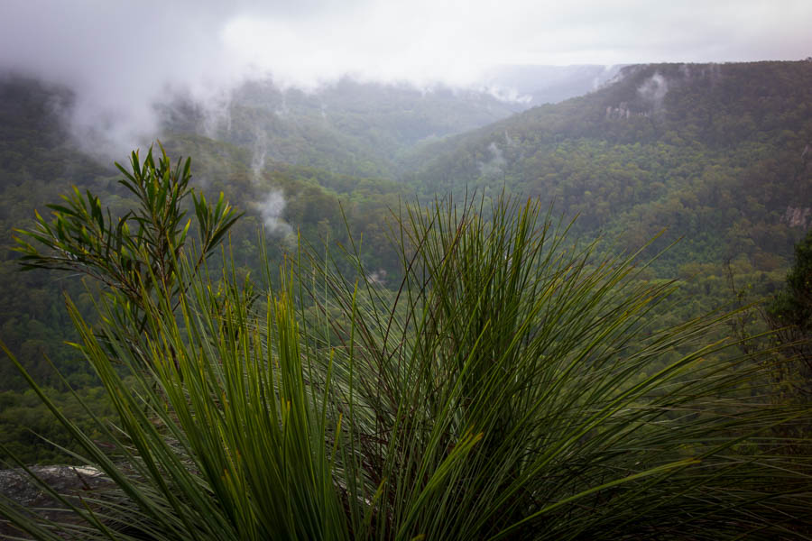
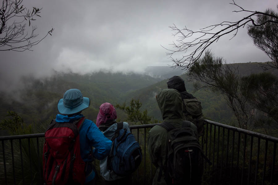
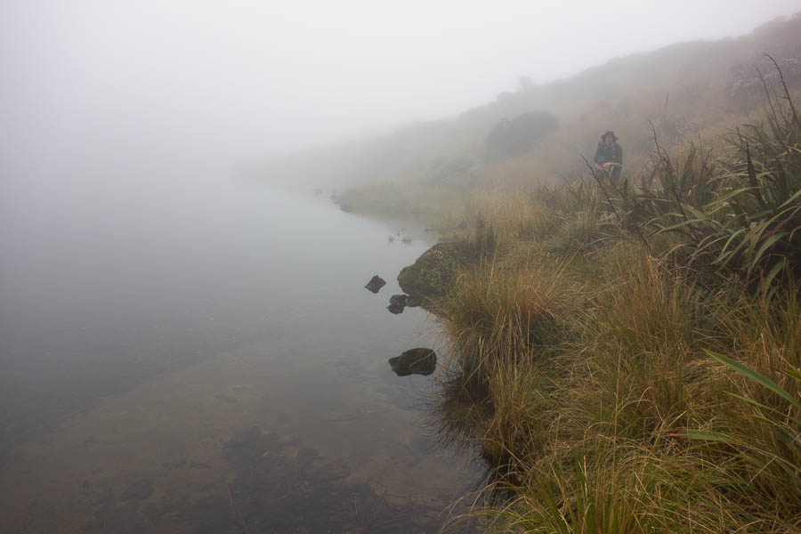
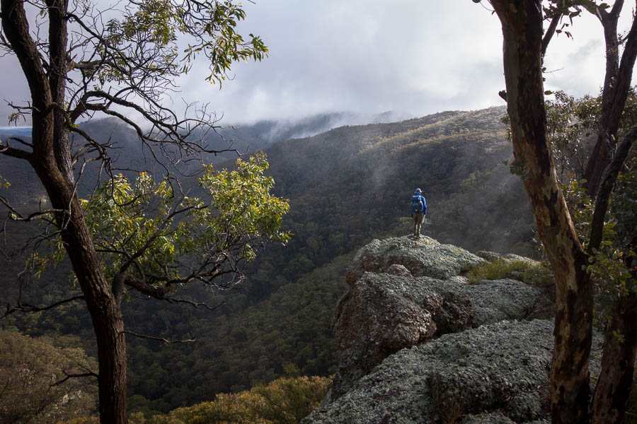
Next morning exploration in the cloud

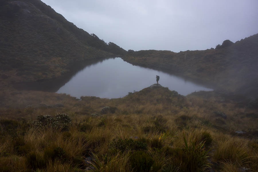
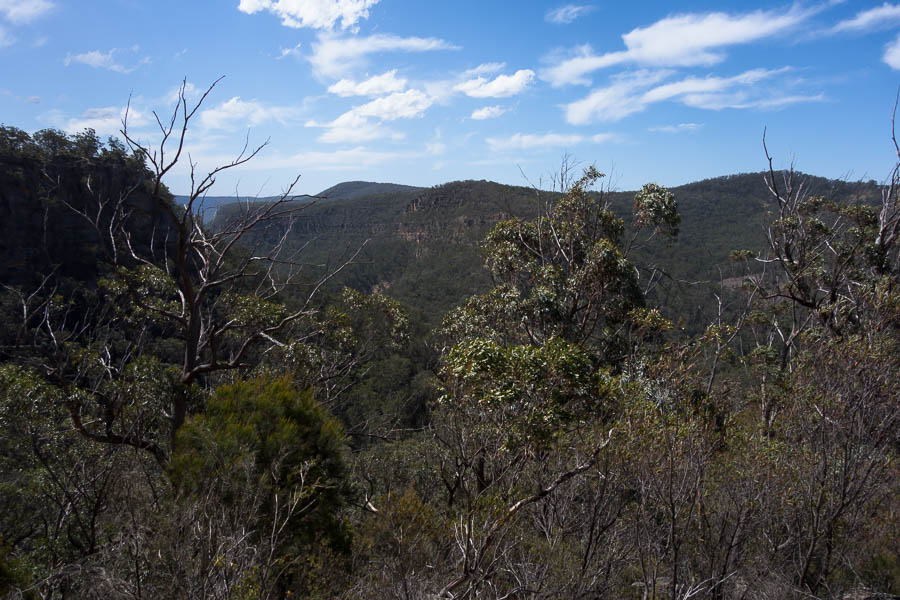
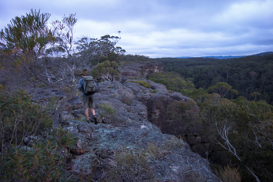
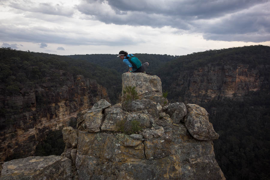
I think we all had a fairly cold night, and getting up wasn’t a particularly enticing idea when we were engulfed in cloud. The advantage of not having a fire was that I felt no guilt in boiling the billy in our vestibule and having coffee and breakfast in the tent. I replanned the route given the weather. I ditched a loop to the north and added few more fire trails instead of creeks given the general damp feeling. Vivien & Lauren suggested we go for a short walk along the cliffs as there were good views (or had been the night before!). We started off in the cloud with no views but by the time we got to the edge it had lifted enough to see what was out there.

DSC02435

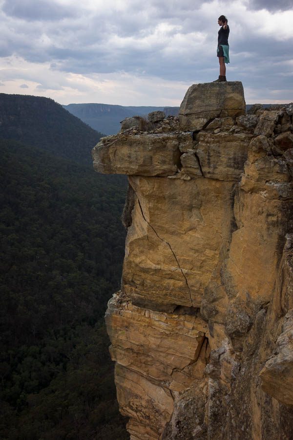
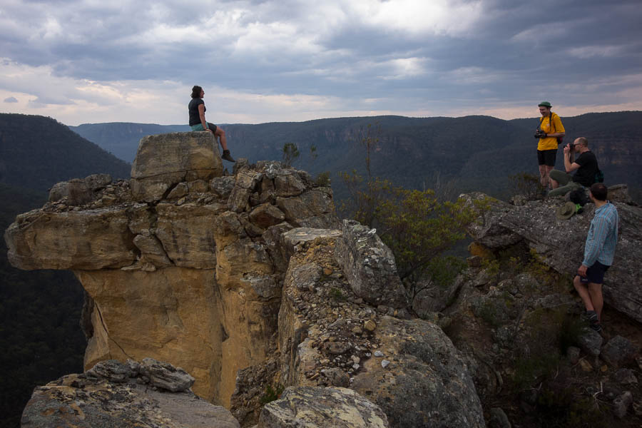
The cloud starts to lift so we get some distant views

DSC02440

Much clearer!

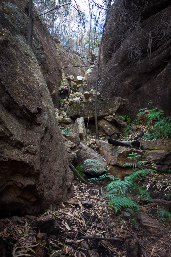
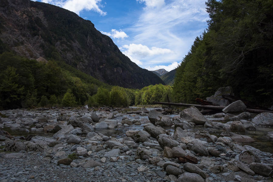
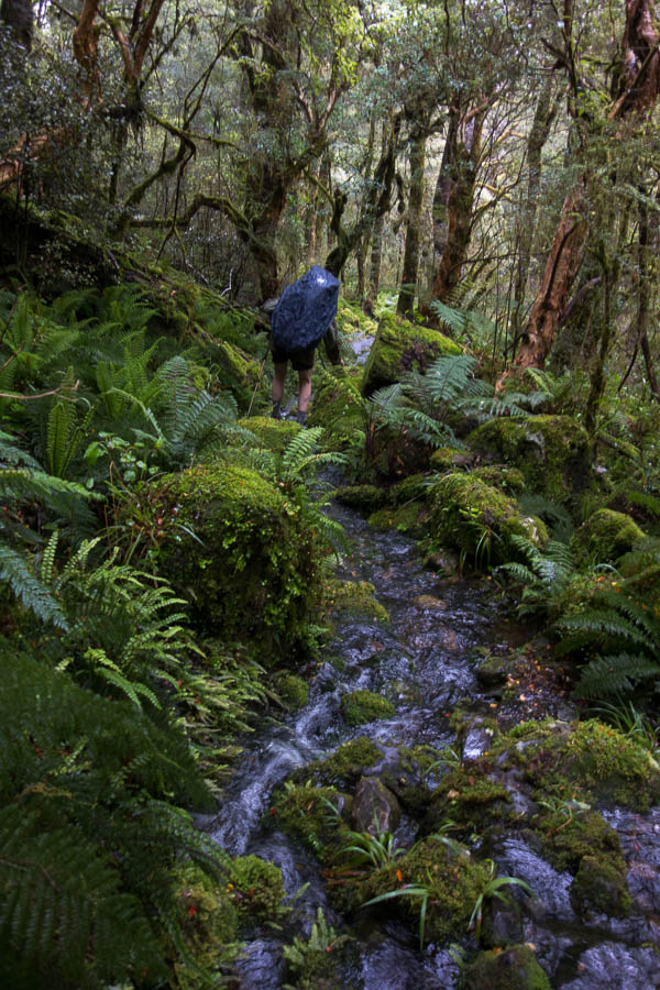
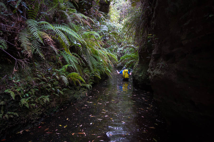
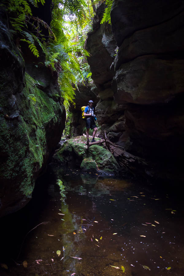
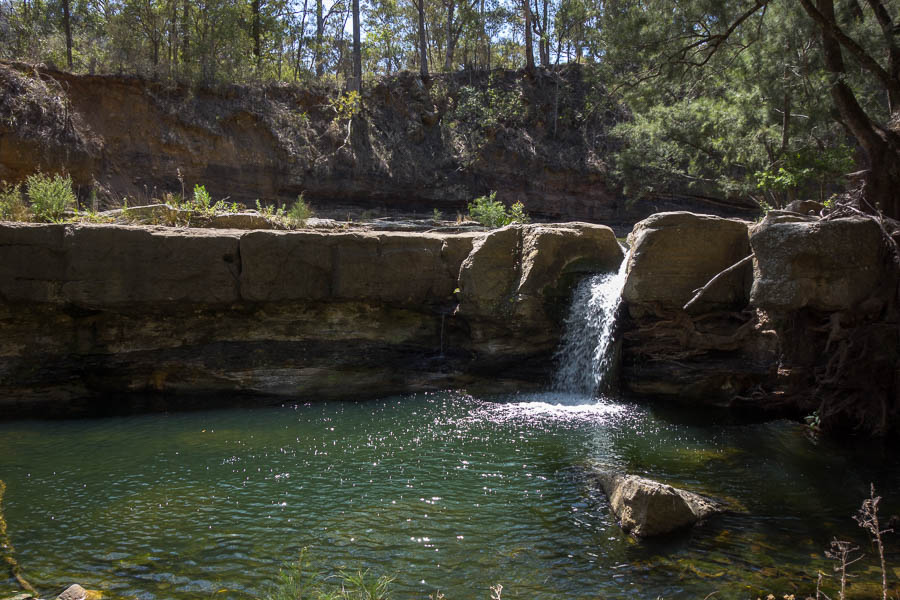
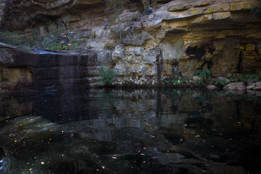
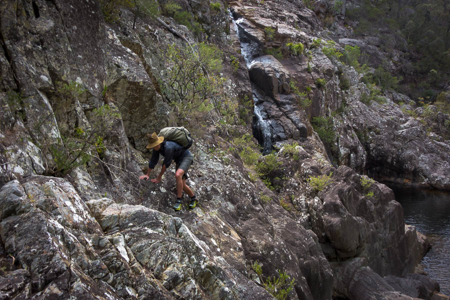
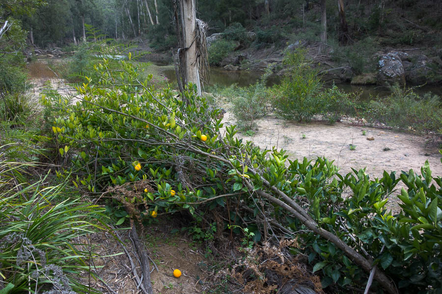
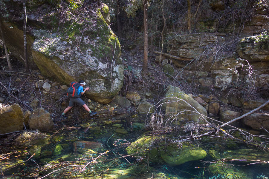
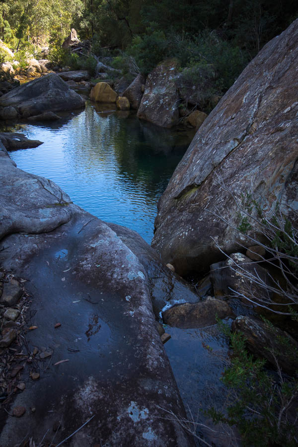
Back with our packs we headed off soon heading down, down, down into a creek. Being the upper reaches I wasn’t expecting much but it was flowing and had some interesting conglomerate rocks in it. There were some helpful wildlife tracks along the edge but after a few hundred metres I decided we’d seen enough and headed up a spur to meet a fire trail.

DSC02444

Alex in Middle Arm Creek

DSC02446

Following (literal) goat tracks along side the creek

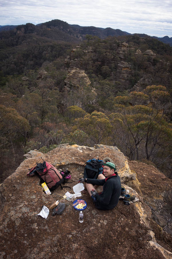
We had a short morning tea at the top, the cold didn’t lend itself to lingering, then followed the fire trails for a while.

DSC02450

Some steep firetrails!

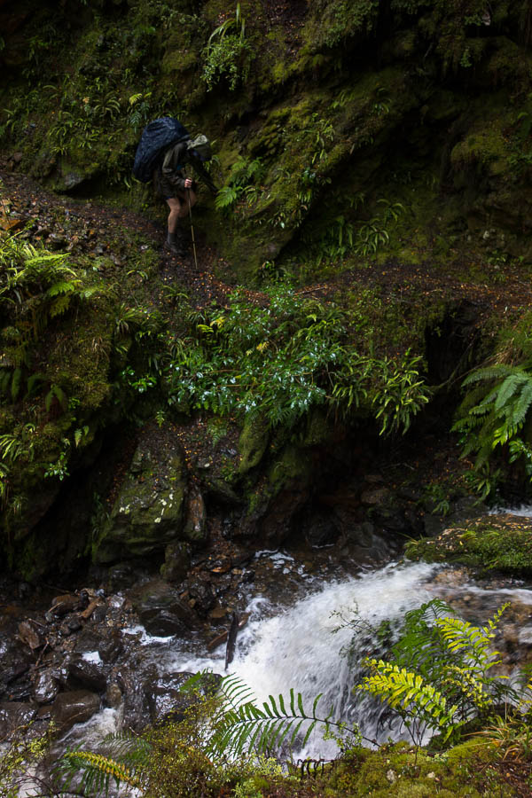
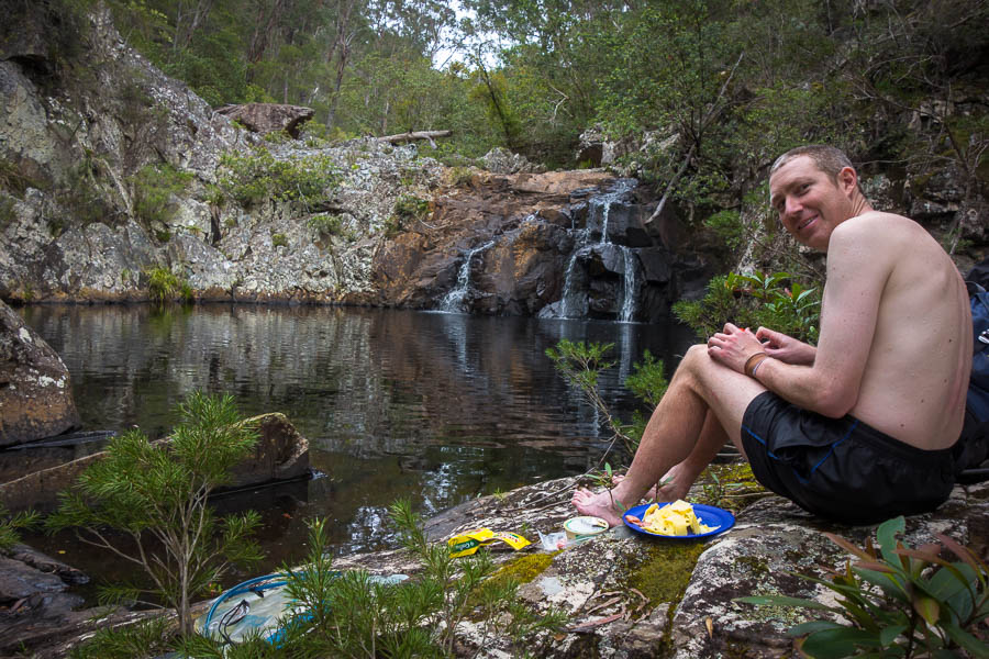
Eventually we headed off the fire trail down a spur. It wasn’t that steep but after several descents already in the trip I think most of our stabilising muscles were protesting from lack of use. Finding a lovely lunch spot near the bottom my legs were glad for a break.

DSC02453

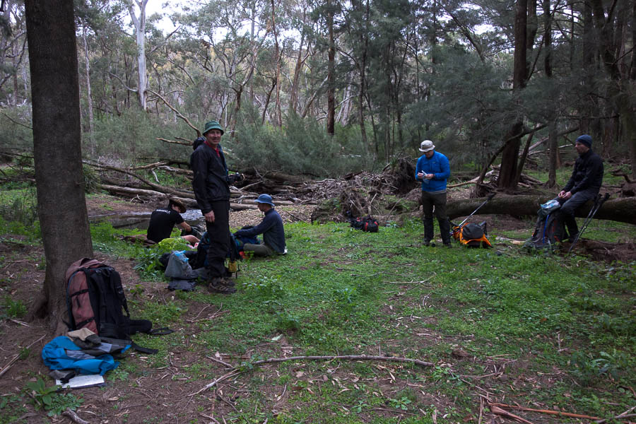
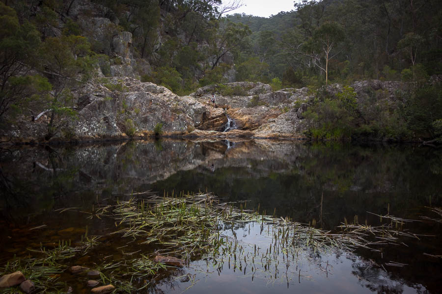
Lovely lunch spot next to a babbling brook

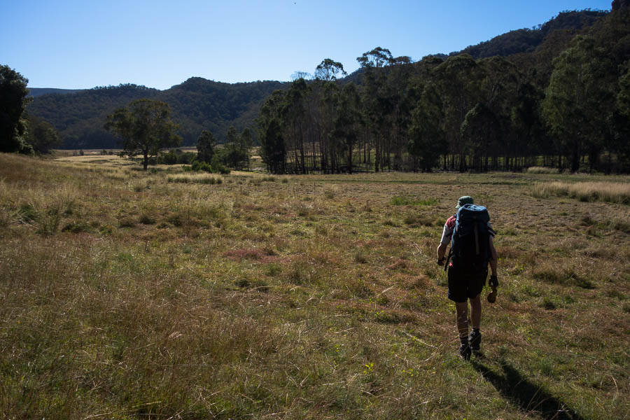
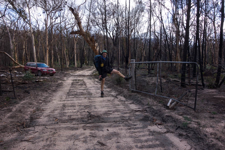
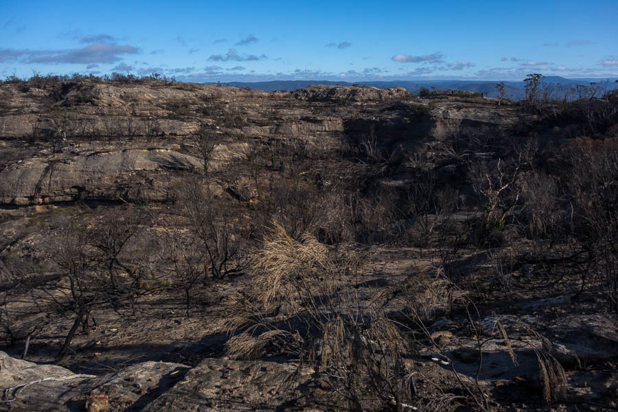
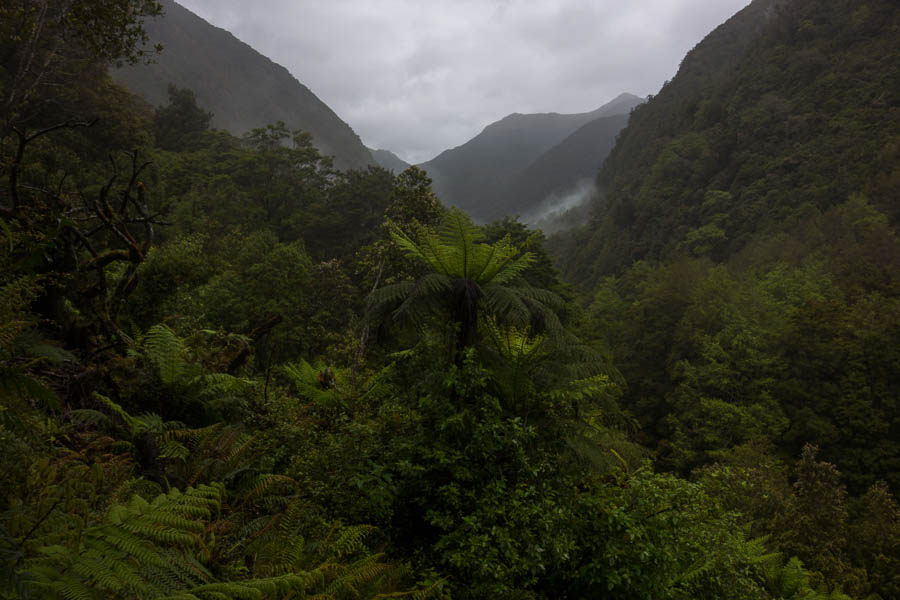
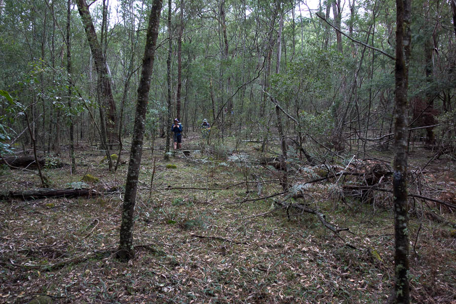
From there it was one more hill back to the cars for a mid-afternoon finish. Winburndale is unburnt, beautiful bushwalking country – very little scrub, mainly open eucalypt forest. There’s definitely a few more adventures to be had there – hopefully in slightly warmer weather though!

Bylong Labyrinth (18-21 June 2020)

My employer “asking” me to take 4-5 days of leave a month to assist with the economics of Covid provided a perfect opportunity for a 4 day walk. Initially I’d thought Nattai or Morton but having been there the previous 2 weekends we decided something a bit more unachievable for a standard weekend was needed. Tom suggested the Bylong Labyrinth which fitted the bill being a longer drive than we’d normally contemplate. Unsurprisingly there weren’t any other takers so it was just me and Tom who left Sydney early on Thursday morning.

The trip had a fair amount of adversity in it, and it started during the drive up. We passed the Wallerawang Power Station to find a barrier across the road. The Castlereagh Highway was closed near Ilford due to a semi-trailer crash, we’d have to get to Rylstone via Glen Alice. So somewhat later than intended we left the car at 11am.

Walks in previous weekends had shown that there was plenty of water around. Rock pools with water had been in abundance on the tops in the Nattai. We knew the Bylong area was problematic for water but given our heavy packs at the start of 4 days we opted not to load up on water at the start, hoping we’d find some.

We skirted around the first pagoda and then some grunt work got us up onto the start of the range we hoped to traverse. Things were quickly more technical than anything done in the prior weekends, with pack passing and exposed scrambling. Soon we arrived above a saddle. Unfortunately it was a reasonable drop to get into the saddle, and we couldn’t see any other ways to get down into it. The lack of suitable anchors was a moot point since the rope we had with us wasn’t long enough to get down anyway. Retracing our steps we didn’t find anywhere we could drop down and sidle, so it looked like going back to the bottom and skipping this section was our only option.

DSC02237

Scrambling on our initial ridge

DSC02239

New growth following the fire

DSC02240

Pagodas galore

DSC02242

Retreating off the ridge

Bylong Labyrinth 1 – Tom & Rachel 0

Having accepted defeat we had lunch before dropping back to the valley floor. It was a warm day and the pagodas didn’t seem to form pools so there had been no water on the ridge. Water was needed before the end of the day. Given our circumstances we opted to follow the dry creek until we found water. The walking was relatively easy and we covered the ground quickly until we reached the spot Tom had expected water might be above ground. There was water. Yay!

DSC02243

Looking at alternative plans (lipstick completely unintended!)

We found a cleaner flowing source in a small side canyon, so after an explore downstream we sculled a few cups each, then filled up with enough to get us through the night and part of the next day.

DSC02245

Our tiny canyon with flowing water

DSC02246

Tom launches himself onto sand… I mean into quicksand

It was a slog up the nearby spur to get back onto the spine of the main ridge we had been spat off earlier in the day.

DSC02249

Slogging back up onto the ridge

Late in the afternoon we viewed the main top we were hoping to camp on. The ascent options looked somewhat imposing but a treed ramp had promise so traversing under the cliff line we sought a way through the cliffs. As we approached the ‘treed ramp’ it became clear it was more of a slopey rounded cliff line. No go. Then we attempted to get to the point. Massive drop-offs. No go. Retreating as the sun rapidly approached the horizon we had another look at a couple of options we had walked past earlier. Maybe one of them was doable, but we were running out of light and retreated back to the saddle and sought out a flat-ish space that would fit the tent.

DSC02252

The sun is setting why have we still got packs on?

Bylong Labyrinth 2 – Tom & Rachel 0

We watched the sunset before settling on a slopey spot for the night. It was a very still night and pleasant around the campfire, though I was exhausted after our early start, the warm day and challenges we’d encountered.

DSC02258

Our slightly slopey site the next morning

DSC02261

But it did have good breakfast views!

The next morning we had a look at the alternative ascent options in the light of day. If we traversed in the opposite direction maybe we’d find a way up. But after the fires there were few trees and on the slopes everything was loose, rocks were de-laminating, and in the end we decided to give up on the mountain and find a way around it. Tom had intended us to drop into a gully, but I led us down the ridge we’d come up the day before. Assuming we’d be able to drop off the side of it as we descended Tom wasn’t too fussed about my route choice. We kept hopefully walking the right-hand side looking for a ramp down, but nothing except cliffs. Eventually accepting defeat we just followed the spur all the way to the base – in the opposite direction to where we were aiming.

Bylong Labyrinth 3 – Tom & Rachel 0

By this point I was pretty frustrated with how things were going. Perhaps Tom had created a rod for his own back – normally his analysis of aerial photos and maps in advance meant that the routes we attempt are successful. I found the 1:25k map confusing and it gave little detail in the way of pagodas – contours which in other parts of the Blue Mountains we’d be able to get through were cliffs and rounded pagodas. Tom had made some detailed 5m contours maps using LIDAR data, but even those couldn’t reveal all of the obstacles. I wasn’t used to this sort of defeat. This was meant to be a fun weekend and it all seemed like a disaster. After a council of war we agreed to stick to the creeks for a bit to hopefully give us enough time to make an assault on Goat Mountain.

The creeks were (comparatively at least!) easy going. We finally achieved some (secondary) objectives by making it to the foot of Goat Mountain for lunch, loaded up with water from one of the creeks we’d descended, which was just as well as the Growee River was wide, sandy and completely dry.

DSC02268

Lovely morning tea spot

DSC02279

Approaching the Growee River

The slog up the unburnt ridge with water-laden packs was more typical of the terrain we were used to in other areas. A minor victory – we’d made it onto the ridge line, but there was still over a kilometre of ridge to traverse before we were on Goat Mountain. Tom assured me there were still plenty of things on his 5m contour map that looked tricky. Great.

DSC02286

OK, so all we’ve got to do is get over there

However, one by one the obstacles were overcome. At one point above another saddle that looked like it require a rope to get in we managed to find a narrow ledge to scurry along. And so it was with much relief we made it on to Goat Mountain.

DSC02287

Just a little ledge scamper

Bylong Labyrinth 3 – Tom & Rachel 1

My one request for the day had been we would make camp at 4pm so that we had time to set-up and enjoy the sunset (just before 5pm in this darkest time of the year). So a 3:40pm arrival was over-achieving! We found a lovely cliff-edge spot to watch sunset and have happy hour #1. It had been a unseasonably warm, still day, and that stillness extended through the evening which made for a relaxing night around the campfire. I was pleasantly surprised when for happy hour #2 the quality of the port went up a few price points. As it was my birthday the next day Tom had carried in some Rutherglen Grand Port. Yummo.

DSC02293

Now this is a happy hour spot

DSC02296

And sun hasn’t even hit the horizon yet

DSC02304

Nice flat campsite

DSC02305

Cosy dining area

Knowing there was a change in the weather expected late on the third day we didn’t dawdle in the morning. The plan we’d discussed around the fire was to continue our traverse a short way but then drop down off the tops. However, when we saw the ridge line ahead of us we decided to keep going with our traverse. Some scrambling up the pagodas eventually got us to the top of the next peak. The crumbling rock post-fires added a level of difficulty which I suspect didn’t exist previously.

DSC02308

Rather than go the presumed safer gully route we decide to try and get up this

DSC02317

Near the top, with lots of loose rock underfoot

Winding our way along the ridge we came to a knife-edge saddle that we wanted to cross. Who would have thought saddles would cause the biggest difficulties of a trip? It looked easy enough to cross if we could get into it. Tom managed to scramble down a few levels on the right side with the use of our rope, but was stymied above the final drop.

DSC02320

Trying to find a way into the saddle (right side)

DSC02322

Tom above the drop which is stopping progress

In the meantime I’d scoped the left and thought it might allow us to traverse on steep slopes. But after descending a loose gully we realised we needed to get down another level and an even steeper gully was the only option. If we’d had a longer rope we might have given it a go but in the end beat a chastened retreat.

DSC02323

Tom scrambling back up from the left-hand side attempt

Bylong Labyrinth 4 – Tom & Rachel 1

A review of the map showed a couple of other ridges were options for getting off the mountain, but Tom had not anticipated us going that far north so there were no detailed 5m contour maps! Easy walking soon got us to the ridge with the widest contour lines on the 1:25k map and we started making our way down. A perfect lunch spot caught our eye just above the saddle we were aiming for. We enjoyed lunch, the views and Tom looked at the aerial photos. His prediction: “it’s going to be a sh*t to get into the saddle”. Great.

DSC02329

Dirty work walking in burnt areas!

DSC02332

Lovely lunch spot, we need to find a way down through those pagodas after lunch…

Sure enough we ended up on a pagoda about 10m above the saddle. I was about to embark on a sidle on the side of the ridge we didn’t want to be on, before Tom pointed out we might be able to work out way round on the other side. Fortunately with a couple of small drops negotiated we had made it to the saddle! One minor objective achieved but we had 3 more for the afternoon; make it down the side creek to Lee Creek, find water, find a campsite. The only one that was causing me any (minor) concern was the water, whereas Tom was thought our side creek could turn into a canyon.

Soon enough we hit water so another big guzzle was had to make sure we were hydrated, though we weren’t inclined to load up at this point with still a 1km to go down the creek. Next minute the creek was dropping into a pool that was rather large and possibly quite deep. Skirting around it the creek dropped away and we were soon many metres above the creek floor. Fortunately I was able to climb down through a quasi-canyon in the side creek.

DSC02335

Scrambling in a side creek

Having hit more water we decided we should just fill up, and then not long after we arrived at the Lee Creek junction. Two more minor objectives achieved. Surprisingly, given our experience of the the water courses so far on the trip, Lee Creek was flowing healthily. I was keen to ditch some of the water in my pack but Tom didn’t want to… so instead we carried 7 litres of water while we walked alongside a healthy creek.

DSC02342

Crossing the Lee Creek with litres of water in our packs

Perhaps unsurprisingly the extra weight took it’s toll and by 3:30pm I was ready to find a campsite. We still had a lot of distance to cover the next day but we hadn’t come across many good sites, so when we got to one we decided to stop for the day. Washing off the accumulated grime/ash/charcoal from the previous 3 days was a good feeling! High camps are lovely but camping next to a flowing creek definitely has some benefits.

DSC02343

Camp on Lee Creek

DSC02350

Washing off the last few days of ash. Glorious!

There was no sign of the weather change yet. We hoped the rainfall models prior to the trip proved correct and the rain would all come during the night.

The rain did arrive during the night, but a bit later than the models had suggested 3 days earlier and so when we woke it was still raining. It didn’t seem close to easing so we ate breakfast in the tent and packed up in the rain. This meant our earliest start of the trip – 8am. Fortunately not long after we started the rain stopped.

DSC02357

Walking up Lee Creek on day 4

Early on we’d gone with the wet feet option in the river which made progress pretty quick. Lee Creek was lovely and easy walking, though sections of quick sand existed for the unwary. Tom’s useful advice to me: “walk like an ant, not like an elephant”. I think that’s up there with “think light thoughts”. We both got stuck in quick sand a couple of times, Tom the worst of it up to his mid-thigh.

DSC02358

Tom thigh deep in quicksand

I needed coffee having skipped it in the morning so we had morning tea and boiled the billy in a small overhang stocked with dry leaves.

DSC02359

Morning tea cave

From there we powered up the rest of Lee Creek and hit the fire trail around 11:30am. We dutifully skirted the inholding rather than following the road and then had lunch on a small pagoda.

DSC02365

Lunch pagoda

Eventually back at the cars at 2:30pm, with time to get to Rylstone before all the cafes shut!

DSC02367

The not so locked gate

Final tally?

Bylong Labyrinth 4 – Tom & Rachel 2

We’ll be back for a rematch!

Morton scrub… not (13-14 June 2020)

A second weekend in a row we were out the house! Yay! This ended up being a pretty bludgy trip – probably wouldn’t have been the case pre-fires. The walking was super easy everywhere, other than the nasty little burnt off spikes waiting to trip you up or pierce your shoes when you’re not paying attention.

DSC02157

This way to Ettrema Tops! (except not.. you turn left immediately)

DSC02164

Morning tea with a view through the burnt out trees

DSC02167

Dangerous walking with all the little burnt-off spikes

DSC02168

These open rock slabs were very easy walking (no nasty spikes!)

DSC02173

A nice spot on the creek for lunch

DSC02178

Creek walking

DSC02184

Pretty waterfall

Tom spent hours photographing this waterfall so I went exploring downstream. I would have liked to have gone further but I hadn’t discussed my plans with Tom so thought I shouldn’t go too far.

DSC02191

Orchid trying to come back to life

DSC02193

Rock formation

DSC02197

New growth

When I got back I couldn’t find Tom so ended up climbing up on the cliff to try and spot him. Turns out he’d still been photographing the waterfall…

DSC02199

Cliff-top views. Tom is somewhere in this photo. Probably 1mm tall if that, so good luck spotting him!

DSC02202

Our narrow cave ledge for the night

We were fortunate it was a still night and we had a pretty good night’s sleep. It poured (as forecast) overnight but had cleared by the time we got up in the morning. The morning also brought a bitterly cold wind – we were very glad that was nowhere to be felt the night before it would have made for a miserable night.

DSC02205

Going slight crazy?

DSC02210

Beautiful creek next morning

DSC02217

Scrambling up a waterfall

DSC02222

Open plains walking

DSC02223

Boggy walking

DSC02224

Waterhole for lunch

Another lovely weekend in the bush. Long may it last!

Wanganderry Wanderings (6-8 June 2020)

It’s been a long time between overnight walks. I’ve been surprised at the number of people who have said to me “but you’ve still been able to do your bushwalking during Covid haven’t you?” Well. There was that restriction on non-essential travel. Oh yeah, and that other restriction on no camping. So, if you think “my bushwalking” involves an hour on local bush tracks then yeah, sure, I’ve been able to do my bushwalking.

We went 2 months without using the car – a weekly visit to the supermarket was done on foot or bike, we were both working from home, and when we left the house for exercise (as permitted!) it was locally on foot, bike or pack-raft (or a combination of all 3). Now that NSW travel is permitted the options are still limited as many of our usual bushwalking haunts are closed due to the devastating bushfires and floods that occurred during summer.

On our first week of permitted travel/camping post-Covid we struggled to come up with an option for a 3-day walk because of the limitations of park closures. I didn’t have particular hopes for our intended route other than I was pretty sure we were unlikely to bump into other people – something I treasure and has been limited of late. This may sound ironic given I’ve been isolated at home with days at a time where the only person I spoke to was Tom. All our local bushtracks were well used during lockdown (which is a good thing), and I was searching for isolation in the bush, something I haven’t been experiencing locally.

So my heart was filled with joy as as we discovered sensational vistas, solitude and promising signs of regeneration after the fires on Wanganderry Tablelands.

DSC02064

Some NPWS signs didn’t fare so well during the fires

The first day the weather came to the party. It was sunny, still, a brilliant temperature for bushwalking and I don’t think it could have been any better. After a couple of hours of pleasant enough bush tracks we emerged onto a rocky ridge reminiscent of the area near Point Cameron. The views stretched as far as the eye could see with familiar features of Mt Colong, the Blue Breaks and maybe even Kanangra Walls.

DSC02070

Morning tea on Day 1

DSC02077

Magnificent ridge walking

DSC02078

And more…

DSC02083

Lunch with a view of scorched Bonnum Pic

So pleasant was the walking and amazing the views that we lingered perhaps a little longer than we should have. Eventually I gave Tom the hurry up. We still had a few more kilometres to go before the spot Tom had picked out on the map as the campsite for the night. It was a good thing we got moving as we left the rocky platforms and made our way onto a flat featureless ridge we slowed down significantly. The scrub was never dreadful but even with the fire there were slow sections with numerous entangled burnt out trees. The first walk in almost 6 months with an overnight pack was also telling on us and we were very happy to get to ‘the spot’ at 4:30pm. The light was golden, so there was no thought of setting up camp, instead we dumped packs, retrieved cheese, port and cameras and settled in for nature’s show.

DSC02086

Happy hour with a view of Lake Burragorang

DSC02094

Sunset

As we set up camp in the fading dusk we were treated to a spectacular moon rise. The full moon was fortunate as Tom discovered his head torch had no life in it. The stillness which we had enjoyed all day continued through the evening, capping off one of the best days I’ve had in the bush.

DSC02096

Full moon and a campfire

It was a perfect night’s sleep to cap off the perfect day. I don’t remember a thing between falling asleep and waking up 5 minutes before the alarm was due to go off. We were up early for sunrise, and coffee on the cliffs.

DSC02100

Sunrise day 2

The previous evening we’d mulled over the options for day 2. Eventually settling on an option which maximised use of the daylight hours and our location. With significantly lighter daypacks we headed further along the ridge to see how far we could get before our turn around time. The going was much easier than the previous afternoon, mainly on cliff edges with constant views.

DSC02112

What a view! (Nattai Valley)

DSC02113

View from the other side of the ridge (Lake Burragorang)

We reluctantly turned-around after morning tea and headed back to camp for lunch. Friends were also in the area and we were hoping to meet up with them to camp for the night. There was a slight chance they might day trip out to where we’d camped. Neither of us gave them great odds on turning up, and so it wasn’t surprising there was no sign of them even after we’d had lunch and packed up. Our faith should have been stronger as we did bump into two of them not long after we set off.

DSC02126

Picking up water for the night from a tiny creek 20m off the ridge

Thanks to the recent rains in the last couple of months there was a lot of water about, and we didn’t have to drop far down into the small creeks to find some when needed.

DSC02130

Late afternoon light

A few hours later we had no trouble locating the rest of our friends and quickly set about getting settled in so we could enjoy another sunset. The wind had come up and was bitingly cold but that seemed a small price to pay for the views. Toasted marshmallows and chestnuts finished off the evening, and we mostly made it to bushwalkers midnight.

DSC02131

Sunset day 2

I’m not sure our friends were quite so happy we camped with them after another pre-dawn wake-up (and associated bag rustling) for sunrise viewing.

DSC02137

Sunrise day 3

Despite the early wake-up breakfast was leisurely and we didn’t go our separate ways until 9:30am.

DSC02143

Burnt out ridge. (And if you look carefully you might see some humans)

DSC02146

Climbing a ridge

We took our time at morning tea… and at a lunch… which was a nice change from the previous two days where it had been a bit more go, go, go. The weather was more akin to the first day so it was a pleasure to sit in the still sunshine.

DSC02147

Morning tea views

Eventually it was time to head towards the cars, enjoying all of the signs of recovery as we went. A wonderful long weekend in a new part of the bush.

DSC02149

Heading back to the car

DSC02152

Signs of life


Missingham Steps (14-03-2020)

Walking in the last few months has been pretty lean, firstly with the fires, and then with ongoing National Park closures to allow the parks to recover from the fires. Budderoo National Park was largely unaffected by the fires, with the bonus it is near our annual Club camping weekend.

Despite an increasingly dire weather forecast, which unfortunately did come to fruition, it was great to get out in the bush. An unexpected benefit, being away from news and updates even for only a few hours, was the mental relief from the current bombardment of updates about Covid-19. I would highly recommend it as a strategy if you’re finding the current state of affairs a little overwhelming.

DSC01954

The cloud cleared briefly for some early views


DSC01956

But by the time we got to our final lookup, before starting to descend, the rain had well and truly set in


DSC01957

Early scrambling


DSC01959

Missingham Steps are impressive (if not in step with current thinking)


DSC01963

Continuing down the steps (or rocks as necessary)


DSC01965

More steps


DSC01966

Sometimes the steps aren’t advisable (these ones end about 3m above the boulder below)


DSC01968

Kangaroo River


DSC01971

Crossing the Kangaroo River


DSC01973

Penny having conquered the walls of dirt at the bottom of the ridge


DSC01974

Crowning glory of the day – a dry overhang for lunch!


DSC01975

Some bush bashing before we picked up Stevo’s Track


DSC01977

Carrington Falls


DSC01979

The final crossing of the Kangaroo River

Back at the cars, soaked and cold, we beat a hasty retreat to the Robertson Pie Shop. Fortunately the rain did stop and we had a wonderful evening at the Club’s annual camping weekend.

Wangapeka Track (16-21 Dec 2019)

It had been a while since we’d done a multi-day walk, but once you’ve done a few the food planning comes pretty naturally. NZ provides some challenge in that we couldn’t bring home-dehydrated meals which had any meat in them. Tom had whipped up a delicious Moroccan vegetable stew which Customs let in.

DSC01621

The usual preparation

We walked the Wangapeka Track from West to East. This meant we had a 4 hour drive to get dropped off at the Little Wanganui end of the track. We were somewhat nervous as there was a fair bit of rain forecast and there are a lot of creek and river crossings to be negotiated. We didn’t really want to walk back out to the West and have to repeat the 4 hour drive.

DSC01622

The unassuming Little Wanganui track end of the Wangapeka Track

Day 1 took us to Belltown-Mananui Hut.

DSC01623

A slip early on day 1

The track was pretty overgrown so we were wet by the time we got to the hut even though the rain wasn’t overly heavy.

DSC01625

A bit overgrown + rain = wet!

It was a warm night and I was unsure if I had brought the wrong sleeping bag. Unfortunately the hut had mossies in it, so I had a sweaty night hiding in my sleeping bag.

DSC01637

Climbing out of McHarries Creek on Day 2

The forecast had been for a clear morning with rain developing so we were walking by 7am (long days meant it was getting light at 5am). This was our longest day – getting to Taipo Hut around 3pm. While there was a reasonable climb up to Little Wanganui Saddle the most challenging part of the day was some of the terrain along the Little Wanganui River which was pretty slow going.

DSC01638

The saddle we’re aiming for. Probably the most visible it will be for us all trip!


DSC01639

Negotiating the slippery track


DSC01645

Tom & a South Island robin

The cloud descended suddenly while we were having morning tea at the Wangapeka Bivvy – unfortunately I didn’t take a photo of the view on arrival, and there was nothing but cloud to see by the time we set off again.

DSC01647

Morning tea break on day 2

And so we arrived at the saddle (we thought) in thick cloud. I knew there was meant to be some tarns but we couldn’t see anything.

DSC01652

Climbing up to the saddle


DSC01659

I think we might be on the saddle. Can’t really see anything

Until suddenly the edge of a lake slowly appeared as I focussed on what I could see through the cloud.

DSC01660

Oh! There’s a lake there.

If Tom hadn’t been dawdling we probably would have missed any views, as suddenly the cloud started lifting.

DSC01675

And suddenly the cloud lifted!

For about 10 minutes we got some views, before abruptly being covered in cloud again.

DSC01676

We can see something

We pushed on to Stag Flat Bivvy for lunch. Glad to be able to get into a dry space to eat.

DSC01682

Stag Flat

Before arriving at Taipo Hut at 3pm – at exactly the same time as a Melbourne family walking the track in the opposite direction. The verandah was not very well designed for multiple people getting out of wet gear at the same time. This was the only night we shared a hut in the 5 nights we were out – it was also the largest hut so that was convenient timing.

DSC01687

Taipo Hut – very small verandah when it’s wet

We had hoped to get up onto the tops somewhere in the later part of the trip, but the weather wasn’t really conducive to a high camp. So we headed for Helicopter Flag Hut for night 3.

DSC01688

Walking on day 3

There were a few fixed chains along the track – some sections which would have been dodgy going without them.

DSC01701

Fixed chains

Tom convinced me we should take detour to see Saxon Falls. It seemed reasonable to expect the Saxon Falls Track might take one near Saxon Falls, but they were illusively out of sight. We settled with our only outdoor lunch of the trip on the river.

DSC01702

Our only lunch outside with some rare blue sky


DSC01708

The very cosy Helicopter Flat Hut. Sleeps 10 – glad it was only the 2 of us!

DSC01712

So where’s the track?


DSC01713

One of many side creek crossings


DSC01715

Purple fungus


DSC01717

Where’s the track?


DSC01720

Out of the bush briefly

We had morning tea next to the Karamea River where we got our first sightings of the rare Whio. There were 4 – seemed to be parents and 2 adolescents. We were privileged to watch them make their way up stream for about 15 minutes.

DSC01723

Whio (blue duck)


DSC01726

Whio (blue duck)

On our way up towards Wangapeka Saddle I spotted a deer and we followed foot prints along the track for quite a way. Wangapeka Saddle had no views and it was completely tree clad, which made it a pleasant enough lunch spot since there was some escape from the wind.

DSC01727

Beech forest growth

There was plenty of beech forest growth. Possibly a result of a masting event.

DSC01733

Stone Hut

That night it poured with rain. I woke to a large bang and wondered if half the hillside had fallen off. It was only when lighting lit up the hut a couple of seconds later I realised the bang was thunder. It rumbled above us before heading down the valley. We were very snug in the hut – and I was very glad of my warm sleeping bag. After night 1 there had been no issues with being too hot!

DSC01736

Early morning clear skies after huge storms over night

By early morning the rain had cleared. I almost forced Tom out of bed so we could do a side-trip up Mt Luna. But I figured with the volume of rain overnight, even with the clear day, it was unlikely to be good conditions for a foray up to the tops. As it turned out we may not have even been able to cross the river to get to the Mt Luna track! Instead we slept in, had a leisurely breakfast, and left the hut around 11am.

DSC01739

The result of the overnight storms…

We lost the track fairly early on and found ourselves walking through a flooded creek – fortunately re-finding the track fairly quickly! That said much of the track was flowing.

DSC01743

More side-creek crossings


DSC01746

Track or creek?


DSC01748

How much longer will this section of track last for?

It was only a short section to get to Kings Creek Hut and the day had somewhat cleared by the time we arrived, but I was grateful we didn’t have to go any further.

DSC01755

Kings Creek Hut

Our final day was the only fine one of the trip. It was nice to finally see some views and blue sky.

DSC01761

What’s going on? Finally a blue sky day for our walk out


DSC01763

Mt Patriach – we had hoped to get up on the tops, but weather didn’t cooperate

Our transport provider had advised us shortly before the trip that they didn’t think they would be able to cross the Dart Ford to pick us up. That meant we had an extra 8km walk along the road to meet them. That was the worst 8km of the trip – neither of us big fans of road walking and my new boots didn’t agree with at all. Fortunately we were able to cross the Dart Ford, and we did see a Pajero get across – but anything less powerful would have struggled. From there it was a 1.5 hour drive back to Nelson for a shower and dry feet!

DSC01769

Crossing the Dart Ford to meet our transport

Despite the weather I enjoyed the trip. It had a really remote feel to it – no doubt aided by us only seeing 2 other groups on the track.

November adventuring (Nov 19)

I’ve been a bit slack on sorting my November photos so they can just go in one post.

First up…
We had hoped to get out for an overnight canyon in Kanangra but given the catastrophic fire danger, and National Parks guidance that the public should keep out of remote areas of the parks we figured that probably wasn’t in the spirit of what they were asking. Instead we visited a canyon Tom had done many years ago, via a new tributary.

DSC01436

Looking canyon-y

DSC01438

Whatcha doing down there?

I was getting a bit nervous as this point as there had been a number of sections where Tom had said “hmm, I don’t remember this”. That’s quite out of character for him and I was beginning to wonder if we were in the right creek. And if we were in a different creek did we have enough rope!?

DSC01457

Hmm. I hope the rope reaches down there!

Fortunately he remembered this point and it became clear once I got to the edge we were going to be ok.

DSC01468

Can he get across?

DSC01471

Guess not!

Though apparently last time he managed to get across. Guess ageing isn’t a good thing.

Then in keeping with not being “remote” we had a lovely cliff-top camp only a few minutes from where we were able to leave the car. Though of course everything was very smokey with the Gospers Mountain Fire raging away.

DSC01485

Wildflowers still out

DSC01487

Sunset, cheese & biccies, fortified shiraz… What more could you want?

DSC01489

Room with a view

DSC01492

Flannel flower

We’d climbed up Portal Lookout many years ago but I couldn’t remember much about the route. I had planned on leading an SBW trip up to it, but after our recce I decided against that idea. Unusually, I (presumably) found this route harder than I had on our earlier trip given I have no real memory of it.

DSC01499

After this recce I decided not to lead this walk for SBW!

DSC01500

Well… we’re abseilers sometimes

DSC01505

On the way back down

DSC01506

Creek walking

DSC01508

The cotton fairy has been?

We had a weekend in Victoria to get some fresh air after all the smoke in Sydney. The Otways are one of the wettest parts of Australia so it was nice to see some decent water flowing – not that I’ve chosen to put up any of the photos of the many waterfalls we saw!

DSC01529

I wonder how old?

DSC01534

Cheecky lunch companion

DSC01541

Stunning… if in the wrong continent

DSC01542

Californian redwoods

Lastly we bashed around in the upper reaches of well-known canyon. This yielded some surprisingly good canyon sections.

DSC01546

The adventurer emerges

DSC01551

Canyon ledges

DSC01557

Canyon

DSC01561

Getting a bit chilly by this point!

DSC01562

The adventurer

We exited via another tributary – not knowing if it would go. We climbed about 8 small waterfalls. Our general technique involved me standing on Tom’s knee to get up, then bracing myself so Tom could use my foot as a handhold so he could haul himself up. It was quite fun… as long as we could continue to get up them… which we did.

DSC01566

Yep, another waterfall to climb up

Unfortunately our choice of route to get back onto the ridge turned out to be less than desirable. It was possibly the worst scrub I’ve had the pleasure of bashing through. I think we took an hour to cover 200m and my legs were streaming with blood from all of the sword grass cuts by the time we got into clearer territory. That part of the day is not one to be repeated!

DSC01571

Sadly this photo doesn’t display the full brutality of the last hour of bush-bashing (for 200m gained)

All in all a pretty good month, given that many of the National Parks in NSW are closed due to the fires.

Upper Nattai (26 Oct 2019)

It has been a trip which had morphed and changed multiple times. Seemingly quite a lot of angst for nothing, since Vivien was the only one who signed up for the trip in the end. Well, and Tom, by default, but then he pulled out two days before. To cancel? To do something else? To do the planned overnight route? To do the original overnight trip as a day trip? Eventually we settled on my original route but converted to a day trip, using bikes to get between the start and end.

The day didn’t start off so well. After picking up Vivien and entering the Gore Hill Freeway on a different entry to usual I ended up going over the bridge rather than taking the Cahill. After 20 minutes of snaking our way across the city we were eventually back on the M1. No further dramas and we were soon parked at the end of the walk. Riding through the back roads of Woodlands was quite pleasant, the occasional sandy section of road keeping us honest, and an exhilarating downhill (top speed 56.1 km/h) before turning off and ditching the bikes in the bush near the Boxvale Tramway Trail. It was then I realised with my keenness to get going after out slightly late arrival I had forgotten to put on sunscreen back at the car.

Surprisingly, given our city detour, we were walking at 9:05am. The air lacking the crispness it had on my previous Boxvale trip. We were just pleased to be away from Sydney after 36°C day yesterday, and another hot one forecast for today. It wasn’t long till we were tackling the steep incline – silence reigned as we concentrated hard on the descent. At the Nattai it was time for new territory – I’d gone upstream previously, so downstream was a mystery. While never particularly hard going there was quite a lot of climbing over small boulders and route finding through the vegetated banks.

DSC01369

Vivien in an old mine shaft

DSC01371

A nice morning tea spot

The nature of the river changed after morning tea (and the junction with Drapers Creek). I was now back on previously visited territory. The walking was very pleasant – sections of rocky slabs, interspersed with open, slightly rocky, banks. Vivien and I picked our own routes as we criss-crossed our way downstream. Being just the two of us we made pretty good time, scrambling when we felt like it – whether it was to avoid a vegetated bank or just because it looked like fun!

DSC01376

There were thousands of daisies everywhere

DSC01381

Lovely slab walking

DSC01384

Another lovely pool and waterfall

There were a few waterfalls along the way and some nice pools (if you didn’t look too deep and see the algae).

DSC01387

Rockfall

DSC01389

Vivien taking the non-scrubby (though probably more crumbly) side of the river

DSC01391

Looking a bit more bouldery

We made it to my intended lunch spot about 1:15pm, and learning from morning tea, we immediately had a swim. The forecast wind suddenly picked up while we were having lunch so Vivien almost had to have a second swim after some of his stuff ended up in the pool. After a few minutes of holding down my slices of cheese and other assorted bits and pieces the strongest gusts died off.

DSC01394

Very pleasant lunch & swim spot

We headed back upstream, found our exit creek and surprisingly quickly we were over Mt Waratah.

DSC01398

Views on our walk out

Back at the cars around 3:30pm, and having to collect the bikes on the way out, meant we were a bit late for the cafes in Mittagong. Fortunately the RSL does a decent selection of sweet treats so we didn’t miss out. A great day out.
Wildlife count – 3 red belly black snakes, 2 lyrebirds, 2 black piglets, plenty of skinks, water dragons and darters.

Exploring Danjera Plateau (5-7 Oct 2019)

The October long weekend has had many great, if somewhat tough, trips over the last few years. Longer daylight hours, hopefully not too hot, perfect for getting a walk with a bit of ridge and a bit of creek. This year was no different. I’d been angling to go to this area for years, but with the installation of a locked gate adding a 13km fire trail bash Tom was never really that keen. I must have got him at a weak point this year, though he did meddle with my route so we didn’t have to do the full fire trail twice. Day 1 we were on the go from 8am – 5:30pm, Day 2 we base camped and did 2 expeditions for a couple of hours each, Day 3 was another long day on the go from 8am – 5:30pm (or 7am – 4:30pm for those still running on pre-daylight savings time). Members of SBW can read my full trip report in the magazine.

DSC01113

The Locked Gate and cause of our 13km fire trail bash

DSC01121

Carl in Blayden’s Pass

DSC01123

Paul and Carl in Blayden’s Pass

DSC01131

Easy descent down to Boolijah Creek

DSC01132

Open forest walking

DSC01135

Alex taking the non-dry feet route across Boolijah Creek

DSC01137

Impressive staghorn fern – we saw lots of these

DSC01140

Not quite sure how to caption this one!?

DSC01141

Making our way up Danjera Creek. Interesting to note the high water mark.

DSC01152

Photographing rock orchids

DSC01157

Nicci, Paul & Tom climbing up a waterfall

DSC01164

The team climbing another waterfall. I took an alternate route allowing me to get this photo.

DSC01174

Crossing the tops

DSC01176

Carl doing the limbo

DSC01190

Tom & Carl in a crack

DSC01192

Paul negotiating an awkward boulder

DSC01198

Rock Orchid (Dendrobium Speciosum)

DSC01201

Orchid (Dockrillia Striolata)

DSC01209

Alex’s first jump of the season

DSC01216

Someone had gone to a lot of effort to construct the seats in this cave

DSC01220

Perfectly cooked damper

DSC01221

Made even better with raspberry jam!

DSC01222

Home for 2 nights

DSC01225

Tom squeezing through

DSC01228

Easy walking across the tops… when you could find rock platforms!

DSC01248

Spectacular gorge… but what is everyone looking at?

DSC01252

… this pool. A great lunch spot. Though no fish.

DSC01254

Enjoying lunch after a swim

DSC01257

Big boulder!

DSC01259

A well camouflaged frog

DSC01266

The pool at the end of the side creek

DSC01269

Looking back upstream

DSC01276

Speccy!

DSC01281

It goes that way 🙂

DSC01284

Alex taking the wet route

DSC01286

A bit of a scramble

DSC01295

Emerging from the scrub

DSC01299

Our old friend the fire trail, as the low cloud descends

Russells Needle & Rocky Waterholes Creek (21-22 September 2019)

Coming up with new trips for the Club Program takes time, and for once I decided a repeat trip was in order. I’d led the same route in 2017 and thought it was good enough to do again without 10 years in between. Plus I figured there’s a limited time before the vegetation in the Nattai River recovers from the floods so best to get as much walking in while it’s relatively open and easy-going! After a very dry winter coastal NSW got 3 days of consecutive rain in the week leading up to the trip. More rain was forecast for the weekend which wasn’t ideal, but fortunately for us (maybe not so much for the environment) the forecast totals had shrunk to negligible levels by the day before.

So we set off at 8:30am from the car park, treading the section of fire trail which I have now walked several times since my first visit in 2016. Other than Tom the rest of the party hadn’t really walked in the area so I was glad I had included the side-trip out to Ahearn Lookout. The low cloud had lifted by the time we got out there for morning tea. The rock pools were full from the recent rain.

DSC00994

Russells Needle from Ahearn Lookout

DSC01000

Lauren pointing out the birds from the lookout half way down Slott Way

DSC01002

Photographer in action

A delightful stand of orchids attracted our attention on the descent to the Nattai. With several keen photographers in the party I think there would have been a mutiny if I hadn’t allowed us to stop for a closer look!

DSC01005

Emilie pointing out a spider in the orchids

We were most surprised to find an orange tree growing in the river bank. It was laden with fruit until Onni went fruit-picking.

DSC01009

Orange tree growing in the Nattai River

DSC01011

Onni boosting his vitamin C intake!

The clouds had started to look a little ominous as we prepared to ascend Russells Needle. Fortunately there were only a few light splotches, not enough to make any of the rock slippery. The tape stayed in my bag as everyone handled the route up confidently. Though not everyone felt the need to attain the true summit.

DSC01013

Alex scrambling up to the Russells Needle ridge

DSC01018

Yep, it’s a long way down

DSC01025

Emilie enjoying that airy feeling

DSC01026

The press gallery

DSC01029

Onni on the (avoidable) scrambling route to the summit

Keen to avoid drinking the Nattai we headed up the side-creek to see if there was water about. With the frog chorus echoing around us we figured it was only a matter of time before we came across some water! We found quite a few reasonable sized pools and filled up. Curiosity not quenched we then went for a further explore upstream with ideas for future exploring being thrown around.

The campsite that we’d used in 2017 seemed a little damp so we headed back downstream to an earlier spot. Of course it was right on arrival that the only reasonable rain for the day arrived. Rather than sit it out we all got our tents up only for the rain to stop pretty much as soon as we’d finished.

DSC01033

Tom supervising the fire starting

DSC01035

Camp

It rained between 6-7am but then cleared which I was glad of as a morning of rock-hopping is much better when the rocks are dry! Though as it turned out, maybe because we were coming off the back of Winter, some of the sections were exceedingly slippery regardless.

I hadn’t spent a lot of looking at timings, or comments, for the previous trip, as my memory was it had all been pretty straight forward.

DSC01040

Lauren & Alex crossing the Nattai on Sunday morning

DSC01041

The Nattai River

Rocky Waterholes Creek started much the way I remembered – flat with lots of small-ish rocks to hop along. We made good time and the conjecture around the fire the night before about today looking like it could be a short day seemed on point.

DSC01043

Early stages of Rocky Waterholes Creek

But then the rocks started getting bigger. The route-finding and scrambling got harder. I didn’t really remember the house-sized boulders. (though on checking my previous trip report I do mention them). Our pace slowed considerably. Onni had decided very early on to go for the barefoot option, I was surprised to see he maintained his barefeet almost the entire way up the creek. It did mean he could move more directly up the creek as the rest of us were trying to keep our feet dry.

DSC01052

Plenty of boulder scrambling

DSC01054

Lauren going for an ambitious route

There were plenty of beautiful pools and Onni even had a swim!

DSC01065

Beautiful pools

DSC01066

Onni on one of the many of the large boulders

The junction with Iron Creek seemed to take an age to get to. We had thought to have morning tea there but at 11am I decided we just needed to stop junction or not.

DSC01069

Lauren checking out an interesting rock seam

DSC01073

The barefoot bushwalker!?

DSC01074

Choose your own adventure (and check out that flood debris!)

Eventually we made it to our exit side-creek and we had lunch. Tom recalled the route Alan had led us up last time and we were quickly through the exposed section. We bashed out to the ridge a bit earlier which brought us out near the end of the fire trail which saved a bit of time. Most of us headed out to the end of the ridge to Fingers Lookout. I discovered the logbook (well single A4 piece of paper in a jar) which I had missed on the earlier trip.

DSC01081

Disintegrating records in the log book jar

DSC01087

Looking down into Rocky Waterholes Creek from Fingers Lookout

DSC01092

Lauren likes sitting near the edge it seems

DSC01094

The yellow fleck in the distance is Tom at the lookout

From there it was just an hour or so back to the car, but probably the most painful of the trip despite it being technically the easiest! I think we were all feeling the full-on two days we’d had, in particular the full body workout in Rocky Waterholes Creek, and were glad to get back to the cars at 5:30pm. A great weekend with a great group.

The only surprise at that point was when Alex asked Tom & I if we were wearing our driving shirts. I had no idea what he was talking about until I came around the side of the car to find that Tom & I had packed the same shirts to change into. How embarrassing!

DSC01096

Awkward. Unplanned wardrobe coordination.


1 6 7 8 9 10 14