Category Archives: Bushwalking

Utah & Arizona (Sep/Oct 2017) – Part 2 – Escalante area

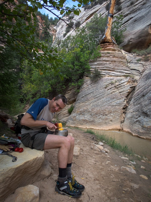
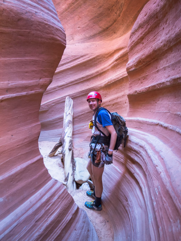
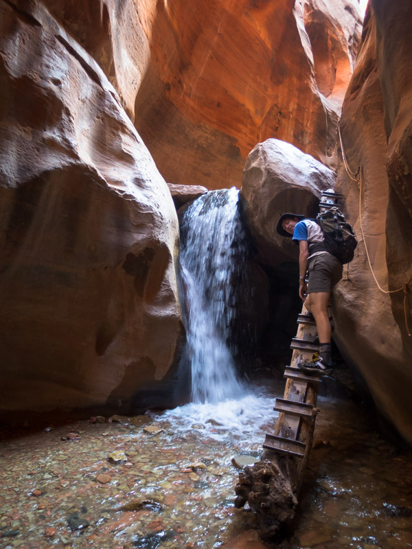
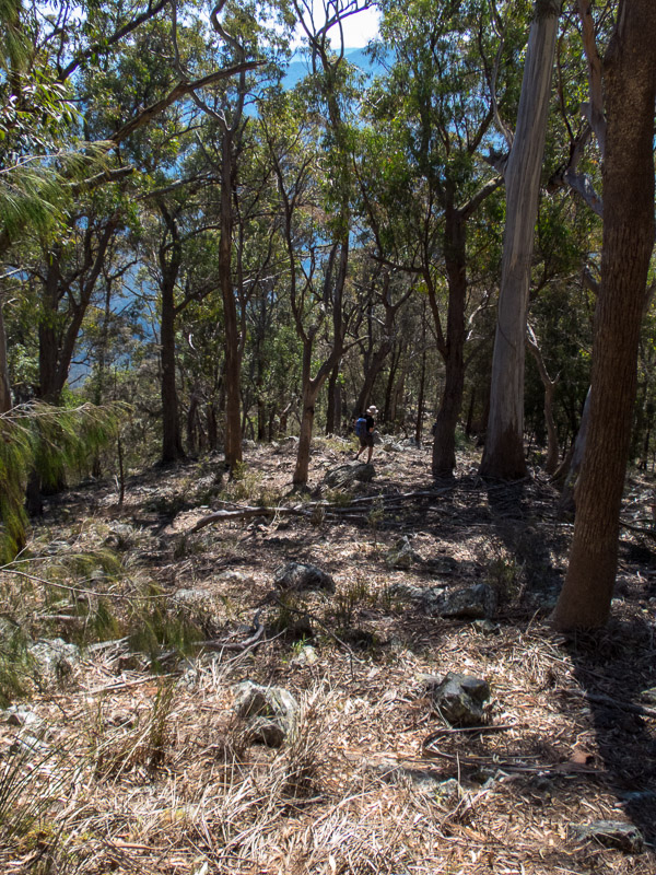
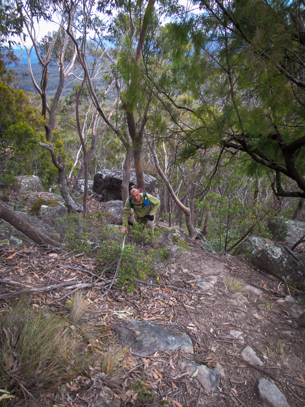
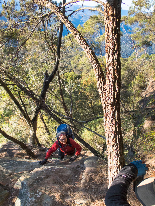
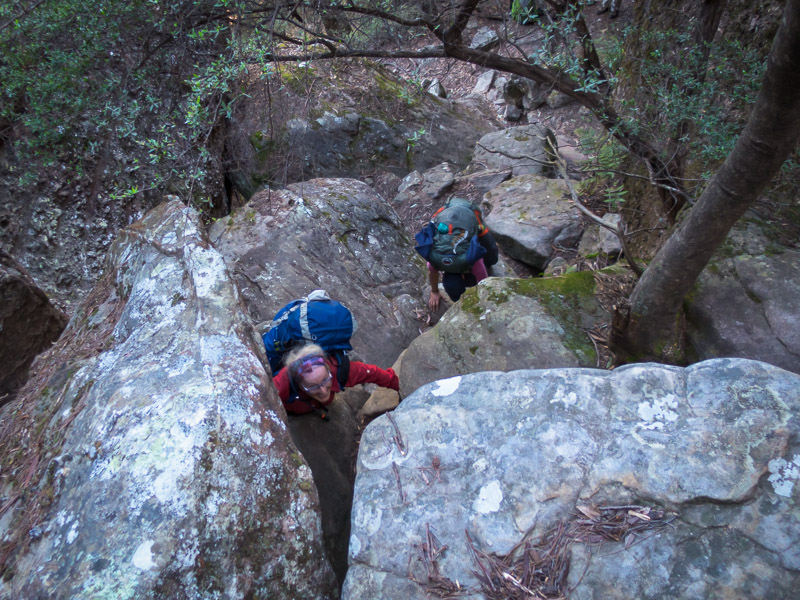
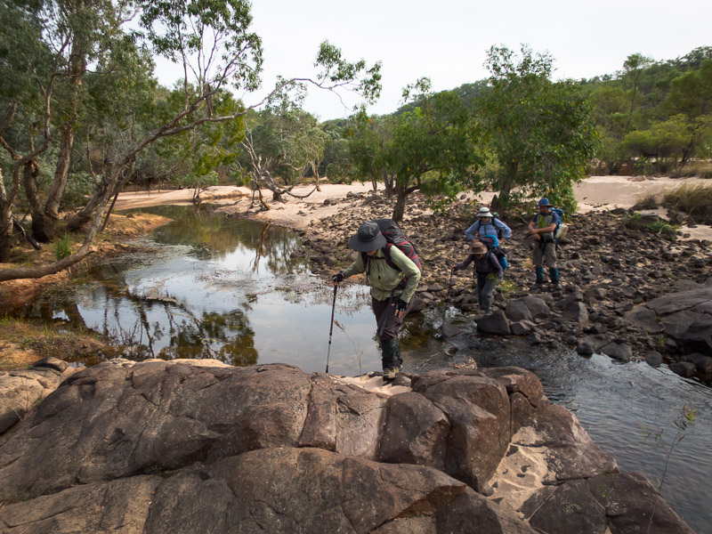
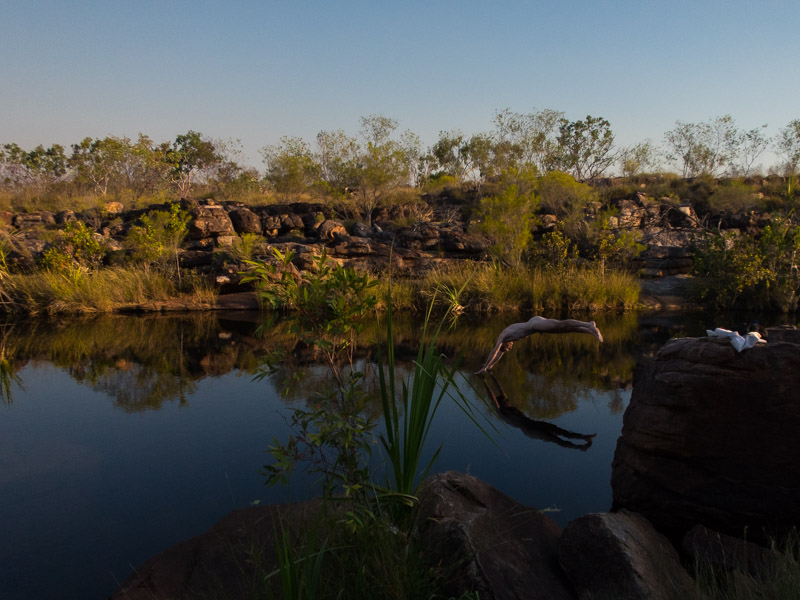
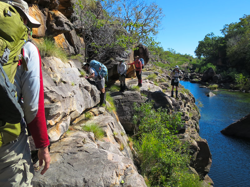
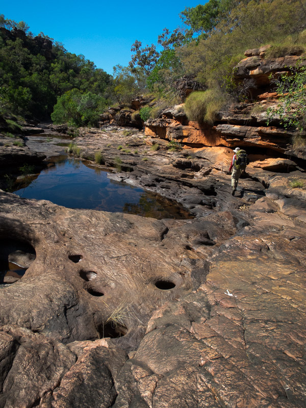
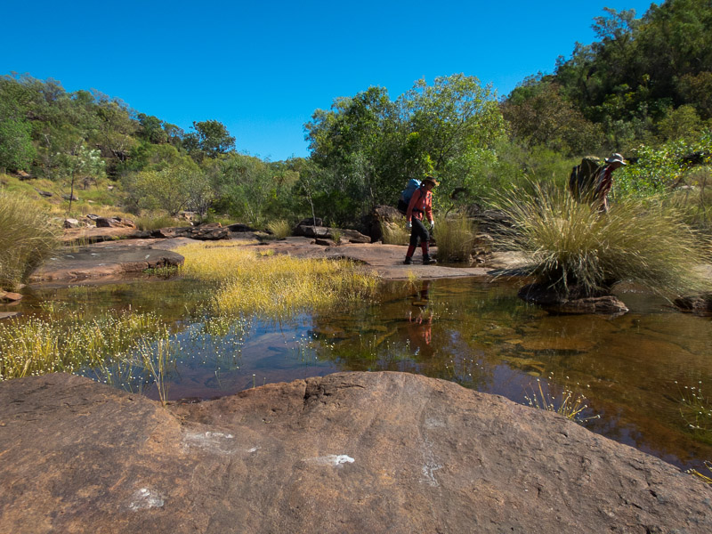
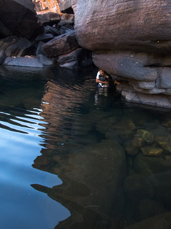
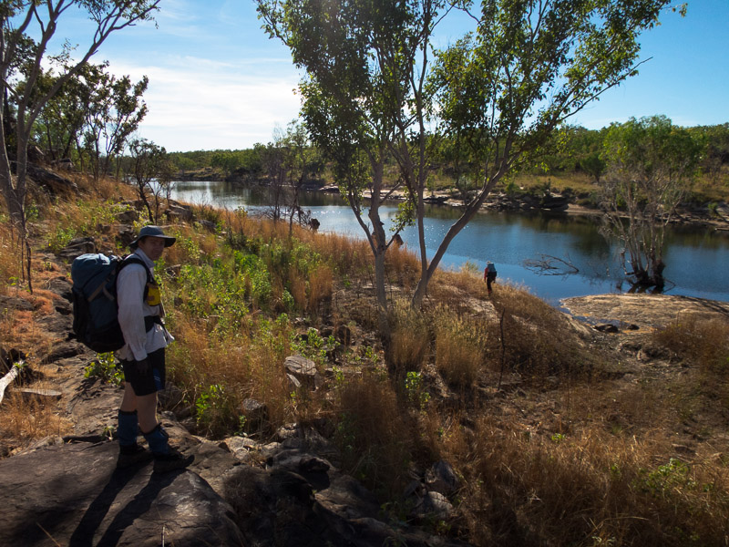
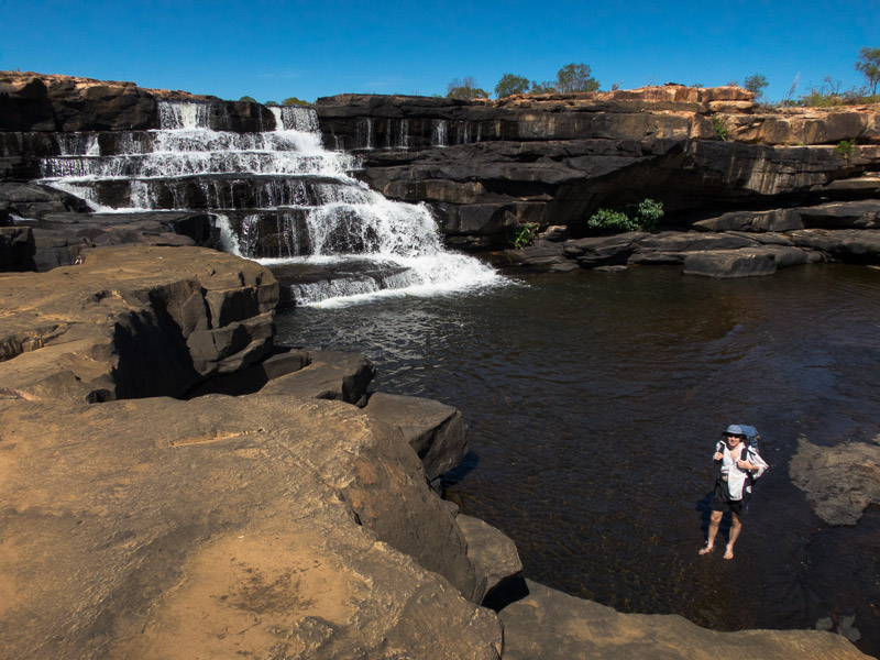
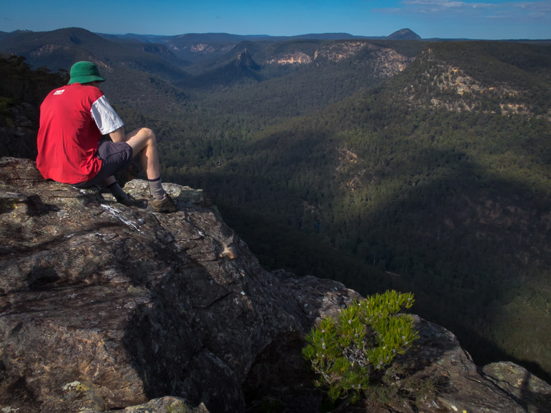
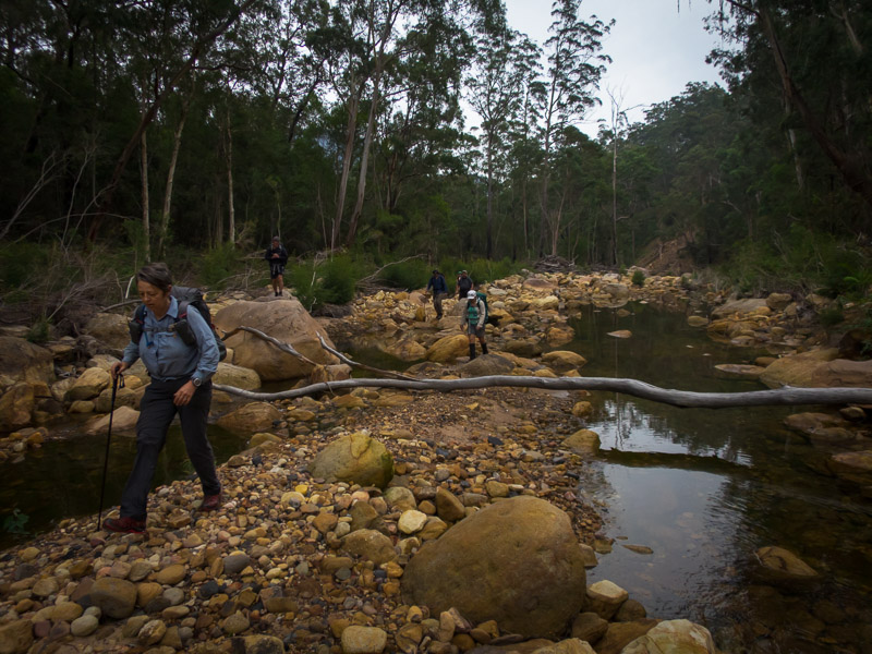
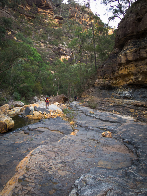
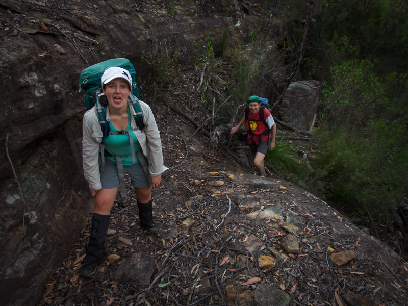
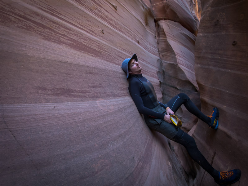
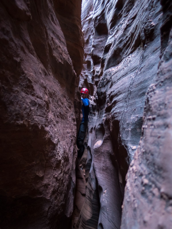
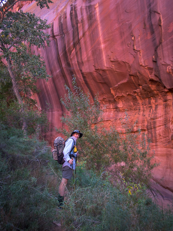
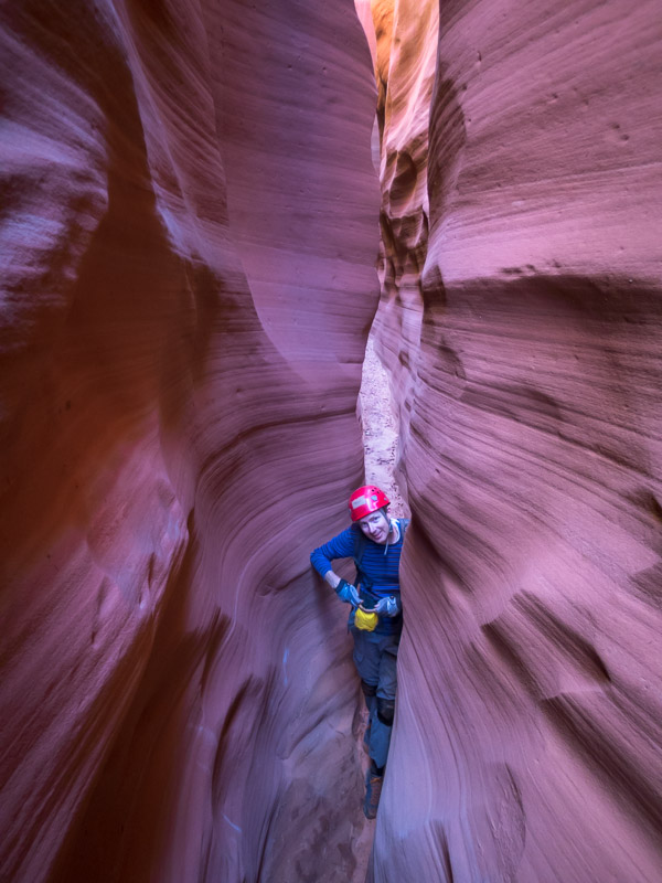
The man at the Grand Staircase Escalante National Monument (GSENM) was very helpful and it was great to speak with someone who seemed to have direct experience with the sort of things we were planning. It was after midday by the time we turned on to Hole in the Rock Road and so a short hike to Zebra and Tunnel Canyons seemed to fit the bill. While eating lunch at the trailhead a number of other hikers returned, advising that the canyon was flooded. Trying to discern what that meant we spoke to a number of groups, the last 2 guys saying that there was swimming and it was freezing and no way through etc. Since we had wetsuits in the car we figured we may as well take them if it was truly that wet. I’m not sure if we were the first people to wear wetsuits in Zebra but we did look slightly ridiculous compared to the many other groups just stripping off and sucking up the cold water temperatures. In the end they were unnecessary, other than for saving our skin on the up climbs (the water was cold, and there was swimming, but the length of the swim was not that long).

IMG_1116

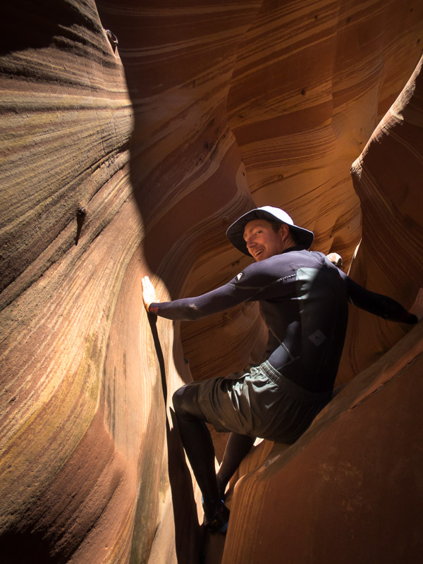
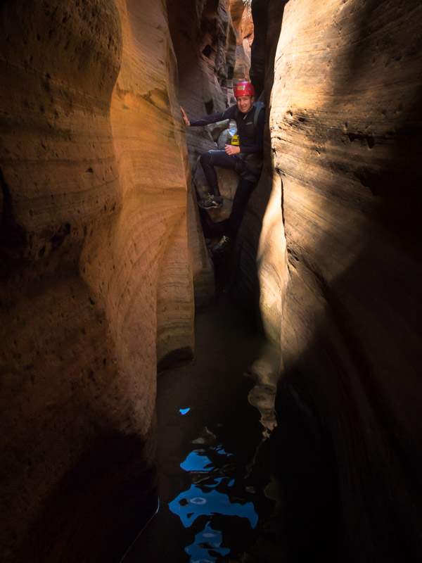
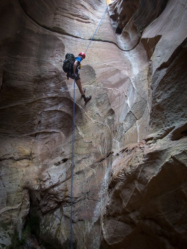
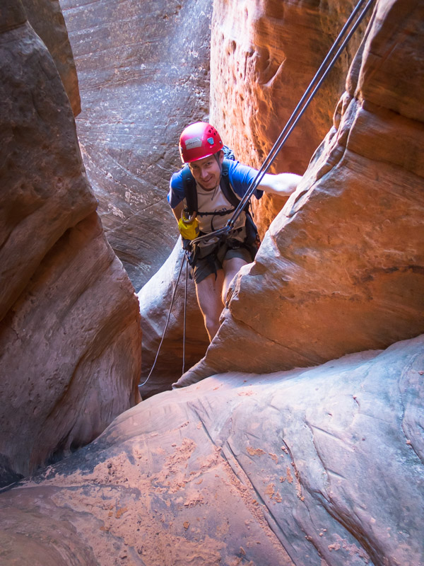
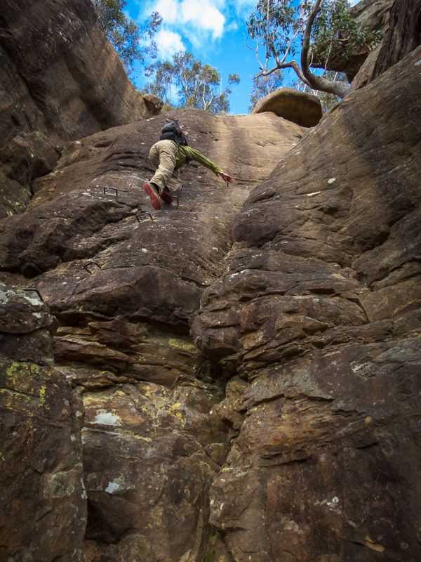
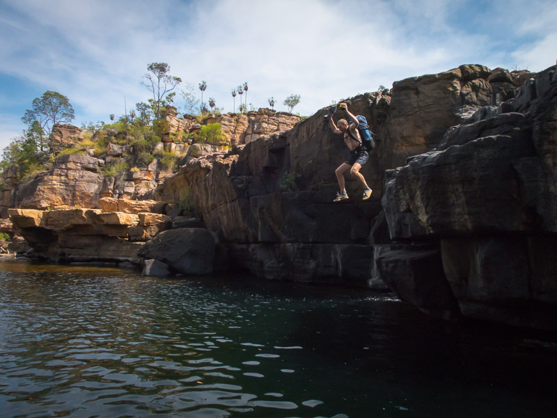
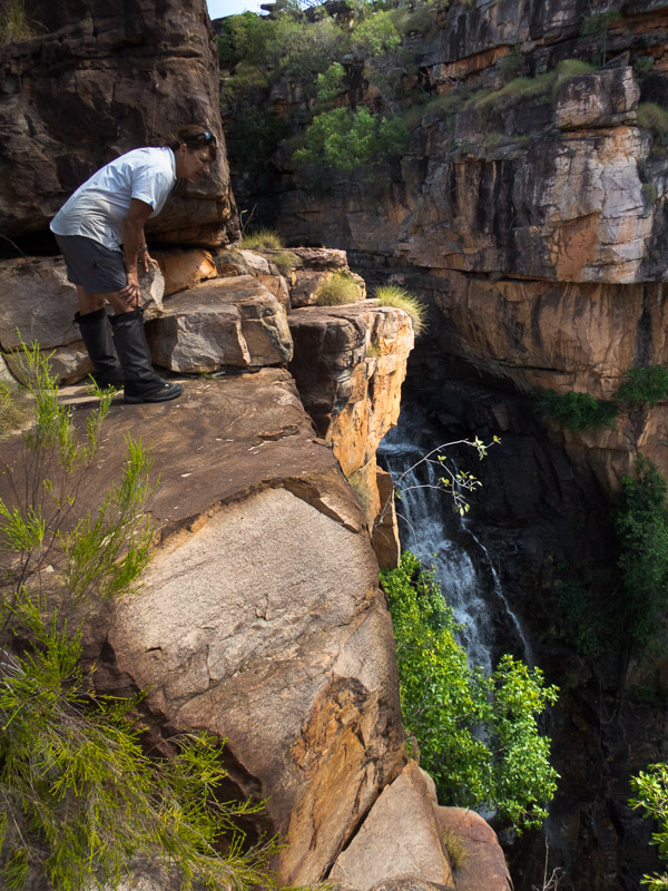
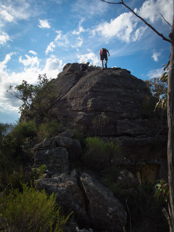
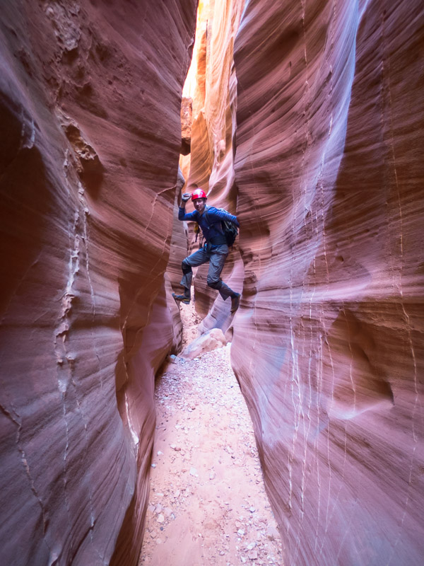
Tom above one of the drops we climbed up in Zebra Canyon

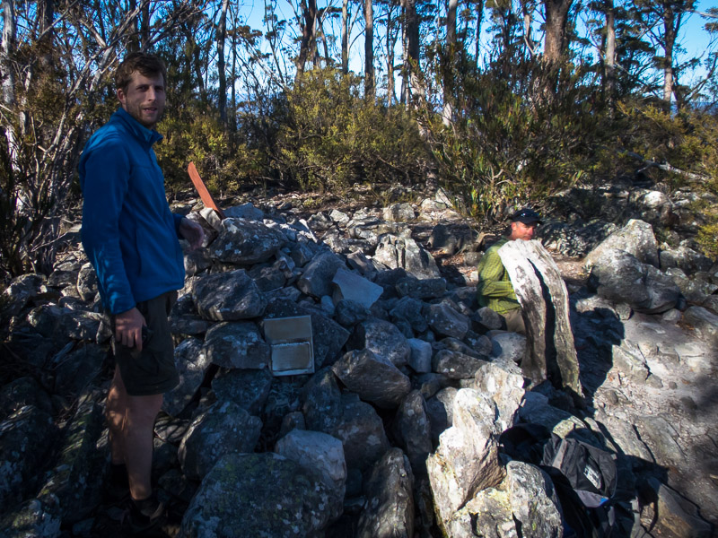
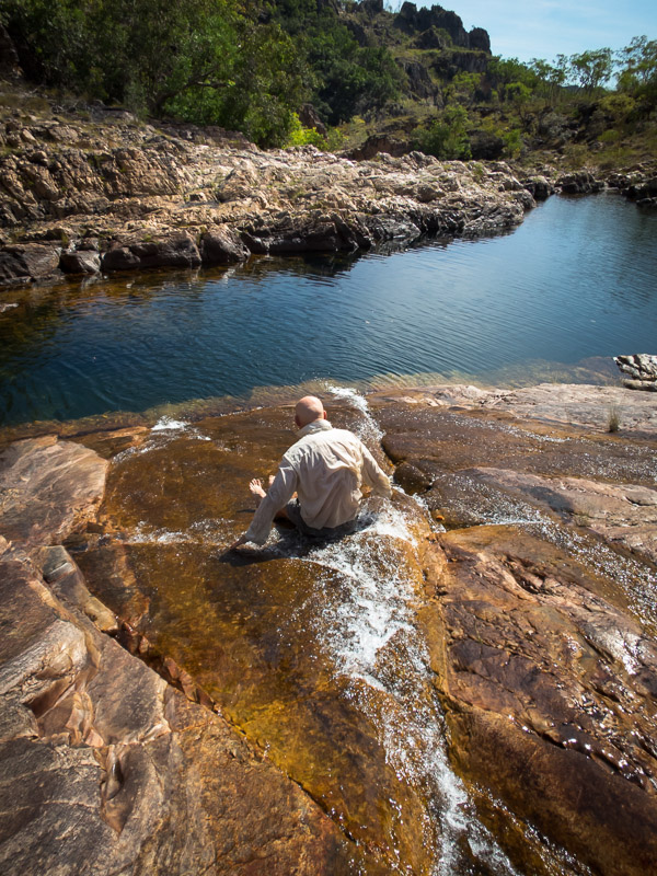
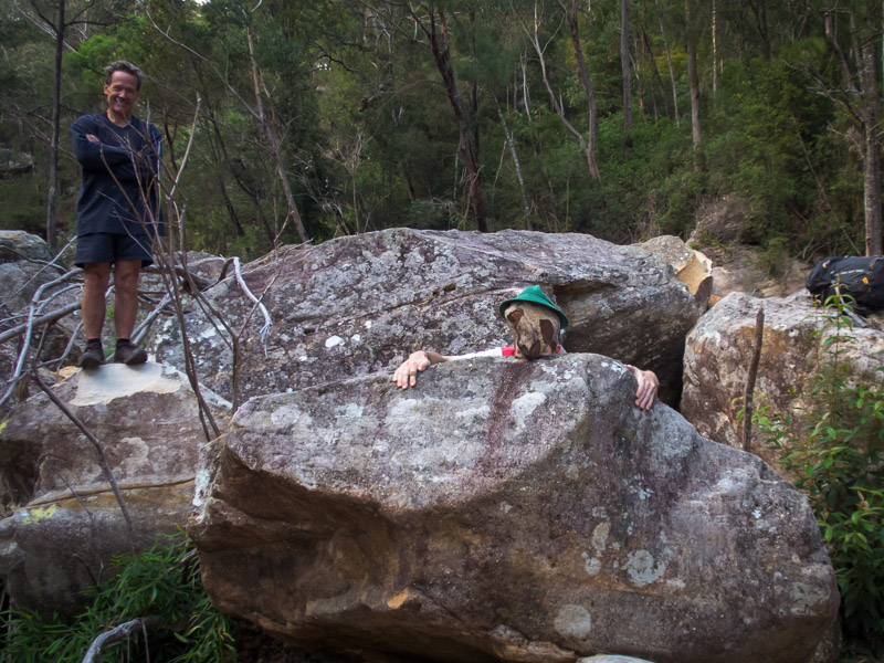
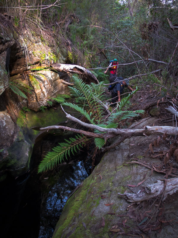
We managed to make it up 2 or 3 obstacles before turning around at a 3m climb which Tom was sure he could have got up… but maybe not back down that safely.

IMG_1117

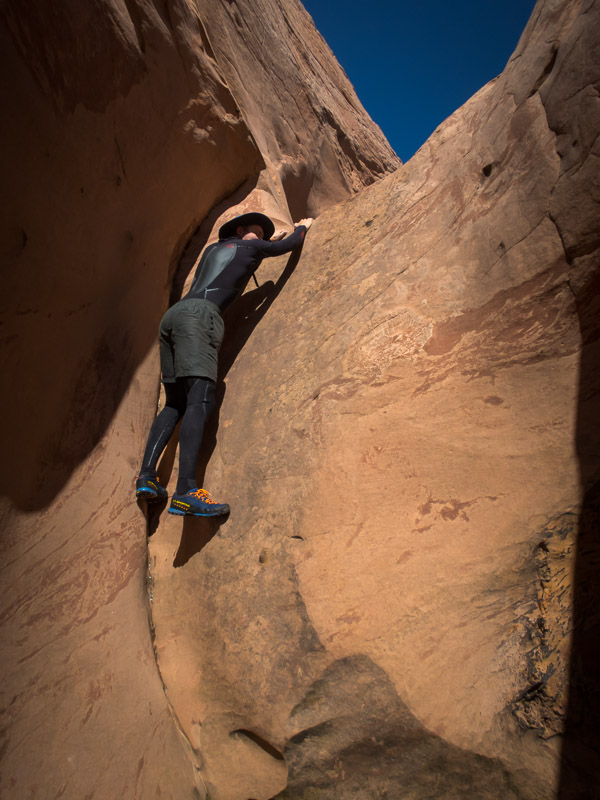
The climb we didn’t go up
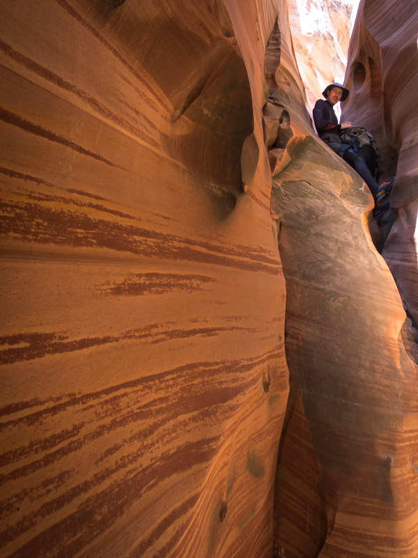
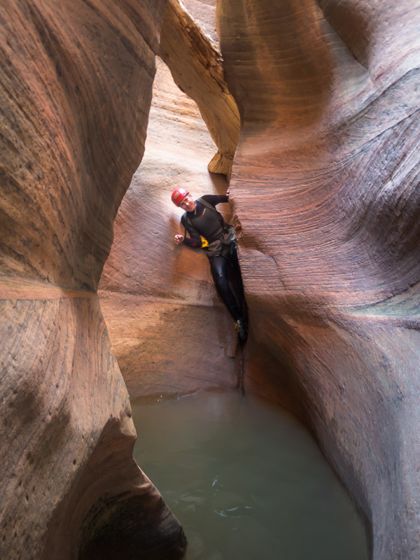
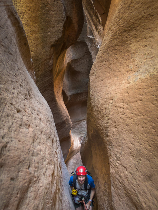
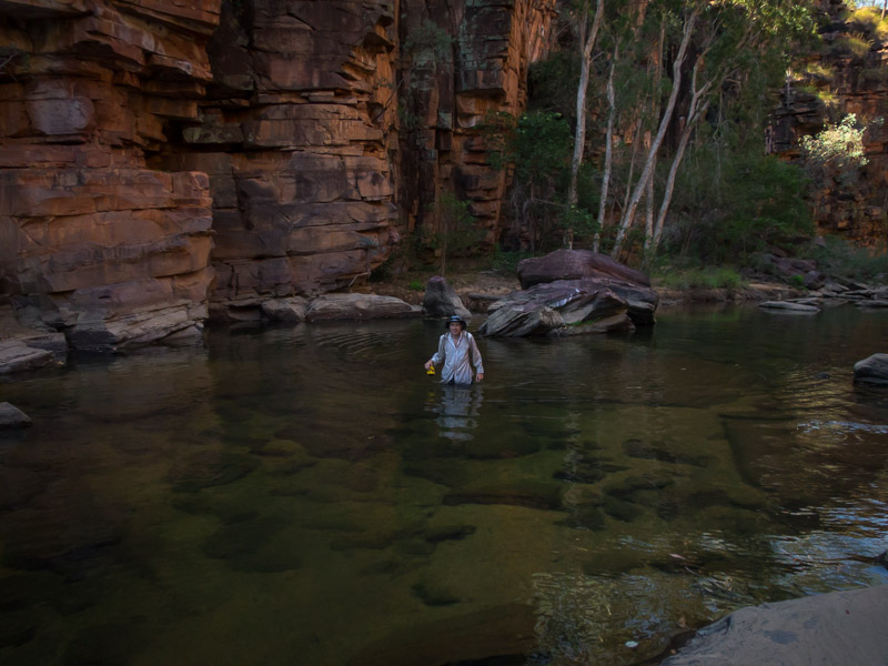
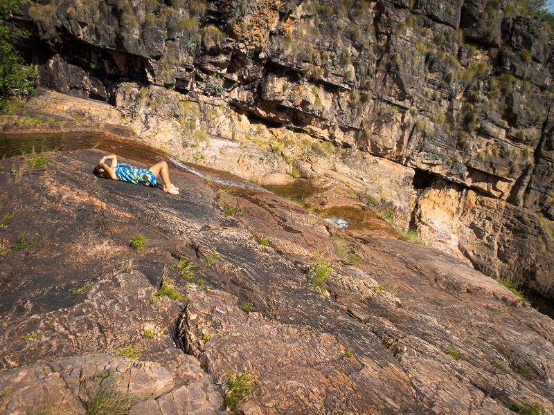
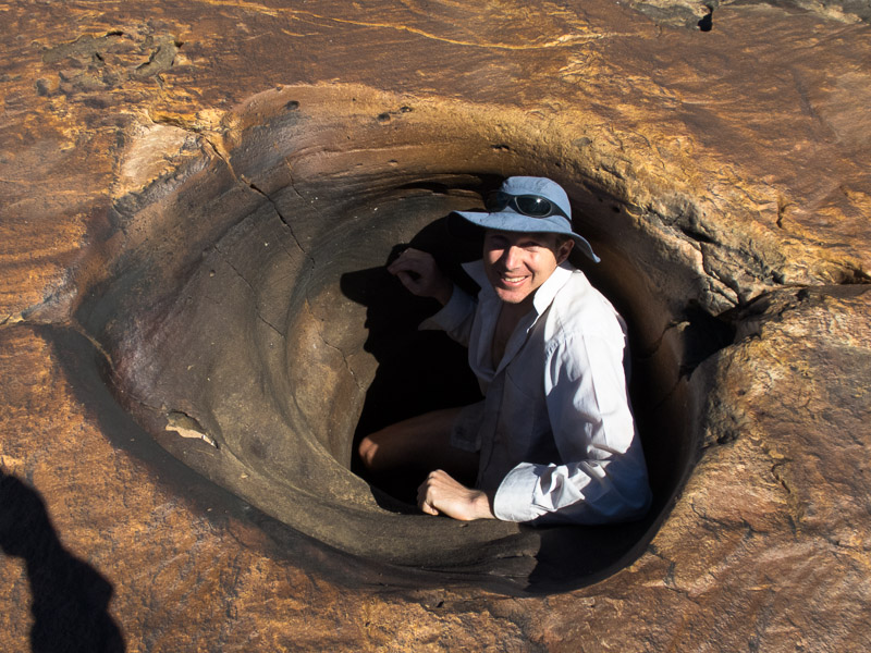
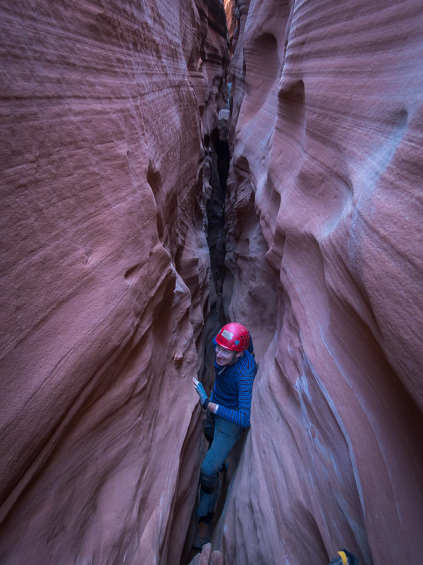
IMG_1122

Tom in Zebra Canyon

IMG_1123

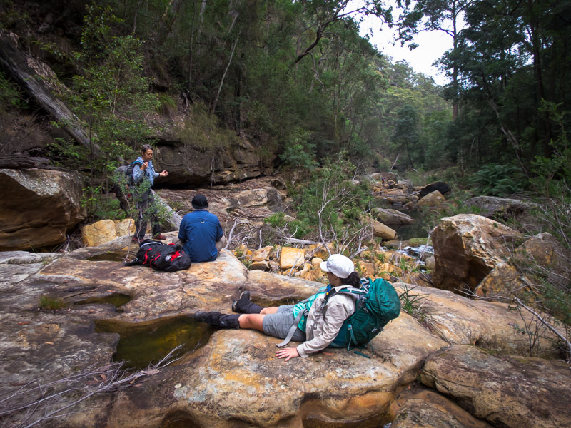
More lounging around in Zebra Canyon

IMG_1125

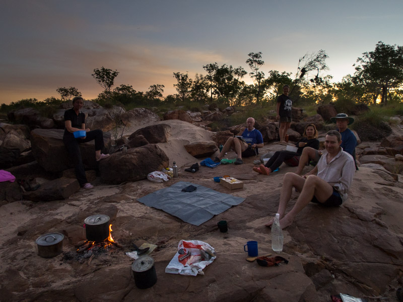
Too much excitement for one day!

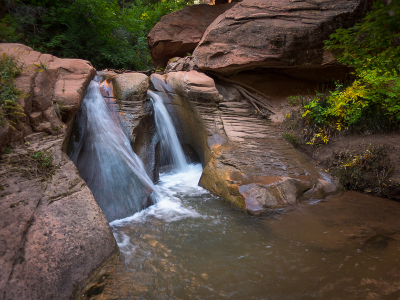
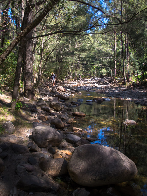
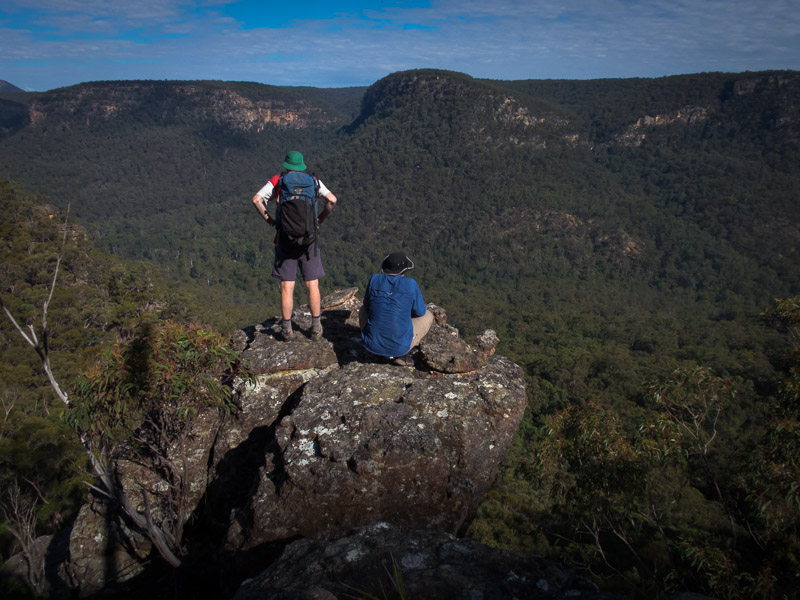
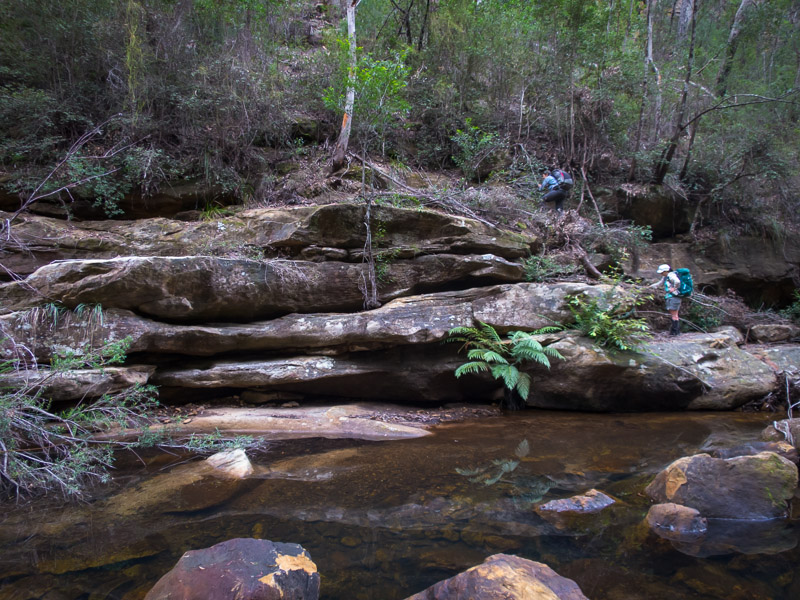
We then headed around the corner to Tunnel Canyon, which was also full of water, but we didn’t bother putting the wetsuits back on for that.

IMG_1129

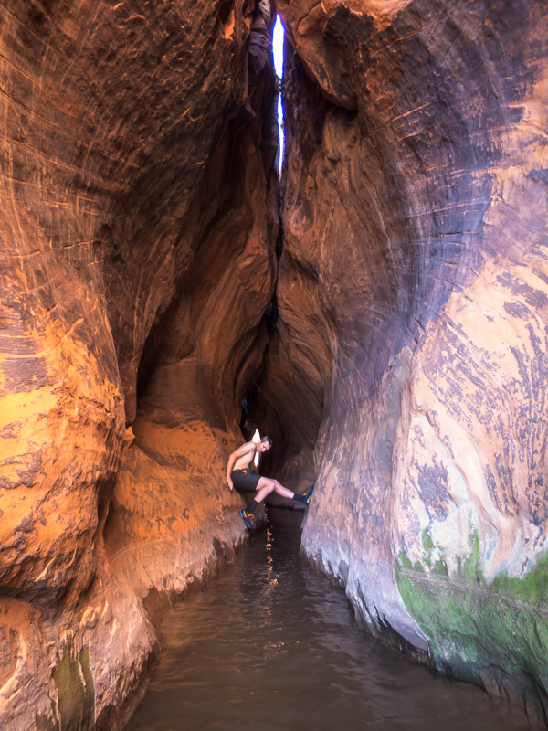
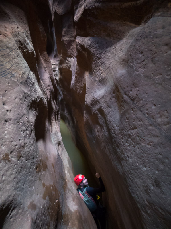
Tom avoiding the water in Tunnel Canyon

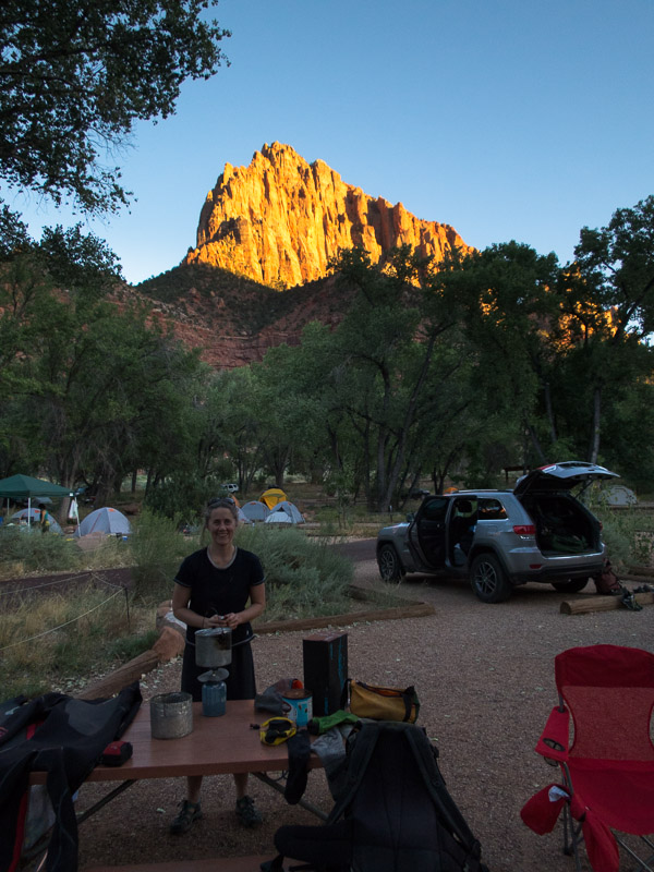
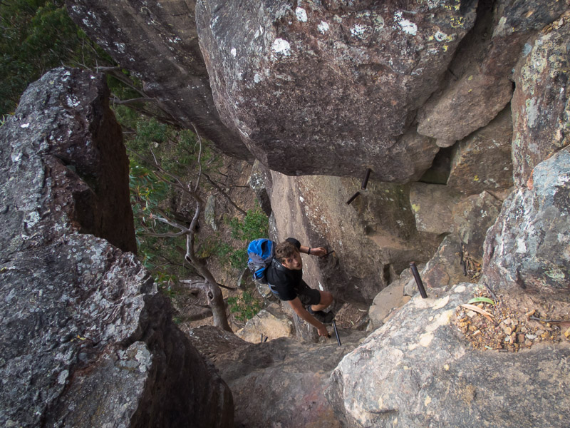
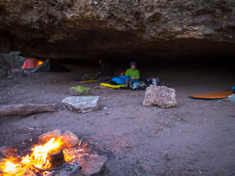
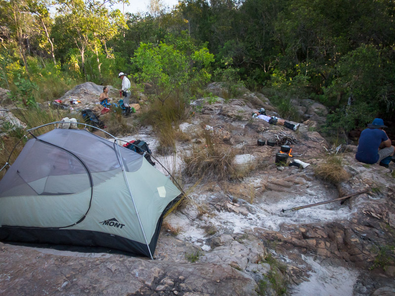
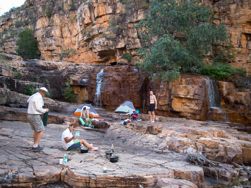
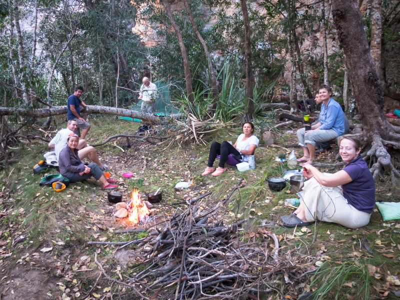
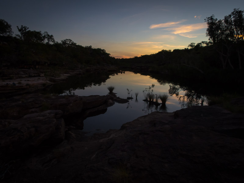
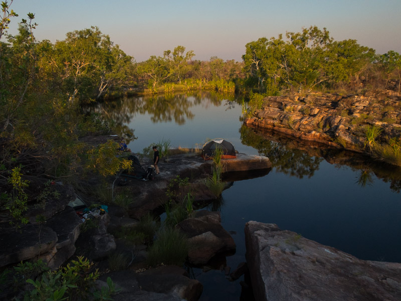
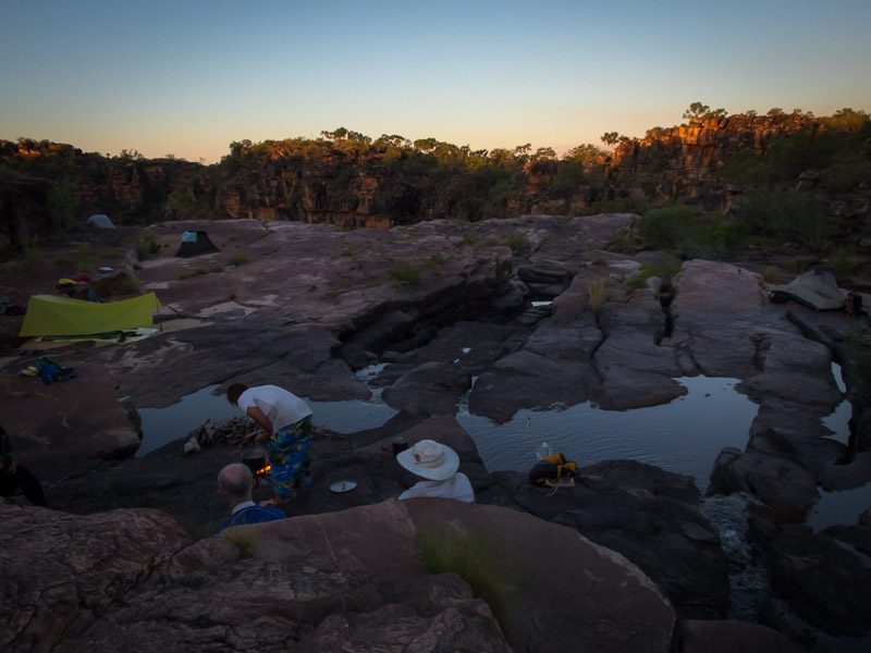
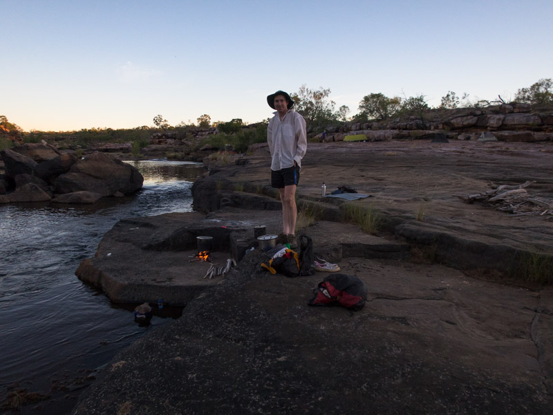
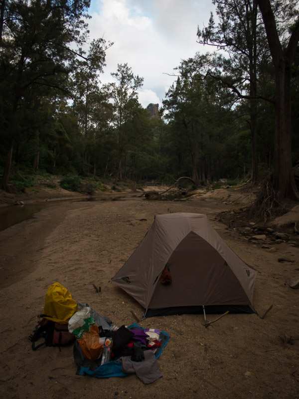
We camped at the head of Egypt 1 canyon that night and marvelled at the first ‘downclimb’ which was pretty daunting.

IMG_1132

Camp at the head of Egypt 1

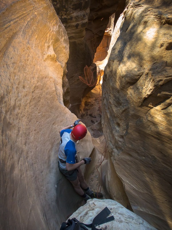
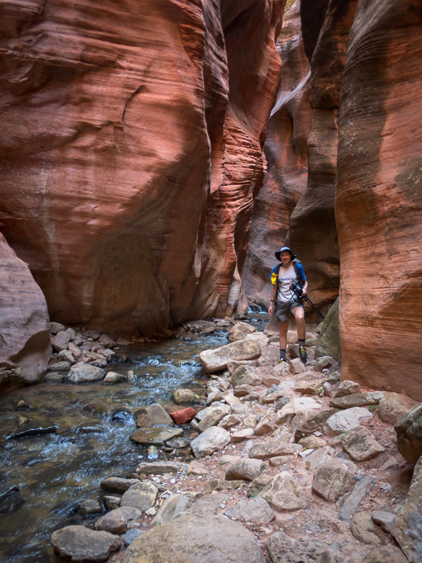
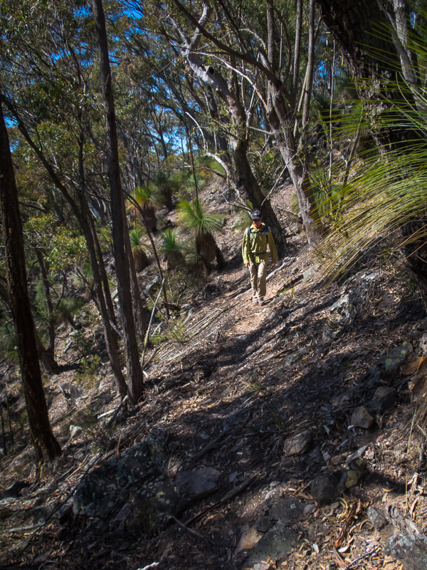
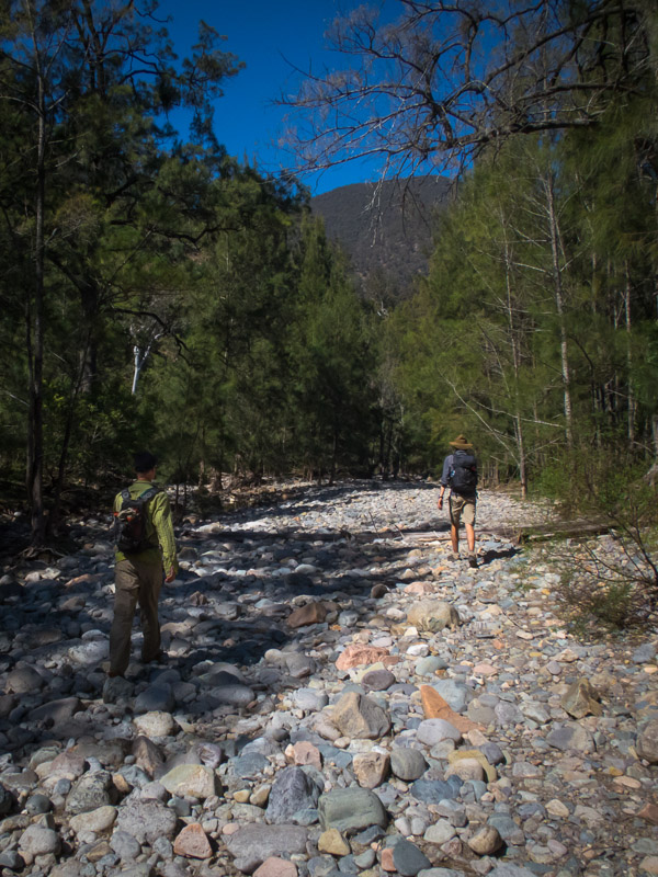
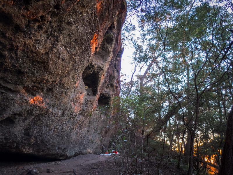
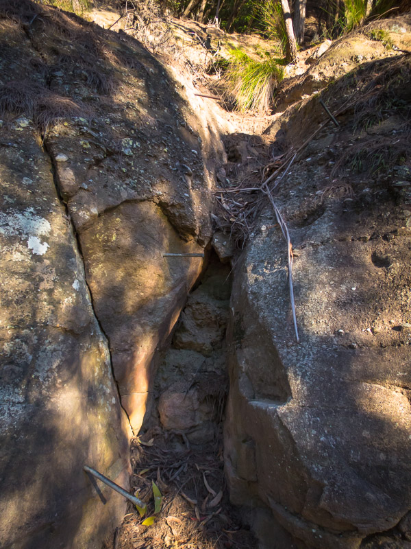
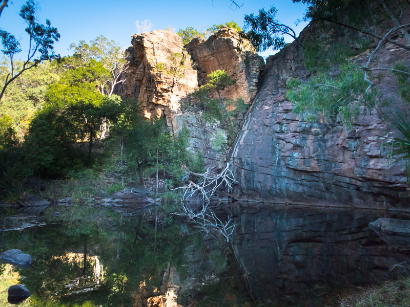
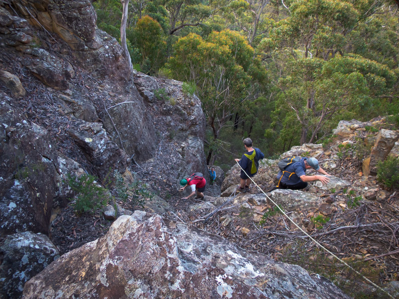
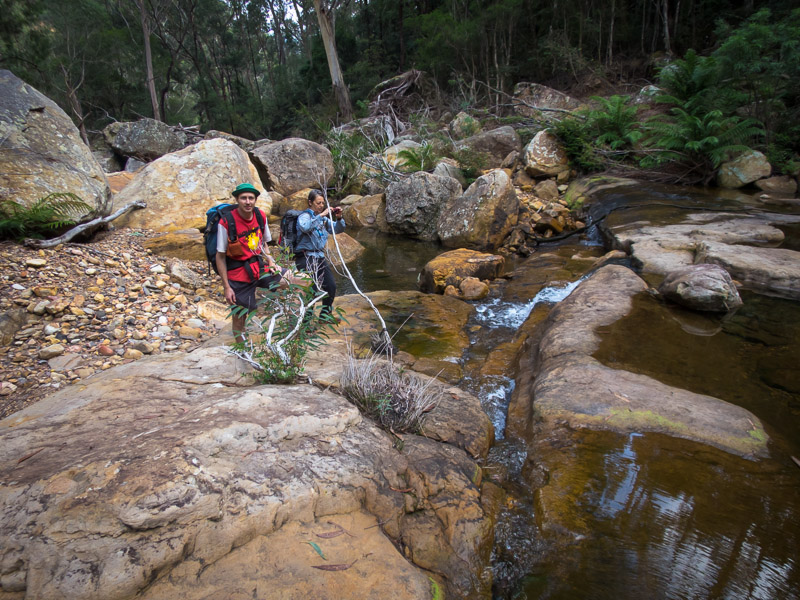
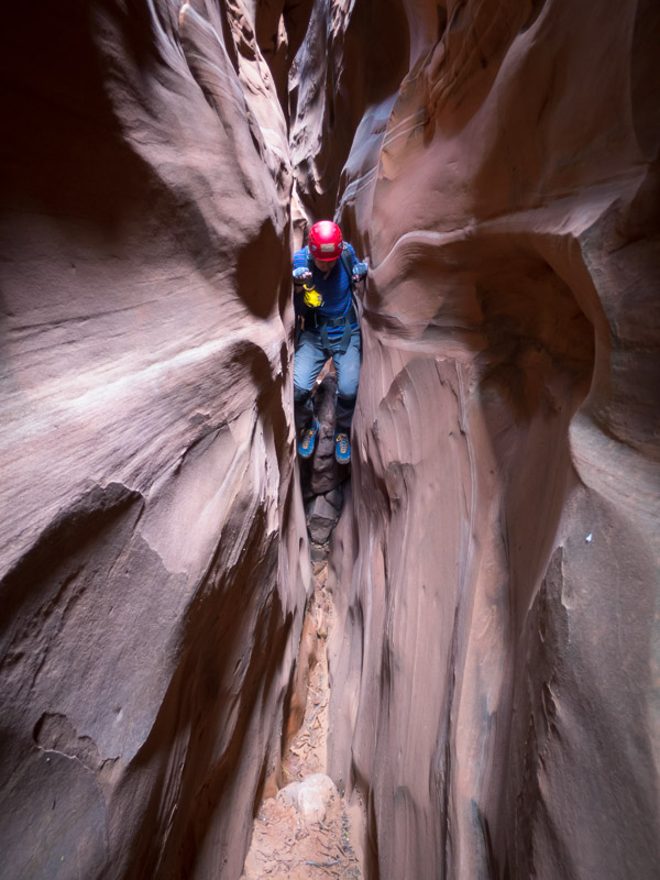
Egypt 1 wasn’t on our hitlist, the next day we headed for Egypt 3. It was full of mud, and a lot of squeezing, with the non-technical section never particularly deep. I wouldn’t be rushing back to it.

IMG_1138

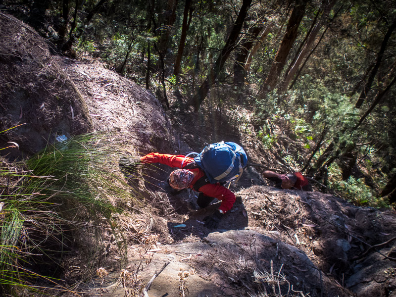
Tom with some particularly painful rock to squeeze through in Egypt 3

IMG_1142

Narrow section in Egypt 3

IMG_1143

I think this is what they call Type 2 Fun.

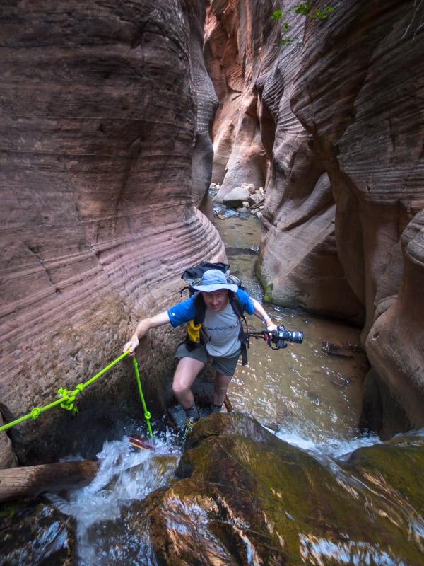
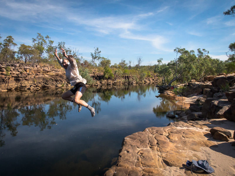
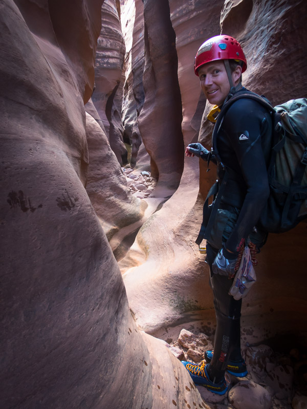
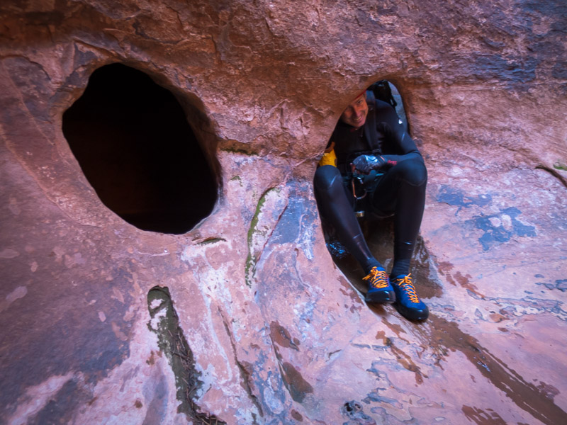
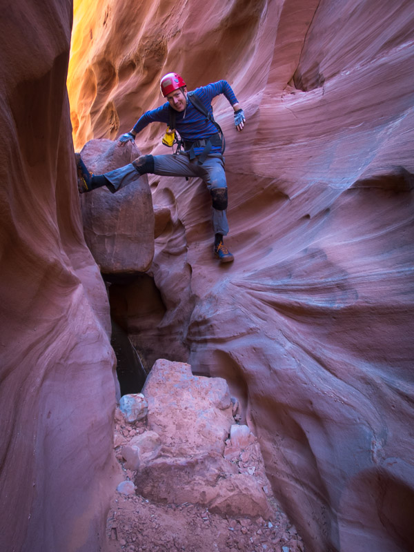
The optional technical section had a semi-keeper pothole which Mel & Rich had told us about. When we got to it there was a lot of water. I gamely dropped into the pothole only to find it was neck deep! And right next to where we needed to climb out I couldn’t touch the bottom. That wasn’t part of the plan! Tom had a go next, and also couldn’t touch the bottom where we needed to climb out, but could a metre to the right. After a couple of attempts I managed to launch myself from standing on his cupped hands across to the lip and haul myself out. I anchored a rope for Tom to climb out on. The second pothole was also wet and muddy and probably not something one person could have got out from. It was satisfying to get through the technical section after being somewhat frustrated by the mud & squeezing in the non-technical section.

IMG_1144

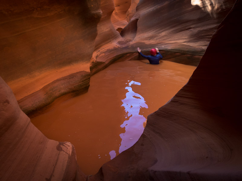
Tom checking out the way out of the first pothole. A metre to his left he couldn’t touch the bottom.
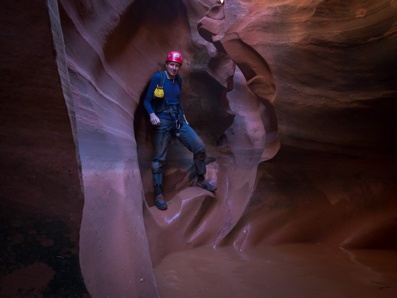
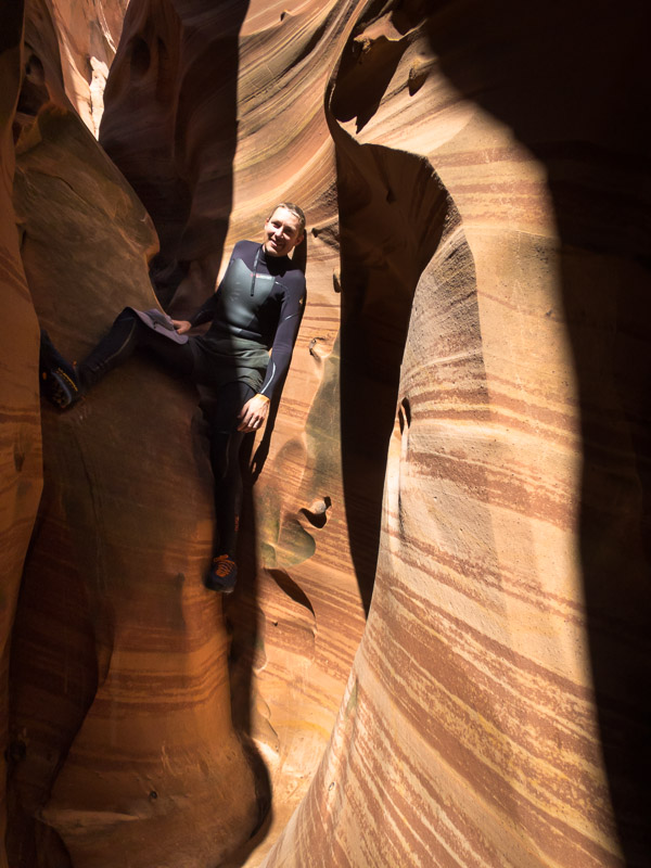
IMG_1149

Tom in Egypt 3

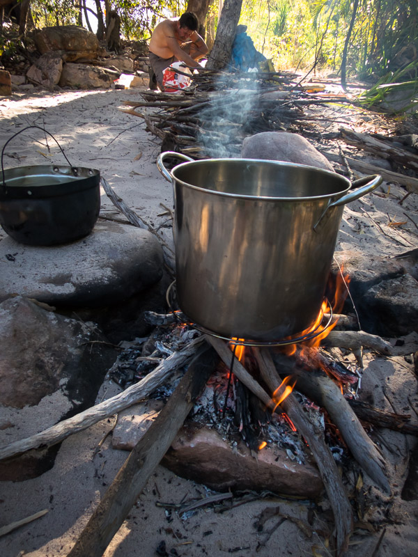
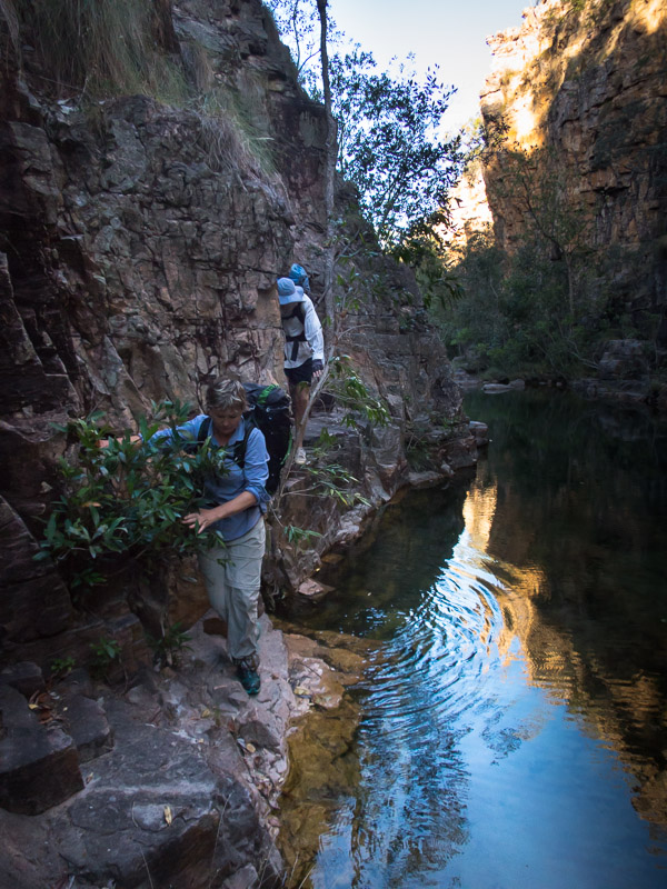
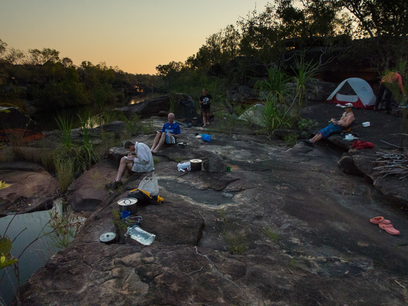
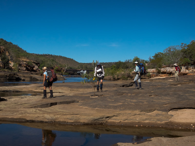
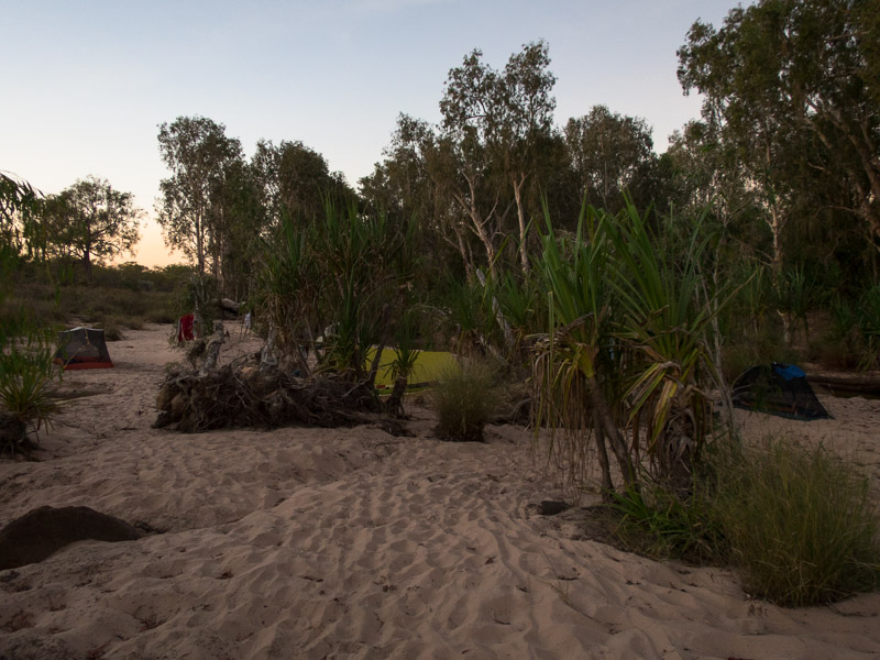
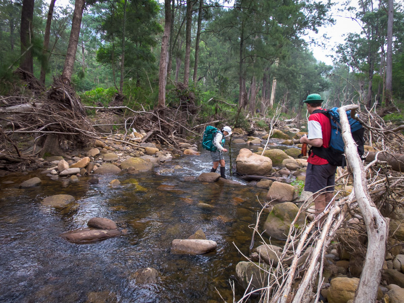
Walking out it was windy and so we were keen to find a sheltered camping spot. Not far from the end of the Egypt Road we tucked ourselves in amongst some bushes. The wind just got worse so we ended up sitting in the car for the remainder of the afternoon and the evening. There was a brief period where we struggled to cook dinner outside before returning to the car to eat. Needless to say I didn’t sleep very well as the wind kept up all night. Just before dawn it finally settled.

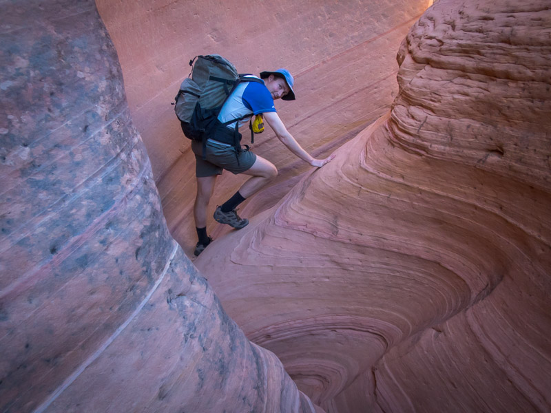
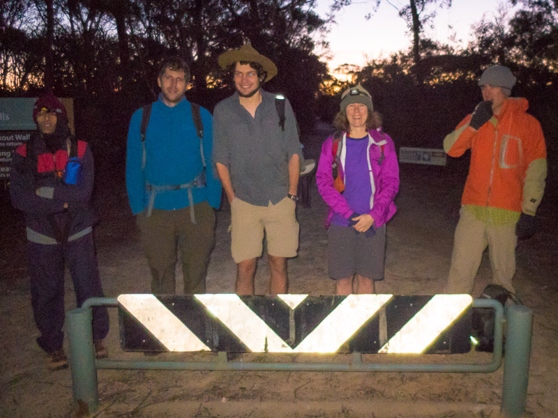
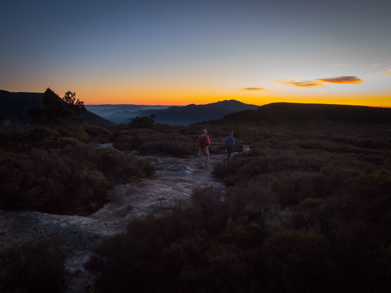
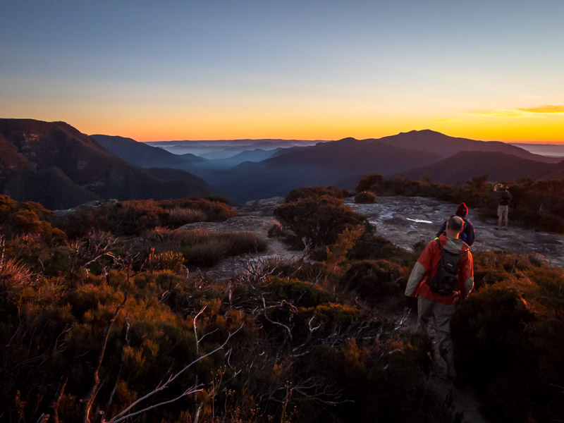
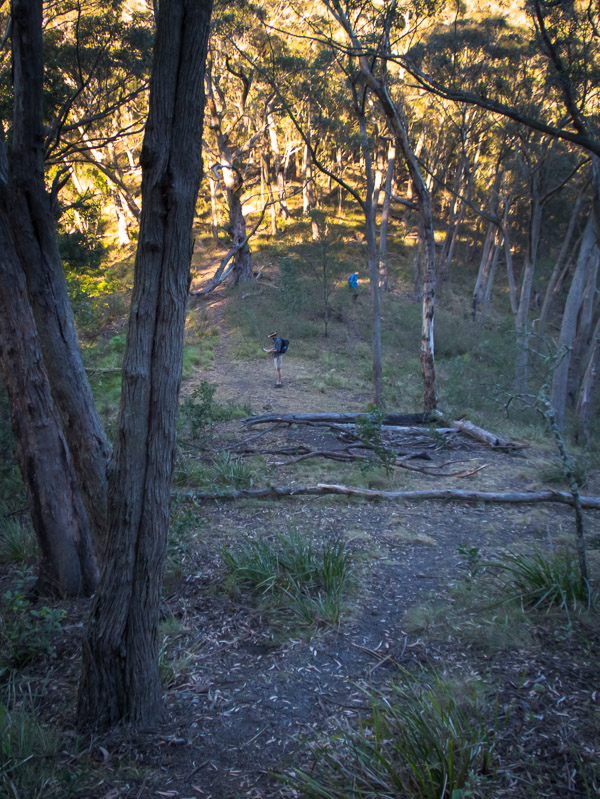
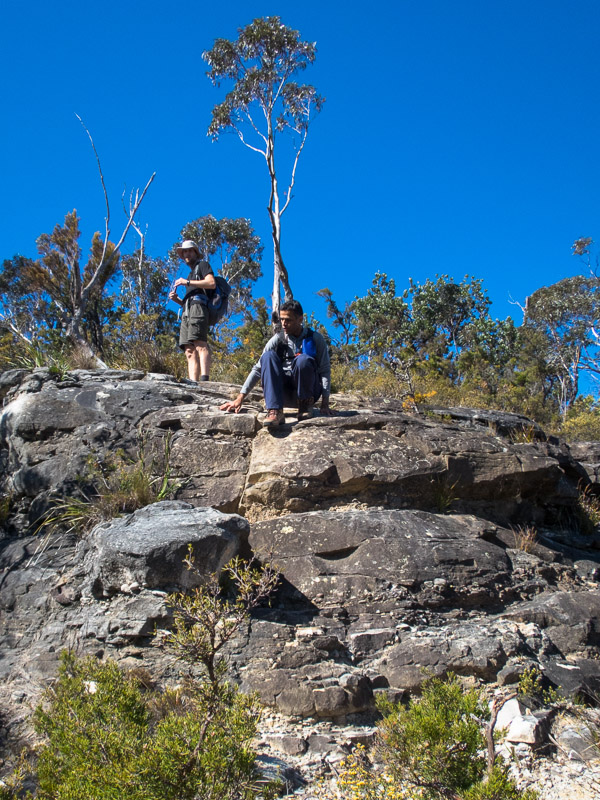
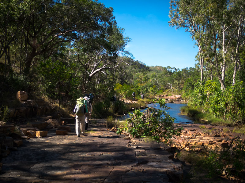
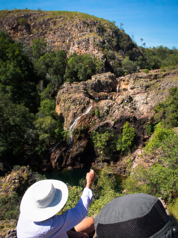
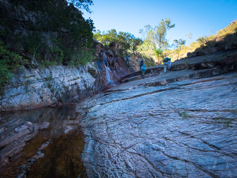
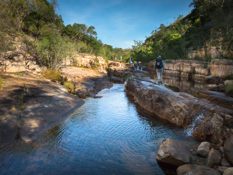
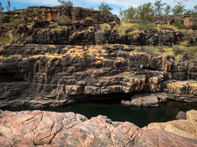
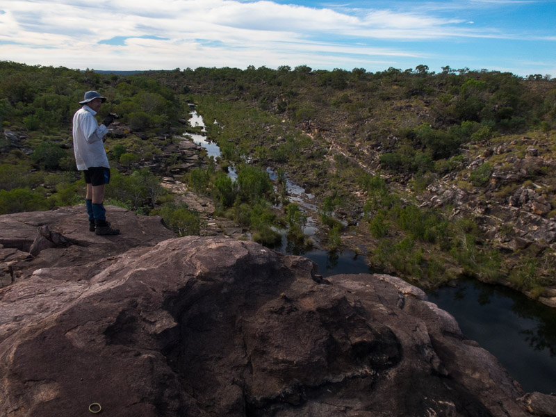
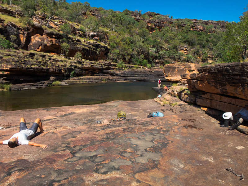
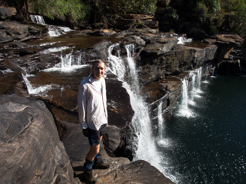
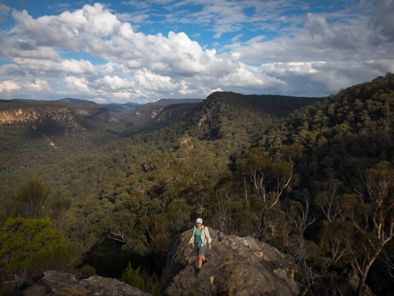
We had various options for the day, one of which was to do Neon Canyon as a day trip (originally we were planning to camp a night on the Escalante River). Initially when the alarm went off I said I didn’t want to go following such an awful night. But after 20 minutes of contemplating I changed my mind and so soon we were eating breakfast and packing gear for the day. It was not long after 8am when we left the Egypt Trailhead. Buoyed (?!) by conversations with other groups that had camped out that it had been a horrendous night with the unseasonable wind for them too. We were a bit scared by the track notes and warnings of a long day which had the pleasant effect of making Tom faff less. However, we managed to do the technical section of the canyon in just under 2 hours (compared to 7h that a group we spoke to on the way in had taken!?). I was very pleased Tom had convinced me we should drop in at the North Fork rather than the earlier entry options on Tom Jones’ track notes. For the first time in the trip we had lunch at lunchtime rather than mid-afternoon.

IMG_1157

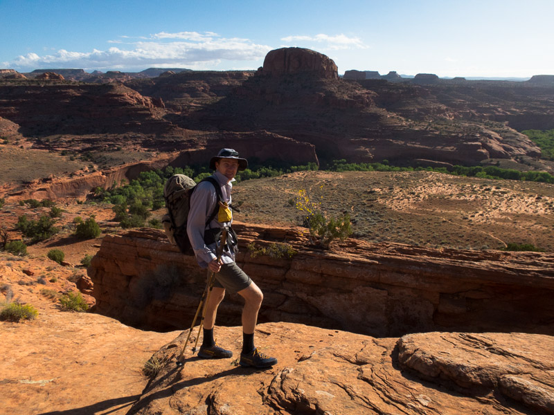
Near the start of the hike. Neon is in the slot in front of the dome.

IMG_1158

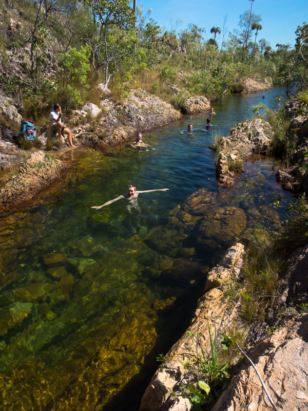
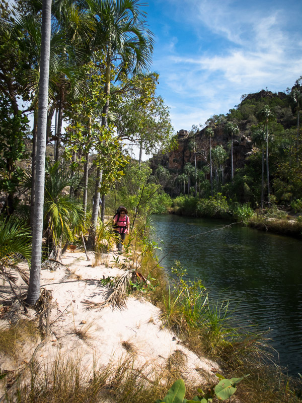
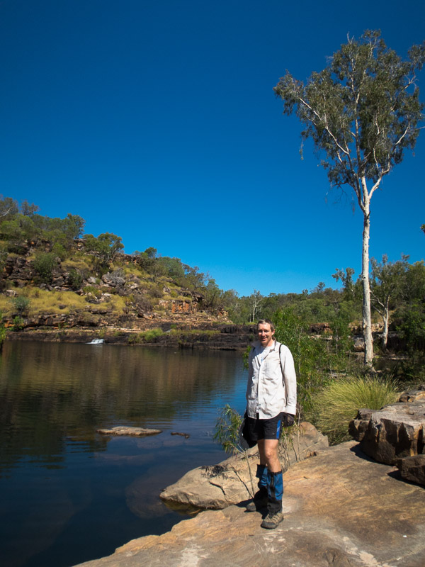
Entering the bottom of Neon Canyon from the Escalante River

IMG_1162

Tom in Neon Canyon

IMG_1167

A less common feature to get through a canyon

IMG_1169v2

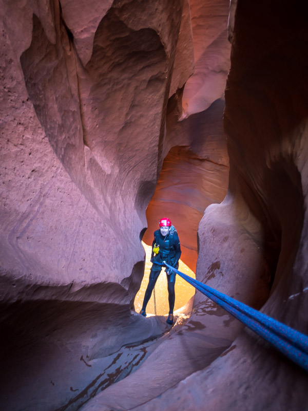
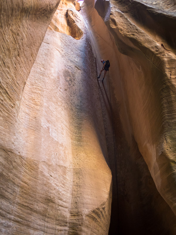
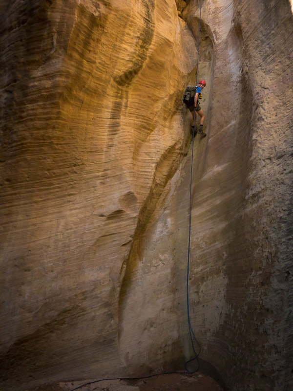
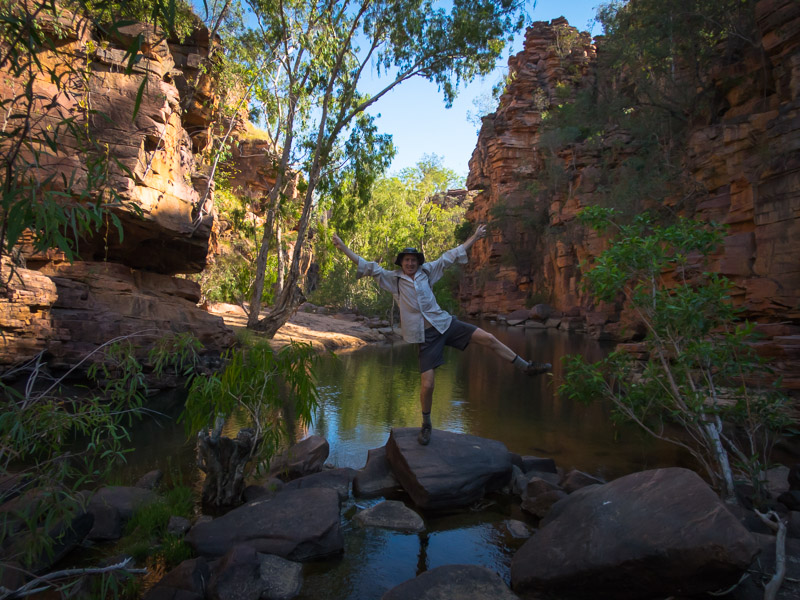
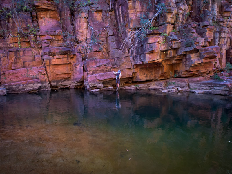
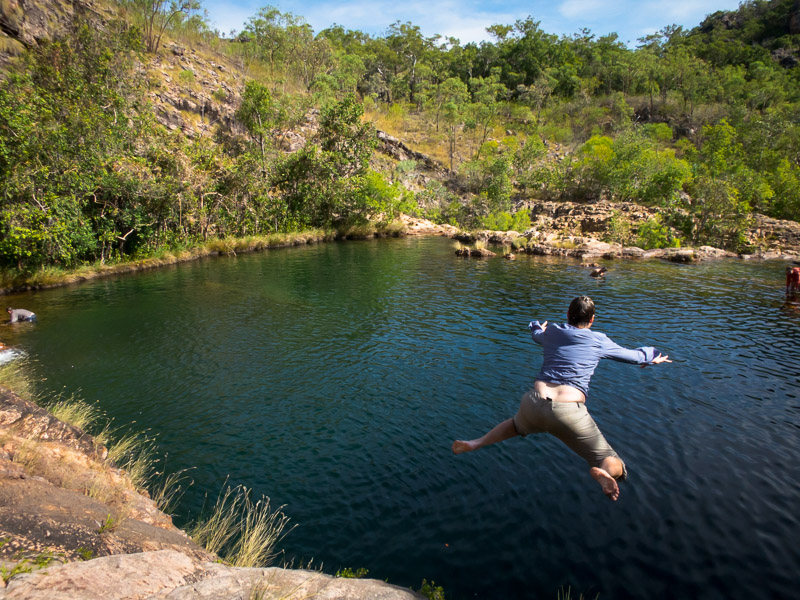
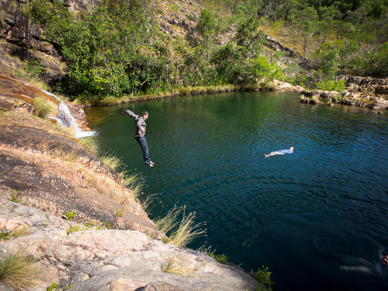
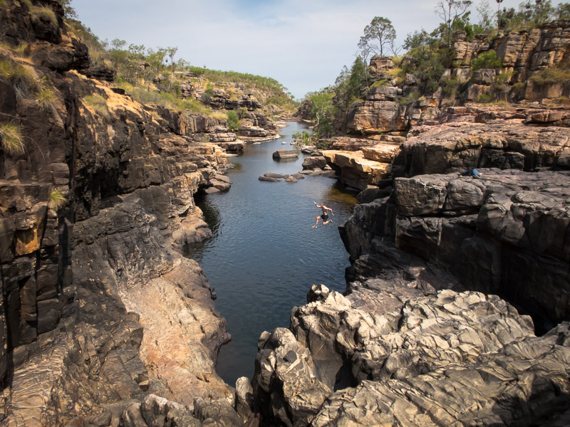
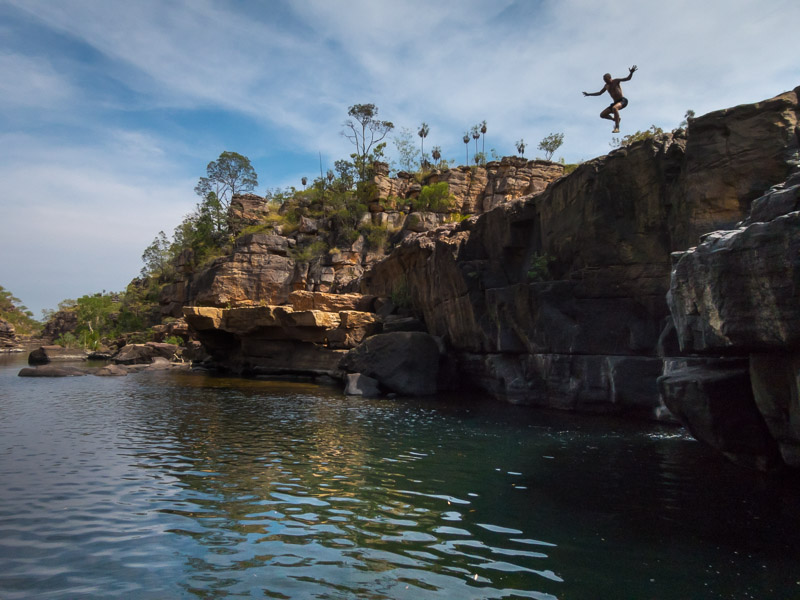
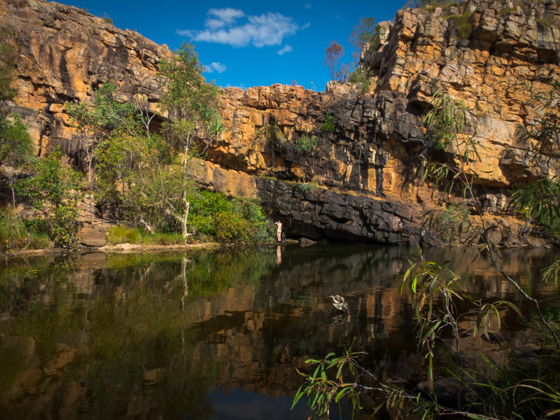
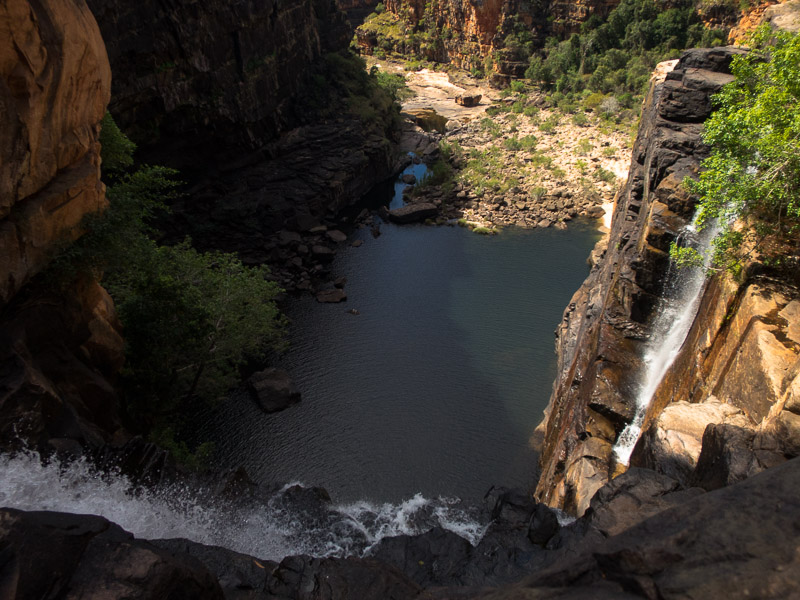
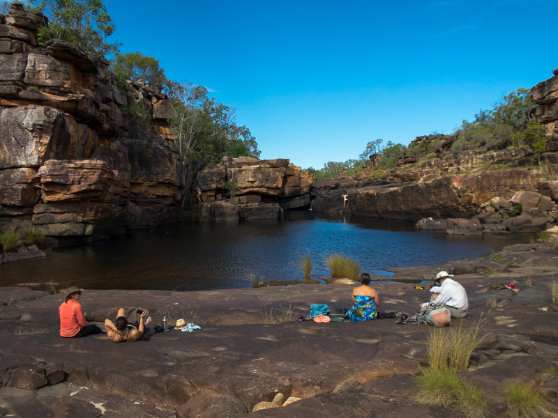
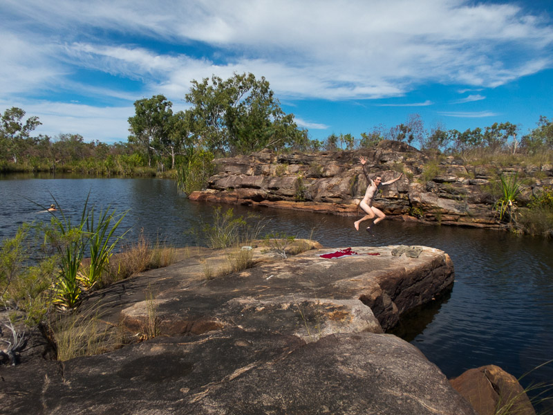
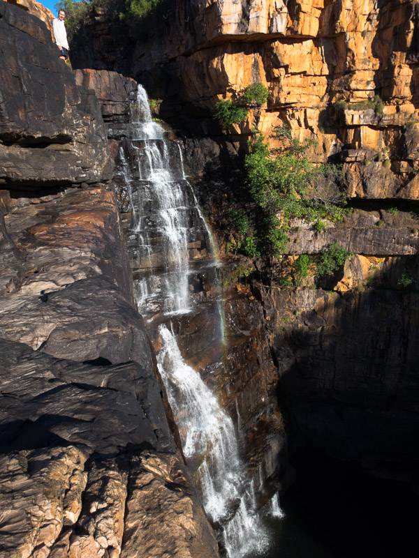
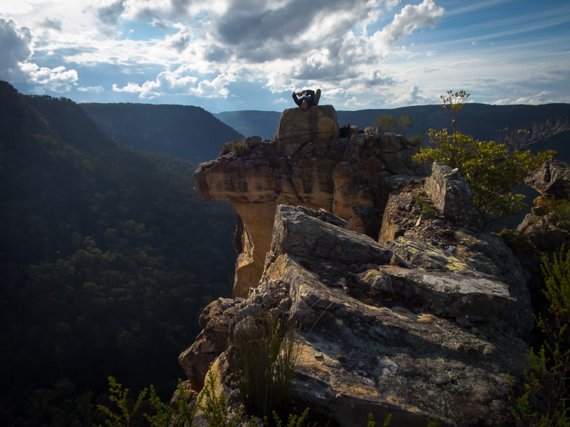
Tom abseiling into the Golden Cathedral

IMG_1171

Tom pulling our rope having abseiled into the Golden Cathedral

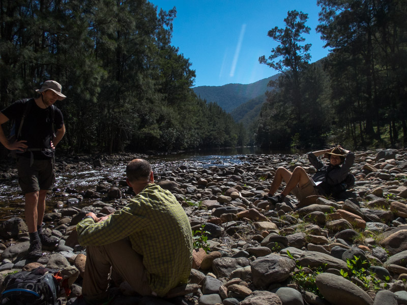
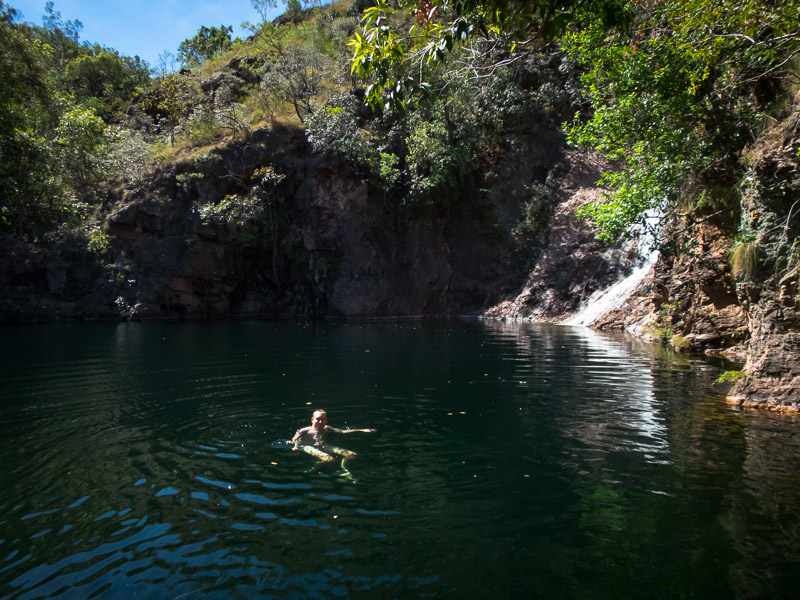
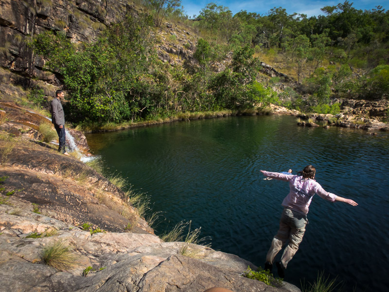
We had a leisurely lunch at the Golden Cathedral, including watching a solo canyoner rap down, before the long slog back to the car. All up 8.5 hour round trip. (including 1.5 hr lunch?)

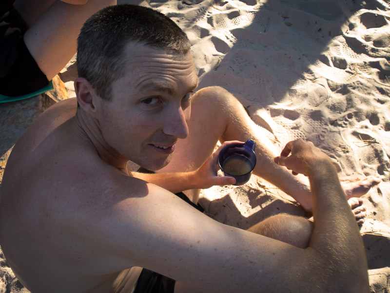
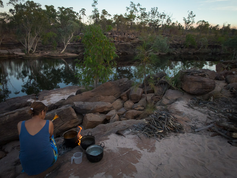
I was worried about getting back out on the Egypt Road and so wanted to get out that evening rather than camp at the scenic trailhead. So off we went, planning to camp somewhere in the vicinity of Spooky/Peek-a-boo Canyons. Using the Kelsey guide we headed off on the Early Weed Road looking for a nearby campsite. Quickly we came to a sandy wash which Tom sped across only to find we couldn’t get out of it. At this point we discovered we had a rear-wheel drive car. A group of 3 women noticed our problem and stopped to help. After letting the tyres down a lot and with pushing we managed to get back onto the road. The car had inbuilt tyre pressure monitoring, and apparently the front left tyre was now at 17psi (instead of 36, the others were in the mid-20s). I was not happy to keep driving round on that and insisted we headed into Escalante to pump the tyres up. So 42km later we were in Escalante as the sun had set, on a Friday night, with no accommodation organised. After driving past numerous motels with ‘no vacancy’ signs we managed to get a tent site at an RV Park. The hot shower was greatly appreciated, as well as the USB charging points at the site, and the lack of wind to keep us awake all night!

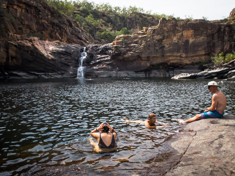
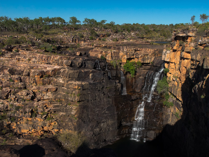
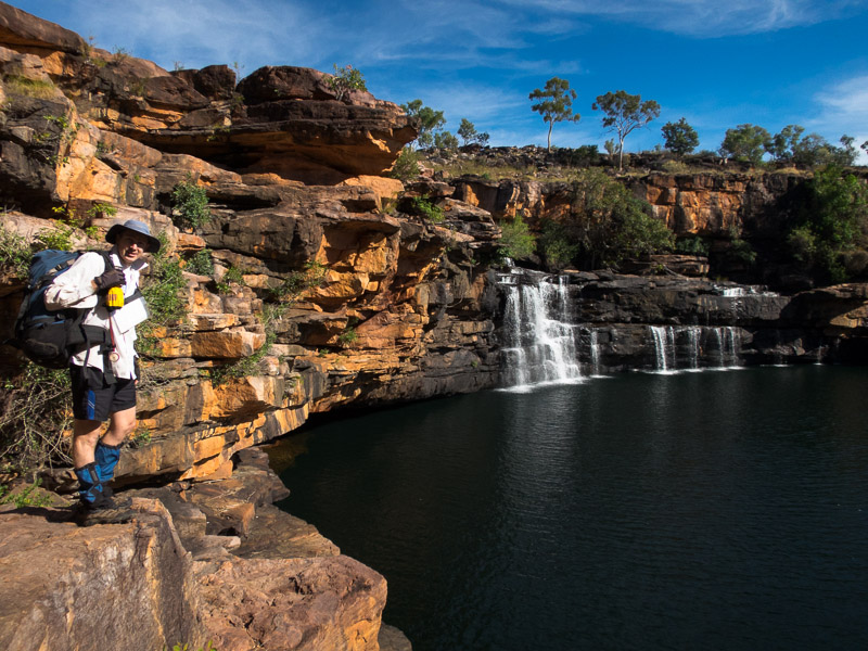
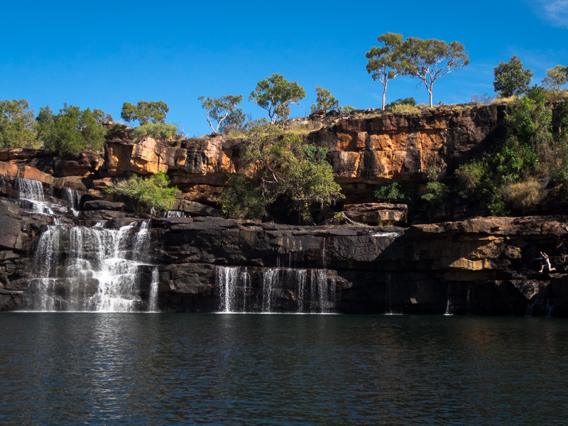
We weren’t going to drive all the way back out to Spooky & Peek-a-boo so we decided to head for Calf Creek Falls instead. Getting there early in the day meant we were able to get one of the first-come, first-serve campsites. The hike to Lower Calf Creek Falls was busy but the falls were spectacular. Yet again we underestimated how long it was going to take and didn’t bring lunch so we had another mid-afternoon lunch when we got back to camp.

IMG_1176

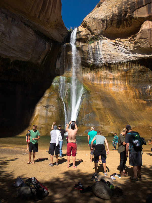
Popular hike to Lower Calf Creek Falls

IMG_1177

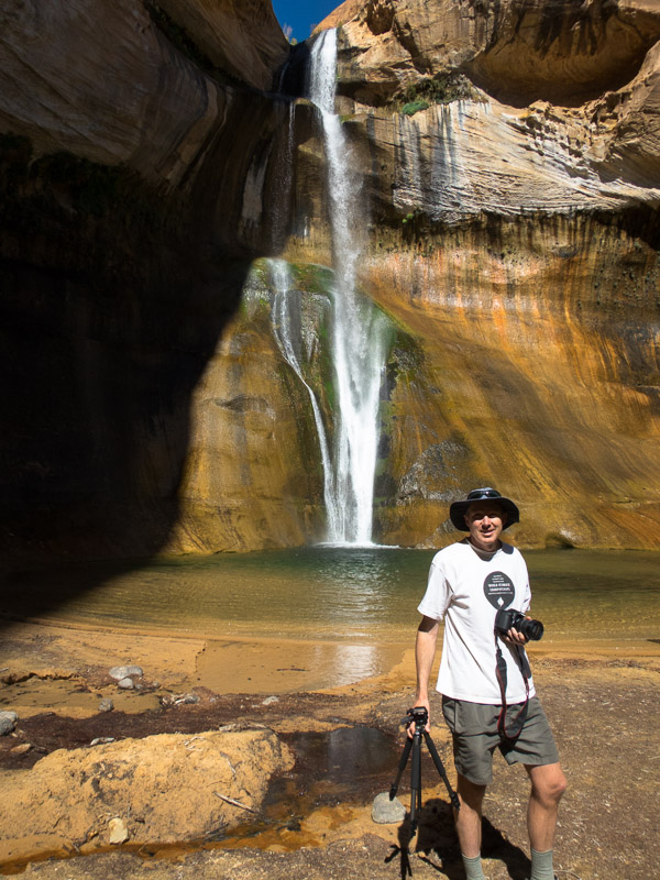
But with the right angle you can make it look like you’re the only one there!

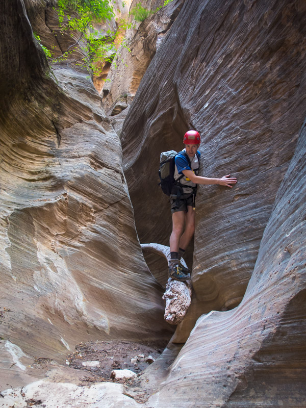
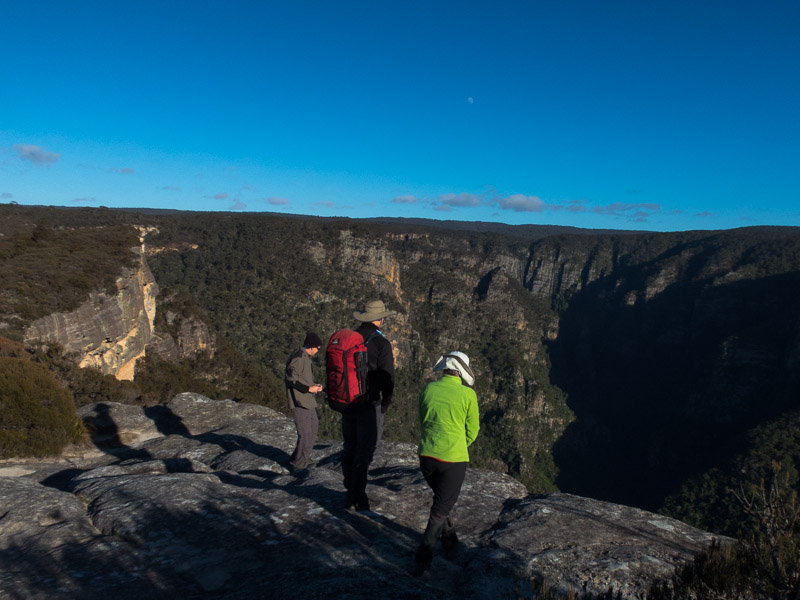
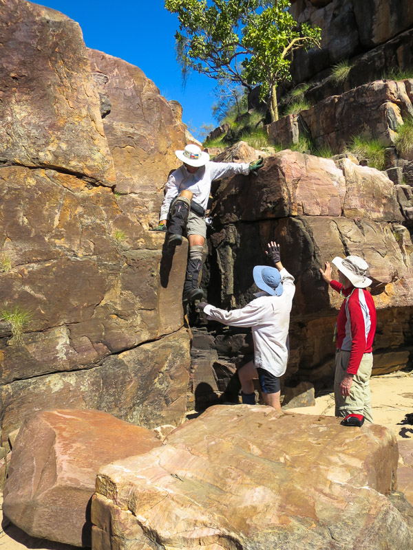
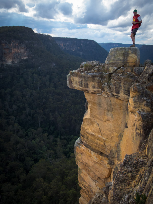
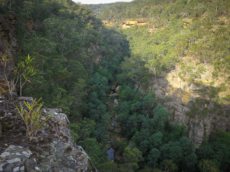
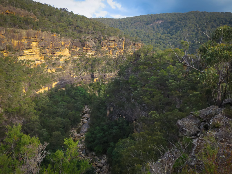
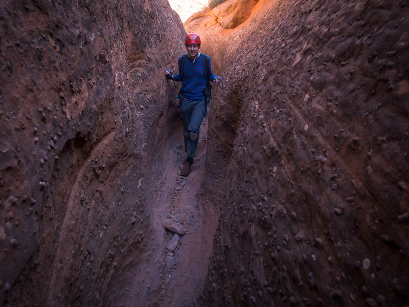
Our final day in the GSENM we headed out on the Old Sheffield Road (Spencer Flat Road) to do Upper Red Breaks Canyon. We almost didn’t get there as the car struggled to get up one steep, rutted out hill, but after 3 attempts we were through. Other than that one section the road was good quality. We descended the East Fork of the Upper West Fork of Red Breaks and ascended the Upper West Fork. The East Fork was ok, but the West Fork was stunning. We had to work pretty hard in the last really tight narrows, which were both squeezy and an up-climb. A beautiful canyon.

IMG_1184

Tom in Red Breaks

IMG_1189

Tom downclimbing in Red Breaks

IMG_1196

Red Breaks

IMG_1198

Tom with all the moves in Red Breaks

IMG_1199

Tom in the most strenuous section of the day. Narrow and an up-climb!

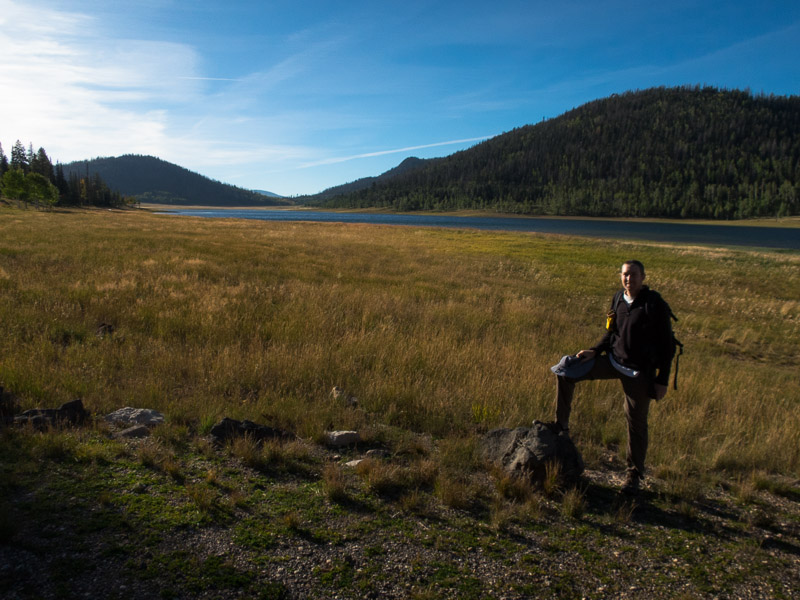
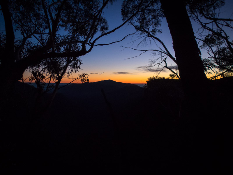
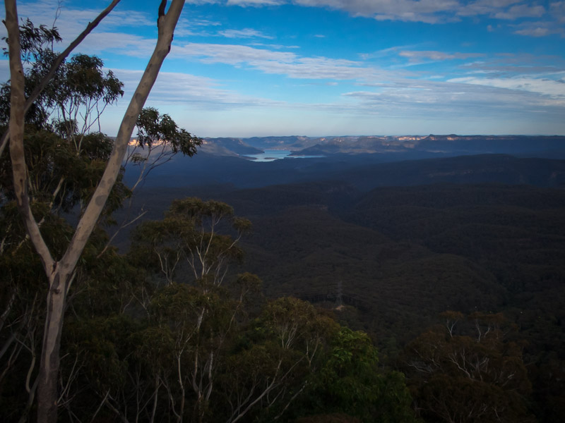
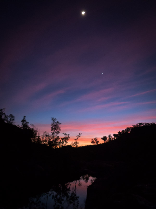
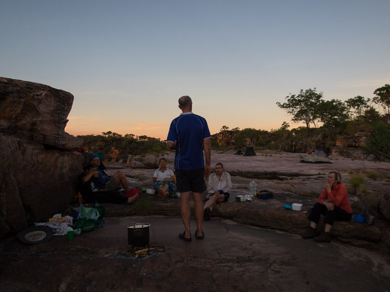
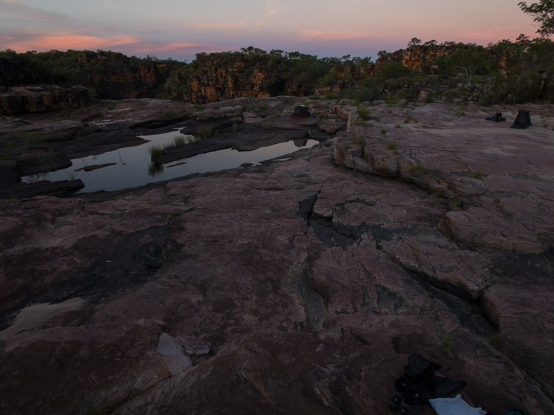
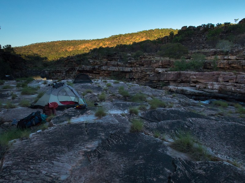
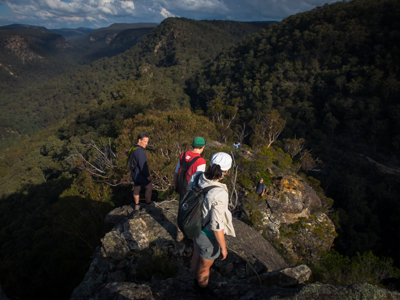
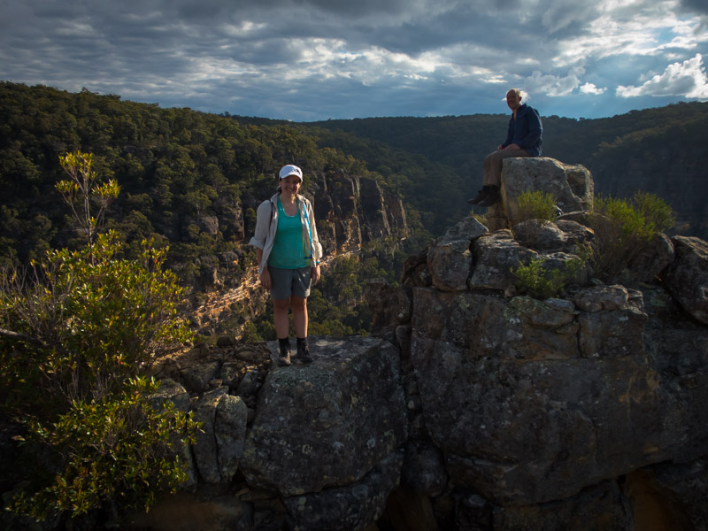
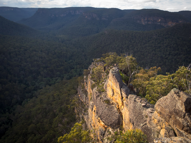
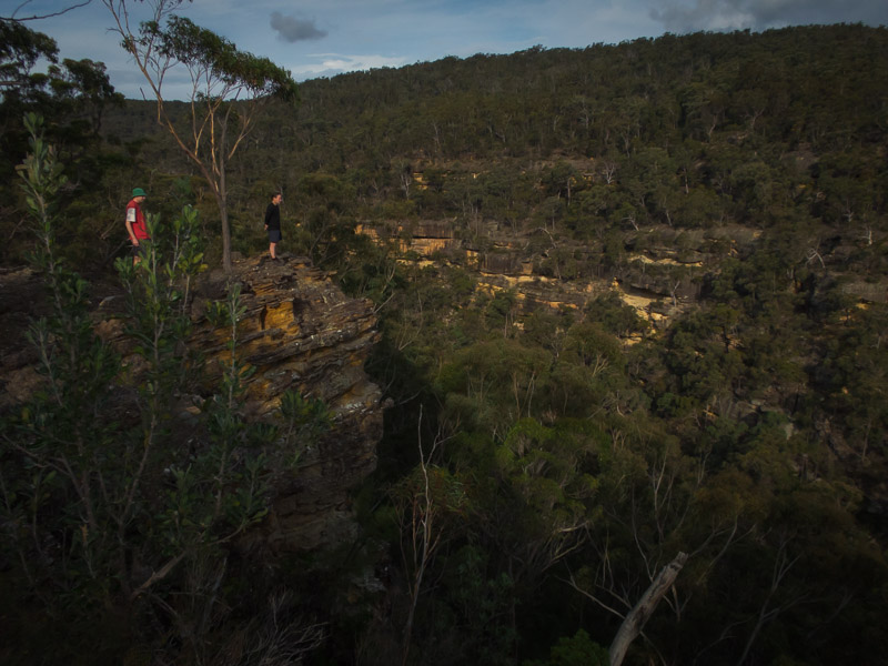
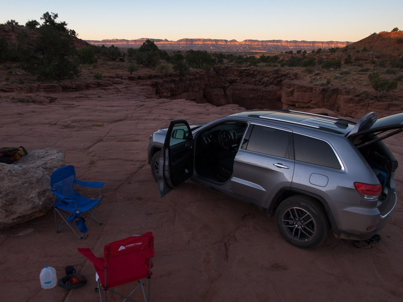
That night we camped just off the Old Sheffield Road at a balcony camp with far-reaching views to the East.
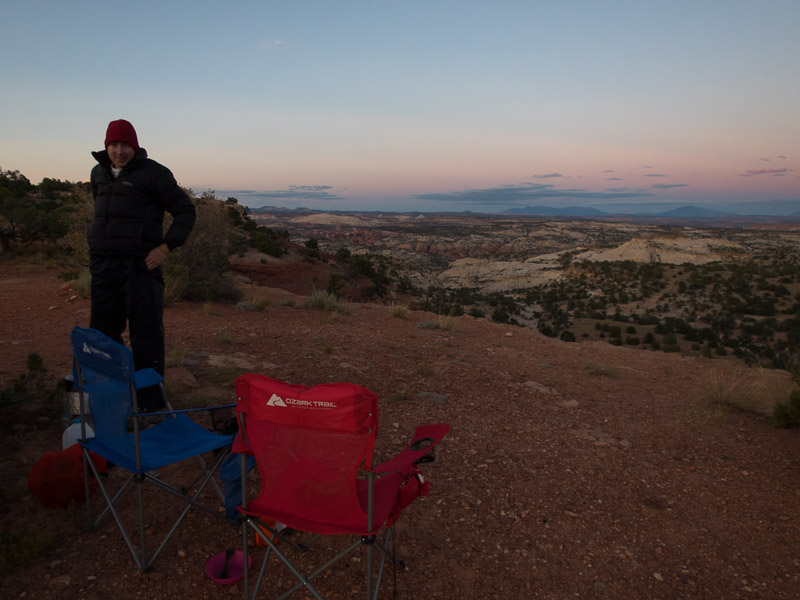
IMG_1205

Balcony Camp

Part 3 – San Rafael Swell & Moab – coming soon

Back to main index

Utah & Arizona (Sep/Oct 2017) – Part 1 – Zion area

Having learnt our lesson after 2013 we didn’t plan to go anywhere the day we arrived in the US. It was just a day of buying food supplies, canyoning gear (knee pads!) and sleeping. By good fortune friends of ours from Australia were finishing their trip the day after we arrived so we were able to get water containers, leftover food and various other supplies from them. Following a good nights sleep in a hotel away from the strip and we were ready to head for the canyons!


With a waffle-machine at breakfast, general slowness in getting ready and the time change between Nevada and Utah, it wasn’t particularly early when we rolled into Zion National Park. Deciding two (albeit short) canyons was probably a bit ambitious given it was after 1pm we just picked up a permit for Keyhole Canyon. Our first time through Keyhole, it’s super accessible with the walk in and out being <15 minutes. This was the perfect canyon to do to remind ourselves how to canyon – remembering of course we were coming off the back of winter and our last canyoning had been in April. We were warned that Keyhole was ‘full’ by the wilderness desk and we must wear wetsuits. Not sure where the swims were – Tom got through without getting more than waist deep. From there we headed to Zion Ponderosa Ranch. We couldn’t resist having dinner in the restaurant rather than cooking – beautiful steaks – our last for a while.

IMG_1027

Tom in Keyhole Canyon, Zion NP

IMG_1029

Tom in Keyhole Canyon

IMG_1037

Tom in Keyhole Canyon

IMG_1039

The first of many slanted corridors for the trip

IMG_1041

Big Horn Sheep on the side of the road

The next day was one of our longer ones. We drove out to the Chamberlain Ranch Trailhead and started walking down the Virgin River. This is where people doing the Narrows as an overnight trip start. But that wasn’t our goal. We exited up a gully – which our notes did say had a couple of up-climbs. The first one was a bit tougher than we were expecting – but then we hadn’t yet got back into the groove of how grippy the rock is here. Nonetheless we made it up and over into Deadeye Dick canyon.

IMG_1042

Tom on the first, somewhat challenging, upclimb

IMG_1046

Tom abseiling in Deadeye Dick Canyon

IMG_1051

Tom in Deadeye Dick Canyon

IMG_1056

Tom in Deadeye Dick Canyon

IMG_1058

Nearing the confluence with the Virgin River

Then a late lunch on the Virgin River before a quick run through Mighty Mouse canyon, then back to the car. A very satisfying first day.

IMG_1059

Lunch on the Virgin River, with makeshift chopping board

IMG_1060

Throwing the rope in Mighty Mouse Canyon

IMG_1064

Tom abseiling in Mighty Mouse Canyon

We had a second night at Zion Ponderosa. We had planned to do Boundary Canyon the next day – which was going to be a long day, as it was a couple of hours drive to the trailhead before even starting what was a reasonable day out. I wasn’t too disappointed when in the early hours of the morning, when we were both awake (jetlag), that Tom said his foot was sore and he wasn’t up for the long day. Getting to sleep in was great but then we needed a new plan. We settled on a short canyon nearby called Diana’s Throne. It was fairly busy, as it is a good beginner canyon outside of the park (so no permit needed). It seems to be popular with the guiding companies as well. After spending a while giving some rope-coiling/management tutelage to a guy we met in the canyon we caught up to a commercial group. The guide mentioned another canyon we could do at the end – this was a great tip and made the day a bit longer. Not sure whether the slot has a name but it was a fun bonus, and despite being the last group (of 4) to leave the cars we were the first back! It also gave us time to do the rounds of the shops in Springdale to buy canyoning shoes (not available in Australia…).

IMG_1070

Tom in Diana’s Throne Canyon

IMG_1078

Tom in Diana’s Throne Canyon

IMG_1082

Tom in Diana’s Throne Canyon

Unlike our 2013 trip where I had booked camping at Watchman Campground more than 6 months in advance this time round we only got 1 night due to a late cancellation. We were in almost the same spot as previously and it was nice to be warm having dropped from 6,500ft (1980m) at Zion Ponderosa to 4,000ft (1220m).

IMG_1087

Camping at Watchman Campground

The next day it was time to move on from Zion. Kanarra Creek wasn’t originally on our plan but with Tom’s sore foot short days were going to be necessary and it looked good. I had originally thought we’d be done in 1.5-2 hours so we didn’t take lunch. Turned out we were out for 3 or 4 hours. Kanarra Creek is a slot canyon with 2 ladders installed at the only obstacles in the creek meaning it can be done as a hike. It’s fairly unusual to have flowing water in the canyons around the area and so Tom spent a lot of time with tripod and camera.

IMG_1090

Impressive narrows in Kanarra Creek

IMG_1091

Tom ascending the first ladder

IMG_1099

Picturesque Falls

IMG_1105

The serious photographer on the second ladder!

IMG_1106

More impressive narrows further up Kanarra Creek

We didn’t have a plan on where to camp and ended up in the Cedar Breaks National Monument at the Navajo Lake campground. We decided this was probably the highest altitude either of us had camped at – 9,035 ft (2,754m).

IMG_1112

Tom at Navajo Lake

Part 2 – Escalante

Back to main index

Utah & Arizona (Sep/Oct 2017)

Tom & I spent four weeks in south-western USA primarily Utah. The main activity was canyoning with a few touristy days thrown in here and there.

I have updated the list of things we learnt which might be helpful to any Australians planning a canyoning trip to Utah.

route_map

K2K in a Day!

An annual feature on the Sydney Bush Walkers calendar is K2K in a Day. For those not in the know that is walking from Kanangra to Katoomba (well to the locked gate on Narrow Neck) in a day. The goal is to make it in 12 hours. Total distance 45km, but more significant is the amount of up and down, +1410/-1470 (just counting the big climbs but with plenty more undulation). I had hoped to do the K2K last year, following my successful Six Foot Track in Day, but the weather didn’t play ball and the Coxs River was up way too high to contemplate a crossing so the trip was cancelled.

K2K elevation profile

K2K elevation profile


This year I hadn’t seriously considered doing it as, firstly, I didn’t think I was fit enough, and secondly, up until 2 days before I had other commitments. When the other commitments fell through I fired an email off to Alex half-expecting to be knocked-back (for both logistics and fitness reasons). Except I wasn’t! So next thing I knew I was setting up my tent at Boyd River Campsite on Friday night. As usual it was freezing at Boyd River but I have learnt by now and had 2 sleeping bags and consequently a good nights sleep. Some of the others were not so fortunate.

Having successfully negotiated an extra 10 minutes sleep my alarm didn’t go off until 4:40am. At 5:25am we left Boyd River. A special thanks to Anna and John who not only drove us round to Kanangra the night before but also got to get up in the early hours to drop us at the Walls. After our briefing at the Walls Carpark there was momentary panic when Alex couldn’t find his pack… we were contemplating having to drive back to Boyd River when… it turned up on the other side of the car. Phew. So after the mandatory photo we started – at 5:56am by my watch.

IMG_0941

The starters just before 6am – Naveen, Adrian, Alex, Rachel, Vivien

I’ve walked the section out to the Plateau many times but the experience of doing it as dawn was breaking was spectacular.

IMG_0944

Early morning Cloudmaker

IMG_0946

Stunning way to start the day

We reached the lookout on the plateau and Alex headed off towards the Coal Seam Cave track. Naveen and Adrian, who hadn’t been to Kanangra before, didn’t know any better and followed him. Vivien & I weren’t so keen on his direction. Which earned us a “come on!” from Alex. At which point Vivien asked him if we were going to Coal Seam Cave. A sheepish change of direction soon had us heading north towards Gordon Smith Path.

IMG_0953

Party with views across the mountains

The photo below is out of order, but about this point in the day I ‘corked’ my left thigh on a sawn off banksia. Being pretty cold it hurt a lot – but I was quite impressed to see how the bruising developed through out the day. This is the bruise about 12 hours after it happened.

IMG_1016

Bruise from walking into a sawn off banksia on the plateau about half an hour in

IMG_0961

Alex cuts a lonely figure at Gabes Gap

IMG_0965

Cloudmaker and it’s only 8:45am!

We made good time getting to and departing Mt Cloudmaker before Alex’s guidance time of 9am.

IMG_0969

Alex dutifully marking down our time (9:20am) at Dex Creek

No one needed water at Dex Creek so we were soon onto “day 2” of the 3-day route. It was 10 years since the only other time I’d done K2K (that time over 3 days). Some sections I’ve walked plenty of times, but the section from Dex Creek to Mt Yellow Dog I’ve only done the once. It was lovely to walk the ridges on a perfect bushwalking weather day.

IMG_0976

Naveen scrambling on the way to Mt Strongleg

IMG_0981

Vivien sidling

IMG_0982

Adrian starting the steep descent down Strongleg

The steep descent down Strongleg spat us out into someone’s campsite on Kanangra Creek. We had wondered whether there would be running water but no need for concern as it was flowing strongly. After a quick water refill we were off again, soon realising we’d hit Kanangra Creek a fair way above the junction which is probably why it was flowing! On the plus side Alex said it was the gentlest descent he’d ever had off Strongleg.

IMG_0984

Making our way down Kanangra Creek

IMG_0986

Kanangra Creek a lot drier closer to the Coxs. Mt Yellow Dog looms above us

The Coxs River was about shin height for me. The Kelpie Point Gauge said 0.12 – much safer than the 0.6 it was at this time last year!

IMG_0987

I thought there were no breaks on this trip Alex?

Now we had the biggest climb of the of the day up Yellow Pup Ridge to Mt Yellow Dog (150m to 780m). It’s a pleasant (?) enough climb as there are a number of switchbacks meaning the legs get a bit of a break from the constant ascent. I was pretty happy to get to the top at 1:05pm (exactly an hour after I’d started) and get into some food.

IMG_0989

Mt Yellow Dog, it’s 1:05pm and I’m hungry!

IMG_0990

Adrian taking a nap

When Alex & Naveen arrived at the top we agreed it was time to let us run free. The group would split to allow everyone to move at whatever speed we wanted. Adrian, Vivien and I set off hoping to make up the half hour we were currently behind based on the 12 hour target schedule.

IMG_0991

Alex dismantling the “inappropriately sized” cairn

IMG_0992

We might have been faster if we didn’t stop to photograph the wildlife

Of course the 12 hour cut-off wasn’t the only priority. We saw a bit of wildlife which we stopped to photograph.

IMG_0993

Apparently we’ve done 39km already (I don’t think so)

The signage on the Medlow Gap firetrail claimed it was 39km to Kanangra. That should mean we only had 6km to go, sadly we knew that wasn’t the case – it was more like 17km… so on we pushed.

IMG_0995

Medlow Gap at 3:15pm. Will we make it in 12 hours?

IMG_0996

Like I said… maybe we would have been faster if we didn’t stop to photograph the wildlife!

IMG_0997

Vivien on the last major climb up Mt Debert

IMG_1001

Vivien on Tarros Ladders

As we started climbing Tarros Ladders I heard voices at the top. I could see faces staring down at me. I was about to yell up for them to wait for us to get up before they descended when I realised it was our support crew. Paul and others had kindly carried out water and snacks for us to the end of Narrow Neck. It was a this point we found out from Paul (who Alex had been in phone contact with) that Naveen had started vomiting not long after we’d left and so him & Alex were heading to Carlons Farm rather than continuing to Narrow Neck.

IMG_1003

Adrian on Tarros Ladders

IMG_1004

Beautiful views to Lake Burragorang

IMG_1007

What’s in the snack stash?

Vivien and I got to the top just before 4pm. I didn’t actually need any water or snacks, still having plenty in my bag, but I drank some Gatorade and ate a chocolate digestive out of guilt for the effort the support crew had put in. I could see in other years though this would be a crucial replenishment. You couldn’t ask for better weather than the day we’d had – it was sunny but not too hot to need to drink that much. Shortly after 4pm I started the fire trail bash. The sign said 9.5km, which was inconsistent with the signage we’d seen at the bottom of Mt Debert. It didn’t really matter though the main thing in my mind was to get to the locked gate by 6pm.. well 5:56pm on my watch.

IMG_1008

Narrow Neck walking with the sun setting

IMG_1010

Vivien running the downhills

And so it was we made it the locked gate at 5:39pm. We were pleased to see Anna waiting for us – a massive effort from her this weekend as well – driving us to Kanangra Friday night, then up early to drop us at the Walls, before hanging out on Narrow Neck waiting for to finish, then driving some of the walkers home after dinner.

IMG_1013

3 finishers

IMG_1015

Started 05:56 – Finished 17:39. Total time 11 hours 45 minutes

We reconvened at the Grand View Hotel in Wentworth Falls for dinner. Paul, Alex & Naveen joined us about 7:15pm, Naveen fortunately feeling better. Most people headed home about 8pm.

IMG_1017

Dinner at the Grand View – Anna (Support), Vivien (Walker), Tom (Fan boy), Lyonel (Support), Jane (Support), Geoff (Support), Adrian (Walker)

Tom and I had decided to stay the night which meant there was plenty of time for dessert. Yum, a great way to end an excellent day.

IMG_1018

I think I deserved this!


Compagnoni Pass (2017-08-12/13)

I organised a weekend trip in the Kanangra-Boyd Wilderness with SBW. I had a lot of takers, probably because it was a Q (Qualifying) walk for Prospective Members of the club. Despite being full weeks in advance there were a number of pull-outs (including Tom – now blacklisted!) so in the end there were 6 in the group which was a good number.

Our route took us from Kanangra Walls Lookout out to the plateau. We had made very good time initially and had an early (9am) morning tea at Cottage Rock.

IMG_0886

Enjoying views from the plateau first thing Saturday morning

We had a second morning tea at the Roots Ridge turn-off before continuing down Gingra Range. A slight navigational error on Fourth Top gave the group an extra 120m of ascent/descent, for which they were highly grateful, before we had lunch on the ridge between Fourth and Fifth Top. After lunch we descended to the Kowmung River where we filled up on water for the rest of the trip.

IMG_0890

Darryl contemplating having to carry 5 litres of water up the hill for a high camp

With considerably heavier packs the last couple of hours were a 650m slog up Willa Spur. We made camp in a nice cave just on 5pm. Wagyu biltong was the highlight of happy hour (Tom wished he’d come along after I told him about that). I threatened no one was allowed to go to bed before 7:30pm and despite the solid day in the legs we all made it through till 9pm!

IMG_0898

Tent City, Darryl & Helen in “Werewolf Cave”

IMG_0899

Early morning light hitting the cliff

The first task of the morning was ascending Compagnoni Pass. It would have been a much simpler ascent if the rock wasn’t covered in Casuarina needles.

IMG_0901

The bottom section of Compagnoni Pass

IMG_0902

Helen climbing the lower section of Compagnoni Pass

IMG_0908

Helen at the very top of Compagnoni Pass, along with the waiting paparazzi

From there we traversed Ti Willa Plateau before having morning tea on Cloudmaker.

IMG_0909

Bill & Helen on Cloudmaker

From Cloudmaker we were in well-trodden territory and it was straight-forward, if undulating, walking for the rest of the day.

IMG_0910

Beautiful Kanangra

IMG_0912

Helen climbing Gordon Smith Pass

IMG_0914

Helen, Bill, Nigel, Sebastian, Darryl

IMG_0915

Almost back to the cars. Seasonal burn-off smoke in the distance.

We made it back to the cars at 3:15pm. An excellent weekend in beautiful country.

Kakadu (July 2017)

After our walking and paddling in Katherine Gorge we had a couple of days off before we joined our SBW group in Darwin. We spent a very enjoyable day at Umbrawarra Gorge – lots of rock-hopping down a gorge which just kept getting deeper and deeper.

IMG_0752

Are we having fun yet?

IMG_0754

Tom trying to get around a pool

Tom didn’t believe me that we might get wet but there were some compulsory wades – no great hardship when it’s over 30°C.

IMG_0755

Conceding defeat and wading!

Back in Darwin we met up with the other 9 people in our group and hopped in a mini-bus which dropped us off at Maguk (Barramundi Gorge). We had a short walk before we made camp. The real walking started on day 2. Disaster almost immediately as we managed to become separated from 2 members of group within 20 minutes of leaving camp! Many ‘day-o’s’ later we were reunited and actually on our way. Much of the first day was on a fairly well-formed (but unmarked) track.

IMG_0773

Day 2 – the start of the real walking

We had a delightful lunch at the “Jade Pool” before spending most of the afternoon at Picaninny Pools.

IMG_0775

Tom cooling off in Jade Pool

IMG_0778

David pointing out Picaninny Pools where we spent much of the afternoon

I’m not sure what possessed me but I did a 6m jump – but I wasn’t standing at the top waiting for the photographers to get in position – I was either going straight away or not at all!

IMG_0784

Peter’s makeshift trivet and contraband stainless steel billy.

IMG_0786

Tom enjoying the daily ritual of rum and lemon barley

Day 3 we left Barramundi Creek and headed across to Gronophyllum Creek.

IMG_0787

The party at the point where we left Barramundi Creek

There were many beautiful waterholes on this creek but we pushed past many of them to have a late morning tea at the “Lap Pool”. [Though it seemed there were multiple “Lap Pools” depending on who you spoke to]

IMG_0788

Everyone enjoying the lap pool

More swims in crystal-clear water before lunch at another delightful pool. We camped earlier than intended as progress had not been as fast we would have liked.

IMG_0793

Our campsite on night 3

IMG_0795

Dawn over Gronophyllum Creek

Day 4 we intended to get going early so were up well before dawn. One of the party had taken some heavy falls the previous day and wasn’t faring too well. We waited for a helicopter to take him out. Subsequently we started walking a fair bit later than planned. Eventually we were on our way down Gronophyllum Creek before crossing over the flood plains (very quickly as they had been burnt) to the exquisite Cascade Creek. Up until this point I’d been a bit ho-hum about the trip. I felt that the creeks we’d walked through in the Kimberley were as good, if not better, than what we’d been passing.

IMG_0799

Mary walking next to the Gronophyllum Palms which feature heavily along Gronophyllum Creek (hence its name)

Cascade Creek is spectacular. Unfortunately as we were trying to make up time from the previous day we couldn’t spend too long here – only 2 hours to enjoy the many jumps, water slide and beautiful pools.

IMG_0803

Tom above the first few pools in Cascade Creek

IMG_0809

Peter showing us how the water slide is done

IMG_0811

Patsy jumping

IMG_0813

Kim jumping (and Alex not jumping… it was meant to be a synchronised jump)

IMG_0814

Alex jumping

IMG_0817

Grace preferring to sunbake

Mid-afternoon we reluctantly headed upstream through an attractive gorge with lots of rock-hopping.

IMG_0820

Walking along Cascade Creek

Again we camped earlier than intended as it was getting late in the day and we were still over an hour from our planned campsite. Our spontaneous campsite was attractive but a little slopey.

IMG_0821

Grace getting rum & lemon barley ready at camp on night 4

We had an early start on day 5 to to continue making up lost time from the previous two days. The party split – 3 of us continued up the gorge, with an expected compulsory swim (pack float), while the remainder headed cross-country to cut off a bend. With some judicious scrambling we managed to avoid swimming but subsequently missed some art work which we were looking for ‘after the packfloat’.

IMG_0825

Patsy and Tom carefully edging around a pool

Patsy got through all the tricky sections only to slip on the last climb-down and took a full dunking (with a non waterproofed pack!). The others had beaten us to the rendezvous point by a few minutes, where they were ‘camelling up’ for the cross-country trek to come. The first 8km or so was easy walking through burnt or low vegetated country. I was feeling confident we’d get into camp in the early afternoon which would be a nice change from the previous few days. We had a dry lunch at 1pm and then continued on. The country got more difficult, progress slowed in a tangle of small tributaries and head-high spear grass. It was after 4pm when we finally found ourselves at the top of the (dry) waterfall we were planning to camp at. There wasn’t a lot of water at the top but a large pool at the bottom. Peter and I headed down to check out the camping options – I was relieved to find an acceptable flat campsite next to the pool. It was a long, tough day with no swims so we were happy to get into camp and have a wash.

IMG_0833

Everyone happy to be at camp after a tough day

IMG_0834

The dry waterfall and large pool

Day 6 surely had to provide some relief. This wasn’t the trip I was expecting!? Where were the early arrivals at camp, followed by multiple cups of tea, swims and general relaxation for the afternoon?

IMG_0835

More cross-country walking on day 6

Fortunately we made good time in pretty easy walking country and were at a lovely campsite by 1:30pm. Everyone enjoyed the chance to chill out after some pretty long days.

IMG_0836

Tom about to do some washing (hence being fully clothed) given we had the afternoon to dry everything

IMG_0840

Grace about to produce a very tasty paella

Day 7 started with a short walk to the start of Koolpin Gorge (Jarrangbarnmi).

IMG_0846

Crossing Koolpin Creek

Once in the gorge some of us opted to pack float where we could while others boulder-hopped. Some people’s packs were more waterproof than others…  fortunately a leisurely lunch break provided time to dry out wet sleeping bags.

IMG_0853

Julie-Anne pack-floating while Alex looks on from dry land

IMG_0855

3 of the non-pack floaters choosing their own adventure above the water

IMG_0857

Tom doing a ‘depth test’ jump

IMG_0858

Having checked the depth he now jumps from about 7m

IMG_0860

Having done his fun jumps he now jumps in from a lower ledge with his pack

IMG_0866

Looking out over the floodplain from near the end of Koolpin Gorge

Our last camp was on the flood plains so we savoured the final swim above the last waterfall before making camp in the late afternoon.

IMG_0868

Final swim in Koolpin Gorge

IMG_0873

Following the tourist track out of the gorge

IMG_0874

Final night camp

The last day we only had 5km to get to Flying Fox Crossing on the South Alligator River where the mini-bus would pick us up. It was good walking and we made it with half an hour to spare. From there it was what felt like a long drive back to Darwin. The trip finished with the buffet at Seafood on Cullen taking in the sunset over the water.

IMG_0882

Sunset in Darwin


Katherine Gorge (July 2017)

We signed up for a week-long SBW trip going to Kakadu and figured it was a waste to come to the NT for just a week. So what else was there to do? Having just bought packrafts Tom suggested we could packraft Katherine Gorge. We decided to spend 2 days walking along the tracks on the Southern rim, and then 3 days paddling in the gorge. The downside of this plan was that we were going to be carrying heavy packs to start with as we would have all our food plus the packrafts (~3kg including paddle).

Katherine_Gorge

So we set off with around 19kg packs (lots of drinking water as well) from the Nitmiluk Visitor Centre early on the first morning. We got good views of Gorge 1 & 2 from Pat’s Lookout and Jedda’s Rock.

IMG_0658

Tom with Gorge 2 in the background

The first day was hard work, with our heavy packs, and 34°C temperature forecast. We were glad to get to the Lily Ponds for lunch and a swim. After the Lily Ponds we still had a bit of walking to get to Smitt Rock our campsite for the night. The bushwalkers campsite at Smitt Rock is set high above the gorge with excellent views. We were pleased to find the creek next to the campsite running so didn’t have to worry about drinking water. To have a swim we headed down the marked track to the river.

IMG_0664

Tom demonstrates his preferred way of entering water of unknown depth, with Smitt Rock behind him.

After lounging around in the shade by the river for a while we pioneered a different route back up to camp. We climbed a couple of waterfalls in the small creek that was running past the campsite to return more directly.

IMG_0668

Campsite at Smitt Rock

There were plenty of sites at Smitt Rock and we were the only ones there. We choose the site closest to the cliffs which had lovely views for happy hour and sunset. It was the first of four very warm nights – not sure if it was a micro-climate thing near the gorge but it never really cooled down.

IMG_0674

Sunset from Smitt Rock campsite

On our second day we walked from Smitt Rock towards 8th Gorge. The track is marked with arrows the whole way. There is not much of a track on the ground and we spent quite a lot of time looking for the next arrow.

IMG_0679

Arrows mark the route every 50-100m. Not always that easy to spot!

Having morning tea shortly before the junction with the Jawoyn track we met another group of bushwalkers. They had been at 8th Gorge the previous night. We had a brief chat and they mentioned there was a small stagnant pool at 8th Gorge and when quizzed said there was no running water.

IMG_0680

Tom with his heavy pack (the yellow thing is the packraft)

Despite it being a hot day and both of us feeling the effects of the heat and our heavy packs we decided to go on a side-trip to Jawoyn Valley. Glad to ditch the packs we found some of the art sites that were shown on the map, and maybe some that weren’t shown.

IMG_0682

Tom with some of the Jawoyn Valley art

Tom decided we should go ‘off piste’ on the way back rather than follow the trail. We walked down a fairly uninspiring dry creek but were delighted when it turned into a few beautiful waterholes. Only problem we hadn’t brought lunch with us so couldn’t linger for too long!

IMG_0684

Enjoying an unexpected waterhole!

We spotted the toilet at the 8th Gorge campsite far sooner than expected. And then were most surprised to come to a large waterhole which had a waterfall running (ok, maybe trickling) into it. So much for the small stagnant pool and no running water! It just illustrates how different people’s perceptions can be based on their experience.

IMG_0689

Tom filling water bladders from the running waterfall, next to the beautiful waterhole.

About 50m downstream was a waterfall dropping 30m or so down to the river. It was a beautiful spot for happy hour. I’d left dinner rehydrating in a ziplock bag underneath my hat. Unfortunately the crows were smart enough to find it so on return from happy hour some of dinner was spread across our sandy campsite. We salvaged what we could and resolved to be more careful of crows in the future.

IMG_0691

Happy hour spot, looking down 7th & 8th Gorges

The next morning we dumped everything out of the tent. Tom went off to take photos from the happy hour spot and I went off to the toilet. When I returned the crows had been at it again. My small ziplock bag of toiletries had been dispersed across the sand. Beware of the crows!

I was excited to change gears from bushwalking to paddling. While the bushwalking had been good it was very hot and being on the water would (hopefully!) be cooler. Down we went to the gorge and pumped up our packrafts.

IMG_0696

Tom inflating his packraft

It wasn’t far upstream to the 9th Gorge campsite. We tried to put our packs where they’d stay in the shade and then continued upstream. Today was just about exploring upstream from 9th Gorge as far as we could get. We had a few portages but the packrafts are pretty easy to tuck under your arm so they didn’t take long – particularly since we only had small daypacks with us. Eventually we came to a big boulder block up in the gorge. Tom explored up a little way and concluded there wasn’t much point taking the rafts any further. We continued on foot.

IMG_0701

Final stop upstream for the rafts

It was a fun section of river to negotiate on foot. We climbed up to a high point for expansive views. I’m not sure what gorge number we got to – maybe 11 or 12? The remote feeling was somewhat tarnished by the frequent helicopters buzzing around with tourists. They were a constant feature every day – quite intrusive.

IMG_0707

Tom above part of what would be a long portage section

IMG_0708

Looking downstream from the boulder block-up. The rafts have been left on the rocks where the water starts in the foreground.

IMG_0710

Tom paddling back to 9th Gorge

The 9th Gorge campsite is a big sandbank on the river. It gets full sun most of the day and only has one small tree for shade. We got back mid-afternoon and decided to hang out in the shade on the other side of the gorge until the sun had lost a bit of its intensity.

IMG_0712

Tom waiting for the sun to go down a bit

9th Gorge Campsite is the only official campsite that doesn’t have a toilet. I guess that means it doesn’t get too much traffic. Climbing out onto the rim in the morning was a good excuse to get some photos.

IMG_0721

Looking downstream over 9th Gorge campsite. Our tent/Tom’s raft visible middle-left.

It was a full moon the day we started the walk so we got some lovely views with the moon.

IMG_0722

Sunrise from the cliffs about 9th Gorge Campsite

The next day was a short one! We only had to get from 9th Gorge campsite to 6th Gorge campsite. The timings on the official canoeing guide were generous – and on the portages we were a lot faster with our light rafts. We gave ourselves a leisurely start but even so were at the campsite by 11am. If we were planning the trip again I’d either combine our day 3 & 4, or else plan to camp at the canoeists campsite at Smitt Rock on night 4 instead of 6th Gorge.

IMG_0727

Tom not going anywhere fast on some not quite deep enough rapids.

It had been quite breezy on day 3, and the wind got more intense on day 4. After arriving at 6th Gorge Campsite we had a bit of an explore. There was a small waterfall (or spring?) running at the back of the camp (would have a pool earlier in the season) which was good for drinking water. We then climbed up on the cliffs to get some views down the gorge. As the wind was unpleasant we retreated back to the waterfall and lazed about there for the afternoon where it was a bit more sheltered.

The previous 3 nights we’d had the campsites to ourselves but not long after lunch another couple arrived. They had paddled up from Gorge 2 with a large esky – which meant they were well provisioned. Turned out they run a EPIRB and satellite phone hire business and I had hired a sat phone from them 2 years ago. I don’t think the kayaks were designed to include 2 people and an esky! It was quite amusing to see them return the next day – the esky got a seat in the kayak and one of them sat on the back with their legs dangling in the water.

IMG_0734

We tucked ourselves away in the trees at 6th Gorge campsite to try and get out of the wind

Our last day was bigger than we would have liked. As the National Park no longer allows paddling in Gorge 1 (due to potential saltwater crocodiles) canoeists have to get the ferry out. I’d tried to book a ferry but was told as we had our own canoes we would have to walk out from Butterfly Gorge. I didn’t pursue the reason for that so I’m not sure if there was any flexibility in that policy.

We had an early start which was lovely, there was no wind and some long paddling sections. I spotted a freshwater crocodile sunning itself near Smitt Rock. When we arrived at the end of Gorge 3 it was a bit of shock. Having seen almost no one for 3 days it was like we were in Pitt St Mall! All of the paddlers who had come across on the 7am ferry were on their way up the gorge. There must have been 50 kayaks, plus a couple of tour boats (and don’t forget the ever present helicopters). Fortunately they were all on their way up the gorge so once we passed them it was back to relative solitude. We stopped for morning tea at Butterfly Gorge and enjoyed chatting with a few day walkers.

IMG_0738

Tom in a long paddling section in Gorge 3

Then it was the final paddling leg to the start of Gorge 2. After drying off our rafts and deflating them all we had left to do was walk out. The ranger we had got our camping permits from told us about an unmarked route we could take from Gorge 2 up to Pat’s Lookout. I’m not sure we followed the exact route she intended but we found our way up a gully and onto the track. We had lunch at Pat’s Lookout and then it was just a few kilometres walk back to the visitor’s centre. A very enjoyable trip.

Prince Regent NP, The Kimberley (June 2017) – Part II

Continued from Part I

The falls were spectacular and we were relieved to know the hardest 2 days of the trip where out of the way.

IMG_0524

Melissah with views down the gorge

IMG_0525

Grace checking out the falls

IMG_0527

Looking down the falls from the top

Ro had ensured happy hour was good on night 6 with a 2L cask of wine in the food drop. That had been her main concern when the bag had rolled off the boulder – did the wine stay intact? It had, the main complaint seemed to be “where was the second cask?”.

IMG_0538

Happy hour on night 6

IMG_0539

Mike holding court

IMG_0540

Sunset over Garimbu Creek

IMG_0541

Camping above the falls on night 6

Unusually there had been a bit of cloud around on day 6 & 7. This provided a magnificent sunrise on day 7.

The morning of day 7 we had a few things missing. Apparently there’s a quoll out there that likes gingernuts, women’s knickers and steel wool.

IMG_0544

Sunrise on day 7

Mike came up with an excellent plan of doing a one-night trip up the creek and then returning to the top of the falls the following day. This meant we could leave a lot of our food behind and avoid heavy packs for a couple of days. The food bags were re-hung (in a more accessible tree) and we headed upstream.

IMG_0547

Views of Garimbu Creek

With a fairly short day ahead we had a leisurely morning tea with lots of jumping by Mike and Tom at a great waterhole.

IMG_0548

Beautiful morning tea spot

IMG_0555

Some of the many wildflowers that were out

Our camp on night 7 was our most intimate of the trip. It was at a wonderful waterhole, almost the definition of serenity (other than when Tom was jumping in!).

IMG_0556

More jumping at camp on night 7

We explored a bit of the nearby country that afternoon.

IMG_0558

Interesting rock formations nearby

IMG_0562

Wandjina art

IMG_0563

Tom about to destroy the reflections… diving for once instead of jumping!

IMG_0565

Camp on night 7

IMG_0568

Camp on night 7

On day 8 we headed back downstream following a slight different route.

IMG_0577

A tricky section of Garimbu Creek

IMG_0578

Grace does a narrow sidle above Garimbu Creek

We camped in a different spot above the falls on night 8 as the spot we’d chosen on night 6 had been a bit of a wind tunnel. The weather which had been quite cool up until night 6 started to warm up so we had a much more pleasant night second time round.

IMG_0580

Camp above the falls on night 8.

IMG_0587

Tom with the falls in early morning sun

On day 9 we descended below the falls – via a side creek a couple of kilometres downstream. We got some great views of the falls on our way out.

IMG_0590

The full falls

IMG_0591

A very pretty, easy-walking, side creek to get back into Garimbu Creek

IMG_0592

Easy walking in the side creek

IMG_0594

Our wonderful campsite for nights 9 and 10

We did a day trip upstream to below the falls in the afternoon. There was some good rock art along the way.

IMG_0599

Tom & Peter checking our some rock art

IMG_0601

Rock art

IMG_0606

Tom jumping below the falls

IMG_0612

Heading back to camp

IMG_0613

Camp night 9 & 10

On day 10 most of us did a day trip downstream to see how far we could get before we would have to swim. The section below was the only time we got wet until the final canal.

IMG_0620

Grace wading

The final canal where swimming was your only option stopped us. We had morning tea and a swim. Tom swam part way down the canal and then climbed up the wall and did a jump (if you look carefully you can see his silhouette in the photo below).

IMG_0625

Looking down the final packfloat at the end of the gorge. If you look carefully you may be able to see Tom jumping part way down.

IMG_0627

Gorgeous waterhole where we swam on the way down and the way back up

Our final day of walking we exited up the side-creek we’d come down on day 9 and then across into another side-creek which cam back to Garimbu Creek below the canal we’d walked down to on day 10. It wasn’t the most pleasant terrain and the temperature seemed to be up a few degrees on previous days. We were all losing the will to walk by the time we got to camp.

IMG_0635

Final night campsite

IMG_0638

Falls below the final campsite

IMG_0640

Final night campsite came with a spa pool

IMG_0643

Sunrise day 12

Our final day we just walked back upstream 100m or so and waited for the chopper to arrive. We were taken back to Mitchell Plateau airstrip, and then a flight back to Kununurra.

IMG_0648

The chopper found us!

IMG_0652

Waiting for our connecting flight

IMG_0653

Very comfortable flight back to Kununurra

IMG_0655

About to land on Lake Kununurra

Back in Kununurra we had a lovely dinner at The Pumphouse, and later that night (with much help from google) we finally finished the crossword we’d been battling with all trip!

crossword An another excellent Kimberley trip. Many thanks for Mike for leading, particularly after Ro left us prematurely on day 4, and to everyone for their excellent company.

Prince Regent NP, The Kimberley (June 2017) – Part I

Getting to The Kimberley region of Australia is a logistics challenge in itself. For Sydney-siders like us, it generally involves flying to Darwin (having to overnight there due to the flight schedules), flying to Kununurra (maybe having to overnight again) and then some other transport to wherever you’re walking. This year’s trip was in the Prince Regent National Park, west of Mitchell Plateau. Once we finally got to Kununurra the adventure started with a 1.5hr flight from Kununurra to the Mitchell Plateau Airstrip.

IMG_0442

Preparing to depart Kununurra

We got great views of the region on the way.

IMG_0443

Views from the plane

From the Mitchell Plateau Airstrip we were then transported by helicopter into the Roe River, via a food drop on Garimbu Creek. We were planning to be out for 12 days/11 nights with us due to get to the food drop on night 6.

IMG_0447

Arriving on the Roe River and our first camp site

We didn’t have far to walk on the first day! In fact we were camping where the chopper dropped us off, which was nice given our packs were full of 6 days of food.

IMG_0449

The other half of the party arriving

Day 2 we started walking down the Roe River.

IMG_0451

Walking down the Roe River

We didn’t get far before we hit these major falls which were a great spot for morning tea and a swim.

IMG_0454

Tom above the falls

IMG_0456

Tom on our way down. The rest of the party sidled down further round on the true right. Tom & I took a more direct route down (which had a couple of tricky sections).

IMG_0460

Tom getting his first (?) water jump of the trip in.

That afternoon we visited the original “Bradshaw” art works.

IMG_0461

Bradshaw (Gwion Gwion) rock art

And then we settled down to camp on night 2. The weather was a lot cooler than we were expecting and most of us were cold on the first few nights.

IMG_0464

Night 2 campsite. Lots of almost flat rocks!

IMG_0465

Reflections

Day 3 saw us go cross-country to cut off a couple of loops on the Roe. Unfortunately we saw quite a few cows, including some herds. In theory DPAW does some culling but from the numbers we saw it’s not that effective.

IMG_0467

Cross-country walking day 3

Lunch was had at this lovely set of falls.

IMG_0473

Lunch spot day 3

There were lots of pot-holes around. This one fitted Tom in it!

IMG_0475

Tom in a pothole

That afternoon there was generally easy walking down the river.

IMG_0479

Easy rock slab walking down the Roe River

We found some lovely shady overhangs, which unsurprisingly had rock art in them.

IMG_0481

The party checking out the rock art

And we had a delightful spot to camp for night 3.

IMG_0488

Tom in the kitchen at night 3’s campsite.

Day 4 we continued down the Roe River. The rocky slabs gave way to more sandy country. It was fairly easy going but not particularly exciting. Tom & I went on a detour up Wyulda Creek where we found some lovely waterholes and had a swim.

IMG_0495

Tom on Wyulda Creek

Expecting to find the rest of the party at camp we were surprised when they flagged us down only a short distance from the Wyulda Ck/Roe River junction. Unfortunately one of our group had broken her wrist and the decision had been made to activate one of the PLBs. A chopper picked her up within 90 minutes of the PLB being activated. And so then there were 7…

Subsequently we got to our intended camp later than planned. We were a little surprised when the creek we intended to follow cross-country the next day was a very small, dry channel. Tom & I headed up it to see what was going on and found the larger creek (with some water in it) actually joined the Roe 500m downstream rather than what was shown on the map.

IMG_0497

Our depleted party at camp on night 4. Note the salami, cheese, crackers & olives for entrée.

IMG_0499

Night 4 – our only sandy camp. Not sure if it was due to the sand but it was a very cold night, with plenty of dew.

We had groups dinners on the trip. Each evening’s food was allocated to one person to prepare (everyone doing 1.5 nights over the trip). Night 4 was Melissah’s night and we had a delicious laksa, followed by damper which we filled with honey for dessert.

IMG_0500

Peter & Mike concentrating hard on their damper.

Day 5 we left the Roe to start our cross-country route to Garimbu Creek. DPAW had been burning in the park in May and when we encountered those sections the walking was a lot faster.

IMG_0501

Crossing burnt-out country made the going much easier

IMG_0503

Rock art

Where vegetation hadn’t been burnt then things were slower as you normally couldn’t see where you were putting your feet so a lot of concentration was required.

IMG_0507

An unburnt section

IMG_0508

Scrambling down a creek

We’d had an early start on day 5 as we were going across the tops on what could have been a long day. The going was reasonable, but we’d been looking for a campsite for a while with no options coming up. We were pinning our hopes on a permanent waterhole marked on the creek we were descending. When we arrived at the waterhole it wasn’t quite the picturesque camp we were hoping for. Having been walking for over 8 hours we weren’t keen to walk much further. It wasn’t too bad; there was some sand we could flatten out to sleep on and the water was ok if you cleared the scum off the surface….

IMG_0519

Potential camp on night 5

I had a bit more energy left then most of party so I decided to push on another hundred metres. To my joy and amazement what had been an exclusively bouldery/rocky creek, with little surface water, suddenly gave way to large rock slabs with running water and even some waterholes big enough to swim in! Amazing. Everyone was pretty happy.

IMG_0514

Tom at the lower waterhole which was deep enough for some water jumps

IMG_0518

Our amazingly comfortable campsite for night 5

Day 6 we didn’t have much distance to cover but we were expecting difficult terrain. The terrain didn’t disappoint, we spent 5 hours covering 5km (including breaks). The worst of it in ‘tiger country’ where we were going about 0.5km/hour through deep spinifex and boulders. We were pretty happy when we got to Garimbu Creek and our food drop. When the food drop had been hung in the trees at the start of the trip one of the bags had rolled off a boulder and got a couple of tears in it. We were a bit concerned that this may have made it vulnerable to animals, but while there had been some gnawing the animal seemed to have mainly had a penchant for plastic bags. The only food casualty was a twiggy stick (salami).

IMG_0523

Our food drops hanging in the trees as we had left them 6 days earlier.

go to part 2

Russells Needle & Rocky Waterholes Creek (2017-05-13/14)

I wanted to put a trip on our bushwalking club’s program and I was searching for inspiration when I stumbled across Tom’s list of ‘future walks he’d like to do’. Russells Needle was on it and from there I had the seed for my trip planning. I’d read a couple of trip reports about sketchy ascents of Russells Needle but I figured it was an out and back so if things got beyond people’s comfort level they could just stop! Planning a route out Rocky Waterholes Creek seemed the obvious choice to avoid backtracking. I found a few more sketchy trip reports of people trying to go up Rocky Waterholes Creek so it seemed like a great adventurous option. And thus it went on the program – all pretty unknown.

In the two weeks leading up to my trip I received quite a bit of information regarding the ascent of Russells Needle and also exits out of Rocky Waterholes Creek. While it is great to have information suddenly it didn’t seem like so much of an adventure!

Saturday morning arrived and 7 of us set out from the Wattle Ridge Carpark. With another bushwalking group also setting out at the same time we had to use overflow parking spaces. The weather was beautiful for walking and it wasn’t long before we were dropping packs at the track junction with Slott Way and the Ahearn Lookout track. We took the opportunity for a side trip to Ahearn Lookout so everyone could get expansive views of the Nattai Valley, and particularly our target for the day – Russells Needle. Russells Needle is an unusual sandstone spine which sticks out into the Nattai Valley, a knife-edge ridge separated from the main cliffline by a deep saddle.

IMG_0334

Tom & Jo looking out over the Nattai Valley

IMG_0336

Matthew enjoying morning tea

IMG_0337

Tom looking towards Russells Needle and Mt Jellore

Back to our packs we made quick time down Slott Way which was (too?) well marked with pink/yellow tape and blue metal markers on what felt like every second tree.

IMG_0340

Tom & Matthew at a lookout half way down Slott Way

The Nattai is still fairly easy going after the floods which scoured it out in mid-2016. Lunch and our campsite was a large sandy bank on the Nattai not far downstream from Needle Creek. After lunch we set off with day packs to ascend Russells Needle. Prickly bushes (blackthorn?) made the initial slopes unpleasant and of course the group were constantly advising the leader that ‘the ridge over there looks nice and clear’ (they were ignored). Once we’d broken through that we were soon skirting the upper cliff line. It took a while to reach a break in the cliffline, which looked easy, though turned out to be a little less so. The rope was deployed for those that wanted it. This brought us on to the knife-edge ridge.

IMG_0343

Gaining the spine of the ridge to Russells Needle

IMG_0346

Jo on her way up with spectacular views up the valley

Now we were almost at the real deal – we picked our way up the rocky spine until we got just below the summit. Soon the majority of the party were standing on the summit plateau.

IMG_0348

Alan & Tom on the last exposed scramble (later discovered the unexposed route to the right of this section)

IMG_0349

Trying to coax the rest of the party up the final scramble

Some were more comfortable with the considerable exposure – Matthew lounged on the true summit rock for quite some time. After a decent period taking in the views and giving everyone who wanted to the opportunity to get to the true summit we started heading down. It was only then that I discovered the easy (unexposed) route up to the summit rather than the more exposed route we’d taken up the boulder.

IMG_0350

Matthew absolutely fine with the exposure on the true summit!

IMG_0351

Jo & Matthew on the true summit

IMG_0353

Looking down the northern spine of the needle

IMG_0354

Looking back to Tom & Jo from the summit

IMG_0357

Tom on the true summit

On the descent we took the ‘clear ridge’ that everyone wanted to be on during the ascent. I’m pleased to report it was just as full of blackthorn… Back to camp around 4:30pm, after picking up water from Needle Creek, we settled in for a pleasant happy hour and evening around the camp fire.

IMG_0361

Our campsite complete with views of the Needle!

Sunday always had the most unknowns – not least what the weather was going to do. The forecast during the week had oscillated between 0-3mm to 5-10mm almost daily. The most recent forecast was fortunately back to 0-3mm and Sunday dawned clear which was a good sign.

Away from camp at 8:30am we walked down the Nattai a few hundred metres before crossing over to Rocky Waterholes Creek.

IMG_0364

Jo crossing the Nattai

Similar to the Nattai there was significant flooding impact so the going was reasonable – as reasonable as it can be when you’re boulder hopping and scrambling. The creek varied between large boulders which were a full body work out to get around, flatter sections with beautiful pools (though only Matthew was keen to swim!), and some delightful cascades over rocky slabs. The clouds started building but other than a few drops at lunch we were spared, which was fortunate as some sections of the creek were slippery enough without extra moisture from above.

IMG_0365

Relatively easy going in the early stages of Rocky Waterholes Creek

IMG_0367

Mucking around with an unusual rock we found

IMG_0372

Tom & Melinda in a very pretty section of creek

IMG_0378

Near the junction with Iron Creek there was a shale (?) band of rock which made for some interesting colours

IMG_0379

Tom & Glenn near the junction with Iron Creek

IMG_0380

Melinda and Jo making their way up Rocky Waterholes Creek

IMG_0381

Lovely lunch spot – even a cup of tea for those that were keen

Shortly after lunch we hit the side creek at 625986 that we hoped to ascend. Alan had kindly scouted it for us during lunch and was able to confirm we could get up. I’m always a bit concerned about whether Alan’s routes will work for the whole party but he assured me he did it with his “Melinda hat” on. We scrambled up the true-left of the creek around a number of waterfalls and then bashed up from the true right to one of the many fire-trails that exist on the ridges in the area.

IMG_0386

Glenn & Tom making their way up the canyoniferous side creek

IMG_0389

Jo might be a little tired…

Those that were keen headed down the firetrail to the skinny ridge which pokes out into Rocky Waterholes Creek, giving spectacular views of where we’d spent most of the day.

IMG_0391

Alan & Tom enjoying the views over Rocky Waterholes Creek

IMG_0396

Lunch was somewhere down there

IMG_0398

If you look very carefully you might be able to see Tom’s red shirt out on the point of the ridge on the right. An interesting finger which extends out into the creek.

From there it was just an easy walk following firetrails and a track skirting the Wattle Ridge property. We arrived back at the cars at 4:30pm – no sign of an epic! An excellent weekend of adventuring in a lesser visited part of the world.

1 11 12 13 14