Author Archives: rachel

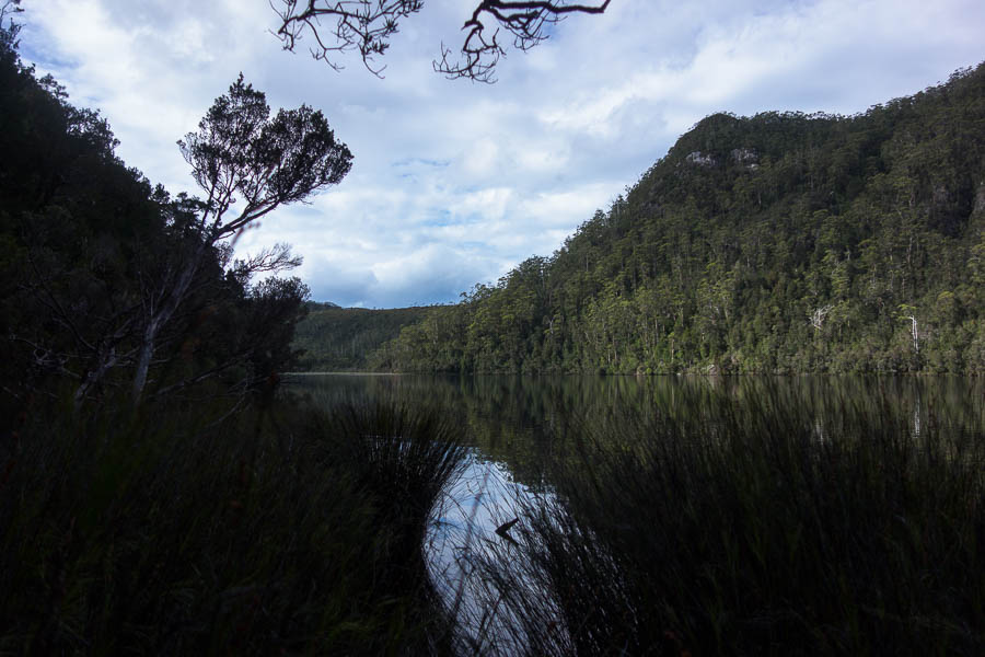
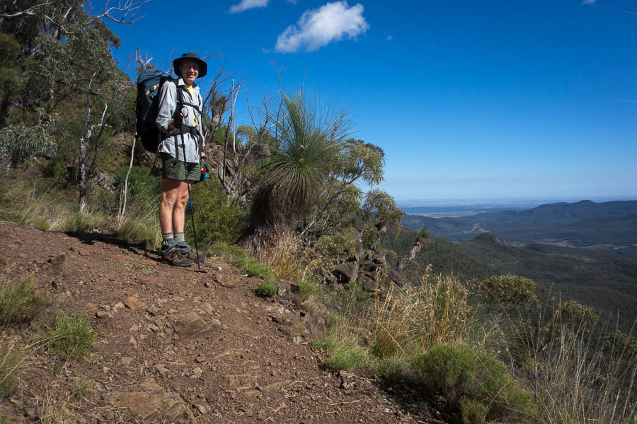
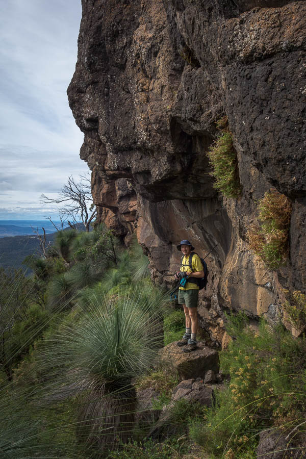
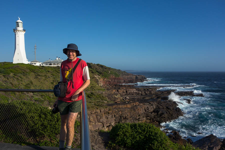
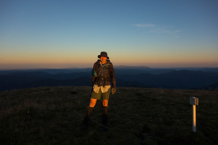
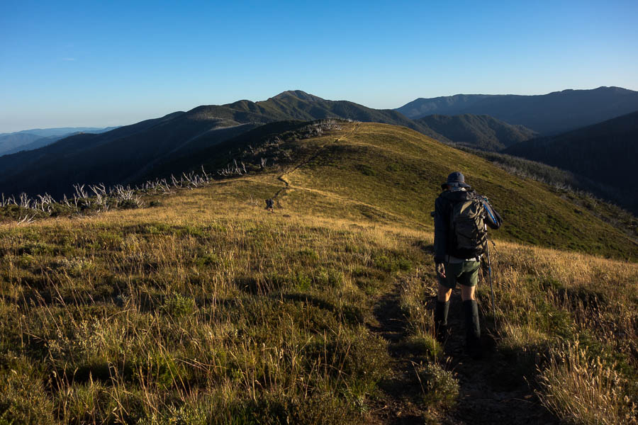
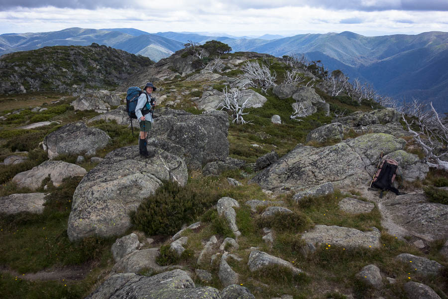
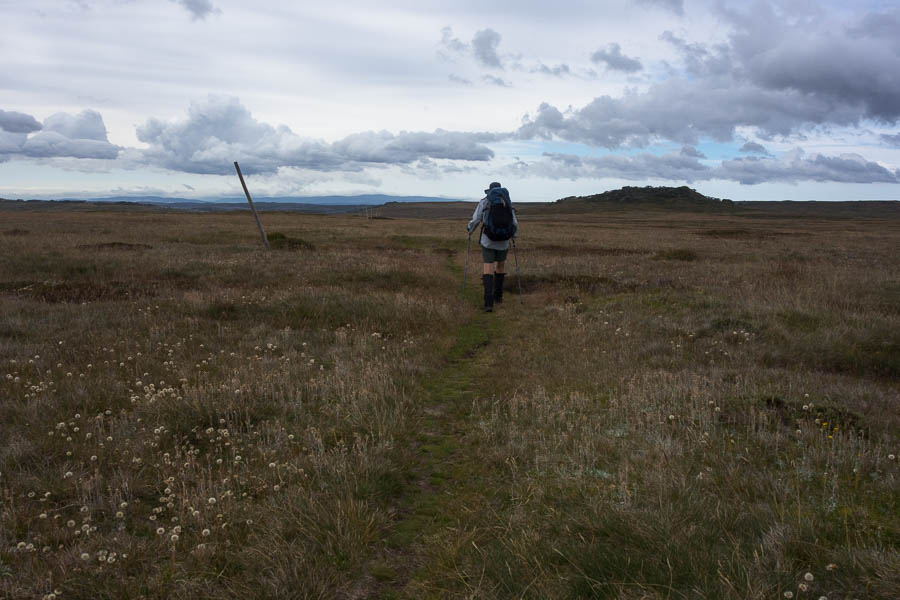
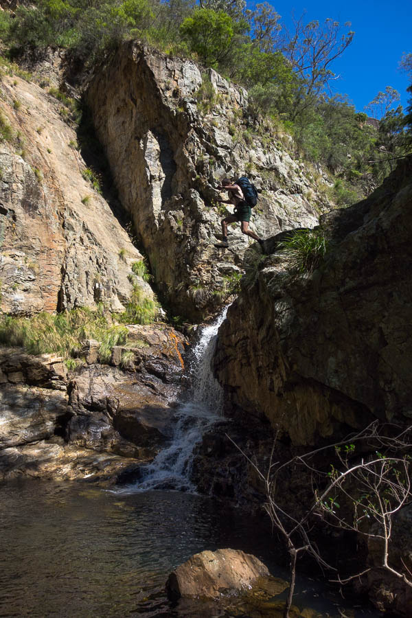
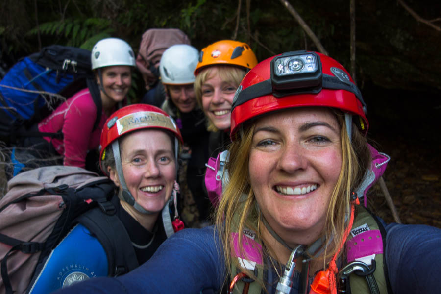
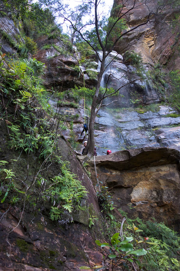
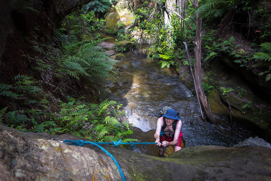
Two Capes (30 Apr & 1 May 2022)

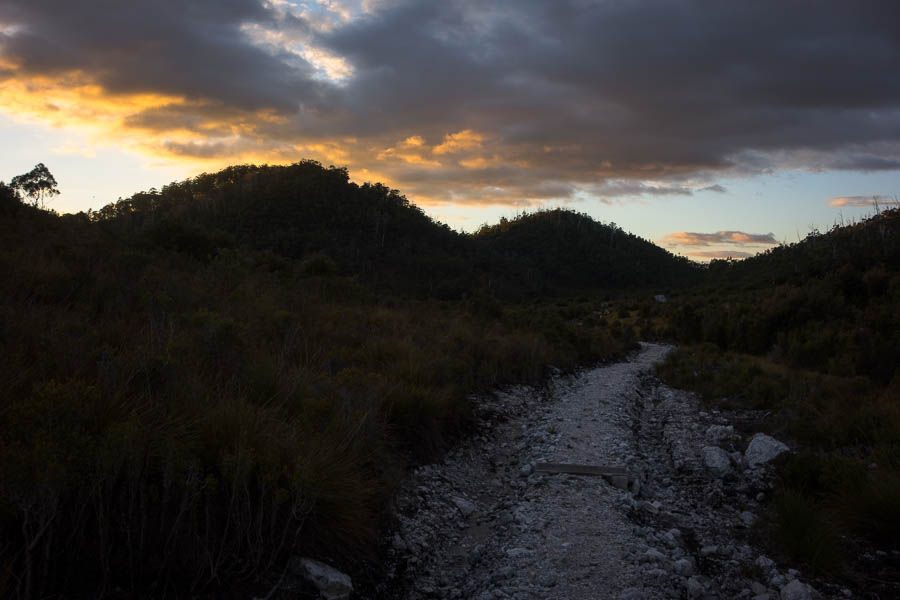
The advantage of planning a walk only a few days in advance is the weather forecast is available. With unpleasant weather moving into the South West of Tassie on Friday afternoon I figured relocating myself for the last two days would be wise. The downside was a four hour drive from the Frenchmans Cap Trailhead to Eaglehawk Neck. That was meant to be done over a relaxing afternoon with plenty of time to stop for coffee, and get to the accommodation I’d booked before dark. As events transpired it ended up being a fairly horrendous drive, mainly in the dark, often in the rain, and I didn’t get to my accom until 9:30pm despite getting to the Frenchmans Cap Trailhead at 11am.

I wasn’t sure I would be that motivated to go walking the next day, but after a few days of waking at 5am my body clock was unaware it was ‘sleep-in’ day. Being able to get up and make as much noise as you want is a definite upside of travelling alone. I couldn’t get going for the walk until 9am when the espresso bar up the road from where I was staying opened. What a great spot!

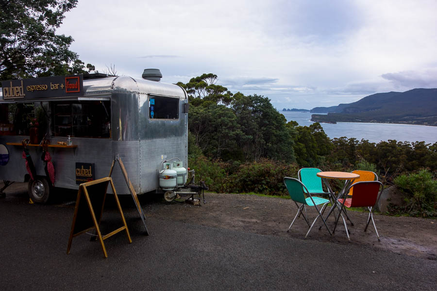
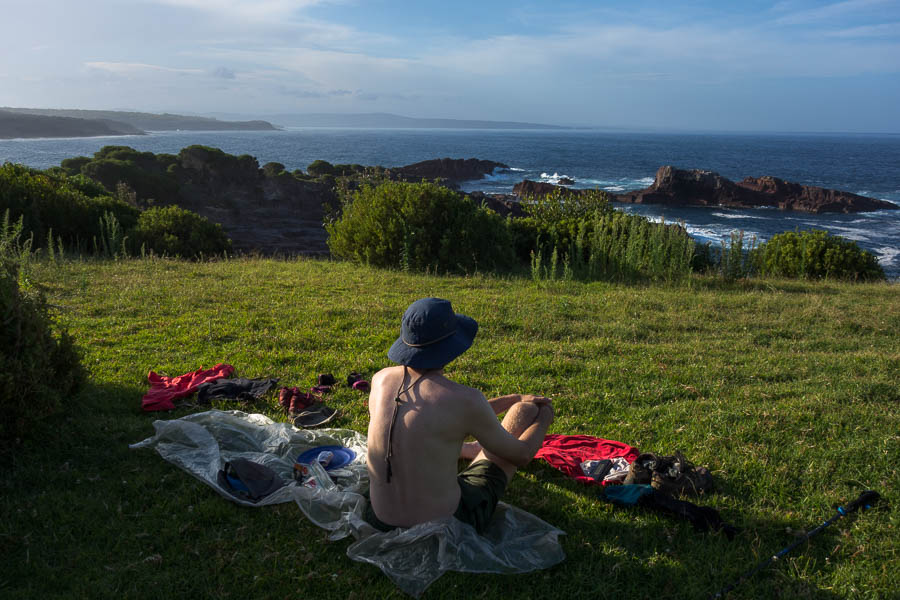
The best way to start the day – coffee & views

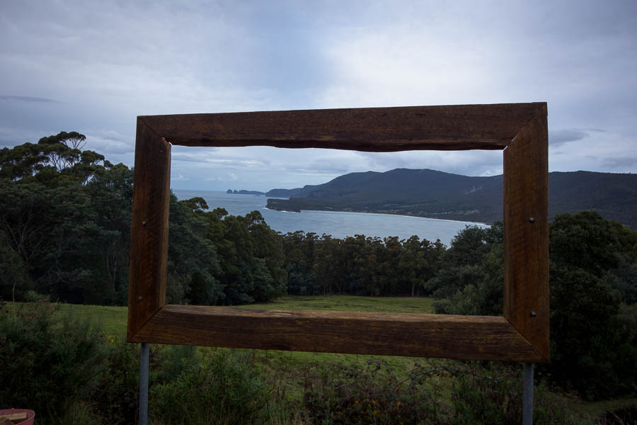
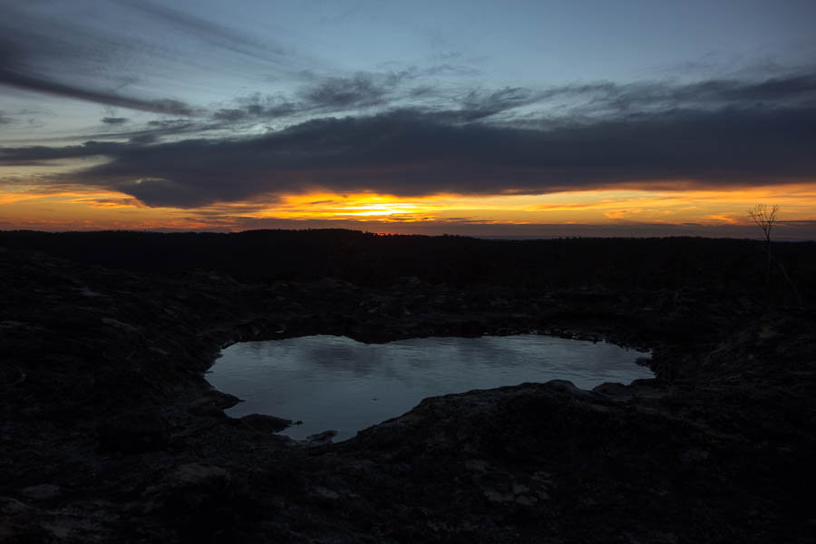
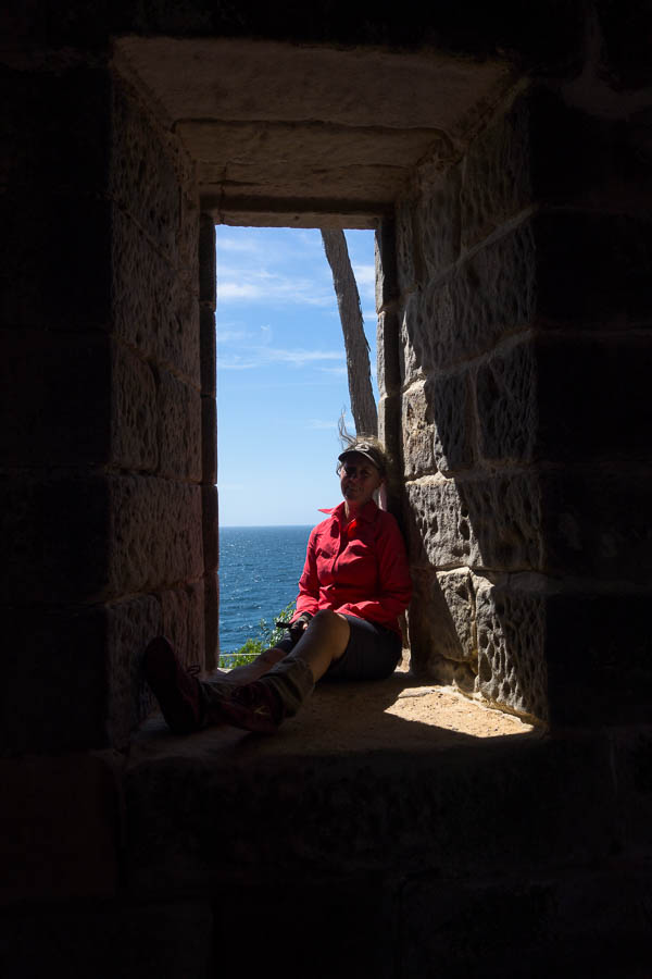
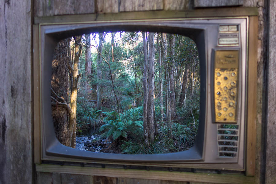
A view worth framing?

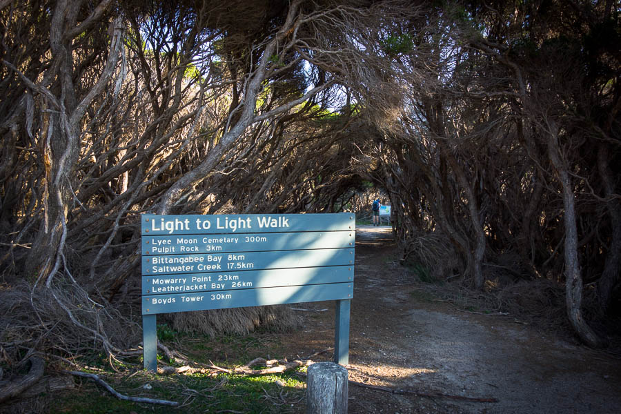
Arriving at the Cape Raoul trailhead I was initially a bit confused by the road markings. Then I realised it was spaces all along the road (overflow from the car park) for parking. It must get very busy at times! But today was not one of those days, with only three other cars there. The icy wind blasted me as I got ready in the car park subsequently all my warm layers came with me.

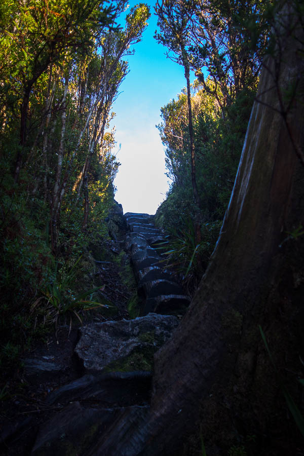
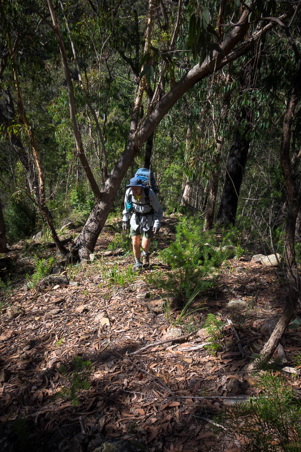
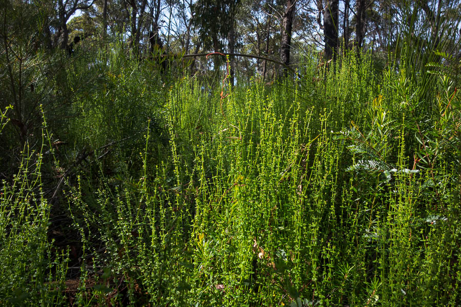
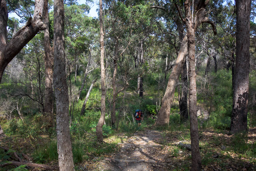
However, the icy wind didn’t last long as almost immediately the trail wound it’s way through beautiful forest. The layers came off, and most of them didn’t get used at all, as the walk is very protected from the elements.

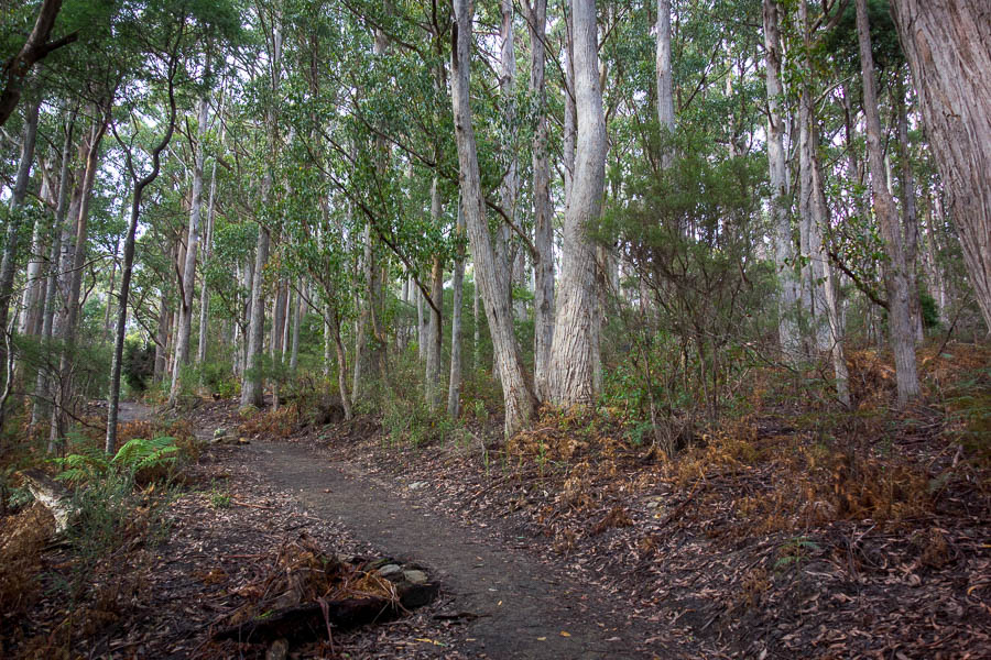
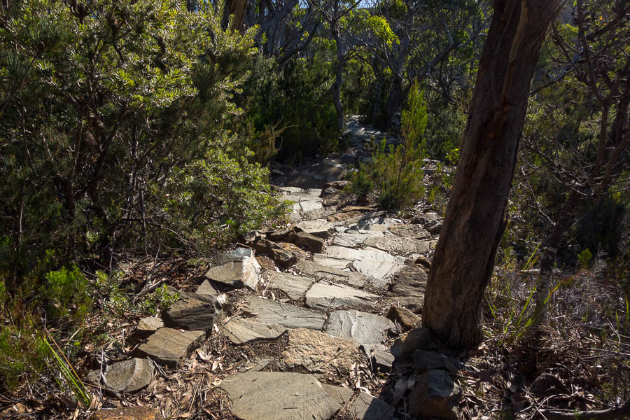
Lovely forest on the way to Cape Raoul

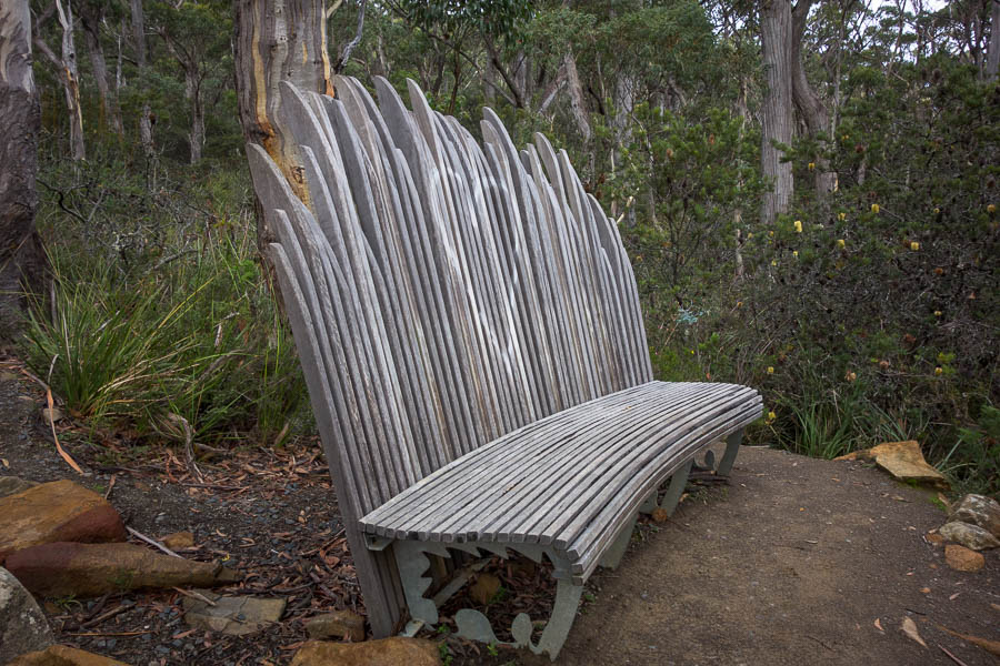
Beautiful seat design

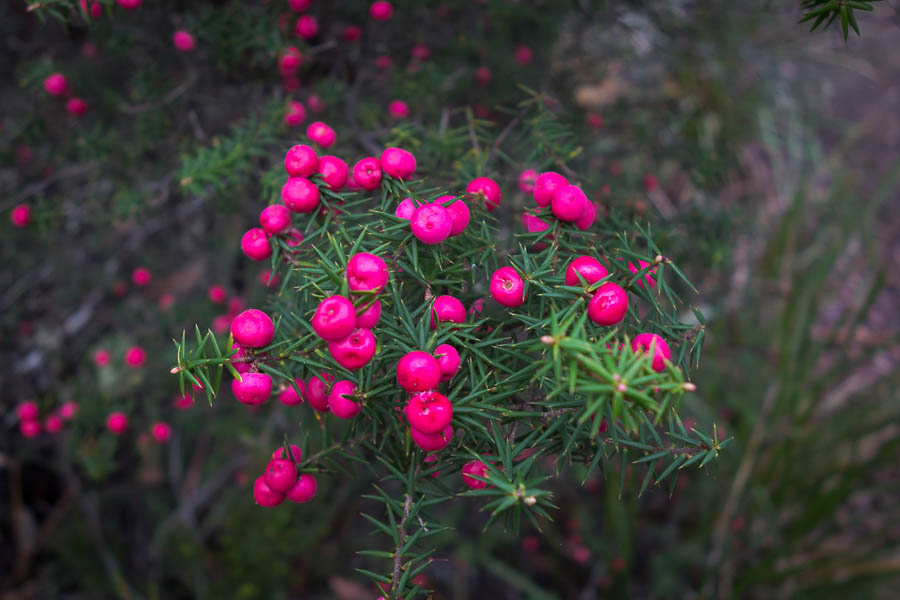
Lots of these were about, making a colourful addition

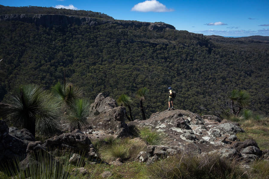
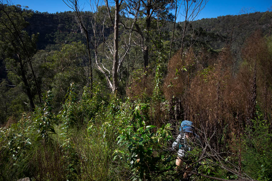
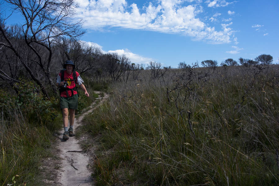
After winding slowly up to the lookouts the track then slowly meanders down towards the Cape. Occasionally there were spots to get views, but mainly you’re in a variety of vegetation – from tall eucalypt forest through to coastal heath.

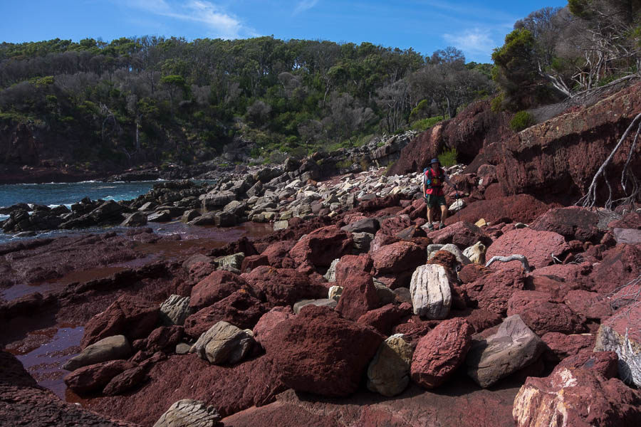
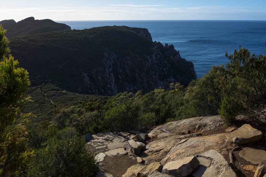
Cape Raoul from the lookout

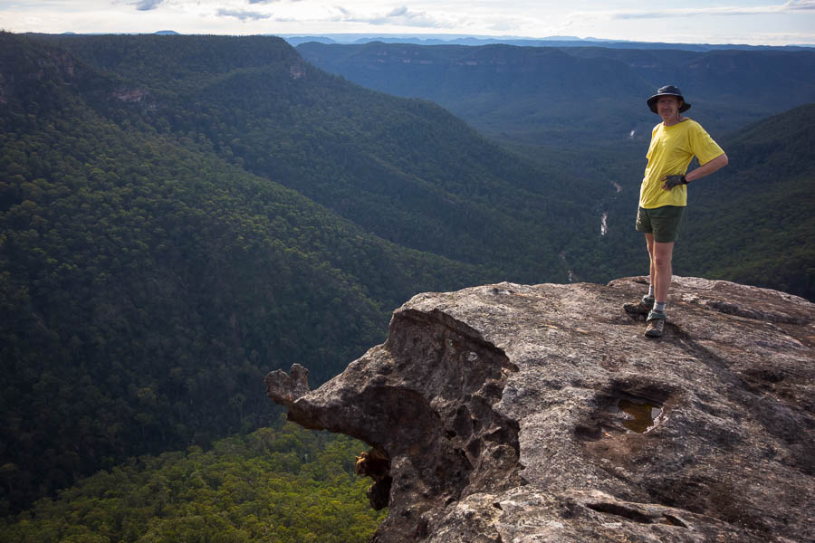
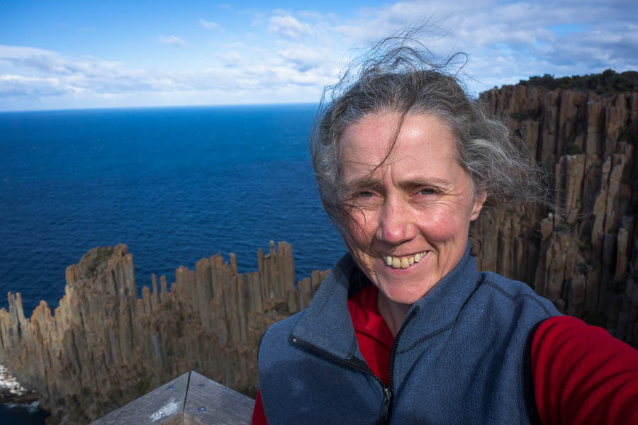
I was beginning to wonder if I was actually going to see any cliffs when I finally popped out of the heath into a low vegetation area. From there I visited the seal lookout where I had lunch, and provided advice on the Larapinta Trail to a fellow walker, and then the main lookout (I forget if it had a name).

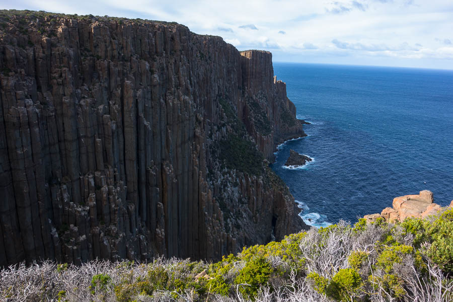
Now this is what I’m here for – Dolorite cliffs

At the Seal Lookout (the white patch bottom left is the seals)

The hordes had started to arrive by this point and I passed lots of people on my way out. It seems my timing was good as I largely had things to myself. There was more up and down than I was expecting on this walk but it was all on gently graded well maintained tracks – so my knees were never under much pressure.

The rest of the afternoon was spent at the Unzoo, which is a Tasmanian Devil retirement village. I fortuitously arrived just before one of the Tasmanian Devil feedings, where we got to see the destructive power of those jaws in action.

Check out those teeth

Green Rosella

Tune into nature

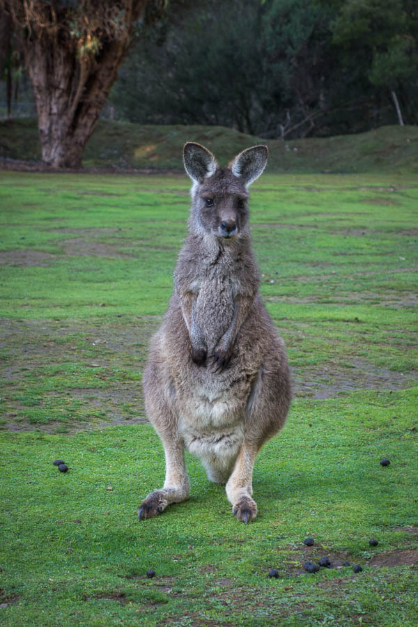
Who do you think you’re looking at?

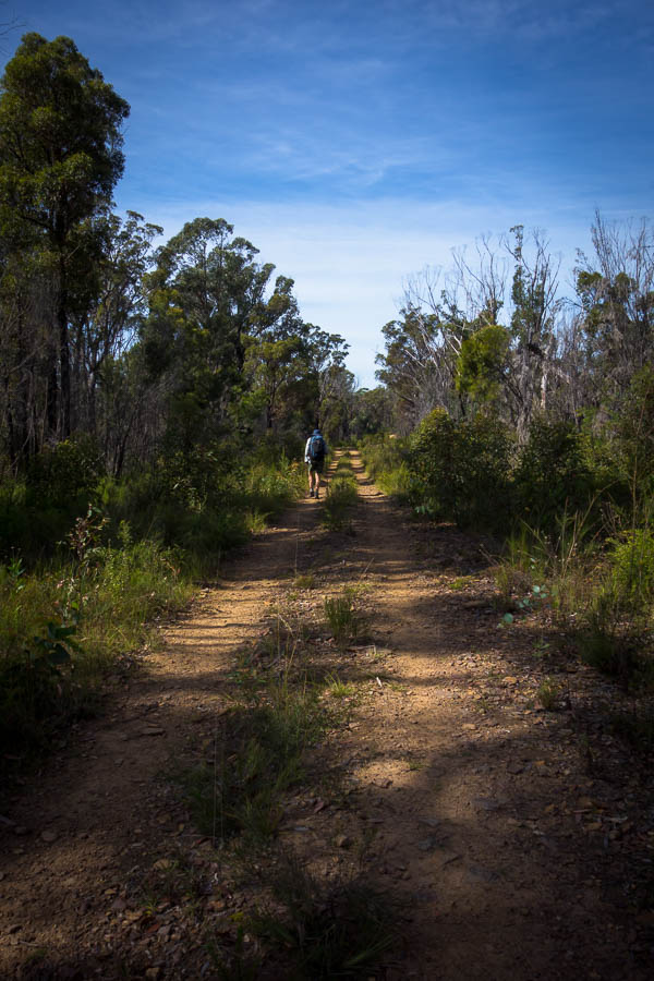
Chatting to a few people through the day I had got the definite theme that Cape Hauy, my intention for the following day, was hilly/had a lot of stairs. I hadn’t done any research into the walk so that came as a little bit of a surprise to me. That evening I decided I better plan my day backwards from the flight departure time. If Cape Hauy did take me 3.5-4 hours, as most of the web information suggested, then I needed to get moving early. I wasn’t keen to have a stressful day worrying about making my flight. As it turned out I was awake early again so I got away with some time to spare in the schedule. The road out to Fortescue Bay was in surprisingly bad condition, but being so early I could be relatively confident of no other traffic and could dodge potholes as needed.

I’m not a beach person but Fortescue Bay was stunning. It was another surprisingly beautiful morning given the forecast was for a cloudy day. My research had advised me there were around 2,500 steps on the walk so I was mentally prepared when I hit the first lot.

Beautiful Fortescue Bay

Some of the many thousand steps on this walk

I realised that I was going to be well inside the time estimates when I reached the junction with the Three Capes track after half an hour, and the sign board said it would be an hour back to Fortescue Bay. I’d like to say that meant I slowed down and enjoyed the views… well maybe just the latter!

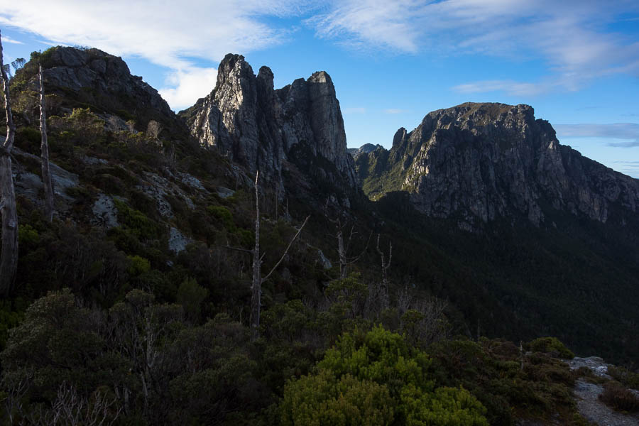
Looking towards Cape Hauy
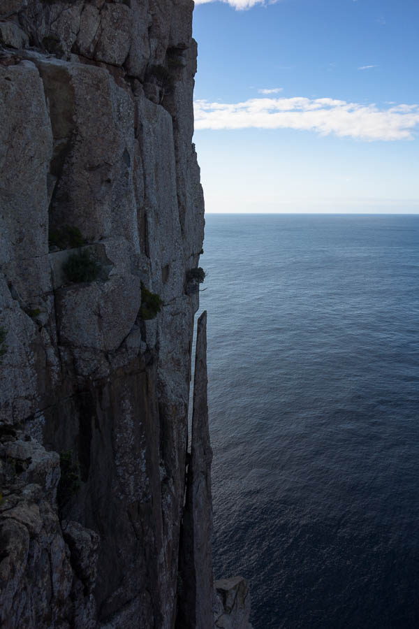
Splintered cliffs

When I got out to the end of the track I was excited to see The Totem Pole in real life, after watching plenty of climbing films about it. I was intrigued that a Tyrolean Traverse was set-up, and wondered if that was permanent. I scrambled someway down the climbers track for a better view before returning to the safety of the official lookout fence. It was only when I noticed the rope moving in a non-wind affected way that I realised there were climbers down there.

I spent the rest of morning tea watching the first climber trying to abseil down the Totem Pole (seemed to be having some rope management difficulties), and the second climber doing the traverse. The notes on one of the climbing sites say “Equip yourself not only with the necessary gear but also a bottle of bravery pills. The challenge is psychological as much as technical.” Just watching the traverse I could definitely see how much your mental state would need to be up for it.

The Totem Pole and The Candlestick. Note Tyrolean line in place

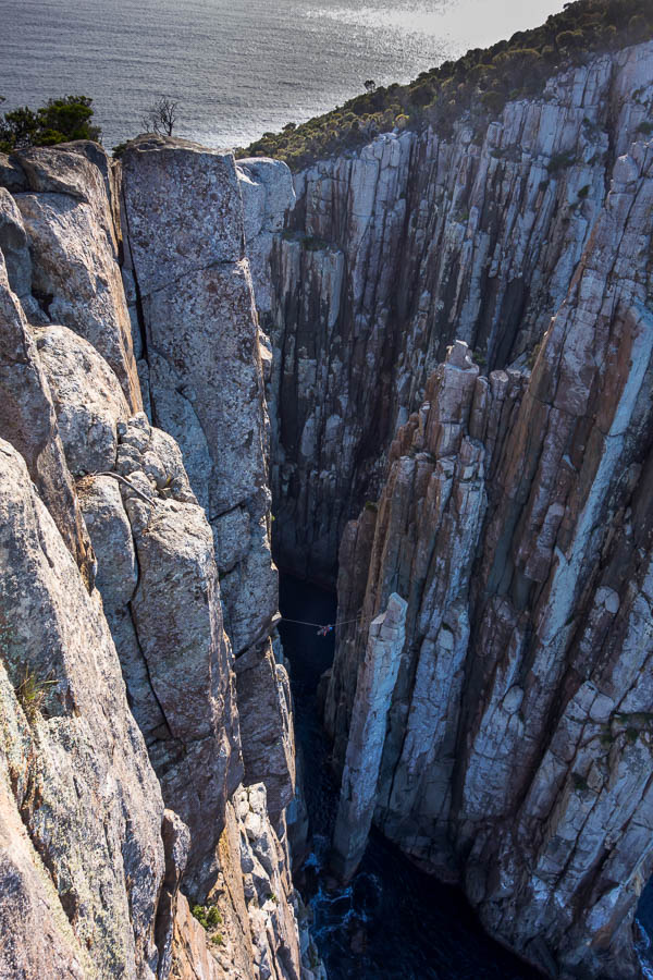
Climber on the Tyrolean traverse

A couple I’d passed earlier on arrived so I took that as my time to head off. Much like the previous day it seemed I’d just avoided rush hour – passing numerous people on my way back to Fortescue Bay.

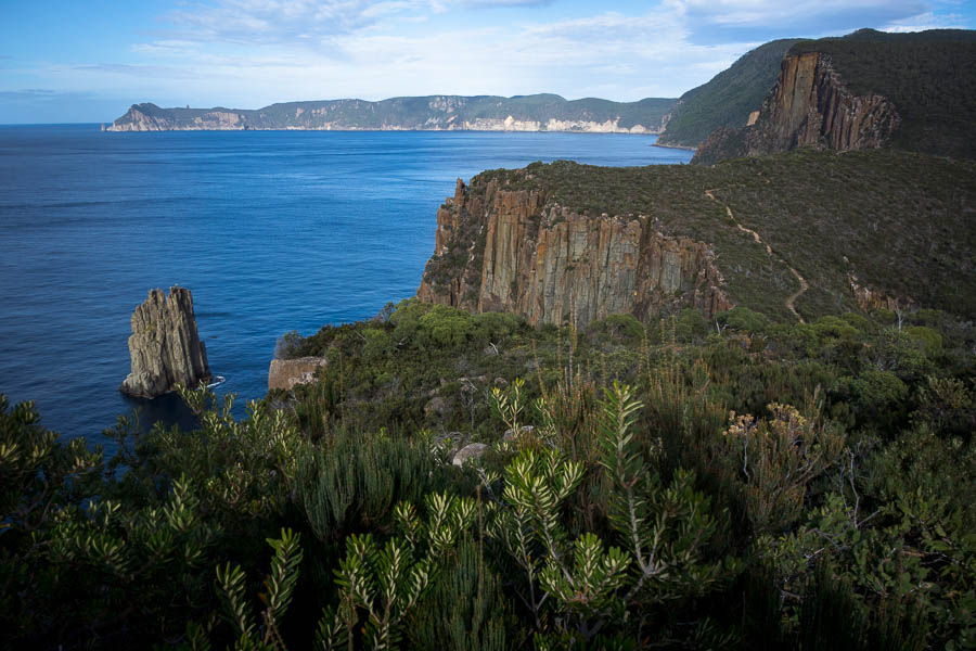
Cape Pillar in the distance,The Monument off the coast, the track clearly visible on the right

Time taken: 2.5 hours return, including 30 minutes at the lookout. The Parks Office was happy to take my partially used gas cyclinder, so with all loose ends tied up I had a stress-free drive to the airport. This walk was a great end to my whirlwind trip to Tasmania!

Frenchmans Cap (27-29 Apr 2022)

I had a five day window between jobs and after spending what felt like much of the last year sitting inside, either because of Covid or the weather, I was determined to use the time. After all, my leave balance would be reset to zero, so I needed to get a holiday in while I could. Unfortunately the timing didn’t work for Tom so without that much consideration I decided I would head to Tasmania.

Parks Tasmania introduced a booking system for many of their popular walks during Covid, which included a cap of 10 people starting Frenchmans Cap track each day. So from a fortnight out, I was frequently refreshing the booking site hoping someone would cancel. My persistence was rewarded when one spot became available. Up until then I hadn’t booked anything, but quickly flights, hire cars and accommodation were sorted. It all seemed a bit crazy, but as the youth would say; YOLO.

That’s where I’m going

We had the long weekend away in Mt Kaputar, then I was back at work for my final day on Tuesday, before a 5:20am taxi to the airport on Wednesday morning. I’d been watching the weather forecast and it seemed I was just going to squeeze into a fine weather window.

The forecast – definite incentive to be out by Friday afternoon!

It wasn’t the most relaxed itinerary in the world. I arrived in Hobart slightly later than hoped, had a quick swing by Anaconda for a gas canister, grabbed some lunch, and then hit the road for the 3 hour drive to the trailhead. I should have looked at Google’s route before setting off – or at least got a bit more suspicious as I followed a series of B-roads and then C-roads… and then eventually found myself at a 4-way intersection where the only sealed road was the one behind me. Great. Fortunately the dirt C-road was in pretty good nick, and it wasn’t that long before I was deposited on the A10 highway. I may have even made up some time with my dirt road driving skills, such that it was only 1:10pm when I left the car park.

The trailhead – just after 1pm on Wednesday

The destination for the first day was Lake Vera Hut – 14.5km from the trailhead. I would likely have been more prepared for the hills had I checked the contour interval on my map in advance. As it turns out it doesn’t take very many contours at 40m intervals to make a reasonable climb! I got my first views of Frenchmans as I came over Mount Mullins. It was a gloomy day – but clear enough for views.

First views of Frenchmans (looks a long way off)

The Lodden River marks almost half way to Lake Vera and like most of this section the track was pretty easy going.

Crossing the Lodden River

After Dick Smith’s intervention to move the Frenchman’s Cap trail away from the Lodden Plains (“Sodden Loddens”) the track is now largely mud-free. Admittedly it has been a fairly dry summer in this part of the world, so perhaps I had it better than normal.

Glad I’m using the boardwalk

I had passed 3 individual walkers, and 1 group of 3 on their way out (including one lady who had been to the summit and back that day), but given my late start I wasn’t expecting to see anyone on their way in. I caught up with a group of families as we started climbing off the Lodden Plains. I concluded the kids needed more weight in their packs, as after I passed them they jogged behind me for a kilometre or so, before eventually passing. They must have given up on running as I did eventually catch them again and got to camp about half an hour before them. One of the Mum’s confessed to me later that night that the kids were all very impressed with how fast I could walk.

I decided to tent that night; given there were already 4 people in the hut; I wasn’t sure what the families were doing; and I was planning a particularly early start in the morning. I was very impressed to use the chains on the tent platforms. The chain links would hook into the holes in the platform at whatever length you needed. This is a significant improvement on just hooking around the little nails, which is what we did on the Western Arthurs.

Excellent tent platform ingenuity

I settled down to cheese & biccies and a very fiery sunset. Every time I sat down to relax I had to leap up again to take another photo as the sky had gone even more red.

Fiery sunset from Lake Vera Hut

I moved into the hut to cook, and was glad I had as a fairly intense burst of rain sent everyone in not long afterwards. With about 16 of us in the hut for the evening it was full of energy. Fortunately the rain passed so that we could get to bed dry, though it did continue to drizzle on and off through the night.

Since we’d turned in around 8pm it wasn’t that surprising I was awake at 4am. By 6:30am I was walking. Sunrise was at 7am, so it was only just light as I left camp. The previous night when I’d arrived I’d gone looking for Lake Vera and didn’t find it. I was hoping that I would be able to find the track in the near dark! The track follows the edge of the lake in the bush, with a lot of undulating over tree routes, so the torch was back on my head very quickly.

A very early start on Thursday morning

I enjoyed the glimpses through the tree canopy of the sun hitting the peaks above me, but sadly there were no clear views. But topping out at Barron Pass was quite dramatic. A beautiful clear blue sky and views as far as the eye could see.

About to top out at Barron Pass.

Magnificent views from Barron Pass

It was only once I was at the top I had a real look at where the route went. I was pleased from there the track sidled along the side of the range rather than plunging back down the other side. I was so excited about the good weather, and the exhilaration of being out there, that the traverse just flew past.

Looking back to Barron Pass (the low point)

I passed one walker on his way out, and then just as I got to Lake Tahune at 9am there was another walker leaving. I had a quick morning tea in the sun in front of the hut before starting the ascent. I was wondering at there only being 2 people at Lake Tahune the previous night, but then I bumped into two women on their way down from the summit. What a gorgeous morning to have been up there! We had a bit of chat and then I continued on up.

Half (?) way up

Not far above the sign-posted junction is a bit of scrambling. The ‘crux’ scramble felt easier for me than a couple of other spots – which I definitely would not want to be doing in the wet. The cloud had started coming in a bit, so I didn’t have full blue skies, but it was still pretty good.

I was a bit confused when I got to the top and it was 10am. Earlier I had calculated how long it had taken me to get to Lake Tahune, and that meant it had only taken me half an hour to ascend. But then realised I had miscalculated the time earlier (only taken 2.5 hours to get to the hut), then an hour for the ascent. I had set myself a turnaround time (whether I’d summitted or not) to ensure I would get back to Lake Vera before dark – didn’t look like that was going to be an issue!

Summit selfie

I had an early lunch on top. By the time I’d finished my fingers were frozen and a few more layers needed to go on. Really I should have descended a little to have lunch as there were some very pleasant sheltered spots not that far below the summit.

Stupendous views from the summit (but it was very windy)

On the way back down (in a sheltered spot where the camera wasn’t going to blow away)

I found the difficulty of the scrambles reversed on the way down. The ones I hadn’t liked going up were fine on the way down, and the ‘crux’ scramble was a bit trickier to descend. I ended up taking off my pack and slithering down the gap on the right, easy enough for a smaller person.

Lake Tahune

Looking back up at Frenchmans from the shore of Lake Tahune

Back at Lake Tahune Hut I had another snack break on the platform in front of the hut. The modern hut looked very comfortable, but I didn’t feel any regret in not staying there for the night. I thought this should be called the Walk of the Hidden Lakes, as both huts are named for the lakes in proximity but neither are really visible. Just before midday I set off on my return trip. I met the families from the previous day, with the kids out the front (of course) not far from the hut.

Interestingly the traverse which I felt I’d glided along on the outward trip seemed decidedly treacherous on the return. Everything felt slightly damper (and consequently more slippery) and I really didn’t remember the amount of undulating. Nevertheless I enjoyed the lack of time pressure to be able to take my time and enjoy the views.

The fagus was starting to turn

Typical (treacherous) terrain of the descent to Lake Vera from Barron Pass

The descent from Barron Pass was hard on the knees, and I was particularly glad to not have a full pack on my back. I was glad to finally get a view of Lake Vera at the base – it’s not an easy lake to see.

The elusive Lake Vera

I’d passed the two women that I’d met on Frenchmans Cap on the descent, and it seemed likely to only be the 3 of us at Lake Vera that night. Given my tent was almost dry from the previous night’s rain I decided to move inside. Having an entire bunk shelf to yourself is a cushy way to enjoy hut life. Annie, Jane and I had a great afternoon/evening, and seemed aligned on our get up times which removed any pressure to be quiet in the morning.

Lake Vera Hut – just 3 of us for the night

We were all up before dawn and Annie & Jane set off just before 7am. I wasn’t far behind them and on the easier terrain I didn’t catch up until one of the tree-root filled descents.

Early morning colour

We continued to pass each other through the morning and got back to the car park within a few minutes of each other.

Weather looking a bit ominous behind us (and Frenchmans is in the cloud)

I got some day visitors to take a picture of me with the hire car when I got there at 11am. I was excited to have the whole day to drive across to the Tasman Peninsula. I had been visualising how the day would play out…. until I tried to unlock the car.

Back at the car before the rain

The keyless entry fob was not eliciting any response from the car. There’s not a lot you can do without a key and no mobile reception. Fortunately I knew Annie & Jane weren’t far behind and were heading towards Derwent Bridge (and mobile reception). They gave me a lift to the Derwent Bridge Hotel where I managed to call roadside assistance. The lady at the call centre clearly had no idea of the logistics of the situation. When I asked how long she thought it would be, she said “oh we like to say within an hour”. Then she said the guy was coming from New Norfolk. I googled the distance after I got off the phone and even if he immediately left it was 2 hours drive. So I settled into a relaxed lunch with Annie & Jane. I recommend the deluxe toastie. We were feeling very smug with ourselves as it was now pouring outside, and we hadn’t used our raincoats at all on the trip.

Annie & Jane headed off, and the roadside assistance man turned up around 2:45pm. (I didn’t get his name, and I should have, because he was amazing. But fortunately a quick search has told me his name is Nic). I was hoping it was going to just be a flat battery in the fob, but that wasn’t the case. The most time-consuming challenge was trying to get into the bonnet – because we couldn’t get into the car (because it’s keyless) we couldn’t use the bonnet release lever. Anyway, after trying many different angles to tackle the issue, Nic had success. Unfortunately through the process it was raining on and off. I was very relieved when he got the car going. He then followed me back to New Norfolk (which was on my route) and checked out the car again before sending me on my way. 5 star review of Nic.

Several hours later… back at the car park with the Roadside Assistance man

Ignoring the car issues this was a great walk, though my knees are still complaining about it!

Mt Kaputar (22-25 Apr 2022)

After being somewhat scarred on our trip over the Easter weekend we weren’t that keen to venture off-track again. But mainly the rain had returned to the East Coast. I was heading to Tassie the weekend after so I wasn’t that disappointed with the forecast since I figured that meant I’d have the weekend to prep. Then Tom announced we should go to Mt Kaputar for the long weekend. “Right…” I say. “It’s a bit of a drive”, he says. “How far is a bit of a drive”. “6 or so hours”. “Oh”.

Tom’s plan involved leaving Thursday night, staying in a motel around the halfway mark, and then finishing the driving early Friday morning so we could be walking most of Friday. It seemed like a dreadful idea! I had a busy week at work, and if we went, I would only have one day between this trip and my Tassie trip. Every fibre of my being said we shouldn’t go. So reluctantly I agreed.

Tom, to his credit, organised everything. A bit dangerous on his part, since now I know he can do it 🙂 All I had to do was pack my individual stuff and hop in the car. We had Thursday night in Murrurundi – it’s claim to fame being where Tom’s great-great-great… something-or-other was a police officer. We were on the road again by 6:30am on Friday and so it was a completely reasonable time when we started the walk to Mt Yulludunida, loaded up with our overnight packs.

Tom on the way up Mt Yulludunida

Morning tea with a view

Tom’s vague plan had to been to climb up, explore part of the plateau, find a high camp, then explore another part of the plateau the next day. As we ascended we checked out the vegetation (relatively thick) and the general landscape (quite rocky). Finding a campsite might be tricky? Having morning tea on the northern summit of Mt Yulludunida we had a good view of the plateau. The plan quickly changed. We decided to try and traverse the Yulludunida spine, then come back and try and find a campsite on the western part of the plateau.

Mountain Lake

Thankful to dump my heavy pack (we were carrying water for two days) we set off with day packs to the Northern summit. While it was a nice day the cloud frustrated us, creating shadows just when we wanted to take a photo.

It was a pretty fun traverse. Going out ahead of Tom so he could take photos I watched him descending from the main summit. It looked so dodgy – but having just done it myself I knew there wasn’t really anything sketchy about it. (That said, I was glad to be wearing my grippy climbing approach shoes).

Traversing the spine of the range

Continuing the traverse

Eventually we got to a gap in the range – only a metre or so wide, but coinciding with a drop. Tom tried to find a way down, but his commentary did not fill me with confidence. We decided we’d come as far as we were comfortable so it was time for lunch. What an amazing spot. There were several wedge-tailed eagles catching the thermals around us, and at times they were only 10-20m away.

Tom checking out whether we can keep going

After lunch we reversed our traverse and reclaimed our packs. We headed out into the bush across the plateau. The busy work week I’d just finished was starting to catch up with me, and when Tom said there were some workable campsites at the knoll we’d paused at I was happy to stop. I thought Tom wanted to camp there as it had good views of the cliffs of Mt Yulludunida. However, when we walked out (sans packs) to the end of the plateau and found some reasonable flat spots near the cliff edge we decided to go back and retrieve our packs. I slept for the rest of the afternoon while Tom went photo hunting.

It was a lovely sunset and we had an enjoyable happy hour on the cliffs.

Sunset & Happy Hour. The best time of the day.

The photographer

It started getting a bit breezy so we retreated back from the cliffs to get some shelter. We got through dinner before it started blowing a gale. The tent was a little away from us, and I’d been down a couple of times to check on it as it was not particularly well-pegged as we were camped on rock. The third time I checked it I didn’t feel safe leaving it alone!

From that point, one of us was in it until the next morning when we took it down. A pretty miserable night followed with the wind whipping the tent down on top of us. We didn’t do the fly up because of the extra sail effect it was having. All our gear was at my feet in the tent so that it didn’t blow away outside.

Site of our dismal night

We survived the night.

Not sure it was my worst night camping. We tried ranking them as we walked out. I think our night at Goosenecks State Park in the US is still my number one. That was also a very windy night.

There wasn’t any discussion about exploring the rest of the plateau. By unspoken agreement we headed directly back to the car, and then to Narrabri for a coffee. After the coffee I was feeling slightly more human. We picked up some firewood and the physical newspaper (how novel) before heading back out to Mt Kaputar.

On our way out

We headed up the Mount Coryah walking track, unfortunately getting to the main lookout at the same time as another group. Not having understood the track I pushed on thinking we’d be doing a circuit of the plateau and returning that way. It was only after we’d descended and started skirting under the cliff that we realised we would not be returning to that lookout without turning around. We settled with having lunch on a rocky outcrop before heading back to the car.

Below the cliff line on Mt Coryah

From there we headed to The Governor (Corrunbral Borawah). The walk description said: “The walking track follows an easy sealed boardwalk to The Governor lookout, where you can bask in the superb scenic mountain views. You’ll see majestic mountain gums and vibrant wildflowers in the spring. The second half of the track, though, will definitely get your heart racing. Ascending steeply via ladders, you’ll have to do some rock scrambling, but it’s all worth the effort.” I was excited for the walk and the scrambling, and then felt completely ripped off when I’d got to the end without using my hands. There were good views though.

By then it was time to go and settle into our, hopefully far more sheltered, campsite for the night. Unusually for us we’d decided to book into the official national park camping. We were less than delighted to find that half the campsite was a construction zone, which was visually jarring. But more intrusively there was work going on in the middle of a Saturday afternoon of a long weekend. Diggers that beeped every time they reversed, trucks and utes driving in and out of the campground. And they didn’t even knock off early. Finally at 5pm there was peace. We were a little annoyed since there had been no information about this when booking the site. We may well have made different plans had we known.

Ah the serenity!

Tom decided sunset was going to be viewed from the Mt Kaputar Summit. Fortunately we were allowed to drive up there. We weren’t the only ones, or the only serious photographers, but we were the only ones with cheese & crackers & port!

Slightly less effort to get to compared to the trig station last weekend!

The joy of a well-pegged tent, in a pretty sheltered campground, led to a good night’s sleep. Despite the campsite being booked out it was very quiet. That was despite the large group of climbers who were camped next to us arriving well after dark. I didn’t know where they were all going to sleep as there were about 8 of them and the tent platforms were only big enough for 1 or 2 tents. But I should have known better – all bar 1 were sleeping in their cars – and they turned in before 9pm.

The next day we opted to do the Kaputar Plateau Walk. This is an 8km loop but 2km of it is on the road. We did the 2km down the road to start. It was surprisingly cool in the shade as wound our way down the mountain. The highlights of the track were the lookouts. We had morning tea at Lairds Lookout which had great views towards Euglah Peak. The family that was leaving as we got there said we were lucky as normally it was a favoured goat hangout. No signs of goat for us though. We went looking for Euglah Cave, and found it (we think!).

Tom and Euglah Peak from Lairds Lookout

Returning to the track we followed the fire trail uphill. Some sections were not too far off feeling like a ‘real’ bush track, others were clearly fire trail. Rangers Lookout gave us good views in the opposite direction towards the Bundabilla Cliffs. Rather than an early lunch we returned to the car and headed back to the campground.

Rangers Lookout

We’d hoped to walk from the campground on the link track to the Bundabilla Circuit. Tom had seen the link track had been closed but was supposed to now be open. Unfortunately the website wasn’t accurate and the link track was still closed. And there were workmen again! On the Sunday of a long weekend!? We did the Nature Trail since we were on it and had lunch on one of the benches along it so that we weren’t next to all the trucks at camp.

Mid-afternoon we drove round to the start of the Bundabilla Circuit since we couldn’t walk there. It had plenty of viewpoints, and the side trip to Lindsey Rocks gave us more great wedge-tailed eagle viewing.

Another lookout…

By the end of the day, I was happy just to settle down at camp, but Tom needed to do sunset at Mount Kaputar again. I left him to it! The campground was only half-full which was quite the contrast to the night before.

Looks cosy in this direction!

Our final day we got going pretty early to get some of the 6-7 hours drive under the belt before we even realised. As it was Anzac Day not much was open in the towns we went through, and the main road was closed off in Gunnedah for a parade.

Burning Mountain Nature Reserve was a good way to break up the drive with a solid 4km walk to see the burning coal seam.

Unsurprisingly every pub we drove past looked packed. Fortunately we managed to get some filled rolls to take away in Scone before the final push back to Sydney. A very enjoyable weekend away, which just proves your instinct is not always right.

No rain and it’s Easter!? (15-18 Apr 2022)

By early April, Sydney and surrounds had already received an average year’s annual rainfall. With the combination of bad weather, deteriorated road access, lack of motivation & softness, we’ve barely been out overnight since the lockdown lifted in October last year. It was with much amazement the 7-day forecast for Easter showed fine weather… which stayed fine. No excuses this time, we had to get out. But given our lack of belief in the weather we had no forward plans, and as has become far too customary of late we were putting together ideas a couple of days beforehand.

Many National Parks were closed due to the 100mm+ of rain the previous week, or the roads into access points were closed. But, as always seems to be the case, the Nattai was open. I do wonder at times whether the person in charge of putting up notices about the Nattai just doesn’t know how to do it? That or it truly is the forgotten National Park. Anyway, I shouldn’t be complaining since it’s been our go-to for the last few years.

Access to different parts of the Nattai can be problematic. I wasn’t in the mood for throwing the dice with access, so we settled on going in from a spot we’d used for a short walk only a couple of weeks earlier. Another advantage of the Nattai is the drive is very reasonable compared to places like Kanangra, Newnes or many parts of the Wollemi. Subsequently it wasn’t a particularly early start on Good Friday, yet we were still walking around 8:30am.

After an hour on the fire trail, we headed off track, hoping we’d be able to get down one ridge and up another to give us access to the Wild Goat Plateau.

Views of the ridge we’re planning to climb

The descent to Little River was unproblematic, with just one short slow section of scrub. We enjoyed morning tea on the picturesque bank having made a thigh-deep crossing.

Lovely spot on Little River

The ascent up the other side started off really well. It was a thoroughly enjoyable climb until about two-thirds of the way up when we hit a serious section of scrub. After wrangling vines, head-high incense plants and deadfall, we emerged near the top. Fortunately there were a couple of nice lunch spots to aid our recovery.

The ridge was pretty nice walking for the first two-thirds

And then not so much

Our end point for the day was a spot I had picked out from the map. Normally Tom would have done some forensic examination of the aerials in advance, but I don’t think he was even listening when I’d proposed the spot at home. So we were both very pleasantly surprised to find ourselves in a lovely rocky section with spectacular views over Martins Creek. Flat campsites needed a bit of hunting for, but fortunately we were only looking for one.

Lovely rocky slab walking

Pretty pleased with our views for the night

Camp amongst the rocks

Feeling very pleased with ourselves after a successful day, we luxuriated in the views. Tom’s photo gear got a work out. His unprocessed photos (at time of writing) look so much better than any of mine – that hopefully anyone looking will see these first and not have the comparison!

More views – recent landslip in the background

Speccy sunset with our mini-tarn

Dawn and some valley cloud

Unsurprisingly there was plenty of water about

The next day we stayed off track, dropping down a spur, across a small creek and up another ridge to pick up another fire trail. After a not particularly inspiring off-track foray for morning tea we stayed on the fire trail till it ended. There was a nice viewpoint where we decided an early lunch was in order. We were somewhat surprised when we had company – though not as surprised as The Other Tom (as his name turned out to be)! We had the warning of his approaching footsteps, whereas he was plugged into a podcast and so had no warning until we were suddenly in his sights. He immediately recognised me from Tom’s website photos, and we had a good chat over lunch about many things bushwalking.

Leaving The Other Tom for his return 15km fire trail bash, we left the fire trail and headed north. The next couple of kilometres was some of the most soul-destroying scrub bashing I’ve done in a while.

Nattai Trig appears to have melted in the fires

Eventually we got through the worst of it and were soon to arrive at a spot we’d camped at a couple of years ago. We didn’t have great hopes for it given the amount of regrowth we’d experienced, but it was even worse than we expected. This was not the spot we were looking for.

I’d not paid much attention when Tom had suggested where we’d end up for the night, and he hadn’t cross-checked the previous trip’s log. After looking at the info we had, we realised were still over a (off-track!) kilometre from where we had previously camped. Agh. And it was 4pm. The spot we were at appeared to have no camping, so I thought we were going to need to keep slogging. Fortunately Tom made us have a look around and we managed to scrounge up what turned out to be a reasonably pleasant site for the night (once again, just as well there was just one tent we were trying to find a spot for).

Camp night 2

I wonder why Tom’s pack was so heavy?

Happy hour after a fairly miserable day

The afternoon had disabused us of the ambitious plans for the amount of ground we had been planning to cover over the next 2 days. Staring at the map we realised we needed to start heading back towards the car the next morning. Yet another thing that Covid took from us – a season of bushwalking in low scrub country!

So on day 3 we headed off on another ridge, vaguely in the direction of “home”. Fortunately, the ridge was “average” scrub so it only took us a couple of hours to cover a couple of kilometres, some sections of it were actually quite delightful. We would have made better time if we had been paying any attention to the compass and not ended up at the top of a cliff having taken the wrong spur.

Why can’t all saddles be like this!?

A late morning tea on the creek was lovely, though neither of it were under any illusions about how much work was still left in the day.

Taking joy in a lovely morning tea spot

We opted for a change of scenery, and hopefully easier walking, by staying in the creek. It was a nice change, though not cleared by recent flooding as much as we might have hoped.

A somewhat precarious spot given the lack of grip on Tom’s shoes

After lunch at a nice spot we landed on the fire trail. Now it was decision time (or was there really a decision to be made?). 10km of fire trail bashing to return to the car the way we came in, or 1.5km of fire trail and 4km off-track along the ridge, and take a different spur back to Little River. Both of us would normally go for the off-track/different route, but so badly beaten were we, that 10km of fire trail won out. My flayed knees thanked me for that decision as we pounded the fire trail for the rest of the afternoon.

On the plus side we had a nice camp, with yet again more good views.

Another beaut high camp

Back in the scrub

Tom had built up the “bad” section of scrub on the ridge, so we were both pleasantly surprised when it really wasn’t that long. It probably helped we could largely follow the route we’d used on our way up – and that it was first thing in the morning. The rest of the ridge was lovely and it wasn’t long before we were back crossing Little River.

Crossing Little River

Morning tea views

The plants that particularly became my nemesis during this trip are shown below. They don’t look overly vicious – there are no thorns, but they have the texture of sandpaper. Constant pulling up through them would fit into any medieval torture textbook.

My new arch nemesis

Nothing complicated now, just plodding

Or maybe there is something complicated left to the trip!?

Back at the car before lunch I was surprised to find police tape around the side mirror, and a note to call the police. I quickly gave them a call and assured them we were fine. We think a concerned resident next to the road where we left the car had contacted the police when it had been there for a couple of days. We spoke to one of the residents who popped over when we were getting changed after the trip – she thought it was probably her neighbour who had contacted the police. Unfortunately cross-checking the National Parks trip intentions database doesn’t seem to be part of the procedure otherwise they would have found our 4-day trip plan, and our car exactly where the trip described it would be. Instead we discovered the police had been door-knocking at our place, our neighbour’s place and Tom’s Dad’s place! Fortunately Tom’s Dad managed to quash any need for a search (though at times during this trip a helo rescue would have been welcome!).

Light to Light & South Coast (15-16 Feb 2022)

From Harrietville we drove to Eden. My research on cafes & bakeries to stop at was thwarted by cafe-owners going on holiday, or not being open on a Monday, or things simply not existing where google said they were! Tom did get a very good beesting at the Swifters Creek Bakery, but otherwise our trip to Cape Conran Coastal Park had little to note. We did the Nature Trail at Cape Conran Coastal Park before the final leg through to Eden.

Our evening meal (very tasty chinese) in Eden was shared with numerous Valentine’s Day diners. Post-dinner we went for a walk out to the Rotary Park lookout. An almost full moon had just risen and it was a beautiful evening.

Another early start – we had to meet our transfer at 7am at Boyd’s Tower – which was around half an hour’s drive away. Steve from Light to Light Transfers drove us to Green Cape Lighthouse. Eden was forecast to get to the high 20s – apparently fairly unusual – so I was particularly glad we’d chosen to get the early start. By the time we got to Green Cape, and walked out to the Lighthouse it wasn’t much before 8am when we started walking.

The Light to Light walk was part of the area affected by the Black Summer Bushfires just two summers earlier. We had seen the previous day at Cape Conran the impact of the fires there and weren’t sure that was going to mean for us for shade for the next 31km.

The Southern end – Green Cape Lighthouse

The start

One of several pleasant creek crossings

We didn’t know it at the time but the section between Green Cape and Bittangabee Bay appeared to be the least fire-affected. In places there was re-growth but in many parts it felt like it has been a low intensity burn and the larger trees were relatively unaffected.

A relatively unburnt section

We started bumping into day walkers from Bittangabee Bay (drive-in) camping area as we got closer. One of them was gamely carrying a fishing rod in case he could cast somewhere – the disappointment on his face when I informed him this section of the track didn’t go anywhere near the coast was quite comical.

Open grasslands and scorched trees

One of the surprisingly few coastal sections

Another creek crossing

We made it into Saltwater Creek (another drive-in camping area) for a late lunch. We were pretty knackered by the time we got there – 18.5km [17.5km from the sign-board, plus 1km to get to the lighthouse & back] before lunch with packs – not something we’d been doing much of recently! So we found some shade next to the day parking area and collapsed. The plan was to spend most of the afternoon at Saltwater Creek in the shade before pushing on to Mowarry Point to camp later in the afternoon. Once we’d had lunch and a hot drink our mental capacity was up to doing a cryptic crossword. This has become one of our essentials to take on long bushwalking trips as something to fill time – weighs nothing, and provides hours of entertainment.

About 4:30pm I decided it was time we moved on. Back on the beach we had to cross the lagoon to continue north. It seemed we were going to have to wade across. But I foolishly decided to take on a high-risk rock-hopping route. It was only 2 rocks to get across but they were covered in black-green algae. My first tentative steps told me they were extremely slippery. However, I decided to pursue my route rather than the small inconvenience of taking off my shoes to wade. I was lucky my decision just ended up with me losing my sunglasses and laying in a series of bruises down my right leg, oh, and losing all dignity as I slipped off the rocks in front of a dozen beach-goers. The sunglasses were washed out to sea, and at the time I thought I was unhurt, but the deep black bruises on my thigh and shin which still persist a week later tell another story.

With that indignity behind me, and Tom crossing by wading, we were on our way again. As we approached a rocky outcrop we spied another group with overnight packs. Initially it seemed they were going north like us, until they passed us going south. I was delighted as I hoped that meant we’d have Mowarry Point to ourselves.

The section from Saltwater Bay to Mowarry Point appeared to have been scorched in the fires. There was significant regrowth – similar to what we’d seen in Morton National Park – it looks ‘weedy’ but most of it is native. But I daresay the Light to Light was a more attractive walk pre-fires. The regrowth made it feel like we were walking through a sauna as it was densely packed with little airflow. Fortunately we had 3 or 4 gnarly crossword clues still to work out, and we managed to solve them while we were walking through this section. The map case around my neck was not for navigating but so I could double-check the clues’ wordings!

The further north we got the clearer the impact of the fires

Somewhat surprisingly the Mowarry Point remote camping area is not really at Mowarry Point (as it’s marked on the map). It’s somewhat past the point. Tom was getting a little nervous that the big grassy headland he’d seen on the aerials had been taken over by vines and we were going to have to fight to find a place to camp. Fortunately it was just a bit further along the route and we were pleased to get there and have it to ourselves, and be able to camp near the edge with a nice view.

Our campsite at Mowarry Point

Another group arrived just after we did – but they were heading for Saltwater Creek – they still had plenty of daylight but weren’t going to be getting there before 7pm. We had a swim at the beach below the headland and found we weren’t alone. There was quite a large group – but they had camped on the northern headland – with 3 or 4 tents almost on top of each other on what looked like a fairly uncomfortable slope.

The campsite wasn’t perfect – we had been hoping for good views of the full moon rising and/or a speccy sunset – but we were facing North rather than West and the light didn’t come to the party. Regardless camping on the tussocky grass is a pretty comfortable experience and we both slept well – particularly given the distance we’d covered.

Sadly sunrise was as uninspiring as sunset, and we were on our way by 9am. There was no great hurry since we just had 7km to cover for the day. Leatherjacket Bay was a very attractive spot, but only an hour into our walking we had no real reason for a break.

Sitting down on the job at Leatherjacket Bay

Red rocks & mandatory rock-hopping

Eventually we started seeing some views of Boyd’s Tower. It was quite the contrast to Green Cape Lighthouse which we’d been able to see for much of the previous day’s walk. There were lots of day visitors at Boyd’s Tower, probably wondering why we were fully kitted out in our overnight gear to walk the 200m from the car park to the tower.

Those are thick walls!

Boyds Tower (Folly)

Later that day we went to the Killer Whale Museum in Eden where I saw some photos of the Tower pre-fires. It was surrounded by trees which were at a similar height to the lone one which features in this photo above. It would have been a very different feeling!

We had our final few days of the trip based in Merimbula. On one of the days we did the 9km Kangarutha Track in Bournda National Park. It’s a one-way track, so the simplest way for Tom & I to walk was to go in opposite directions. I dropped Tom off at the southern end and then drove to the northern end. We met about half-way through, passed over the car key, and continued on our way. It appeared to have avoided the fires and had quite a different feel to the Light to Light. Perhaps what the Light to Light would have been like before it burnt?

I realised early on that I had stuffed up the logistical arrangements. The southern end of the walk is in the National Park, nowhere near anything, whereas the northern end is on the outskirts of Tathra. We should have swapped the arrangements – since I walk faster and faff less than Tom so was likely to finish quicker (and did). If we’d swapped it up I would have been able to find a coffee in Tathra before picking him up!

The Razorback & Bungalow Spur (13 Feb 2022)

After our trip out of Falls Creek we had a a few nights based in Harrietville. We had been unsure about whether to stay in Mt Hotham or Dinner Plain or Harrietville – but we were glad with our choice. Harrietville has a lovely village ambiance. The day after our arrival from Falls Creek was meant to be a rest day. But that had been on the premise we had descended from Mt Bogong the day before rather than our relatively flat stroll back to the car from High Plains Creek. So we decided to walk the section of Bon Accord Track as far as Washington Creek.

Fortunately I had been doing my research on bakeries and cafes in Harrietville the night before and concluded we needed to visit the bakery before we went walking. We timed it well – the vanilla slices had just come out, and so with two (not the one Tom had suggested we share!?!) of them tucked into the pack we set off on our walk.

Not long in I convinced Tom we really should have morning tea and eat them. He kept talking about eating half of one now and saving one for later. Amateur. They were amazing. And it would have been impossible to cut them in half without making a complete mess even if you’d wanted to.

Washington Creek itself was a bit disappointing. The sign boards said it was a great place for a picnic, I think that was overstating it. After being ejected from our initial lunch spot by some ants (I didn’t want a repeat of the previous day where half my thigh swelled up from a bite), we crossed the creek and used the camping flat. We did have a dip in the icy creek as well – but there wasn’t really anywhere more than thigh-deep. Back in Harrietville we enjoyed a coffee and a relaxed afternoon.

The alarm went off at 5am. Groan. The winding road to Mt Hotham starts immediately after Harrietville. I drove past the warning signs about the deer/kangaroos/wombats which were going to litter the road. Tom was about to make a joke about looking out for deer, when we rounded a corner to find one standing on our side of the road. After a bit of face-off it decided it might move.

The sky had lightened considerably by the time we got to Diamantina Hut. Ideally I think we would have got there 15-20 minutes earlier. As it was we started walking about 6:30am – sunrise at 6:42am. The light was magic. There’s no better place to be then on a magnificent ridge pre-dawn when it’s a still clear morning. There were plenty of stops for photos as the light changed and sun met us.

Tom in the early morning light

The Razorback awaits

We were glad to let a large group pass us on the way out. They were pretty boisterous and the noise carries when it’s so still. Otherwise we didn’t see anyone until we met the crowds who had been camped at Federation Hut overnight. It seemed they had all set the same alarm time. We passed something like 8 groups all in a row on their way back out. It was in a section where we had to stand off the track and every time we thought it was safe to move on another group would pop round the corner!

We made it to the Federation Hut/Feathertop junction shortly after 9am. Unfortunately the cloud was gathering around Feathertop despite it having been clear all of our way in. Nevertheless we of course headed up into the cloud. The large group from earlier were flying a drone on the summit so we decided to make do with a spot slightly short of the summit for morning tea. It was really quite pleasant once you dropped a metre off the ridge out of the wind.

Morning tea on the lee side of the Feathertop summit ridge

Once the summit was a bit more peaceful we headed across, willing the clouds to part, which they did sporadically. You didn’t have to descend far to get out of the cloud and at Federation Hut it was a lovely, sunny day.

Looking back the way we came

Weather was much nicer at Federation Hut!

Tom had offered me the option of continuing down to Harrietville via Bungalow Spur – he would go back the way we came and drive the car back. I happily took him up on the offer – though a little apprehensive on how steep it might be. As it turned out Bungalow Spur is a fairly gentle grade. I had been expecting something like Strongleg!!

Part of the reason for Tom’s offer was due to the bakery opening hours. The only way to visit the bakery again during our visit was to get there before 2pm – and that was only going to happen via Bungalow Spur. Tom reckoned I would be running to get there at the bottom. I don’t think he realises how much dawdling gets eliminated when I’m walking by myself 🙂 I made it to the bakery by 1:30pm… only to find the lady in front of me had bought the last vanilla slice 🙁 I had to settle for some other goodies. I suddenly felt the exhaustion having knocked off 22km and 1300m descent, and gratefully sunk into a chair at our accommodation to wait for Tom’s return.

The next day we headed to the south coast.

Jaithmathangs & High Plains Creek (9-11 Feb 2022)

Our original plan had been a 4 day / 3 night circuit around Mt Bogong. It became clear after our 2 days of walking at Mt Buffalo that we probably weren’t fit enough to enjoy what we’d planned. So on our additional night in Mount Beauty we glared at the maps… daring them to strike us with inspiration for something more aligned to our current capabilities.

I was getting increasingly frustrated at the lack of options until I had a look at the Fainters. We had originally intended to avoid going to Falls Creek so that we didn’t have to drive the windy road. Having driven up & down Mt Buffalo, and come across Tawonga Gap we’d already done a bunch of windy roads – what was another one to add to the collection!? If we started from Falls Creek then we could reduce any climbing and so a plan started to come together. Thank goodness.

We did better than Mt Buffalo and were walking before 9:30am. There was one other walker at the carpark who came over to tell his he was heading Mt Jaithmathang as a day walk so we’d probably see him on the track. When he did overtake us a couple of kilometres in I mentioned it was our first time (ever) in the Alpine National Park. He was somewhat incredulous; “you’ve picked a very obscure walk as your first one”.

Tom looking not quite looking happy at the prospect of 3 days out

Cloud looking menacing as we approach Tawonga Huts

We had morning tea at Tawonga Huts under heavy grey cloud cover, then continued on the Fainter Fire Track towards Little Plain. I had originally thought we might make it out to the Fainters, but by the time we’d fought our way along a fairly muddy section of track (hoof prints well in evidence) I was ready for lunch above Little Plain.

Are we back in Tassie!?

Neither of us had any inclination to extend our short day and so after lunch we went off-track along the Jaithmathangs ridge to Mt Jaithmathang. Some sections were absolutely delightful, others required a bit more effort. The closer we got to the summit the stronger a footpad became – but there wasn’t any real evidence of a pad for most of the route.

Beautiful sections of grass & flowers

Some not quite so pleasant sections

Views!

We found a campsite near the summit and got ourselves sorted. Water never felt like it was going to be an issue and we didn’t have to go far to find a small stream. Finding a place to fill up from was perhaps the most challenging bit (much of it flowing under boulders).

Our cooking spot just below camp

After a bit of weather blew through we were treated to a double rainbow (the second one not so obvious in the photo)

The light on the summit in the hour or so before sunset was just magical and Tom hopefully got lots of good photos with his fancy camera. I could spot a couple of tents being set up down at Tawonga Huts so we wouldn’t have had it to ourselves.

Back up on Mt Jaithmathang for sunset photos

Given I’d only spotted 2 tents I was surprised to meet a school group of around 25 as we headed down the main track to Tawonga Huts the next day. It was incredible to see all the tents at the bottom – and very glad we’d had our high camp!

Back at Tawonga Huts the next morning

walking the Bogong Hill Plains towards Mt Jim

Pole 333

Ascending Mt Jim

From Mt Jim we went looking for old snowgums that one of the teachers in the school group had mentioned. I don’t think we found them, and it certainly made our descent to the Cope West Aquaduct track take longer than it might of. We spotted our second mob of brumbies for the trip as we descended.

Not your every day obstacle on a bushwalk…

I didn’t know much about High Plains Creek – except Vivien & Emmanuelle had mentioned good camping. And Vivien had said there would be a track. Turned out the track was on Open Street Maps (and so on Tom’s GPS) and we were glad we continued along till we hit it rather than going off-track towards our goal. I’m not sure if it’s because you can see so far ahead, or if it’s because we were using a 1:50k map (rather than 1:25k we’re used to) but everything seemed to take longer than I expected. I was so ready for a swim when we arrived at the first falls on High Plains Creek. Having not done any research I was particularly delighted to find such a nice swimming hole. Not that I stayed in for very long – the water was brisk.

Swim time

We’d just finished an afternoon cuppa when some (unforecast) rain arrived. It blew through after 15 minutes so I sheltered under a very small overhang and Tom just hung out in the rain. The granite boulders were all wet but once it stopped we scrambled, with some difficulty, down to the second set of falls. Probably only something to be recommended to those who really like rock-hopping/bush-bashing.

The lower falls on High Plains Creek

We decided to camp up out of the creek valley in a spot with lovely views towards Mt Cope. It was so warm we were hiding in the shade into the early evening.

But the expansive views meant we could see the cloud drop over Mt Cope and slowly edge its way towards us. By the time we’d finished dinner we were well and truly enveloped in cloud.

Beaut campsite with views to Mt Cope

Except then the weather came in

It was a very still night, so the cloud remained well-entrenched when we woke up the next morning. Given the weather we took Cope West Aquaduct track to Cope Saddle and then the Cope Saddle Track through to Pretty Valley Hut and down the road to the car.

Walking out in the cloud on day 3

By the time we got back to the car the cloud had lifted and it looked like a pleasant afternoon would follow on – but we opted for a delicious lunch at the cafe in Falls Creek, and a walk to Fainter Falls on our way to Harrietville. Not a bad outing for something pulled together the day before we started!!

Mount Buffalo & Mount Beauty (6-8 Feb 2022)

After taking a couple of days to get ourselves from Sydney to Mt Buffalo it was time for some bushwalking!

Turns out Sunday morning is not the best time to be driving up the mountain – plenty of cyclists and blind corners to contend with. Despite good intentions of getting to Mt Buffalo by 9am it was after 10am when we left the car.

Our first day loop was about as unprepared as we’d ever been for a walk. Armed with the Parks map and a route I found from someone’s blog off we went. Not having a topo map we didn’t know how much up & down was in the route, or even how long our intended plan was. Our lack of fitness became apparent quickly – though I choose to blame the altitude… I wasn’t complaining about the altitude with respect to the temperature though – a nice change from the steamy humidity we’d had in Sydney for most of summer.

Tom emerges from the bush at Eagle Point

Lunch views from Eagle Point

Caution!

Alpine scenery

Speccy views from Mt Dunn

Emerging back at the car – Cathedral back right

The GPS put our loop for the day at 21km. The most we’ve done in a day in… I’m not sure how long. I was very happy to make use of the hot showers at Lake Catani campground (make sure you book ahead) and get into warm clothes. The evening was fairly chilly.

Camping at Lake Catani campground

The next day we walked from the campground to the Chalwell Galleries – which is just a 50m section of ‘canyon’. Given how little canyoning we’ve been able to do this summer we enjoyed it – even if granite doesn’t given you the same kind of grip that sandstone does.

Granite canyoning 🙂

This seems to have a few modifications

Returning to camp via a circuit of Lake Catani we packed up, drove the car to the day use area and then walked to the Gorge area of the park. Had we hung around there for another hour we would have been able to watch 60+ paragliders launch – as it was we saw them taking to the skies from View Point.

Lake Catani from View Point

A very large caterpillar (or “faterpillar” as we christened it). Unfortunately nothing in the picture really gives the scale

We stopped at Eurobin Falls in our way our and walked up to the Upper Falls. The crowds had departed from Lady Bath Falls by the time we returned so Tom managed to get a couple of photos.

Finally we headed to Mount Beauty for the night. The next day we had an easy day and did the Mount Beauty Gorge Walk – though I suspect we went a bit further up the gorge compared to most people!

Tom in the Mount Beauty Gorge

The next part of our trip was out of Falls Creek – read about it here.

Ettrema New Year (28 Dec 2021 – 1 Jan 2022)

With just one overnight walk (and it was only a half-day each day at that!) under our belts in the last six months, the obvious next step was a 4-day trip in the Ettrema Wilderness. So for the first time in many months the alarm went off at 5:30am and we were on the road.

We were somewhat bemused to get flagged down on Tolwong Road by a guy carrying jumper leads. He was parked 3km further along the road and had a flat battery. I’m not sure what he would have done if we hadn’t come along – a bit more difficult to convince someone from the main road to come and give him a jump start – whereas it wasn’t out of our way at all. With his car started, we left him to drive drive out and sort out his battery, and continued on to where we would leave the car while we were walking.

We took a new route (for us) into Ettrema Gorge. The regrowth wasn’t too bad and after a couple of hours we were having a rather bracing dip in Ettrema Creek.

We found a trig!

Walking in fields of wildflowers

Some slightly less pleasant vegetation to walk through

Pre-lunch swim

After lunch we started our ascent out of the other side of the gorge. We managed to negotiate our way up a side creek for someway, before being forced out and up some loose scree slopes to avoid a large waterfall (or two).

We’re going up there… somehow?

Found a way!

Don’t think we’re climbing up that

Eventually we made it to the tops where we we had a mix of pleasant walking through fields of wildflowers, combined with some less pleasant sections.

On the tops some of the vegetation was a little challenging

Views over Jones Creek

Late afternoon swim in Jones Creek

I had been trying to convince Tom that we should just camp on the plateau we were crossing rather than drop down into Jones Creek and then out again. I didn’t have particularly good memories of the end of the Pauls Pass Walking Track from my visit the previous year. Fortunately, I let Tom have his way. We found some excellent views and a passable (if not completely flat) campsite. I realised in retrospect I had only visited the West/South-West side, rather than the North-West – which actually had a view of Tingha Falls. Plus the day I was there it was so windy I could barely get near the edge for fear of being blown of! Fortunately the weather was far more agreeable this time round.

The end of the Jones Creek Walking Track

Happy hour views

Tom in his happy place

Camp with a view

The next day we returned to Jones Creek and explored up stream until I insisted we turned round, since Tom had been talking up how long a day we might have. Reunited with our packs we then headed downstream. There were so many lovely cascades and pools – I haven’t included many photos so they probably don’t do it justice. At times it was hard going up and around large boulders, so don’t be deceived into thinking it was just a cruisy romp!

Exploring Jones Creek

Descending Jones Creek

Eventually we found ourselves at the start of the main drop (Tinga or Tingha Falls? Not actually sure where Tom got that name from…). We managed to scramble down the first few levels until we came to the main sheer drop. No going down directly so we examined the traverse required to get around it. I estimated at least an hour – and was spot on! It was “easier” than I anticipated – which is to say I didn’t feel like I was one small slip from catastrophe for much of it. A swim and late lunch at the bottom was lovely.

Upper Tingha Falls

The main Tingha Falls

Tom had been to the bottom of the Falls back in 2005. Looking at the topo Jones Creek only dropped a further 120m from there to the junction with Ettrema. Tom assured me there was no other major difficulties in the rest of the creek. I was a little surprised when we had a bit more serious scrambling to do, and as we approached some of the drops they seemed unlikely to go. But as had been the case for much of the day the terrain gave way…. until it didn’t. Not long after leaving the base of the main falls we found ourselves at the top of a 4m drop with no obvious way down. Tom scrambled up on the true left to see if we could climb around but came back without finding a way. Anything which was wet in the creek was very slippery and the ‘obvious’ route down would have required negotiating a fair bit of wet rock. We had a handline but there was a paucity of rigging options. It seemed clear back in 2005, at the height of the Millennium Drought that scrambling up would have been straight-forward, but in our current La Niña weather pattern that wasn’t the case.

We were left with 3 options; 1) jump into a pool of unknown depth, with what seemed to be a relatively narrow landing zone, but looked “ok” 2) try and negotiate the wet waterfall where slipping was likely to have a nasty fall onto sharp rocks or 3) reverse back up Jones Creek and try and find an alternative way down. Option 3 was unpalatable – we’d already been going for 6 hours, and it was a hot day. Reversing would take many, many more hours. After a fair bit more prevaricating I volunteered to jump first since I was lighter – though if it had gone wrong we would have been up the proverbial without a paddle. Fortunately the pool proved fairly deep and we chose our landing spot well. Having had a bit more excitement then we’d wanted we continued on.

Tom jumping

The other risk with jumping was that we had committed ourselves to going forward. What if there were more drops which had been negotiable in drier conditions which now weren’t? We did encounter a couple more which required climbing out of the creek and around bluffs to get down – but those seemed to be regular routes and we negotiated them without issue. As we got closer to the junction we started seeing footprints that were only a day or two old. I didn’t really want to think about what we’d have to do if the campsite was already occupied. It has been a tough couple of days – especially given our current fitness levels. Relief all round when there was no one in sight at camp!

We made it to camp!

Originally we had thought to make our way up to Myall Creek the following day, but we concluded for the effort of moving camp, for all of an hours walking, we may as well just stay put. We rose late, had a leisurely breakfast, did some crosswords, had some swims. I spent time with Catherine and Heathcliff (smallest unread book on the book shelf!). The day passed very quickly – the laziest day either of us could remember having in the bush. We made it to bushwalkers midnight (and therefore New Year) before retiring to bed.

A day of R&R

The next day we set out by 8am. Almost immediately it looked like we were going to need to wade – Tom couldn’t be bothered with the scrambling I managed to keep my feet dry. I thought back to my first time walking Ettrema Gorge – also during the Millenium Drought – where we struggled to find pools of water (downstream of Jones Creek) let along be stymied by it across the entire gorge!

Early morning on Ettrema Creek

About an hour later we found ourselves at Myall Creek and with our only human encounter of the trip (excluding flat battery guy). A couple were camped on the rocks at the junction – they had got in late the night before having had a hard time of coming down Jingles Pass. Tom had a look around for the “usual” campsite at the junction – concluding the lower one had been destroyed in the floods, and the upper ones while still there were likely to be taken over by regrowth if they didn’t get a decent amount of use in the near future.

We headed up Myall Creek. When we had ascended in 2019 I had largely forgotten all the scrambling, despite it being my third time through. This time my memory was fresh and I knew was what was coming. It’s fairly relentless in it’s climbing and I felt like I was doing sets of stairs after morning tea!

Ascending Myall Creek

Another lovely waterfall on Myall Creek

Morning tea swim

At the top of last main waterfall in Myall Creek

It took us around 2 hours to get up the creek. Being so early in the day we decided to exit via Churinga Head for lunch.

From there it was a relatively straight-forward bush bash back to the road – though I’m not sure how long the bush will be relatively pleasant to negotiate! For some reason so many trips seems to end with firetrail bashes – this was no exception – despite less than an hour of the road we were over it by the time we reached the car!

Lunch views from Churinga Head

Hot walking back to the car

Taking the Coast Road home we were pleasantly surprised to find the Albion Rail Bypass has been completed – making it a much clearer run back to Sydney. A great few days in a wonderful part of the world.

Yileen & Dargans Creek Canyons (18 Dec 2021)

Summer finally arrived in late December – a hot forecast, instead of November’s incessant rain and cool temperatures. Thanks to Kylie’s instigation of “Summer Slaydies”, five women met up for the first time and did a very enjoyable run through Yileen. It was a pleasure to spend the day with this group and share our love of canyoning.

Expansive views on the way in

Expansive views on the way in

The crew (clockwise): Me, Laura, Monika, Jannice, Lorien. (The best photo of a blurry bunch!)

Green corridor

Small scramble into the depths

Jannice on the first abseil

Laura on the first abseil

Loz abseiling, while everyone else looks on

Beautiful section of canyon

Loz in another corridor

Canyoning is such hard work!

Monika at the bottom of the second abseil

Laura on the final drop

The party following us abseiling the wet line

We were so efficient that we were back at the Pierces Pass Lower Carpark for lunch.

I met up with Tom afterwards and we did a run through Dargans Creek Canyon.

An awkward downclimb with the volume of water obscuring views of the holds

Downclimb in the canyon

Classic canyon formation

Tom trying out a new camera carry method

Apparently the method is a winner

Soaring walls

The first part of the exit

Trademark Dargans – the spiked tree exit route

1 4 5 6 7 8 19