Author Archives: rachel

Claustral (5 Mar 2021)

Well, this was a luxurious day. We didn’t leave home until 9am, leaving the cars at 11am to start our canyon. As it was a Friday ours was the only car in the car park – and so had the canyon to ourselves.

Tom had requested the late start so we had a better chance of getting sunbeams in the canyon – well we got them. It was a beautiful day, we couldn’t really have asked for better weather. It was clear blue skies on our way in, but by the time we exited it was a bit cooler with some cloud cover.

DSC04809

First abseil into the Black Hole

DSC04814

Second abseil

DSC04819

Sunbeams!

DSC04824

Nice light

DSC04829

Sunbeams

DSC04830

Sunbeams

DSC04832

More sunbeams

DSC04836

Magnificent

DSC04838

More sunbeams

DSC04840

Canyon

DSC04844

Oh wait, more sunbeams

DSC04852

Abseiling down to the tunnel swim

I always find on ‘trade’ routes it’s harder to write an interesting trip report. But, some memorable moments so that in ten years when I re-read this I can remember…

Both Tom & I at different points managed to fall over while standing in the water. We both fell to our left – where our camera case and dry bags were held in our left hands, while keeping our right hands high in the air out of the water – because of course that was where the cameras were! Tom was only in ankle deep water so the case didn’t get so wet, whereas I was in knee deep water and the case & dry bag got a full dunking. So, a lot less photos in the later half of the trip from me as the camera had to go into my main dry bag.

We tried the banh mi (as opposed to “not rolls”!) from My Dad’s Bakery as a lunch option for the first time. It was pretty good, even if the paper bags had largely disintegrated by the time we had lunch at the exit gully (“like the old days” said Tom at the lunch spot choice).

Timings: 11am left car, 2:30pm at exit gully where we had lunch for about half an hour, 5:30pm back at cars. 6.5 hour day – 2 people, who had done canyon multiple times previously, but with a lot of photo-faffing.

Boolijah Take 3 (27-28 Feb 2021)

I’ve tried to do this trip twice in the last two years. Both times on the SBW Program. Last year the bushfires put paid to the plans, this year it was rain. It was probably fortunate it didn’t go ahead as I had originally planned – since we didn’t really find anywhere that we could have camped. However, it was a pretty good trip and I intend to put it on the SBW Program again soon – though it will require a bit of thought as to the best way to configure it.

As with much of this summer it was a wet weather forecast – but the rain seemed more likely north of Sydney, so we headed south. It was nice to not have any time pressure since we weren’t meeting anyone and we were expecting Saturday to be a fairly short day. After picking up a few supplies and a coffee in Nowra we were walking by 10am.

DSC04707

Starting to get interesting

DSC04710

Tom trying to work out if we can get down

DSC04713

Guess we didn’t get down 🙂

DSC04717

Below it now!

DSC04723

Yep, guess what? There were pink flannel flowers!

As expected we were at our intended campsite by early afternoon. We went for an explore and climbed a nearby pinnacle before settling in for the rest of the afternoon with our books. It is not often I take a book on a bushwalking trip!

DSC04730

Lazy afternoon reading in an overhang

DSC04733

Early morning on the tops

DSC04735

Why hello

DSC04741

Cascades

DSC04744

More cascades

DSC04747

Another set of cascades

DSC04748

Probably too big to be described as cascades?

DSC04752

Waterfall

DSC04754

Pool & waterfalls

DSC04756

Lovely creek

DSC04762

Tom picking his way down

DSC04764

Back to cascades?

DSC04765

Probably the trickiest bit to get through.

DSC04767

Tom looking for a dry way

DSC04771

But why am I now in front of him?

DSC04777

Waterfall!

DSC04783

Waterfall

DSC04784

Waterfalls

DSC04791

Glad we weren’t exiting up the east-facing bank…

DSC04792

Creek was still nice if of a different nature

DSC04796

Nearly at the top

DSC04798

Views from a pinnacle

Back at the cars at 4pm but then got caught in a traffic snarl on the way home which meant to we detoured via Camberwarra – a new experience. A great weekend with pretty good weather too.

Creek exploration (13-14 Feb 2021)

The weather forecast was looking pretty ugly for Friday night – with the Norwegian forecasters predicting 37mm a few days out – the BOM forecast was a more “reasonable” 6-15mm. It didn’t sound particularly compatible with the exploration of a quartzite creek! After much agonising Plan B was enacted which involved a very late start by SBW standards – 10am! As hoped for the rain had largely blown through by the time we started – we didn’t really get much beyond spitting through the rest of the day.

DSC04624

Climbing up through the burnt pagodas

DSC04628

Crossing a void

DSC04629

Lunch in the mizzle (with some views though)

DSC04634

Afternoon excursion

DSC04639

Pleasant creek

DSC04640

Home for the night

DSC04642

The other end of home!

Day 2 we revelled in the open walking across the Morton tops (whoever thought they would hear that phrase in their lifetime!) before we set off with day packs into a creek system I’d been wanting to explore for a while.

DSC04646

Meadow walking across the tops

DSC04652

Starting to look canyony

I thought we might by stymied almost as soon as we got into the creek, as there was a drop that needed a handline – at least at the water levels we encountered. Fortunately Tom was able to meat anchor the rest of the party allowing us to use a line with a few footholds, and then he reset off a natural anchor and had a more difficult descent (but he was the tallest in the group by a fair way). I headed down first to make sure we were going to be able to continue on without issue – which we were – other than getting waist deep wet!

DSC04654

The others negotiating a small drop

DSC04660

Bouldery section of creek

DSC04661

Pink flannel flowers everywhere!

DSC04662

Jon going the sloped route

For the rest of the creek any time we hit a drop that we couldn’t downclimb easily we were able to walk around the top of the creek and find a straight forward way back in.

DSC04666

The guys about to launch (not)

DSC04668

Tom about to launch again (not)

DSC04673

Canyon!

DSC04679

In the canyon

DSC04680

Cascades

DSC04681

Impressive country

DSC04684

On a rocky ledge

DSC04685

Tom kindly clearing the spider webs for the rest of us

DSC04688

Lunch spot

DSC04691

Swim time

DSC04693

Nice section of creek

DSC04698

Spitfire (sawfly larvae) – we saw a lot of these over the weekend

DSC04699

The final creek crossing

Yarramun Canyoning (30-31 Jan 2021)

A long time ago in a galaxy far, far away…. James was a regular canyoning buddy. But since 2012 we’ve averaged less than a trip a year with him (the last one being 2017!!!). So it was with some anticipation that the date which had been locked in months earlier approached. True to our previous attempt at this route the forecast was rubbish. Ok, so maybe not as bad as 2017 where we ended up just doing a tour of waterfalls in the Blue Mountains (I think there had been 100mm of rain). This time it had rained for the three days leading up to the trip, and the forecast for Sunday was for more rain, but nothing too serious – though I was less than impressed when I checked the forecast early on Saturday morning to find a possible severe thunderstorm had crept into late Saturday.

Much to my relief James had volunteered his 4WD as transport for the weekend. We negotiated the road without any issue and it wasn’t long before we’d made our way into our creek system. Given the bush was wet and it was drizzling I suggested we put the wetsuits on as soon as it looked like we were going to be pushing through ferns. It wasn’t long before we were chest-deep, and we were in and out of the water for the rest of the day.

DSC04503

Early shallow canyon

DSC04506

A low section in log & debris soup

DSC04507

One of many log jams to be negotiated through the weekend

DSC04510

Tom & James on a climb down

DSC04514

James abseiling a short drop, as Tom waits around the corner

DSC04515

Tom trying to work out what to anchor off

DSC04518

Tom looking unimpressed. Probably because he choose the awkward abseil start.

DSC04521

James with the somewhat less awkward abseil start

DSC04528

Team work gets an stuck rope unstuck

DSC04529

Tom & James in the canyon

The guys went off to look up a side canyon while I decided to continue downstream to an overhang. Unfortunately in my way was this tiger (?) snake who had no interest in moving. I climbed around him, though by the time the guys came through he had relocated to under the log.

DSC04531

You shall not pass!

DSC04536

James down-climbing

This yabbie appeared to have been caught in the flood debris (of which there was a lot). I feel like there’s a funny caption just waiting to be written – it just hasn’t come to mind yet.

DSC04537

Victim of a flood sometime in the past

DSC04542

Tom in his element (photographing canyon formation)

DSC04551

Swim time

DSC04556

More swimming

Despite the short distance we were intending to cover it took us all day. Admittedly there was a lot of photo-faffing, and James did spend a lot of time waiting for me and Tom… We didn’t emerge into a cave (was it our intended one??) until after 4:30pm. There had been some talk of doing another canyon that afternoon, but not with a 4:30pm arrival – there was port to drink and pistachios/biltong/cheese to eat!

DSC04560

We emerge into a cave

Based on Tom’s underselling of the camp cave and the brief look at the photos from his previous trips I had a pretty low expectation of our intended overnight location.

Fortunately it ended up being very large and well protected (if not overly flat) as a severe thunderstorm came through around 8pm. There was at least one lightning strike where the thunder was almost instantaneous! We were very glad to be sheltered from the storm and well above the creek. After the rain had settled down we went down and checked out the creek level – it was definitely up since we’d cleaned out our shoes earlier in the evening.

DSC04565

But there’s a bigger (if less flat) one round the corner). The last occupants went a bit crazy with stockpiling firewood.

The followers had mutinied and decided on a revised route for day 2. Tom our leader was helpless in the face of the overthrow. After an excellent nights sleep (with no mosquitoes – we didn’t end up using the net despite putting it up) we were off to find our next canyon at 8:20am the next morning. An hour later we dropped into the creek just as the canyon started. And an impressive start it was!

DSC04567

Day 2 – this canyon looks like a cracker!

DSC04568

Tom setting the rope from above

DSC04574

Tom abseiling

DSC04576

Lots of swimming through narrow sections follows

DSC04579

Spider web and moss

DSC04580

Probably the most difficult section. It seemed to take Tom (who had the biggest pack as he had the rope at that stage) about 10 minutes to squeeze his way through here. Though maybe he was just taking photos while grunting!?

DSC04586

Finally he emerges from the narrows

DSC04593

Another short drop. Tom’s sporting a debris beard from a the duck-under (sort of) route we took

DSC04595

Canyon formation

DSC04599

James disappearing through a small gap under (yet another) a log pile up

DSC04600

Go that way!

DSC04603

The water levels were somewhat elevated after the big storm the night before

We got back to the cave in time for an early lunch. Packing up we repeated our route from the morning before heading across the ridges and dropping into yesterday’s creek.

DSC04605

an inconspicuous looking pass

From there we took a side-creek we hadn’t explored the day before which was pretty impressive.

DSC04611

Do the limbo!

DSC04613

Canyon formation

DSC04614

A tunnel

Then it was time to head for the cars. The weather had packed it in by then and we walked in light mizzle for most of the exit.

DSC04618

Great views on our walk out

Back at the cars at 4:30pm was a pretty respectable time to end the day. An excellent weekend, despite the weather, hopefully not another 3 years before we have the opportunity to go canyoning with James again!

Extra long weekend (23-26 Jan 2021)

Australia Day fell on a Tuesday this year so it only made sense to take the Monday off work and turn it into a 4 day long weekend. Tom had a plan which he showed me on the Friday night. The plan was full of caveats that we might go several kilometres up a creek and find an obstacle and not be able to find a pass out and have to retreat. Why not do the trip in the other direction then? Tom listened to me – which turned out to be a poor idea in retrospect…. but I’m getting ahead of myself as we wouldn’t find that out until day 3.

The forecast for the 4 days was for a heatwave over NSW. Temperatures around the area we were going to be in were expected to be around 30°C each day. Subsequently we were hoping to spend most of our time in creeks!

We knocked off the ridge walking to get into our creek system by late morning on day 1, glad to have morning tea in relative cool of the creek.

After that we hit one of the few (only?) keeper potholes I have encountered in the Blue Mountains which looks to operate in keeper mode most of the time. Fortunately it was easily bypassed by abseiling into the creek downstream of it. From there we abseiled and waded our way downstream. We sweltered at times in our wetsuits as the canyon was fairly open and shallow.

DSC04407

Tom on the second abseil in our first canyon

DSC04408

Below the second abseil

DSC04411

Tom abseiling (again)

DSC04414

Tom in the canyon

DSC04416

Tom still in the canyon

After a long section of creek walking we eventually hit what Tom said would be the final abseil. As it turned out we ended up doing another one, but perhaps in more drought-like conditions it could have been down climbed.

DSC04422

The final (not) awkward abseil

DSC04429

Camp night 1

The next day we headed down the several kilometres of creek which might have had an impassable obstacle and no way round. We didn’t find any – which just shows you never know till you go.

DSC04436

Impressive amphitheatre

DSC04438

Tom disturbing a bunch of composting debris

DSC04443

Crossing a wide section of creek

DSC04444

Crossing back again…

DSC04446

Finally something that resembles a canyon

Eventually we decided we should make camp. There had been plenty of options through the day, but as is typical at the point where you start wanting a campsite they dry up. We did employ a fairly inefficient method of finding a campsite, which probably made the whole process take three times as long as it should. However, eventually we found ourselves a nice raised sandbank. It was a very warm evening and even with our mossie net allowing us the luxury of not being mauled by mossies outside our sleeping bags I was still a sweaty mess.

DSC04451

Camp night 2

DSC04452

Happy hour!

DSC04453

Early morning dip on day 3

DSC04458

More wading early on day 3

Our third day was the least “successful”. Our plan to ascend a creek was stymied fairly early on. We managed to bypass one obstacle by climbing high around it, only to hit another obstacle shortly afterwards. Perhaps we could have climbed around it, but there was still a long way to go and the further up we went the longer we’d have to retreat if we got stuck. Reluctantly we bailed out onto the ridge. It wasn’t that far to walk around to the upper section of the creek… but even if it was only a couple of hours with the heat it was pretty oppressive.

DSC04462

The end of our attempt to go up this creek

A late lunch back in the shade of a side canyon was a welcome relief. Unfortunately that episode really took it out of us and we didn’t have a lot of energy left for exploration for the rest of the day.

DSC04464

Some hours later, having survived the blazing heat of the ridges, we are back in a side creek

DSC04466

We are not alone! We followed these footprints for the rest of the day

When we found a not particularly good camp cave at 4pm there was unanimous agreement that we should call it a day. A full body immersion in a pool downstream was welcome, as was the temperature dropping a bit overnight.

DSC04467

Camp night 3

After our experience on the ridge the previous day we agreed to get moving early on day 4. We were walking before 7:30am and decided to roll the dice and ascend another side creek. Fortunately this time luck was on our side and we managed to get almost the whole way up it, and once we were stymied we forced our way out onto the ridge.

DSC04479

Early morning canyon exploration day 4

DSC04481

He’s got the moves like… Jagger!?

We did drop back in and explore the upper section which was very nice canyon, but I didn’t take my camera so no photos!

From there we had the ridge-bash back to Deep Pass, but a reasonable breeze made the temperatures more bearable. We were somewhat surprised to stumble across some gear – particularly since we were on the side of the ridge at the time. I wrote them a “Hi” with stones – whether they noticed it on their return who knows!? To go with the footprints we’d been following it made it feel very busy out there in the wilderness!!

DSC04484

We left this stone message for the owners of this gear we randomly stumbled over on the ridge

DSC04486

Descending back to Deep Pass

We had lunch at Deep Pass and sent a few groups who couldn’t find the “waterfall” in the right direction. Post lunch we ascended Deep Pass Canyon back to the cars – we bumped into a large group near the top – including some people we knew.

DSC04488

Tom proving he still has the nerve in Deep Pass

DSC04492

Deep Pass Canyon

DSC04496

Deep Pass Canyon

DSC04498

Deep Pass Canyon

We got to Pie in the Sky in time to claim their last apple pie (but sadly there was only one not two). A good weekend out even if it not quite going to plan.

Yileen Canyon (16 Jan 2020)

Somehow Tom convinced me to come along and be pack-mule, belay bunny and rope wrangler while he sat about at the top of the abseils and took photos. Good thing it was a great day for it – lovely to have some decent sunshine after so much rain over the Christmas period.

DSC04383

The Toms near the top of the canyon

DSC04384

The team getting into the canyon

DSC04386

Tom C bridging

DSC04387

The Toms negotiating the first obstacle

DSC04389

Sculpted canyon

DSC04391

Tom C hand-over-handing a small drop

DSC04395

Alex, Giles & Tom C

DSC04397

Tom in his element

DSC04398

Waiting for Tom B…

At the end we caught up with another group who were just finishing up lunch. Fortunately they hung around to chat for a bit, as when our rope got stuck Alicia volunteered to climb up and sort it out! Thanks Alicia & Paul/Paul/Josh.

Tom tricked us into walking back to the car via Walls Lookout. We got to watch someone climb Check Ya Head (19) on the opposing wall which looked airy.

DSC04402

A great view of these climbers on “Check Ya Head” from Walls Lookout

We finished off the day with a perfectly timed stop at Pie in the Sky – if we’d been even 5 minutes later we would have been out of luck on the pies as we were the start of a mini-rush hour.

Wentworth Creek (9-10 Jan 2021)

Another trip which I’d cajoled out of Tom when I was seeking walks for the Summer Program. We didn’t know anything about the section we were attempting so I guess it wasn’t that surprising when we couldn’t do the trip as planned.

The weather wasn’t ideal for a wet trip, or at least not on Saturday, when it was grey and cool. With the large amount of recent rain there was plenty of flowing water in the creek. Our feet didn’t stay dry for long, and after a couple of swims I think we were all feeling a little chilly.

DSC04343

Early on in the creek

DSC04344

Walking through an overhang

DSC04346

Slow section

DSC04349

Mark hand-over-hands, while Jo watches on

DSC04350

Looking pretty canyony

DSC04353

Tom & Lauren above a waterfall which needs to be abseiled… we don’t have gear.

Having got to a waterfall that we couldn’t safely get down without abseiling gear we reversed upstream and managed to exit via a side creek.

DSC04355

Lauren reversing up the creek

DSC04358

Lauren & Jo in a side creek/canyon

DSC04359

Forcing a pass out

We had lunch on the cliffs above the creek and marvelled that we’d found a way out given how many cliffs there were. Tom gave us a less than 50% chance of finding a way down the next side creek (without using rope). But we went to check it out. Unfortunately his odds were right and were again stymied.

So we picked up water and headed up the nearest ridge. This area hadn’t been burnt and it was a good reminder on what unburnt bush-basing is like…. To our surprise after a fairly unpleasant ascent the ridge opened out to a delightful series of cliffs with enough flat areas for us to have a great camp. Jo made the unfortunate decision to sleep under the stars, but with the cloud clearing there was a lot of dew and her tent went up just before bed (that didn’t save the sleeping bag which had been out though).

DSC04376

Delightful sunset

DSC04377

Dusk

DSC04378

Dawn

Next morning we had a fairly early start and got back to the cars at 10am. Not quite the planned weekend but good company and fun exploring anyway!

DSC04379

Our camp

A gap in the storms (26-28 Dec 2020)

We had grand plans for a 5-6 day canyoning trip post Christmas. La Niña had other ideas. The forecast between Christmas and New Year alternated between a lot of rain, and a bit of rain, but generally with possible thunderstorms. Having already diced with the weather before Christmas we weren’t overly enthused to take it on in anger again any time soon. Unfortunately the best weather was early on and my visions of lazing around on Boxing Day were dashed as Toni & Smiffy motivated us to get out and join them. At least they had suggested we just meet up in the bush on the evening of the 26th so we didn’t have to get up early on Boxing Day.

Early afternoon we started driving. Part way along Bells Line of Road I had a look at the forecast. “Severe weather warning”. A quick check of the radar showed an intense cell tracking west to east, south of Lithgow. Around Bell we drove into it. Hail and rain smashed down on us. I wondered how much hail you needed to break a windscreen? Most cars were driving at a crawl with their hazard lights on.

20201226_160456

Hail storm on the way

Some cars stopped but the quickest way out of it was to keep driving. By the time we started the descent into Lithgow we could just see the aftermath. Hail all over the road as if it had been snowing. Water pouring off every rock around us. I would not have wanted to be in a canyon constriction. My already weak enthusiasm was being tested.

20201226_160759_HDR

Aftermath of the storm – see how much water/hail is on the road!

Fortunately once we were through the cell it was back to a nice enough day. We left the car at 5pm hoping to be at our pre-arranged meeting spot with Toni & Smiffy by 6:30pm. The thunder started rumbling around us, and I was mentally noting there were a lot of overhangs along the edges of the gully we were ascending. The rain held off and held off, and started teeming down when we were fortunately about 50m away from a decent cave.

DSC04296

A fine place to shelter from another storm!

Tom looks at the map and realises we’re on the wrong side of the gully. After half an hour of dumping the rain stopped and we sauntered all of 5 minutes around the cliffline to find Toni & Smiffy. At which point both parties admit if it hadn’t been for the others we probably would have all been safely tucked up at home!

DSC04297

Eventually we get to our pre-arranged meeting point with Toni & Smiffy

However, the next day rewards us for being out there. A blue sky with no hint of the unsettled weather.

DSC04298

Completely different weather the next day

Eventually we make it down into the creek Tom wants to explore. A sling at the top of the first major drop tells us we’re not the first (though we knew that anyway). With three photographers out of four we don’t set any speed records for our descent. Plus with the storm the night before there was a reasonable water flow, and some blocked up sections to clear out.

DSC04304

A vegetated first abseil

DSC04305

Foam left from the storm the night before

DSC04309

Another vegetated abseil

DSC04312

No vegetation in sight!

DSC04318

Smiffy checking out what’s below

DSC04322

Tom descending into the unknown

When Smiffy & I first got to the top of this drop the pool came up over the slings, but with a bit of clearing of debris we dropped the water level in the pool by over a foot.

DSC04325

Smiffy on the same deep abseil

DSC04326

It’s still going

DSC04327

Canyon formation 🙂

DSC04333

Smiffy photographing Toni on our final abseil

We were glad to find a nice sunny spot to have lunch in as it had been a relatively wet canyon. However, we had a long way to go to get back to our gear.

DSC04340

Checking out another canyon

After a couple of kilometres of creek-bashing we tried to force a pass onto the tops. Tom & I had found a pass some years earlier but we couldn’t remember where it was having not brought any notes with us. After a bit of exploring we couldn’t find a way up, so retreated back to the creek having lost half an hour. Several more kilometres of creek-bashing it was to be then. Fortunately, unlike our pre-Christmas trip, this creek did get easier the higher we went and we got back to our gear at 7pm…. still plenty of light, but Tom & I had ditched thoughts of heading back to the car that night. It was a much longer day than any of us had expected.

Despite how tired I was I didn’t sleep well, and we were all woken by an early morning thunderstorm rolling through at first light (5am). By 6am we were up and moving, Tom somewhat bemused since he figured we weren’t going anywhere till the storm had passed.

Once it passed we went our separate ways since our cars were parked in different directions. Tom & I were back at the car just before 9am, and having breakfast at a cafe in Lithgow by 10:30am. It was a hot and sunny day and there was a twinge of guilt at not being out in it – until another severe thunderstorm swept across the state in the late afternoon. La Niña is here for the summer it seems.

DSC04342

A dry-feet crossing


Mostly Type 2 Fun (19-21 Dec 2020)

With more “forced” holidays (me from Christmas shutdown, Tom from having to use his 4 weeks of leave in the calendar year) we had the week before Christmas off. Throwing around ideas Tom suggested exploring some tributaries of Annie Rowan Creek, but he would rather have more than just us. Well, I was trying to get more activities for the Club program so here was a perfect match! Unsurprisingly there wasn’t much interest – finding those special canyoning companions that a) could give up 5 days in the week before Christmas to go bush b) had sufficient exploratory canyoning experience and c) were actually interested were likely a very narrow intersection on a venn diagram! So it was just 3 of us who met at Clarence on a rainy, cool Saturday morning – a day later than originally scheduled, as the Friday forecast had involved 20-40mm of rain, mainly to be delivered via storm cells.

Saturday and Sunday were now forecast for just a few millimetres of rain – just drizzly – and relatively cool. Monday originally had a new trough forecast but then it moved to Tuesday so we were feeling happy we should get 3 relatively good days in, and if it rained Tuesday we would probably just be walking out. I was wondering if we were a little crazy as I shivered while we exchanged pleasantries. Forty-five minutes later we were at the Natural Bridge car park – unsurprisingly the only ones there. The walk in on the Mt Cameron track was very easy going after the fires last summer. And so it wasn’t long before we were leaving the trail and heading off to find our first creek. It didn’t seem like it had taken very long so I was quite surprised when my camera said it was almost 12:30pm as we were finishing our first abseil.

DSC04194

Tom on our first abseil of the trip

The first creek Tom had been down previously. I was quite impressed by the canyon, Tom definitely hadn’t oversold it.

DSC04198

Alan surveying an impressive section of canyon

DSC04203

Tom ready for a swim

DSC04205

Log slide!

DSC04206

Alan in the constriction

DSC04208

Tom in the canyon

We had a very late (3pm) lunch in our intended overhang for the night. The afternoon was spent exploring the nearby creeks. It was a useful afternoon in the sense of answering a bunch of questions (can we get back up if we abseil this waterfall? Is there a pass out here? Does this tributary have any canyon?). Unfortunately the answers to the questions were all “No”. So it was a bit of a disheartening afternoon. I was tired (not that surprising with a 5:30am start), and very glad when we finally headed back to camp. As usual Tom and I had our lengthy procession of courses (cheese & crackers, soup, main, tea)… while Alan had his oat bar dinner in about 5 minutes, probably before we’d even sat down!

DSC04209

Our little overhang for the night

At least our exploration the afternoon before meant we were efficient the next morning. We quickly made our way into a nearby creek and walked up it further than yesterday to a tributary Tom wanted to have a look at. Getting into it required a swim – which neither Alan or I were game for at 8:45am. You can’t stop the canyon explorer though as he swam away camera in his mouth. He was gone longer than I expected – apparently a nice little section above what we could see.

DSC04215

Tom braving a swim very early in the morning, exploring up a tributary of a tributary

From there we found a way out of the creek and into a nearby creek system.

DSC04216

Morning tea views from the ridge

We expected canyon (though we knew nothing beyond that) in the lower section of the creek. Tom had identified via the aerials an upper tributary of interest, so decided we may as well drop in high up and see what was there. It was a surprisingly good section, with a few drops and a bit wet.

DSC04221

Dropping into our next canyon

DSC04227

Tom after making this abseil start look very awkward

DSC04235

Ferny delight

DSC04237

Tom ledge walking

And the creek between Tom’s upper tributary and the “known” canyon was pleasant. It felt like today was coming together almost the opposite of yesterday afternoon! The lower section didn’t have much rope work but lots of scrambling and water.

DSC04238

Tom and the ferns

Lower down I was a bit perturbed to see a goanna on a rock in the middle of the canyon. I was going to have to go past it on one side or the other – and I really didn’t want it running up me – especially given I was just wearing shorts and swimmers! Even though it seemed pretty cold it’s beady eyes were watching me as I approached. Being a bit nervous I then tried to rush past it and of course screwed up the next downclimb, sacrificing my elbow skin to the canyon gods. For the record the goanna was still sitting there when we left it.

DSC04241

Here’s a first for me – goanna in a canyon

Tom’s studying of the DEM data meant we followed a half-way ledge around into the next creek. While it was essentially a means to an end, as a way to get across to our next canyon, it was a nice creek in its own right. My favourite feature was the creek of sand – no water in sight – but the sand made up for it.

DSC04244

Creek of sand

The original plan for the day had been to drop into another canyon, but given the time and unknown nature of the next canyon we decided to have a high camp and leave it for the next day. It was a speccy spot with fantastic views over the Wolgan. There were ominous clouds in the sky so taking advantage of the reception we checked the forecast. “Hmmm” said Tom. “What?” I said in reply. “30-50mm of rain tomorrow, with potential storms”. Great.

DSC04250

Top views for happy hour

We had hoped being up high would mean less mosquitoes but it was not to be. The mosquitoes were one of the reasons Tom and I were up for the pre-sunrise light show. Many bush trips are about trade-offs in suffering. Carry a tent – suffer with the weight in your pack the whole time. Carry a fly – suffer when the mosquitoes try to bite your face and any other exposed body parts. Coincidentally it was also the summer solstice. If only we had known just how long a day it was going to be…

DSC04252

Stunning sunrise

DSC04255

Stunning sunrise (but you know what they say “red in the morning, shepherds’ warning”)

The sunrise was great, even though Tom didn’t have any of his fancy cameras with him to truly capture it. But by the time we’d boiled the billy you couldn’t see anything. The cloud had rolled in and we were in mist. Everything was damp while we packed up.

DSC04256

Not much later, same spot as the sunrise shots

Given the forecast we decided the best plan was to cut the trip short a day. This was easier said then done since we were a fair way from the car. The first point of business was the canyon we were camped above.

DSC04257

Many of these to walk through!

Not long after 8:30am we were dropping into the creek. We had thought this canyon had been reversed but the first major obstacle we came to even Alan agreed there didn’t appear to be any way to climb the waterfall.

DSC04258

The start of our next canyon

DSC04266

Tom abseiling

DSC04268

Mainly down climbs in the upper section of this canyon

DSC04269

Alan went down the log, but Tom and I opted for the comfort of a rope!

We thought this spectacular cavern was the end of the canyon. Tom even stopping to mark ‘end of canyon’ on his GPS.

DSC04271

Spectacular cavern, hard to do it justice

DSC04274

Tom below the cavern

But not long after that we catch up with Alan who’s sitting above a drop into a dark, curved canyon.

DSC04276

But wait, that’s not the end!?

DSC04277

Nope! Look down there

I went down first, and then realised there was another small drop. The light Alan had been able to see seemed a long way above me so I wanted to make sure we could actually get through. I was hoping I wasn’t going to have reverse the two ropes I had just come down as I proceeded down stream to check it out. I had an awkward floating disconnect, glad to find I could walk in most of the water sections rather than needing to swim without the buoyancy of my pack which I’d left behind. Eventually I got to a section where it was clear we would be able to get through. A couple of whistles up to the guys for them to proceed. Slightly embarrassingly I found there had been no need for the floating disconnect as only a metre away I would have been able to stand!

DSC04279

In the depths of the canyon

DSC04282

Tom swimming

DSC04283

It keeps going

Finally we think we’ve got to the end. An impressive canyon! It had a taken a bit longer than we’d expected since there was so much of it – so we were glad we hadn’t decided to go for it the night before, as well as a bit apprehensive about the distance still ahead of us for the day. We stopped for an early lunch around 11:15 in an overhang which would be a reasonable camp option. We figured this might be our last time out of the rain for the day.

From there it was definitely type 2 fun for the rest of the (longest) day. We followed the cliff line around for a bit – alternating between relatively easy passage following wombat tracks and fighting our way up and down through scrub. Eventually we dropped down to a ‘grassy’ shelf which was much easier going, before making it across to Annie Rowan Creek. Here we were met with fields of cigesbeckia (as Tom kept telling us). While not particularly scratchy or woody it still proved quite difficult to move through when it was head high. Alternating leads we eventually escaped it and sidled above the creek for a while. I had mentally budgeted 1 km/hour – which meant with 4-5 kms in the creek we were going to be in for a long time, not a good time. Tom said he thought 2km/hour was achievable – I was dubious, with good reason as it turned out. The creek was pleasant enough, but it had been raining since mid-morning so everything was wet and slippery. Tom managed to flick something across his left eye, and couldn’t focus. I smacked my head into a rock overhang and needed a few minutes to compose myself. Alan just kept on going, as Alan does.

DSC04288

Many hours later, traipsing up our exit creek

By 6:20pm we made it to our exit from the creek. Still 1h 40 of daylight left, but definitely not 1h 40 from the car. Tom called a halt to get water, clean out shoes and find our head torches. Fortunately the pass was straight-forward and once on top we just had to walk ridges until we found the trail we came in on. It wasn’t difficult walking but with more knee high natives (that look like weeds) it wasn’t quick.

DSC04289

Even more hours later, the remains of the hut on Mt Cameron

After what seemed like hours we founds ourselves on the track. After what seemed like more hours we were back at the saddle where Tom & I had stashed our more comfortable shoes from the walk in. And after what seemed like the most hours ever we finally were back at the cars. At 10:41pm. It was still raining, though had eased off a bit in the last half an hour so fortunately we were able to get changed into warm, dry clothes without getting too wet. By 11pm we were driving out in convoy – fortunately the road held up pretty well given the rain. Once we got back to the main Glow Worm Tunnel road we waved Alan past us. He sped off, and we crawled along – Tom driving, but apparently unable to read the speedo as his vision was still blurry.

I suggested we go via Lithgow so we could get some food – all we’d had since our early lunch was a couple of nut bars and some dried apples. It had been a long time since we’d used the State Gully Mine Road to leave the Newnes Plateau. A left instead of right hand turn when we got to town made the day even longer. Navigation corrected we found ourselves at the 24 hour McDonalds a bit after midnight. The Longest Day was over but we were still a long way from bed.

Walking like a cowboy from chaffing, I also couldn’t stop shaking – I couldn’t tell if it was shivering from the cold, or general body discomfort from lack of food and the efforts of the day. Once I got some food and coffee into me I felt a bit better – which was just as well since there was a 2 hour drive still to go, which I definitely needed to drive given Tom was seeing multiples of any reflective things!

I decided to take the main line rather than Bells Line due to the easier driving – only to find as we made our way to Victoria Pass that the Great Western Highway was closed at Mt Vic and we were going to have to divert to Bells Line anyway. Can this day get any longer? We pulled into the garage at 2:45am, stumbling into bed leaving a car full of wet stuff to be dealt with in the morning. With my various flesh wounds (chafing from swimmers, chafing on my lower back from the pack, chafing on both my hips, both knees cut to pieces from bush bashing) I wasn’t sure sleep was going to come easy despite having been awake for 22 hours.

DSC04291

Assessing the damage at home – so it seemed the strapping after day 2 did have some impact!

DSC04292

I’m sure there’s a mindfulness challenge awaiting me here


Western Arthurs (A-K) (21-27 Nov 2020)

DSC04133

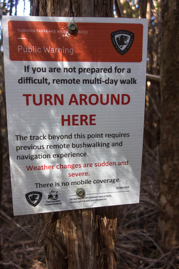
Turn around… (bright eyes)

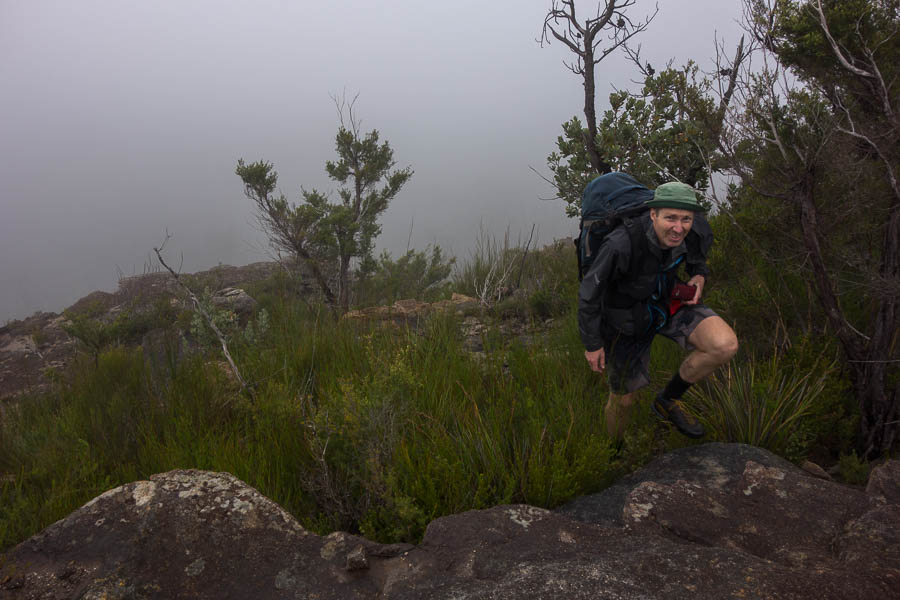
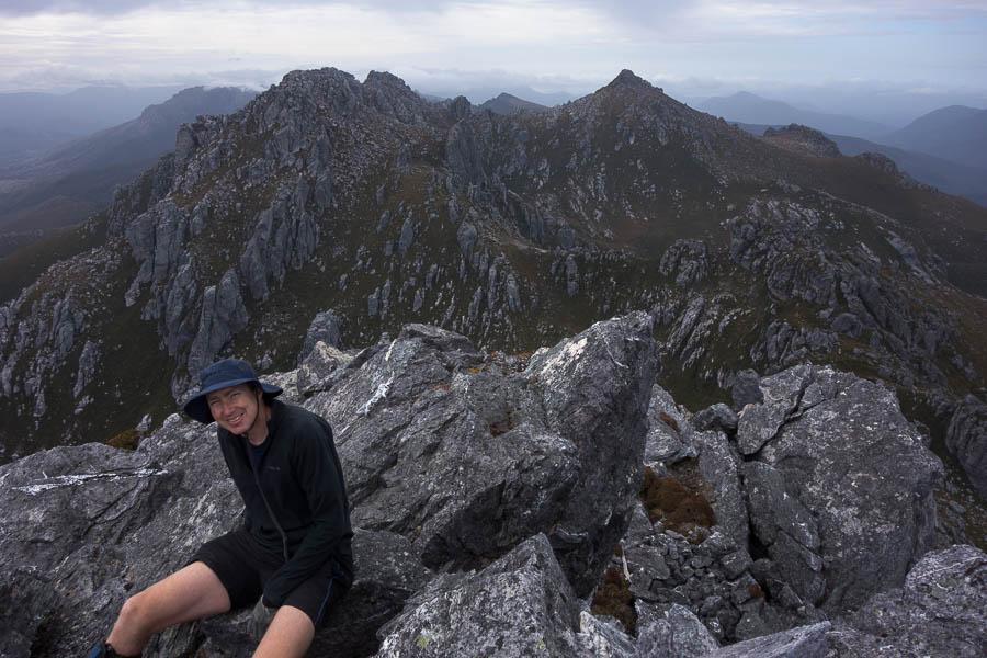
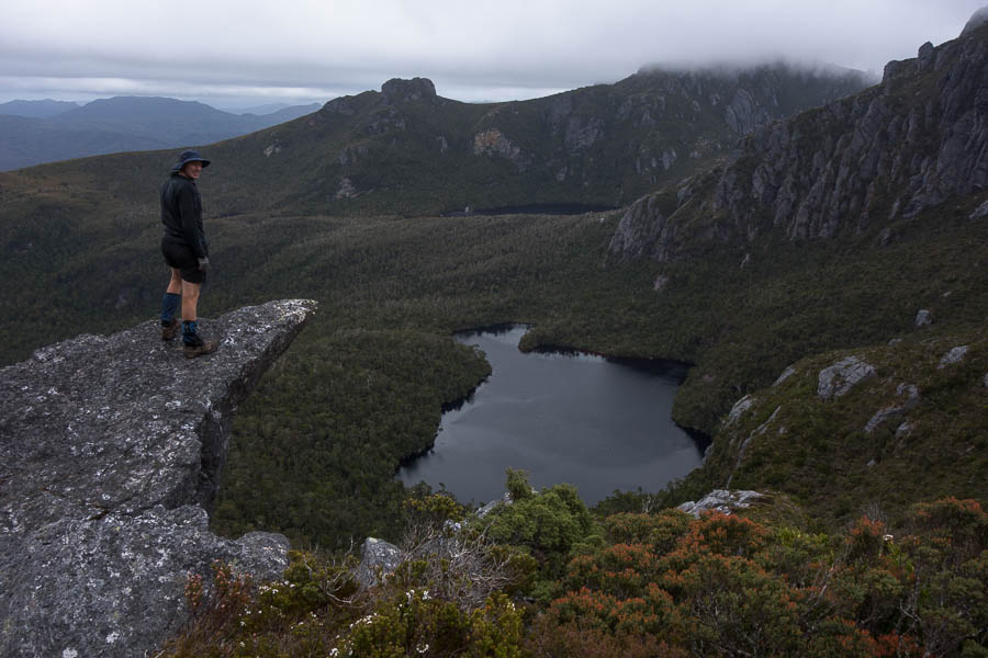
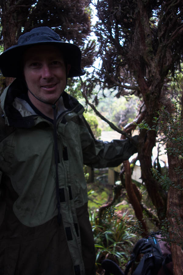
Yet again I felt like pinching myself. Less than 12 hours ago I was in my bed in Sydney, now I was standing on Mt Hesperus surveying the majesty of the Western Arthurs.

The past few days seemed like a dream. It had only been 3 days since we decided we were going to tackle the Western Arthurs (A-K). Trailhead transport booked Wednesday night. Packing list written up at work on Thursday. Fortunately Tom had been dehydrating food in anticipation of some sort of trip for a few days, but even so the last things came off the dehydrator Friday night. And Saturday morning we had taken our first flight in Covid-world, been whisked away from the airport by TWE, allowing us to start walking from the Scotts Peak Dam trackhead shortly before midday.

It’s very easy to be a fair-weather bushwalker in NSW, particularly when you’re just heading out for a weekend. Weather’s looking truly awful? Stay home. Really need to get out? Re-route to a camp cave, half the time the rain doesn’t come anyway. Subsequently Tom & I have done very little camping in the rain over our bushwalking history. I’ve had the Eastern & Western Arthurs on a vague to-do list for some years. But they had always hovered low enough that no action materialised, because the thought of spending a day or two stuck in a tent due to the weather seemed so unpalatable. So little thought had been put towards the area that, the weekend before we headed to Tassie, when on a club trip Lauren mentioned doing “A-K” I had no idea what she was talking about.

Tom had been forced to book in his leave entitlements for the year months ago, which is why we had a random week off in November. We were toying with options for Wollemi traverses when the Tasmanian border re-opened creating another option. Initially I’d looked at Federation Peak (closed), Mt Anne Circuit (closed), Frenchmans Cap (too short)… but then saw the Franklin River and tried to book us on a rafting trip. Minimum numbers were needed for the rafting and Plan B, C & D were rapidly being spun up just in case. Plan E (Western Arthurs) only eventuated after Lauren mentioned it the Sunday before we were meant to leave! I had assumed because Federation Peak was closed the surrounding area was – secretly I was much keener on this idea, so there was little disappointment when on the Wednesday before we officially pulled the pin on rafting due to lack of numbers.

DSC03824

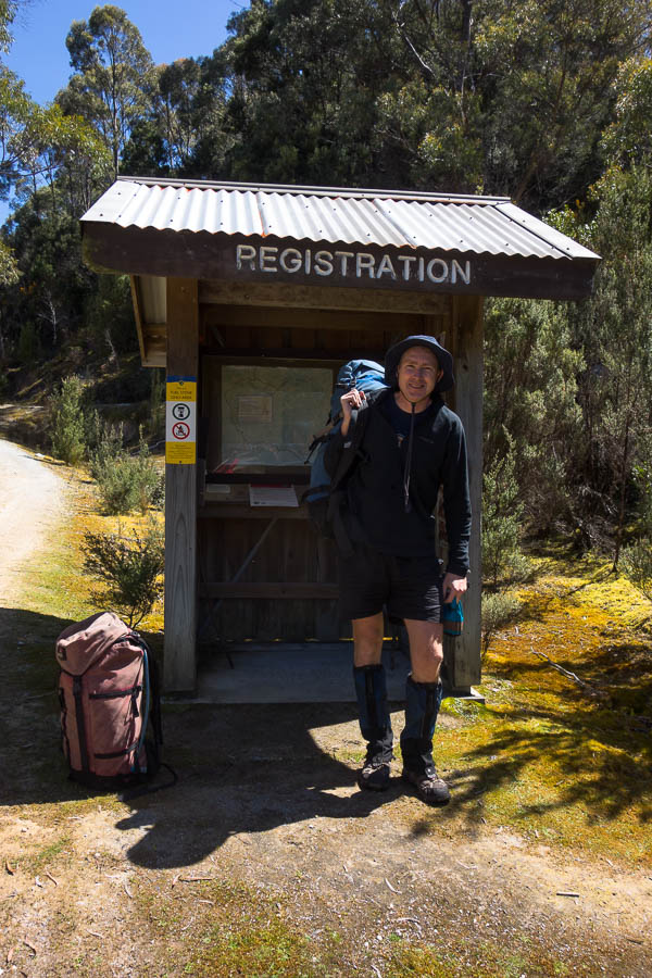
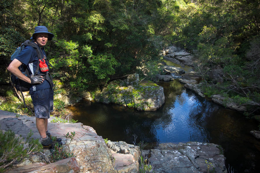
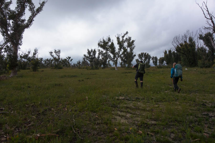
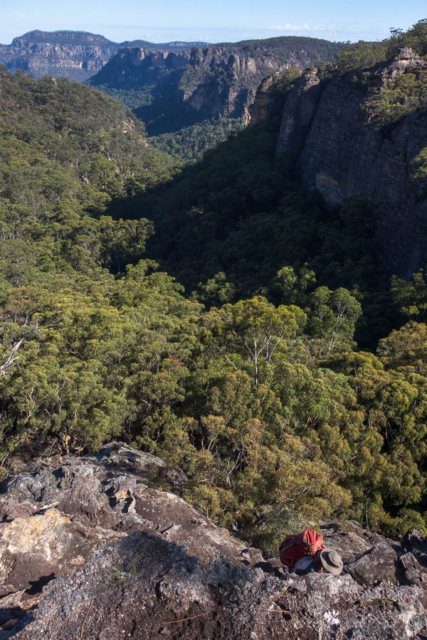
The start – packs not looking too big

DSC03827

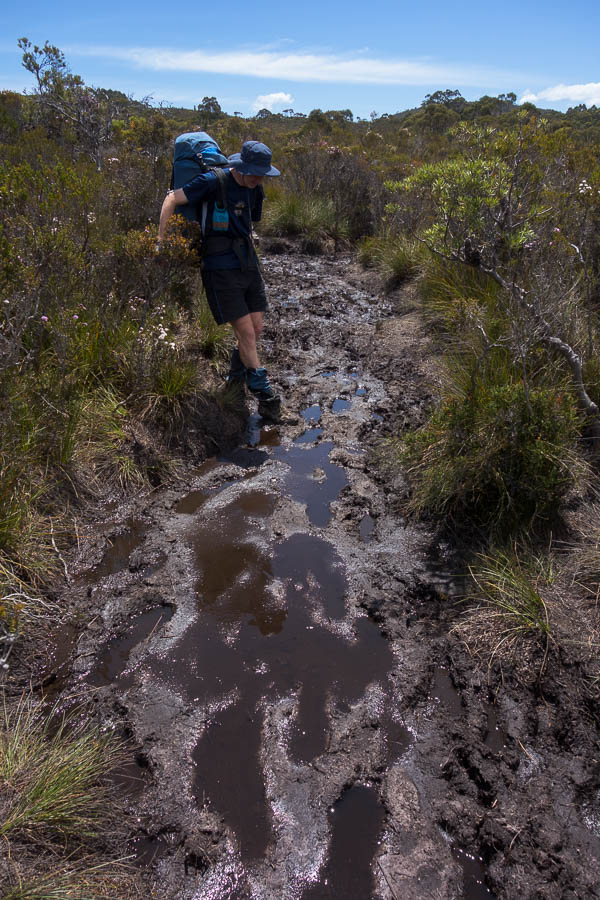
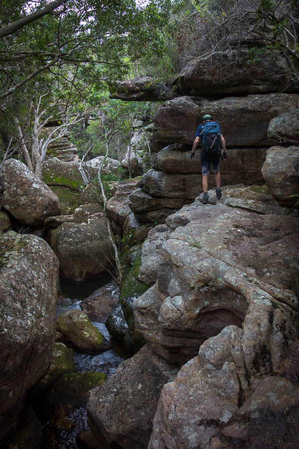
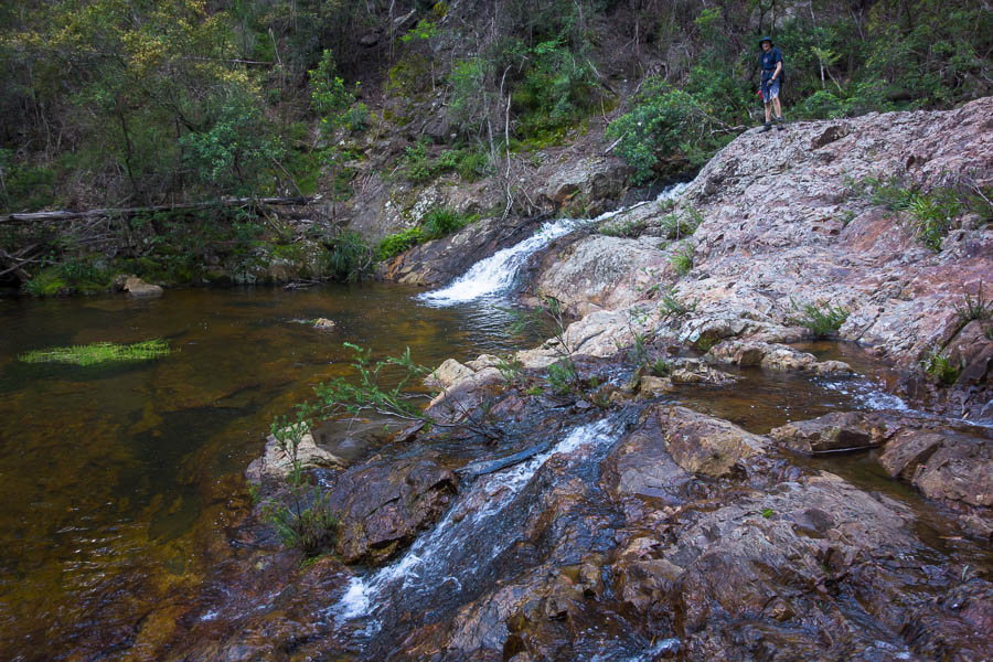
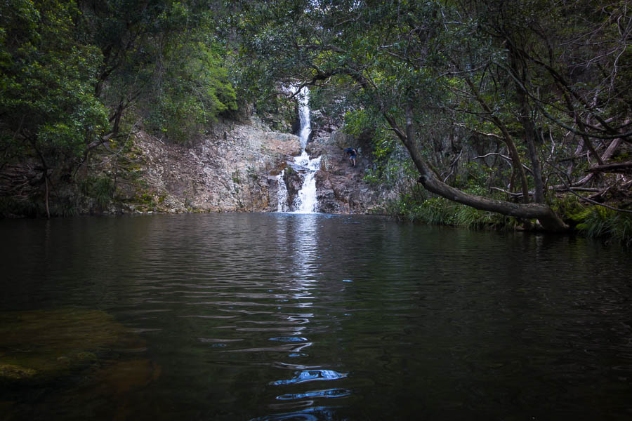
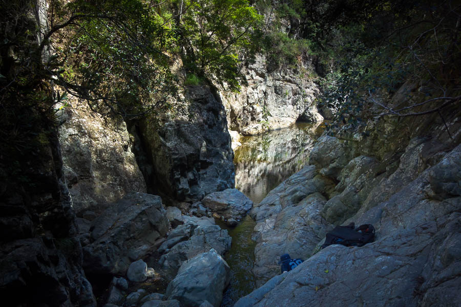
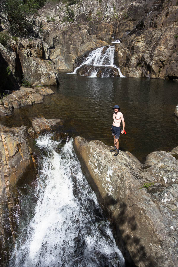
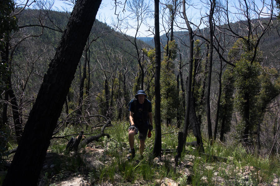
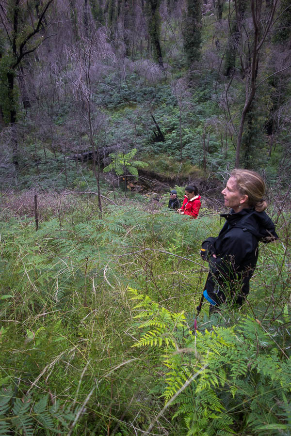
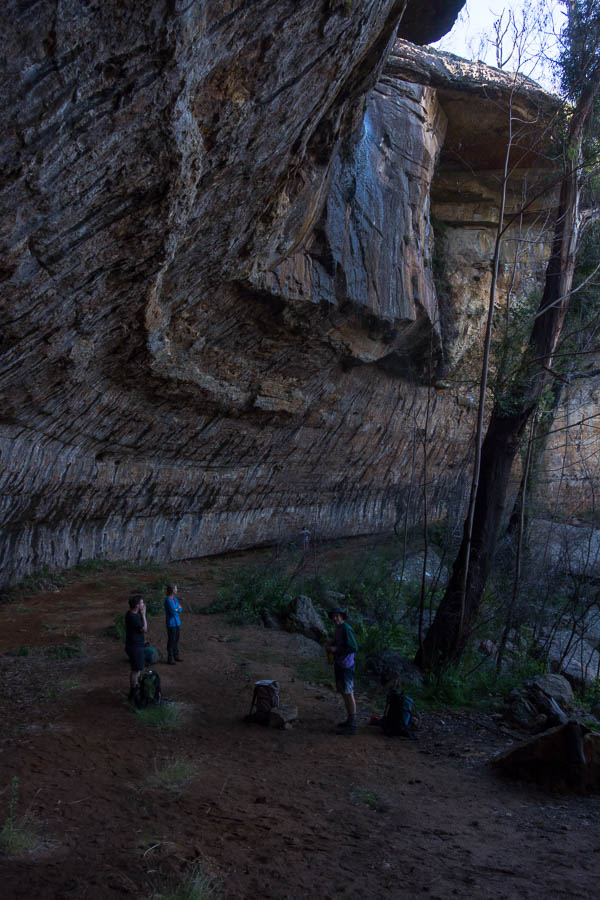
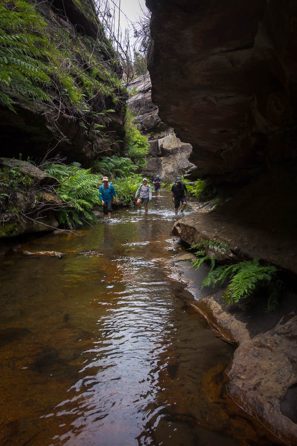
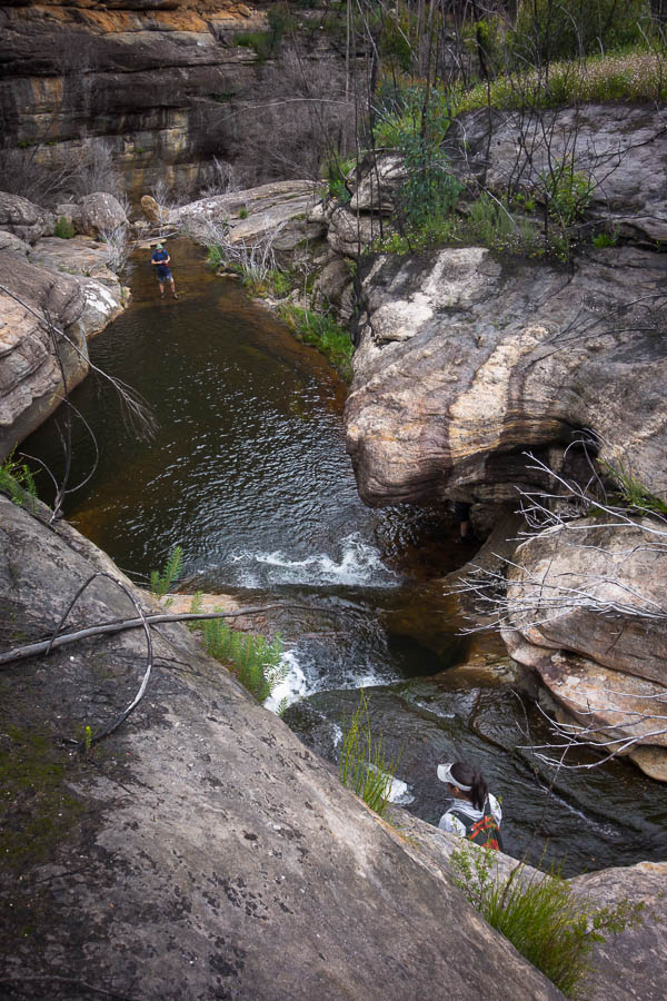
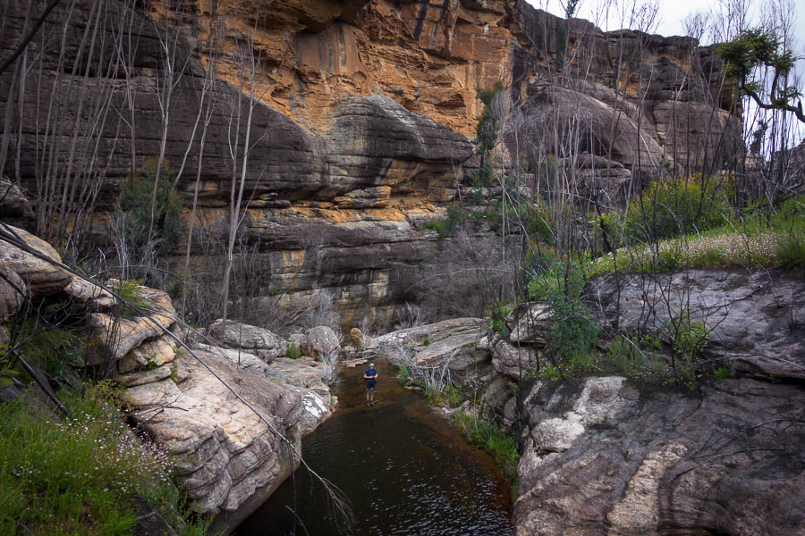
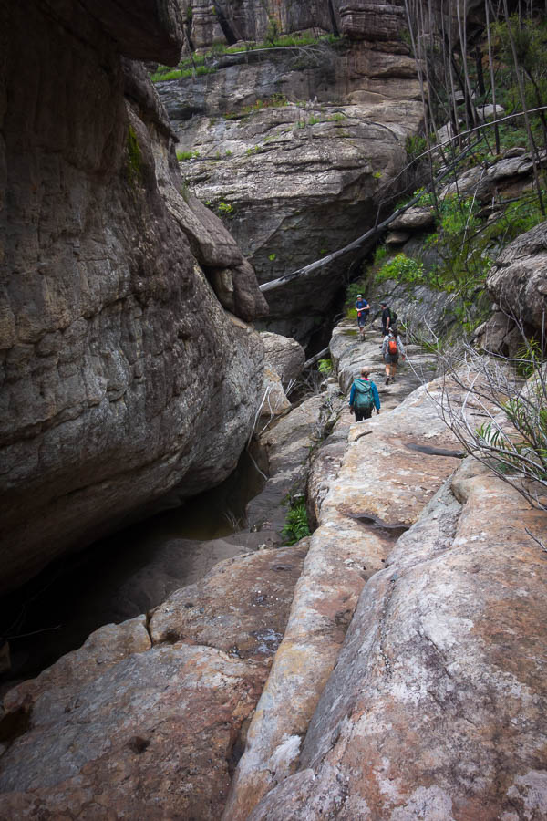
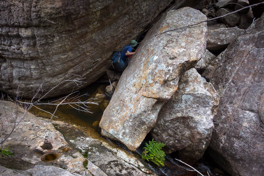
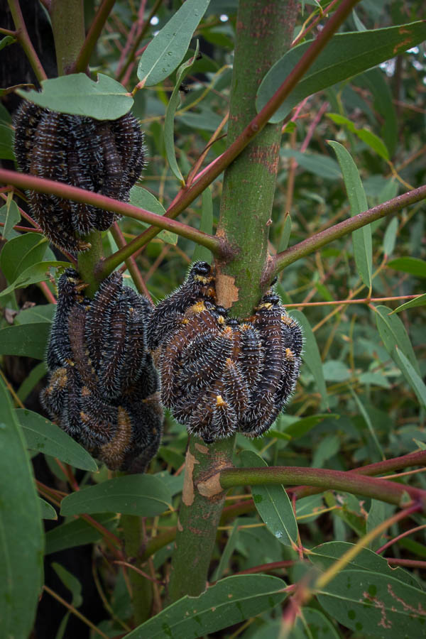
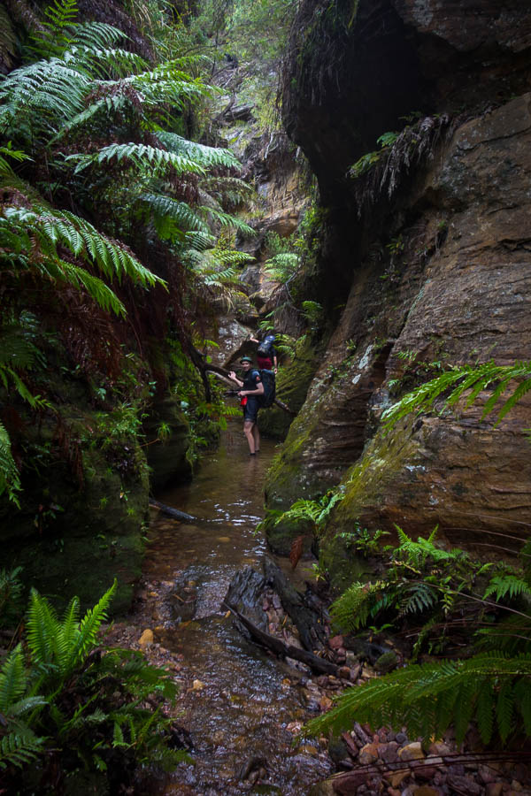
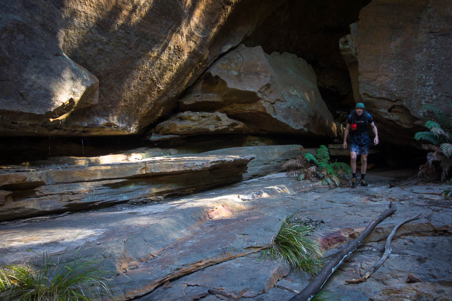
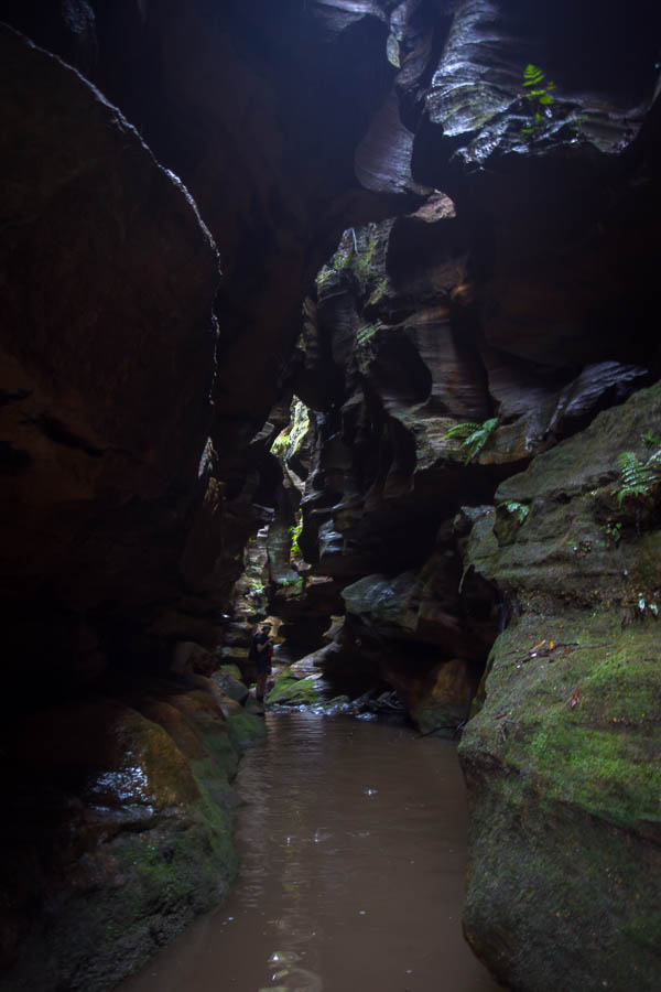
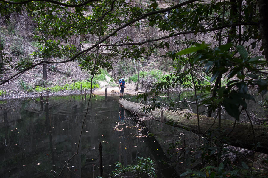
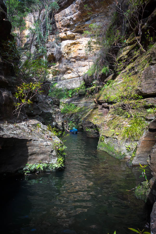
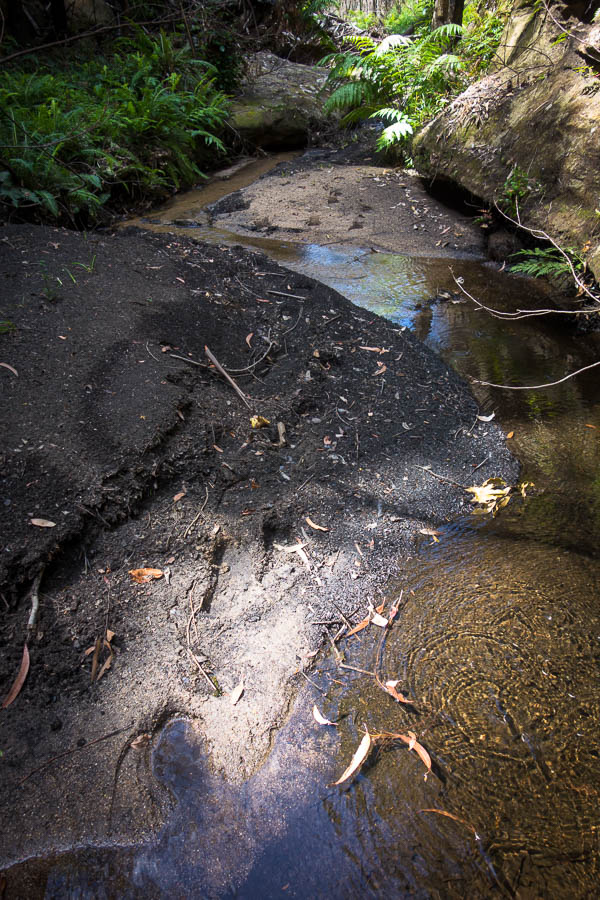
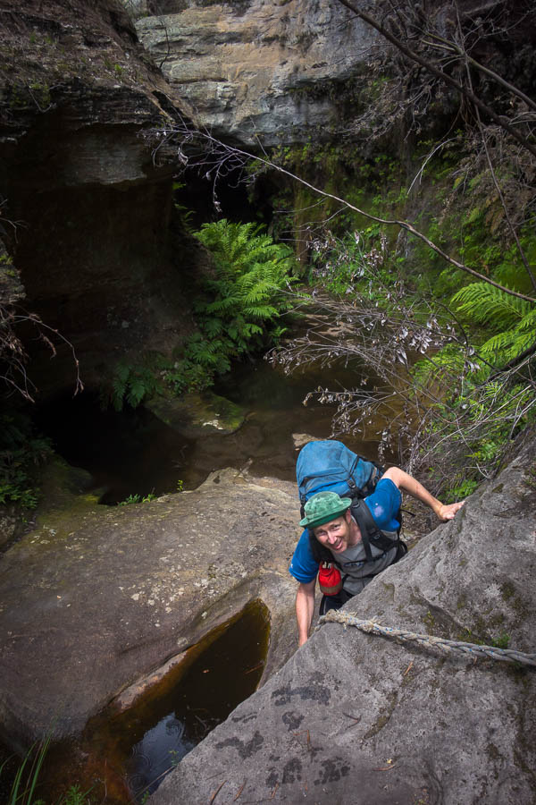
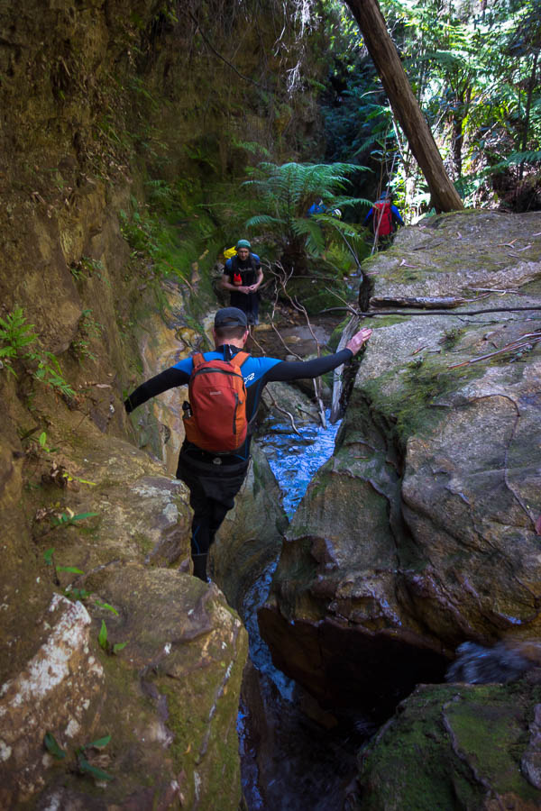
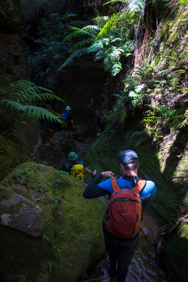
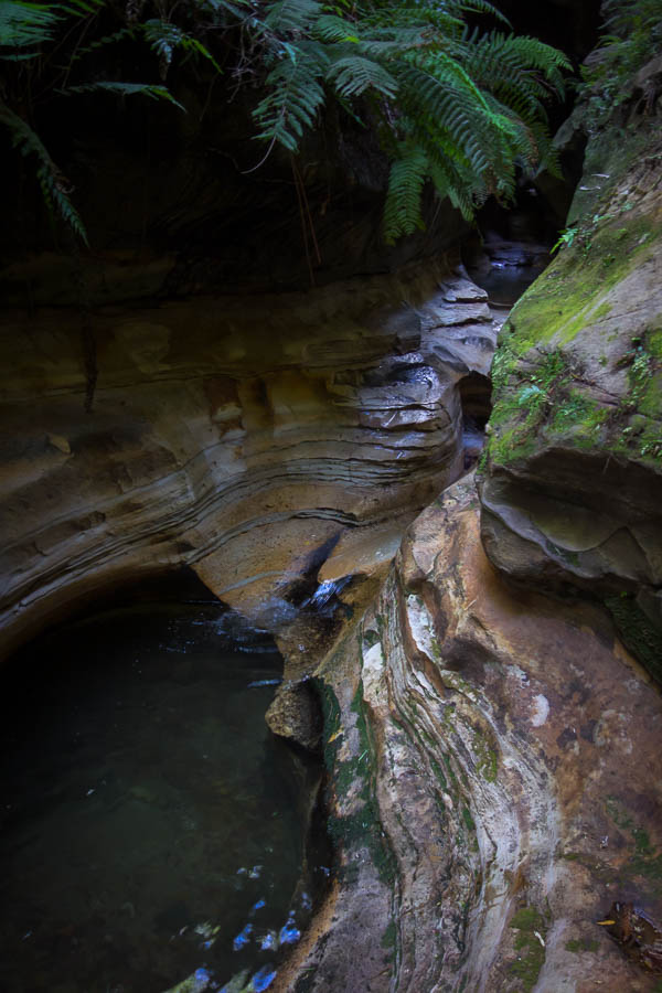
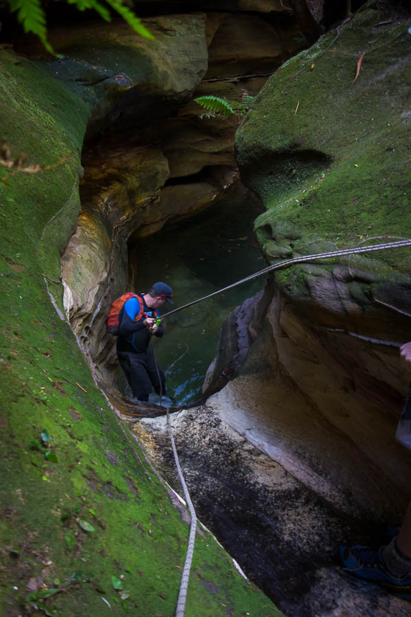
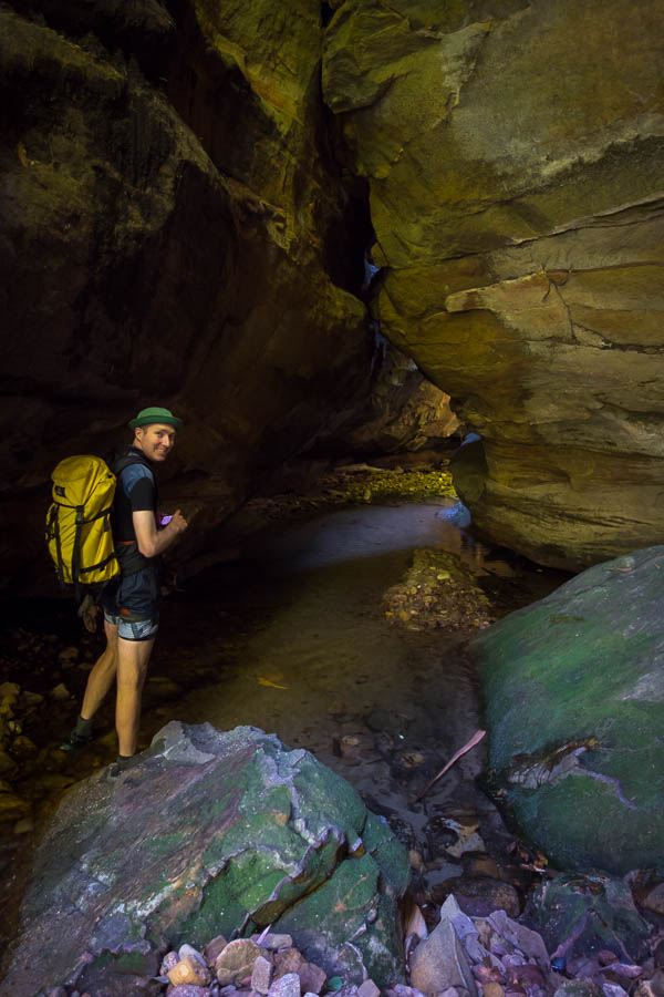
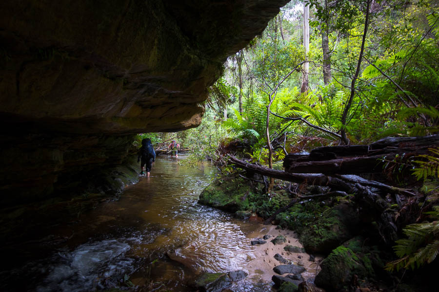
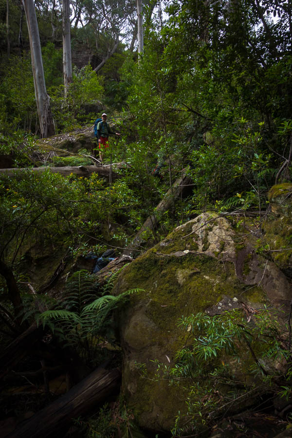
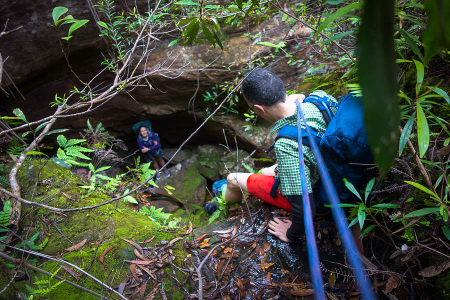
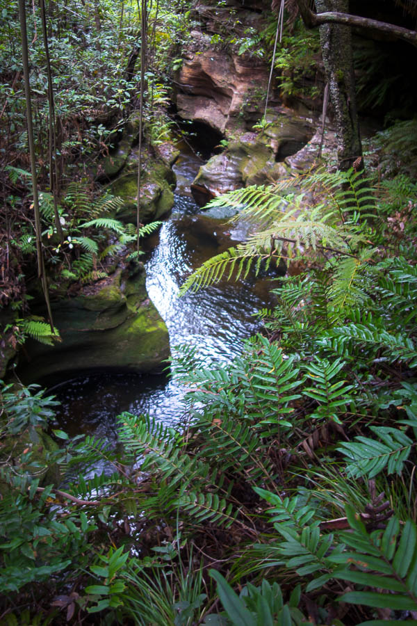
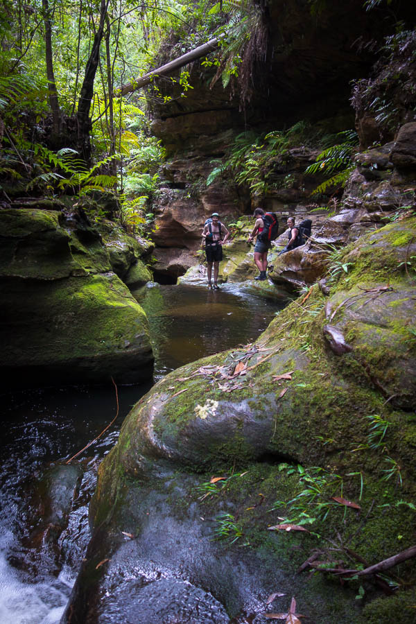
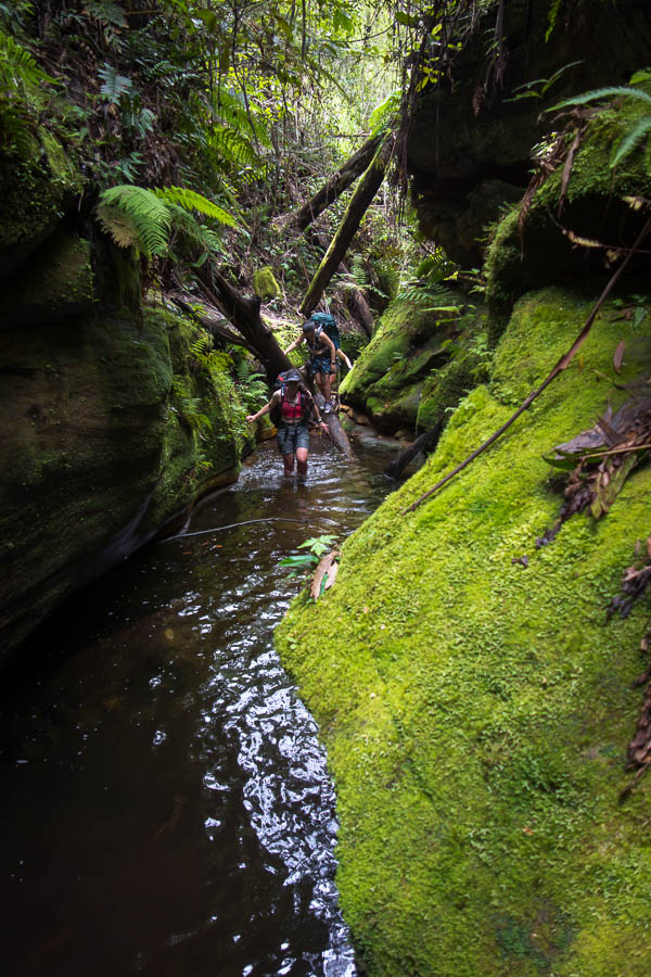
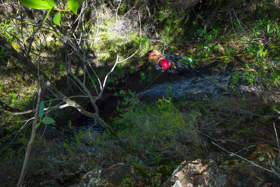
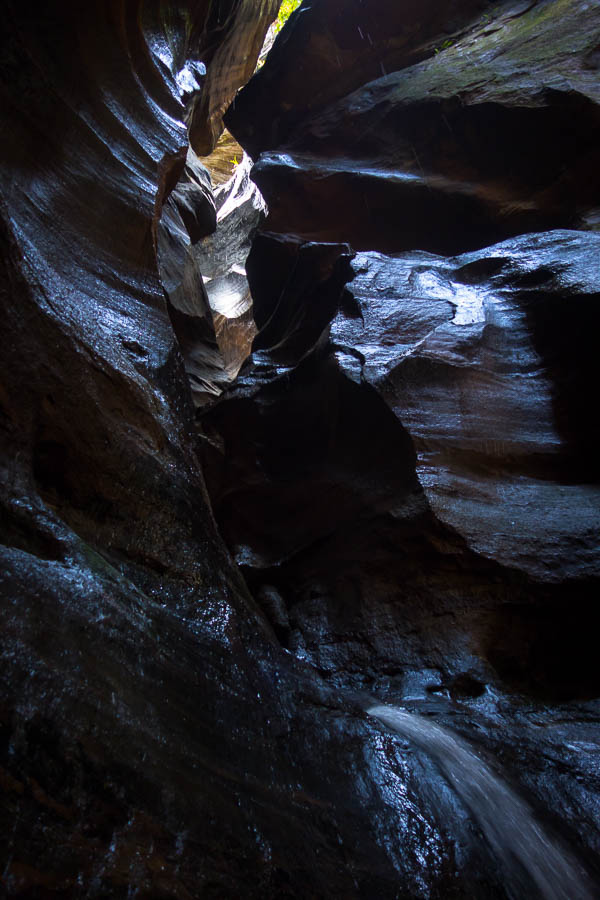
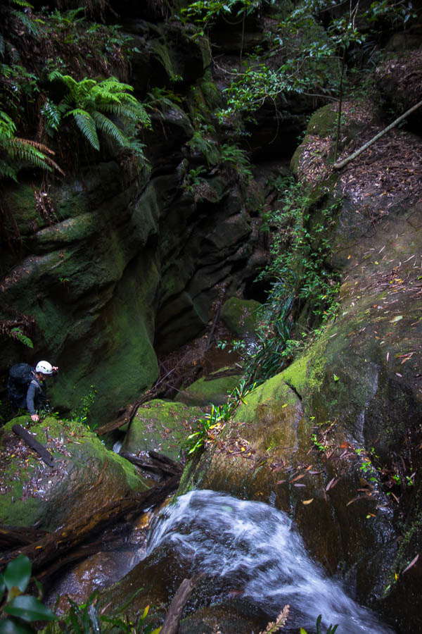
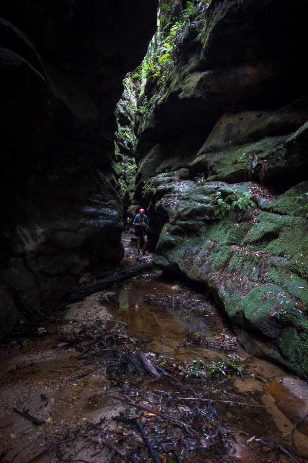
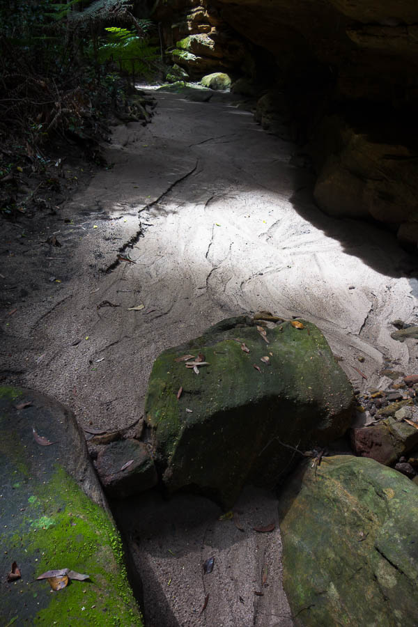
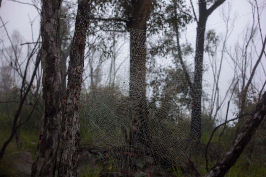
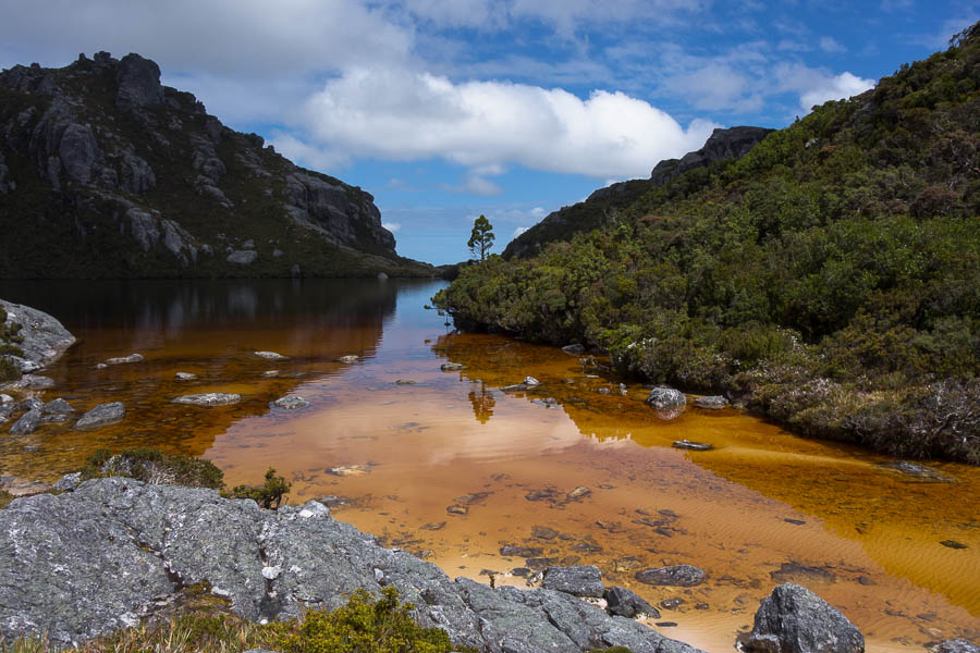
A sample of the section from the car park through to Junction Creek

DSC03829

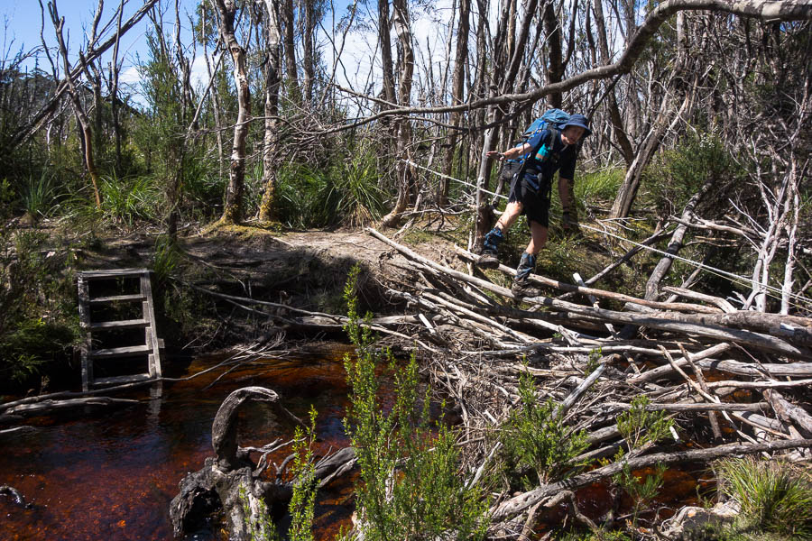
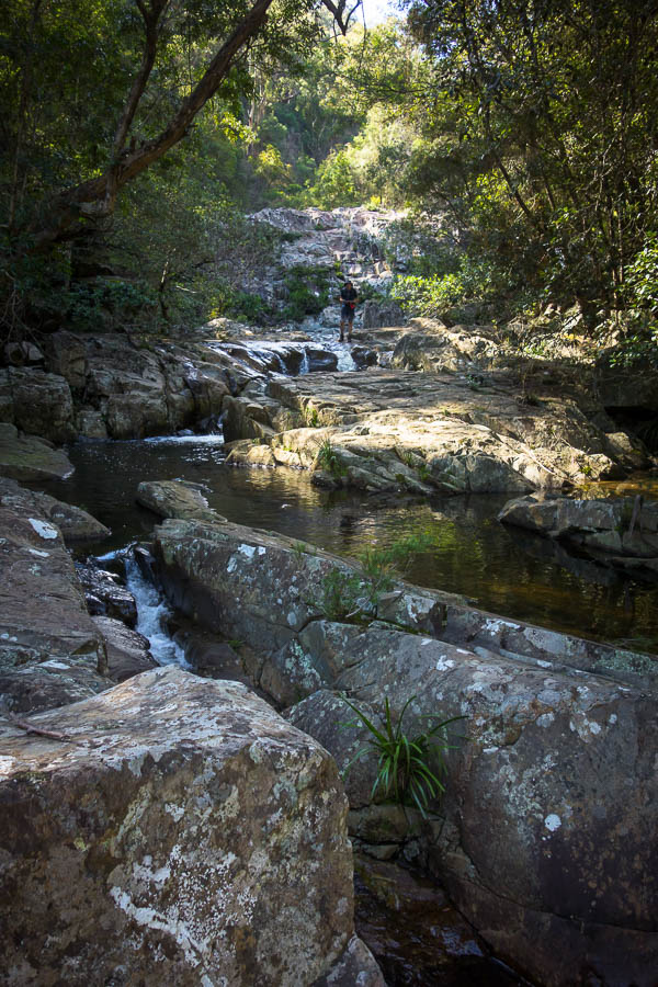
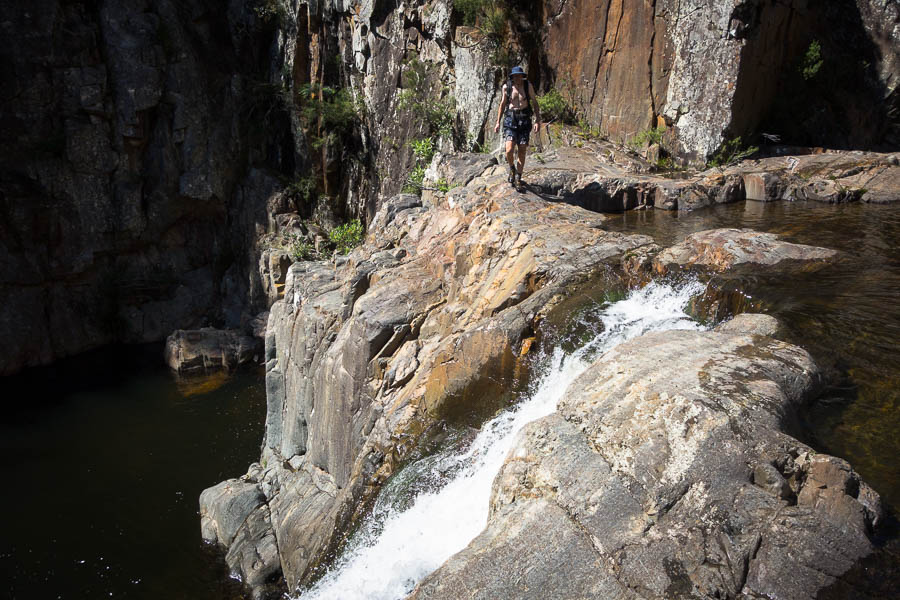
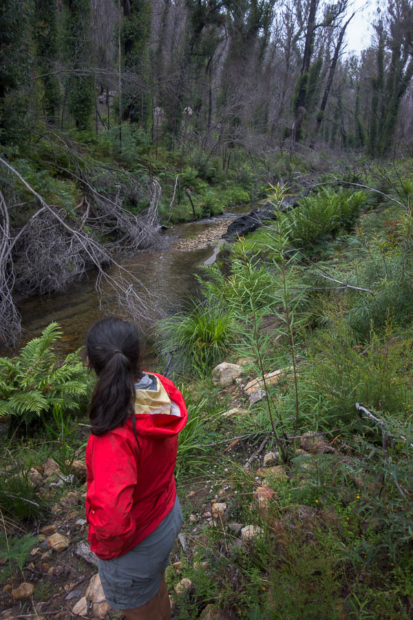
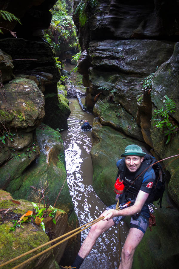
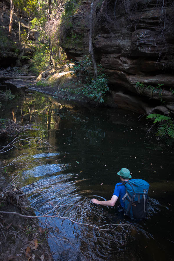
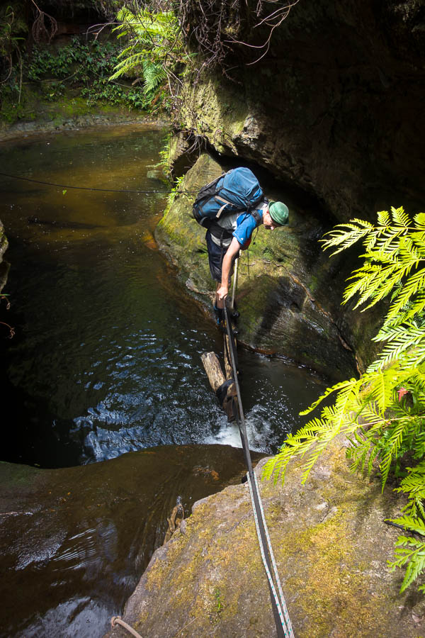
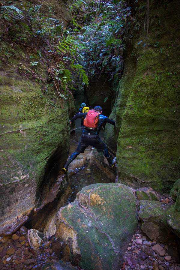
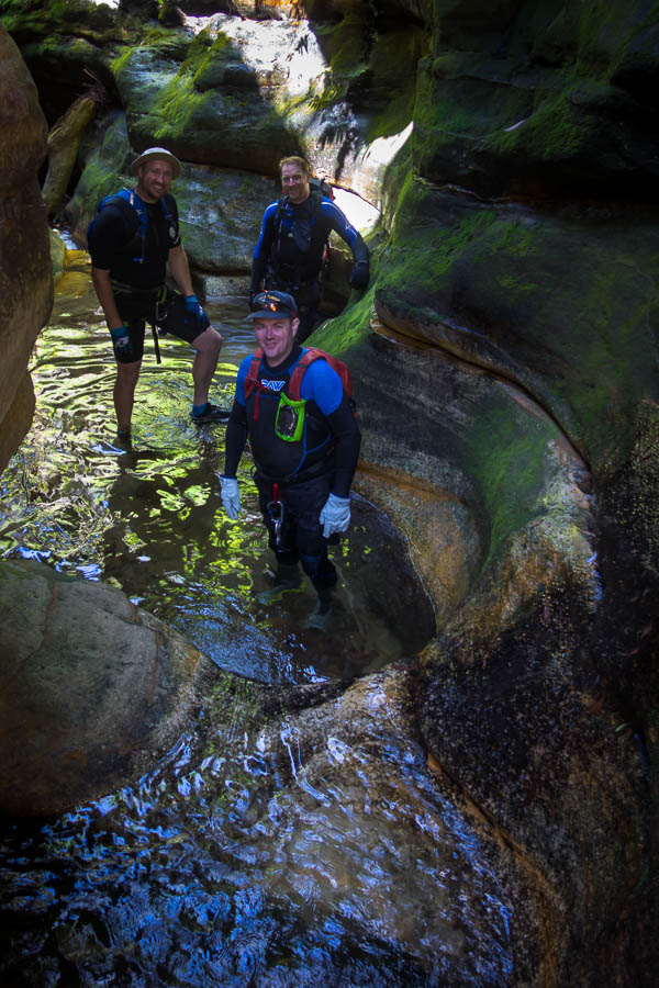
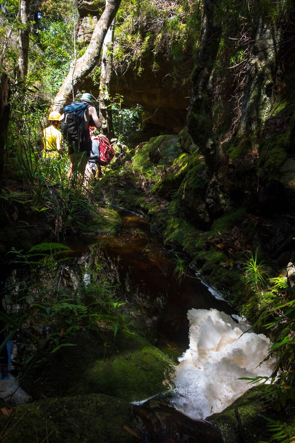
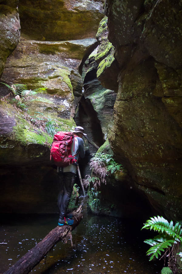
Crossing Junction Creek

DSC03830

Beautiful weather to start our walk (almost too hot)

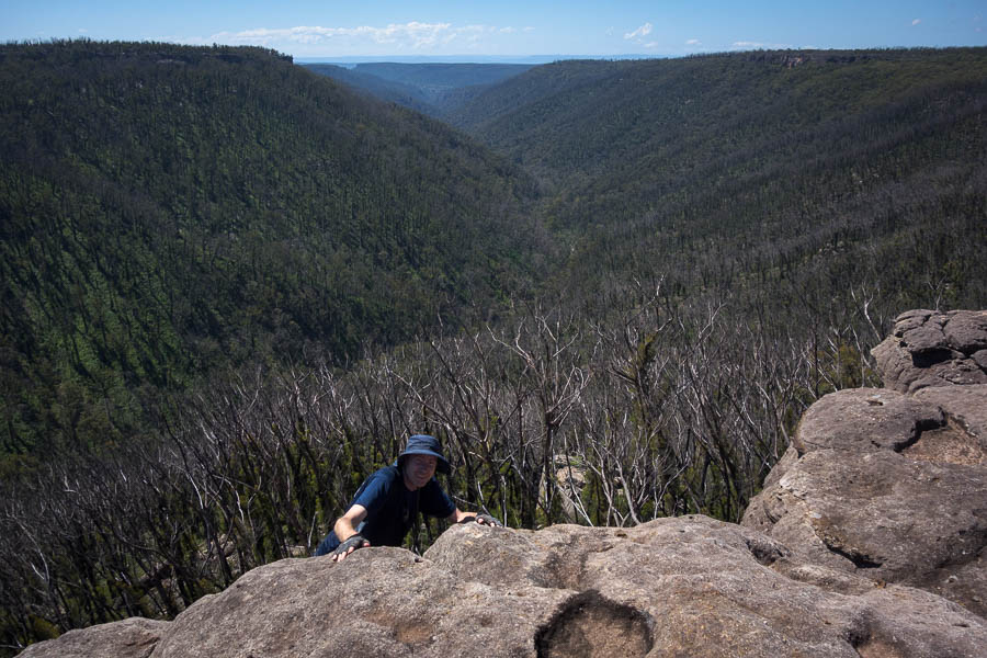
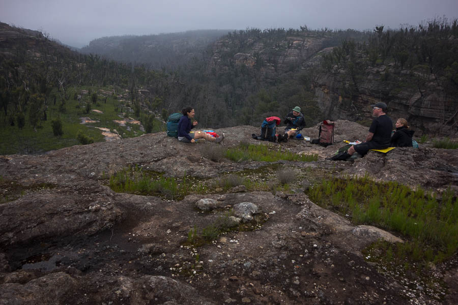
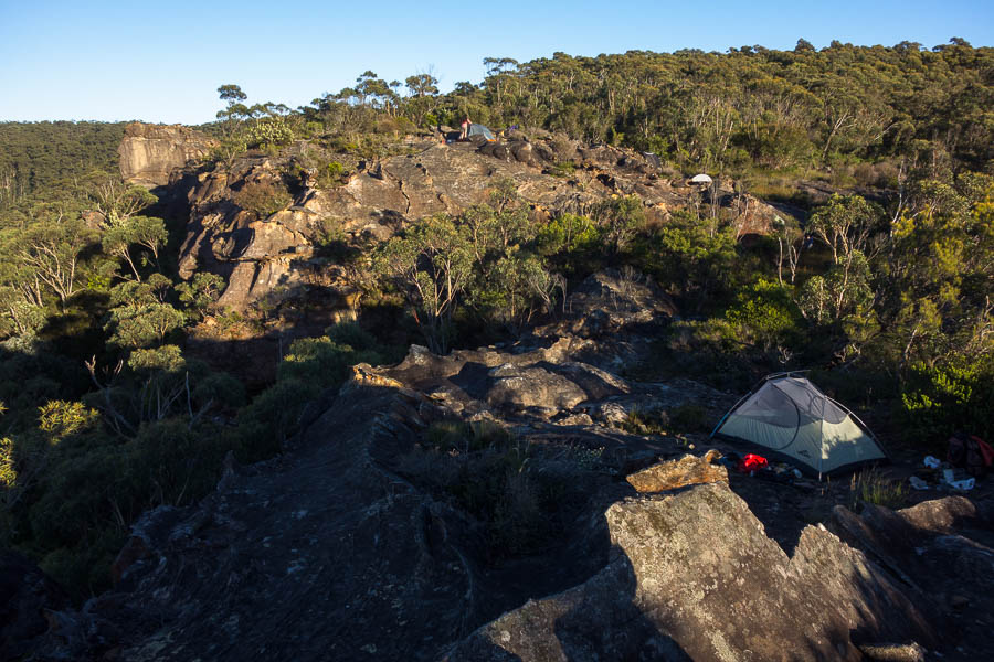
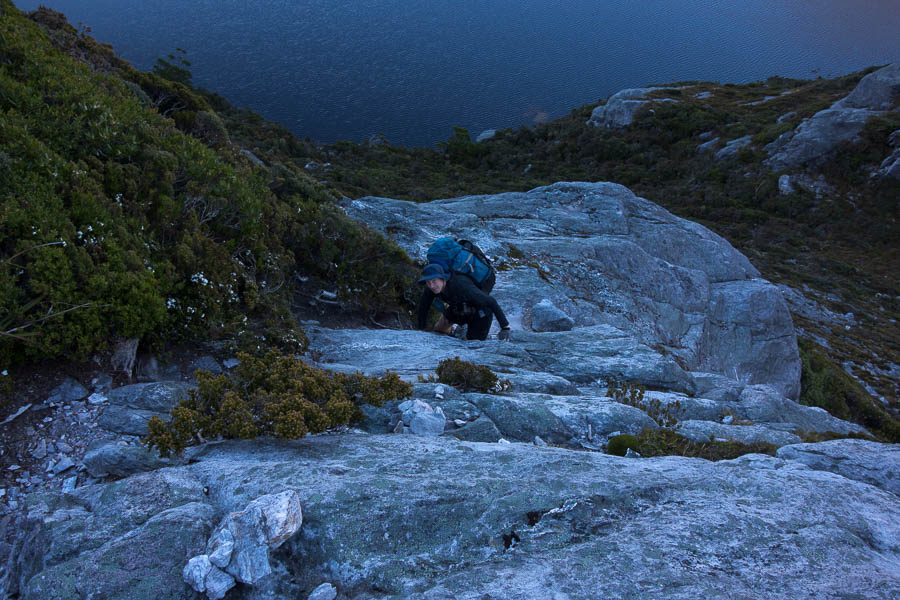
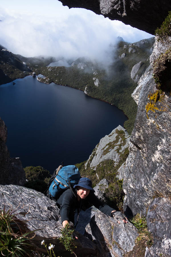
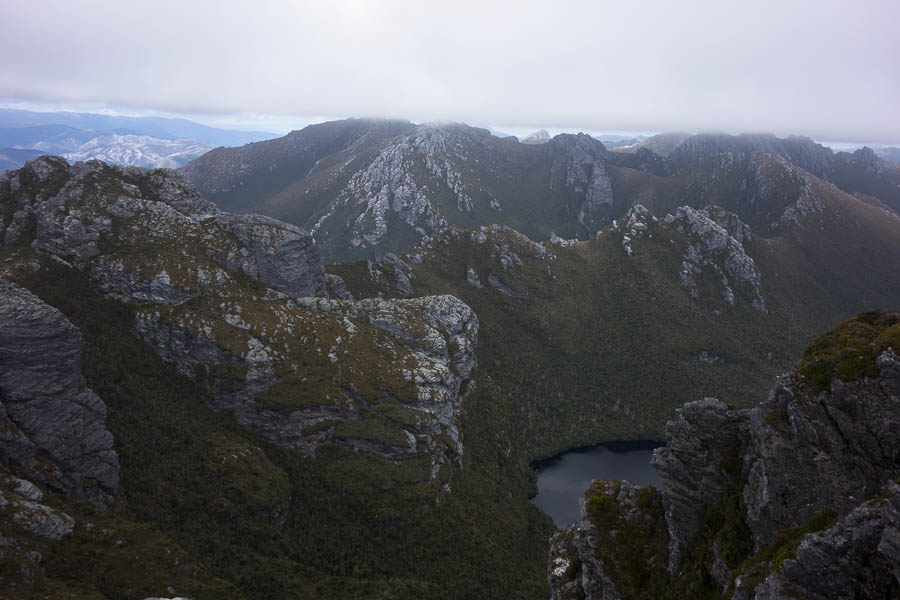
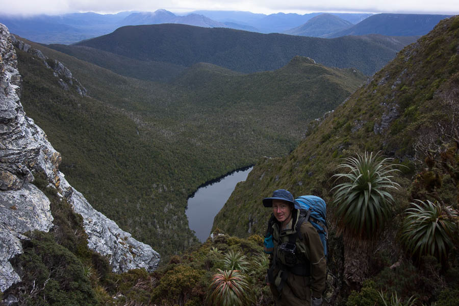
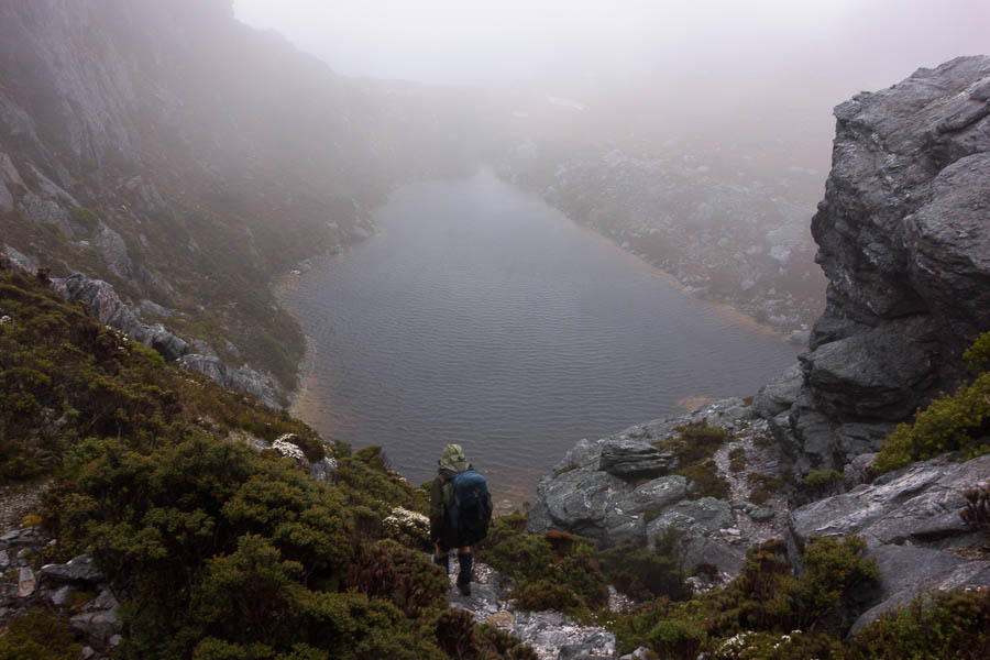
And now here we were having slogged the 800m up Alpha Moraine (“A” in the “A-K”) with our fingers-crossed the forecast would hold. It was still an hour or so from Mt Hesperus to our first night’s camp at Lake Cygnus.

DSC03842

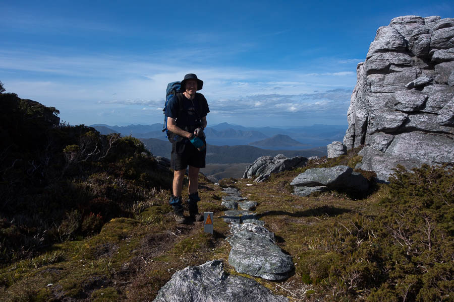
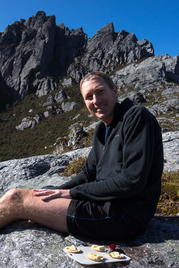
Tom with Lake Pedder in the distance, after we’ve completed the biggest climb of the trip – 800m up Alpha Moraine

DSC03845

Now we just have lots of ups and downs as we go along the range

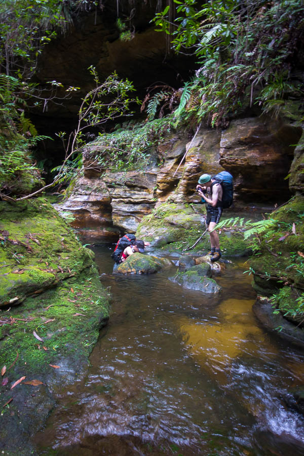
Some way out we spotted the silhouette of a person on the ridge line. Interesting. According to the log book there had been twelve starters two days earlier, but none since, so presumably this was someone from one of those groups. Tom’s assessment of photographic equipment as we approached the lone figure pegged him as a serious photographer. As it turned out his collection of 4 lenses, 2 bodies and various other paraphernalia made Tom look like a model of restraint with “only” 3kg of camera gear! It took a bit effort to keep Tom moving, having got caught up in a photographic discussion with Ross. Subsequently it wasn’t until 7:30pm we found ourselves near the shore of Lake Cygnus setting up for the night. I was sure sleep would come easily – after a 5am start, a couple of poor night’s sleep in the lead-up, a 900m climb with a 16kg+ pack – until I returned from the toilet to find a rat investigating my pack.

DSC03850

Heading down to Lake Cygnus – camp for night 1

My biggest worry coming into the trip was rats eating my pack at Lake Oberon. In the flurry of blog-post reading in the two days we had of planning, rats had featured in a few reports. And now we had one at Lake Cygnus. I scared it off and packed everything away as best I could. I lay there listening for the tell-tale scurry of little feet. Imagination on overdrive, there were a couple of false starts, but then sleep came and I didn’t hear anything until the next morning – where to my great relief my pack still had the same number of holes as the night before.

Day 1: 15.7km, 11:45am – 7:15pm = 7.5 hours including water collection, afternoon tea, photo-faffing etc. Chapman’s estimate: 6-9.5 hours (excluding breaks)
animal count: one native rat, 2 small snakes
packweight: 16kg?

DSC03855

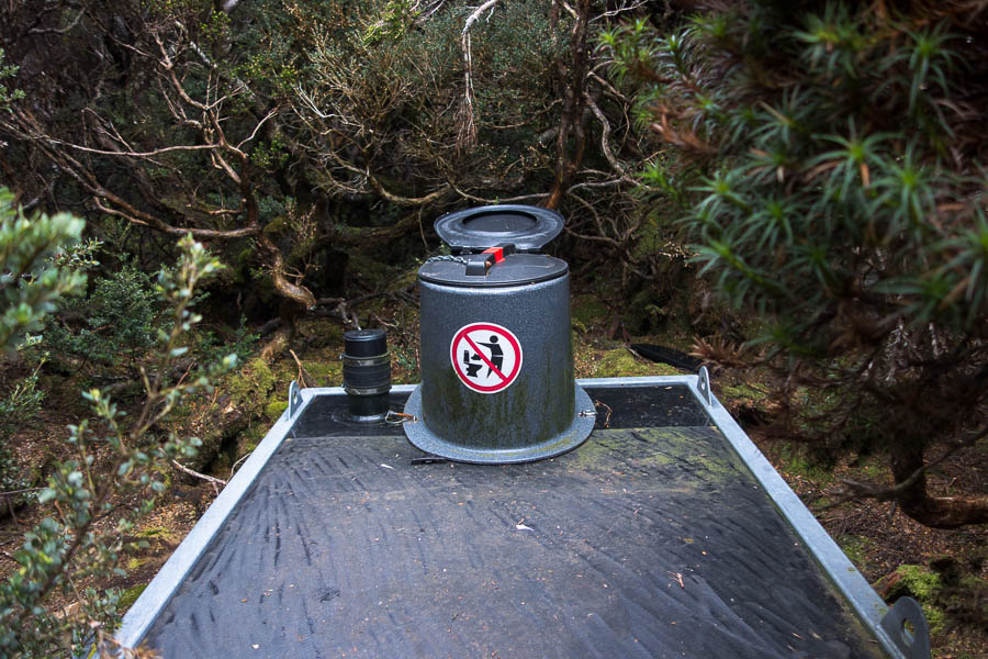
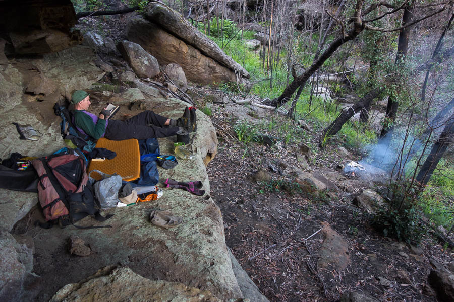
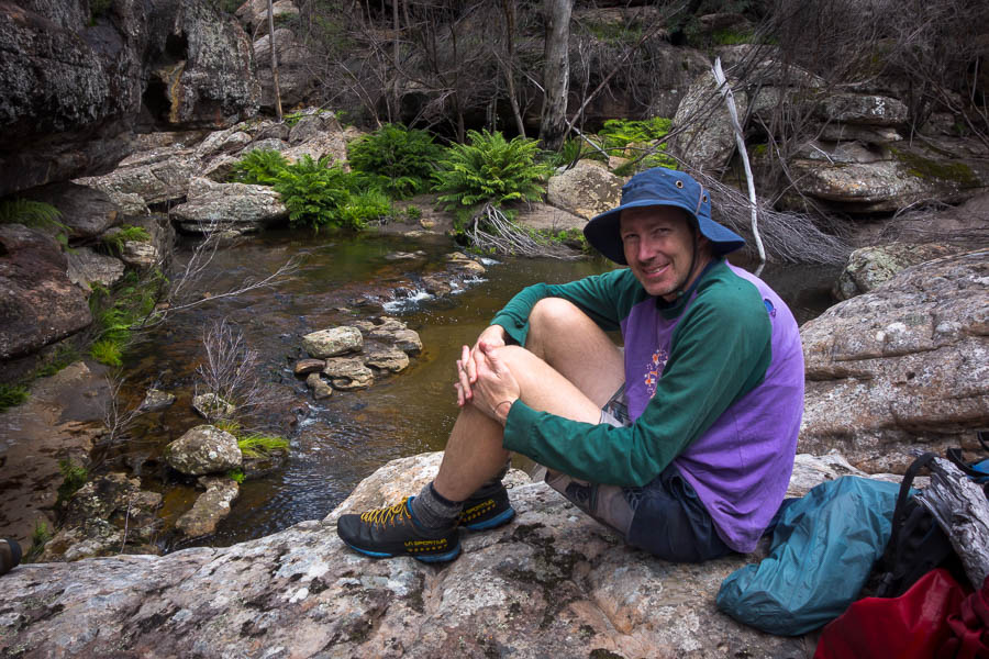
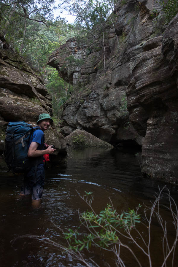
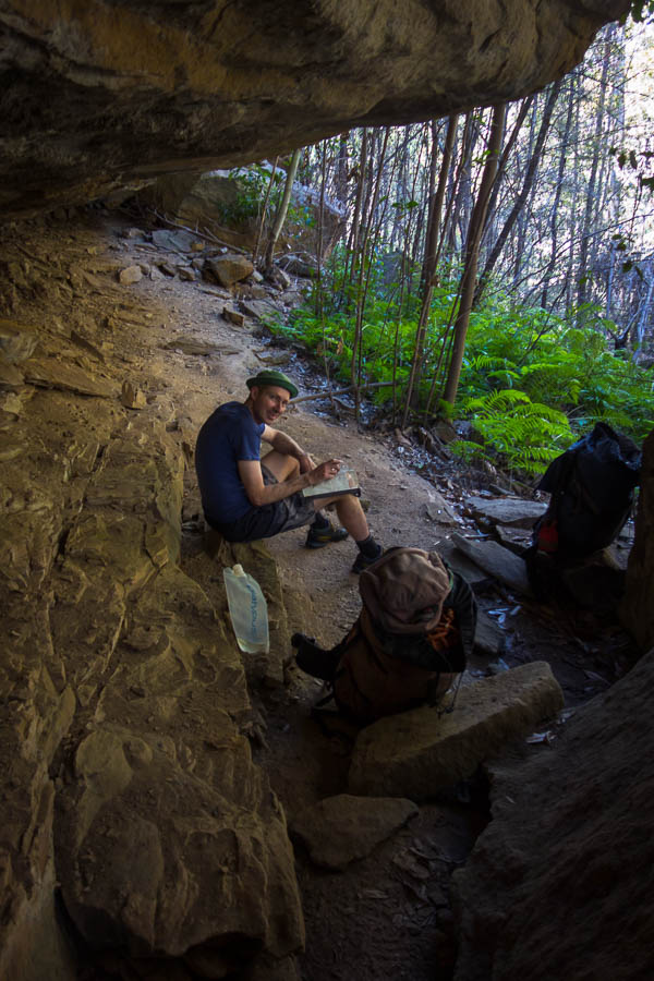
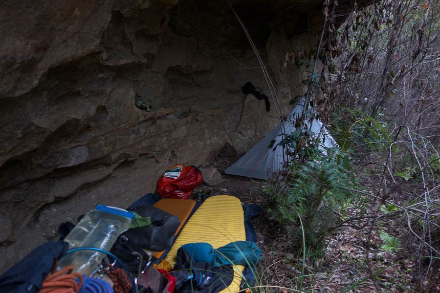
The toilets at each site were like this. Unscrew the lid, put down the seat, then screw the lid back on when you’re done. Fortunately I never needed to use one when it was pouring with rain.

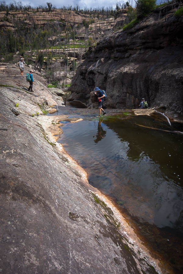
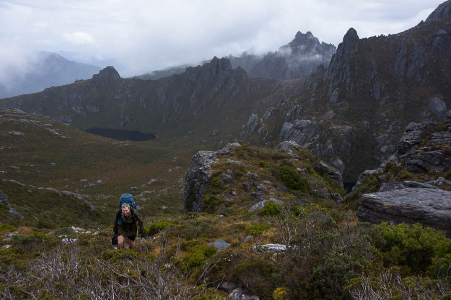
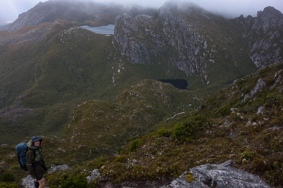
We thought day 1 would be the most physically challenging day on the trip for us. Give us difficult terrain and short distances over long distance on track any time. Our second day was much shorter and we didn’t hurry to get moving in the morning. Ross headed off back to the car park with his 30kg pack shortly after 7am while we were still eating breakfast. The blue skies we’d started with yesterday had been replaced with a grey version, but overall the conditions were relatively pleasant. We took a side-trip up Mt Hayes for morning tea, and then had an early lunch at Square Lake.

DSC03865

Views from Mt Hayes

There’d been the odd spot of rain during the morning but it started drizzling which brought an abrupt end to lunch. We powered up the next hill and by the time we got to the top the precipitation had eased off, but it had also put any thoughts of a side trip up Mt Orion out of our minds.

DSC03880

Lake Ceres & Square Lake behind us we climb up to the Mt Sirius saddle

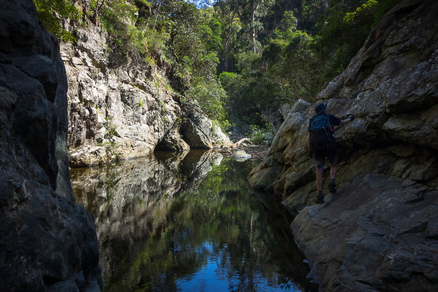
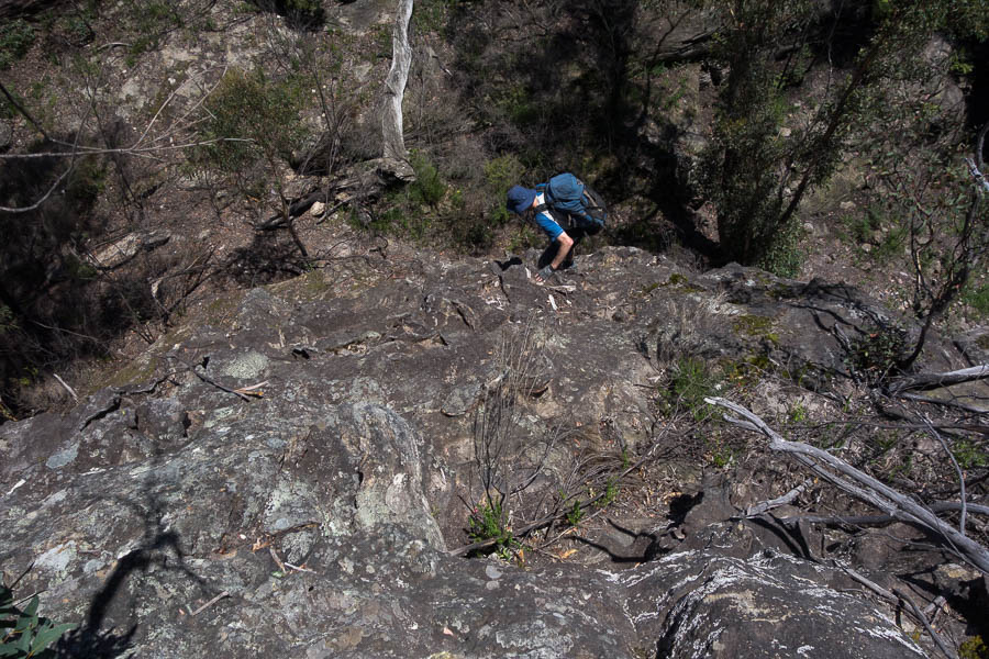
We oohed and aahed over the classic Mt Oberon view from the saddle before heading down. I had anticipated this section keenly as it was where all the notes said “if you don’t like the approach to Lake Oberon then turn-around”. It was also to be our first encounter with a Chapman “steep” section. Curious to see how things would pan out we walked down the constructed steps wondering what was to come. Steep, it certainly was. Our packs were still relatively heavy having only eaten a day’s food which made things a little more awkward, but there was nothing overly difficult in the descent for us. My main complaint being a wet butt by the time we got down, as I had to sit on a few of the ledges to order to scramble down. Tom as usual hit the right sympathetic notes with his “better a wet butt than a squashed Rachel”.

DSC03890

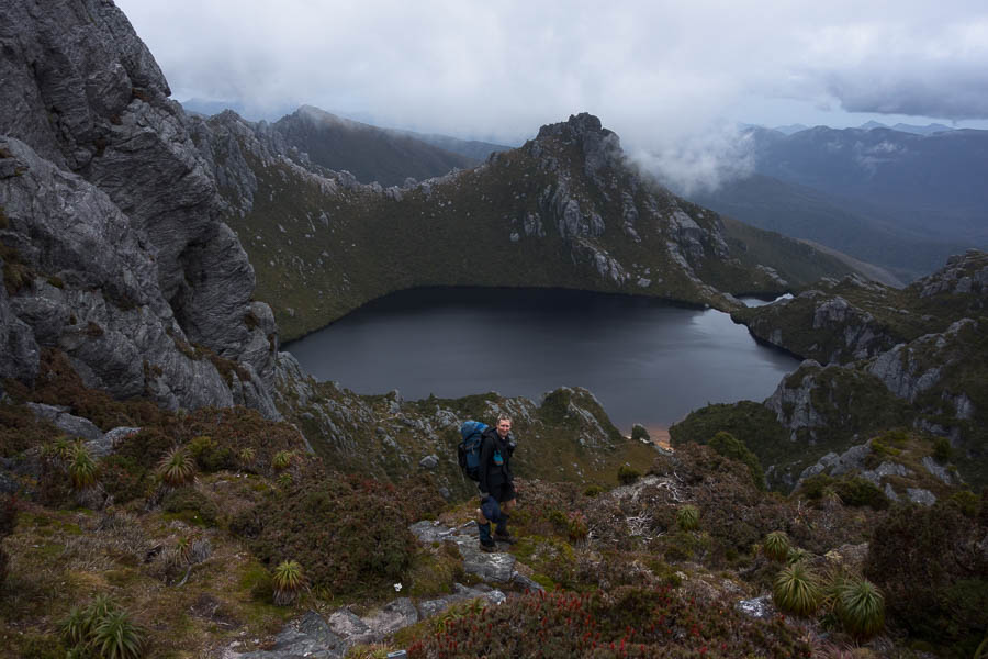
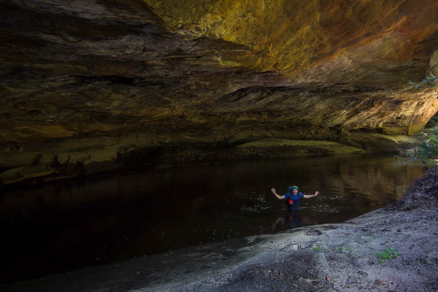
The classic view of Lake Oberon

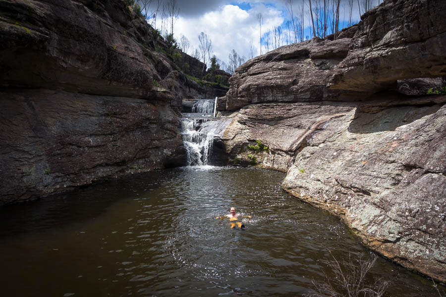
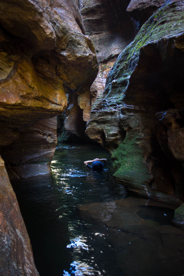
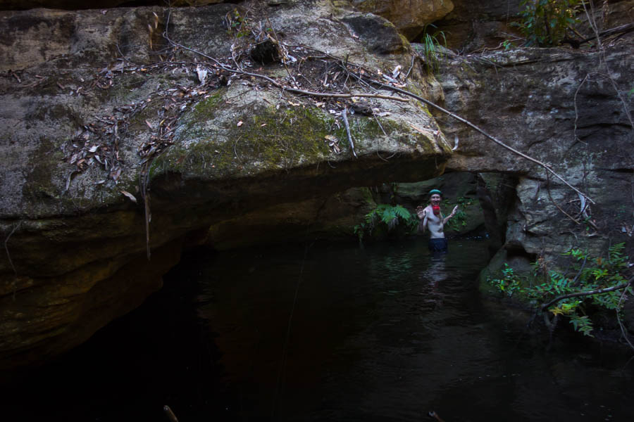
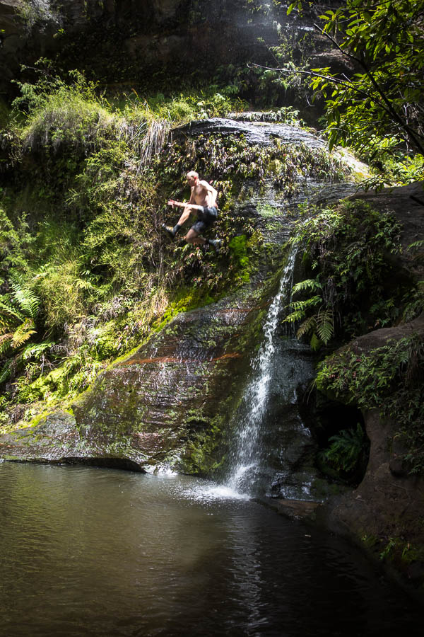
By the time we got to the lake shore the sun was out with blue sky aplenty. I stripped off and threw myself into the lake before I cooled down. The water was chilly away from the shallow foreshore! The campsites at Lake Oberon are tucked away in the bushes – which I’m sure is great in inclement weather but it was a little gloomy on a day like the one we had. We settled down to do a crossword in the sun by the shore before eventually retreating to set up camp.

DSC03902

Turned into a stunning afternoon at Lake Oberon

Happy hour was again out by the shore with Tom chasing the sunlight up the slope as the sun sunk behind the surrounding hills. During dusk we heard some voices, presumably starting to descend to Lake Oberon. We headed back out to the lake shore for some sunset photos but couldn’t see anyone and no one ever arrived (that we could tell).

DSC03907

Happy hour on the lakeshore

DSC03912

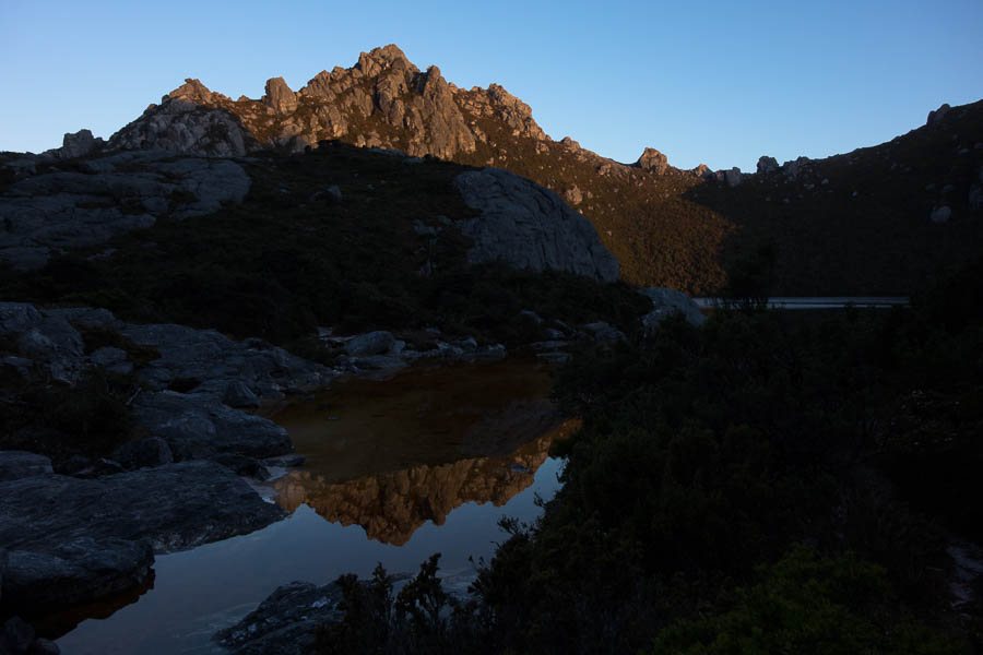
Sunset on Mt Pegasus (we climb that first thing the next day)

Day 2: 4.2km + Mt Hayes sidetrip, 8am (?) – 1:45pm = 5.75 hours including morning tea, lunch, photo-faffing. Chapman’s estimate: 3hr10 – 4hr 40 (excluding breaks)

It was a very still night, and the night sky was spectacular. On the downside that meant heavy condensation on the tent, which we spent a lot of time wiping down with the chux the next morning. Even so we were still away by 7am, in perfect weather conditions. My worst fears for the trip hadn’t eventuated – no sign of any rats overnight.

DSC03920

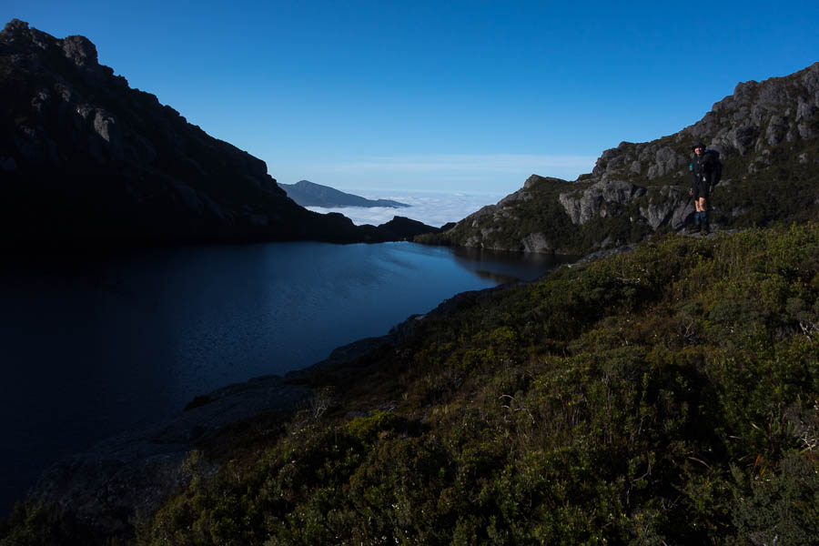
Still morning with a sea of cloud in the distance

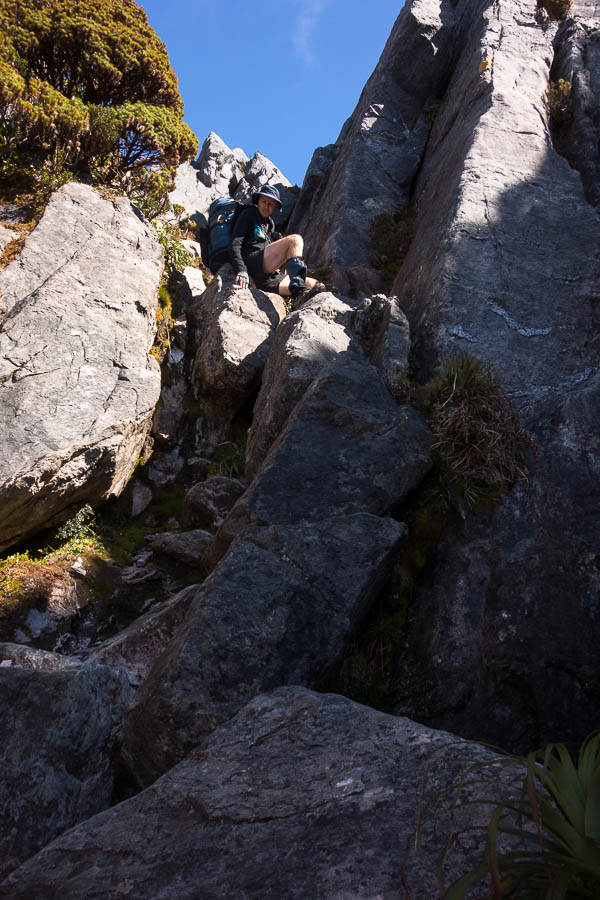
The scrambling on the lower slopes of Pegasus was my least favourite part of the day. It was the start of a mantra I repeated a few times over the next two days; “I am so glad I’m not doing this in the wet!!” We made pretty good time getting up Pegasus. But after we got through the hole at the top, we wasted quite a bit of time finding our way along the ridge to start the descent off. Probably my fault for claiming we were going to be on the 1 hour end of the 1-2 hour Chapman estimate….

DSC03927

Scrambling on the lower slopes of Mt Pegasus

DSC03937

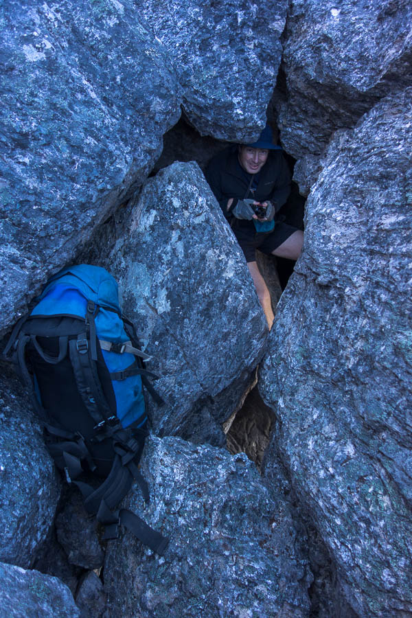
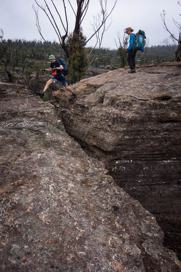
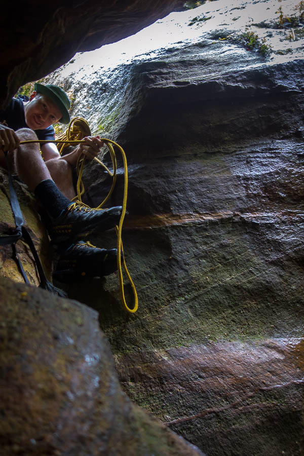
The hole near the top of Mt Pegasus. The only place on the trip we passed packs.

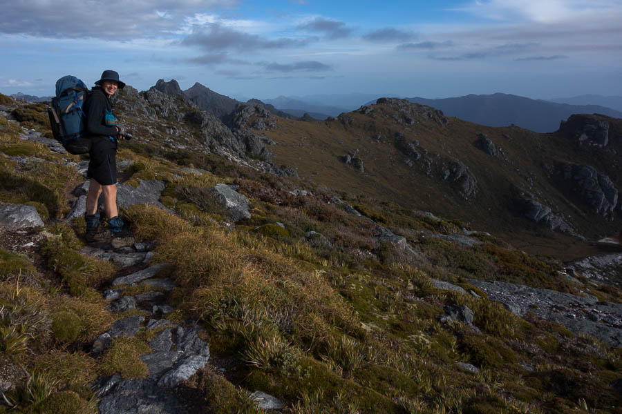
The views in this next section were amazing. But off in the periphery I could see the sea of cloud which had been so attractive in our earlier photos rising… and rising… until we were engulfed in it. That wasn’t quite the end of the views for the day, but they were a bit more sporadic depending on height of the cloud.

DSC03946

Descending off Mt Pegasus

DSC03950

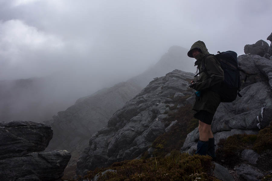
Looking along the ridge to Mt Capricorn. Somehow we’re going along there.

DSC03951

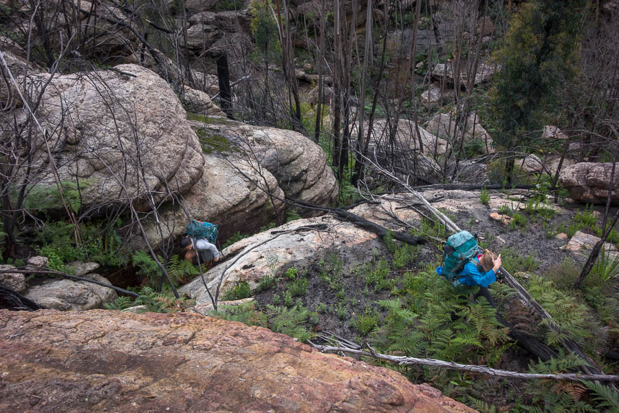
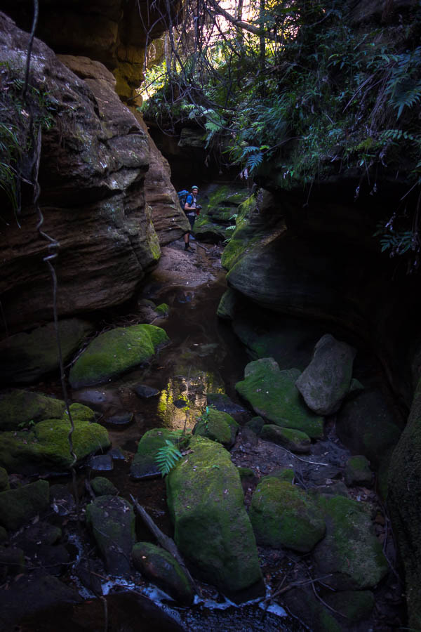
Scrambling above Lake Uranus

DSC03953

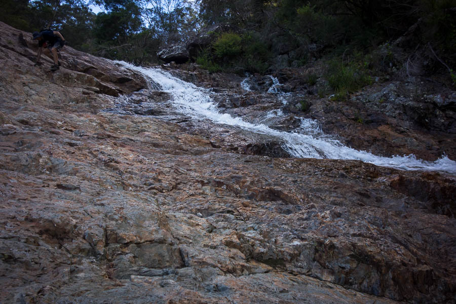
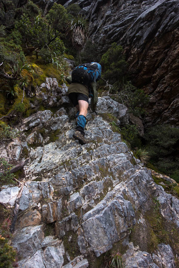
More scrambling (and this is why it takes 5-7 hours to cover 4km)

DSC03958

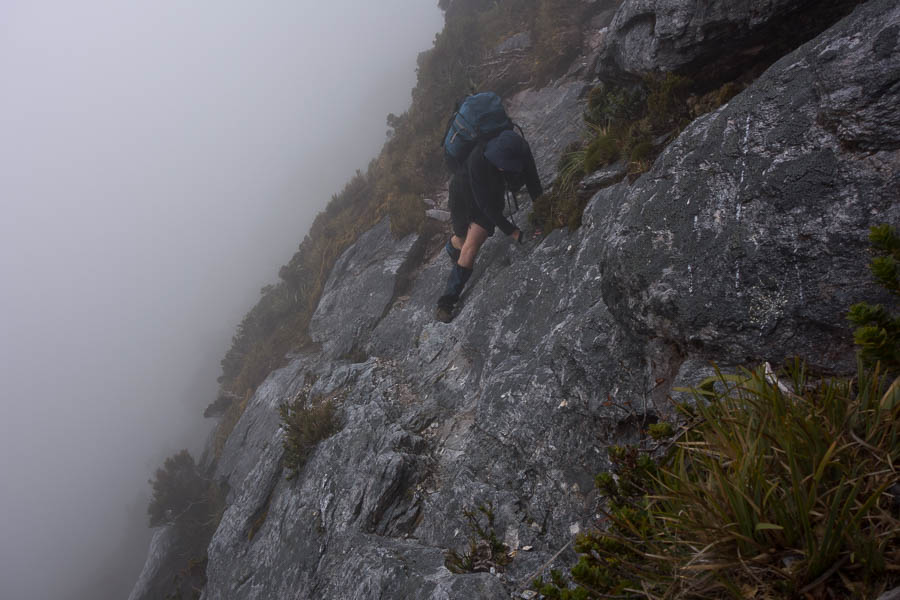
The cloud has engulfed us, but this traverse still feels airy

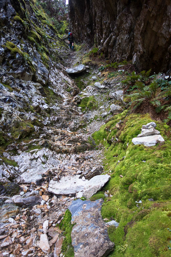
We experienced our first (but not last) experience of dirt bank climbing in the next section. I was somewhat horrified at the erosion in some sections and as Chapman says in the notes it seems likely some sections of the route may become impassable in future due to the erosion. It’s a difficult conundrum – by being there we were contributing to the problem – should we not go?

DSC03965

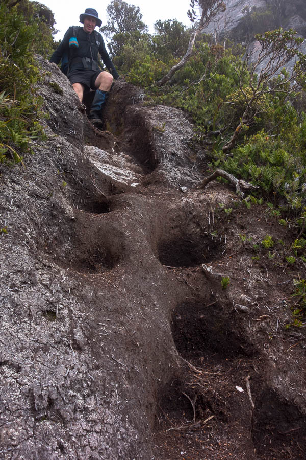
Our first encounter with eroded dirt banks. There are many more sections like this (mostly dodgier/more eroded).

DSC03988

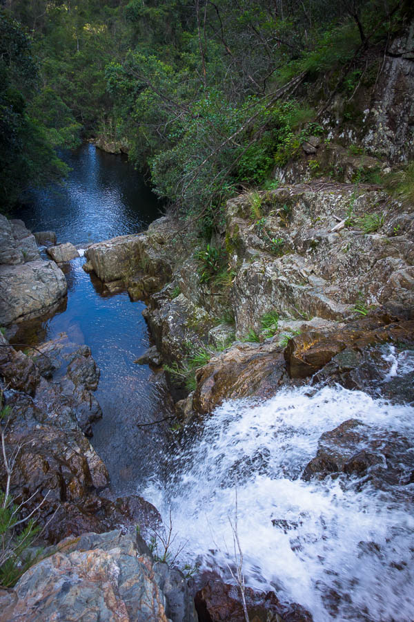
Looking over Lakes Ariel & Titania

We arrived at High Moor in the early afternoon. I optimistically assessed the tent platform for its quality as a back rest not realising we’d spend most of our time in the tent to escape the wind. It cleared a little mid-afternoon so we climbed Mt Columba where we got good views of the route ahead. We also attempted to check the weather forecast. Of course, turning on the phone to get the forecast does mean other messages pop up as well. Tom spent a few minutes giving permissions to files needed for our bushwalking club’s Weekly Update to go out. By the time he’d finished that there was a bit more cloud around and the 2 bars of reception were diminished. We didn’t manage to get the 3-hourly rain forecast or, as it turned out, more importantly, the wind forecast. We just saw that the overall rain forecast for the days ahead was still pretty benign – 0-3mm the next day being the worst of it.

DSC04004

View from Mt Columba of our route for the next day – yep following that narrow ridge line

Day 3: 4.3km, 7am – 1:45pm = 6h45 including morning tea, lunch, much photo-faffing and wasting time route-finding on top of Pegasus. Chapman’s estimate: 5-7 hours (excluding breaks)

DSC04012

Camp at High Moor, with Dorado Peak in the background

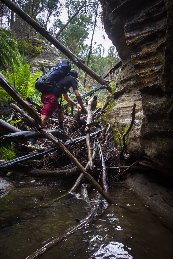
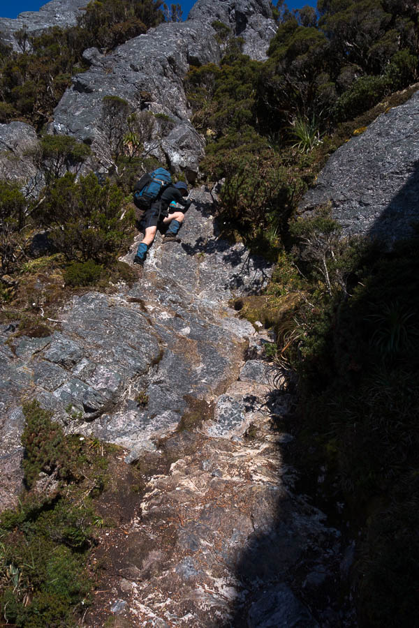
The next morning we got going early again. The cloud was high enough that we could see the ridgeline ahead as we set off along the almost paved path to the start of the Beggary Bumps. The first gully was my least favourite section of the day – a wet steep climb down with a tumble to oblivion if you stuffed up.

DSC04014

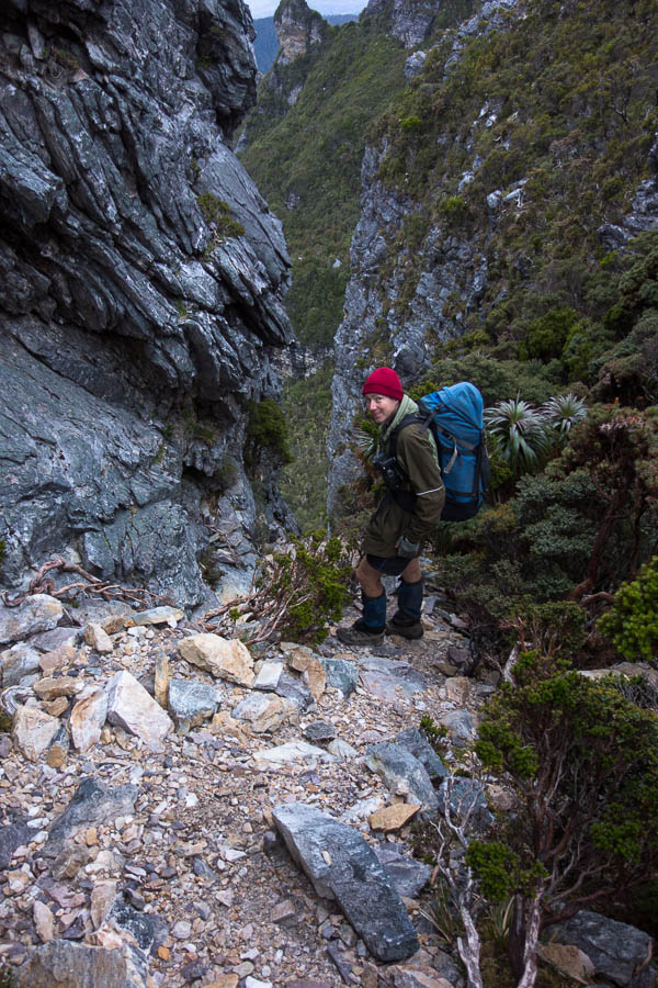
Our first steep gully on day 4

DSC04016

The bottom of the gully. This was the section I liked least for the day.

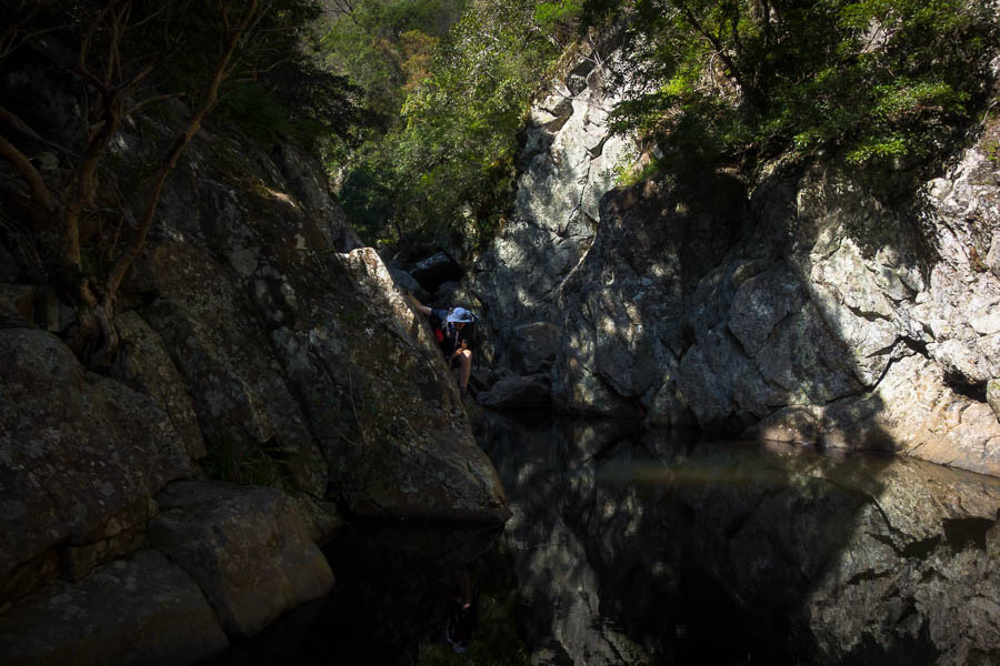
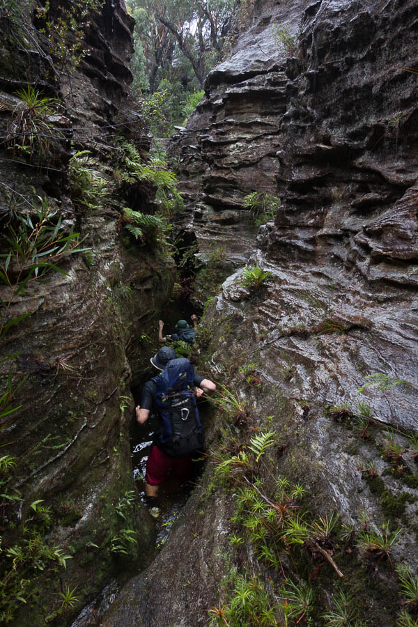
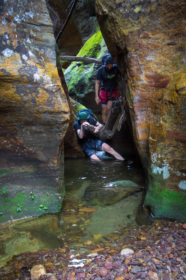
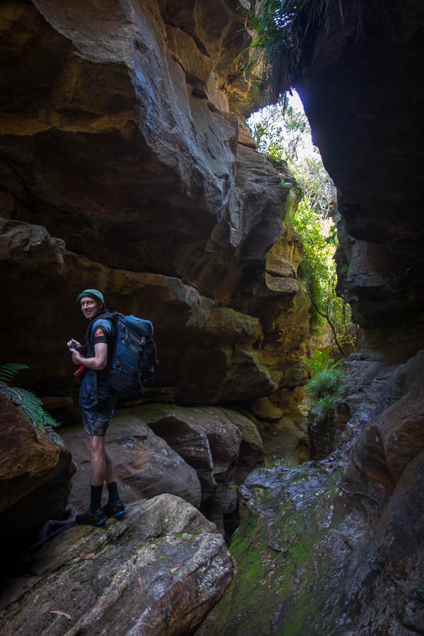
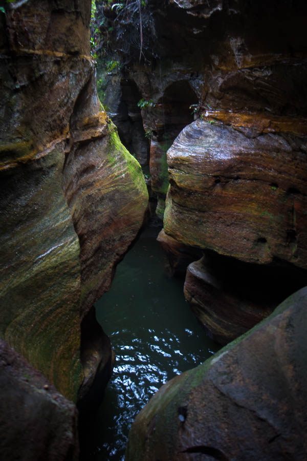
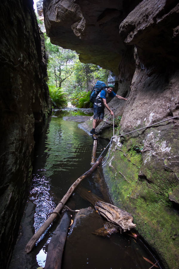
By the time we’d been up and down and around and got to the “Tilted Chasm” it seemed comparatively tame. I suspect our canyoning experience helped though, as getting into the top was a fairly standard canyoning scramble.

DSC04034

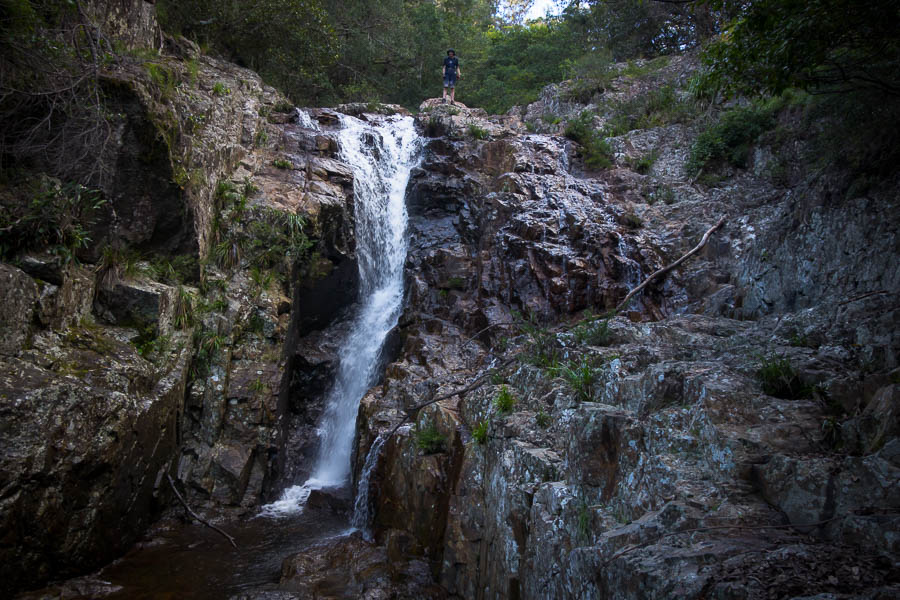
The Tilted Chasm felt comparatively easier

DSC04037

Views over Lake Ganymede

DSC04042

More scrambling. Let’s be honest on a day which is 3.8km and takes 4-6 hours, there’s an awful lot of scrambling.

DSC04044

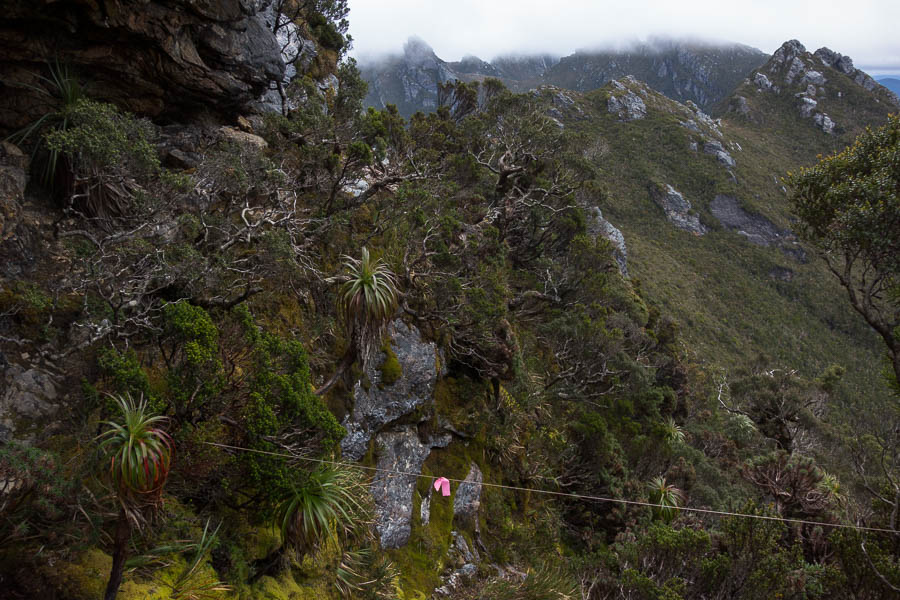
Do not pass the pink tape! (Actual route sidles around on the left)

The slow progress up and down and around continued until I suggested an early lunch in the saddle before Mt Taurus. Mt Taurus and the other surrounding peaks had been in cloud for most of the day, whereas from the saddle we at least had some views. It turned out to be a good call as the rain started just as we finished lunch, and we spent the rest of the day walking in drizzle and cloud. My orientation completely gone – at one stage if felt like we’d gone over Mt Taurus just to come back up to it again – though that’s probably mostly to do with the circuitous route that was needed to get off the peak. Keen to get down and dry I initially baulked at the cleft we needed to descend. But the alternative track seemed to just lead to a lookout (who knows we couldn’t see anything just being in cloud). Tom had a second look at the cleft and concluded it was actually pretty easy to get down – putting me to shame, but I agreed once I actually tried it.

DSC04057

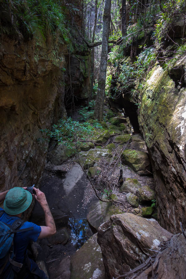
My life. Waiting for the photographer.

Eventually we could see a lake, and skirted around it through overgrown tracks to find the tent platforms. We stood under the relatively dry shelter of a stand of scorparia optimistically hoping it would stop raining. After a while I decided we had to just bite the bullet and put up the tent in the rain.

DSC04075

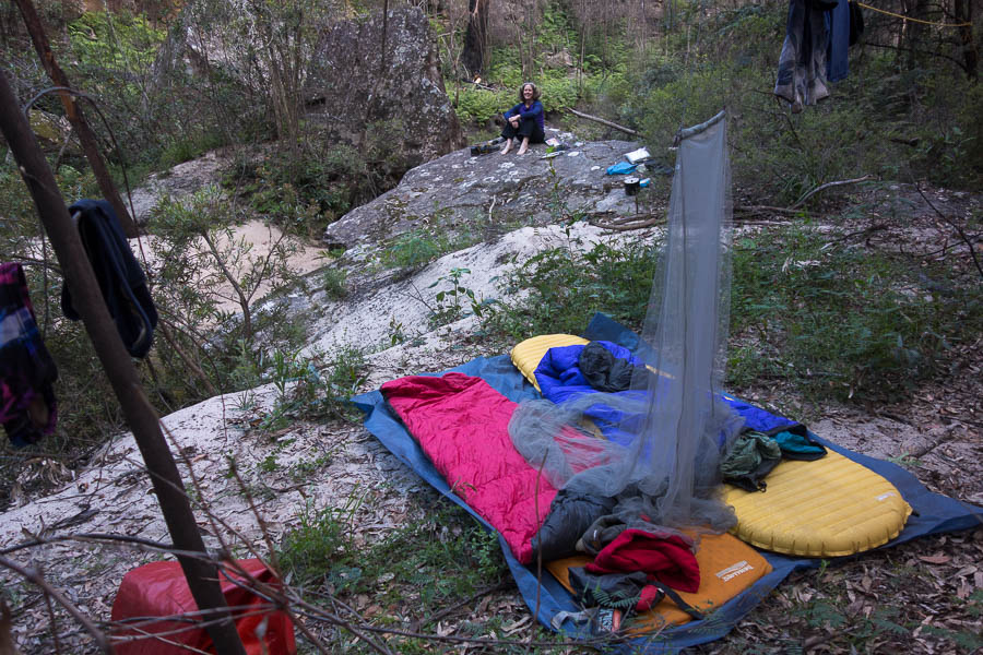
Hanging out under the scoparia at Haven Lake hoping it will stop raining

We got a short break where we wiped down the platform with the Chux so we weren’t pitching on puddles. Soon we were inside and dry. Yay. And that is where we spent most of the next 36 hours.

Day 4: 3.8km, 7:05am – 1:30pm = 6h25 including morning tea, lunch, not so much photo taking. Chapman’s estimate: 4-6 hours (excluding breaks)

DSC04076

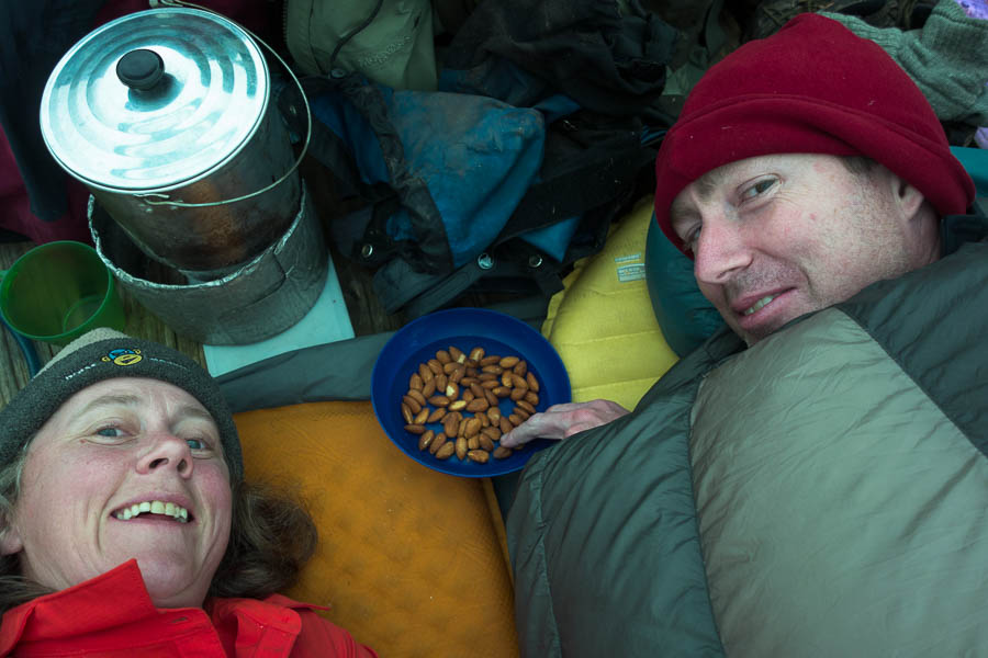
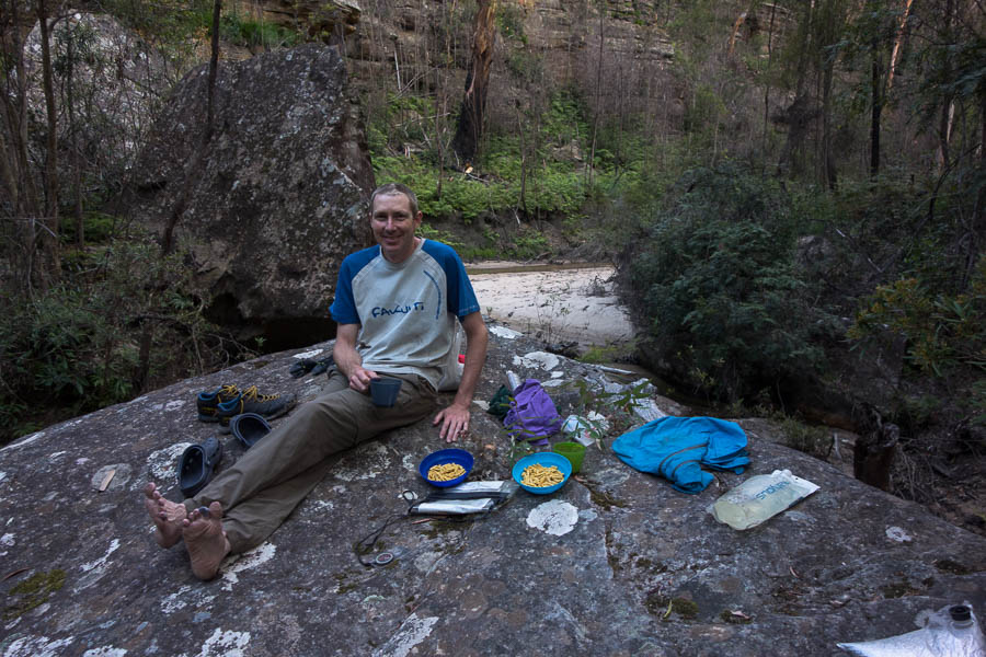
Happy hour… from the comfort of our sleeping bags

The weather wasn’t so bad that we couldn’t have moved on the next day, but as we had baked an extra day into the trip our pick up schedule meant we didn’t need to move. Our knees were happy for a rest day as well! There wasn’t that much rain but the wind gusts were significant. By mid-afternoon we got some blue sky and that with the wind meant we dried everything out. Unfortunately the wind was such that a side trip up Mt Aldebaran was out of the question. Tom was even getting optimistic of some sunset photography, but the clear skies didn’t last and by dinner time we were back in low cloud.

Day 5: 0km (well maybe 1km to walk back to the saddle below Mt Taurus and see the views we missed the day before)

DSC04082

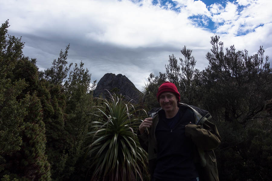
During a fine break on our day at Haven Lake we actually get to see Mt Taurus

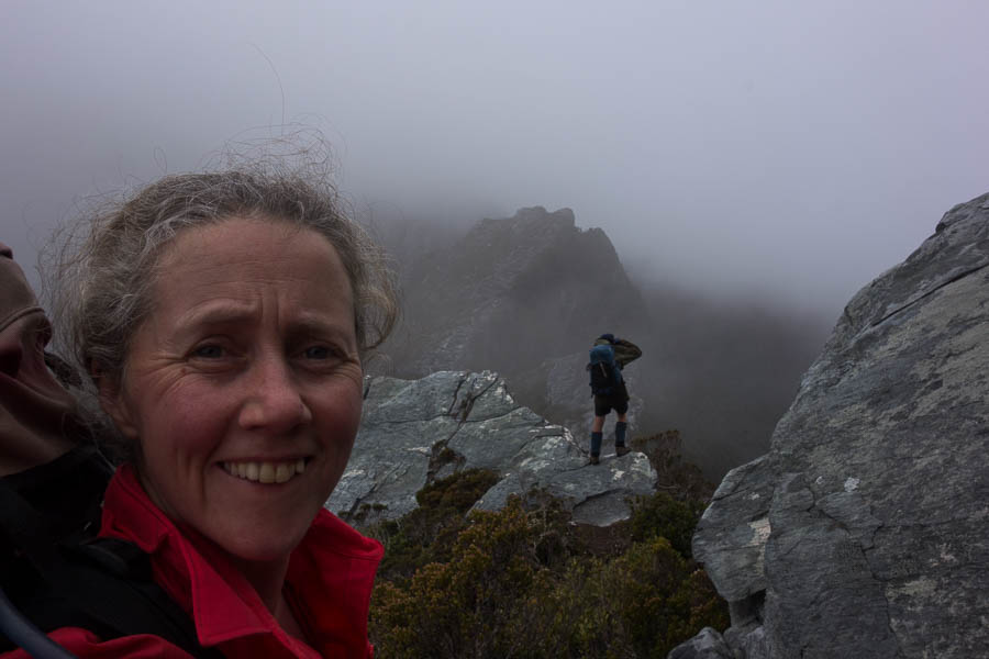
Overnight it rained again and it was drizzling when we woke in the morning. Hoping it would clear we packed up and got moving. As we climbed up into the saddle above Haven Lake we realised how sheltered it had been (even if it didn’t feel it at the time). We were buffeted by the wind, and it was with much relief we dropped onto the other side of the ridge out of the wind. There were a couple more exposed sections of ridge walking where I wondered if it was possible to get blown off, and I was quite surprised when we soon arrived at Lake Sirona. We briefly sheltered in a crevice enjoying the respite from the wind and rain. Should we be out in it? Tom asked if we should take shelter, I figured we were already pretty wet so should just keep moving and stay warm. The wind and rain intensified and the visibility dropped. And just when I was questioning the decision to push on the sky lightened in places and we started being able to see more than a few metres in front of us.

DSC04089

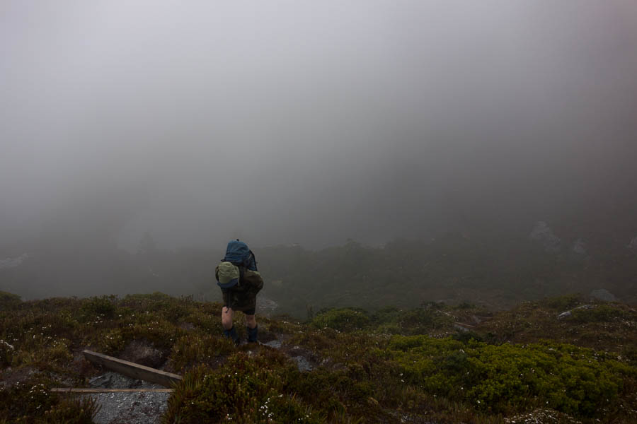
Leaving Haven Lake in the wind & rain on day 6

DSC04095

Descending to Lake Sirona in the wind & rain, fortunately having not been blown off the exposed ridgeline

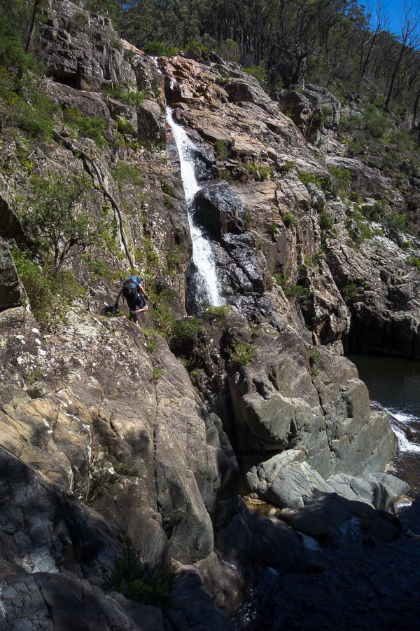
The daunting ridge line of Mt Scorpio popped out of the cloud. The notes had said we needed to climb an exposed, rocky, rib. Not exactly ideal conditions for it. Our trepidation was much worse than what actually needed to be done and we were soon over the rib and staring down Kappa Moraine (“K”) our descent point from the range.

DSC04096

Mt Scorpio suddenly appears out of the clouds. Which part of the exposed, rocky rib do we need to climb?

Taking advantage of a break in the weather meant morning tea with views over Promontory Lake, Lake Vesta and Lake Juno. Then the rain returned and we slogged down the unprotected Kappa Moraine ridge line.

DSC04106

In slightly clearer conditions we get views of Promontory Lake, Lake Juno and Lake Vesta

DSC04108

Descending Kappa Moraine

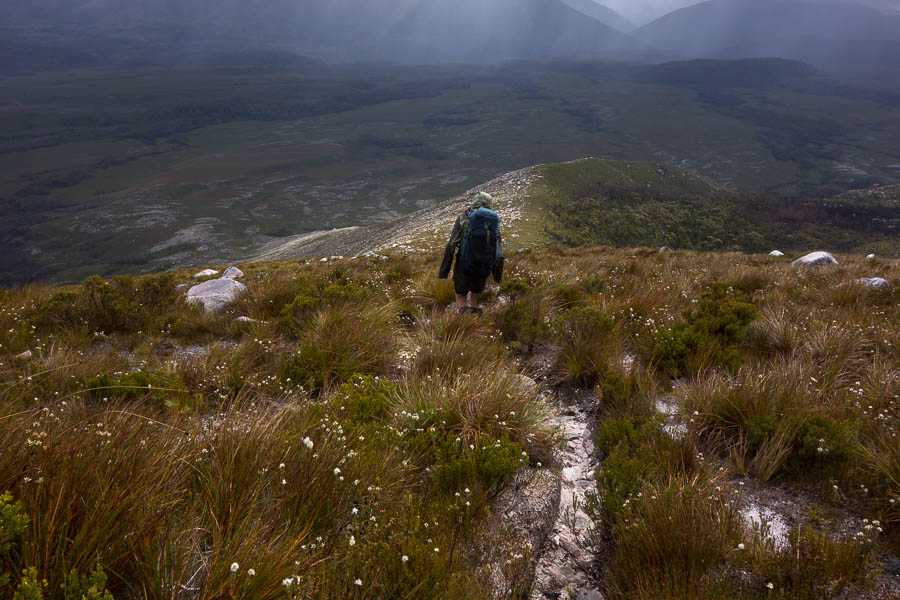
By the time we turned off for the cross-country shortcut the rain had stopped, and the wind felt like it would dry us out pretty quickly. The cross-country route went fairly smoothly other than briefly getting caught in the scrubby banks of Seven Mile Creek. By lunch the wind had done its job and we were completely dry.

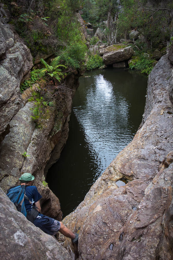
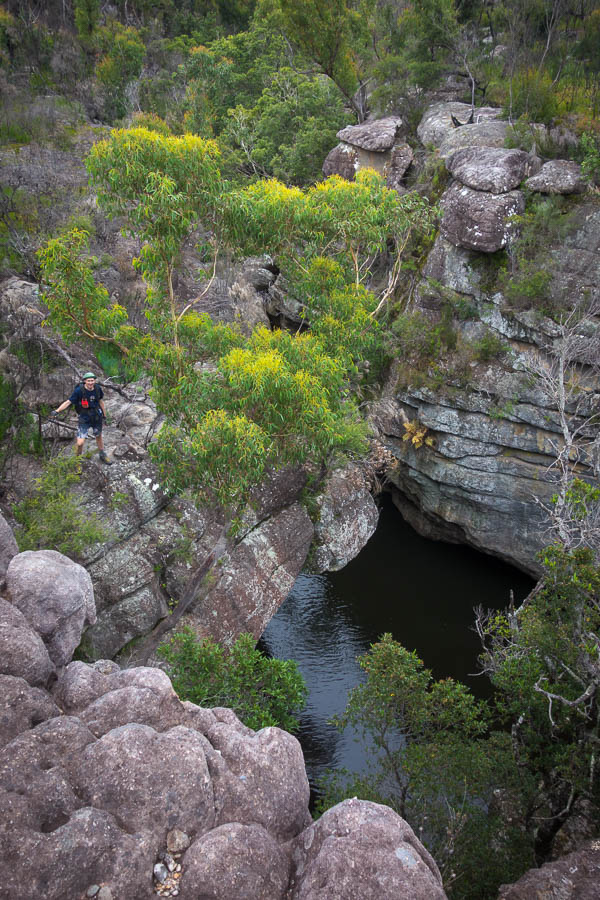
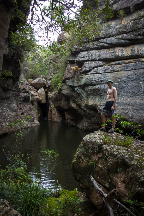
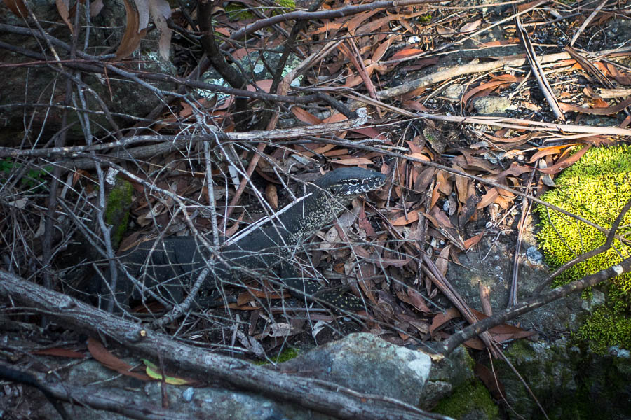
The last few kilometres to Junction Creek were a slog. Though a large tiger snake on the track had me leaping about with energy (briefly)! We were both tired. I had spoken the night before of potentially walking all the way back to the car park but even if it had been pouring with rain I’m not sure I would have had the energy. Fortunately the day had cleared to be quite pleasant and we had a lovely final evening at Junction Creek.

DSC04124

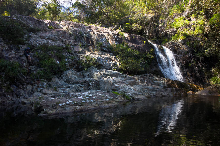
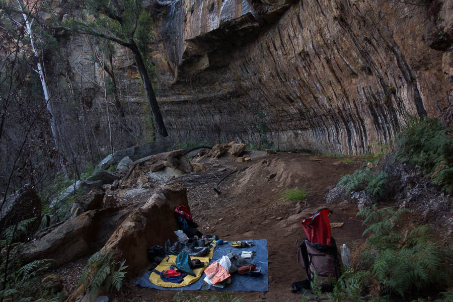
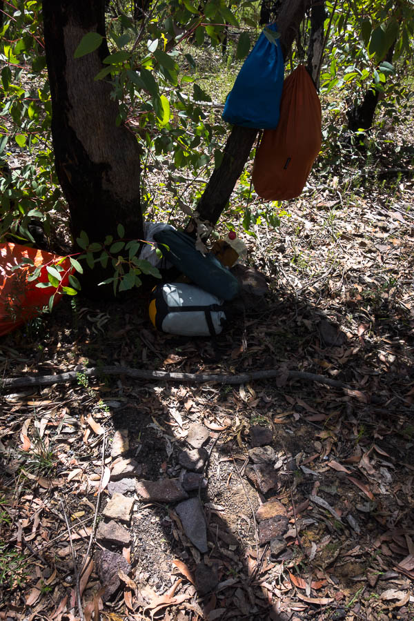
The day clears so we have a pleasant camp at Junction Creek

Day 6: 14.5km, 7:30am – 3:30pm = 8 hours including very few photos early on, morning tea, lunch. Chapman’s estimate: 6-7.5h (excluding breaks)

Our final day was just retracing our original steps back to the car park. Only 7km, but not the easiest walking. The weather the same glorious still day with blue skies that we’d had on our way in. It would have been lovely to be up on the range!

Day 7: 8.4km, 7:50am – 10:40am = 2h 50 (no breaks) Chapman’s estimate: 2-3.5h (excluding breaks)

1 6 7 8 9 10 19